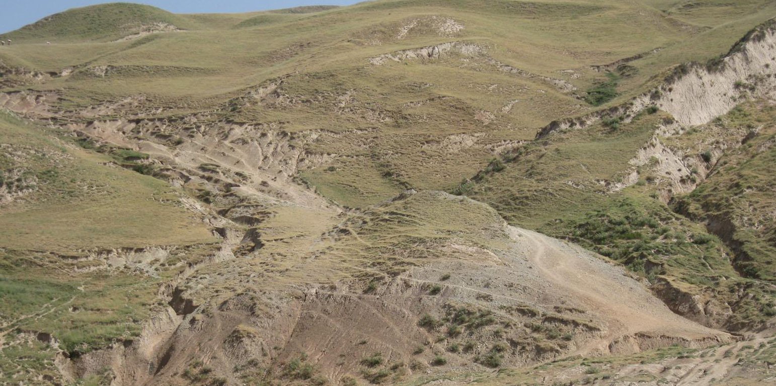
Trampled and eroded area on the communal pastureland (Conder Malgorzata)

Degraded communal pasture Obishur (Tajikistan)

Description

Degraded communal pasture without grazing management and sufficient waterpoints

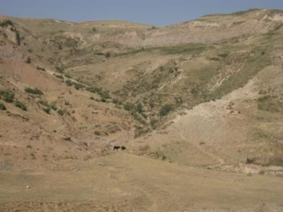
On the communal pasture, located at the foothill around 85 households graze their livestock totally 500 cows and 100 sheep and goats. Half of the households of the village Momandion have livestock which is meant to graze at different places on that pasture. As there is no water point higher up in the pasture area, livestock grazes near the village where a water point is installed. The rolling zone is totally overgrazed and shows several deep gullies. Cows and the small livestock are divided for grazing. Every family is looking after a herd for a day every month. Although the families of the herding livestock communicate with each other, there is no planning for a sustainable grazing management.

Purpose of the Technology: The whole plot is overgrazed and livestock is increasing, so at least controlled pasture management could be expected to decrease the degradation process. Additionally, more vegetation would be available for feeding livestock. More water points have to be installed higher up in the pasture, to decrease pressure on soil and vegetation. More waterpoints would extend the area to be used for grazing. Another issue is that nobody really feels responsible for the pasture and its management. This explains why no pasture management exists at Jamoat level. Farmers are not organized in terms of pasture rotation and control. Livestock owners pay very small rent, which does not make them vakue the pastureland. Additionally, the tax is not enough for projects or investments (like installing water points).

Establishment / maintenance activities and inputs: Every household pays 12 Somoni per year for pasture rent, which is in total around 1000 Somoni. Rent is per household not per livestock number. No maintenance is done.

Natural / human environment: The pasture extends from the foothill to the upper parts of the hill with a high percentage of overgrazed, trampled, erosive area. Except for the water point near the village, there is no water and no shady points for livestock. 85 households graze their livestock, which total 1500 cows and small livestock. Every household is responsible for grazing the herd one day every month. Apart from that, no management exists between the families and Jamoat.

Location

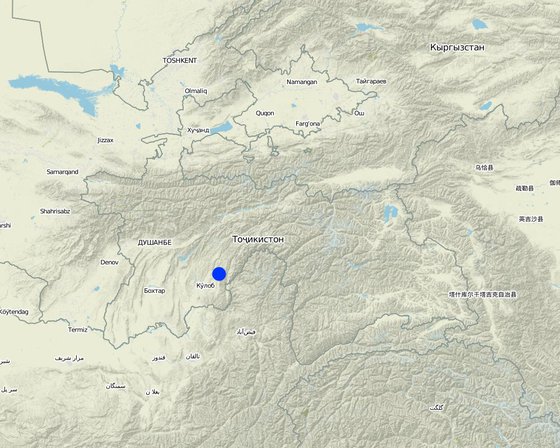
Location: Muminabad, Khatlon, Tajikistan, Tajikistan

No. of Technology sites analysed:

Geo-reference of selected sites
  • 70.05114, 38.09412

Spread of the Technology: evenly spread over an area (approx. 0.1-1 km2)

In a permanently protected area?:

Date of implementation:

Type of introduction
Degraded pastureland (Conder Malgorzata)

Classification of the Technology

Main purpose
  • improve production
  • reduce, prevent, restore land degradation
  • conserve ecosystem
  • protect a watershed/ downstream areas – in combination with other Technologies
  • preserve/ improve biodiversity
  • reduce risk of disasters
  • adapt to climate change/ extremes and its impacts
  • mitigate climate change and its impacts
  • create beneficial economic impact
  • create beneficial social impact
Land use

  • Grazing land
    • Semi-nomadic pastoralism
    Animal type: goats, sheep, cows
Water supply
  • rainfed
  • mixed rainfed-irrigated
  • full irrigation

Purpose related to land degradation
  • prevent land degradation
  • reduce land degradation
  • restore/ rehabilitate severely degraded land
  • adapt to land degradation
  • not applicable
Degradation addressed
  • soil erosion by water - Wt: loss of topsoil/ surface erosion, Wg: gully erosion/ gullying
  • soil erosion by wind - Eo: offsite degradation effects
  • physical soil deterioration - Pc: compaction
  • biological degradation - Bc: reduction of vegetation cover
  • water degradation - Hs: change in quantity of surface water
SLM group
  • pastoralism and grazing land management
  • Water points
SLM measures
  • management measures - M2: Change of management/ intensity level, M3: Layout according to natural and human environment

Technical drawing

Technical specifications
Bare vegetation cover, no trees, soil erosion, trampled paths, rill building, no waterpoints are all calling for pasture management among the villages.

Location: Obishur watershed, Momandion. Muminabad, Khatlon, Tajikistan

Technical knowledge required for field staff / advisors: moderate

Technical knowledge required for land users: low

Main technical functions: control of concentrated runoff: impede / retard, improvement of ground cover, stabilisation of soil (eg by tree roots against land slides), increase of infiltration

Secondary technical functions: control of dispersed runoff: impede / retard, increase of surface roughness, improvement of surface structure (crusting, sealing), improvement of topsoil structure (compaction), increase in organic matter, increase in nutrient availability (supply, recycling,…), increase / maintain water stored in soil, increase of biomass (quantity), spatial arrangement and diversification of land use

Change of land use practices / intensity level: Controlled access, staged grazing
Author: Malgorzata Conder

Establishment and maintenance: activities, inputs and costs

Calculation of inputs and costs
  • Costs are calculated:
  • Currency used for cost calculation: Somoni
  • Exchange rate (to USD): 1 USD = 4.83 Somoni
  • Average wage cost of hired labour per day: 12.40
Most important factors affecting the costs
It wouldn not be expensive to hold regular meetings between the livestock keeping families for a better organization of the grazing area. The installation of a water point is very costly and labour intensive in contrast.
Establishment activities
  1. Possible solutions: Pasture ManagementWorkshops, Meetings, Round table (Timing/ frequency: None)
  2. Water points (Timing/ frequency: None)
  3. Reduce Livestock quantity (Timing/ frequency: None)
Maintenance activities
n.a.

Natural environment

Average annual rainfall
  • < 250 mm
  • 251-500 mm
  • 501-750 mm
  • 751-1,000 mm
  • 1,001-1,500 mm
  • 1,501-2,000 mm
  • 2,001-3,000 mm
  • 3,001-4,000 mm
  • > 4,000 mm
Agro-climatic zone
  • humid
  • sub-humid
  • semi-arid
  • arid
Specifications on climate
Totally 800 mm: 700mm in winter-spring, July-Sept dry season
Thermal climate class: temperate, LPG from end of March until September
Slope
  • flat (0-2%)
  • gentle (3-5%)
  • moderate (6-10%)
  • rolling (11-15%)
  • hilly (16-30%)
  • steep (31-60%)
  • very steep (>60%)
Landforms
  • plateau/plains
  • ridges
  • mountain slopes
  • hill slopes
  • footslopes
  • valley floors
Altitude
  • 0-100 m a.s.l.
  • 101-500 m a.s.l.
  • 501-1,000 m a.s.l.
  • 1,001-1,500 m a.s.l.
  • 1,501-2,000 m a.s.l.
  • 2,001-2,500 m a.s.l.
  • 2,501-3,000 m a.s.l.
  • 3,001-4,000 m a.s.l.
  • > 4,000 m a.s.l.
Technology is applied in
  • convex situations
  • concave situations
  • not relevant
Soil depth
  • very shallow (0-20 cm)
  • shallow (21-50 cm)
  • moderately deep (51-80 cm)
  • deep (81-120 cm)
  • very deep (> 120 cm)
Soil texture (topsoil)
  • coarse/ light (sandy)
  • medium (loamy, silty)
  • fine/ heavy (clay)
Soil texture (> 20 cm below surface)
  • coarse/ light (sandy)
  • medium (loamy, silty)
  • fine/ heavy (clay)
Topsoil organic matter content
  • high (>3%)
  • medium (1-3%)
  • low (<1%)
Groundwater table
  • on surface
  • < 5 m
  • 5-50 m
  • > 50 m
Availability of surface water
  • excess
  • good
  • medium
  • poor/ none
Water quality (untreated)
  • good drinking water
  • poor drinking water (treatment required)
  • for agricultural use only (irrigation)
  • unusable
Water quality refers to:
Is salinity a problem?
  • Yes
  • No

Occurrence of flooding
  • Yes
  • No
Species diversity
  • high
  • medium
  • low
Habitat diversity
  • high
  • medium
  • low

Characteristics of land users applying the Technology

Market orientation
  • subsistence (self-supply)
  • mixed (subsistence/ commercial)
  • commercial/ market
Off-farm income
  • less than 10% of all income
  • 10-50% of all income
  • > 50% of all income
Relative level of wealth
  • very poor
  • poor
  • average
  • rich
  • very rich
Level of mechanization
  • manual work
  • animal traction
  • mechanized/ motorized
Sedentary or nomadic
  • Sedentary
  • Semi-nomadic
  • Nomadic
Individuals or groups
  • individual/ household
  • groups/ community
  • cooperative
  • employee (company, government)
Gender
  • women
  • men
Age
  • children
  • youth
  • middle-aged
  • elderly
Area used per household
  • < 0.5 ha
  • 0.5-1 ha
  • 1-2 ha
  • 2-5 ha
  • 5-15 ha
  • 15-50 ha
  • 50-100 ha
  • 100-500 ha
  • 500-1,000 ha
  • 1,000-10,000 ha
  • > 10,000 ha
Scale
  • small-scale
  • medium-scale
  • large-scale
Land ownership
  • state
  • company
  • communal/ village
  • group
  • individual, not titled
  • individual, titled
Land use rights
  • open access (unorganized)
  • communal (organized)
  • leased
  • individual
Water use rights
  • open access (unorganized)
  • communal (organized)
  • leased
  • individual
Access to services and infrastructure
health

poor
x
good
education

poor
x
good
technical assistance

poor
x
good
employment (e.g. off-farm)

poor
x
good
markets

poor
x
good
energy

poor
x
good
roads and transport

poor
x
good
drinking water and sanitation

poor
x
good
financial services

poor
x
good

Impacts

Socio-economic impacts
animal production
decreased
x
increased


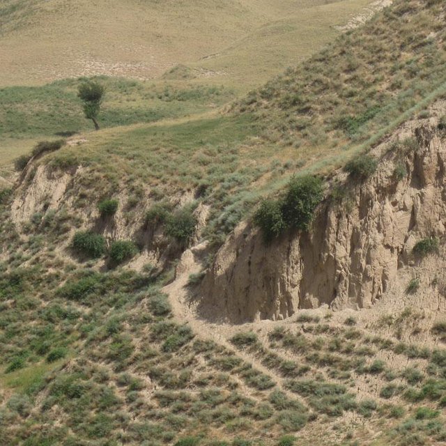
Less forage available for livestock due to reduce vegetation cover

wood production
decreased
x
increased


important clear-cutting in the past

land management
hindered
x
simplified

Quantity before SLM: no organizational task without pasture management
Quantity after SLM: None
no organizational task without pasture management

water availability for livestock
decreased
x
increased


lack of water points for livestock

water quality for livestock
decreased
x
increased


lack of water points for livestock

expenses on agricultural inputs
increased
x
decreased


more fodder has to be bought, because grazing is insufficient

farm income
decreased
x
increased


Less forage for livestock

workload
increased
x
decreased


no organizational task without pasture management / feeding animals

Socio-cultural impacts
food security/ self-sufficiency
reduced
x
improved


More difficult to feed livestock

Improved livelihoods and human well-being
decreased
x
increased

Ecological impacts
surface runoff
increased
x
decreased

groundwater table/ aquifer
lowered
x
recharge

soil moisture
decreased
x
increased

soil cover
reduced
x
improved

soil crusting/ sealing
increased
x
reduced

soil compaction
increased
x
reduced

soil organic matter/ below ground C
decreased
x
increased

wind velocity
increased
x
decreased

Off-site impacts
downstream flooding (undesired)
increased
x
reduced

buffering/ filtering capacity (by soil, vegetation, wetlands)
reduced
x
improved

damage on public/ private infrastructure
increased
x
reduced

Cost-benefit analysis

Benefits compared with establishment costs
Benefits compared with maintenance costs

Climate change

Gradual climate change
annual temperature increase

not well at all
x
very well
Climate-related extremes (disasters)
local rainstorm

not well at all
x
very well
drought

not well at all
x
very well
general (river) flood

not well at all
x
very well

Adoption and adaptation

Percentage of land users in the area who have adopted the Technology
  • single cases/ experimental
  • 1-10%
  • 11-50%
  • > 50%
Of all those who have adopted the Technology, how many have done so without receiving material incentives?
  • 0-10%
  • 11-50%
  • 51-90%
  • 91-100%
Has the Technology been modified recently to adapt to changing conditions?
  • Yes
  • No
To which changing conditions?
  • climatic change/ extremes
  • changing markets
  • labour availability (e.g. due to migration)

Conclusions and lessons learnt

Strengths: land user's view
Strengths: compiler’s or other key resource person’s view
  • Establishment of rotational grazing is not expensive and does not require further equipment

    How can they be sustained / enhanced? Empower communication and decision-making also between the farmers
Weaknesses/ disadvantages/ risks: land user's viewhow to overcome
Weaknesses/ disadvantages/ risks: compiler’s or other key resource person’s viewhow to overcome
  • Importance of rotational grazing depends on Jamoat and farmers level Strengthen communication between Jamoat and farmers through consultancy, meetings etc. Farmer as tenants should get a voice.
  • Pastureland rent is too cheap and is not valued. There is no incentive to change, because nobody feels responsible for that area. Increase the rent and discuss communally where money should go to (e.g. water points).
  • Pasture management does not show benefits immediately which makes it difficult to evidence good Technology. Explanation/ education about short and long-term benefits

References

Compiler
  • Malgorzata Conder
Editors
Reviewer
  • Fabian Ottiger
  • Alexandra Gavilano
Date of documentation: July 31, 2012
Last update: Aug. 4, 2019
Resource persons
Full description in the WOCAT database
Linked SLM data
Documentation was faciliated by
Institution Project
This work is licensed under Creative Commons Attribution-NonCommercial-ShareaAlike 4.0 International