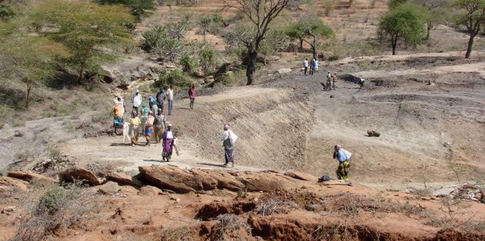
Manual construction of a small dam requires community action: soil is transported in bags, piled up and compacted layer by layer (Maimbo Malesu)

Small Earth Dams (Zambia)

Description

Water harvesting and storage structures to impound runoff generated from upstream catchment areas.

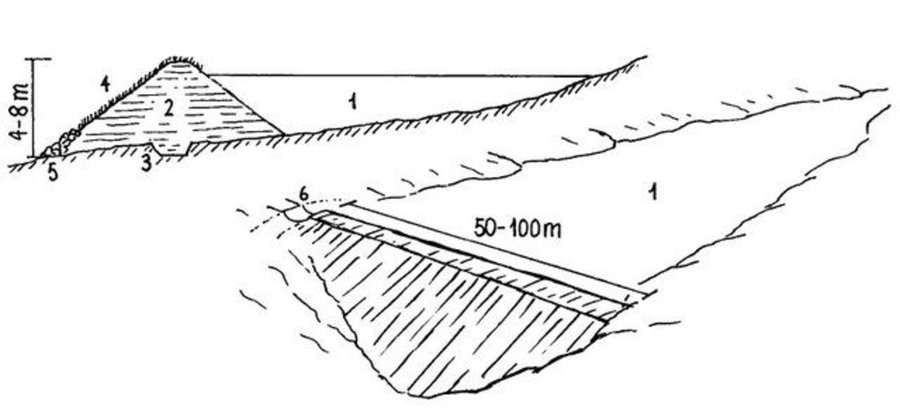
Small earth dams are water harvesting storage structures, constructed across narrow sections of valleys, to impound runoff generated from upstream catchment areas.

Establishment / maintenance activities and inputs: Construction of the dam wall begins with excavation of a core trench along the length of the dam wall which is filled with clay and compacted to form a ‘central core’ that anchors the wall and prevents or minimizes seepage. The upstream and downstream embankments are also built using soil with a 20-30% clay content. During construction – either by human labour, animal draught or machine (bulldozer, compacter, grader etc.) – it is critical to ensure good compaction for stability of the wall. It is common to plant Kikuyu grass (Pennisetum clandestinum) to prevent erosion of the embankment. The dam is fenced with barbed wire to prevent livestock from eroding the wall. Typical length of the embankment is 50-100 m with water depth ranging 4-8 m. An emergency spillway (vegetated or a concrete shute) is provided on either, or both sides, of the wall for safe disposal of excess water above the full supply level. The dam water has a maximum throwback of 500 m, with a capacity ranging from 50,000 – 100,000 m3.

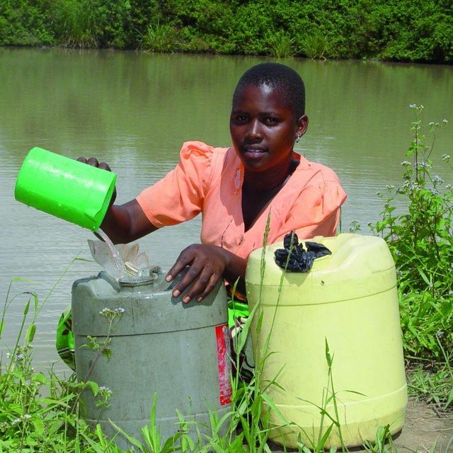
Natural / human environment: The dams are mainly used for domestic consumption, irrigation or for watering livestock. If the dams are located on communal lands, their establishment requires full consultation and involvement of the local community. The government provides technical and financial assistance for design, construction and management of these infrastructures. Community contribution includes land, labour and local resources. The community carries out periodic maintenance of the infrastructure – including vegetation management on embankment, desilting etc. – and of the catchment areas (through soil and water conservation practices).

Location

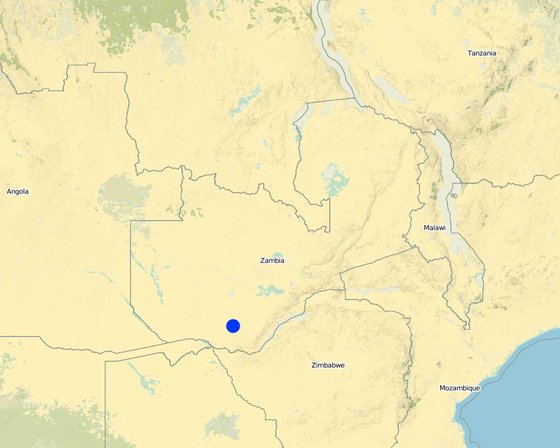
Location: Southern Province, Zambia

No. of Technology sites analysed:

Geo-reference of selected sites
  • 26.0, -17.0

Spread of the Technology: applied at specific points/ concentrated on a small area

In a permanently protected area?:

Date of implementation: 10-50 years ago

Type of introduction
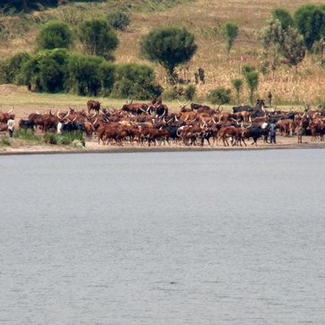
Water point for livestock (Maimbo Malesu)
Fetching water for domestic use at a small dam (Maimbo Malesu)

Classification of the Technology

Main purpose
  • improve production
  • reduce, prevent, restore land degradation
  • conserve ecosystem
  • protect a watershed/ downstream areas – in combination with other Technologies
  • preserve/ improve biodiversity
  • reduce risk of disasters
  • adapt to climate change/ extremes and its impacts
  • mitigate climate change and its impacts
  • create beneficial economic impact
  • create beneficial social impact
  • Access to water
Land use

  • Cropland
    • Annual cropping
    Number of growing seasons per year: 1
Water supply
  • rainfed
  • mixed rainfed-irrigated
  • full irrigation

Purpose related to land degradation
  • prevent land degradation
  • reduce land degradation
  • restore/ rehabilitate severely degraded land
  • adapt to land degradation
  • not applicable
Degradation addressed
  • soil erosion by water - Wt: loss of topsoil/ surface erosion, Wg: gully erosion/ gullying
SLM group
  • improved ground/ vegetation cover
  • water harvesting
SLM measures
  • vegetative measures - V2: Grasses and perennial herbaceous plants
  • structural measures - S5: Dams, pans, ponds

Technical drawing

Technical specifications
Dimensions and main components of a small dam: (1) water body; (2) dam wall (with layers of compacted soil; side slopes 3:1); (3) central core ('key'); (4) grass cover; (5) stone apron; (6) spillway

Southern Province

Technical knowledge required for field staff / advisors: high

Technical knowledge required for land users: high

Main technical functions: control of concentrated runoff: retain / trap, water harvesting / increase water supply

Aligned: -contour
Vegetative material: G : grass

Grass species: Pennisetum clandestinum

Dam/ pan/ pond
Depth of ditches/pits/dams (m): 4.00
Length of ditches/pits/dams (m): 50.00

Construction material (earth): 20-30% clay content

Specification of dams/ pans/ ponds: Capacity 100000.00m3

Dimensions of spillways: 5.00m

Vegetation is used for stabilisation of structures.
Author: Mats Gurtner, Center for Development and Environment, University of Bern

Establishment and maintenance: activities, inputs and costs

Calculation of inputs and costs
  • Costs are calculated: per Technology unit (unit: Dam volume, length: 10’000 m3 (44 m long; 8 m deep))
  • Currency used for cost calculation: n.a.
  • Exchange rate (to USD): 1 USD = n.a
  • Average wage cost of hired labour per day: n.a
Most important factors affecting the costs
n.a.
Establishment activities
  1. Site selection in consultation with community. (Timing/ frequency: None)
  2. Dam survey and design: Topographical survey of dam area; using leveling equipment (dumpy level or theodolite); Determination of dam wall dimensions. (Timing/ frequency: None)
  3. Dam wall construction: Excavate core trench (usually 4m wide; 2m deep). Excavate and transport clay-rich soil to the dam site. Construct core and embankments (slope angles 3:1). Continuously compact placed soil. (Timing/ frequency: None)
  4. Construct lateral spillway(s), 5-30m wide (depending on the flood flow and the return slope). (Timing/ frequency: None)
  5. Design and installation of irrigation and drainage infrastructure (in case of crop production). (Timing/ frequency: None)
  6. Completion: plant kikuyu grass on dam embank-ment, spillway and irrigation canals and fence of; alternatively line with cement (Timing/ frequency: None)
Establishment inputs and costs (per Dam)
Specify input Unit Quantity Costs per Unit (n.a.) Total costs per input (n.a.) % of costs borne by land users
Labour
Dam and spillway construction unit 1.0 2000.0 2000.0 20.0
Equipment
Tools unit 1.0 30000.0 30000.0 20.0
Plant material
Seeds unit 1.0 1000.0 1000.0 20.0
Fertilizers and biocides
Fertilizer unit 1.0 1000.0 1000.0 20.0
Biocides unit 1.0 1000.0 1000.0 20.0
Construction material
Stone unit 1.0 15000.0 15000.0 20.0
Total costs for establishment of the Technology 50'000.0
Total costs for establishment of the Technology in USD 50'000.0
Maintenance activities
  1. Catchment conservation to minimise siltation of dam and irrigation infrastructure (continuous). (Timing/ frequency: None)
  2. (Re-)planting grass on dam and irrigation infrastructure (annually, using hand hoes). (Timing/ frequency: None)
  3. Desiliting of the dam (every 5-10 years): excavate and remove the silt deposited in the dam. (Timing/ frequency: None)
  4. Cleaning of dam and irrigation infra-structure (annually): remove trees/ shrubs from dam / canals. If concrete lined: repair of any damages. (Timing/ frequency: None)
Maintenance inputs and costs (per Dam)
Specify input Unit Quantity Costs per Unit (n.a.) Total costs per input (n.a.) % of costs borne by land users
Labour
Maintenance of dam unit 1.0 200.0 200.0
Equipment
Tools unit 1.0 2000.0 2000.0
Plant material
Seeds unit 1.0 300.0 300.0
Construction material
Stone unit 1.0 1500.0 1500.0
Total costs for maintenance of the Technology 4'000.0
Total costs for maintenance of the Technology in USD 4'000.0

Natural environment

Average annual rainfall
  • < 250 mm
  • 251-500 mm
  • 501-750 mm
  • 751-1,000 mm
  • 1,001-1,500 mm
  • 1,501-2,000 mm
  • 2,001-3,000 mm
  • 3,001-4,000 mm
  • > 4,000 mm
Agro-climatic zone
  • humid
  • sub-humid
  • semi-arid
  • arid
Specifications on climate
Average annual rainfall in mm: 700.0
Slope
  • flat (0-2%)
  • gentle (3-5%)
  • moderate (6-10%)
  • rolling (11-15%)
  • hilly (16-30%)
  • steep (31-60%)
  • very steep (>60%)
Landforms
  • plateau/plains
  • ridges
  • mountain slopes
  • hill slopes
  • footslopes
  • valley floors
Altitude
  • 0-100 m a.s.l.
  • 101-500 m a.s.l.
  • 501-1,000 m a.s.l.
  • 1,001-1,500 m a.s.l.
  • 1,501-2,000 m a.s.l.
  • 2,001-2,500 m a.s.l.
  • 2,501-3,000 m a.s.l.
  • 3,001-4,000 m a.s.l.
  • > 4,000 m a.s.l.
Technology is applied in
  • convex situations
  • concave situations
  • not relevant
Soil depth
  • very shallow (0-20 cm)
  • shallow (21-50 cm)
  • moderately deep (51-80 cm)
  • deep (81-120 cm)
  • very deep (> 120 cm)
Soil texture (topsoil)
  • coarse/ light (sandy)
  • medium (loamy, silty)
  • fine/ heavy (clay)
Soil texture (> 20 cm below surface)
  • coarse/ light (sandy)
  • medium (loamy, silty)
  • fine/ heavy (clay)
Topsoil organic matter content
  • high (>3%)
  • medium (1-3%)
  • low (<1%)
Groundwater table
  • on surface
  • < 5 m
  • 5-50 m
  • > 50 m
Availability of surface water
  • excess
  • good
  • medium
  • poor/ none
Water quality (untreated)
  • good drinking water
  • poor drinking water (treatment required)
  • for agricultural use only (irrigation)
  • unusable
Water quality refers to:
Is salinity a problem?
  • Yes
  • No

Occurrence of flooding
  • Yes
  • No
Species diversity
  • high
  • medium
  • low
Habitat diversity
  • high
  • medium
  • low

Characteristics of land users applying the Technology

Market orientation
  • subsistence (self-supply)
  • mixed (subsistence/ commercial)
  • commercial/ market
Off-farm income
  • less than 10% of all income
  • 10-50% of all income
  • > 50% of all income
Relative level of wealth
  • very poor
  • poor
  • average
  • rich
  • very rich
Level of mechanization
  • manual work
  • animal traction
  • mechanized/ motorized
Sedentary or nomadic
  • Sedentary
  • Semi-nomadic
  • Nomadic
Individuals or groups
  • individual/ household
  • groups/ community
  • cooperative
  • employee (company, government)
Gender
  • women
  • men
Age
  • children
  • youth
  • middle-aged
  • elderly
Area used per household
  • < 0.5 ha
  • 0.5-1 ha
  • 1-2 ha
  • 2-5 ha
  • 5-15 ha
  • 15-50 ha
  • 50-100 ha
  • 100-500 ha
  • 500-1,000 ha
  • 1,000-10,000 ha
  • > 10,000 ha
Scale
  • small-scale
  • medium-scale
  • large-scale
Land ownership
  • state
  • company
  • communal/ village
  • group
  • individual, not titled
  • individual, titled
  • not titled
Land use rights
  • open access (unorganized)
  • communal (organized)
  • leased
  • individual
Water use rights
  • open access (unorganized)
  • communal (organized)
  • leased
  • individual
Access to services and infrastructure

Impacts

Socio-economic impacts
Crop production
decreased
x
increased

animal production
decreased
x
increased

irrigation water availability
decreased
x
increased

irrigation water quality
decreased
x
increased

farm income
decreased
x
increased

Socio-cultural impacts
food security/ self-sufficiency
reduced
x
improved

recreational opportunities
reduced
x
improved

community institutions
weakened
x
strengthened

Ecological impacts
water quantity
decreased
x
increased

harvesting/ collection of water (runoff, dew, snow, etc)
reduced
x
improved

groundwater table/ aquifer
lowered
x
recharge

drought impacts
increased
x
decreased

Off-site impacts
water availability (groundwater, springs)
decreased
x
increased

downstream flooding (undesired)
increased
x
reduced

Cost-benefit analysis

Benefits compared with establishment costs
Short-term returns
very negative
x
very positive

Long-term returns
very negative
x
very positive

Benefits compared with maintenance costs
Short-term returns
very negative
x
very positive

Long-term returns
very negative
x
very positive

Climate change

Gradual climate change
annual temperature increase

not well at all
x
very well
Climate-related extremes (disasters)
local rainstorm

not well at all
x
very well
local windstorm

not well at all
x
very well
drought

not well at all
x
very well
general (river) flood

not well at all
x
very well
Other climate-related consequences
reduced growing period

not well at all
x
very well

Adoption and adaptation

Percentage of land users in the area who have adopted the Technology
  • single cases/ experimental
  • 1-10%
  • 11-50%
  • > 50%
Of all those who have adopted the Technology, how many have done so without receiving material incentives?
  • 0-10%
  • 11-50%
  • 51-90%
  • 91-100%
Has the Technology been modified recently to adapt to changing conditions?
  • Yes
  • No
To which changing conditions?
  • climatic change/ extremes
  • changing markets
  • labour availability (e.g. due to migration)

Conclusions and lessons learnt

Strengths: land user's view
Strengths: compiler’s or other key resource person’s view
  • Small earth dams allow for the diversification of income activities including tree nurseries, brick making, fish farming, raising ducks and geese and thus alleviate poverty

    improvement of access to markets will be crucial to support such income generating activities
  • Saves people’s time by reducing the distance to fetch water for domestic use

    clear and equitable water use rights and agreements
  • Reduced risk of crop failure by bridging prolonged dry periods and as such contribute to food security and climate change adaptation

    How can they be sustained / enhanced? combine with water saving cultivation practices such as mulching, pitting etc.
  • Reduced damages from soil erosion and flooding by storing excessive runoff water

    How can they be sustained / enhanced? use an integrated watershed management approach to reduce flood and erosion risk
  • Possibility for watering cattle near the village reduced soil compaction and erosion

    How can they be sustained / enhanced? regulate access of cattle to avoid degradation around the water source and protect water source from pollution
Weaknesses/ disadvantages/ risks: land user's viewhow to overcome
Weaknesses/ disadvantages/ risks: compiler’s or other key resource person’s viewhow to overcome
  • Dams are communally owned requires strong organisation and commitment by community
  • Risk of siltation de-silting and Catchment conservation is essential
  • Vulnerability to climate change increase depth and design storage to last at least for two rainy seasons
  • Evaporation and seepage losses maintain minimum design depth of 4 meters; if seepage is high: provide impervious material on the upstream embankment, i.e. clay or plastic lining if necessary

References

Compiler
  • MAIMBO MALESU
Editors
Reviewer
  • Deborah Niggli
  • David Streiff
  • Alexandra Gavilano
Date of documentation: Sept. 23, 2010
Last update: Aug. 22, 2019
Resource persons
Full description in the WOCAT database
Linked SLM data
Documentation was faciliated by
Institution Project
Key references
  • Nissen-Petersen E. 2006. Water from small dams. A handbook for technicians, farmers and others on site investigations, designs, cost estimations, construction and maintenance of small earth dams:
  • Morris P. H. 1991. Statement of Policy: Progress Review of the Drought Relief Dam Cons/ruction Project, Southern Province. Part 1 — Main Report. Irrigation and Land Husbandry Branch, Department of Agriculture, Chôma:
  • Sichingabula H.M. 1997. Problems of sedimentation in small dams in Zambia. Human Impact on Erosion and Sedimentation (Proceedings of the Rabat Symposium, April 1997. IAHS Publ. no. 245, 1997:
Links to relevant information which is available online
This work is licensed under Creative Commons Attribution-NonCommercial-ShareaAlike 4.0 International