DireDawaTraditional Checkdam [Ethiopia]
- Creation:
- Update:
- Compiler: Daniel Danano
- Editor: –
- Reviewer: Fabian Ottiger
Chiba
technologies_1065 - Ethiopia
View sections
Expand all Collapse all1. General information
1.2 Contact details of resource persons and institutions involved in the assessment and documentation of the Technology
SLM specialist:
Tesema Million Ajire
Ethiopia
Name of the institution(s) which facilitated the documentation/ evaluation of the Technology (if relevant)
FAO Food and Agriculture Organization (FAO Food and Agriculture Organization) - Italy1.3 Conditions regarding the use of data documented through WOCAT
When were the data compiled (in the field)?
19/10/2005
The compiler and key resource person(s) accept the conditions regarding the use of data documented through WOCAT:
Yes
2. Description of the SLM Technology
2.1 Short description of the Technology
Definition of the Technology:
It is a stone wall built across a gully at a given interval to trap moisture and sediment for crop production.
2.2 Detailed description of the Technology
Description:
It is an enbankment placed in the gully. It is constructed with stones. The purpose is to conserve and retain runoff coming from upslopes. It is intended to trap sediment running from slopes. It converts gully land into cultivated. The establishment starts with a given height of stone wall which is increased every year as the need comes and when sediment fills up. It is essentially water harvesting practice and is very suitable in areas where moisture stress is high. At present new design and layout elements have been included to improve durability of structures and efficiency to store more water and soils. Top soils eroded from upper catchments and sedimented by the checkdams. Maintenance is made every year to repair breaks and additional height is given for the checkdams.
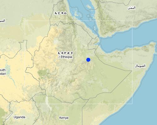
2.5 Country/ region/ locations where the Technology has been applied and which are covered by this assessment
Country:
Ethiopia
Region/ State/ Province:
Dire Dawa
Further specification of location:
Legedon
Map
×2.6 Date of implementation
If precise year is not known, indicate approximate date:
- more than 50 years ago (traditional)
2.7 Introduction of the Technology
Specify how the Technology was introduced:
- through projects/ external interventions
Comments (type of project, etc.):
It evolved from the local practices.
3. Classification of the SLM Technology
3.1 Main purpose(s) of the Technology
- improve production
- reduce, prevent, restore land degradation
3.2 Current land use type(s) where the Technology is applied

Cropland
- Annual cropping
- Perennial (non-woody) cropping
Main crops (cash and food crops):
Major food crop annual cropping: Sorghum, Maize
Major cash crop tree/shrub cropping: Chat

Grazing land
Extensive grazing land:
- Semi-nomadism/ pastoralism
Main animal species and products:
Stall feeding: Very common during crop growing season
Comments:
Major land use problems (compiler’s opinion): Soil erosion, stream bank erosion, gully expansion
Major land use problems (land users’ perception): increase in eroded land, shortage of cultivable land.
Type of cropping system and major crops comments: (1) Sorghum-Maize-Legume, (2) Sorghum-Sorghum
3.3 Further information about land use
Water supply for the land on which the Technology is applied:
- rainfed
Comments:
Water supply: Also post-flooding
Number of growing seasons per year:
- 1
Specify:
Longest growing period in days: 210 Longest growing period from month to month: Apr - Nov
3.4 SLM group to which the Technology belongs
- cross-slope measure
- surface water management (spring, river, lakes, sea)
3.5 Spread of the Technology
Specify the spread of the Technology:
- evenly spread over an area
If the Technology is evenly spread over an area, indicate approximate area covered:
- 10-100 km2
Comments:
70% of the woreda is under this technology
3.6 SLM measures comprising the Technology
3.7 Main types of land degradation addressed by the Technology

soil erosion by water
- Wt: loss of topsoil/ surface erosion
- Wg: gully erosion/ gullying
- Wr: riverbank erosion
Comments:
Main type of degradation addressed: Wt: loss of topsoil / surface erosion
Secondary types of degradation addressed: Wg: gully erosion / gullying, Wr: riverbank erosion
Main causes of degradation: over-exploitation of vegetation for domestic use (suseptable for erosion), education, access to knowledge and support services (lack of knowledge)
Secondary causes of degradation: overgrazing (free grazing), other human induced causes (specify) (agricultural causes - traditional farm implements), lack of enforcement of legislat./authority (less attention is given), land subdivision (smaller land holdings)
3.8 Prevention, reduction, or restoration of land degradation
Specify the goal of the Technology with regard to land degradation:
- reduce land degradation
4. Technical specifications, implementation activities, inputs, and costs
4.2 Technical specifications/ explanations of technical drawing
Technical knowledge required for field staff / advisors: moderate
Technical knowledge required for land users: moderate
Main technical functions: increase of infiltration, increase / maintain water stored in soil, water harvesting / increase water supply, water spreading, sediment retention / trapping, sediment harvesting, expansion of cultivated area
Secondary technical functions: reduction of slope angle, reduction of slope length
Mixed cropping / intercropping
Material/ species: sorghum, soyabean
Contour planting / strip cropping
Material/ species: oxen plough
Contour ridging
Remarks: use basins to collect wate
Scattered / dispersed
Vegetative material: F : fruit trees / shrubs
Number of plants per (ha): 4000
Spacing between rows / strips / blocks (m): 5x5m
Vertical interval within rows / strips / blocks (m): 30x30m
Width within rows / strips / blocks (m): 30x30m
In blocks
Vegetative material: O : other
Spacing between rows / strips / blocks (m): 30x30
Vertical interval within rows / strips / blocks (m): 25x25
Width within rows / strips / blocks (m): 25x25
Fruit trees / shrubs species: mango, orange, prunus, papaya
Perennial crops species: Coffee, Chat
Slope (which determines the spacing indicated above): 3.00%
If the original slope has changed as a result of the Technology, the slope today is (see figure below): 2.00%
Gradient along the rows / strips: 0.00%
Structural measure: infiltration ditch / sediment sand / trap
Vertical interval between structures (m): 1.5
Spacing between structures (m): 15-30
Depth of ditches/pits/dams (m): 1.5
Slope (which determines the spacing indicated above): 8%
If the original slope has changed as a result of the Technology, the slope today is: 3%
Lateral gradient along the structure: 0%
For water harvesting: the ratio between the area where the harvested water is applied and the total area from which water is collected is: 1:1
Vegetation is used for stabilisation of structures.
Change of land use type: grazing lands are put under cultivation
Control / change of species composition: incorporation of fruits and legume trees
Other type of management: change of management / intensity level - intensity of cultivation and number of weeding has increased.
4.3 General information regarding the calculation of inputs and costs
other/ national currency (specify):
Birr
Indicate exchange rate from USD to local currency (if relevant): 1 USD =:
8.6
Indicate average wage cost of hired labour per day:
1.00
4.4 Establishment activities
| Activity | Type of measure | Timing | |
|---|---|---|---|
| 1. | land preparation | Vegetative | during early rains |
| 2. | formation of bench terrace | Vegetative | dry season |
| 3. | manuring | Vegetative | dry season 1st application |
| 4. | planting/pitting | Vegetative | during rains 2nd application |
| 5. | stone collection | Structural | off farming season/dry season |
| 6. | layout, digging foundation | Structural | off farming season/dry season |
| 7. | shaping stone | Structural | off farming season/dry season |
| 8. | placing of stone | Structural | off farming season/dry season |
| 9. | interlocking stone | Structural | off farming season/dry season |
| 10. | giving shape | Structural | off farming season/dry season |
4.5 Costs and inputs needed for establishment
| Specify input | Unit | Quantity | Costs per Unit | Total costs per input | % of costs borne by land users | |
|---|---|---|---|---|---|---|
| Labour | Labour | ha | 1.0 | 406.0 | 406.0 | |
| Plant material | Seeds | ha | 1.0 | 23.0 | 23.0 | |
| Total costs for establishment of the Technology | 429.0 | |||||
4.6 Maintenance/ recurrent activities
| Activity | Type of measure | Timing/ frequency | |
|---|---|---|---|
| 1. | land preparation | Agronomic | April / once |
| 2. | planting | Agronomic | April, June / once |
| 3. | weeding and cultivation | Agronomic | June/August / twice |
| 4. | repair in break stone walls | Vegetative | dry season /as need arises |
| 5. | increasing heights & length of stone walls (side ways) | Vegetative | while cultivating /as need arises |
| 6. | repair break in the check | Structural | dry period/annual |
| 7. | raising the height | Structural | dry period/annual |
| 8. | increasing the length | Structural | dry period/annual |
4.7 Costs and inputs needed for maintenance/ recurrent activities (per year)
| Specify input | Unit | Quantity | Costs per Unit | Total costs per input | % of costs borne by land users | |
|---|---|---|---|---|---|---|
| Labour | Labour | ha | 1.0 | 40.0 | 40.0 | |
| Plant material | Seeds | ha | 1.0 | 23.0 | 23.0 | |
| Total costs for maintenance of the Technology | 63.0 | |||||
Comments:
length of structure
4.8 Most important factors affecting the costs
Describe the most determinate factors affecting the costs:
labour
5. Natural and human environment
5.1 Climate
Annual rainfall
- < 250 mm
- 251-500 mm
- 501-750 mm
- 751-1,000 mm
- 1,001-1,500 mm
- 1,501-2,000 mm
- 2,001-3,000 mm
- 3,001-4,000 mm
- > 4,000 mm
Specify average annual rainfall (if known), in mm:
593.00
Agro-climatic zone
- semi-arid
- arid
5.2 Topography
Slopes on average:
- flat (0-2%)
- gentle (3-5%)
- moderate (6-10%)
- rolling (11-15%)
- hilly (16-30%)
- steep (31-60%)
- very steep (>60%)
Landforms:
- plateau/plains
- ridges
- mountain slopes
- hill slopes
- footslopes
- valley floors
Altitudinal zone:
- 0-100 m a.s.l.
- 101-500 m a.s.l.
- 501-1,000 m a.s.l.
- 1,001-1,500 m a.s.l.
- 1,501-2,000 m a.s.l.
- 2,001-2,500 m a.s.l.
- 2,501-3,000 m a.s.l.
- 3,001-4,000 m a.s.l.
- > 4,000 m a.s.l.
Comments and further specifications on topography:
Altitudinal zone: 1001-1500 m a.s.l. (Ranked 1, 1001 m a.s.l) and 1501-2000 m a.s.l. (ranked 2)
Landforms: Also Footslopes (ranked 2) and valley floors (ranked 3)
Slopes on average: Also moderate (ranked 2) and hilly (ranked 3)
5.3 Soils
Soil depth on average:
- very shallow (0-20 cm)
- shallow (21-50 cm)
- moderately deep (51-80 cm)
- deep (81-120 cm)
- very deep (> 120 cm)
Soil texture (topsoil):
- coarse/ light (sandy)
- medium (loamy, silty)
Topsoil organic matter:
- low (<1%)
If available, attach full soil description or specify the available information, e.g. soil type, soil PH/ acidity, Cation Exchange Capacity, nitrogen, salinity etc.
Soil fertility is low
Soil drainage/infiltration is good
Soil water storage capacity is low (ranked 1) and very low (ranked 2)
5.6 Characteristics of land users applying the Technology
Market orientation of production system:
- subsistence (self-supply)
- mixed (subsistence/ commercial
Relative level of wealth:
- very poor
- poor
Level of mechanization:
- manual work
- animal traction
Indicate other relevant characteristics of the land users:
Population density: 100-200 persons/km2
Annual population growth: 2% - 3%
60% of the land users are poor.
40% of the land users are poor.
Level of mechanization: Manual work (ranked 1, tillage is primarily done manually) and animal traction (ranked 2, large portion of farmers use oxen plough on gentle slopes)
5.7 Average area of land owned or leased by land users applying the Technology
- < 0.5 ha
- 0.5-1 ha
- 1-2 ha
- 2-5 ha
- 5-15 ha
- 15-50 ha
- 50-100 ha
- 100-500 ha
- 500-1,000 ha
- 1,000-10,000 ha
- > 10,000 ha
5.8 Land ownership, land use rights, and water use rights
Land ownership:
- state
Land use rights:
- individual
6. Impacts and concluding statements
6.1 On-site impacts the Technology has shown
Socio-economic impacts
Production
crop production
wood production
Socio-cultural impacts
community institutions
national institutions
SLM/ land degradation knowledge
Ecological impacts
Soil
soil moisture
soil loss
Other ecological impacts
Soil fertility
6.2 Off-site impacts the Technology has shown
reliable and stable stream flows in dry season
downstream flooding
downstream siltation
6.4 Cost-benefit analysis
How do the benefits compare with the establishment costs (from land users’ perspective)?
Short-term returns:
positive
Long-term returns:
very positive
How do the benefits compare with the maintenance/ recurrent costs (from land users' perspective)?
Short-term returns:
positive
Long-term returns:
very positive
6.5 Adoption of the Technology
Of all those who have adopted the Technology, how many have did so spontaneously, i.e. without receiving any material incentives/ payments?
- 50-90%
Comments:
50% of land user families have adopted the Technology with external material support
Comments on acceptance with external material support: estimates
50% of land user families have adopted the Technology without any external material support
Comments on spontaneous adoption: estimates
There is a moderate trend towards spontaneous adoption of the Technology
Comments on adoption trend: farmers who have implemented the technology have improved their income.
6.7 Strengths/ advantages/ opportunities of the Technology
| Strengths/ advantages/ opportunities in the land user’s view |
|---|
| conserve moisture |
| increases yield |
| Strengths/ advantages/ opportunities in the compiler’s or other key resource person’s view |
|---|
|
high efficiency for storing soil and water, How can they be sustained / enhanced? frequent maintenanace and upgrading |
| durable |
| forms bench fast |
Links and modules
Expand all Collapse allLinks
No links
Modules
No modules