Land terracing in olive groves [Greece]
- Creation:
- Update:
- Compiler: Costas Kosmas
- Editor: –
- Reviewer: Deborah Niggli
Αναβαθμοί Greek
technologies_1512 - Greece
View sections
Expand all Collapse all1. General information
1.2 Contact details of resource persons and institutions involved in the assessment and documentation of the Technology
SLM specialist:
Mentzidakis Ioannis
imetzis@nagref-cha.gr
National Agricultural Research Foundation - NAGREF, Institute of OliveTrees and Subtropical plants
Agrokipio, 73100 Chania, Crete
Greece
1.3 Conditions regarding the use of data documented through WOCAT
When were the data compiled (in the field)?
07/02/2011
The compiler and key resource person(s) accept the conditions regarding the use of data documented through WOCAT:
Yes
1.4 Declaration on sustainability of the described Technology
Is the Technology described here problematic with regard to land degradation, so that it cannot be declared a sustainable land management technology?
No
1.5 Reference to Questionnaire(s) on SLM Approaches
Sustainable development of olive groves III [Greece]
No description available.
- Compiler: Costas Kosmas
2. Description of the SLM Technology
2.1 Short description of the Technology
Definition of the Technology:
Terraces are constructions built mainly in hilly areas to reduce water erosion losses from cultivated erodible soils and for water conservation.
2.2 Detailed description of the Technology
Description:
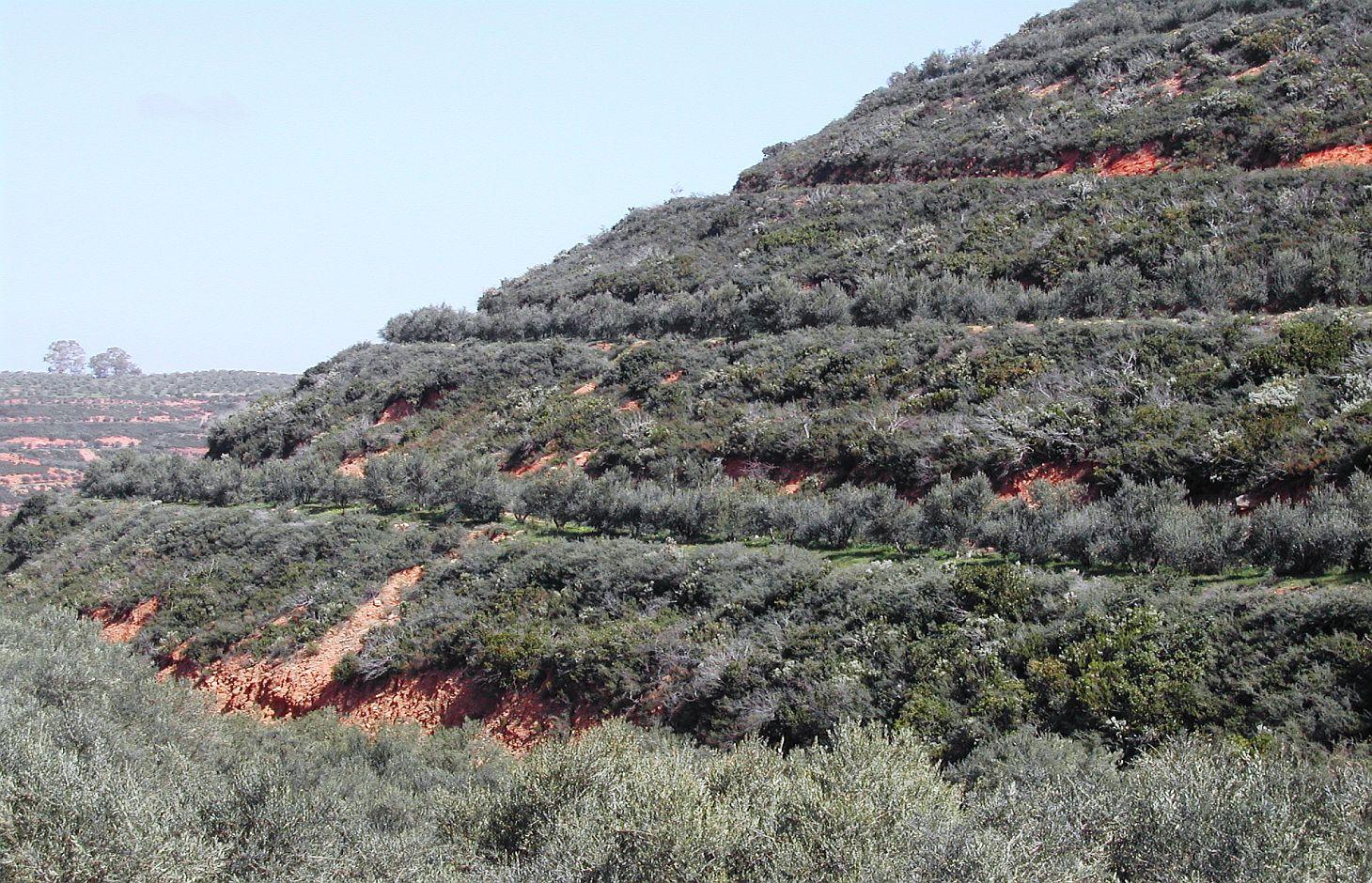
Bench terrace is the main type of terraces existing in the area of Chania. Land terracing is mainly found in the middle and upper zone of the study area and especially in steep slopes and in soils formed mainly in shale or conglomerates parent material. The land in which terraces have been constructed is estimated to 7.7% of the total area of Chania. Some bench terraces have been constructed recently in very steep slopes for cultivating the land.
Local agronomists recommend the construction of terraces as a measure for soil erosion protection in hilly areas.
The first step for construction of bench terrace is to clear the field of trash, dead furrows are filled in, and small ridges are levelled. The interval between terraces depends on soil characteristics and amount of rainfall. Usually, it is not recommended space interval narrower than 30 meters. Terrace system design usually begins with a technician evaluating the water regime of the field from observations, soil surveys, and other information. The next decision is whether waterways should follow natural draws or be constructed on new sites. The channel along the terrace for removing excess of runoff water is at least 30 to 45 cm deep and the maximum allowed gradient 0.4% for most soils to avoid serious erosion. Terrace layout begins from the highest point of the field. The vertical fall and slope gradient from the high point to the approximate site of the top terrace, usually 30 to 50 m downslope (depending on gradient), is determined with an engineering level. It is usually preferable to begin staking a terrace at the waterway and work up to the top end. Usually some stakes need to be reset to avoid short, sharp curves and to make field work parallel to the terrace easier. The first layout of a terrace system seldom achieves the most satisfactory design. Some unexpected topographical feature may show up and necessitate changing one or more terrace lines. The final terrace positions should be identified by plough furrows or other implement marks before construction begins. Conventional terraces can be built with bulldozers, motor patrol graders, carryall scrapers, elevating grader terracers, mould-board ploughs, disk tillers with 60 cm or larger disks, and with hand tools and baskets, headpans, or other carrying devices. Terraces rarely should be longer than 600 m. Terraces should not be longer than 375 m on already gullied land. Longer terraces need to be sub¬divided with an outlet provided for each segment. Terraces must be wide enough to accommodate the equipment that will be used in the field, generally not less than 4.5 m. The flatter these slopes are, the easier is to farm but the more expensive they are to build. Trees are usually planted in the upper part of the terrace. In modern terraced fields crop cultivation is fully mechanized. In such terraced fields all farm operations should carried out as nearly as parallel to the terrace as possible to minimize water and soil movement between terraces and to reduce damage to the terrace ridges. The most evident effect of tillage operations, after several years is the increase in the base width of the terrace. The best method of maintaining the shape of the terrace cross section and counteracting erosion from the inter-terraced area is by ploughing with a reversible mouldboard. In steep slopes is recommended to keep the natural vegetation in the part of the steep slope for soil erosion protection.
2.3 Photos of the Technology
Media Gallery
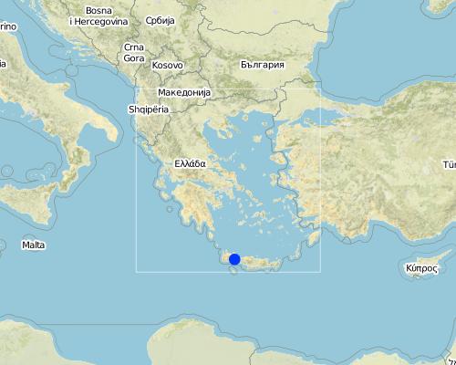
2.5 Country/ region/ locations where the Technology has been applied and which are covered by this assessment
Country:
Greece
Region/ State/ Province:
Selinos province
Further specification of location:
Chania-Cete
Map
×2.6 Date of implementation
If precise year is not known, indicate approximate date:
- more than 50 years ago (traditional)
2.7 Introduction of the Technology
Specify how the Technology was introduced:
- as part of a traditional system (> 50 years)
3. Classification of the SLM Technology
3.1 Main purpose(s) of the Technology
- reduce, prevent, restore land degradation
- conserve ecosystem
3.2 Current land use type(s) where the Technology is applied

Cropland
- Tree and shrub cropping
Comments:
Major land use problems (compiler’s opinion): Soil erosion and loss of water
Major land use problems (land users’ perception): Difficulties in cultivatiing the land and harvesting the olive fruits
Future (final) land use (after implementation of SLM Technology): Cropland: Ct: Tree and shrub cropping
Livestock is grazing on crop residues
If land use has changed due to the implementation of the Technology, indicate land use before implementation of the Technology:
Mixed: Mf: Agroforestry
3.3 Further information about land use
Water supply for the land on which the Technology is applied:
- rainfed
Number of growing seasons per year:
- 2
Specify:
Longest growing period in days: 120, Longest growing period from month to month: March to July, Second longest growing period in days: 150, Second longest growing period from month to month: March to August
3.4 SLM group to which the Technology belongs
- cross-slope measure
3.5 Spread of the Technology
Comments:
Total area covered by the SLM Technology is 55 m2.
3.6 SLM measures comprising the Technology

structural measures
- S1: Terraces
3.7 Main types of land degradation addressed by the Technology

soil erosion by water
- Wt: loss of topsoil/ surface erosion

water degradation
- Ha: aridification
Comments:
Main causes of degradation: deforestation / removal of natural vegetation (incl. forest fires) (Clearing of natural vegetation for planting olives. Natural vegetation is kept in the steep slope for soil erosion protection), inputs and infrastructure: (roads, markets, distribution of water points, other, …) (access to the field by machineries)
Secondary causes of degradation: other human induced causes (specify) (destroying soil characteristics)
3.8 Prevention, reduction, or restoration of land degradation
Specify the goal of the Technology with regard to land degradation:
- reduce land degradation
4. Technical specifications, implementation activities, inputs, and costs
4.1 Technical drawing of the Technology
Author:
C. Kosmas
4.2 Technical specifications/ explanations of technical drawing
size of the terrace including bench and sloping part is 35 meters. The original slope with the natural vegetation is 64%. The bench width is 6 meters, the size of the sloping part with natural vegetation is 22 meters, and the length of the bench 145 meters. Olive trees have been planted 2 meters from upper part of the bench.
The vertical interval (VI in meters) between two adjacent terraces can be estimated by the formula given by the U.S. Soil Conservation Service: VI = xS + y. Where x is rainfall factor, S is slope gradient (%), and y is soil and cropping factor. The U.S. Soil conservation Service recommends values for x and y 0.12-0.24, and 0.3-1.2, respectively. The horizontal interval (HI in meters) can be calculated from the equation: HI = (VI/S)*100.
Location: Strovles. Crete
Date: 5/2007
Technical knowledge required for field staff / advisors: moderate (It needs planning of location of various strips and water outlets)
Technical knowledge required for land users: moderate (technical supoport)
Main technical functions: reduction of slope angle, reduction of slope length, increase / maintain water stored in soil
Secondary technical functions: stabilisation of soil (eg by tree roots against land slides)
Terrace: bench level
Spacing between structures (m): 35
Width of ditches/pits/dams (m): 6
Length of ditches/pits/dams (m): 145
Construction material (earth): Displacement of soil for constructing the bench
Slope (which determines the spacing indicated above): 65%
Lateral gradient along the structure: 65%
4.3 General information regarding the calculation of inputs and costs
other/ national currency (specify):
Euro
Indicate exchange rate from USD to local currency (if relevant): 1 USD =:
1.39
Indicate average wage cost of hired labour per day:
80.00
4.4 Establishment activities
| Activity | Type of measure | Timing | |
|---|---|---|---|
| 1. | Shaping the land using a bulldoze and constructing terraces, cost 1950 euro/ha | Structural | once |
4.5 Costs and inputs needed for establishment
| Specify input | Unit | Quantity | Costs per Unit | Total costs per input | % of costs borne by land users | |
|---|---|---|---|---|---|---|
| Equipment | machine use | ha | 1.0 | 1950.0 | 1950.0 | |
| Total costs for establishment of the Technology | 1950.0 | |||||
Comments:
Duration of establishment phase: 24 month(s)
4.6 Maintenance/ recurrent activities
| Activity | Type of measure | Timing/ frequency | |
|---|---|---|---|
| 1. | clearing waterways, and checking terraces for collapse, cost 60 euro/ha | Structural | once per year |
4.7 Costs and inputs needed for maintenance/ recurrent activities (per year)
| Specify input | Unit | Quantity | Costs per Unit | Total costs per input | % of costs borne by land users | |
|---|---|---|---|---|---|---|
| Equipment | machine use | ha | 1.0 | 60.0 | 60.0 | |
| Total costs for maintenance of the Technology | 60.0 | |||||
Comments:
Machinery/ tools: Bullldoze
year 2011
4.8 Most important factors affecting the costs
Describe the most determinate factors affecting the costs:
Slope angle, soil depth, parent material
5. Natural and human environment
5.1 Climate
Annual rainfall
- < 250 mm
- 251-500 mm
- 501-750 mm
- 751-1,000 mm
- 1,001-1,500 mm
- 1,501-2,000 mm
- 2,001-3,000 mm
- 3,001-4,000 mm
- > 4,000 mm
Specifications/ comments on rainfall:
670 mm, 6 months dry period
Agro-climatic zone
- sub-humid
- semi-arid
Thermal climate class: tropics, temperate
5.2 Topography
Slopes on average:
- flat (0-2%)
- gentle (3-5%)
- moderate (6-10%)
- rolling (11-15%)
- hilly (16-30%)
- steep (31-60%)
- very steep (>60%)
Landforms:
- plateau/plains
- ridges
- mountain slopes
- hill slopes
- footslopes
- valley floors
Altitudinal zone:
- 0-100 m a.s.l.
- 101-500 m a.s.l.
- 501-1,000 m a.s.l.
- 1,001-1,500 m a.s.l.
- 1,501-2,000 m a.s.l.
- 2,001-2,500 m a.s.l.
- 2,501-3,000 m a.s.l.
- 3,001-4,000 m a.s.l.
- > 4,000 m a.s.l.
5.3 Soils
Soil depth on average:
- very shallow (0-20 cm)
- shallow (21-50 cm)
- moderately deep (51-80 cm)
- deep (81-120 cm)
- very deep (> 120 cm)
Soil texture (topsoil):
- medium (loamy, silty)
- fine/ heavy (clay)
Topsoil organic matter:
- medium (1-3%)
5.4 Water availability and quality
Ground water table:
> 50 m
Availability of surface water:
good
Water quality (untreated):
for agricultural use only (irrigation)
5.5 Biodiversity
Species diversity:
- high
5.6 Characteristics of land users applying the Technology
Market orientation of production system:
- subsistence (self-supply)
- mixed (subsistence/ commercial
Off-farm income:
- less than 10% of all income
Relative level of wealth:
- average
- rich
Individuals or groups:
- individual/ household
Level of mechanization:
- animal traction
- mechanized/ motorized
Gender:
- men
Indicate other relevant characteristics of the land users:
Land users applying the Technology are mainly common / average land users
Difference in the involvement of women and men: Women use to work in the house
Population density: 10-50 persons/km2
Annual population growth: 0.5% - 1%
50% of the land users are average wealthy.
5.7 Average area of land owned or leased by land users applying the Technology
- < 0.5 ha
- 0.5-1 ha
- 1-2 ha
- 2-5 ha
- 5-15 ha
- 15-50 ha
- 50-100 ha
- 100-500 ha
- 500-1,000 ha
- 1,000-10,000 ha
- > 10,000 ha
Is this considered small-, medium- or large-scale (referring to local context)?
- small-scale
5.8 Land ownership, land use rights, and water use rights
Land ownership:
- communal/ village
- individual, titled
Land use rights:
- individual
Water use rights:
- communal (organized)
- individual
5.9 Access to services and infrastructure
technical assistance:
- poor
- moderate
- good
markets:
- poor
- moderate
- good
roads and transport:
- poor
- moderate
- good
financial services:
- poor
- moderate
- good
6. Impacts and concluding statements
6.1 On-site impacts the Technology has shown
Socio-economic impacts
Production
crop production
Quantity before SLM:
1200 kg/ha
Quantity after SLM:
1500 kg/ha
product diversity
land management
Quantity before SLM:
120 euro/ha
Quantity after SLM:
80 euro/ha
Income and costs
farm income
Quantity before SLM:
3600 euro/ha
Quantity after SLM:
4500 euro/ha
Socio-cultural impacts
cultural opportunities
recreational opportunities
conflict mitigation
contribution to human well-being
Comments/ specify:
increase farmers income and reduction the off site effects
Ecological impacts
Water cycle/ runoff
water quantity
Comments/ specify:
15% more water stored into the soil
surface runoff
Comments/ specify:
75% reduction in runoff
Soil
soil moisture
Comments/ specify:
10% increase in soil moisture
soil loss
Comments/ specify:
75% reduction in soil loss
6.2 Off-site impacts the Technology has shown
downstream flooding
6.3 Exposure and sensitivity of the Technology to gradual climate change and climate-related extremes/ disasters (as perceived by land users)
Climate-related extremes (disasters)
Meteorological disasters
| How does the Technology cope with it? | |
|---|---|
| local rainstorm | not well |
6.4 Cost-benefit analysis
How do the benefits compare with the establishment costs (from land users’ perspective)?
Short-term returns:
negative
Long-term returns:
positive
How do the benefits compare with the maintenance/ recurrent costs (from land users' perspective)?
Short-term returns:
positive
Long-term returns:
positive
6.5 Adoption of the Technology
- more than 50%
Of all those who have adopted the Technology, how many have did so spontaneously, i.e. without receiving any material incentives/ payments?
- 50-90%
Comments:
15% of land user families have adopted the Technology with external material support
150 land user families have adopted the Technology with external material support
85% of land user families have adopted the Technology without any external material support
240 land user families have adopted the Technology without any external material support
There is a moderate trend towards spontaneous adoption of the Technology
6.7 Strengths/ advantages/ opportunities of the Technology
| Strengths/ advantages/ opportunities in the land user’s view |
|---|
| increase of farmers income from the land exploitation in less favourable areas |
| Strengths/ advantages/ opportunities in the compiler’s or other key resource person’s view |
|---|
| Land terracing is one of the soil conservation and cultivation techniques for combating land desertification . It is a practice applied to reduce rainfall runoff on sloping land, from accumulating and causing serious problems of soil erosion. Terraces, usually allow better management of soil and water, improve access to land and facilitate farm operations. |
6.8 Weaknesses/ disadvantages/ risks of the Technology and ways of overcoming them
| Weaknesses/ disadvantages/ risks in the land user’s view | How can they be overcome? |
|---|---|
| Planning of land terracing | Local institutes and experts to help them |
| Weaknesses/ disadvantages/ risks in the compiler’s or other key resource person’s view | How can they be overcome? |
|---|---|
| Disturbing natural environment and landscapes | Better planning |
7. References and links
7.1 Methods/ sources of information
- field visits, field surveys
- interviews with land users
Links and modules
Expand all Collapse allLinks
Sustainable development of olive groves III [Greece]
No description available.
- Compiler: Costas Kosmas
Modules
No modules