Technologies

Stone faced trench [Ethiopia]

Emnigetsu metrebawi zala

technologies_1396 - Ethiopia

Completeness: 71%

1. General information

1.2 Contact details of resource persons and institutions involved in the assessment and documentation of the Technology

Key resource person(s)

SLM specialist:

Giday Hlefom

Ministry of Agriculture and Natural Resources

Ethiopia

{'additional_translations': {}, 'value': 1094, 'label': 'Name of the institution(s) which facilitated the documentation/ evaluation of the Technology (if relevant)', 'text': 'Ministry of Agriculture and Natural Resources (MoA) - Ethiopia', 'template': 'raw'}

1.3 Conditions regarding the use of data documented through WOCAT

The compiler and key resource person(s) accept the conditions regarding the use of data documented through WOCAT:

Yes

2. Description of the SLM Technology

2.1 Short description of the Technology

Definition of the Technology:

Construction of stones walls along the contour with trenches on the upper side of the structure while the upper part of the structure filled with soil and compacted.

2.2 Detailed description of the Technology

Description:

allignment of the soil along the contour, diiging of foundation, trench construction, spacing tie ridge, tree planting,

Purpose of the Technology: reduce erosion, increase soil moisture, recharge ground water, decrease ground water

Establishment / maintenance activities and inputs: stone wall construction, trench digging, tree and forage planting, area closure

Natural / human environment: enhance vegetation growth, decrease desertification, increase biodiversity

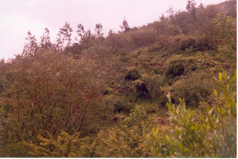
2.3 Photos of the Technology

2.5 Country/ region/ locations where the Technology has been applied and which are covered by this assessment

Country:

Ethiopia

Region/ State/ Province:

Tigray

Further specification of location:

Atsbi Womberta

Comments:

Total area covered by the SLM Technology is 20.3 km2.

in some places some of the structures spacing closer than the design requirement

{'is_geometry': True, 'configuration': 'technologies', 'additional_translations': {}, 'key': 'Map', 'value': '{"type":"FeatureCollection","features":[{"type":"Feature","id":1490254924771,"geometry":{"type":"Point","coordinates":[39,13]},"properties":null}]}', 'questionnaire_object': <Questionnaire: {"qg_name": [{"name": {"en": "Stone faced trench"}, "name_local": {"en": "Emnigetsu metrebawi zala"}}], "qg_photos": [{"image": "e09ea067-b9da-4336-adfd-eff70fa8a6de", "image_location": {"en": "Tigray"}}], "tech_qg_1": [{"tech_definition": {"en": "Construction of stones walls along the contour with trenches on the upper side of the structure while the upper part of the structure filled with soil and compacted."}}], "tech_qg_2": [{"tech_description": {"en": "allignment of the soil along the contour, diiging of foundation, trench construction, spacing tie ridge, tree planting,\r\n\r\nPurpose of the Technology: reduce erosion, increase soil moisture, recharge ground water, decrease ground water\r\n\r\nEstablishment / maintenance activities and inputs: stone wall construction, trench digging, tree and forage planting, area closure\r\n\r\nNatural / human environment: enhance vegetation growth, decrease desertification, increase biodiversity"}}], "tech_qg_5": [{"tech_who_implemented": ["implementation_externally"], "tech_who_implemented_comments": {"en": "From outside the country"}}], "tech_qg_6": [{"tech_main_purpose": ["main_purpose_degradation", "main_purpose_biodiversity"]}], "tech_qg_7": [{"tech_lu_comments": {"en": "Major land use problems (compiler\u2019s opinion): deforestation, soil erosion and overgrazing\r\n\r\nMajor land use problems (land users\u2019 perception): shortage of fuel wood, shortage of food, shortage of drinking water, soil erosion\r\n\r\nClear felling of (semi-)natural forests: illegal cutting of trees\r\n\r\nPlantation forestry: Yes"}}], "tech_qg_9": [{"tech_landuse_2018": ["tech_lu_grazingland", "tech_lu_forest"]}], "tech_qg_12": [{"tech_lu_forest_type": ["lu_forest_natural", "lu_forest_plantation"], "tech_lu_forest_other": {"en": "Cut and carry"}, "tech_lu_forest_natural": ["lu_forest_clearfelling"], "tech_lu_forest_products": ["tech_lu_forestproducts_fuelwood", "tech_lu_forestproducts_otherproducts", "tech_lu_forestproducts_conservation"]}], "tech_qg_19": [{"tech_watersupply_comments": {"en": "Number of growing seasons per year:\r\n 1\r\n\r\nSpecify:\r\nLongest growing period in days: 180 Longest growing period from month to month: Jun - Oct"}}], "tech_qg_20": [{"tech_slm_group": ["tech_slm_group_crossslope"]}], "tech_qg_26": [{"tech_measures_comments": {"en": "Main measures: structural measures\r\n\r\nSecondary measures: agronomic measures, vegetative measures, management measures\r\n\r\nType of vegetative measures: aligned: -contour"}}], "tech_qg_27": [{"tech_degradation": ["degradation_erosion_water", "degradation_chemical", "degradation_water"]}], "tech_qg_28": [{"degradation_erosion_water_sub": ["degradation_wt", "degradation_wg"]}], "tech_qg_30": [{"degradation_chemical_sub": ["degradation_cn"]}], "tech_qg_33": [{"degradation_water_sub": ["degradation_ha"]}], "tech_qg_34": [{"degradation_comments": {"en": "Main type of degradation addressed: Wt: loss of topsoil / surface erosion\r\n\r\nSecondary types of degradation addressed: Wg: gully erosion / gullying, Cn: fertility decline and reduced organic matter content, Ha: aridification"}}], "tech_qg_35": [{"tech_prevention": ["intervention_reduce_ld"], "tech_prevention_comments": {"en": "Secondary goals: prevention of land degradation, rehabilitation / reclamation of denuded land"}}], "tech_qg_36": [{"tech_input_est_unit": {"en": "ha"}, "tech_input_est_costs": 234.0, "tech_input_est_specify": {"en": "Labour"}, "tech_input_est_quantity": 1.0, "tech_input_est_total_costs_pi": 234.0, "tech_input_est_percentage_costs": 10.0}, {"tech_input_est_unit": {"en": "ha"}, "tech_input_est_costs": 45.0, "tech_input_est_specify": {"en": "Harvesting"}, "tech_input_est_quantity": 1.0, "tech_input_est_total_costs_pi": 45.0}], "tech_qg_37": [{"tech_input_est_unit": {"en": "ha"}, "tech_input_est_costs": 14.0, "tech_input_est_specify": {"en": "Tools"}, "tech_input_est_quantity": 1.0, "tech_input_est_total_costs_pi": 14.0, "tech_input_est_percentage_costs": 5.0}], "tech_qg_38": [{"tech_input_est_unit": {"en": "ha"}, "tech_input_est_costs": 86.0, "tech_input_est_specify": {"en": "Seedlings"}, "tech_input_est_quantity": 1.0, "tech_input_est_total_costs_pi": 86.0}], "tech_qg_43": [{"tech_maint_timing": {"en": "July /once"}, "tech_maint_activity": {"en": "replanting"}}, {"tech_maint_timing": {"en": "January/once"}, "tech_maint_activity": {"en": "stone collection"}}], "tech_qg_45": [{"tech_input_maint_unit": {"en": "ha"}, "tech_input_maint_costs": 4.0, "tech_input_maint_specify": {"en": "Labour"}, "tech_input_maint_quantity": 1.0, "tech_input_maint_total_costs_pi": 4.0, "tech_input_maint_percentage_costs": 100.0}], "tech_qg_52": [{"tech_input_maint_comments": {"en": "Machinery/ tools: hand tools\r\n\r\nlength of structure"}}], "tech_qg_54": [{"tech_rainfall": ["tech_rainfall_251_500"], "tech_rainfall_annual": 300.0}], "tech_qg_55": [{"tech_agroclimatic_zone": ["tech_agroclimatic_zone_subhumid", "tech_agroclimatic_zone_semiarid"]}], "tech_qg_56": [{"tech_slopes": ["tech_slopes_hilly", "tech_slopes_steep"], "tech_landforms": ["tech_landforms_mountainslopes"], "tech_altitudinalzone": ["tech_altitudinalzone_2000_2500"]}], "tech_qg_57": [{"tech_topography_comments": {"en": "Altitudinal zone: 1500-3000 m a.s.l.\r\nLandforma: Also hillslopes and footslopes\r\nSlopes on average: Also moderate and rolling"}}], "tech_qg_58": [{"tech_soil_depth": ["tech_soil_depth_shallow"], "tech_topsoil_organic": ["tech_topsoil_organic_medium", "tech_topsoil_organic_low"], "tech_soil_texture_topsoil": ["tech_soil_texture_medium"]}], "tech_qg_59": [{"tech_soil_comments": {"en": "Soil texture: Medium (also fine/heavy and coarse/light) \r\nSoil fertility is low-medium\r\nSoil drainage/infiltration is medium \r\nSoil water storage capacity is medium-low"}}], "tech_qg_71": [{"tech_wealth": ["tech_wealth_verypoor", "tech_wealth_poor"], "tech_mechanisation": ["mechanisation_manual", "mechanisation_animal"], "tech_offfarm_income": ["offfarm_income_0_10"], "tech_market_orientation": ["tech_market_orientation_subsistence"]}], "tech_qg_72": [{"tech_land_size": ["tech_land_size_05_1"]}], "tech_qg_73": [{"tech_ownership": ["tech_ownership_state"]}], "tech_qg_76": [{"tech_impacts_cropproduction": 7}], "tech_qg_77": [{"tech_landuser_comments": {"en": "Annual population growth: 3% - 4%\r\n\r\n40% of the land users are poor and own 40% of the land.\r\n60% of the land users are poor and own 60% of the land.\r\n\r\nOff-farm income specification: there is no difference"}}], "tech_qg_79": [{"tech_impacts_fodderproduction": 6}], "tech_qg_80": [{"tech_impacts_fodderquality": 6}], "tech_qg_82": [{"tech_impacts_woodproduction": 5}], "tech_qg_87": [{"tech_impacts_productionarea": 4}], "tech_qg_93": [{"tech_input_est_comments": {"en": "Duration of establishment phase: 84 month(s)"}}], "tech_qg_95": [{"tech_input_determinate_factors": {"en": "labour, slope, low survival rate of seedlings"}}], "qg_location": [{"country": "country_ETH", "state_province": {"en": "Tigray"}, "further_location": {"en": "Atsbi Womberta"}}], "tech_qg_104": [{"tech_impacts_farmincome": 7}], "tech_qg_113": [{"tech_impacts_community": 7}], "tech_qg_115": [{"tech_impacts_slmknowledge": 7}], "tech_qg_122": [{"tech_impacts_waterdrainage": 4}], "tech_qg_125": [{"tech_impacts_soilmoisture": 7}], "tech_qg_126": [{"tech_impacts_soilcover": 6}], "tech_qg_127": [{"tech_impacts_soilloss": 7}], "tech_qg_147": [{"tech_impacts_downstreamflooding": 6}], "tech_qg_148": [{"tech_impacts_reliableflows": 5}], "tech_qg_149": [{"tech_impacts_downstreamsiltation": 6}], "tech_qg_150": [{"tech_impacts_groundwaterpollution": 4}], "tech_qg_160": [{"tech_implementation_decades": "implemenation_50_plus"}], "tech_qg_164": [{"tech_input_average_wage": {"en": "0.88"}, "tech_input_exchange_rate": 8.0, "tech_input_national_currency": {"en": "birr"}}], "tech_qg_165": [{"tech_est_timing": {"en": "July-June"}, "tech_est_activity": {"en": "seedling production"}}, {"tech_est_timing": {"en": "April-May"}, "tech_est_activity": {"en": "pitting"}}, {"tech_est_timing": {"en": "July"}, "tech_est_activity": {"en": "planting"}}, {"tech_est_timing": {"en": "July"}, "tech_est_activity": {"en": "over sawing of grasses"}}, {"tech_est_timing": {"en": "Dec.-April"}, "tech_est_activity": {"en": "survey & layout"}}, {"tech_est_timing": {"en": "Dec.-April"}, "tech_est_activity": {"en": "collection of stones"}}, {"tech_est_timing": {"en": "Dec.-April"}, "tech_est_activity": {"en": "digging foundation & trench"}}, {"tech_est_timing": {"en": "Jan.-April"}, "tech_est_activity": {"en": "construction"}}, {"tech_est_timing": {"en": "the whole year"}, "tech_est_activity": {"en": "site guard"}}, {"tech_est_timing": {"en": "onset of rainy season"}, "tech_est_activity": {"en": "enrichment plantation and replanting"}}], "tech_qg_181": [{"tech_costbenefit_est_long": "costbenefit_verypositive", "tech_costbenefit_est_short": "costbenefit_positive"}], "tech_qg_182": [{"tech_costbenefit_est_long": "costbenefit_positive", "tech_costbenefit_est_short": "costbenefit_slightlypositive"}], "tech_qg_184": [{"country": "country_ETH", "person_lastname": {"en": "Giday"}, "person_firstname": {"en": "Hlefom"}, "person_institution_name": {"en": "Ministry of Agriculture and Natural Resources"}, "user_resourceperson_type": "resourceperson_slmspecialist"}], "tech_qg_185": [{"tech_specifications": {"en": "Technical knowledge required for field staff / advisors: moderate\r\n\r\nTechnical knowledge required for land users: moderate\r\n\r\nMain technical functions: control of dispersed runoff: retain / trap, control of concentrated runoff: retain / trap, reduction of slope angle, reduction of slope length\r\n\r\nSecondary technical functions: improvement of ground cover, increase of infiltration, water harvesting / increase water supply\r\n\r\nAligned: -contour\r\nVegetative material: T : trees / shrubs, G : grass\r\nNumber of plants per (ha): 2500\r\nVertical interval between rows / strips / blocks (m): 1\r\nSpacing between rows / strips / blocks (m): 10\r\nVertical interval within rows / strips / blocks (m): 0.5\r\nWidth within rows / strips / blocks (m): 1\r\n\r\nSlope (which determines the spacing indicated above): 25.00%\r\n\r\nIf the original slope has changed as a result of the Technology, the slope today is (see figure below): 15.00%\r\n\r\nGradient along the rows / strips: 0.00%\r\n\r\nBund/ bank: level\r\nVertical interval between structures (m): 1\r\nSpacing between structures (m): 10\r\nDepth of ditches/pits/dams (m): 0.5\r\nWidth of ditches/pits/dams (m): 0.85\r\nLength of ditches/pits/dams (m): 5\r\nHeight of bunds/banks/others (m): 0.9\r\nWidth of bunds/banks/others (m): 1\r\nLength of bunds/banks/others (m): 250\r\n\r\nSlope (which determines the spacing indicated above): 25%\r\n\r\nIf the original slope has changed as a result of the Technology, the slope today is: 15%\r\n\r\nLateral gradient along the structure: 0%\r\n\r\nVegetation is used for stabilisation of structures.\r\n\r\nChange of land use practices / intensity level: area closure"}}], "tech_qg_186": [{"tech_impacts_other_measure": 7, "tech_impacts_other_specify": {"en": "Honey production"}, "tech_impacts_other_labelleft": {"en": "decreased"}, "tech_impacts_other_labelright": {"en": "increased"}}], "tech_qg_189": [{"tech_impacts_other_measure": 6, "tech_impacts_other_specify": {"en": "Biodiversity"}, "tech_impacts_other_labelleft": {"en": "decreased"}, "tech_impacts_other_labelright": {"en": "increased"}}, {"tech_impacts_other_measure": 5, "tech_impacts_other_specify": {"en": "Soil fertility"}, "tech_impacts_other_labelleft": {"en": "decreased"}, "tech_impacts_other_labelright": {"en": "increased"}}], "tech_qg_191": [{"tech_adoption_comments": {"en": "100% of land user families have adopted the Technology with external material support\r\n\r\n35000 land user families have adopted the Technology with external material support\r\n\r\nComments on acceptance with external material support: estimates\r\n\r\nThere is no trend towards spontaneous adoption of the Technology\r\n\r\nComments on adoption trend: it is constructed on the hillside and it is labourous"}, "tech_adoption_spontaneously": "tech_adoption_spont_0_10"}], "tech_qg_222": [{"tech_input_est_total_costs": 379.0}], "tech_qg_223": [{"tech_input_maint_total_costs": 4.0}], "tech_qg_225": [{"location_comments": {"en": "Total area covered by the SLM Technology is 20.3 km2.\r\n\r\nin some places some of the structures spacing closer than the design requirement"}}], "tech_qg_232": [{"tech_input_est_total_costs_usd": 47.38}], "tech_qg_233": [{"tech_input_maint_total_costs_usd": 0.5}], "tech_qg_250": [{"date_documentation": "01/08/2003"}], "qg_location_map": [{"location_map": "{\"type\":\"FeatureCollection\",\"features\":[{\"type\":\"Feature\",\"id\":1490254924771,\"geometry\":{\"type\":\"Point\",\"coordinates\":[39,13]},\"properties\":null}]}"}], "qg_accept_conditions": [{"accept_conditions": 1}], "qg_strengths_compiler": [{"strengths_compiler": {"en": "it has a great contribution for the sustainability of production"}}, {"strengths_compiler": {"en": "increase the flow of streams"}}, {"strengths_compiler": {"en": "recharge and increase water table"}}], "qg_funding_institution": [{"funding_institution": 1094}], "qg_strengths_landusers": [{"strengths_landuser": {"en": "highly appreciate the construction of the trench because it enhance soil miosture and improve productivity of land and cropproduction."}}], "qg_weaknesses_compiler": [{"weaknesses_compiler": {"en": "it needs much labour during construction"}, "weaknesses_overcome": {"en": "mobilize the community"}}, {"weaknesses_compiler": {"en": "it takes land out of production"}, "weaknesses_overcome": {"en": "integrate the technology with other vegetative measures in order to increase the productivity of land including the areas ocuppied by the structure"}}], "qg_weaknesses_landusers": [{"weaknesses_landuser": {"en": "restricts free grazing"}, "weaknesses_overcome": {"en": "allow cut and carry from the area closure"}}]}>, 'map_url': '/en/wocat/technologies/view/technologies_1396/map/', 'template': 'raw'}

2.6 Date of implementation

If precise year is not known, indicate approximate date:
  • more than 50 years ago (traditional)

2.7 Introduction of the Technology

Specify how the Technology was introduced:
  • through projects/ external interventions
Comments (type of project, etc.):

From outside the country

3. Classification of the SLM Technology

3.1 Main purpose(s) of the Technology

  • reduce, prevent, restore land degradation
  • preserve/ improve biodiversity

3.2 Current land use type(s) where the Technology is applied

Grazing land

Grazing land

Forest/ woodlands

Forest/ woodlands

  • (Semi-)natural forests/ woodlands
  • Tree plantation, afforestation
(Semi-)natural forests/ woodlands: Specify management type:
  • Clear felling
Products and services:
  • Fuelwood
  • Other forest products
  • Nature conservation/ protection
  • Cut and carry
Comments:

Major land use problems (compiler’s opinion): deforestation, soil erosion and overgrazing

Major land use problems (land users’ perception): shortage of fuel wood, shortage of food, shortage of drinking water, soil erosion

Clear felling of (semi-)natural forests: illegal cutting of trees

Plantation forestry: Yes

3.4 Water supply

Comments:

Number of growing seasons per year:
1

Specify:
Longest growing period in days: 180 Longest growing period from month to month: Jun - Oct

3.5 SLM group to which the Technology belongs

  • cross-slope measure

3.6 SLM measures comprising the Technology

3.7 Main types of land degradation addressed by the Technology

soil erosion by water

soil erosion by water

  • Wt: loss of topsoil/ surface erosion
  • Wg: gully erosion/ gullying
chemical soil deterioration

chemical soil deterioration

  • Cn: fertility decline and reduced organic matter content (not caused by erosion)
water degradation

water degradation

  • Ha: aridification
Comments:

Main type of degradation addressed: Wt: loss of topsoil / surface erosion

Secondary types of degradation addressed: Wg: gully erosion / gullying, Cn: fertility decline and reduced organic matter content, Ha: aridification

3.8 Prevention, reduction, or restoration of land degradation

Specify the goal of the Technology with regard to land degradation:
  • reduce land degradation
Comments:

Secondary goals: prevention of land degradation, rehabilitation / reclamation of denuded land

4. Technical specifications, implementation activities, inputs, and costs

4.1 Technical drawing of the Technology

{'additional_translations': {}, 'content_type': None, 'preview_image': '', 'key': 'Technical drawing', 'value': None, 'template': 'raw'}
Technical specifications (related to technical drawing):

Technical knowledge required for field staff / advisors: moderate

Technical knowledge required for land users: moderate

Main technical functions: control of dispersed runoff: retain / trap, control of concentrated runoff: retain / trap, reduction of slope angle, reduction of slope length

Secondary technical functions: improvement of ground cover, increase of infiltration, water harvesting / increase water supply

Aligned: -contour
Vegetative material: T : trees / shrubs, G : grass
Number of plants per (ha): 2500
Vertical interval between rows / strips / blocks (m): 1
Spacing between rows / strips / blocks (m): 10
Vertical interval within rows / strips / blocks (m): 0.5
Width within rows / strips / blocks (m): 1

Slope (which determines the spacing indicated above): 25.00%

If the original slope has changed as a result of the Technology, the slope today is (see figure below): 15.00%

Gradient along the rows / strips: 0.00%

Bund/ bank: level
Vertical interval between structures (m): 1
Spacing between structures (m): 10
Depth of ditches/pits/dams (m): 0.5
Width of ditches/pits/dams (m): 0.85
Length of ditches/pits/dams (m): 5
Height of bunds/banks/others (m): 0.9
Width of bunds/banks/others (m): 1
Length of bunds/banks/others (m): 250

Slope (which determines the spacing indicated above): 25%

If the original slope has changed as a result of the Technology, the slope today is: 15%

Lateral gradient along the structure: 0%

Vegetation is used for stabilisation of structures.

Change of land use practices / intensity level: area closure

4.2 General information regarding the calculation of inputs and costs

other/ national currency (specify):

birr

If relevant, indicate exchange rate from USD to local currency (e.g. 1 USD = 79.9 Brazilian Real): 1 USD =:

8.0

Indicate average wage cost of hired labour per day:

0.88

4.3 Establishment activities

Activity Timing (season)
1. seedling production July-June
2. pitting April-May
3. planting July
4. over sawing of grasses July
5. survey & layout Dec.-April
6. collection of stones Dec.-April
7. digging foundation & trench Dec.-April
8. construction Jan.-April
9. site guard the whole year
10. enrichment plantation and replanting onset of rainy season

4.4 Costs and inputs needed for establishment

Specify input Unit Quantity Costs per Unit Total costs per input % of costs borne by land users
Labour Labour ha 1.0 234.0 234.0 10.0
Labour Harvesting ha 1.0 45.0 45.0
Equipment Tools ha 1.0 14.0 14.0 5.0
Plant material Seedlings ha 1.0 86.0 86.0
Total costs for establishment of the Technology 379.0
Total costs for establishment of the Technology in USD 47.38
Comments:

Duration of establishment phase: 84 month(s)

4.5 Maintenance/ recurrent activities

Activity Timing/ frequency
1. replanting July /once
2. stone collection January/once

4.6 Costs and inputs needed for maintenance/ recurrent activities (per year)

Specify input Unit Quantity Costs per Unit Total costs per input % of costs borne by land users
Labour Labour ha 1.0 4.0 4.0 100.0
Total costs for maintenance of the Technology 4.0
Total costs for maintenance of the Technology in USD 0.5
Comments:

Machinery/ tools: hand tools

length of structure

4.7 Most important factors affecting the costs

Describe the most determinate factors affecting the costs:

labour, slope, low survival rate of seedlings

5. Natural and human environment

5.1 Climate

Annual rainfall
  • < 250 mm
  • 251-500 mm
  • 501-750 mm
  • 751-1,000 mm
  • 1,001-1,500 mm
  • 1,501-2,000 mm
  • 2,001-3,000 mm
  • 3,001-4,000 mm
  • > 4,000 mm
Specify average annual rainfall (if known), in mm:

300.00

Agro-climatic zone
  • sub-humid
  • semi-arid

5.2 Topography

Slopes on average:
  • flat (0-2%)
  • gentle (3-5%)
  • moderate (6-10%)
  • rolling (11-15%)
  • hilly (16-30%)
  • steep (31-60%)
  • very steep (>60%)
Landforms:
  • plateau/plains
  • ridges
  • mountain slopes
  • hill slopes
  • footslopes
  • valley floors
Altitudinal zone:
  • 0-100 m a.s.l.
  • 101-500 m a.s.l.
  • 501-1,000 m a.s.l.
  • 1,001-1,500 m a.s.l.
  • 1,501-2,000 m a.s.l.
  • 2,001-2,500 m a.s.l.
  • 2,501-3,000 m a.s.l.
  • 3,001-4,000 m a.s.l.
  • > 4,000 m a.s.l.
Comments and further specifications on topography:

Altitudinal zone: 1500-3000 m a.s.l.
Landforma: Also hillslopes and footslopes
Slopes on average: Also moderate and rolling

5.3 Soils

Soil depth on average:
  • very shallow (0-20 cm)
  • shallow (21-50 cm)
  • moderately deep (51-80 cm)
  • deep (81-120 cm)
  • very deep (> 120 cm)
Soil texture (topsoil):
  • medium (loamy, silty)
Topsoil organic matter:
  • medium (1-3%)
  • low (<1%)
If available, attach full soil description or specify the available information, e.g. soil type, soil PH/ acidity, Cation Exchange Capacity, nitrogen, salinity etc.

Soil texture: Medium (also fine/heavy and coarse/light)
Soil fertility is low-medium
Soil drainage/infiltration is medium
Soil water storage capacity is medium-low

5.6 Characteristics of land users applying the Technology

Market orientation of production system:
  • subsistence (self-supply)
Off-farm income:
  • less than 10% of all income
Relative level of wealth:
  • very poor
  • poor
Level of mechanization:
  • manual work
  • animal traction
Indicate other relevant characteristics of the land users:

Annual population growth: 3% - 4%

40% of the land users are poor and own 40% of the land.
60% of the land users are poor and own 60% of the land.

Off-farm income specification: there is no difference

5.7 Average area of land used by land users applying the Technology

  • < 0.5 ha
  • 0.5-1 ha
  • 1-2 ha
  • 2-5 ha
  • 5-15 ha
  • 15-50 ha
  • 50-100 ha
  • 100-500 ha
  • 500-1,000 ha
  • 1,000-10,000 ha
  • > 10,000 ha

5.8 Land ownership, land use rights, and water use rights

Land ownership:
  • state

6. Impacts and concluding statements

6.1 On-site impacts the Technology has shown

Socio-economic impacts

Production

crop production

decreased
increased

fodder production

decreased
increased

fodder quality

decreased
increased

wood production

decreased
increased

production area

decreased
increased
Income and costs

farm income

decreased
increased
Other socio-economic impacts

Honey production

decreased
increased

Socio-cultural impacts

community institutions

weakened
strengthened

SLM/ land degradation knowledge

reduced
improved

Ecological impacts

Water cycle/ runoff

excess water drainage

reduced
improved
Soil

soil moisture

decreased
increased

soil cover

reduced
improved

soil loss

increased
decreased
Other ecological impacts

Biodiversity

decreased
increased

Soil fertility

decreased
increased

6.2 Off-site impacts the Technology has shown

reliable and stable stream flows in dry season

reduced
increased

downstream flooding

increased
reduced

downstream siltation

increased
decreased

groundwater/ river pollution

increased
reduced

6.4 Cost-benefit analysis

How do the benefits compare with the establishment costs (from land users’ perspective)?
Short-term returns:

positive

Long-term returns:

very positive

How do the benefits compare with the maintenance/ recurrent costs (from land users' perspective)?
Short-term returns:

slightly positive

Long-term returns:

positive

6.5 Adoption of the Technology

Of all those who have adopted the Technology, how many did so spontaneously, i.e. without receiving any material incentives/ payments?
  • 0-10%
Comments:

100% of land user families have adopted the Technology with external material support

35000 land user families have adopted the Technology with external material support

Comments on acceptance with external material support: estimates

There is no trend towards spontaneous adoption of the Technology

Comments on adoption trend: it is constructed on the hillside and it is labourous

6.7 Strengths/ advantages/ opportunities of the Technology

Strengths/ advantages/ opportunities in the land user’s view
highly appreciate the construction of the trench because it enhance soil miosture and improve productivity of land and cropproduction.
Strengths/ advantages/ opportunities in the compiler’s or other key resource person’s view
it has a great contribution for the sustainability of production
increase the flow of streams
recharge and increase water table

6.8 Weaknesses/ disadvantages/ risks of the Technology and ways of overcoming them

Weaknesses/ disadvantages/ risks in the land user’s view How can they be overcome?
restricts free grazing allow cut and carry from the area closure
Weaknesses/ disadvantages/ risks in the compiler’s or other key resource person’s view How can they be overcome?
it needs much labour during construction mobilize the community
it takes land out of production integrate the technology with other vegetative measures in order to increase the productivity of land including the areas ocuppied by the structure

7. References and links

7.1 Methods/ sources of information

Links and modules

Expand all Collapse all

Modules