Small Watershed Comprehensive Development [China]
- Creation:
- Update:
- Compiler: Jun XIA
- Editor: –
- Reviewers: David Streiff, Alexandra Gavilano
Integrated administration/control of small basin
technologies_973 - China
View sections
Expand all Collapse all1. General information
1.2 Contact details of resource persons and institutions involved in the assessment and documentation of the Technology
Key resource person(s)
SLM specialist:
1.3 Conditions regarding the use of data documented through WOCAT
The compiler and key resource person(s) accept the conditions regarding the use of data documented through WOCAT:
Yes
1.5 Reference to Questionnaire(s) on SLM Approaches (documented using WOCAT)

Small Watershed Comprehensive Control [China]
Controlling a small watershed comprehensively with structural, vegetative, management, and agronomic measures based on harvesting area of ground water and underground water, to improve the production and conservation of land.
- Compiler: Jun XIA
2. Description of the SLM Technology
2.1 Short description of the Technology
Definition of the Technology:
Controlling a small watershed comprehensively with structural, vegetative, management, and agronomic measures based on harvesting area of ground water and underground water, to improve the production and conservation of land.
2.2 Detailed description of the Technology
Description:
Over several decades of SWC practices, a successful experience of SWC has been concluded, that is Small Watershed Comprehensive Development. The main aim is regarded a small watershed as a control unit for soil and water conservation. The approach is to control soil and water loss comprehensively by structural measure combining vegetative, agronomic and management measures. Specifically:
1. Agronomic method/measure: contour cultivation, area closure, and green manure
2. Vegetative method/measure: plant trees, grass, grass strip, windbreaks and reforestation
3. Structural method/measures: terrace, ands, small reservoir, and dams
4. Land use management/measure: grazing, area closure, and land use change
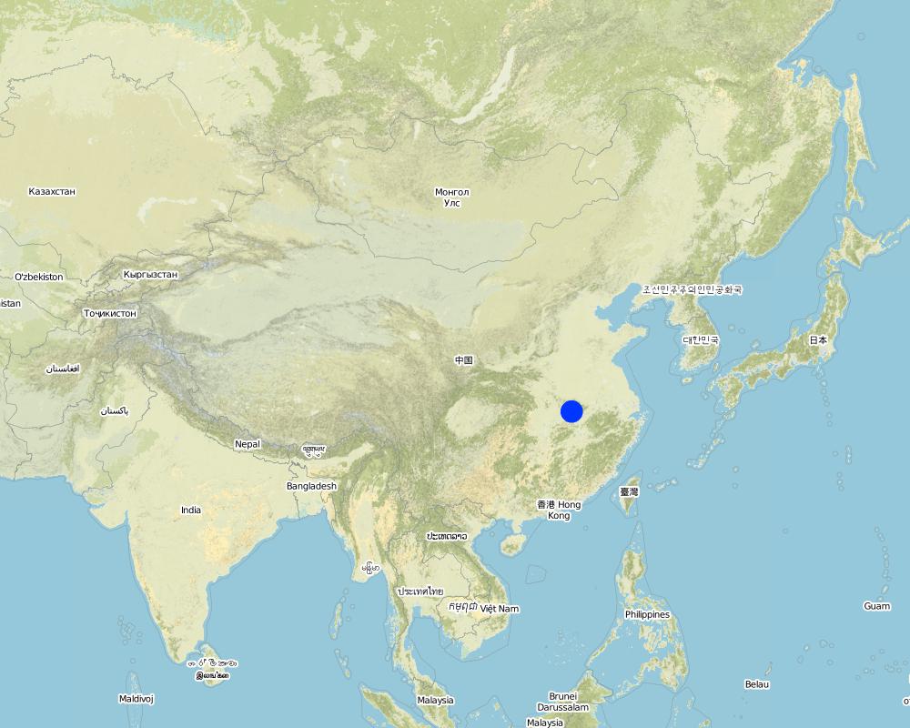
2.5 Country/ region/ locations where the Technology has been applied and which are covered by this assessment
Country:
China
Region/ State/ Province:
Hubei
Specify the spread of the Technology:
- evenly spread over an area
If the Technology is evenly spread over an area, specify area covered (in km2):
39.8
If precise area is not known, indicate approximate area covered:
- 10-100 km2
Comments:
Total area covered by the SLM Technology is 39.8 km2.
Map
×2.6 Date of implementation
If precise year is not known, indicate approximate date:
- more than 50 years ago (traditional)
2.7 Introduction of the Technology
Specify how the Technology was introduced:
- through projects/ external interventions
Comments (type of project, etc.):
From 1950's, China began to work on integrated control of watershed based on the long term experiences of the mass's practices in SWC.
3. Classification of the SLM Technology
3.1 Main purpose(s) of the Technology
- protect a watershed/ downstream areas – in combination with other Technologies
3.2 Current land use type(s) where the Technology is applied
Land use mixed within the same land unit:
Yes
Specify mixed land use (crops/ grazing/ trees):
- Agroforestry

Cropland
- Annual cropping
Annual cropping - Specify crops:
- cereals - wheat (winter)
- rice
Number of growing seasons per year:
- 3
Specify:
Longest growing period in days: 90Longest growing period from month to month: Jul - SepSecond longest growing period in days: 60Second longest growing period from month to month: May - Jun

Forest/ woodlands
Type of tree:
- Pinus species (pine)
- Economic forest with small water comprehensiv effect
Comments:
Main crops (cash and food crops): Winter wheat - rice, or cole - rice.
Major land use problems (compiler’s opinion): In the mountainous area, land users always open up wasteland along slopes to improve/increase the productivity, but these lands tend to increase in the soil loss. In my opinion, in these areas land users should plant trees to develop economy, increase the annual productivity to improve the economy.
Major land use problems (land users’ perception): The land users become to realize the importance of maintaining ecological balance, so many of them are now acting to plant trees and stopping overgrazing in the areas.
Grazingland comments: More recently, SWC areas are closed, calling for stall feeding.
Problems / comments regarding forest use: Developing more fruit trees and economic woodland.
Type of grazing system comments: More recently, SWC areas are closed, calling for stall feeding.
3.4 Water supply
Water supply for the land on which the Technology is applied:
- rainfed
Comments:
Water supply also mixed rainfed - irrigated
3.5 SLM group to which the Technology belongs
- surface water management (spring, river, lakes, sea)
3.6 SLM measures comprising the Technology

agronomic measures
- A7: Others

vegetative measures
- V2: Grasses and perennial herbaceous plants

structural measures
- S1: Terraces
- S5: Dams, pans, ponds
- S7: Water harvesting/ supply/ irrigation equipment

management measures
- M1: Change of land use type
Comments:
Type of agronomic measures: early planting, zero tillage / no-till, minimum tillage, contour tillage
3.7 Main types of land degradation addressed by the Technology

soil erosion by water
- Wt: loss of topsoil/ surface erosion

chemical soil deterioration
- Cn: fertility decline and reduced organic matter content (not caused by erosion)
Comments:
Main type of degradation addressed: Wt: loss of topsoil / surface erosion, Cn: fertility decline and reduced organic matter content
Main causes of degradation: deforestation / removal of natural vegetation (incl. forest fires), poverty / wealth (Lack of captial)
3.8 Prevention, reduction, or restoration of land degradation
Specify the goal of the Technology with regard to land degradation:
- reduce land degradation
4. Technical specifications, implementation activities, inputs, and costs
4.1 Technical drawing of the Technology
Technical specifications (related to technical drawing):
Technical knowledge required for field staff / advisors: low
Technical knowledge required for land users: moderate
Main technical functions: control of raindrop splash, control of dispersed runoff: retain / trap, control of concentrated runoff: retain / trap, control of concentrated runoff: impede / retard, control of concentrated runoff: drain / divert, reduction of slope angle, improvement of ground cover, increase of surface roughness, increase in organic matter, increase of infiltration, increase / maintain water stored in soil, water harvesting / increase water supply, sediment retention / trapping, sediment harvesting, increase in soil fertility, improvement of soil structure
Early planting
Material/ species: velamen
Quantity/ density: Row
Zero tillage / no-till
Material/ species: On the slope lands where have
Minimum tillage
Material/ species: On the slopes where have
Trees/ shrubs species: pine
Slope (which determines the spacing indicated above): 28.00%
If the original slope has changed as a result of the Technology, the slope today is (see figure below): 15.00%
Gradient along the rows / strips: 60.00%
Slope (which determines the spacing indicated above): 28.00%
If the original slope has changed as a result of the Technology, the slope today is: 15.00%
Lateral gradient along the structure: 40.00%
For water harvesting: the ratio between the area where the harvested water is applied and the total area from which water is collected is: 1:5.00
Vegetation is used for stabilisation of structures.
4.2 General information regarding the calculation of inputs and costs
Specify currency used for cost calculations:
- USD
Indicate average wage cost of hired labour per day:
1.70
4.3 Establishment activities
| Activity | Timing (season) | |
|---|---|---|
| 1. | plant fence beside terrace | 1965 |
| 2. | terrace | 1968 |
| 3. | small reservior | 1959 |
4.4 Costs and inputs needed for establishment
Comments:
Duration of establishment phase: 84 month(s)
4.5 Maintenance/ recurrent activities
| Activity | Timing/ frequency | |
|---|---|---|
| 1. | conserving soil and planting crops | seeding season / annual |
| 2. | improve fertilizer | winter, spring / |
| 3. | increase fertilizer | seeding season / |
| 4. | Cutting fence, planting | fall /annual |
| 5. | terrace | leisure/annual |
| 6. | small reservior | winter/annual |
4.6 Costs and inputs needed for maintenance/ recurrent activities (per year)
Comments:
It is estimated from the management in local area.
4.7 Most important factors affecting the costs
Describe the most determinate factors affecting the costs:
Much money is needed to build terraces if hill slope is steeper.
5. Natural and human environment
5.1 Climate
Annual rainfall
- < 250 mm
- 251-500 mm
- 501-750 mm
- 751-1,000 mm
- 1,001-1,500 mm
- 1,501-2,000 mm
- 2,001-3,000 mm
- 3,001-4,000 mm
- > 4,000 mm
Agro-climatic zone
- humid
5.2 Topography
Slopes on average:
- flat (0-2%)
- gentle (3-5%)
- moderate (6-10%)
- rolling (11-15%)
- hilly (16-30%)
- steep (31-60%)
- very steep (>60%)
Landforms:
- plateau/plains
- ridges
- mountain slopes
- hill slopes
- footslopes
- valley floors
Altitudinal zone:
- 0-100 m a.s.l.
- 101-500 m a.s.l.
- 501-1,000 m a.s.l.
- 1,001-1,500 m a.s.l.
- 1,501-2,000 m a.s.l.
- 2,001-2,500 m a.s.l.
- 2,501-3,000 m a.s.l.
- 3,001-4,000 m a.s.l.
- > 4,000 m a.s.l.
Comments and further specifications on topography:
Landforms also valley floors and footslopes
5.3 Soils
Soil depth on average:
- very shallow (0-20 cm)
- shallow (21-50 cm)
- moderately deep (51-80 cm)
- deep (81-120 cm)
- very deep (> 120 cm)
Soil texture (topsoil):
- coarse/ light (sandy)
Topsoil organic matter:
- medium (1-3%)
If available, attach full soil description or specify the available information, e.g. soil type, soil PH/ acidity, Cation Exchange Capacity, nitrogen, salinity etc.
Soil fertility; medium
Soil drainage / infiltration: good
Soil water storage capacity: low
5.6 Characteristics of land users applying the Technology
Off-farm income:
- > 50% of all income
Relative level of wealth:
- average
- rich
Level of mechanization:
- animal traction
- mechanized/ motorized
Indicate other relevant characteristics of the land users:
Population density: 100-200 persons/km2
Annual population growth: < 0.5%
80% of the land users are rich and own 100% of the land (Lease bared land).
Off-farm income specification: It is much different between whose who have SWC practice and not involved in the SWC. Those who take part in the SWC implementation can get much benefits than whose who not.
Level of mechanization: animal traction: Land in the mountain areas are very small, tilled using animal labor, some are tilled by tractor.
Level of mechanization: mechanized/motorized: If area of land is large enough for tractor.
5.8 Land ownership, land use rights, and water use rights
Land ownership:
- state
Land use rights:
- individual
6. Impacts and concluding statements
6.1 On-site impacts the Technology has shown
Ecological impacts
Water cycle/ runoff
surface runoff
Quantity before SLM:
40
Quantity after SLM:
20
Soil
soil loss
Quantity before SLM:
570
Quantity after SLM:
60
6.4 Cost-benefit analysis
How do the benefits compare with the establishment costs (from land users’ perspective)?
Short-term returns:
positive
Long-term returns:
very positive
How do the benefits compare with the maintenance/ recurrent costs (from land users' perspective)?
Short-term returns:
positive
Long-term returns:
very positive
6.5 Adoption of the Technology
If available, quantify (no. of households and/ or area covered):
138 Households
Of all those who have adopted the Technology, how many did so spontaneously, i.e. without receiving any material incentives/ payments?
- 11-50%
Comments:
90% of land user families have adopted the Technology with external material support
80 land user families have adopted the Technology with external material support
Comments on acceptance with external material support: estimates
30% of land user families have adopted the Technology without any external material support
58 land user families have adopted the Technology without any external material support
Comments on spontaneous adoption: estimates
There is a strong trend towards spontaneous adoption of the Technology
Comments on adoption trend: More and more peasants and local government become to understand the advantages. They would use these technologies. Meanwhile they also want to get help from the government.
7. References and links
7.1 Methods/ sources of information
Links and modules
Expand all Collapse allLinks
Small Watershed Comprehensive Control [China]
Controlling a small watershed comprehensively with structural, vegetative, management, and agronomic measures based on harvesting area of ground water and underground water, to improve the production and conservation of land.
- Compiler: Jun XIA
Modules
No modules