Willows and gabions will protect the village from Riverbank erosion (Nodir Muhidinov)
Villages at the northern slopes of the Turkestan range in Sughd region are often located at riverbanks. The amounts of water flowing in the river channels naturally varies much during the year. After intensive rainfall or snowmelt the water flow can suddenly increase manifold. These flashfloods carry huge amounts of debris and are therefore even more destructive. The combined effects of degradation of woodlands and rangelands in the upper catchments and the impact of climate change with accelerated snowmelt and higher frequency and intensity of heavy rainfall events have increased the risks of these debris flows. In several villages of Sughd region, especially in Spitamen and Devashtich districts, riverbank erosion during flashflood and debris flows increasingly threatened houses, infrastructure and productive lands.
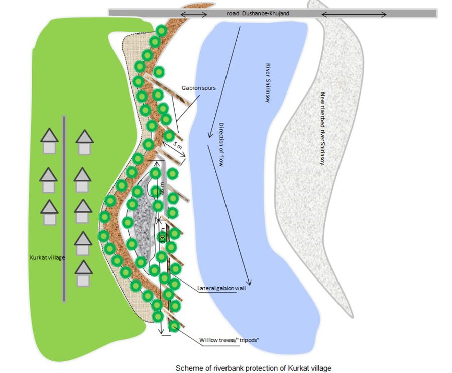
GIZ in collaboration with the local branches of the Committee for Emergency Situations, district and sub-district authorities assisted local community in the implementation of riverbank protection measures. The design of the protective structure was specifically adapted to the local situation. For achieving immediately reliable protection structural measures (“grey”) included:
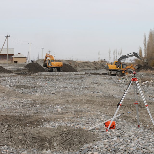
•Modification of river channels with excavators and bulldozers to redirect flows;
•Erection of dykes and spurs from large rocks along erosion prone riverbanks;
•Erection of lateral gabion walls along erosion prone riverbanks;
•Erection of gabion spurs, which concentrate the water flow in the center of the river channel and thus reduce the force of water and debris on riverbanks and lateral gabion walls.
In the long run “grey” measures tend to be damaged by flashfloods and debris flows. “Green” measures can enforce the protective structures and thus increase the sustainability, effectiveness and cost efficiency of structural measures. Willows are particularly suitable for erosion prevention in river channels as they grow fast, establish a large fixing root system in the riverbed, their wood is flexible and withstands intensive force and they well regenerate after damage. “Green” measures for reinforcing riverbank protection included:
•Planting of single willow saplings in rows immediately behind stone dykes;
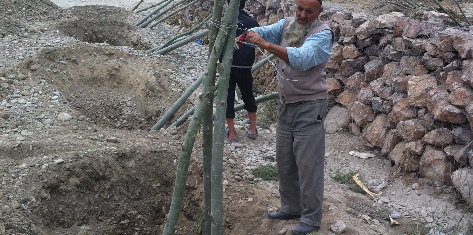
•Planting of willows in form of one or several rows of three seedlings per spot, connected with cords to “tripods” to increase stability;
•Planting of willows in form of one or several rows of three seedlings per spot, connected with cords to “tripods” around a small gabion, which additionally increases the resistance of the planted willows against the forces of water and debris.
The works have been overseen by the GIZ engineer, GIZ also covered expenses for gabion nets and machinery, while willow branches and labor were provided by the communities.
After up to five years the riverbank protection is still functional at all sites and prevented damage from floods to lives and property. No substantial damage occurred to the erected structures despite several heavy flashflood and debris flow events at all sites. Most planted willows established well, have substantially grown and provide an increasingly effective protection. In few spots willows dried up, where washed out or damaged by livestock and replanting would be necessary to maintain the effectiveness of the riverbank protection. In the future the willows can be used as coppice wood with their large branches cut, providing new planting material for additional “green” protection measures, for construction and as fuel. Additionally the willows contribute to the local biodiversity by providing habitat for birds and other animals, improve the microclimate and improve the view of the villages and the landscape. The multiple benefits from the “green” measures are expected to motivate care by the villagers, in particular prevention of damage caused by livestock and insufficient water supply and replanting of lost trees.
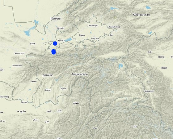
Lugar: Spitamen district, Devashtich district, Sughd region, Tayikistán
No. de sitios de Tecnología analizados: 2-10 sitios
Difusión de la Tecnología: aplicada en puntos específicos/ concentrada en un área pequeña
¿En un área de protección permanente?: No
Fecha de la implementación: 2013; hace menos de 10 años (recientemente)
Tipo de introducción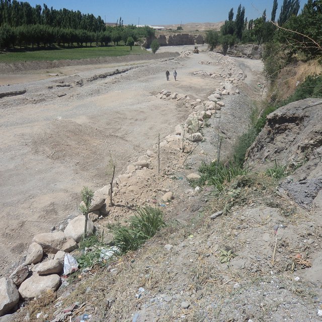


| Especifique insumo | Unidad | Cantidad | Costos por unidad (TJS) | Costos totales por insumo (TJS) | % de los costos cubiertos por los usuarios de las tierras |
| Mano de obra | |||||
| Construction of tripod from a willow tree and gabion net | pieces | 46,0 | |||
| Constrcution of gabion spurs | m³ | 381,0 | |||
| Laying down gabion net | m² | 812,4 | |||
| Equipo | |||||
| Excavator | m³ | 1800,0 | |||
| Buldozer | m³ | 7040,0 | |||
| Material para plantas | |||||
| willow tree tripods | pieces | 46,0 | |||
| Material de construcción | |||||
| Gabion net | m² | 812,4 | |||
| Stones for gabions | m³ | 381,0 | |||
Locally additional land reclaimed for fruit trees.
Cantidad antes de MST: 0
Cantidad luego de MST: Some
Use of willow branches for small construction and as fuel
Cantidad antes de MST: High damage
Cantidad luego de MST: Low or zero damage
Effective protection against medium and large events, potentially no full protection in case of extreme events.
Local improvement due to trees planted
Redirected river channel can locally cause lateral erosion.


