MAPPING, MONITORING, AND MITIGATION OF LAND DEGRADATION IN THE SULTANATE OF OMAN [Omán]
- Creación:
- Actualización:
- Compilador: Laila AlShmali
- Editor: –
- Revisores: William Critchley, Rima Mekdaschi Studer
MAPPING, MONITORING, AND MITIGATION OF LAND DEGRADATION IN THE SULTANATE OF OMAN
approaches_5972 - Omán
Visualizar secciones
Expandir todo Colapsar todos1. Información general
1.2 Detalles de contacto de las personas de referencia e instituciones involucradas en la evaluación y la documentación del Enfoque
Persona(s) de referencia clave/s
Especialista MST:
Al-Sareeria Thuraya
00968 24404762
thuraya.alsareeri@meca.gov.om
Environment Authority
Muscat, Oman
Omán
Especialista MST:
Al-Saadi Saleh Naghmush
00968 24404750
saleh.alsaadi@meca.gov.om
Environment Authority
Muscat, Oman
Omán
researcher:
Al-Wardy Malik
00968 24141224
mwardy@squ.edu.om
Sultan Qaboos University
Muscat, Oman
Omán
Nombre de la(s) institución(es) que facilitaron la documentación/ evaluación del Enfoque si fuera relevante)
Sultan Qaboos University (SQU) - Omán1.3 Condiciones referidas al uso de datos documentados mediante WOCAT
¿Cuándo se compilaron los datos (en el campo)?
15/09/2013
El compilador y la/s persona(s) de referencia claves aceptan las condiciones acerca del uso de los datos documentados mediante WOCAT :
Sí
2. Descripción del Enfoque MST
2.1 Breve descripción del Enfoque
Mapping of land degradation in the Sultanate of Oman to identify areas with various degrees of degradation, and factors and processes causing degradation.
2.2 Descripción detallada del Enfoque MST
Descripción detallada del Enfoque MST:
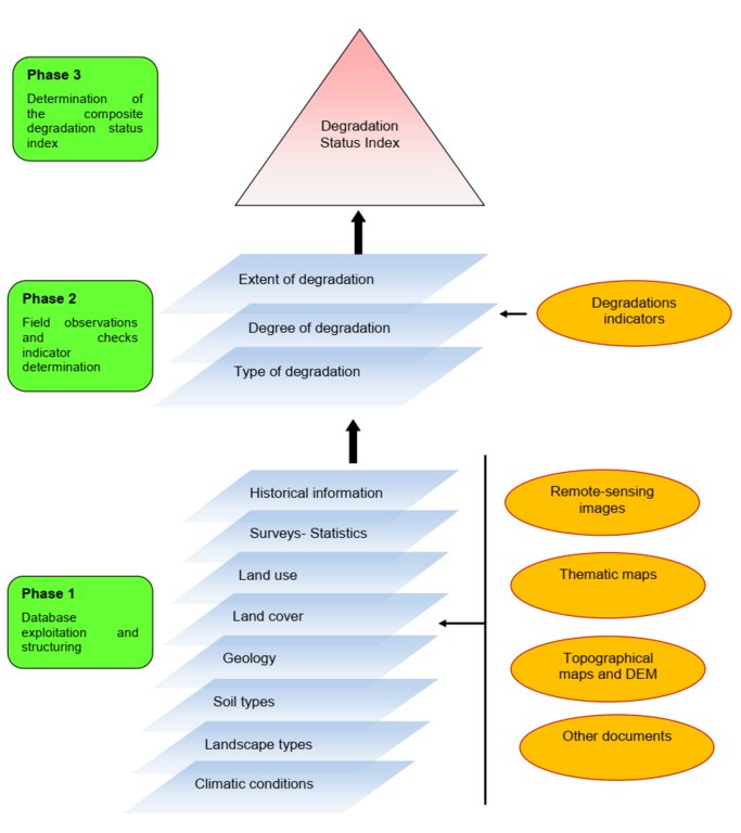
The Environment Authority has implemented land degradation mapping in the Sultanate of Oman in the Governorate of Dhofar, South and North Al Sharqiyah Governorates, and the Governorate of Al Dakhiliyah, in cooperation with Sultan Qaboos University, with the aim of identifying areas with various degrees of degradation and identifying the factors and processes causing degradation.
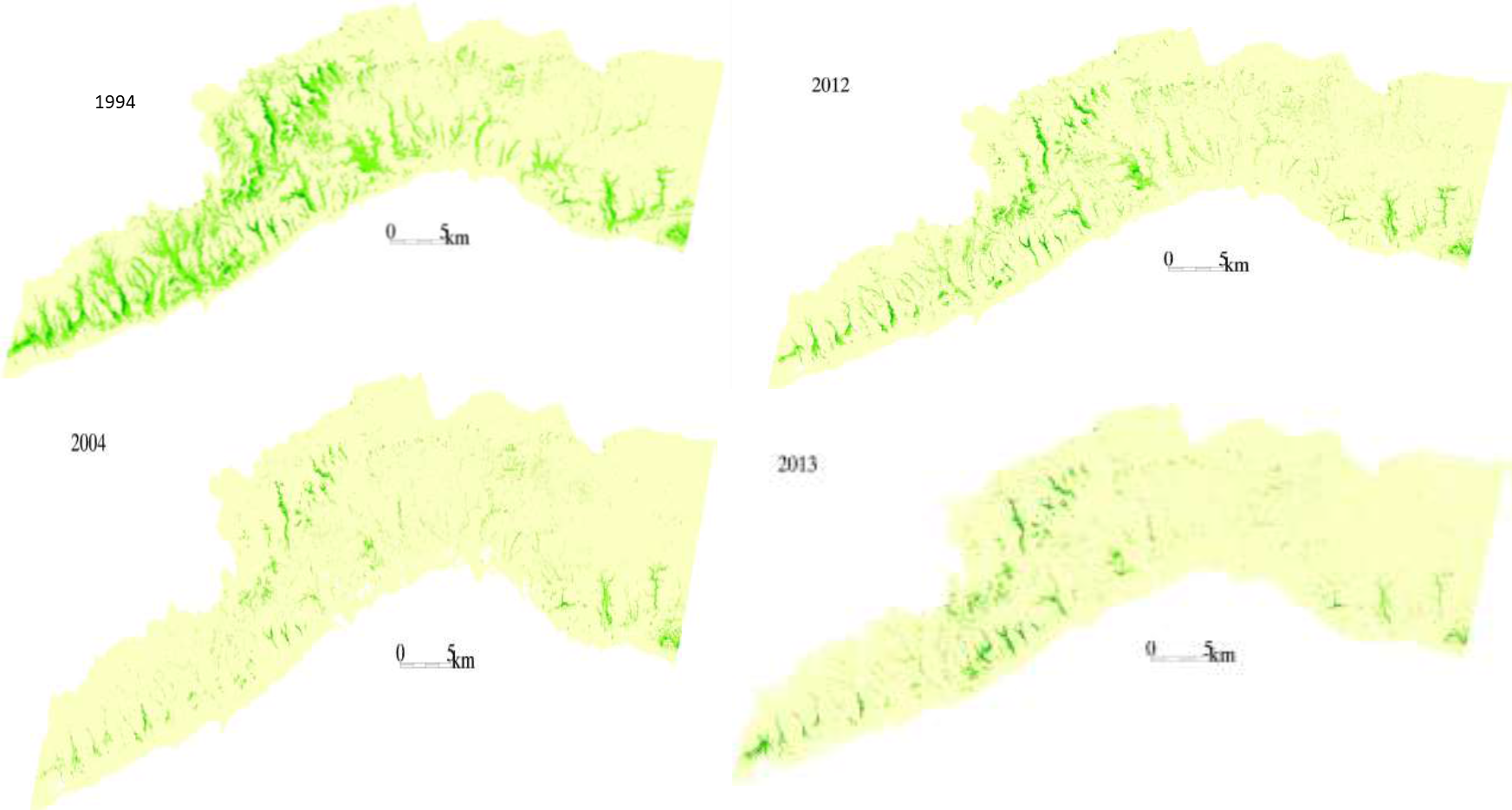
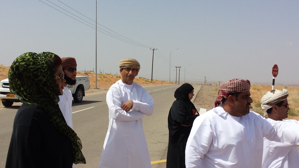
This investigation was based on high-resolution satellite imagery using NDVI as an Index of land degradation in the Dhofar Mountains and the invasion of mesquite (Prosopis juliflora.) in the plain of Salalah, as well as very high resolution aerial and satellite images of Jebal Al-Akhder derived from National Survey Authority. Precipitation data from two WMO stations were also utilized to test the link between precipitation and vegetation health. Vegetation was mapped to monitor changes and its health over time. In addition, a socio-economic survey in the Governorate of Dhofar was conducted, based on random sampling. The survey covered 6 different locations (Taqa, Taaqa farm, Zaik, Qiroon, Marbath, Al-Haqq and Taitam). The preliminary results clearly show that the study area has witnessed significant land use change between 1985 and 2013, marked by the emerging of a significant built-up area and water conservation infrastructure.
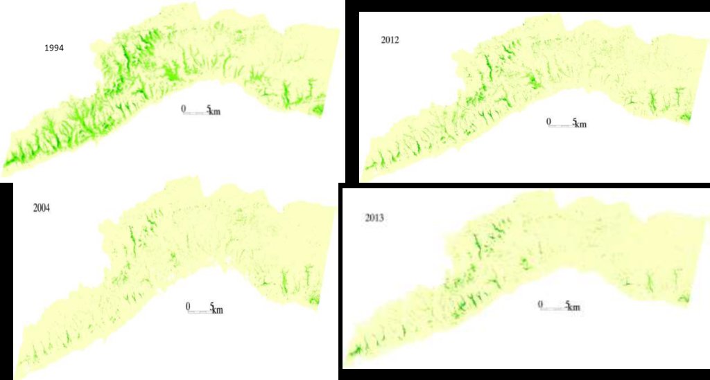
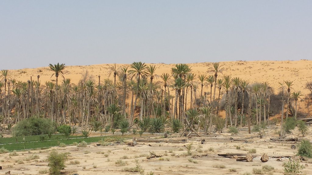
Spot images clearly show sharp changes in vegetation health through the years from 1994 to 2013. Vegetative vigour is lower in all years compared to 1994. Besides, the investigation shows a statistical relationship between rainfall and the status of the health of vegetation. Monsoon rainfall has an impact on the growth of vegetation. Around 2002-2003, the region suffered a major drought. Between 2012 and 2013, vegetative activity shows a decreasing trend. The analysis identified an area affected by the worst degree of land degradation. This area is situated in the southeastern of the Dhofar Mountains. In this area the process of land degradation is very active, with significant decrease in vegetation in 2013 compared to 2004. The mequite invasion in the Salalah Plain contributed to the degradation of natural vegetative cover in Dhofar Governorate. In nearly 30 years, the infested area almost quadrupled, indicating an average rate of expansion of 122,555m2 per year. The mesquite stands seem to have survived through the drought of 2002-2003.
The preliminary results of the survey clearly show that the mountains of Dhofar are under heavy anthropic pressure. The number of livestock is increasing and the native plant species are in great demand for cooking and heating.
Fortunately, the analysis identifies two areas, situated in the south-west of the study area, where vegetation has increased in vigor and density. The areas preserved from this process are usually inaccessible and far from human activities.
Vegetation cover change in Al-Jabal Al-Akhdar from 1985 to 2014 was analysed using very high resolution aerial and satellite images. Vegetation cover is also studied near settlements, dams, in wadis, and in agricultural areas. The change in total vegetation cover in the study area of Al-Jabal Al-Akhdar from 1985 to 2014 is very evident from the analysis of the data and maps produced.
Vegetation cover increased from 7.38 km2 during 1985 to 13.65 km2 in 2014. This change of vegetation cover was most noticeable in wadis and gullies where vegetation increased from 4.56 km2 during to 9.38 km2. One main factor that might be contributing to this increase of vegetation in wadis is the increase in the number of dams for storing surface water, as the number of dams increased from 7 in 1985 in the study area to 27 in 2014. Vegetation within and around 1 km of settlements in the study area increased from 2.09 km2 during 1985 to 5.45 km2 in 2014. In all other areas, that are distant from human activities, there is a considerable change in green vegetation cover between 1985 and 2014 where vegetation cover increased from 2.49 km2 in 1985 to 3.91 km2 in 2014. It is important to note here that vegetation cover density has a strong correlation with the amount of rainfall in Al-Jabal Al-Akhdar and there was a large difference in the annual rainfall between the two years, i.e. 1985 and 2014. The annual rainfall in 1985 was about 150mm for that particular year. The year 1984 was not much better where annual rainfall was lower than 200mm according to available records. The annual rainfall in 2013, the year preceding date of image in 2014, was 466mm, which is three times higher that that of 1985. Given the results of this study, there is a clear indication that the amount of rainfall plays a major role in defining the density of vegetation cover even if land degradation is taking place in very localized areas where there is pressure from grazing, urbanization, and tourism.
2.3 Fotos del Enfoque
2.5 País/ región/ lugares donde el Enfoque fue aplicado
País:
Omán
Región/ Estado/ Provincia:
Governorate of Dhofar, North and South Al Sharqiyah Governorates and Governorate of Al Dakhiliyah
Especifique más el lugar :
Governorate of Dhofar: Taqa, Taaqa farm, Zaik, Qiroon, Marbath, Al-Haqq and Taitam Governorate of Al Dakhiliyah: Al-Jabal Al-Akhdar
2.6 Fechas de inicio y conclusión del Enfoque
Indique año del inicio:
2013
2.7 Tipo de Enfoque
- proyecto/ basado en un programa
2.8 Propósitos/ objetivos principales del Enfoque
1.Monitoring and survey of land degradation and areas vulnerable to degradation
2.Enhancing human abilities in land degradation issues
3.Identifying various degrees of degraded areas, and factors and processes causing degradation
4.Regular monitoring of degraded areas
2.9 Condiciones que facilitan o impiden la implementación de la/s Tecnología/s aplicadas bajo el Enfoque
normas y valores sociales/ culturales/ religiosos
- facilitan
Cultural and religious values encourage the protection of land and planting of trees
colaboración/ coordinación de actores
- facilitan
There is always a good collaboration between the government and academic/research institutions to determine the right approaches and technologies for better management practices
marco de trabajo legal (tenencia de tierra, derechos de uso de tierra y agua)
- impiden
In some regions land tenure is not defined which affects grazing activities in these regions making it difficult to implement any replanting or reforestation projects
3. Participación y roles de las partes interesadas involucradas
3.1 Partes interesadas involucradas en el Enfoque y sus roles
- investigadores
Researchers from Sultan Qaboos University
Approach development, analysis, and survey
- gobierno local
Municipalities, Authority departments, and Governor's offices
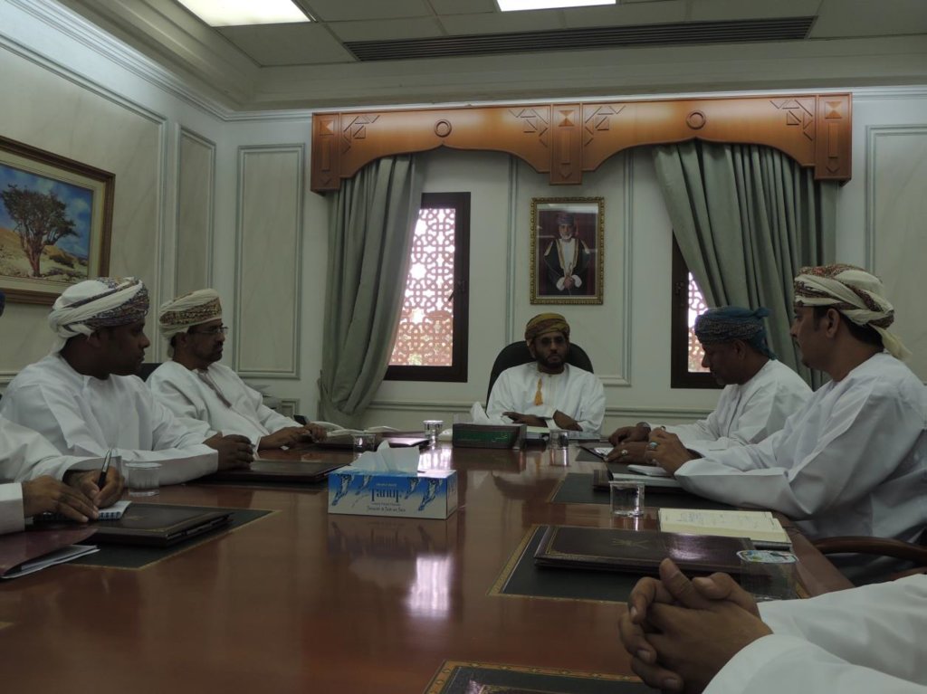
Field visits and survey, meeting community
- gobierno nacional (planificadores, autoridades)
Environment Authority
Funding, planning approach
3.2 Involucramiento de los usuarios locales de tierras/ comunidades locales en las distintas fases del Enfoque
| Involucramiento de los usuarios locales de tierras/ comunidades locales | Especifique quién se involucró y describa las actividades | |
|---|---|---|
| iniciación/ motivación | apoyo externo | Governor's offices in respective regions played a major role in motivating community leaders to participate in the project |
| implementación | apoyo externo | Regional directorates and Governor offices helped in organizing meetings with local communities to collect information about land use activities, including farming and grazing, in their respective villages |
3.3 Flujograma (si estuviera disponible)
3.4 La toma de decisiones en la selección de Tecnología(s) MST
Especifique quién decidió la selección de las Tecnología/ Tecnologías a implementarse:
- por políticos/ líderes
Especifique las bases que sustentaron la toma de decisiones:
- hallazgos de investigaciones
4. Apoyo técnico, fortalecimiento institucional y gestión del conocimiento
4.1 Construcción de capacidades / capacitación
¿Se proporcionó la capacitación a usuarios de tierras/ otras partes interesadas?
Sí
Especifique quién fue capacitado:
- personal de campo/ consejeros
Forma de capacitación:
- cursos
Temas avanzados:
1.Understanding GIS and geographical approach to land degradation
2. Use of remote sensing techniques for data collection
3. Land degradation assessment in drylands
4.2 Servicio de asesoría
¿Los usuarios de tierras tienen acceso a un servicio de asesoría?
No
4.3 Fortalecimiento institucional (desarrollo institucional)
¿Se establecieron o fortalecieron instituciones mediante el Enfoque?
- sí, moderadamente
Especifique el nivel o los niveles en los que se fortalecieron o establecieron las instituciones:
- nacional
Especifique el tipo de apoyo:
- construcción de capacidades/ entrenamiento
4.4 Monitoreo y evaluación
¿El monitoreo y la evaluación forman parte del Enfoque?
Sí
Si respondió que sí, ¿la documentación se utilizará para monitoreo y evaluación?
No
4.5 Investigación
¿La investigación formó parte del Enfoque?
Sí
Especifique los temas:
- sociología
- ecología
5. Financiamiento y apoyo material externo
5.1 Presupuesto anual para el componente MST del Enfoque
Si no se conoce el presupuesto anual preciso, indique el rango:
- 100,000-1,000,000
5.2 Apoyo financiero/material proporcionado a los usuarios de tierras
¿Los usuarios de tierras recibieron financiamiento/ apoyo material para implementar la Tecnología/ Tecnologías? :
No
5.4 Crédito
¿Se proporcionó crédito bajo el Enfoque para actividades MST?
No
5.5 Otros incentivos o instrumentos
¿Se usaron otros incentivos o instrumentos para promover la implementación de Tecnologías MST?
No
6. Análisis de impacto y comentarios de conclusión
6.1 Impactos del Enfoque
¿El Enfoque empoderó a los usuarios locales de tierras, mejoró el involucramiento de las partes interesadas?
- No
- Sí, un poco
- Sí, moderadamente
- Sí, mucho
Stakeholders participated in collecting social data by visiting different towns and sitting with the community to explain the approach, define the problems, and evaluate solutions
¿El Enfoque facilitó la toma de decisiones basada en evidencia?
- No
- Sí, un poco
- Sí, moderadamente
- Sí, mucho
Solutions and practices suggested resulted from extensive field work and image analysis
¿El Enfoque movilizó/mejoró el acceso a recursos financieros para implementar MST?
- No
- Sí, un poco
- Sí, moderadamente
- Sí, mucho
Financial resources were mobilized and directed towards plantation of trees in degraded lands
¿El Enfoque mejoró el conocimiento y capacidades de otras partes interesadas?
- No
- Sí, un poco
- Sí, moderadamente
- Sí, mucho
Training courses were developed for government staff to collect field and social data
¿El Enfoque construyó/ fortaleció instituciones, colaboración entre partes interesadas?
- No
- Sí, un poco
- Sí, moderadamente
- Sí, mucho
6.2 Motivación principal del usuario de la tierra para implementar MST
- reducción de la degradación de la tierra
- conciencia medioambiental
- conocimiento y capacidades mejorados de MST
6.3 Sostenibilidad de las actividades del Enfoque
¿Pueden los usuarios de tierras sostener lo que se implementó mediante el Enfoque (sin apoyo externo)?
- incierto
6.4 Fortalezas/ ventajas del Enfoque
| Fuerzas/ ventajas/ oportunidades desde la perspectiva del compilador o de otra persona de referencia clave |
|---|
| 1-As the results show that the amount of rainfall plays a major role in defining the density of vegetation, water catchment techniques can be deployed during rainfall periods – especially during Dhofar monsoon characterized with white fog and light rains- such as fog harvesting, increasing recharge dams, using new irrigation techniques from dams for affected areas |
| 2-By mapping land degradation in the Sultanate, areas that need protective strategies and policies can be defined, to avoid the degradation of areas of similar features through the coordination with respective sectors including urban planning, tourism, and agriculture. |
| 3- As the analysis identifies areas where vegetation has increased in vigor and density, factors leading to that may be explored and studied in order to apply same factors in similar environments. |
6.5 Debilidades/ desventajas del Enfoque y formas de sobreponerse a ellos
| Debilidades/ desventajas/ riesgos desde la perspectiva del compilador o de otra persona de referencia clave | ¿Cómo sobreponerse a ellas? |
|---|---|
| 1-As the spread and type of vegetation and climatic conditions differs greatly from area to area in the Sultanate of Oman, different procedures and techniques need to be employed. | studying the general conditions and features of each area and applying different procedures and techniques based on specific characteristics. |
| 2-Analysis of vegetation change using satellite images in terrain characterized by deep slopes and deep valleys in some areas in the Sultanate is very difficult. | using very high resolution remotely sensed images |
| 3-High resolution remotely sensed images are sometimes unavailable for past periods, which hinder studying vegetation change in this region where using satellite is difficult as well. |
7. Referencias y vínculos
7.1 Métodos/ fuentes de información
- visitas de campo, encuestas de campo
- entrevistas con usuarios de tierras
More than 500 questionnaires
Vínculos y módulos
Expandir todo Colapsar todosVínculos
No hay vínculos
Módulos
No se hallaron módulos


