Securing the mobility of pastoralism through consultation and access to water sources [Chad]
- Creación:
- Actualización:
- Compilador: Bonnet Bernard
- Editor: –
- Revisores: Simone Verzandvoort, Rima Mekdaschi Studer, Donia Mühlematter
Projet Almy Al Afia
technologies_3356 - Chad
- Resumen completo en PDF
- Resumen completo en PDF para imprimir
- Resumen completo en el navegador
- Resumen completo (sin formato)
- Securing the mobility of pastoralism through consultation and access to water sources: 12 de marzo de 2019 (inactive)
- Securing the mobility of pastoralists through consultation and access to water sources: 9 de mayo de 2018 (inactive)
- Securing the mobility of pastoralism through consultation and access to water sources: 2 de noviembre de 2021 (public)
- Securing the mobility of pastoralism through consultation and access to water sources: 28 de mayo de 2018 (inactive)
- Securing the mobility of pastoralists through consultation and access to water sources: 13 de mayo de 2018 (inactive)
- Securing the mobility of pastoralists through consultation and access to water sources: 9 de mayo de 2018 (inactive)
Visualizar secciones
Expandir todo Colapsar todos1. Información general
1.2 Detalles de contacto de las personas de referencia e instituciones involucradas en la evaluación y la documentación de la Tecnología
Persona(s) de referencia clave
Especialista MST:
Bernard BONNET
b.bonnet@iram-fr.org
IRAM
49 rue de la Glacière, 75013 Paris
Francia
1.3 Condiciones referidas al uso de datos documentados mediante WOCAT
¿Cuándo se compilaron los datos (en el campo)?
2016
El compilador y la/s persona(s) de referencia claves aceptan las condiciones acerca del uso de los datos documentados mediante WOCAT:
Sí
1.4 Declaración de la sostenibilidad de la Tecnología descrita
¿La Tecnología aquí descrita resulta problemática en relación a la degradación de la tierra, de tal forma que no puede considerársela una tecnología sostenible para el manejo de la tierra?
No
Comentarios:
Degradation of natural resources is taken into account in the management of water resources for pastoral land, and in the social approach prior to the development of the technology. For example, the locations of new sites for water supply structures should correspond to the capacity of the grazing land in terms of the period of access, the quantity of available resources and the integration of the area into a larger coherent landscape (especially the complementary relationship between the agropastoral zones in the south and the pastoral zones in the north). Several impact assessments and preliminary analyses have been carried out, including diagnoses of the pastoralist system with regard to the logistics of the movements of the herds, the social organisation related to the management of the areas, diagnoses of the grasslands, geophysical analyses, etc.
2. Descripción de la Tecnología MST
2.1 Breve descripción de la Tecnología
Definición de la Tecnología:
Securing the mobility of pastoralism through access to water sources (open wells and ponds in pastoral areas) and marking the livestock routes for transhumance: the case of the project Almy Al Afia in Chad and its consultative approach.
2.2 Descripción detallada de la Tecnología
Descripción:
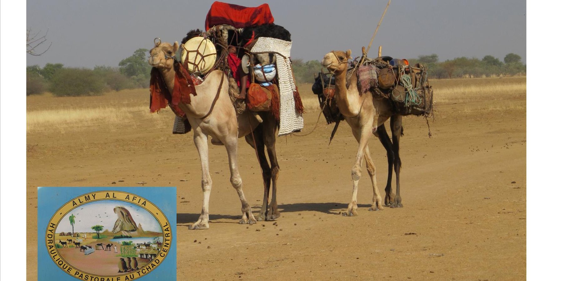
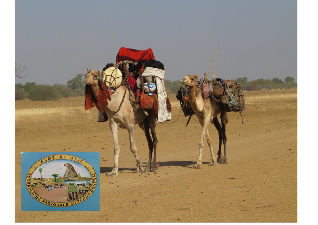
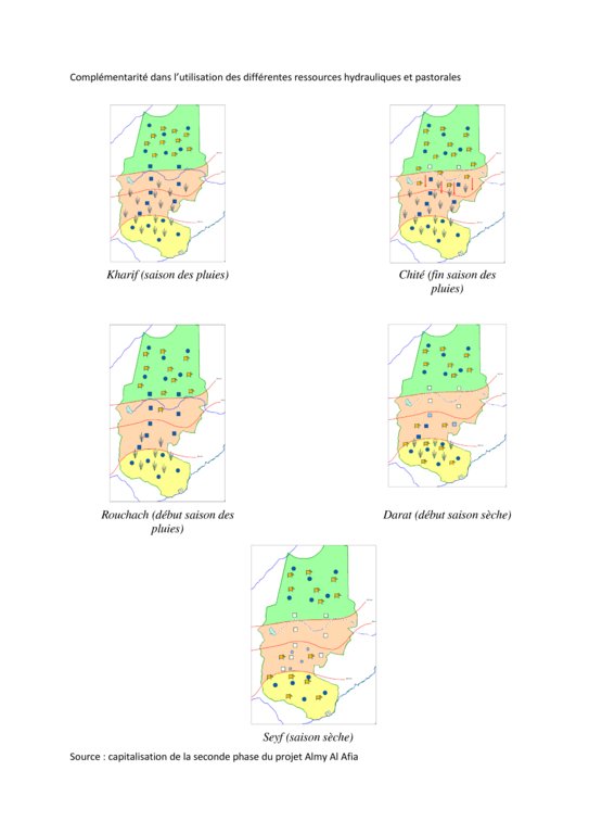
Livestock keeping is one of the main economic resources in Chad (in support of 40% of the population and 18% of the GDP, Ministry of Livestock, General census). Pastoralism in the country is based on the mobility of herds in a context of irregular precipitation and variable forage resources in time and space, and benefits from complementary relationships between the different ecological zones. In Chad, herds are taken in regular movements with the seasons between the Sahelian and the Sudanese grazing areas. The former are nutritious but limited in quantity, while the latter are more abundant but of lower quality, and not accessible until the fields are cleared after the harvest (meta-evaluation of projects on pastoral water sources, IIED, 2013). Thus, pastoral livestock keeping is founded on mobility and rangeland management, and on building complementary relationships and trade around farming systems and cultivated areas. The pastoralist systems are economically competitive (limited use of food inputs), and occur in marginal land which is characterized by conflicts, riots and a high level of insecurity (Conference of N'Djamena: 'Pastoral livestock keeping: a sustainable contribution to development and security in Saharan and Sahelian regions'). In the pastoral zone of Chad, where access to water is limited, the management and control of water sources by a social group in practice also leads to the monitoring and control of the use of grazing land which becomes available when water is present.
The project Almy Al Afia (2004-2016), developed by a partnership between the AFD and the Ministry of Water of Chad, operated in two regions of central Chad. The project Almy Al Afia was based on an entry 'development', concurrently with a process to consult and involve joint agencies. The project has improved approaches of preceding initiatives: concerted action and identification of water sources derived from the dialogue between users and authorities, and development of the local management of infrastructures and rangeland. The latter counteracts an exclusively private management or, instead, an ineffective public management which promotes free access to water sources and grazing land.
The project has enabled to address the following points:
1. Support mobility in pastoralism by enhancing the access to water (rehabilitation and construction of 160 wells; digging of 31 ponds for pastoral use);
2. Maintain or build processes of consultation and restoring security (joint committees for consultation and prevention of conflicts during transhumance);
3. Promote the proper use of water supply structures, in time and space (rehabilitated and new wells, excavated ponds) by context-specific management (strengthening of traditional management systems) and encourage the maintenance of infrastructure.
The pastoral ponds should be constructed in locations of existing water sources (natural ponds in suitable places, i.e. with a clayey soil capable to retain water). The existing water source is enlarged and improved by rural engineering (enlargement of the surface, deepening).
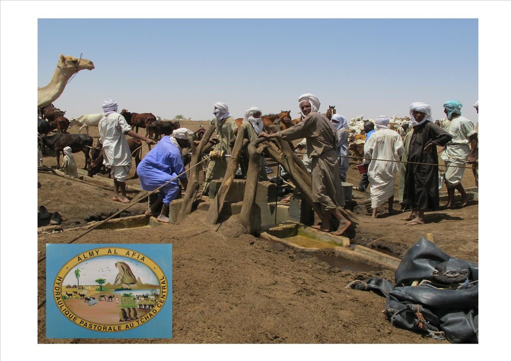
The wells are rehabilitated. Most wells were constructed several decades ago and are severely damaged. The water supply structures all have different and complementary functions. The deep wells in the pastoral zone are generally used throughout the year, and are overexploited. The way in which these structures are managed is strongly anchored in the region. The District officer delegates the management to 'Heads of Wells'. These old wells, which are used day and night, are often in a poor condition. Rehabilitating degraded wells is given priority over digging new wells because of the substantial potential for conflict. The water supply structures in areas of dry forest are less old and smaller in number. These wells are less frequently used and function as an alternative water source when the traditional ponds, water reservoirs and wells have dried up. They allow to delay the movement of the herds towards grazing areas in the Sahelian zone.
The strip between these two zones is used for agropastoralism. Herds cannot remain there. Therefore the project has facilitated the movement of the herds to the zones further south. The pastoral ponds close to the livestock routes for the transhumance were created in a way to be easily used by the herders, but also to encourage short stays.
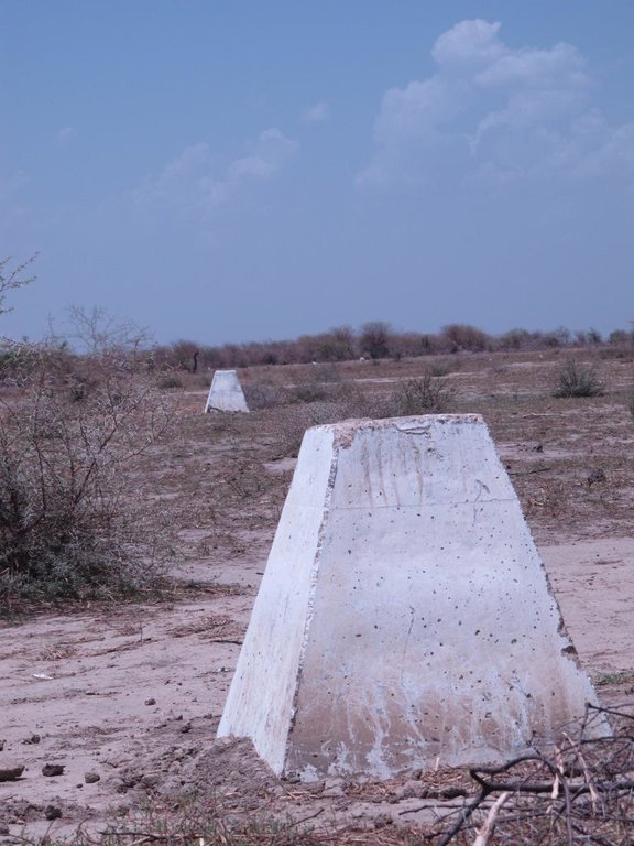
The approach was combined with consultation through joint committees for the prevention of conflicts, and at a later stage by marking of sections of the livestock routes for the transhumance. Many meetings were held with the users of the land management structures and policy makers, with the aim to identify and negotiate the target sites and to anticipate methods for the management and maintenance of the structures. This has enabled to maintain an atmosphere of social stability conducive to cooperation. Along almost 550 km of the livestock routes for the transhumance, sections were marked ('mourhals' in Chadian Arabic). The demarcation was not intended to enclose the herds in the livestock corridors (from which they can move freely outside the growing seasons for agricultural crops), but rather to implement the results of the consultations on the land use on the ground. The committees for the prevention of conflicts, which were supported by the project, also played a major role.
2.3 Fotografías de la Tecnología
2.4 Videos de la Tecnología
2.5 País/ región/ lugares donde la Tecnología fue aplicada y que se hallan comprendidos por esta evaluación
País:
Chad
Región/ Estado/ Provincia:
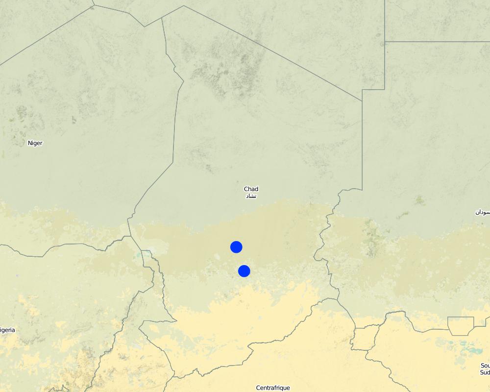
Regions of Batha and of Guéra
Especifique más el lugar :
Although the sites where the technology was applied are at the local scale, the project has considered pastoralism and the relationships between the two regions at the broader landscape scale.
Comentarios:
Main towns of the two relevant regions (Ati for the region of Batha and Mongo for the region of Guéra).
Map
×2.6 Fecha de la implementación
Indique año de implementación:
2018
2.7 Introducción de la Tecnología
Especifique cómo se introdujo la Tecnología:
- mediante la innovación de usuarios de tierras
- como parte de un sistema tradicional (> 50 años)
Comentarios (tipo de proyecto, etc.):
Projects on pastoral water resources like the project Almy Al Afia primarily focus on the development of water sources for pastoralism. The phases preceding the implementation are extremely important, because they are based on consultation and on the appreciation of local management systems. These phases include registration, selection of construction sites and the development of guidelines.
3. Clasificación de la Tecnología MST
3.1 Propósito(s) principal(es) de la Tecnología MST
- reducir, prevenir, restaurar la degradación de la tierra
- conservar el ecosistema
- proteger una cuenca hidrográfica/ áreas corriente abajo – en combinación con otras Tecnologías
- preservar/ mejorar biodiversidad
- reducir el riesgo de desastres naturales
- crear impacto económico benéfico
- crear impacto social benéfico
3.2 Tipo(s) actuales de uso de la tierra donde se aplica la Tecnología

Tierra de pastoreo
Tierras de pastoreo extensivo:
- Nomadismo
- Semi-nomadismo/ pastoralismo
Si el uso de la tierra ha cambiado debido a la implementación de la Tecnología, indique el uso de la tierra antes de la implementación de la Tecnología.
The target areas of the project Almy Al Afia vary with regard to their context and issues. The structures which were implemented in the framework of the project had the following objectives:
- In the zones with dry forest in the south, to slow down the return of the herds to the grazing areas in the north. The wells thus function as a substitute for the other traditional systems of water supply.
- In the pastoral zone, the wells which have been rehabilitated or replaced have limited the impacts of the concentration of herds around operational water supply structures.
- In between these two zones, the herds should be able to cross a large strip of land allocated to agricultural use (valley bottoms, zones with rainfed cropping).
3.3 Información adicional sobre el uso de tierras
Provisión de agua para la tierra donde se aplica la Tecnología:
- de secano
Comentarios:
In these zones, rainfall is erratic in terms of spatial distribution and in quantity. Hence, grazing areas are not uniformly covered from year to year. The mobility of herds is the only way to adapt to this variability.
Número de temporadas de cultivo por año:
- 1
Densidad del ganado (si fuese relevante):
Variable depending on zones and seasons.
3.4 Grupo MST al que pertenece la Tecnología
- pastoralismo y manejo de tierras de pastoreo
- manejo de agua subterránea
3.5 Difusión de la Tecnología
Especifique la difusión de la Tecnología:
- distribuida parejamente sobre un área
Si la tecnología se halla difundida homogéneamente en un área, indique el área aproximada que cubre:
- 10-100 km2
Comentarios:
The water sources constitute an anchorage point for the herds. The surrounding grazing land is controlled by the access to the water supply points (impact zone with a radius of 15 to 20 km around the wells). Apart from the area directly influenced by the technology, complementary relationships between the zones provide an added value: hence the zone targeted by the decision-making process of the herders is very large.
3.6 Medidas MST que componen la Tecnología

medidas estructurales
- S8: Saneamiento/ estructuras para aguas residuales

medidas de manejo
- M2: Cambio de gestión/ nivel de intensidad
- M3: disposición de acuerdo al entorno natural y humano
3.7 Principales tipos de degradación de la tierra encarados con la Tecnología

erosión de suelos por agua
- Wt: pérdida de capa arable/ erosión de la superficie

erosión de suelos por viento
- Et: pérdida de capa arable
- Eo; efectos de degradación fuera del sitio:

deterioro físico del suelo
- Ps: hundimiento de suelos orgánicos, asentamiento del suelo

degradación biológica
- Bc: reducción de la cobertura vegetal del suelo
- Bq: reducción de la cantidad/ biomasa

degradación del agua
- Hs: cambio en la cantidad de aguas superficiales
- Hg: cambio en nivel de aguas subterráneas/ nivel de acuífero
- Hq: reducción de la calidad de subterráneas
- Hq: reducción de la calidad de aguas subterráneas
3.8 Prevención, reducción o restauración de la degradación de la tierra
Especifique la meta de la Tecnología con relación a la degradación de la tierra:
- prevenir la degradación de la tierra
- reducir la degradación de la tierra
4. Especificaciones técnicas, actividades de implementación, insumos y costos
4.1 Dibujo técnico de la Tecnología
Autor:
Project Almy Al Afia
Autor:
Project Almy Al Afia
4.2 Especificaciones técnicas/ explicaciones del dibujo técnico
The wells (new and rehabilitated) and the demarcation of the livestock routes are the outcome of a long process of outreach. The communications between the local level (taking account of the views of future users) and the level of decision-making (administration) enable social agreements to be formalized. These agreements set the rules for the selection of the locations of the water supply structures, their management and maintenance.
4.3 Información general sobre el cálculo de insumos y costos
Especifique cómo se calcularon los costos e insumos:
- por unidad de Tecnología
Especifique unidad:
Structure (new well, rehabilitation or km of markings)
otra / moneda nacional (especifique):
FCFA
Indique el costo promedio del salario de trabajo contratado por día:
1000 FCFA
4.4 Actividades de establecimiento
| Actividad | Tipo de medida | Momento | |
|---|---|---|---|
| 1. | Outreach / awareness raising | Manejo | Four to six meetings prior to the signing of the social agreements |
| 2. | Construction of the facilities | Estructurales | Four to six months, depending on the type of structure and its depth |
| 3. | Monitoring the management | Manejo | Regular visits of the project team to support the implementation of adapted management practices |
Comentarios:
The implementation of the different phases varies greatly in terms of the location of the outreach activities and the duration of the construction work.
4.5 Costos e insumos necesarios para el establecimiento
| Especifique insumo | Unidad | Cantidad | Costos por unidad | Costos totales por insumo | % de los costos cubiertos por los usuarios de las tierras | |
|---|---|---|---|---|---|---|
| Material de construcción | Rehabilitated wells (mean depth 56 m) | 1 | 93,0 | 10497939,0 | 976308327,0 | |
| Material de construcción | Geophysical assessment for new wells | 1 | 158,0 | 17979914,0 | 2840826412,0 | |
| Material de construcción | Exploration drilling for new wells (mean depth 96 m) | 1 | 220,0 | 6005415,0 | 1321191300,0 | |
| Material de construcción | New wells (mean depth 45 m) | 1 | 62,0 | 45145740,0 | 2799035880,0 | |
| Material de construcción | Pastoral ponds (6000 m3 on average) | 1 | 31,0 | 23008065,0 | 713250015,0 | |
| Material de construcción | Markers (8 signs / km) | 1 | 492,0 | 1069203,0 | 526047876,0 | |
| Otros | Outreach on new wells (/site) | 1 | 62,0 | 213428,0 | 13232536,0 | |
| Otros | Outreach on rehabilitation (/site) | 1 | 93,0 | 248695,0 | 23128635,0 | |
| Otros | Outreach on marking (/km) | 1 | 492,0 | 52088,0 | 25627296,0 | |
| Otros | None | None | ||||
| Costos totales para establecer la Tecnología | 9238648277,0 | |||||
Comentarios:
The context of pastoralism has taken the project approach to not ask compensation from users: if the users are never the same, then who should be charged? Who will collect the payments and manage the collected funds? In addition, most of the water supply structures are far from financial institutions, which causes problems in securing these funds. Therefore the users contribute in terms of day-to-day maintenance of structures, by mobilizing labour in particular.
4.6 Actividades de establecimiento/ recurrentes
| Actividad | Tipo de medida | Momento/ frequencia | |
|---|---|---|---|
| 1. | Mobilising indigenous groups for day-to-day maintenance of structures (dredging, cleaning) | Estructurales | Depending on the type of structure (generally monthly) |
4.7 Costos e insumos necesarios para actividades de mantenimiento/ recurrentes (por año)
| Especifique insumo | Unidad | Cantidad | Costos por unidad | Costos totales por insumo | % de los costos cubiertos por los usuarios de las tierras | |
|---|---|---|---|---|---|---|
| Mano de obra | Support missions for the management and maintenance of the water supply structures (2 missions per structure for the entire project) | 1 | 155,0 | 53000,0 | 8215000,0 | |
| Mano de obra | Support mission for the management and maintenance of the markings | 1 | 100,0 | 53000,0 | 5300000,0 | |
| Indique los costos totales para mantenecer la Tecnología | 13515000,0 | |||||
Comentarios:
The amount of financial support varied with the type of structure (more support for management and maintenance is needed for new structures than for rehabilitated structures) and with their location or specific problem (in the case of structures located in the agropastoral zones). Financial support to the markings of the livestock corridors was indirectly provided through the committees for the prevention and management of conflicts.
4.8 Factores más determinantes que afectan los costos:
Describa los factores más determinantes que afectan los costos:
The costs of the constructions are highly dependent on their location (costs for the supply and disposal of equipment and materials), on the price of inputs (cement, etc.), and especially on the type of structure (depth of the wells, geological environment). The costs of the supply and disposal of equipment and materials include costs for the installation of the structures (water, cement, labour, machinery) on the construction sites (which are often far away from routes and towns), and costs for the disposal of the equipment after the construction is completed. The costs of supply and disposal can be significant with respect to the costs of the structure itself.
5. Entorno natural y humano
5.1 Clima
Lluvia anual
- < 250 mm
- 251-500 mm
- 501-750 mm
- 751-1,000 mm
- 1,001-1,500 mm
- 1,501-2,000 mm
- 2,001-3,000 mm
- 3,001-4,000 mm
- > 4,000 mm
Especificaciones/ comentarios sobre la cantidad de lluvia:
One rainy season per year (from June to September)
Indique el nombre de la estación metereológica de referencia considerada:
Ati
Zona agroclimática
- semi-árida
- árida
The target region includes large areas extending over important gradients (encompassing boundaries of the desert zone, the forested zone and the cotton-growing zone).
5.2 Topografía
Pendientes en promedio:
- plana (0-2 %)
- ligera (3-5%)
- moderada (6-10%)
- ondulada (11-15%)
- accidentada (16-30%)
- empinada (31-60%)
- muy empinada (>60%)
Formaciones telúricas:
- meseta/ planicies
- cordilleras
- laderas montañosas
- laderas de cerro
- pies de monte
- fondo del valle
Zona altitudinal:
- 0-100 m s.n.m.
- 101-500 m s.n.m.
- 501-1,000 m s.n.m
- 1,001-1,500 m s.n.m
- 1,501-2,000 m s.n.m
- 2,001-2,500 m s.n.m
- 2,501-3,000 m s.n.m
- 3,001-4,000 m s.n.m
- > 4,000 m s.n.m
Indique si la Tecnología se aplica específicamente en:
- no relevante
5.3 Suelos
Profundidad promedio del suelo:
- muy superficial (0-20 cm)
- superficial (21-50 cm)
- moderadamente profunda (51-80 cm)
- profunda (81-120 cm)
- muy profunda (>120 cm)
Textura del suelo (capa arable):
- áspera/ ligera (arenosa)
Textura del suelo (> 20 cm debajo de la superficie):
- áspera/ ligera (arenosa)
Materia orgánica de capa arable:
- baja (<1%)
5.4 Disponibilidad y calidad de agua
Agua subterránea:
> 50 m
Disponibilidad de aguas superficiales:
pobre/ ninguna
Calidad de agua (sin tratar):
agua potable de buena calidad
¿La salinidad del agua es un problema?
Sí
Especifique:
Depending on the zones: presence of sodium carbonate.
¿Se está llevando a cabo la inundación del área? :
No
5.5 Biodiversidad
Diversidad de especies:
- mediana
Diversidad de hábitats:
- mediana
5.6 Las características de los usuarios de la tierra que aplican la Tecnología
Sedentario o nómada:
- Semi-nómada
- Nómada
Orientación del mercado del sistema de producción:
- mixta (subsistencia/ comercial)
Ingresos no agrarios:
- menos del 10% de todos los ingresos
Nivel relativo de riqueza:
- muy pobre
- pobre
Individuos o grupos:
- grupos/ comunal
Nivel de mecanización:
- trabajo manual
Género:
- mujeres
- hombres
Edad de los usuarios de la tierra:
- jóvenes
- personas de mediana edad
5.7 Área promedio de la tierra que pertenece a o es arrendada por usuarios de tierra que aplican la Tecnología
- < 0.5 ha
- 0.5-1 ha
- 1-2 ha
- 2-5 ha
- 5-15 ha
- 15-50 ha
- 50-100 ha
- 100-500 ha
- 500-1,000 ha
- 1,000-10,000 ha
- > 10,000 ha
¿Esto se considera de pequeña, mediana o gran escala (refiriéndose al contexto local)?
- gran escala
Comentarios:
Transhumance, and more generally pastoral mobility, applies to large geographical scales and long periods. The areas involved are very large, far above 10.000 ha.
5.8 Tenencia de tierra, uso de tierra y derechos de uso de agua
Tenencia de tierra:
- grupal
Derechos de uso de tierra:
- comunitarios (organizado)
Derechos de uso de agua:
- comunitarios (organizado)
5.9 Acceso a servicios e infraestructura
salud:
- pobre
- moderado
- bueno
educación:
- pobre
- moderado
- bueno
asistencia técnica:
- pobre
- moderado
- bueno
empleo (ej. fuera de la granja):
- pobre
- moderado
- bueno
mercados:
- pobre
- moderado
- bueno
energía:
- pobre
- moderado
- bueno
caminos y transporte:
- pobre
- moderado
- bueno
agua potable y saneamiento:
- pobre
- moderado
- bueno
servicios financieros:
- pobre
- moderado
- bueno
6. Impactos y comentarios para concluir
6.1 Impactos in situ demostrados por la Tecnología
Impactos socioeconómicos
Disponibilidad y calidad de agua
disponibilidad de agua para ganado
Cantidad antes de MST:
n/a
Cantidad luego de MST:
n/a
Comentarios/ especifique:
Expansion of the areas covered by water supply points. Reduced closure of water supply points (rehabilitation), opening-up of new grazing land, securing the movement of livestock and people.
calidad de agua para ganado
Cantidad antes de MST:
n/a
Cantidad luego de MST:
n/a
Impactos socioculturales
seguridad alimentaria/ autosuficiencia
Comentarios/ especifique:
Preserving the capacity of herders and their families to move, to choose their trajectories rather than responding to imposed conditions.
derechos de uso de la tierra/ agua
Cantidad antes de MST:
n/a
Cantidad luego de MST:
n/a
Comentarios/ especifique:
Upgrading of traditional management systems of water supply structures.
instituciones comunitarias
mitigación de conflicto
situación de grupos en desventaja social y económica
Impactos ecológicos
Suelo
cubierta del suelo
Comentarios/ especifique:
Reduction of the impacts of the concentration of livestock and people in small areas. Promotes the complementary relations between the zones (pressure relief in some zones and use and maintenance of other zones), and over the seasons.
materia orgánica debajo del suelo C
Biodiversidad: vegetación, animales
Cubierta vegetal
diversidad vegetal
Reducción de riesgos de desastres y riesgos climáticos
impactos de sequías
6.2 Impactos fuera del sitio demostrados por la Tecnología
disponibilidad de agua
Cantidad antes de MST:
n/a
Cantidad luego de MST:
n/a
Comentarios/ especifique:
Increased access to groundwater through the rehabilitation of wells and the construction of new wells.
Comentarios acerca de la evaluación del impacto:
As explained above, in these zones with low rainfall and scarce natural water sources of temporary character (ponds), it is essential to combine the use of surface water with the use of water from deep permanent groundwater bodies. When they have the choice, herders almost exclusively choose sources with surface water (avoiding effort to extract the water). But when these sources run dry, they fall back on using wells (and deep groundwater). The rehabilitation of old wells and the construction of new wells in zones without wells contributes to increasing the availability of water.
6.3 Exposición y sensibilidad de la Tecnología al cambio climático gradual y a extremos relacionados al clima/ desastres (desde la percepción de los usuarios de tierras)
Cambio climático gradual
Cambio climático gradual
| Estación | tipo de cambios climáticos/ climas extremos | ¿Cómo es que la tecnología soporta esto? | |
|---|---|---|---|
| lluvia anual | disminuyó | no muy bien | |
| lluvia estacional | estación húmeda/ de lluvias | disminuyó | no muy bien |
Extremos (desastres) relacionados al clima
Desastres climatológicos
| ¿Cómo es que la tecnología soporta esto? | |
|---|---|
| sequía | bien |
6.4 Análisis costo-beneficio
¿Cómo se comparan los beneficios con los costos de establecimiento (desde la perspectiva de los usuarios de tierra)?
Ingresos a corto plazo:
positivo
Ingresos a largo plazo:
muy positivo
¿Cómo se comparan los beneficios con los costos de mantenimiento/ recurrentes (desde la perspectiva de los usuarios de tierra)?
Ingresos a corto plazo:
positivo
Ingresos a largo plazo:
positivo
Comentarios:
The profitability is considered in relation to the number of animals/herds involved. The costs of construction and rehabilitation are certainly significant, but the water supply structures are used for thousands of animals (in case of the most heavily used wells); most animals drink every two days. Therefore the costs per head of livestock are limited. The wells are long lasting, and therefore the returns are positive in the short and the long term.
6.5 Adopción de la Tecnología
- más de 50%
Si tiene la información disponible, cuantifique (número de hogares y/o área cubierta):
The technology responds to a substantial need, but also corresponds to the capacity of land users to use and maintain the structures. The energy supply is provided by animal traction, and does not require external energy sources.
De todos quienes adoptaron la Tecnología, ¿cuántos lo hicieron espontáneamente, es decir, sin recibir incentivos/ pagos materiales?
- 90-100%
Comentarios:
Access to water is such a large problem that it requires all the land users who enter the zone to be informed when a water supply structure is rehabilitated or constructed. The involvement of traditional leaders in the management of the structures, and the system of representatives of the traditional leadership in the various other zones (Khalifas) contributes to the spontaneous dissemination of the information.
6.6 Adaptación
¿La tecnología fue modificada recientemente para adaptarse a las condiciones cambiantes?
No
6.7 Fuerzas/ ventajas/ oportunidades de la Tecnología
| Fuerzas/ ventajas/ oportunidades desde la perspectiva del usuario de la tierra |
|---|
| Permanent access to water. |
| Reopening of water supply structures and consolidation of access to water at some degraded sites. |
| Agencies and authorities for conflict prevention. |
| Marking of sections of livestock corridors with conflict situations. |
| Fuerzas/ ventajas/ oportunidades desde la perspectiva del compilador o de otra persona de referencia clave |
|---|
| Full commitment of groups (access to water is a major problem). |
| Continuation of the approach through the development of other projects and inclusion at the national level. |
6.8 Debilidades/ desventajas/ riesgos de la Tecnología y formas de sobreponerse a ellos
| Debilidades/ desventajas/ riesgos desde la perspectiva del usuario de la tierra | ¿Cómo sobreponerse a ellas? |
|---|---|
| Interventions are limited with regard to the needs (rehabilitation in particular). | By larger investments and better integration of the approach in public action. |
| There is a need to extend the approach, in particular the support to the consultative bodies. | Formalize support to the consultation process. |
| Debilidades/ desventajas/ riesgos desde la perspectiva del compilador o de otra persona de referencia clave | ¿Cómo sobreponerse a ellas? |
|---|---|
|
Recognition of the experiences, the approach and the methodology in other interventions. Outreach and awareness raising are performed during the project, but at the end the management of the infrastructure is no longer supported. The government should be able to follow up on the support (mechanism for monitoring and maintenance). |
Formalize support to the consultation process. |
| There is a need to mainstream outreach and consultation (lengthy process). | Formalize support to the consultation process. |
7. Referencias y vínculos
7.1 Métodos/ fuentes de información
- visitas de campo, encuestas de campo
Progress reports and thematic reports of the project Almy Al Afia
- entrevistas con usuarios de tierras
Follow-up and evaluation of the project activities (logbook, annual update)
- compilación de informes y otra documentación existente
Creating value from lessons learned in the project Almy Al Afia (Republic of Chad, Ministry of Water)
7.2 Vínculos a las publicaciones disponibles
Título, autor, año, ISBN:
Capitalisation des enseignements de la deuxième phase du projet Almy Al Afia, Main document, DHP, Antea/Iram, March 2016
¿Dónde se halla disponible? ¿Costo?
Republic of Chad, General Secretariat, Ministry of Water, Directorate of Pastoral Water Resources
Título, autor, año, ISBN:
Document de Suivi-Evaluation des activités du PHPTC II, tableau de bord des activités du projet, DHP, Antea/Iram, mars 2016
¿Dónde se halla disponible? ¿Costo?
Republic of Chad, General Secretariat, Ministry of Water, Directorate of Pastoral Water Resources
Título, autor, año, ISBN:
Note Entretiens Techniques du PRAPS, Accès et gestion durable des espaces pastoraux (chemins de transhumance, aires de pâturages et de repos), PRAPS, 2016, B. Bonnet, A. H. Dia, P. Ndiaye, I. Touré
¿Dónde se halla disponible? ¿Costo?
Republic of Chad, General Secretariat, Ministry of Water, Directorate of Pastoral Water Resources
Título, autor, año, ISBN:
Evaluation et capitalisation de 20 ans d’intervention du Groupe AFD portant sur le secteur de l’Hydraulique Pastorale au Tchad, IIED, May 2013, S. Krätli, M. Monimart, B. Jallo, J. Swift, C. Hesse
¿Dónde se halla disponible? ¿Costo?
Republic of Chad, General Secretariat, Ministry of Water, Directorate of Pastoral Water Resources
7.3 Vínculos a la información relevante disponible en línea
Título/ descripción:
Platform on pastoralism in Chad
URL:
www.plateforme-pastorale-tchad.org/
Título/ descripción:
Website of PRAPS-TD
URL:
www.praps.cilss.int/index.php/praps-pays-tchad/
Título/ descripción:
Website of Iram
URL:
https://www.iram-fr.org/elevage-pastoralisme-et-hydraulique-pastorale.html
Título/ descripción:
AFD in Chad
URL:
http://www.afd.fr/fr/page-region-pays/tchad
Vínculos y módulos
Expandir todo Colapsar todosVínculos
No hay vínculos
Módulos
No se hallaron módulos


