Riverbank stabilization [Afganistán]
- Creación:
- Actualización:
- Compilador: Aqila Haidery
- Editor: –
- Revisores: Deborah Niggli, Joana Eichenberger
Nehal Shani Kenar Darya
technologies_1285 - Afganistán
Visualizar secciones
Expandir todo Colapsar todos1. Información general
1.2 Detalles de contacto de las personas de referencia e instituciones involucradas en la evaluación y la documentación de la Tecnología
Especialista MST:
Especialista MST:
Slaimankhil Abdul Ghafar
HELVETAS Swiss Intercooperation, Afghanistan
Afganistán
Nombre de la(s) institución(es) que facilitaron la documentación/ evaluación de la Tecnología (si fuera relevante)
HELVETAS (Swiss Intercooperation)1.3 Condiciones referidas al uso de datos documentados mediante WOCAT
El compilador y la/s persona(s) de referencia claves aceptan las condiciones acerca del uso de los datos documentados mediante WOCAT:
Sí
1.4 Declaración de la sostenibilidad de la Tecnología descrita
¿La Tecnología aquí descrita resulta problemática en relación a la degradación de la tierra, de tal forma que no puede considerársela una tecnología sostenible para el manejo de la tierra?
No
2. Descripción de la Tecnología MST
2.1 Breve descripción de la Tecnología
Definición de la Tecnología:
A low cost and an easy activity for protecting agricultural lands, gardens and public infrastructure from the damages of flash flood.
2.2 Descripción detallada de la Tecnología
Descripción:
Lack of vegetation coverage in the hills and mountains of Saighan district has become the source of destructive flash floods. Harvest of shrubs and other vegetation for fuel wood and the uncontrolled grazing of animals in upper catchment areas are some of the reasons for the loss of vegetation. Flash floods, that mainly occur during the spring and summer seasons, destroy many hectares of agriculture lands and gardens,damage public infrastructures and sometimes threatens lives.
The plantation of long root trees in lower catchment areas is an effective and low-cost technology. Its objective is to prevent flood damage. Trees
hold the soil in place with their root structures decreasing land degradation and soil erosion. It is a low cost activity that can be
alternative option to protection walls which are more costly, both in terms of establishments and maintenance. Additional benefits of the technology are the increased availability of wood beams for
construction, of fuel wood and of fodder. This technology, coupled with information campaigns, may help to provide a strong disincentive against
cutting shrubs and grazing in upper catchment areas. In addition, increasing the number of indigenous trees help reduce the negative effects of climate change. The trees also serve as wind breaks.
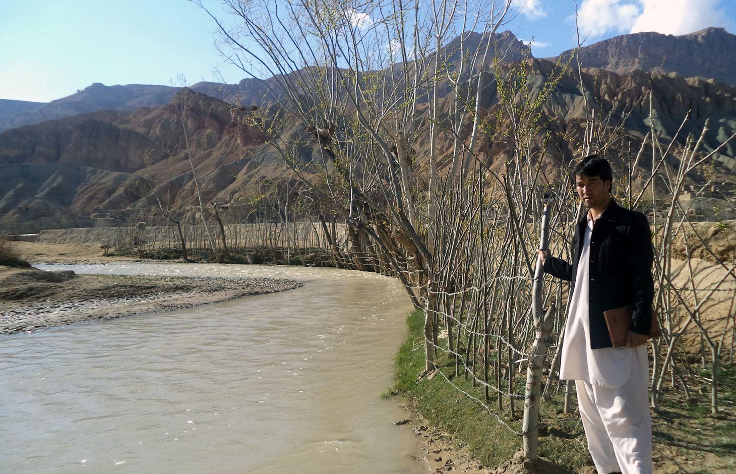
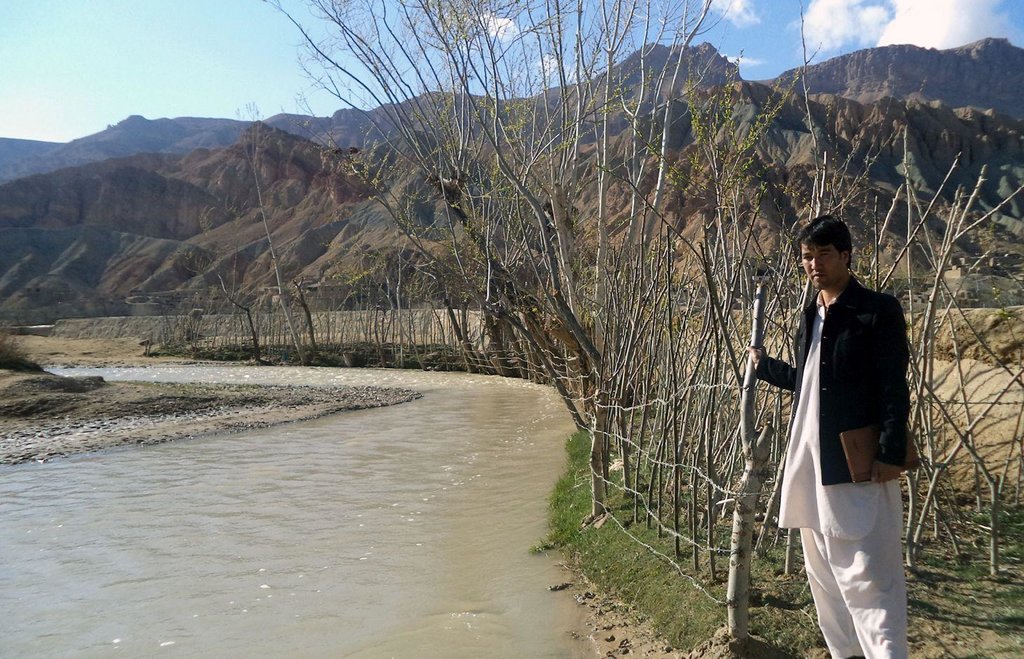
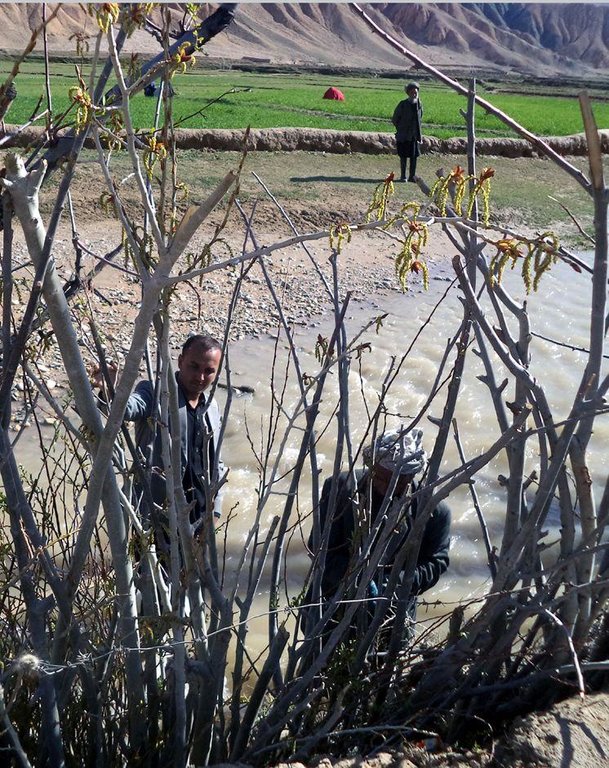
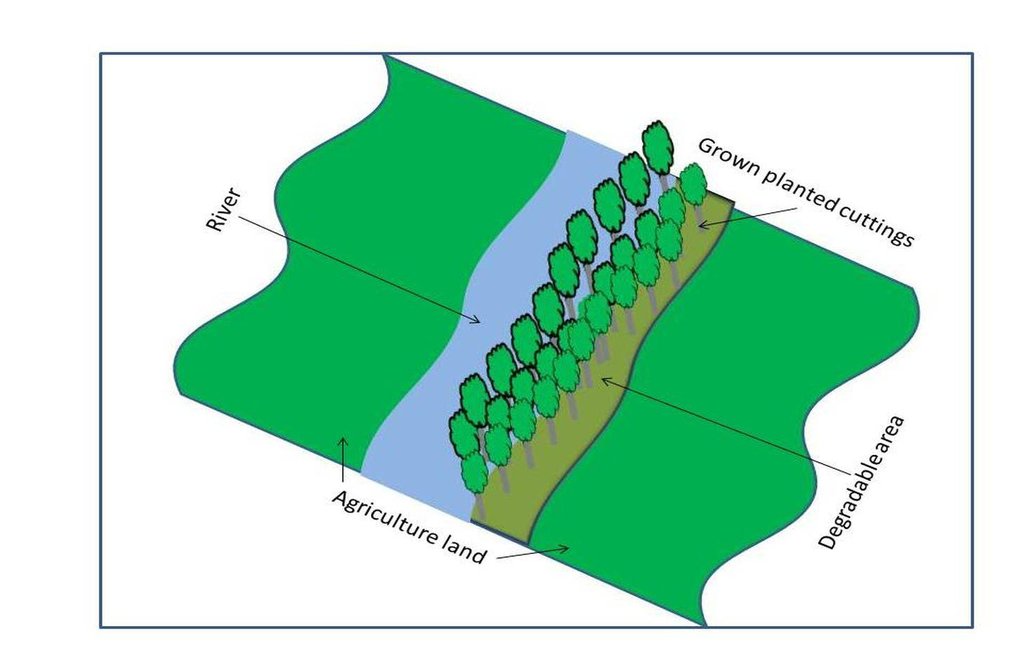
Having mobilized the community, areas along the watercourse that have been damaged by floods as well as unproductive lands were selected. Based on their ability to adapt well to the local environment, cuttings of Salix (or Willow) and Populus (or Poplar) were selected for planting. Cuttings were provided from the district. Each participating household planted 400 cuttings (2 m long size). The cuttings were planted at a distance of 25 cm and the line to line distance was 100 cm. For the first year, wooden belts, placed along the plating line may protect the new saplings from flood damages, ensuring that the sapling are able to grow. Protection by fencing with barbed wire in two first years also prevents grazing of leaves and new branches by animals.
Interested households should be introduced by the Community Development Council members through a transparent selection process and considering the following criteria:
•the household should be interested to plant long root tree cuttings;
•the household should have enough degraded / riverbank and waste land to plant cuttings;
•Willingness to invest.
The cost of applying riverbank stabilization (plantation of Salix and Populus) is estimated to be 10 AFN/cutting. One person can plant over 500 cuttings per day. In this case, 50% of the cutting cost was contributed by HELVETAS projects and 50% of the cost of the cuttings was contributed by the participating households.
Participating households maintain the plantations. They are responsible for irrigating the cuttings and for protecting them from grazing animals for the first few years. In addition to improved flood protection, participating households increased their understanding riverbank stabilization and energy plantation and managing cuttings (selection, land preparation, fascine and palisade plantation).
Bamyan province is a remote province of Afghanistan with a high poverty rate. It has a semi-arid climate with cold winters and hot and dry summers. During winter, temperatures can drop below -22 degrees. Summer temperatures can reach 34 degrees in the month of July. The average annual rainfall in the area is about 230 mm and some years can be very dry. 90% of the population relies on subsistence agriculture for their livelihoods and off-farm activities are marginal. The growing season in Saighan district is relatively short from April to October and farmers can produce only one crop per year. Farmers with access to irrigation water cultivate cash crops, for example potato and vegetables, in addition to staple crops (wheat) and fodder crops. Those without access to irrigation water cultivate wheat and fodder crops only. Water scarcity during May to September may result to lack of high value crops.
2.3 Fotografías de la Tecnología
2.5 País/ región/ lugares donde la Tecnología fue aplicada y que se hallan comprendidos por esta evaluación
País:
Afganistán
Región/ Estado/ Provincia:
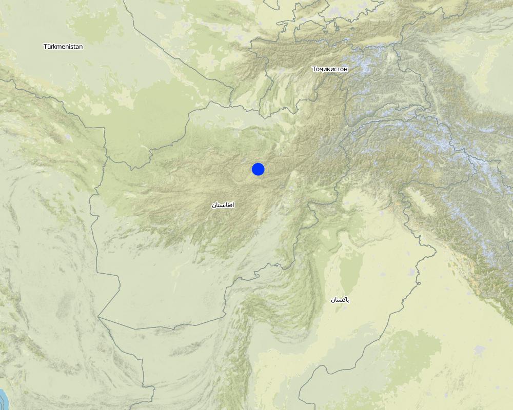
Bamyan
Especifique más el lugar :
Saighan
Especifique la difusión de la Tecnología:
- distribuida parejamente sobre un área
Si la Tecnología se halla difundida homogéneamente a lo largo de un área, especifique el área que cubre (en km2):
0,0000985
Comentarios:
Total area covered by the SLM Technology is 98.5 m2.
Map
×2.6 Fecha de la implementación
Si no se conoce el año preciso, indique la fecha aproximada:
- hace menos de 10 años (recientemente)
2.7 Introducción de la Tecnología
Especifique cómo se introdujo la Tecnología:
- mediante proyectos/ intervenciones externas
Comentarios (tipo de proyecto, etc.):
When the people migrated in other provinces, they saw over there and learnt. Since 2011 HELVETAS introduced this activity for alternative option of cutting shrubs and low cost protection wall against flood damages.
3. Clasificación de la Tecnología MST
3.1 Propósito(s) principal(es) de la Tecnología MST
- reducir, prevenir, restaurar la degradación de la tierra
- reducir el riesgo de desastres naturales
3.2 Tipo(s) actuales de uso de la tierra donde se aplica la Tecnología

Tierra de pastoreo
Pastoreo extenso:
- Pastoralismo semi-nómada
Pastoreo intensivo/ producción de forraje:
- Cortar y llevar/ cero pastoreo

vías fluviales, masas de agua, humedales
- Estanques, diques
Comentarios:
Major land use problems (compiler’s opinion): Lack of sustainable land management, uncontrolled overgrazing of animals and collection of woods and bushes for fuel by the people in the upper catchment area. Occurrence of flash floods which damage public infrastructure, gardens and farm lands the sources of livelihoods downstream areas.
Major land use problems (land users’ perception): Population increase and lack of resources and service delivery during the war caused over exploitation of resources in upper catchment areas. Increase in flock sizes to improve incomes which resulted to overgrazing.
Semi-nomadism / pastoralism: People move their flocks to other provinces and graze also in the area hill and mountaines
Cut-and-carry/ zero grazing: Provide fodder from agriculture land and graze in unimproved pasture areas. People have less animals like sheep, goat and cows
Number of growing seasons per year: 1
Longest growing period in days: 90, Longest growing period from month to month: April to June; Second longest growing period in days: 120, Second longest growing period from month to month: July to October
Livestock density: 1-10 LU /km2
3.3 ¿Cambió el uso de tierras debido a la implementación de la Tecnología?
¿Cambió el uso de tierras debido a la implementación de la Tecnología?
- Sí (Por favor responda las preguntas de abajo referidas al uso de la tierra antes de implementar la Tecnología)

vías fluviales, masas de agua, humedales
- Líneas de drenaje, vías fluviales
- Estanques, diques
3.4 Provisión de agua
Provisión de agua para la tierra donde se aplica la Tecnología:
- totalmente irrigada
3.5 Grupo MST al que pertenece la Tecnología
- manejo de agua superficial (manantial, río, lagos, mar):
- protección/manejo de humedales
3.6 Medidas MST que componen la Tecnología

medidas vegetativas
- V1: Cubierta de árboles y arbustos
Comentarios:
Type of vegetative measures: aligned: -along boundary
3.7 Principales tipos de degradación de la tierra encarados con la Tecnología

erosión de suelos por agua
- Wt: pérdida de capa arable/ erosión de la superficie
- Wr: erosión de riberas

erosión de suelos por viento
- Et: pérdida de capa arable
Comentarios:
Main causes of degradation: deforestation / removal of natural vegetation (incl. forest fires) (Cutting shrubs of upper catchments increased naked area, so flash flood and drought years resulted), overgrazing (Free grazing of animals in spring and summer seasons resulted that domestic plants have eaten by animals before producing seed), floods (Naked area of upper catchments is the source of comming multi times flood per year), population pressure (Increasing population demanded more), war and conflicts (War limited services and caused less availability of fuel)
Secondary causes of degradation: droughts (No vegetation coverage increased temprature of the area and reduced deep moisture of soil), poverty / wealth (Poverty is the reason of destroying natural resources), governance / institutional (Lack of good governance for having development strategy)
3.8 Prevención, reducción o restauración de la degradación de la tierra
Especifique la meta de la Tecnología con relación a la degradación de la tierra:
- prevenir la degradación de la tierra
- reducir la degradación de la tierra
4. Especificaciones técnicas, actividades de implementación, insumos y costos
4.1 Dibujo técnico de la Tecnología
Especificaciones técnicas (relacionadas al dibujo técnico):
The technology should be applied along the damageable areas into multi lines. The technoIogy should be applied along the
damaged areas in multiple lines.
Location: Saighan district. Bamyan province
Date: 12/10/2015
Technical knowledge required for field staff / advisors: high (To advice and train people on lining system and propaganda of its importance)
Technical knowledge required for land users: moderate
Main technical functions: stabilisation of soil (eg by tree roots against land slides), reduction in wind speed
Secondary technical functions: control of raindrop splash, improvement of surface structure (crusting, sealing), improvement of topsoil structure (compaction), improvement of subsoil structure (hardpan)
Aligned: -along boundary
Vegetative material: T : trees / shrubs
Number of plants per (ha): 5000
Vertical interval between rows / strips / blocks (m): 2
Spacing between rows / strips / blocks (m): 1
Vertical interval within rows / strips / blocks (m): 2
Width within rows / strips / blocks (m): 0.25
Trees/ shrubs species: Salix, poplar
Slope (which determines the spacing indicated above): >50%
If the original slope has changed as a result of the Technology, the slope today is (see figure below): 15-30%
Gradient along the rows / strips: >3%
Autor:
Shabir Shahem, HELVETAS Swiss Intercooperation, Afghanistan
4.2 Información general sobre el cálculo de insumos y costos
otra / moneda nacional (especifique):
Afghani
Si fuera relevante, indique la tasa de cambio de dólares americanos a la moneda local (ej. 1 U$ = 79.9 Reales Brasileros): 1 U$ =:
64,0
Indique el costo promedio del salario de trabajo contratado por día:
5.46
4.3 Actividades de establecimiento
| Actividad | Momento (estación) | |
|---|---|---|
| 1. | Cutting preparation and plantation | 5 days (April) |
4.4 Costos e insumos necesarios para el establecimiento
| Especifique insumo | Unidad | Cantidad | Costos por unidad | Costos totales por insumo | % de los costos cubiertos por los usuarios de las tierras | |
|---|---|---|---|---|---|---|
| Mano de obra | labour | ha | 1,0 | 54,6 | 54,6 | 100,0 |
| Otros | cutting | ha | 1,0 | 1562,5 | 1562,5 | 50,0 |
| Costos totales para establecer la Tecnología | 1617,1 | |||||
| Costos totales para establecer la Tecnología en USD | 25,27 | |||||
Comentarios:
Duration of establishment phase: 0.33 month(s)
4.5 Actividades de establecimiento/ recurrentes
| Actividad | Momento/ frequencia | |
|---|---|---|
| 1. | No maintenance cost is required so far. |
4.6 Costos e insumos necesarios para actividades de mantenimiento/ recurrentes (por año)
Comentarios:
Riverbank establishment cost is calculated here assuming that the soil is soft, gulleys have not formed and the cuttings are available within the villages and cost efficiently provided by the farmer.
4.7 Factores más determinantes que afectan los costos:
Describa los factores más determinantes que afectan los costos:
The severity of erosion, hard soil and lack of long root cuttings are the factors which effect the cost of riverbank establishment the most.
5. Entorno natural y humano
5.1 Clima
Lluvia anual
- < 250 mm
- 251-500 mm
- 501-750 mm
- 751-1,000 mm
- 1,001-1,500 mm
- 1,501-2,000 mm
- 2,001-3,000 mm
- 3,001-4,000 mm
- > 4,000 mm
Especificaciones/ comentarios sobre la cantidad de lluvia:
Annual rainy days are 37 and snowy days are 14 days, mostly June to September are dry months.
Zona agroclimática
- semi-árida
Thermal climate class: temperate
5.2 Topografía
Pendientes en promedio:
- plana (0-2 %)
- ligera (3-5%)
- moderada (6-10%)
- ondulada (11-15%)
- accidentada (16-30%)
- empinada (31-60%)
- muy empinada (>60%)
Formaciones telúricas:
- meseta/ planicies
- cordilleras
- laderas montañosas
- laderas de cerro
- pies de monte
- fondo del valle
Zona altitudinal:
- 0-100 m s.n.m.
- 101-500 m s.n.m.
- 501-1,000 m s.n.m
- 1,001-1,500 m s.n.m
- 1,501-2,000 m s.n.m
- 2,001-2,500 m s.n.m
- 2,501-3,000 m s.n.m
- 3,001-4,000 m s.n.m
- > 4,000 m s.n.m
5.3 Suelos
Profundidad promedio del suelo:
- muy superficial (0-20 cm)
- superficial (21-50 cm)
- moderadamente profunda (51-80 cm)
- profunda (81-120 cm)
- muy profunda (>120 cm)
Textura del suelo (capa arable):
- mediana (limosa)
Materia orgánica de capa arable:
- media (1-3%)
5.4 Disponibilidad y calidad de agua
Agua subterránea:
5-50 m
Disponibilidad de aguas superficiales:
mediana
Calidad de agua (sin tratar):
agua potable de mala calidad (requiere tratamiento)
5.5 Biodiversidad
Diversidad de especies:
- mediana
5.6 Las características de los usuarios de la tierra que aplican la Tecnología
Orientación del mercado del sistema de producción:
- mixta (subsistencia/ comercial)
Ingresos no agrarios:
- menos del 10% de todos los ingresos
Nivel relativo de riqueza:
- rico
- muy rico
Individuos o grupos:
- grupos/ comunal
Nivel de mecanización:
- trabajo manual
Género:
- hombres
Indique otras características relevantes de los usuarios de las tierras:
Land users applying the Technology are mainly common / average land users
Difference in the involvement of women and men: In Afghanistan societies women don't work in such hard works, although now women work out of their homes but they work as teacher, staff of organizations, self professionals and etc.
Population density: 10-50 persons/km2
Annual population growth: 3% - 4%; 3%
60% of the land users are very rich and own 30% of the land (Able to purchase cutting and hire worker).
30% of the land users are rich and own 40% of the land (Able to purchase cutting and hire worker).
10% of the land users are average wealthy and own 30% of the land (Able to purchase cutting and work by themselves). (Mainly they do not have land).
Off-farm income specification: Those people who not applied such technology, their lands are under threat of flood and to provide fuel wood should pay more in a year
5.7 Área promedio de la tierra usada por usuarios de tierra que aplican la Tecnología
- < 0.5 ha
- 0.5-1 ha
- 1-2 ha
- 2-5 ha
- 5-15 ha
- 15-50 ha
- 50-100 ha
- 100-500 ha
- 500-1,000 ha
- 1,000-10,000 ha
- > 10,000 ha
¿Esto se considera de pequeña, mediana o gran escala (refiriéndose al contexto local)?
- escala mediana
5.8 Tenencia de tierra, uso de tierra y derechos de uso de agua
Tenencia de tierra:
- individual, sin título
Derechos de uso de tierra:
- individual
- individual/communal
- individual/communal
Comentarios:
The water use rights is determined by hours on 2000m2 land area.
5.9 Acceso a servicios e infraestructura
salud:
- pobre
- moderado
- bueno
educación:
- pobre
- moderado
- bueno
asistencia técnica:
- pobre
- moderado
- bueno
empleo (ej. fuera de la granja):
- pobre
- moderado
- bueno
mercados:
- pobre
- moderado
- bueno
energía:
- pobre
- moderado
- bueno
caminos y transporte:
- pobre
- moderado
- bueno
agua potable y saneamiento:
- pobre
- moderado
- bueno
servicios financieros:
- pobre
- moderado
- bueno
6. Impactos y comentarios para concluir
6.1 Impactos in situ demostrados por la Tecnología
Impactos socioeconómicos
Producción
producción de forraje
Cantidad antes de MST:
0
Cantidad luego de MST:
19700 kg
Comentarios/ especifique:
The leaves of tree can be more after 5 years, now the saplings are small size
producción de madera
Cantidad antes de MST:
0
Cantidad luego de MST:
985 pcs
Comentarios/ especifique:
It is going to be increased after some years when the tree saplings groth more sizes
área de producción
Cantidad antes de MST:
0
Cantidad luego de MST:
49250 kg
Comentarios/ especifique:
Fuel wood increased
generación de energía
Cantidad antes de MST:
0
Cantidad luego de MST:
50
Comentarios/ especifique:
The household who applied technology are about sufficient from fuel energy
Impactos socioculturales
seguridad alimentaria/ autosuficiencia
Cantidad antes de MST:
0
Cantidad luego de MST:
20%
Comentarios/ especifique:
Houshoulds who applied the technology now they don't pay for providing fuel wood as more as they paid in the past. they provide fuel wood more from their established forest and save their moneys for other needs
MST/ conocimiento de la degradación de la tierra
Comentarios/ especifique:
People undrestood it is a good technique to control soil erosion and get fuel wood to do not go got mountains for cutting shrubs
mitigación de conflicto
Cantidad antes de MST:
0
Cantidad luego de MST:
30%
contribution to human well-being
Comentarios/ especifique:
Now the boys don't go to the mountains to collect bushes for fuel wood and get education. It has as well contributed the households economically as they do not need to spend money in purchasing fuel wood.
Impactos ecológicos
Suelo
cubierta del suelo
Cantidad antes de MST:
0
Cantidad luego de MST:
30%
Comentarios/ especifique:
Now the hard wind is not a reason of soil erosion in covered land areas and it get more however the trees grow more and become tall
pérdida de suelo
Cantidad antes de MST:
0
Cantidad luego de MST:
50%
Comentarios/ especifique:
Protection of area from damage of flood and wind by tree belts decreased soil loss of agriculture lands
materia orgánica debajo del suelo C
Cantidad antes de MST:
10
Cantidad luego de MST:
50%
Comentarios/ especifique:
Raw materials which accelerate micro organism activities increase in the area
Biodiversidad: vegetación, animales
biomasa/ sobre suelo C
Cantidad antes de MST:
10%
Cantidad luego de MST:
50%
Comentarios/ especifique:
Fallen leaves increased biomass
Reducción de riesgos de desastres y riesgos climáticos
velocidad de viento
Cantidad antes de MST:
0
Cantidad luego de MST:
30%
Comentarios/ especifique:
Wind breaks and protected about more than 3 Hectare agriculture lands
6.2 Impactos fuera del sitio demostrados por la Tecnología
inundaciones río abajo
Cantidad antes de MST:
0
Cantidad luego de MST:
15%
Comentarios/ especifique:
Breaks wave of flood
sedimentos transportados por el viento
Cantidad antes de MST:
0
Cantidad luego de MST:
50%
Comentarios/ especifique:
Decreased damages of wind and frost
daños a infraestructura pública / privada
Cantidad antes de MST:
0
Cantidad luego de MST:
50%
Comentarios/ especifique:
Protected the road
6.3 Exposición y sensibilidad de la Tecnología al cambio climático gradual y a extremos relacionados al clima/ desastres (desde la percepción de los usuarios de tierras)
Cambio climático gradual
Cambio climático gradual
| Estación | Incremento o reducción | ¿Cómo es que la tecnología soporta esto? | |
|---|---|---|---|
| temperatura anual | incrementó | bien |
Extremos (desastres) relacionados al clima
Desastres climatológicos:
| ¿Cómo es que la tecnología soporta esto? | |
|---|---|
| tormenta de lluvia local | bien |
| tormenta de viento | bien |
Desastres climatológicos
| ¿Cómo es que la tecnología soporta esto? | |
|---|---|
| sequía | no muy bien |
Desastres hidrológicos
| ¿Cómo es que la tecnología soporta esto? | |
|---|---|
| inundación general (río) | no muy bien |
Otras consecuencias relacionadas al clima
Otras consecuencias relacionadas al clima
| ¿Cómo es que la tecnología soporta esto? | |
|---|---|
| periodo reducido de crecimiento | no muy bien |
Comentarios:
During the first years, as the roots are still undeveloped, saplings should be protected by a stone wall from floods. During drought years saplings
should be irrigated at least 2 times per week over two years.
6.4 Análisis costo-beneficio
¿Cómo se comparan los beneficios con los costos de establecimiento (desde la perspectiva de los usuarios de tierra)?
Ingresos a corto plazo:
ligeramente positivo
Ingresos a largo plazo:
muy positivo
¿Cómo se comparan los beneficios con los costos de mantenimiento/ recurrentes (desde la perspectiva de los usuarios de tierra)?
Ingresos a corto plazo:
muy positivo
Ingresos a largo plazo:
muy positivo
Comentarios:
Expenditure occurs mostly during the establishment of the technology. After a few years, benefits (including production) increase without significant expenditure.
6.5 Adopción de la Tecnología
- > 50%
De todos quienes adoptaron la Tecnología, ¿cuántos lo hicieron espontáneamente, por ej. sin recibir nada de incentivos/ materiales:
- 91-100%
Comentarios:
It was applied as extension activity but when the others families learnt and saw the good results, they applied by themselves without any external supports
985 land user families have adopted the Technology without any external material support
The land users also decided to extend this activity in other place lands which they have.
There is a strong trend towards spontaneous adoption of the Technology
As this technology is applicable by each family and has good results, many other people has trend toward the spontaneous adoption of the technology.
6.7 Fuerzas/ ventajas/ oportunidades de la Tecnología
| Fuerzas/ ventajas/ oportunidades desde la perspectiva del usuario de la tierra |
|---|
| Increasing fuel wood |
| Prevents occurrence of flash floods in the agricultural lands |
| Fuerzas/ ventajas/ oportunidades desde la perspectiva del compilador o de otra persona de referencia clave |
|---|
| Applicable by rural community members. |
| Low cost technology to prevent damage of floods in comparison with concrete protection wall. |
| A good option for reducing shrubs cutting in the upper catchment areas. |
| Prevent soil erosion by winds |
| Contributes in the greening of the environment |
6.8 Debilidades/ desventajas/ riesgos de la Tecnología y formas de sobreponerse a ellos
| Debilidades/ desventajas/ riesgos desde la perspectiva del compilador o de otra persona de referencia clave | ¿Cómo sobreponerse a ellas? |
|---|---|
| Lack of good and improved cuttings | Production of good species in wood lot or nurseries |
| Small landholdings per households (limiting the establishment of the technology) | Group decision and motivating and involving larger group of people to apply the technology |
| Saplings are vulnerable towards floods in the first two years because still they have not long roots and saplings are as well small | Protection by a stone wall belt in the way of coming flood for 2 first years |
7. Referencias y vínculos
7.1 Métodos/ fuentes de información
- visitas de campo, encuestas de campo
- entrevistas con usuarios de tierras
¿Cuándo se compilaron los datos (en el campo)?
12/10/2015
7.2 Vínculos a las publicaciones disponibles
Título, autor, año, ISBN:
HELVETAS Swiss IntercooperationSaighan field officeILRC and GS projects 2012 to 2015
¿Dónde se halla disponible? ¿Costo?
HELVETAS Swiss Intercooperation, Afghanistan
Vínculos y módulos
Expandir todo Colapsar todosVínculos
No hay vínculos
Módulos
No se hallaron módulos


