Grass buffer zones alongside waterways in cropland [Norvège]
- Création :
- Mise à jour :
- Compilateur : Kamilla Skaalsveen
- Rédacteurs : Zhanguo Bai, Dominika Krzeminska, Anne-Grete Buseth Blankenberg
- Examinateurs : Alexandra Gavilano, William Critchley, Rima Mekdaschi Studer
Grasdekt buffersone
technologies_1656 - Norvège
- Résumé complet en PDF
- Résumé complet en PDF pour impression
- Résumé complet dans le navigateur
- Résumé complet (non formaté)
- Grass buffer zones alongside waterways in cropland: 3 février 2023 (public)
- Grass buffer zones alongside waterways in cropland: 17 juin 2022 (inactive)
- Grass Covered Riparian Buffer Strips: 5 septembre 2019 (inactive)
- Grass Covered Riparian Buffer Strips: 16 mars 2017 (inactive)
- Grass Covered Riparian Buffer Strips: 16 mars 2017 (inactive)
Voir les sections
Développer tout Réduire tout1. Informations générales
1.2 Coordonnées des personnes-ressources et des institutions impliquées dans l'évaluation et la documentation de la Technologie
Spécialiste GDT:
Spécialiste GDT:
Nom du projet qui a facilité la documentation/ l'évaluation de la Technologie (si pertinent)
Preventing and Remediating degradation of soils in Europe through Land Care (EU-RECARE )Nom du ou des institutions qui ont facilité la documentation/ l'évaluation de la Technologie (si pertinent)
Norwegian Institute for Agricultural and Environme (Norwegian Institute for Agricultural and Environme) - Norvège1.3 Conditions relatives à l'utilisation par WOCAT des données documentées
Le compilateur et la(les) personne(s) ressource(s) acceptent les conditions relatives à l'utilisation par WOCAT des données documentées:
Oui
1.4 Déclaration sur la durabilité de la Technologie décrite
Est-ce que la Technologie décrite ici pose problème par rapport à la dégradation des terres, de telle sorte qu'elle ne peut pas être déclarée comme étant une technologie de gestion durable des terres?
Non
1.5 Référence au(x) Questionnaires sur les Approches de GDT (documentées au moyen de WOCAT)

Regional Environmental program [Norvège]
Regulations and financial grants for reduction of pollution and promotion of the cultural landscape.
- Compilateur : Kamilla Skaalsveen
2. Description de la Technologie de GDT
2.1 Courte description de la Technologie
Définition de la Technologie:
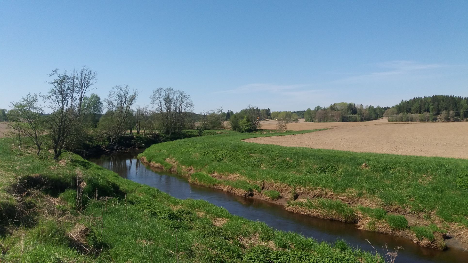
Grass buffer zones are established along waterways in cropland to reduce the surface runoff rate, and the amounts of sediment, nutrients and pesticides in the runoff.
2.2 Description détaillée de la Technologie
Description:
Commonly used names: buffer zones, buffer strips, riparian buffers
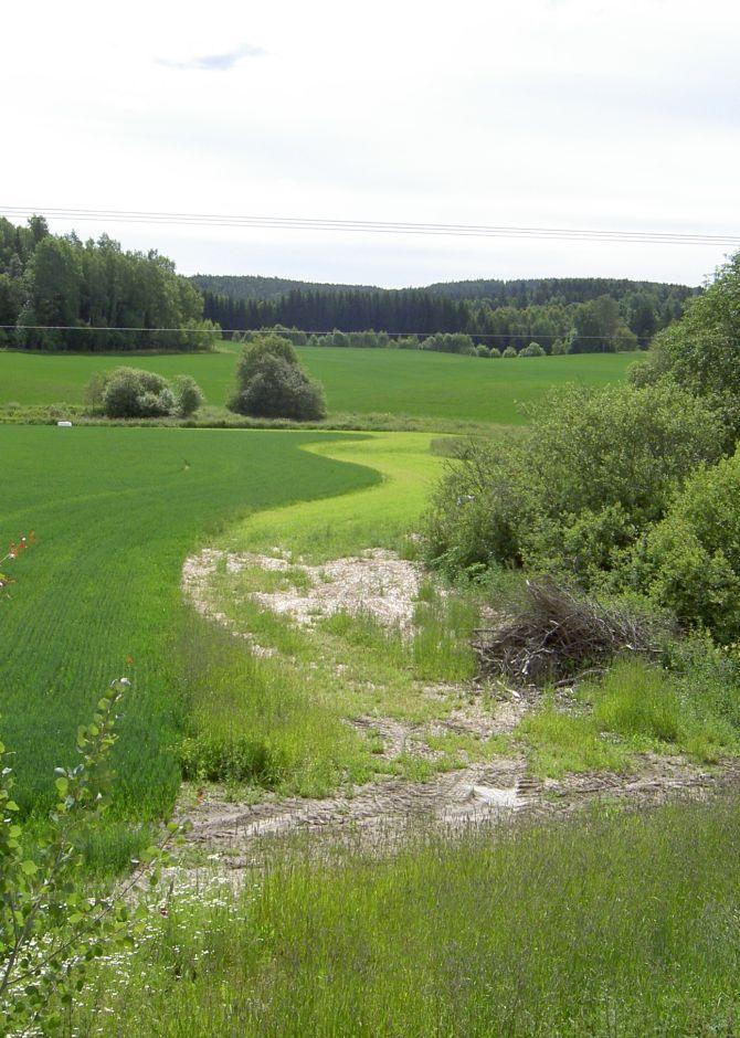
Purpose/aim: Vegetative buffers are areas of permanent vegetation located within and between agricultural fields and the watercourses to which they drain. The purpose of the vegetative buffer is to intercept, and reduce the rates of surface runoff and to reduce loads of sediment, nutrients and pesticide delivered to waterways. The processes involved are filtration, sedimentation, infiltration and absorption. Reducing the input of particles and nutrients into surface waterways is desirable both to improve water quality and to prevent eutrophication of downstream water bodies. In Norway, buffer zones are primarily established to reduce surface runoff of particles and phosphorus. However, vegetation in these zones can also serve other useful functions, such as protection against bank erosion, production of biomass, and/or provision of habitats for wildlife.
Establishment/maintenance activities:
Buffer zones are most commonly designed to retain inputs of nutrients and particles from adjacent fields. Vegetative buffers may be constructed or naturally vegetated, within or alongside fields, or adjacent to drainage ditches, streams, lakes, ponds, and wetlands. The buffer zones may consist of grass for fodder production, or be natural vegetation composed of herbs, weeds, bushes and trees.
In Norway, farmers receive subsidies when the area is still used for production, e.g. grass production for fodder. Farmers leave a strip in cropland for grass and herbs to grow alongside rivers, streams and lakes that intersect their cropland areas. It is recommended to sow grass when establishing grass buffer zones. Robust and dense grass types with a high uptake of nutrients are often the best suited for the purpose. The grass strips should generally not be ploughed, fertilized or treated by herbicides, but some exceptions may be made. The degree to which the grass is harvested varies with the grass type and if it is valuable for livestock fodder.
Buffer zones are one of the most common measures in Norway, and the requirements for the dimension of buffer zones have changed with time - and depend on the region. According to current regulations, buffer zones between the field and the watercourse have to be a minimum of 2 meters in order to qualify for production subsidies (PT-forskriften, § 4). In addition, there is a national recommendation (RMP) to maintain a minimum 6-metre wide buffer zone along all watercourses. However, regional guidelines (RMP) can differ from national ones and the width recommendation differ from county to county.
Benefits/impact: The effectiveness of buffer zones in retaining nutrients and soil particles has been explored by many authors. Retention capacity for phosphorus in buffer zones depends on several factors including vegetation, soil type, slope, hydrological conditions, and the width of the zone. There are large variations in the effectiveness of buffer zones: 32-91% retention of sediment, 26-100% retention of phosphorus and 0-100% retention of nitrogen. The retention effect of grass buffer zones along the Hobøl River, measured with rainfall simulation experiments under the BUFFERKLIMA project (Krzeminska et al., 2020), was: 86-94% for sediment, 86-86% for phosphorus and 78-89% for nitrogen.
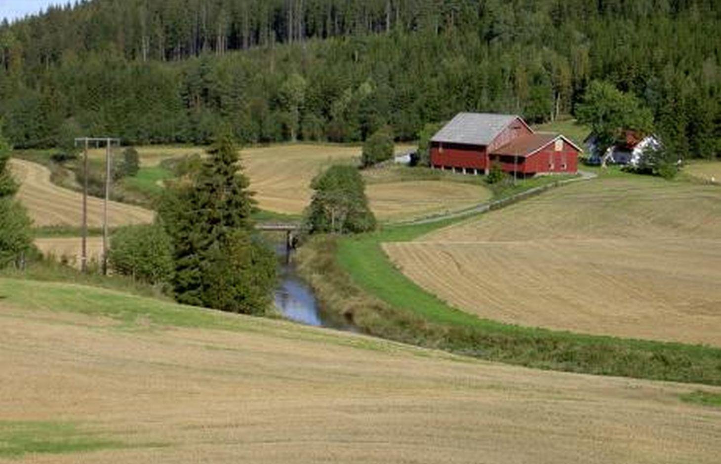
Natural / human environment: The information about this Technology is based on investigations and/or reports from different part of Norway. For the purpose of the OPTAIN project, the technology is further presented in the natural and human environment context of the Kråkstad River catchment - a Norwegian Case Study catchment within the project.
The Kråkstad River is mainly situated in the Ski municipality in the South-Eastern part of Norway. The river catchment is a western tributary of the Vansjø-Hobøl watercourse, also known as the Morsa watercourse. The Kråkstad River catchment area is c. 51 km², 43% of which is agricultural land. Cereals are the major crop, produced on the heavy clays soils. The main environmental challenge in the area is water quality (incl. high phosphorus pollution) and soil erosion (incl. riverbank erosion and quick-clay landslides).The Morsa watercourse is a drinking water resource and there are specific environmental regulations for land management supported by subsidies through the Regional Environmental Programme (RMP).
2.3 Photos de la Technologie
Galerie Médias
2.5 Pays/ région/ lieux où la Technologie a été appliquée et qui sont couverts par cette évaluation
Pays:
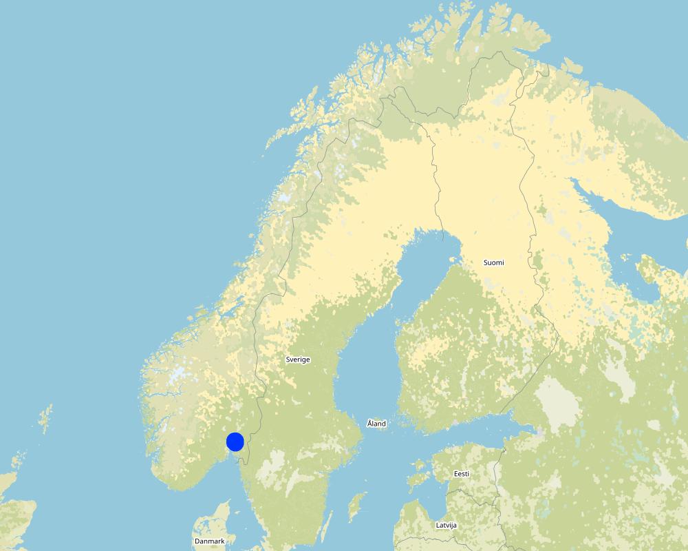
Norvège
Région/ Etat/ Province:
Viken county
Autres spécifications du lieu:
The Vansjø - Hobøl catchment
Spécifiez la diffusion de la Technologie:
- répartie uniformément sur une zone
S'il n'existe pas d'informations exactes sur la superficie, indiquez les limites approximatives de la zone couverte:
- 1-10 km2
Est-ce que les sites dans lesquels la Technologie est appliquée sont situés dans des zones protégées en permanence?
Non
Map
×2.6 Date de mise en œuvre de la Technologie
Si l'année précise est inconnue, indiquez la date approximative: :
- il y a entre 10-50 ans
2.7 Introduction de la Technologie
Spécifiez comment la Technologie a été introduite: :
- au cours d'expérimentations / de recherches
- par le biais de projets/ d'interventions extérieures
- Regional Environmental Programme (RMP)
Commentaires (type de projet, etc.) :
The Morsa Project (morsa.org)
Buffer zones along streams and lakes are measures eligible for subsidies under the Regional Environmental Programme (RMP).
3. Classification de la Technologie de GDT
3.1 Principal(aux) objectif(s) de la Technologie
- réduire, prévenir, restaurer les terres dégradées
- protéger un bassin versant/ des zones situées en aval - en combinaison avec d'autres technologies
3.2 Type(s) actuel(s) d'utilisation des terres, là où la Technologie est appliquée

Terres cultivées
- Cultures annuelles
Cultures annuelles - Précisez les cultures:
- céréales - autres
- small grains
Nombre de période de croissance par an: :
- 1
Précisez:
Longest growing period in days: 135Longest growing period from month to month: May to mid September

Forêts/ bois
Produits et services:
- Bois de chauffage
Commentaires:
Major land use problems (compiler’s opinion): Erosion, flooding and landslides, eutrophication of rivers and lakes.
Major land use problems (land users’ perception): Cropland is occupied by the buffer strips, which may lead to decreased production and loss of income.
3.3 Est-ce que l’utilisation des terres a changé en raison de la mise en œuvre de la Technologie ?
Est-ce que l’utilisation des terres a changé en raison de la mise en œuvre de la Technologie ?
- Oui (Veuillez remplir les questions ci-après au regard de l’utilisation des terres avant la mise en œuvre de la Technologie)
Les divers types d'utilisation des terres au sein du même unité de terrain: :
Non
Terres cultivées
- Cultures annuelles
Cultures annuelles - Précisez les cultures:
- cultures fourragères - graminées
Commentaires:
When buffer zones are implemented, part of the cropland is occupied by the grass strips. The grass strips should generally not be ploughed, fertilized or treated by herbicides, but some exceptions may be made. The degree to which it is harvested varies with the grass type, and if it is used for animal fodder.
3.4 Approvisionnement en eau
Approvisionnement en eau des terres sur lesquelles est appliquée la Technologie:
- pluvial
3.5 Groupe de GDT auquel appartient la Technologie
- gestion des eaux de surface (sources, rivières, lacs, mers)
3.6 Mesures de GDT constituant la Technologie

pratiques végétales
- V2: Herbes et plantes herbacées pérennes
3.7 Principaux types de dégradation des terres traités par la Technologie

érosion hydrique des sols
- Wt: perte de la couche superficielle des sols (couche arable)/ érosion de surface
- Wg: ravinement/ érosion en ravines
- Wm: mouvements de masse/ glissements de terrain
- Wr: érosion des berges

dégradation hydrique
- Hp: baisse de la qualité des eaux de surface
Commentaires:
Main type of degradation addressed:
Wt: loss of topsoil / surface erosion
Hp: decline of surface water quality
Secondary types of degradation addressed:
Wg: gully erosion/gullying,
Wr: riverbank erosion
Wm: mass movements/landslides,
Main causes of degradation:
soil management - use of fertilizer and heavy machinery (compression of the soil and low infiltration rate)
crop management - annual, perennial, tree/shrub
heavy / extreme rainfall (intensity/amounts) - more flooding and erosion, floods
Secondary causes of degradation:
deforestation / removal of natural vegetation (incl. forest fires) - the runoff has a lower retention time in the forest. Leads to higher velocity and more flooding of downstream cropland areas),
change of seasonal rainfall - heavier rainfall events due to climate change,
land tenure
governance / institutional
3.8 Prévention, réduction de la dégradation ou réhabilitation des terres dégradées
Spécifiez l'objectif de la Technologie au regard de la dégradation des terres:
- prévenir la dégradation des terres
- réduire la dégradation des terres
Commentaires:
Main goals: mitigation / reduction of land degradation
Secondary goals: prevention of land degradation
4. Spécifications techniques, activités, intrants et coûts de mise en œuvre
4.1 Dessin technique de la Technologie
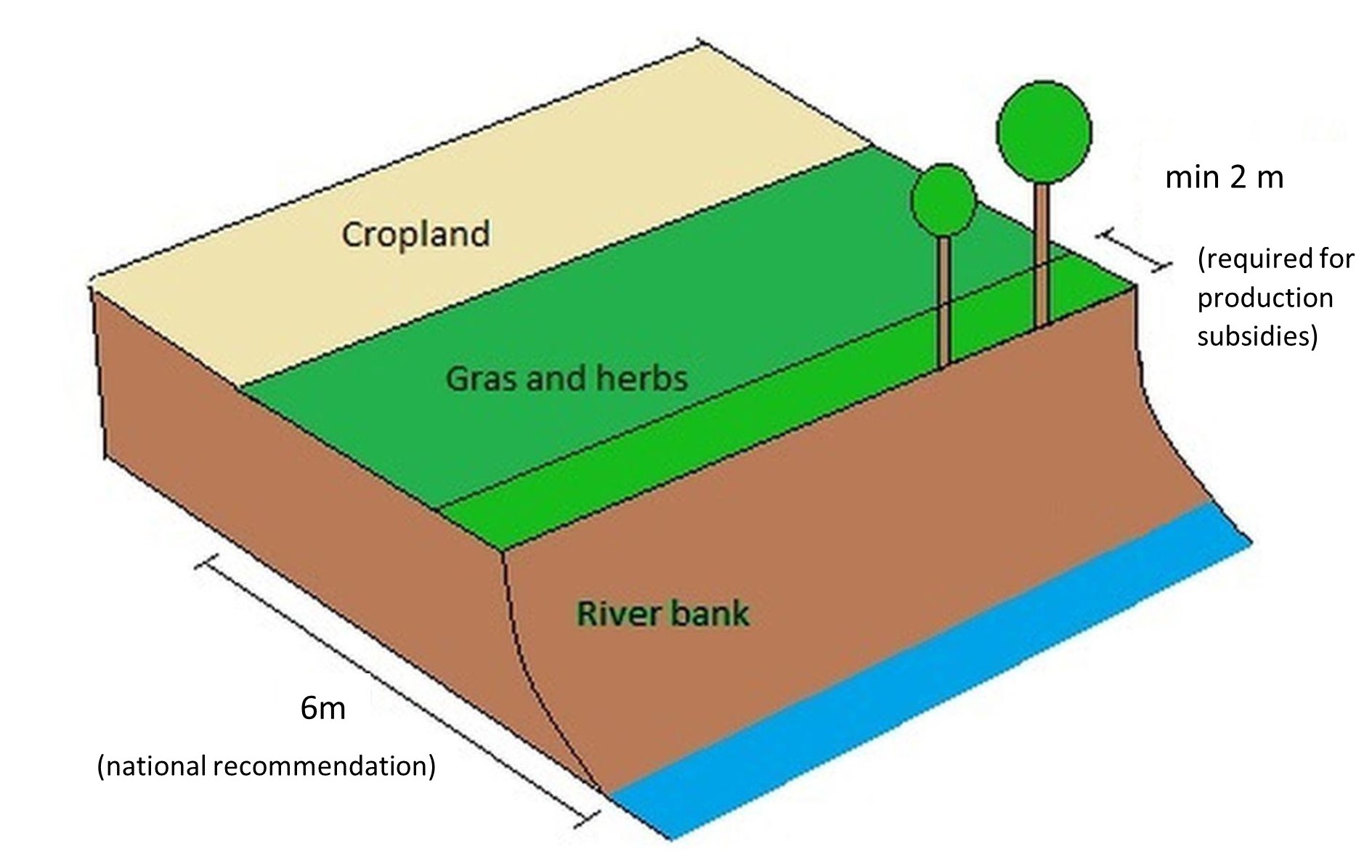
Spécifications techniques (associées au dessin technique):
A technical drawing of a grass buffer zone - example setup based on the Norwegian recomendation
Technical knowledge required for field staff / advisors: low
Technical knowledge required for land users: low
Main technical functions: control of concentrated runoff: impede / retard
Secondary technical functions: control of raindrop splash, control of dispersed runoff: retain / trap, control of dispersed runoff: impede / retard, control of concentrated runoff: retain / trap, improvement of ground cover, increase of surface roughness, increase of infiltration, increase / maintain water stored in soil, improvement of water quality, buffering / filtering water, sediment retention / trapping, sediment harvesting
Aligned: -along boundary
Vegetative material: T : trees / shrubs
Vegetative measure: Along waterways
Vegetative material: G : grass
Trees/ shrubs species: Naturally
Grass species: Seeded
Auteur:
Kamilla Skaalsveen
4.2 Informations générales sur le calcul des intrants et des coûts
Spécifiez la manière dont les coûts et les intrants ont été calculés:
- par entité de la Technologie
Précisez l'unité:
a buffer zone strip along the stream or lake
Précisez les dimensions de l'unité de terrain (le cas échéant):
dimensions can vary greatly
autre/ monnaie nationale (précisez):
Kroner (NOK)
Indiquez le taux de change des USD en devise locale, le cas échéant (p.ex. 1 USD = 79.9 réal brésilien): 1 USD = :
8,89
Indiquez le coût salarial moyen de la main d'œuvre par jour:
c.a. 3000 NOK (it is only the cost of the time assuming 8h work per day, 320-500 NOK/hour; person; machinery, equipment, materials not included)
4.3 Activités de mise en place/ d'établissement
| Activité | Calendrier des activités (saisonnier) | |
|---|---|---|
| 1. | Plowing | 1 time/yr |
| 2. | Harrowing | 2-3 times/yr |
| 3. | Sowing grass | 2-3 times/yr |
| 4. | Harvesting grass | 2-3 times/yr |
4.4 Coûts et intrants nécessaires à la mise en place
| Spécifiez les intrants | Unité | Quantité | Coûts par unité | Coût total par intrant | % du coût supporté par les exploitants des terres | |
|---|---|---|---|---|---|---|
| Main d'œuvre | Ploughing | zone/farmer/day | 1,0 | 321,0 | 321,0 | 7,0 |
| Main d'œuvre | Harrowing | zone/farmer/day | 1,0 | 321,0 | 321,0 | 7,0 |
| Main d'œuvre | Sowing grass | zone/farmer/day | 1,0 | 321,0 | 321,0 | 7,0 |
| Main d'œuvre | Harvesting grass | zone/farmer/day | 1,0 | 321,0 | 321,0 | 7,0 |
| Coût total de mise en place de la Technologie | 1284,0 | |||||
| Coût total de mise en place de la Technologie en dollars américains (USD) | 144,43 | |||||
Si le coût n'est pas pris en charge à 100% par l'exploitant des terres, indiquez qui a financé le coût restant:
Grass covered buffer zones are measures eligible for subsidies under the Regional Environmental Programme (RMP)
Commentaires:
The costs of establishment and management of grass covered buffer zone are the same as in the case of regular crop land management. The subsidy is compensation for land withdrawn from the main production (crop land).
Grass covered buffer zones are measures eligible for subsidies under Regional Environmental Programme (RMP) - between 2019 and 2022 the subsidy for grass covered buffer zones was 15 kr/m in Viken county.
4.5 Activités d'entretien/ récurrentes
| Activité | Calendrier/ fréquence | |
|---|---|---|
| 1. | Ploughing | Every 5th year |
| 2. | Harrowing | Every 5th year |
| 3. | Sowing grass | Every 5th year |
| 4. | Harvesting grass | 1-2 times/yr |
Commentaires:
These areas are often used as grass production areas so some maintenance and harvesting of grass is needed.
4.6 Coûts et intrants nécessaires aux activités d'entretien/ récurrentes (par an)
| Spécifiez les intrants | Unité | Quantité | Coûts par unité | Coût total par intrant | % du coût supporté par les exploitants des terres | |
|---|---|---|---|---|---|---|
| Main d'œuvre | Ploughing | zone/farmer/day | 1,0 | 53,0 | 53,0 | |
| Main d'œuvre | Harrowing | zone/farmer/day | 1,0 | 321,0 | 321,0 | |
| Main d'œuvre | Sowing grass | Day | 1,0 | 321,0 | 321,0 | |
| Main d'œuvre | Harvesting grass | Day | 1,0 | 321,0 | 321,0 | |
| Coût total d'entretien de la Technologie | 1016,0 | |||||
| Coût total d'entretien de la Technologie en dollars américains (USD) | 114,29 | |||||
Si le coût n'est pas pris en charge à 100% par l'exploitant des terres, indiquez qui a financé le coût restant:
Grass covered buffer zones are eligible for subsidies under the Regional Environmental Programme (RMP)
Commentaires:
The costs of establishment and management of grass covered buffer zones are are the same as in case of regular crop land management.
Maintenance of grassed buffer zones is a part of the subsidy system:
-production subsidies - the regulations relating to production subsidies include a number of environmental standards that farmers must meet to receive production support, including two-metre buffer zones along water ways. A farmer who does not comply with the requirements may lose part of their production subsidies.
- RMP - Buffer zones may be eligible for subsidies under the Regional Environmental Programme (RMP) – for 2019-2022 the subsidy level for maintaining grass covered buffer zones was 15 kr/m in the Viken region. The subsidy is compensation for land withdrawn from the main production (crop land).
4.7 Facteurs les plus importants affectant les coûts
Décrivez les facteurs les plus importants affectant les coûts :
The costs of establishment and management of grass buffer zone are are the same as in case of regular crop land management. The subsidy is compensation for land withdrawn from the main production (crop land).
Establishment and maintenance costs of buffer strip depends mostly on:
- the area (width and continuity) of the buffer strip.
- type of vegetation
- possibility to use the grass as a fodder.
5. Environnement naturel et humain
5.1 Climat
Précipitations annuelles
- < 250 mm
- 251-500 mm
- 501-750 mm
- 751-1000 mm
- 1001-1500 mm
- 1501-2000 mm
- 2001-3000 mm
- 3001-4000 mm
- > 4000 mm
Zone agro-climatique
- subhumide
- semi-aride
Thermal climate class: temperate
Thermal climate class: boreal
5.2 Topographie
Pentes moyennes:
- plat (0-2 %)
- faible (3-5%)
- modéré (6-10%)
- onduleux (11-15%)
- vallonné (16-30%)
- raide (31-60%)
- très raide (>60%)
Reliefs:
- plateaux/ plaines
- crêtes
- flancs/ pentes de montagne
- flancs/ pentes de colline
- piémonts/ glacis (bas de pente)
- fonds de vallée/bas-fonds
Zones altitudinales:
- 0-100 m
- 101-500 m
- 501-1000 m
- 1001-1500 m
- 1501-2000 m
- 2001-2500 m
- 2501-3000 m
- 3001-4000 m
- > 4000 m
5.3 Sols
Profondeur moyenne du sol:
- très superficiel (0-20 cm)
- superficiel (21-50 cm)
- modérément profond (51-80 cm)
- profond (81-120 cm)
- très profond (>120 cm)
Texture du sol (de la couche arable):
- moyen (limoneux)
- fin/ lourd (argile)
Texture du sol (> 20 cm sous la surface):
- moyen (limoneux)
- fin/ lourd (argile)
Matière organique de la couche arable:
- moyen (1-3%)
Si disponible, joignez une description complète du sol ou précisez les informations disponibles, par ex., type de sol, pH/ acidité du sol, capacité d'échange cationique, azote, salinité, etc.
Soil fertility is medium-high
Soil drainage/infiltration is poor
Soil water storage capacity is very low-low
5.4 Disponibilité et qualité de l'eau
Profondeur estimée de l’eau dans le sol:
< 5 m
Disponibilité de l’eau de surface:
bonne
Qualité de l’eau (non traitée):
uniquement pour usage agricole (irrigation)
La qualité de l'eau fait référence à:
à la fois les eaux souterraines et de surface
La salinité de l'eau est-elle un problème? :
Non
La zone est-elle inondée?
Oui
Régularité:
fréquemment
5.5 Biodiversité
Diversité des espèces:
- faible
Diversité des habitats:
- faible
5.6 Caractéristiques des exploitants des terres appliquant la Technologie
Sédentaire ou nomade:
- Sédentaire
Orientation du système de production:
- exploitation mixte (de subsistance/ commerciale)
- commercial/ de marché
Revenus hors exploitation:
- 10-50% de tous les revenus
- > 50% de tous les revenus
Niveau relatif de richesse:
- moyen
- riche
Individus ou groupes:
- individu/ ménage
Niveau de mécanisation:
- mécanisé/ motorisé
Genre:
- femmes
- hommes
Age des exploitants des terres:
- jeunes
- personnes d'âge moyen
Indiquez toute autre caractéristique pertinente des exploitants des terres:
Land users applying the Technology are mainly common / average land users
Population density: < 10 persons/km2
Annual population growth: < 0.5%
10% of the land users are rich and own 10% of the land.
90% of the land users are average wealthy and own 90% of the land.
5.7 Superficie moyenne des terres utilisées par les exploitants des terres appliquant la Technologie
- < 0,5 ha
- 0,5-1 ha
- 1-2 ha
- 2-5 ha
- 5-15 ha
- 15-50 ha
- 50-100 ha
- 100-500 ha
- 500-1 000 ha
- 1 000-10 000 ha
- > 10 000 ha
Cette superficie est-elle considérée comme de petite, moyenne ou grande dimension (en se référant au contexte local)?
- moyenne dimension
5.8 Propriété foncière, droits d’utilisation des terres et de l'eau
Propriété foncière:
- individu, avec titre de propriété
Droits d’utilisation des terres:
- communautaire (organisé)
- individuel
Droits d’utilisation de l’eau:
- accès libre (non organisé)
5.9 Accès aux services et aux infrastructures
santé:
- pauvre
- modéré
- bonne
éducation:
- pauvre
- modéré
- bonne
assistance technique:
- pauvre
- modéré
- bonne
emploi (par ex. hors exploitation):
- pauvre
- modéré
- bonne
marchés:
- pauvre
- modéré
- bonne
énergie:
- pauvre
- modéré
- bonne
routes et transports:
- pauvre
- modéré
- bonne
eau potable et assainissement:
- pauvre
- modéré
- bonne
services financiers:
- pauvre
- modéré
- bonne
6. Impacts et conclusions
6.1 Impacts sur site que la Technologie a montrés
Impacts socio-économiques
Production
production agricole
surface de production
Commentaires/ spécifiez:
The grass (from buffer strips) is often unfit for fodder
Revenus et coûts
revenus agricoles
Commentaires/ spécifiez:
Despite subsidies, many farmers view grass buffer zones as a financial loss since the grass is often unfit for fodder.
diversité des sources de revenus
charge de travail
Impacts socioculturels
Improved livelihoods and human well-being
Commentaires/ spécifiez:
Because of the drinking water quality
Impacts écologiques
Cycle de l'eau/ ruissellement
qualité de l'eau
Commentaires/ spécifiez:
less sediment and nutrient input to surface water
Sols
couverture du sol
perte en sol
compaction du sol
cycle/ recharge des éléments nutritifs
Biodiversité: végétale, animale
diversité végétale
espèces bénéfiques
diversité des habitats
6.2 Impacts hors site que la Technologie a montrés
pollution des rivières/ nappes phréatiques
capacité tampon/de filtration
6.3 Exposition et sensibilité de la Technologie aux changements progressifs et aux évènements extrêmes/catastrophes liés au climat (telles que perçues par les exploitants des terres)
Changements climatiques progressifs
Changements climatiques progressifs
| Saison | Augmentation ou diminution | Comment la Technologie fait-elle face à cela? | |
|---|---|---|---|
| températures annuelles | augmente | bien | |
| précipitations annuelles | augmente | bien |
Extrêmes climatiques (catastrophes)
Catastrophes météorologiques
| Comment la Technologie fait-elle face à cela? | |
|---|---|
| pluie torrentielle locale | modérément |
| tempête de vent locale | bien |
Catastrophes climatiques
| Comment la Technologie fait-elle face à cela? | |
|---|---|
| sécheresse | bien |
Catastrophes hydrologiques
| Comment la Technologie fait-elle face à cela? | |
|---|---|
| inondation générale (rivière) | modérément |
Autres conséquences liées au climat
Autres conséquences liées au climat
| Comment la Technologie fait-elle face à cela? | |
|---|---|
| réduction de la période de croissance | bien |
6.4 Analyse coûts-bénéfices
Quels sont les bénéfices comparativement aux coûts de mise en place (du point de vue des exploitants des terres)?
Rentabilité à court terme:
légèrement négative
Rentabilité à long terme:
neutre / équilibrée
Quels sont les bénéfices comparativement aux coûts d'entretien récurrents (du point de vue des exploitants des terres)?
Rentabilité à court terme:
légèrement négative
Rentabilité à long terme:
légèrement négative
6.5 Adoption de la Technologie
- 11-50%
De tous ceux qui ont adopté la Technologie, combien d'entre eux l'ont fait spontanément, à savoir sans recevoir aucune incitation matérielle, ou aucune rémunération? :
- 0-10%
Commentaires:
There is no trend towards spontaneous adoption of the Technology. Doubts about the retention capacity of buffer zones reduce farmers’ motivation.
Local regulations determine that farmers only receive subsidies per production area along with financial grants if they implement the technology.
6.6 Adaptation
La Technologie a-t-elle été récemment modifiée pour s'adapter à l'évolution des conditions?
Non
6.7 Points forts/ avantages/ possibilités de la Technologie
| Points forts/ avantages/ possibilités du point de vue de l'exploitant des terres |
|---|
| Probably good for the environment |
| Points forts/ avantages/ possibilités du point de vue du compilateur ou d'une autre personne ressource clé |
|---|
|
The grass captures sediments and nutrients from the cropland How can they be sustained / enhanced? May be more efficient with a change in grass type (but this has not been not tested) |
|
Reduced fertilizer usage How can they be sustained / enhanced? Continue in the same way |
|
Co-operation between farmers How can they be sustained / enhanced? Joint utilization of the buffer strips for grass production |
6.8 Faiblesses/ inconvénients/ risques de la Technologie et moyens de les surmonter
| Faiblesses/ inconvénients/ risques du point de vue de l’exploitant des terres | Comment peuvent-ils être surmontés? |
|---|---|
| Loss of productive cropland | Narrower buffer strips |
| Not always good for the farm economy | Review the subsidies scheme |
| Doubts about the effectiveness of the technology (infiltration and stream bank erosion) |
| Faiblesses/ inconvénients/ risques du point de vue du compilateur ou d'une autre personne ressource clé | Comment peuvent-ils être surmontés? |
|---|---|
| Low infiltration rates | Less heavy machinery on the buffer strips and a wider zone of natural vegetation along the banks |
7. Références et liens
7.1 Méthodes/ sources d'information
- visites de terrain, enquêtes sur le terrain
BUFFERKLIMA project (Krzeminska et al 2020)
Projects within Halden, MORSA and PURA water region (Blankenberg and Skarbøvik, 2020)
- compilation à partir de rapports et d'autres documents existants
Quand les données ont-elles été compilées (sur le terrain)?
10/02/2022
7.2 Références des publications disponibles
Titre, auteur, année, ISBN:
Blankenberg, A-G.B., Skarbøvik E., 2020. Phosphorus retention, erosion protection and farmers’ perceptions of riparian buffer zones with grass and natural vegetation: Case studies from South-Eastern Norway.
Disponible à partir d'où? Coût?
Ambio
Titre, auteur, année, ISBN:
Krzeminska D, Blankenberg A‐G, Bøe F, Nemes A, Skarbøvik E. 2020.Renseeffekt og kanterosjon i kantsoner med forskjellig vegetasjonstype.
Disponible à partir d'où? Coût?
NIBIO website
Titre, auteur, année, ISBN:
Blankenberg, A-G.B., Skarbøvik E., Kværnø S. 2017. Effekt av buffersoner ‐ på vannmiljø og andre økosystemtjenester.
Disponible à partir d'où? Coût?
NIBIO website
7.3 Liens vers les informations pertinentes en ligne
Titre/ description:
Blankenberg and Skarbøvik, 2020. Phosphorus retention, erosion protection and farmers’ perceptions of riparian buffer zones with grass and natural vegetation: Case studies from South-Eastern Norway.
URL:
https://link.springer.com/content/pdf/10.1007/s13280-020-01361-5.pdf
Titre/ description:
Krzeminska D, Blankenberg A‐G, Bøe F, Nemes A, Skarbøvik E. 2020.Renseeffekt og kanterosjon i kantsoner med forskjellig vegetasjonstype.
URL:
https://nibio.brage.unit.no/nibio-xmlui/bitstream/handle/11250/2645890/NIBIO_RAPPORT_2020_6_30.pdf?sequence=2&isAllowed=y
Titre/ description:
Blankenberg, A-G.B., Skarbøvik E., Kværnø S. 2017. Effekt av buffersoner ‐ på vannmiljø og andre økosystemtjenester.
URL:
https://nibio.brage.unit.no/nibio-xmlui/bitstream/handle/11250/2448787/NIBIO_RAPPORT_2017_3_14.pdf?sequence=2&isAllowed=y
7.4 Observations d'ordre général
no remarks
Liens et modules
Développer tout Réduire toutLiens
Regional Environmental program [Norvège]
Regulations and financial grants for reduction of pollution and promotion of the cultural landscape.
- Compilateur : Kamilla Skaalsveen
Modules
Aucun module trouvé