Unexpected flood risk control in village
(ប្រទេសនេប៉ាល់)
Bhelbadi Niyantran
ការពណ៌នា
It is a technology used to control and reduce the effects of downstream flood by physical interventions like construction of spillway, ditch and stone dam on the wall of ditch.
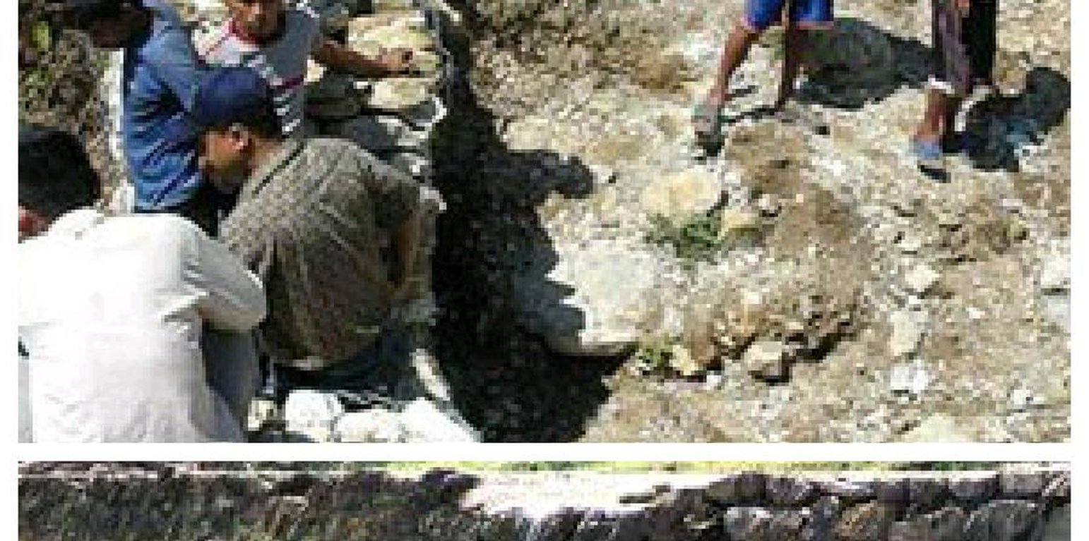
Hilly areas are prone to flash flood that occur with little warning. During rainy season, level of water rises in the stream due to which land mass field of around area was degraded. This technology is used to control the land mass and water flowing from upper region to the lower region of the hill. The natural stream was modified to deep and more sloppy. And surrounding walls were made by piling up stones dams and tighten them by metal wires. These dams decrease the slope gradient and reduce the velocity of water flow and promote the deposition of eroded materials.
Purpose of the Technology: There was no problem of landslide and downstream flood before. But after the road construction, soil became loose resulting in the occurrence of downstream flood. It caused massive destruction of agricultural fields and disturbed settlement areas. Also, stone and gravel during landslide and stream flood used to be deposited and block the flow of the water. So land user invented by this technology to control and reduce the effects of downstream flood.
Establishment / maintenance activities and inputs: Land users and other villagers took the initiative to carry out the technology. Stones were abundantly found in the stream that were utilized to make the dams on lining the stream. Dozer was used to deepen the stream and increase the slope of stream. Stones were piled up and tied by iron wires on the bank of stream by local farmers themselves with their own investment.
Natural / human environment: The area where this technology has been used is a hilly area. Soil fertility in that area is low or medium which differs according to the place. Due to landslide and downstream flood, sand and gravel get deposited in the cropland, so its fertility is very low. No crops can be grown in there. This technology helps to control further degradation of land but could't help to restore natural quality of land.
This area is semi arid area. Due to the proper supply of water the area is prevented from drying. People living in that area are mainly farmers and depend on agriculture for livelihood. Also the area is developing more after the road construction. People are now being more aware about health, education and development.
ទីតាំង
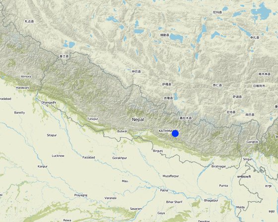
ទីតាំង: Kavre, Nepal, ប្រទេសនេប៉ាល់
ចំនួនទីកន្លែងបច្ចេកទេស ដែលវិភាគ:
ចំណុចយោងភូមិសាស្ត្រនៃទីតាំងជ្រើសរើស
ការសាយភាយនៃបច្ចេកទេស: អនុវត្តនៅកន្លែងជាក់លាក់មួយ/ ប្រមូលផ្តុំនៅតំបន់តូចៗ
តើស្ថិតក្នុងតំបន់ការពារអចិន្ត្រៃយ៍?:
កាលបរិច្ឆេទនៃការអនុវត្ត: តិចជាង 10ឆ្នាំមុន (ថ្មី)
ប្រភេទនៃការណែនាំឱ្យអនុវត្តន៍៖
-
តាមរយៈការបង្កើតថ្មីរបស់អ្នកប្រើប្រាស់ដី
-
ជាផ្នែកនៃប្រព័ន្ធប្រពៃណី (> 50 ឆ្នាំ)
-
ពេលកំពុងពិសោធន៍
-
តាមរយៈគម្រោង / អន្តរាគមន៍ពីខាងក្រៅ
គោលបំណងចម្បងៗ
-
ធ្វើឱ្យប្រសើរឡើងនូវផលិតកម្ម
-
កាត់បន្ថយ, បង្ការ, ស្តារឡើងវិញនូវការធ្លាក់ចុះគុណភាពដី
-
អភិរក្សប្រព័ន្ធអេកូឡូស៊ី
-
ការពារតំបន់ទីជម្រាល/តំបន់ខ្សែទឹកខាងក្រោមបញ្ចូលជាមួយបច្ចេកទេសផ្សេងទៀត
-
អភិរក្ស/ធ្វើឱ្យប្រសើរឡើងជីវចម្រុះ
-
កាត់បន្ថយហានិភ័យនៃគ្រោះមហន្តរាយ
-
បន្ស៊ាំទៅនឹងការប្រែប្រួលអាកាសធាតុ/គ្រោះមហន្តរាយ និងផលប៉ះពាល់របស់វា
-
កាត់បន្ថយការប្រែប្រួលអាកាសធាតុ និងផលប៉ះពាល់របស់វា
-
បង្កើតផលប្រយោជន៍សេដ្ឋកិច្ច
-
បង្កើតផលប្រយោជន៍សង្គម
ការប្រើប្រាស់ដី
-
ផ្លូវទឹក ផ្ទៃទឹក ដីសើម - ផ្សេងៗ (សូមបញ្ជាក់): Waterway, ditch
ការផ្គត់ផ្គង់ទឹក
-
ទឹកភ្លៀង
-
ទឹកភ្លៀង និងប្រព័ន្ធស្រោចស្រព
-
ប្រព័ន្ធស្រោចស្រពទាំងស្រុង
គោលបំណងទាក់ទងនឹងការធ្លាក់ចុះគុណភាពដី
-
ការការពារការធ្លាក់ចុះគុណភាពដី
-
ការកាត់បន្ថយការធ្លាក់ចុះគុណភាពដី
-
ការជួសជុល/ ស្តារឡើងវិញនៃឱនភាពដីធ្ងន់ធ្ងរ
-
ការបន្ស៊ាំទៅនឹងការធ្លាក់ចុះគុណភាពដី
-
ដែលមិនអាចអនុវត្តបាន
ប្រភេទនៃការធ្លាក់ចុះគុណភាពដីដែលបានដោះស្រាយ
-
ការហូរច្រោះដីដោយសារទឹក - Wg: ការកកើតឡើងនូវកំទេចកំទីដីស្រទាប់ក្រោម, Wo: ផលប៉ះពាល់នៃការធ្លាក់ចុះគុណភាពកន្លែងឆ្ងាយ
ក្រុម SLM
-
ការគ្រប់គ្រងទឹកលើដី (ទឹកធ្លាក់ ទន្លេ បឹង សមុទ្រ)
វិធានការ SLM
-
វិធានការរចនាស័ម្ពន្ធ - S3: កម្ពស់ភ្លឺ ប្រឡាយ ផ្លូវទឹក , S6: ជញ្ជាំង, របាំង, របងឈើខ្ពស់ៗ
គំនូរបច្ចេកទេស
លក្ខណៈបច្ចេកទេស
ការបង្កើតនិងការថែទាំ៖ សកម្មភាព ធាតុចូល និងថ្លៃដើម
ការគណនាធាតុចូល និងថ្លៃដើម
- ថ្លៃដើមត្រូវបានគណនា៖
- រូបិយប័ណ្ណសម្រាប់ការគណនាថ្លៃដើម៖ ដុល្លារ
- អត្រាប្តូរប្រាក់ (ទៅជាដុល្លារអាមេរិក)៖ 1 USD = មិនមាន
- ថ្លៃឈ្នួលជាមធ្យមក្នុង ១ ថ្ងៃ៖ មិនមាន
កត្តាសំខាន់បំផុតដែលមានឥទ្ធិពលលើថ្លៃដើម
The most determinate factor affecting the cost is land structure. Land contains loamy soil which made it difficult for construction of ditch.
សកម្មភាពបង្កើតបច្ចេកទេស
-
Land user increased the width and slope of existing ditch for easy flow of water. (ពេលវេលា/ ភាពញឹកញាប់: dry seasonm)
-
Land user embanked the bank with stones on either side. (ពេលវេលា/ ភាពញឹកញាប់: dry season)
-
Stones are bind together by wires in some places. (ពេលវេលា/ ភាពញឹកញាប់: dry season)
ធាតុចូល និងថ្លៃដើមសម្រាប់ការបង្កើតបច្ចេកទេស
| បញ្ជាក់ពីធាតុចូល |
ឯកតា |
បរិមាណ |
ថ្លៃដើមក្នុងមួយឯកតា (ដុល្លារ) |
ថ្លៃធាតុចូលសរុប (ដុល្លារ) |
% នៃថ្លៃដើមដែលចំណាយដោយអ្នកប្រើប្រាស់ដី |
|
កម្លាំងពលកម្ម
|
| Increase the width and slope of ditch |
ha |
1,0 |
941,17 |
941,17 |
100,0 |
| ថ្លៃដើមសរុបក្នុងការបង្កើតបច្ចេកទេស |
941.17 |
|
| ថ្លៃដើមសរុបក្នុងការបង្កើតបច្ចេកទេសគិតជាដុល្លារ |
941.17 |
|
សកម្មភាពថែទាំ
n.a.
បរិស្ថានធម្មជាតិ
បរិមាណទឹកភ្លៀងជាមធ្យមប្រចាំឆ្នាំ
-
< 250 មម
-
251-500 មម
-
501-750 មម
-
751-1,000 មម
-
1,001-1,500 មម
-
1,501-2,000 មម
-
2,001-3,000 មម
-
3,001-4,000 មម
-
> 4,000 មម
តំបន់កសិអាកាសធាតុ
-
សើម
-
មានភ្លៀងមធ្យម
-
មានភ្លៀងតិចតួច
-
ស្ងួត
លក្ខណៈសម្គាល់នៃអាកាសធាតុ
monsoon rain, dry winter
Thermal climate class: subtropics
ជម្រាល
-
រាបស្មើ (0-2%)
-
ជម្រាលតិចតួច (3-5%)
-
មធ្យម (6-10%)
-
ជម្រាលខ្ពស់បន្តិច (11-15%)
-
ទីទួល (16-30%)
-
ទីទួលចោត (31-60%)
-
ទីទួលចោតខ្លាំង (>60%)
ទម្រង់ដី
-
ខ្ពង់រាប
-
កំពូលភ្នំ
-
ជម្រាលភ្នំ
-
ជម្រាលទួល
-
ជម្រាលជើងភ្នំ
-
បាតជ្រលងភ្នំ
រយៈកម្ពស់ធៀបនឹងនីវ៉ូទឹកសមុទ្រ
-
0-100 ម
-
101-500 ម
-
501-1,000 ម
-
1,001-1,500 ម
-
1,501-2,000 ម
-
2,001-2,500 ម
-
2,501-3,000 ម
-
3,001-4,000 ម
-
> 4,000 ម
បច្ចេកទេសត្រូវបានអនុវត្តនៅក្នុង
-
សណ្ឋានដីប៉ោង
-
សណ្ឋានដីផត
-
មិនពាក់ព័ន្ធទាំងអស់
ជម្រៅដី
-
រាក់ខ្លាំង (0-20 សម)
-
រាក់ (21-50 សម)
-
មធ្យម (51-80 សម)
-
ជ្រៅ (81-120 សម)
-
ជ្រៅខ្លាំង (> 120 សម)
វាយនៈភាពដី (ដីស្រទាប់ខាងលើ)
-
គ្រើម/ មានពន្លឺ (ខ្សាច់)
-
មធ្យម (ល្បាយ, ល្បាប់)
-
ម៉ត់/ ធ្ងន់ (ឥដ្ឋ)
វាយនភាពដី (> 20 សម ក្រោមស្រទាប់លើ)
-
គ្រើម/ មានពន្លឺ (ខ្សាច់)
-
មធ្យម (ល្បាយ, ល្បាប់)
-
ម៉ត់/ ធ្ងន់ (ឥដ្ឋ)
កម្រិតសារធាតុសរីរាង្គក្នុងដីស្រទាប់លើ
-
ខ្ពស់ (>3%)
-
មធ្យម (1-3%)
-
ទាប (<1%)
ដង្ហើមទឹកក្នុងដី
-
ផ្ទៃខាងលើ
-
< 5 ម
-
5-50 ម
-
> 50 ម
ភាពអាចរកបាននៃទឹកលើដី
-
លើស
-
ល្អ
-
កម្រិតមធ្យម
-
មិនមាន/ គ្មាន
គុណភាពទឹក (មិនបានធ្វើប្រព្រឹត្តិកម្ម)
-
ទឹកពិសារដែលមានគុណភាពល្អ
-
ទឹកពិសារដែលគ្មានគុណភាព (តម្រូវឱ្យមានការសំអាត)
-
ទឹកសម្រាប់តែការធ្វើកសិកម្ម (ស្រោចស្រព)
-
ទឹកមិនអាចប្រើប្រាស់បាន
គុណភាពទឹក គឺផ្តោតទៅលើ៖
តើមានបញ្ហាទឹកប្រៃហូរចូលដែរឬទេ?
ការកើតឡើងនៃទឹកជំនន់
ភាពសំបូរបែបនៃជម្រកធម្មជាតិ
ចរិតលក្ខណៈរបស់អ្នកប្រើប្រាស់ដីដែលប្រើបច្ចេកទេស SLM
ទីផ្សារ
-
សម្រាប់ហូបក្នុងគ្រួសារ (ផ្គត់ផ្គង់ខ្លួនឯង)
-
ពាក់កណ្តាលពាណិជ្ជកម្ម (ផ្គត់ផ្គង់ខ្លួនឯង/ ពាណិជ្ជកម្ម)
-
ពាណិជ្ជកម្ម/ ទីផ្សារ
ចំណូលក្រៅកសិដ្ឋាន
-
តិចជាង 10% នៃចំណូល
-
10-50% នៃចំណូល
-
ច្រើនជាង 50% នៃចំណូល
កម្រិតជីវភាព
-
មិនល្អខ្លាំង
-
មិនល្អ
-
មធ្យម
-
មាន
-
មានខ្លាំង
កម្រិតនៃការប្រើគ្រឿងយន្ត
-
ប្រើកម្លាំងពលកម្ម
-
ប្រើកម្លាំងសត្វ
-
គ្រឿងយន្ត/ ម៉ាស៊ីន
នៅមួយកន្លែង ឬពនេចរ
-
នៅមួយកន្លែង
-
ពាក់កណ្តាលពនេចរ
-
ពនេចរ
បុគ្គល ឬក្រុម
-
ធ្វើខ្លួនឯង/ គ្រួសារ
-
ជាក្រុម/ សហគមន៍
-
សហករ
-
មានបុគ្គលិក (ក្រុមហ៊ុន, រដ្ឋ)
អាយុ
-
កុមារ
-
យុវវ័យ
-
វ័យកណ្តាល
-
មនុស្សចាស់
ផ្ទៃដីប្រើប្រាស់ក្នុងមួយគ្រួសារ
-
< 0.5 ហិកតា
-
0.5-1 ហិកតា
-
1-2 ហិកតា
-
2-5 ហិកតា
-
5-15 ហិកតា
-
15-50 ហិកតា
-
50-100 ហិកតា
-
100-500 ហិកតា
-
500-1,000 ហិកតា
-
1,000-10,000 ហិកតា
-
> 10,000 ហិកតា
មាត្រដ្ឋាន
-
ខ្នាតតូច
-
ខ្នាតមធ្យម
-
ខ្នាតធំ
ភាពជាម្ចាស់ដីធ្លី
-
រដ្ឋ
-
ក្រុមហ៊ុន
-
ភូមិ
-
ក្រុម
-
ឯកជន មិនមានកម្មសិទ្ធ
-
ឯកជន មានកម្មសិទ្ធ
សិទ្ធិប្រើប្រាស់ដី
-
អាស្រ័យផលសេរី (មិនមានការកំណត់)
-
ជាក្រុម (មានដែនកំណត់)
-
កិច្ចសន្យាជួល
-
ឯកជន
សិទ្ធិប្រើប្រាស់ទឹក
-
អាស្រ័យផលសេរី (មិនមានការកំណត់)
-
ជាក្រុម (មានដែនកំណត់)
-
កិច្ចសន្យាជួល
-
ឯកជន
ប្រើប្រាស់សេវាកម្ម និងហេដ្ឋារចនាសម្ព័ន្ធ
ការងារ (ឧ. ការងារក្រៅកសិដ្ឋាន)
ផលប៉ះពាល់
ផលប៉ះពាល់សេដ្ឋកិច្ចសង្គម
ហានិភ័យនៃភាពបរាជ័យរបស់ផលិតកម្ម
គុណភាពមុន SLM: n/a
គុណភាពក្រោយ SLM: n/a
protected the cropland from flood
ផលប៉ះពាល់វប្បធម៌សង្គម
ចំណេះដឹង SLM / ការធ្លាក់ចុះគុណភាពដី
គុណភាពមុន SLM: n/a
គុណភាពក្រោយ SLM: n/a
active participating people on land conservation.
ផលប៉ះពាល់លើអេកូឡូស៊ី
លំហូរទឹកលើផ្ទៃដី
water travel in fixed path
ប្រព័ន្ធបង្ហូរទឹក
improved water way for passage of excess water
ការបាត់បង់ដី
soil loss due to flooding is reduced
ផលប៉ះពាល់ក្នុងបរិវេណ
ទឹកជំនន់ខ្សែទឹកខាងក្រោម (មិនត្រូវការ)
the main benefits of this technology
ការវិភាគថ្លៃដើម និងអត្ថប្រយោជន៍
អត្ថប្រយោជន៍បើប្រៀបធៀបនឹងថ្លៃដើមក្នុងការបង្កើតបច្ចេកទេស
រយៈពេលខ្លី
អវិជ្ជមានខ្លាំង
វិជ្ជមានខ្លាំង
រយៈពេលវែង
អវិជ្ជមានខ្លាំង
វិជ្ជមានខ្លាំង
អត្ថប្រយោជន៍បើប្រៀបធៀបនឹងថ្លៃដើមក្នុងការថែទាំបច្ចេកទេស
ការប្រែប្រួលអាកាសធាតុ
ការប្រែប្រួលអាកាសធាតុ
សីតុណ្ហភាពប្រចាំឆ្នាំ កើនឡើង
គ្រោះអាកាសធាតុ (មហន្តរាយ)
ការទទួលយក និងការបន្ស៊ាំ
ភាគរយនៃអ្នកប្រើប្រាស់ដីនៅតំបន់ដែលបានទទួលយកបច្ចេកទេស
-
តែមួយករណី /ពិសោធន៍
-
1-10%
-
11-50%
-
> 50%
ក្នុងចំណោមអ្នកទទួលយកបច្ចេកទេសនេះ តើមានប៉ុន្មានភាគរយដែលបានអនុវត្តន៍ដោយមិនបានទទួលការលើកទឹកចិត្តជាសម្ភារៈ?
-
0-10%
-
11-50%
-
51-90%
-
91-100%
ចំនួនខ្នងផ្ទះ និង/ឬតំបន់ដែលគ្របដណ្តប់
14 households in an area of 10 - 100 sq km (50 - 100 persons per sq km)
តើថ្មីៗនេះ បច្ចេកទេសនេះត្រូវបានកែតម្រូវដើម្បីបន្ស៊ាំទៅនឹងស្ថានភាពប្រែប្រួលដែរឬទេ?
ចំពោះលក្ខខណ្ឌប្រែប្រួលណាមួយដែលត្រូវបានបន្ស៊ាំ?
-
ការប្រែប្រួលអាកាសធាតុ/គ្រោះមហន្តរាយធម្មជាតិ
-
បម្រែបម្រួលទីផ្សារ
-
កម្លាំងពលកម្មដែលអាចរកបាន (ចំណាកស្រុក)
សេក្តីសន្និដ្ឋាន និងមេរៀនបទពិសោធន៍
ភាពខ្លាំង: ទស្សនៈអ្នកប្រើប្រាស់ដី
-
Risk of downstream flood and landslide is reduced.
How can they be sustained / enhanced? If they had been more donation from government or any other projects, they would construct concrete or more flood resistance dams. As some parts are still unconstructed they would complete them with some more external support.
-
Agriculture land get protected so they can plant the crop without being at risk.
ភាពខ្លាំង: ទស្សនៈរបស់អ្នកចងក្រង ឬបុគ្គលសំខាន់ផ្សេងទៀត
-
Proper water drainage system and water can get collected in the river following the fix path.
How can they be sustained / enhanced? Fodder plant could be grown on the stream banks which is now left and unused. This could be used to feed the animals and would also help to control flood and landslide.
-
It reduced the risk of further land degradation by downstream flood.
How can they be sustained / enhanced? Dams can be made more strong by making concrete walls
ចំណុចខ្សោយ/ គុណវិបត្តិ/ ហានិភ័យ : ទស្សនៈអ្នកប្រើប្រាស់ដីវិធីដោះស្រាយ
ចំណុចខ្សោយ/ គុណវិបត្តិ/ ហានិភ័យ : ទស្សនៈរបស់អ្នកចងក្រង ឬបុគ្គលសំខាន់ផ្សេងទៀតវិធីដោះស្រាយ
ឯកសារយោង
អ្នកត្រួតពិនិត្យ
-
David Streiff
-
Alexandra Gavilano
កាលបរិច្ឆេទនៃការអនុវត្ត: 14 ខែ មករា ឆ្នាំ 2014
កែតម្រូវចុងក្រោយ: 3 ខែ មិថុនា ឆ្នាំ 2019
បុគ្គលសំខាន់ៗ
-
Sabita Aryal - អ្នកជំនាញឯកទេស SLM
-
Pratiksha Koirala - None
-
Bibhu Gautam - None
-
Anjuli Mulmi - None
ការពណ៌នាលម្អិតក្នុងប្រព័ន្ធគ្រប់គ្រងទិន្នន័យរបស់វ៉ូខេត
ឯកសារនេះត្រូវបានសម្របសម្រួលដោយ
ស្ថាប័ន៖
- Kathmandu University (KU) - ប្រទេសនេប៉ាល់
គម្រោង