Multi-specific plantation of semiarid woody species on slopes [ប្រទេសអេស្ប៉ាញ]
- ការបង្កើត៖
- បច្ចុប្បន្នភាព
- អ្នកចងក្រង៖ Susana Bautista
- អ្នកកែសម្រួល៖ matteo jucker riva
- អ្នកត្រួតពិនិត្យច្រើនទៀត៖ Fabian Ottiger, Alexandra Gavilano
Plantación pluriespecífica de especies leñosas de ambiente semiárido en laderas
technologies_1618 - ប្រទេសអេស្ប៉ាញ
ពិនិត្យមើលគ្រប់ផ្នែក
ពង្រីកមើលទាំងអស់ បង្រួមទាំងអស់1. ព័ត៌មានទូទៅ
1.2 ព័ត៌មានលម្អិតពីបុគ្គលសំខាន់ៗ និងស្ថាប័នដែលចូលរួមក្នុងការវាយតម្លៃ និងចងក្រងឯកសារនៃបច្ចេកទេស
អ្នកជំនាញឯកទេស SLM:
Guixot Lorena
Universidad de Alicante
ប្រទេសអេស្ប៉ាញ
អ្នកជំនាញឯកទេស SLM:
Urgeghe Anna Maria
Universidad de Alicante
ប្រទេសអេស្ប៉ាញ
Governement official:
Bartual Miguel
Conselleria de infrastructuras, territorio y medioambiente
ប្រទេសអេស្ប៉ាញ
ឈ្មោះគម្រោងដែលបានចងក្រងឯកសារ/ វាយតម្លៃលើបច្ចេកទេស (បើទាក់ទង)
Catastrophic shifts in drylands (EU-CASCADE)ឈ្មោះអង្គភាពមួយ (ច្រើន) ដែលបានចងក្រងឯកសារ/ វាយតម្លៃបច្ចេកទេស (បើទាក់ទង)
Universidad de Alicante (Universidad de Alicante) - ប្រទេសអេស្ប៉ាញឈ្មោះអង្គភាពមួយ (ច្រើន) ដែលបានចងក្រងឯកសារ/ វាយតម្លៃបច្ចេកទេស (បើទាក់ទង)
Conselleria de infrastructuras, territorio y medioambiente - ប្រទេសអេស្ប៉ាញ1.3 លក្ខខណ្ឌទាក់ទងទៅនឹងការប្រើប្រាស់ទិន្នន័យដែលបានចងក្រងតាមរយៈ វ៉ូខេត
អ្នកចងក្រង និង(បុគ្គលសំខាន់ៗ)យល់ព្រមទទួលយកនូវលក្ខខណ្ឌនានាទាក់ទងទៅនឹងការប្រើប្រាស់ទិន្នន័យដែលបានចងក្រងតាមរយៈវ៉ូខេត:
បាទ/ចា៎
2. ការពណ៌នាពីបច្ចេកទេស SLM
2.1 ការពណ៌នាដោយសង្ខេបពីបច្ចេកទេស
និយមន័យបច្ចេកទេស:
Plantation of native woody species using planting holes on slopes
2.2 ការពណ៌នាលម្អិតពីបច្ចេកទេស
ការពណ៌នា:
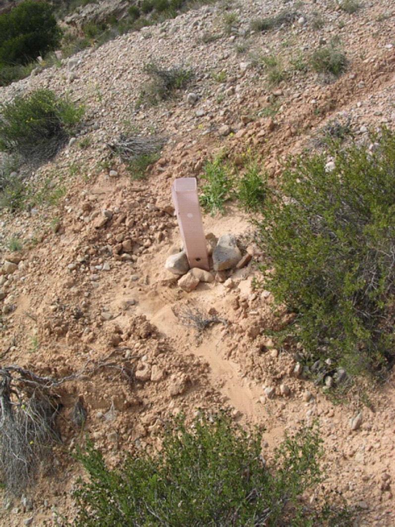
This technology is a restauration technology implemented on degraded south-facing slopes of a semiarid mountain range. The restoration technology consisted of a plantation of seedlings of a variety of native woody species, mostly shrubs, using deep (60cm depth) planting holes. Microcatchments were established upslope the planting hole in suitable areas. Seedlings were protected from extreme radiation and predation by biodegradable seedling shelters. The target area was highly degraded due to long-term overexploitation of resources under harsh environmental conditions. Failed previous reforestation actions on bench terraces led to further degradation in some areas. Degradation resulted in low plant cover, decreased plant biodiversity, lack of riparian vegetation on the ramblas (ravines with intermittent flow), soil erosion, development of gullies, and frequent floods. To address this problem, the Forest Administration implemented a restoration program on the south-facing slopes of the Albatera-Crevillente mountain range. The program was implemented in 2006-07.
Purpose of the Technology: The purpose of the plantation is the restoration of diversity and cover of vegetation on degraded south-facing slopes of a semiarid mountain range, erosion control, and flood prevention.
Natural / human environment: The target area is the south-facing side of a mountain range in a semiarid area of Southeast Spain. Exploitation of resources over centuries, mostly grazing and wood gathering, under harsh environmental conditions, led to very low plant cover, mostly consisting of dwarf shrubs sparsed in a matrix of bare soil, lack of riparian vegetation on the ramblas (ravines with intermittent flow), soil erosion, development of gullies, and frequent floods. The exploitation of the land was drastically reduced during the second half of the 20th century due to the general rural land abandonment trend that started in Spain around the 1950’s driven by critical socio-economic changes such as the use of fossil fuels and the sharp increase in activity in the tourism and services business sectors, mostly in the coast land. However, despite the reduction, or even complete abandonment, of rural activity on the mountain range area, there was no sign of spontaneous recovery from degradation. Soil erosion and floods were of major concern for the resource managers in the area (Public Forest Administration), and a number of reforestation and restoration programs have been implemented in the area, with varying degree of success. In more recent decades, new pressures appeared in the mountain area, such as agricultural expansion into the range area (1970s), mining activities (late 1990’s - early 2000’s), and urbanization (2000s). Rural tourism and recreation are new activities in the mountain range area. For the time being, the intensity of these activities is low to moderate. However there is already some evidence of incipient degradation associated to recreation, and some regulation is being demanded by environmental NGOs.
2.3 រូបភាពនៃបច្ចេកទេស
វិចិត្រសាលប្រព័ន្ធផ្សព្វផ្សាយ
2.5 ប្រទេស/តំបន់/ទីតាំងកន្លែង ដែលបច្ចេកទេសត្រូវបានអនុវត្ត និងបានគ្រប់ដណ្តប់ដោយការវាយតម្លៃនេះ
ប្រទេស:
ប្រទេសអេស្ប៉ាញ
តំបន់/រដ្ឋ/ខេត្ត:
Spain/Alicante
បញ្ជាក់បន្ថែមពីលក្ខណៈនៃទីតាំង:
Albatera
មតិយោបល់:
Comments:
Total area covered by the SLM Technology is 5.7 km2.
The MST was applied on the south-facing side of Albatera-Crevillente mountain range. The area consisted of a sequence of southeast and southwest-facing slopes with small ravines (barrrancos) in between. The MST was specifically applied to the slopes.
2.6 កាលបរិច្ឆេទនៃការអនុវត្ត
ប្រសិនបើមិនច្បាស់ឆ្នាំ សូមបញ្ជាក់កាលបរិច្ឆេទដែលប្រហាក់ប្រហែល:
- តិចជាង 10ឆ្នាំមុន (ថ្មី)
2.7 ការណែនាំពីបច្ចេកទេស
សូមបញ្ជាក់តើបច្ចេកទេសត្រូវបានណែនាំឱ្យអនុវត្តដោយរបៀបណា:
- តាមរយៈគម្រោង / អន្តរាគមន៍ពីខាងក្រៅ
មតិយោបល់ (ប្រភេទនៃគម្រោង ។ល។):
The MST was designed by the Forest Administration in the framework of a restoration programme for degraded semiarid lands and incorporated recent scientific findings regarding the technology and species used.
3. ចំណាត់ថ្នាក់នៃបច្ចេកទេស SLM
3.1 គោលបំណងចម្បង (១ ឬច្រើន) នៃបច្ចេកទេសនេះ
- កាត់បន្ថយ, បង្ការ, ស្តារឡើងវិញនូវការធ្លាក់ចុះគុណភាពដី
- កាត់បន្ថយហានិភ័យនៃគ្រោះមហន្តរាយ
3.2 ប្រភេទដីប្រើប្រាស់មួយប្រភេទ (ច្រើនប្រភេទ) ដែលបានអនុវត្តបច្ចេកទេស

ដីព្រៃ/ដីដាំដើមឈើ
- Olea europaea var sylvestris, Ephedra fragilis, Pistacia lentiscus and Pinus halepensis
ផលិតផល និងសេវាកម្ម:
- ការកំសាន្ត/ទេសចរណ៍
មតិយោបល់:
Major land use problems (compiler’s opinion): Erosion, water scarcity, low productivity, loss of soil functions (water infiltration, nutrient cycling), low biodiversity, loss of landscape structure
Major land use problems (land users’ perception): Low productivity, aridity, erosion
Plantation forestry: Without exploitation
Forest products and services: nature conservation / protection, recreation / tourism
Future (final) land use (after implementation of SLM Technology): Forests / woodlands: Fp: Plantations, afforestations
Number of growing seasons per year:
1
Specify:
Longest growing period in days: 240Longest growing period from month to month: November-June
3.5 ក្រុម SLM ដែលបច្ចេកទេសស្ថិតនៅក្នុង
- ធ្វើឱ្យប្រសើរឡើងគម្របដី/ ដំណាំគម្របដី
- វិធានការអនុវត្តកាត់ទទឹងទីជម្រាល
3.6 វិធានការ SLM ដែលបញ្ចូលនូវបច្ចេកទេស

វិធានការរុក្ខជាតិ
- V1: ឈើធំៗ និងដើមឈើតូចៗ

វិធានការរចនាស័ម្ពន្ធ
- S1: ការធ្វើដីថ្នាក់ៗតាមជម្រាលភ្នំ
មតិយោបល់:
Main measures: vegetative measures
3.7 កំណត់ប្រភេទនៃការធ្លាក់ចុះគុណភាពដីសំខាន់ៗដែលបច្ចេកទេសនេះបានដោះស្រាយ

ការហូរច្រោះដីដោយសារទឹក
- Wt: ការបាត់ដីស្រទាប់លើដោយការហូរច្រោះ
- Wo: ផលប៉ះពាល់នៃការធ្លាក់ចុះគុណភាពកន្លែងឆ្ងាយ

ការធ្លាក់ចុះជីវសាស្ត្រនៃដី
- Bc: ការថយចុះនូវគម្របរុក្ខជាតិ
- Bq: ការថយចុះនូវជីវម៉ាស/ បរិមាណ
- Bs: សមាសភាពដែលមានគុណភាពនិងប្រភេទសត្វ/ការថយចុះនូវជីវចម្រុះ

ការបាត់បង់ទឹក
- Ha: ការថយចុះសំណើមដី
មតិយោបល់:
Main type of degradation addressed: Wt: loss of topsoil / surface erosion, Wo: offsite degradation effects, Bc: reduction of vegetation cover, Bq: quantity / biomass decline, Bs: quality and species composition /diversity decline
Secondary types of degradation addressed: Ha: aridification
Main causes of degradation: deforestation / removal of natural vegetation (incl. forest fires) (Agricultural land expansion. Starting in 1965, peaking in late 1970’s), over-exploitation of vegetation for domestic use (Peaking during 1940’s), poverty / wealth (Poverty)
Secondary causes of degradation: overgrazing (Peaking during 1940’s), industrial activities and mining (Late 1990’s - early 2000’s), urbanisation and infrastructure development (Last 10 years), droughts, population pressure (Relative demographic pressure given the low productivity of the land), land tenure (Lack of proper land demarcation until late 1990’s - early 2000’s, leading to misuse and mismanagement of public land)
3.8 ការពារ កាត់បន្ថយ ឬស្តារឡើងវិញនៃការធ្លាក់ចុះគុណភាពដី
មតិយោបល់:
Main goals: rehabilitation / reclamation of denuded land
Secondary goals: prevention of land degradation, mitigation / reduction of land degradation
4. បច្ចេកទេសជាក់លាក់ សកម្មភាពអនុវត្ត ធាតុចូល និងថ្លៃដើម
4.1 គំនូសបច្ចេកទេសនៃបច្ចេកទេសនេះ

លក្ខណៈពិសេសនៃបច្ចេកទេស (ទាក់ទងនឺងគំនូរបច្ចេកទេស):
Test
Location: Test. Test
Date: Test
Technical knowledge required for field staff / advisors: moderate (Needed for field implementation: soil preparation, planting techniques)
Technical knowledge required for land users: high (Forest Administration staff: High technical knowledge is required for the design of technology implementation)
Main technical functions: control of dispersed runoff: retain / trap, improvement of ground cover, increase in nutrient availability (supply, recycling,…)
Secondary technical functions: control of raindrop splash, control of dispersed runoff: impede / retard, control of concentrated runoff: retain / trap, increase of surface roughness, improvement of surface structure (crusting, sealing), improvement of topsoil structure (compaction), stabilisation of soil (eg by tree roots against land slides), increase in organic matter, increase of infiltration, increase / maintain water stored in soil, sediment retention / trapping, sediment harvesting, increase of biomass (quantity), promotion of vegetation species and varieties (quality, eg palatable fodder), spatial arrangement and diversification of land use
Vegetative measure: Staggered pattern
Vegetative material: T : trees / shrubs
Number of plants per (ha): 610
Spacing between rows / strips / blocks (m): 5
Vertical interval within rows / strips / blocks (m): 5
Vegetative measure: Vegetative material: T : trees / shrubs
Vegetative measure: Vegetative material: T : trees / shrubs
Vegetative measure: Vegetative material: T : trees / shrubs
Trees/ shrubs species: Olea europaea var sylvestris, Ephedra fragilis, Pistacia lentiscus and Pinus halepensis
ឈ្មោះអ្នកនិពន្ធ:
Test, Test
4.2 ព័ត៌មានទូទៅដែលពាក់ព័ន្ធនឹងការគណនាធាតុចូល និងថ្លៃដើម
ផ្សេងៗ/ រូបិយប័ណ្ណជាតិ (បញ្ជាក់):
Euro
បើពាក់ព័ន្ធសូមកំណត់អត្រាប្តូរប្រាក់ពីដុល្លាទៅរូបិយប័ណ្ណតំបន់ (ឧ. 1 ដុល្លារ = 79.9 រៀលនៃរូបិយប័ណ្ណប្រេស៊ីល) ៖ 1 ដុល្លារ =:
0,78
4.3 សកម្មភាពបង្កើត
| សកម្មភាព | រយៈពេល (រដូវកាល) | |
|---|---|---|
| 1. | Soil preparation and planting holes | during winter |
| 2. | Soil and microcatchment preparation | during winter |
| 3. | Fertilization plantation (holes) | Winter |
| 4. | Fertilization microcatchment | Winter |
| 5. | Plantation | during winter |
| 6. | Plantation (microcatchments) | during winter |
| 7. | Tree shelter placement | late winter |
| 8. | tree shelter placement (Microcatchments) | late winter |
4.4 ថ្លៃដើម និងធាតុចូលដែលត្រូវការសម្រាប់ការបង្កើតបច្ចេកទេស
| បញ្ជាក់ពីធាតុចូល | ឯកតា | បរិមាណ | ថ្លៃដើមក្នុងមួយឯកតា | ថ្លៃធាតុចូលសរុប | % នៃថ្លៃដើមដែលចំណាយដោយអ្នកប្រើប្រាស់ដី | |
|---|---|---|---|---|---|---|
| កម្លាំងពលកម្ម | Labour | ha | 1,0 | 1343,0 | 1343,0 | 100,0 |
| សម្ភារៈ | Machine use | ha | 1,0 | 853,0 | 853,0 | 100,0 |
| សម្ភារៈដាំដុះ | Seedlings | ha | 1,0 | 252,0 | 252,0 | 100,0 |
| ជី និងសារធាតុពុល | Biocides | ha | 1,0 | 154,0 | 154,0 | 100,0 |
| ផ្សេងៗ | Tree shelters | ha | 1,0 | 424,0 | 424,0 | 100,0 |
| ថ្លៃដើមសរុបក្នុងការបង្កើតបច្ចេកទេស | 3026,0 | |||||
| ថ្លៃដើមសរុបក្នុងការបង្កើតបច្ចេកទេសគិតជាដុល្លារ | 3879,49 | |||||
មតិយោបល់:
Duration of establishment phase: 5 month(s)
4.6 កំណត់ថ្លៃដើមសម្រាប់ការថែទាំ/ សកម្មភាពរបស់បច្ចេកទេស (ក្នុងរយៈពេលមួយឆ្នាំ)
មតិយោបល់:
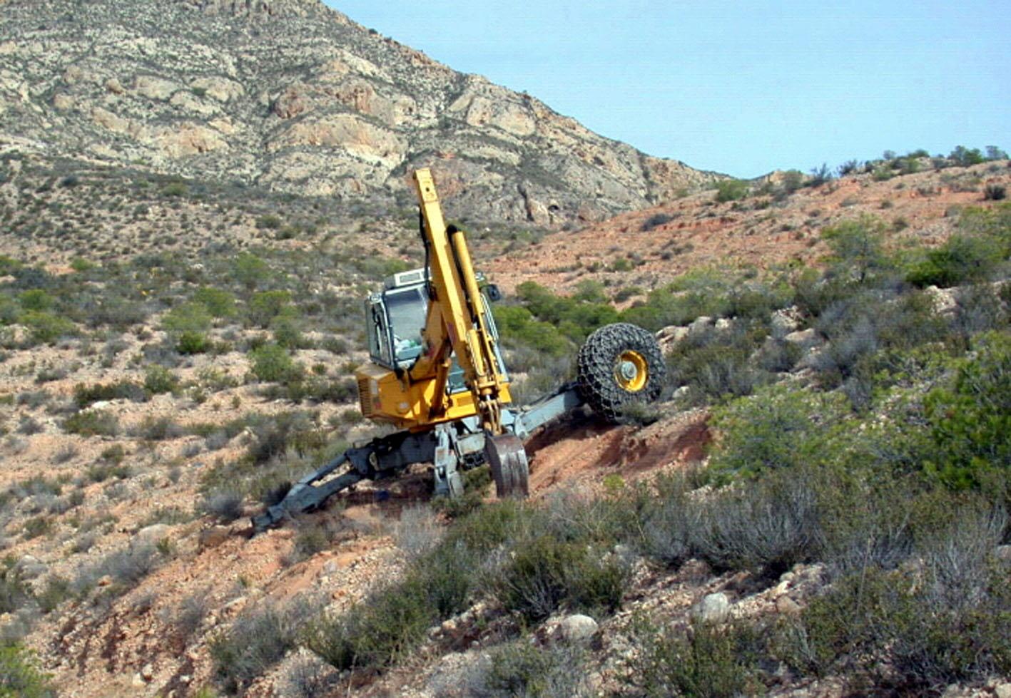
Machinery/ tools: Walking Excavator
5. លក្ខណៈបរិស្ថានធម្មជាតិ និងមនុស្ស
5.1 អាកាសធាតុ
បរិមាណទឹកភ្លៀងប្រចាំឆ្នាំ
- < 250 មម
- 251-500 មម
- 501-750 មម
- 751-1,000 មម
- 1,001-1,500 មម
- 1,501-2,000 មម
- 2,001-3,000 មម
- 3,001-4,000 មម
- > 4,000 មម
លក្ខណៈពិសេស/ មតិយោបល់លើរដូវភ្លៀង:
280 mm (mean 1958 – 2007) Rainy seasons: spring and autumn
តំបន់កសិអាកាសធាតុ
- មានភ្លៀងតិចតួច
Thermal climate class: subtropics
5.2 សណ្ឋានដី
ជម្រាលជាមធ្យម:
- រាបស្មើ (0-2%)
- ជម្រាលតិចតួច (3-5%)
- មធ្យម (6-10%)
- ជម្រាលខ្ពស់បន្តិច (11-15%)
- ទីទួល (16-30%)
- ទីទួលចោត (31-60%)
- ទីទួលចោតខ្លាំង (>60%)
ទម្រង់ដី:
- ខ្ពង់រាប
- កំពូលភ្នំ
- ជម្រាលភ្នំ
- ជម្រាលទួល
- ជម្រាលជើងភ្នំ
- បាតជ្រលងភ្នំ
តំបន់តាមរយៈកម្ពស់ :
- 0-100 ម
- 101-500 ម
- 501-1,000 ម
- 1,001-1,500 ម
- 1,501-2,000 ម
- 2,001-2,500 ម
- 2,501-3,000 ម
- 3,001-4,000 ម
- > 4,000 ម
បញ្ជាក់ថាតើបច្ចេកទេសនេះត្រូវបានអនុវត្តន៍នៅក្នុង:
- មិនពាក់ព័ន្ធទាំងអស់
5.3 ដី
ជម្រៅដីជាមធ្យម:
- រាក់ខ្លាំង (0-20 សម)
- រាក់ (21-50 សម)
- មធ្យម (51-80 សម)
- ជ្រៅ (81-120 សម)
- ជ្រៅខ្លាំង (> 120 សម)
វាយនភាពដី (ស្រទាប់លើ):
- គ្រើម/ មានពន្លឺ (ខ្សាច់)
- មធ្យម (ល្បាយ, ល្បាប់)
សារធាតុសរីរាង្គនៅស្រទាប់ដីខាងលើ:
- មធ្យម (1-3%)
បើអាចសូមភ្ជាប់ការពណ៌នាពីដីឱ្យបានច្បាស់ ឬព័ត៌មានដែលអាចទទួលបាន ឧ. ប្រភេទដី, pH ដី/ ជាតិអាស៊ីត, សមត្ថភាពផ្លាស់ប្តូរកាចុង, វត្តមាននីត្រូសែន, ភាពប្រៃ ។ល។:
Soil texture is medium (Sandy- loam (dominant))
Soil fertility is low
Soil drainage/infiltration is good
Soil water storage capacity is medium
5.4 ទឹកដែលអាចទាញមកប្រើប្រាស់បាន និងគុណភាពទឹក
នីវ៉ូទឹកក្រោមដី:
> 50 ម
ទឹកលើដីដែលអាចទាញយកប្រើប្រាស់បាន:
មិនមាន/ គ្មាន
គុណភាពទឹក (មិនបានធ្វើប្រត្តិកម្ម):
ទឹកសម្រាប់តែការធ្វើកសិកម្ម (ស្រោចស្រព)
មតិយោបល់ និងលក្ខណៈពិសេសផ្សេងៗទៀតលើគុណភាព និងបរិមាណទឹក :
Water quality (untreated): For agricultural use only (irrigation)(groundwater)
5.5 ជីវៈចម្រុះ
ភាពសម្បូរបែបនៃប្រភេទ:
- កម្រិតមធ្យម
5.6 លក្ខណៈនៃអ្នកប្រើប្រាស់ដីដែលអនុវត្តបច្ចេកទេស
ចំណូលក្រៅកសិកម្ម:
- ច្រើនជាង 50% នៃចំណូល
ឯកជន ឬក្រុម:
- មានបុគ្គលិក (ក្រុមហ៊ុន, រដ្ឋ)
យេនឌ័រ:
- ស្ត្រី
- បុរស
សូមបញ្ជាក់ពីលក្ខណៈពាក់ព័ន្ធផ្សេងទៀតអំពីអ្នកប្រើប្រាស់ដី:
Land users applying the Technology are mainly Leaders / privileged
Population density: 100-200 persons/km2
Annual population growth: 2% - 3%
Market orientation of production system: No forestry production
5.7 ទំហំផ្ទៃដីជាមធ្យមនៃដីប្រើប្រាស់ដោយអ្នកប្រើប្រាស់ដី ក្នុងការអនុវត្តបច្ចេកទេស
- < 0.5 ហិកតា
- 0.5-1 ហិកតា
- 1-2 ហិកតា
- 2-5 ហិកតា
- 5-15 ហិកតា
- 15-50 ហិកតា
- 50-100 ហិកតា
- 100-500 ហិកតា
- 500-1,000 ហិកតា
- 1,000-10,000 ហិកតា
- > 10,000 ហិកតា
តើផ្ទៃដីនេះចាត់ទុកជាទំហំកម្រិតណាដែរ ខ្នាតតូច មធ្យម ឬខ្នាតធំ (ធៀបនឹងបរិបទតំបន់)?
- ខ្នាតធំ
មតិយោបល់:
Public land
5.8 ភាពជាម្ចាស់ដី កម្មសិទ្ធប្រើប្រាស់ដី និងកម្មសិទ្ធប្រើប្រាស់ទឹក
ភាពជាម្ចាស់ដី:
- រដ្ឋ
កម្មសិទ្ធិប្រើប្រាស់ដី:
- អាស្រ័យផលសេរី (មិនមានការកំណត់)
5.9 ការប្រើប្រាស់សេវាកម្ម និងហេដ្ឋារចនាសម្ព័ន្ធ
សុខភាព:
- មិនល្អ
- មធ្យម
- ល្អ
ការអប់រំ:
- មិនល្អ
- មធ្យម
- ល្អ
ជំនួយបច្ចេកទេស:
- មិនល្អ
- មធ្យម
- ល្អ
ការងារ (ឧ. ការងារក្រៅកសិដ្ឋាន):
- មិនល្អ
- មធ្យម
- ល្អ
ទីផ្សារ:
- មិនល្អ
- មធ្យម
- ល្អ
ថាមពល:
- មិនល្អ
- មធ្យម
- ល្អ
ផ្លូវ និងការដឹកជញ្ជូន:
- មិនល្អ
- មធ្យម
- ល្អ
ទឹកផឹក និងអនាម័យ:
- មិនល្អ
- មធ្យម
- ល្អ
សេវាកម្មហិរញ្ញវត្ថុ:
- មិនល្អ
- មធ្យម
- ល្អ
6. ផលប៉ះពាល់ និងការសន្និដ្ឋាន
6.1 ផលប៉ះពាល់ក្នុងបរិវេណអនុវត្តបច្ចេកទេសដែលកើតមាន
ផលប៉ះពាល់ទៅលើវប្បធម៌សង្គម
ឱកាសនៃការបង្កើតថ្មី
ចំណេះដឹង SLM / ការធ្លាក់ចុះគុណភាពដី
Improved livelihoods and human well-being
មតិយោបល់/ ការបញ្ជាក់:
Recreational use
ផលប៉ះពាល់ទៅលើអេកូឡូស៊ី
វដ្តទឹក/លំហូរ
ការប្រមូលស្តុកទុកទឹក
លំហូរទឹកលើផ្ទៃដី
រំហួត
ដី
សំណើមដី
គម្របដី
ការបាត់បង់ដី
វដ្តនៃសារធាតុចិញ្ចឹម/ការទទួលបាន
សារធាតុសរីរាង្គដី/ការបូនក្រោមដី
ជីវចម្រុះ៖ ដំណាំ, សត្វ
ជីវម៉ាស/ កាបូនលើដី
ភាពសម្បូរបែបនៃរុក្ខជាតិ
ភាពសម្បូរបែបនៃសត្វ
ប្រភេទសត្វមានប្រយោជន៍
ភាពសម្បូរបែបនៃទីជំរក
6.2 ផលប៉ះពាល់ក្រៅបរិវេណអនុវត្តបច្ចេកទេសដែលកើតមាន
ទឹកជំនន់ខ្សែទឹកខាងក្រោម
6.3 ភាពប្រឈម និងភាពរួសនៃបច្ចេកទេសទៅនឹងការប្រែប្រួលអាកាសធាតុ និងគ្រោះអាកាសធាតុ/ គ្រោះមហន្តរាយ (ដែលដឹងដោយអ្នកប្រើប្រាស់ដី)
ការប្រែប្រួលអាកាសធាតុ
ការប្រែប្រួលអាកាសធាតុ
| រដូវកាល | កើនឡើង ឬថយចុះ | លក្ខណៈឆ្លើយតបនៃបច្ចេកទេសទៅនឹងការប្រែប្រួលអាកាសធាតុ | |
|---|---|---|---|
| សីតុណ្ហភាពប្រចាំឆ្នាំ | កើនឡើង | ល្អ |
គ្រោះអាកាសធាតុ (មហន្តរាយ)
គ្រោះមហន្តរាយធម្មជាតិ
| លក្ខណៈឆ្លើយតបនៃបច្ចេកទេសទៅនឹងការប្រែប្រួលអាកាសធាតុ | |
|---|---|
| ព្យុះភ្លៀងតាមតំបន់ | មិនល្អ |
| ព្យុះកំបុតត្បូងតាមតំបន់ | មិនស្គាល់ |
គ្រោះមហន្តរាយអាកាសធាតុ
| លក្ខណៈឆ្លើយតបនៃបច្ចេកទេសទៅនឹងការប្រែប្រួលអាកាសធាតុ | |
|---|---|
| រាំងស្ងួត | មិនល្អ |
គ្រោះមហន្តរាយទឹក
| លក្ខណៈឆ្លើយតបនៃបច្ចេកទេសទៅនឹងការប្រែប្រួលអាកាសធាតុ | |
|---|---|
| ទឹកជំនន់ទូទៅ (ទន្លេ) | មិនស្គាល់ |
ផលវិបាកដែលទាក់ទងនឹងបរិយាកាសផ្សេងៗទៀត
ផលវិបាកដែលទាក់ទងនឹងបរិយាកាសផ្សេងៗទៀត
| លក្ខណៈឆ្លើយតបនៃបច្ចេកទេសទៅនឹងការប្រែប្រួលអាកាសធាតុ | |
|---|---|
| កាត់បន្ថយពេលដាំដុះ | ល្អ |
6.4 ការវិភាគថ្លៃដើម និងអត្ថប្រយោជន៍
តើផលចំណេញ និងថ្លៃដើមត្រូវបានប្រៀបធៀបគ្នាយ៉ាងដូចម្តេច (ទស្សនៈរបស់អ្នកប្រើប្រាស់ដី)?
រយៈពេលខ្លី:
អវិជ្ជមានតិចតួច
រយៈពេលវែង:
វិជ្ជមាន
7. ឯកសារយោង និងវេបសាយ
7.1 វិធីសាស្ត្រ/ ប្រភពនៃព័ត៌មាន
ការតភ្ជាប់ និងម៉ូឌុល
ពង្រីកមើលទាំងអស់ បង្រួមទាំងអស់ការតភ្ជាប់
គ្មានការតភ្ជាប់
ម៉ូឌុល
គ្មានម៉ូឌុល