Preparation of zai planting pits in a field. (PASP, GIZ)
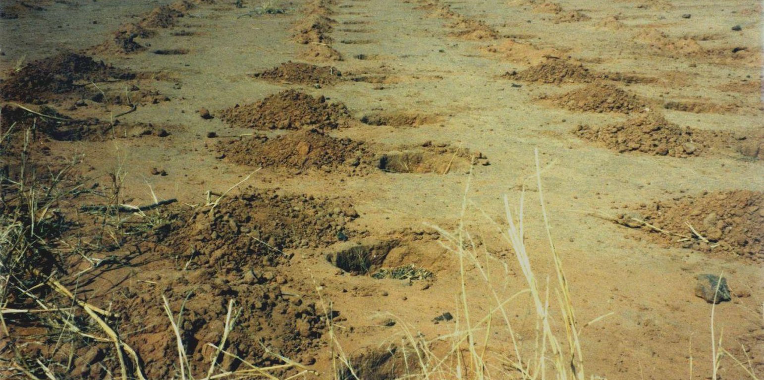
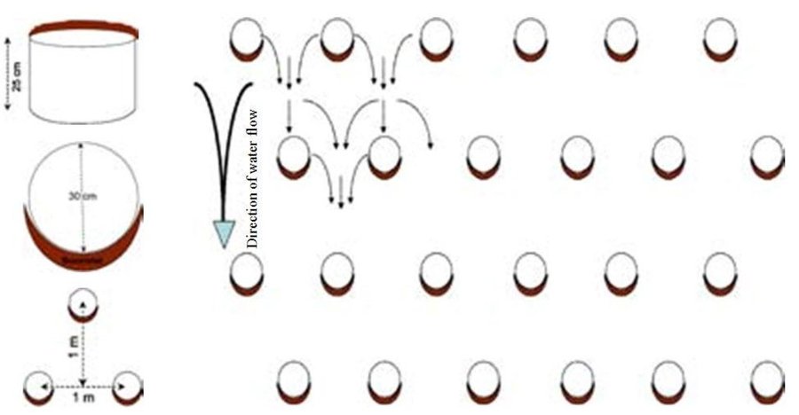
Zai or tassa planting pits are an old farming technique rediscovered after the great drought of 1973/74 and later perfected by development partners working with the farmers. It involves digging planting pits with a diameter of at least 30 to 40 cm and 10 to 15 cm deep. They are spaced 70 to 80 cm apart, resulting in around 10,000 pits per hectare. Staggered rows of holes are dug perpendicularly to the slope. The earth dug out of the hole is piled up to form a small ridge around the rim, which captures water. A couple of handfuls of organic fertiliser or compost are put into each pit. They are normally made in the dry season before the first rains start. However, it is recommended that the pits be made immediately after the rainy season, when the soil is still moist and the weather is not too hot. If the pits are in place early in the dry season, they act as traps during the windy period in February and March, retaining rich dust carried by the harmattan and wind-blown organic matter. At least 3 tonnes of compost per hectare is recommended.
Purpose of the Technology: The arrangement of the pits in staggered rows ensures the most efficient collection of rainwater and slows the flow of water over the surface. The zai technique concentrates and conserves nutrients and water near the roots of the plants grown in them. The application of organic fertiliser directly around the plants is an economical use of a factor of production to which most farmers have limited access. It also reactivates biological activity, increases fertility and loosens the soil.
As zai planting pits restore degraded, uncultivated land, they lessen the pressure to clear other land for farming. They also reduce the vulnerability of plants during dry spells and droughts, ensuring crop production and improving food security.
Plots with zai planting pits (with fertiliser) average yields of 409 kg of millet grain per hectare, compared to 195 kg per hectare registered on control plots. Millet yields can therefore be doubled with this technique.
Establishment / maintenance activities and inputs: The zai technique requires high labour input. It is estimated that between 40 and 60 man-days per hectare are required, depending on the density of the pits. There is a mechanised system for making the holes, using a special animal-drawn plough, which considerably reduces the number of man-days required to 7 per hectare.
If the pits are prepared each year or once every two years (using the same pits or making new ones in the spaces between the old ones), soil fertility is restored and the crop cycle can be resumed. The application of organic fertiliser in sufficient quantities enables the plot to be cultivated sustainably. After five years, it can be farmed in the normal way.
Covering extensive areas with zai planting pits requires a high level of community mobilisation and effective organisation and logistics. Apart from this, the technique is very simple to implement and easily mastered by the farmers.
Natural / human environment: Zai planting pits are used on marginal or degraded land that is no longer cultivated, such as low-gradient pediments and land with encrusted soil in areas with rainfall levels of less than 800 mm a year. They are not recommended for sandy soils, as they are not stable when dug in this type of soil, or for valley bottoms, where they risk being flooded. Zai planting pits are particularly useful in areas where land use pressure is high, as they permit the rehabilitation of unproductive land for farming.
From the point of view of climate change adaptation, zai planting pits are particularly useful in areas with erratic or low rainfall, as they prevent the loss of water. As the fertiliser is placed inside the pits, it is not washed away by heavy rain.
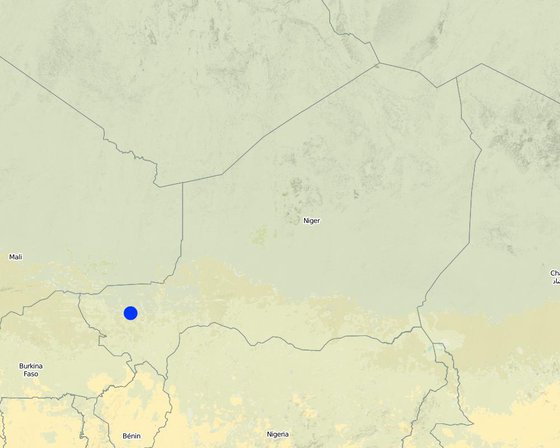
ສະຖານທີ່: Regions of Tillabéri, Filingué, Ouallam, Téra and Tahuoa, Niger, ໄນເຈີ
ຈໍານວນ ພື້ນທີ່ ທີ່ໃຊ້ ເຕັກໂນໂລຢີ ທີ່ໄດ້ວິເຄາະ:
ການແຜ່ກະຈາຍຂອງເຕັກໂນໂລຢີ:
ຢູ່ໃນເຂດປ່າສະຫງວນທີ່ບໍ?:
ວັນທີຂອງການປະຕິບັດ: 10-50 ປີ ຜ່ານມາ
ປະເພດຂອງການນໍາສະເໜີ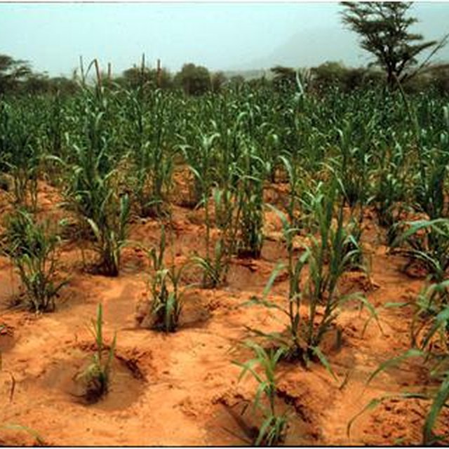


| ລະບຸ ປັດໃຈ ນໍາເຂົ້າ ໃນການຜະລີດ | ຫົວໜ່ວຍ | ປະລິມານ | ຕົ້ນທຶນ ຕໍ່ຫົວໜ່ວຍ (CFA Franc) | ຕົ້ນທຶນທັງໝົດ ຂອງປັດໃຈຂາເຂົ້າ ໃນການຜະລິດ (CFA Franc) | % ຂອງຕົ້ນທຶນທັງໝົດ ທີ່ຜູ້ນໍາໃຊ້ທີ່ດິນ ໃຊ້ຈ່າຍເອງ |
| ແຮງງານ | |||||
| labour | 1.0 | 16.3 | 16.3 | ||
| transport and planting trees | 1.0 | 12.3 | 12.3 | ||
| ອຸປະກອນ | |||||
| machine use | 1.0 | 23.6 | 23.6 | ||
| ວັດສະດຸໃນການປູກ | |||||
| seedlings | |||||
| ຕົ້ນທຶນທັງໝົດ ໃນການຈັດຕັ້ງປະຕິບັດ ເຕັກໂນໂລຢີ | 52.2 | ||||
| ຄ່າໃຊ້ຈ່າຍທັງໝົດ ສຳລັບການສ້າງຕັ້ງເຕັກໂນໂລຢີ ເປັນສະກຸນເງີນໂດລາ | 52.2 | ||||
Plots with zai planting pits (with fertiliser) average yields of 409 kg of millet grain per hectare, compared to 195 kg per hectare registered on control plots. Millet yields can therefore be doubled with this technique. They also reduce the vulnerability of plants during dry spells and droughts, ensuring crop production and improving food security.


