Grass or stubble in areas prone to flooding and erosion [ນໍເວ]
- ການສ້າງ:
- ປັບປູງ:
- ຜູ້ສັງລວມຂໍ້ມູນ: Dominika Krzeminska
- ບັນນາທິການ: Lillian Øygarden
- ຜູ້ທົບທວນຄືນ: William Critchley, Rima Mekdaschi Studer
Gras (eller ingen jordarbeiding) på arealer utsatt for flom og erosjon
technologies_6170 - ນໍເວ
ເບິ່ງພາກສ່ວນ
ຂະຫຍາຍທັງໝົດ ຍຸບທັງໝົດ1. ຂໍ້ມູນທົ່ວໄປ
1.2 ຂໍ້ມູນ ການຕິດຕໍ່ພົວພັນ ຂອງບຸກຄົນທີ່ສໍາຄັນ ແລະ ສະຖາບັນ ທີ່ມີສ່ວນຮ່ວມ ໃນການປະເມີນເອກກະສານ ເຕັກໂນໂລຢີ
ບັນດາຜູ້ຕອບແບບສອບຖາມທີ່ສໍາຄັນ ()
ຜຸ້ຊ່ຽວຊານ ດ້ານການຄຸ້ມຄອງ ທີ່ດິນແບບຍືນຍົງ:
ຜຸ້ຊ່ຽວຊານ ດ້ານການຄຸ້ມຄອງ ທີ່ດິນແບບຍືນຍົງ:
ຜຸ້ຊ່ຽວຊານ ດ້ານການຄຸ້ມຄອງ ທີ່ດິນແບບຍືນຍົງ:
1.3 ເງື່ອນໄຂ ກ່ຽວກັບ ການນໍາໃຊ້ຂໍ້ມູນເອກະສານ ທີ່ສ້າງຂື້ນ ໂດຍຜ່ານ ອົງການພາບລວມຂອງໂລກ ທາງດ້ານແນວທາງ ແລະ ເຕັກໂນໂລຢີ ຂອງການອານຸລັກ ທໍາມະຊາດ (WOCAT)
ຜູ້ປ້ອນຂໍ້ມູນ ແລະ ບຸກຄົນສຳຄັນ ທີ່ໃຫ້ຂໍ້ມູນ (ຫຼາຍ) ຍິນຍອມ ຕາມເງື່ອນໄຂ ໃນການນຳໃຊ້ຂໍ້ມູນ ເພື່ອສ້າງເປັນເອກກະສານຂອງ WOCAT:
ແມ່ນ
1.4 ແຈ້ງການວ່າ ດ້ວຍຄວາມຍືນຍົງຂອງ ເຕັກໂນໂລຢີ
ການນໍາໃຊ້ ເຕັກໂນໂລຢີ ດັ່ງກ່າວໄດ້ອະທິບາຍ ເຖິງບັນຫາ ກ່ຽວກັບ ການເຊື່ອມໂຊມຂອງດິນບໍ? ຖ້າບໍ່ດັ່ງນັ້ນ ມັນບໍ່ສາມາດ ຢັ້ງຢືນໄດ້ວ່າ ເປັນເຕັກໂນໂລຊີ ໃນການຄຸ້ມຄອງ ທີ່ດິນແບບຍືນຍົງ? :
ບໍ່ແມ່ນ
1.5 ແບບສອບຖາມທີ່ອ້າງອີງເຖີງແນວທາງ ການຄຸ້ມຄອງທີ່ດິນແບບຍືນຍົງ (ໄດ້ເຮັດເປັນເອກະສານທີ່ໃຊ້ WOCAT)

Regional Environmental program [ນໍເວ]
Regulations and financial grants for reduction of pollution and promotion of the cultural landscape.
- ຜູ້ສັງລວມຂໍ້ມູນ: Kamilla Skaalsveen
2. ການອະທິບາຍ ເຕັກໂນໂລຢີ ຂອງການຄຸ້ມຄອງ ທີ່ດິນແບບຍືນຍົງ
2.1 ຄໍາອະທິບາຍສັ້ນຂອງ ເຕັກໂນໂລຢີ
ການກຳໜົດຄວາມໝາຍ ຂອງເຕັກໂນໂລຢີ:
Establishment of grass - or retaining stubble - on arable land that is prone to erosion and flooding to reduce the risk of soil and nutrient losses.
2.2 ການອະທິບາຍ ລາຍລະອຽດ ຂອງເຕັກໂນໂລຢີ
ການພັນລະນາ:
Flood prone areas are located close to watercourses (up to 22m from the watercourse) and are flooded regularly - at least once every ten years. If the area is considered as “flood prone” area must be assessed locally and approved at municipality or county level. Areas prone to erosion are the areas in the erosion class 2 (if there is a gully erosion), 3 and 4 (based on the erosion risk map; kilden.nibio.no).
Purpose/Aim: The main purpose of establishing grass cover (or at least maintaining stubble over winter) in the areas prone to erosion and flooding is to reduce soil erosion and nutrient losses. Grass cover protects the surface from detachment of particles and erosion processes. Grass covered areas enhance infiltration and provide good conditions for the uptake and storage of water during temporary floods. As such, the measure offers the potential for temporary flood storage, increased water retention in the landscape and runoff attenuation.
Perennial grass cover in the areas prone to flooding also protects water quality by enhanced sedimentation of suspended materials and increased adsorption of material to vegetation and soil surface.
Maintaining grass or stubble in areas prone to flooding and erosion is a subject for subsidies within Regional Environmental Programme RMP. The purpose of subsidies for is to reduced flood erosion. It includes both reducing soil erosion and preventing loss of nutrients.
Establishment/maintenance: vegetated zones or permanent meadows should be established and maintained within agricultural flood prone areas. As a minimum these areas should be left in stubble through the winter. These areas should not be fertilized, and grass should be harvested to reduce nutrient leakage to the watercourse. Where farmers persist in growing cereals in these areas they should at least leave the flood prone areas unploughed and covered in stubble over winter.
Benefit/Impact: The effect of (any) vegetation zones depends on several factors such as the flow properties and the characteristics of the vegetative surface. Studies of Norwegian conditions indicate that the most relevant factor for function of the vegetation zone is the character of the vegetation (height, robustness, and density), rather than the type of vegetation (Blankenberg & Hougsrud 2010). As the efficiency of vegetation is composed of a variety of factors, the implementation of the measures is to a large degree site specific (Kværnø & Stolte 2012). There is insufficient documentation on how the level of erosion is affected by floods. In Norway, there are no direct figures for the efficiency of grass cover on the areas prone to flooding.
Recent trends in climatic changes are expected to result in increase in extreme meteorological events and related natural hazards. The area along the streams and rivers are among the landscape elements, which first will notice the impact of climate change in the form of floods and consequent erosion. Therefore, measures dedicated to these areas might become more and more important.
Natural / human environment: The information about Technology is based on the investigations and/or reports from the Vansjø-Hobøl catchment. For the purpose of OPTAIN project (https://www.optain.eu/), the technology is further presented in the natural and human environment context of the Kråkstad River catchment - a Norwegian Case Study catchment within OPTAIN project.
The Kråkstad River is mainly situated in Ski municipality in South-Eastern parts of Norway. The river catchment is a western tributary of the Vansjø-Hobøl watercourse, also known as the Morsa watercourse. The Kråkstad River catchment area is c.a 51 km², 43% of which is agricultural land, where mostly cereals are produced on heavy clays soils. The main environmental challenge in the area is water quality (incl. high phosphorus pollution) and soil erosion (incl. riverbank erosion and quick-clay landslides).The Morsa watercourse is a drinking water resource and there are specific environmental regulations for land management followed by subsidies through the Regional Environmental Programme (RMP). Management of areas prone to flooding are part of these regulations.
2.3 ຮູບພາບຂອງເຕັກໂນໂລຢີ
ສື່ຮູບພາບ
2.5 ປະເທດ / ເຂດ / ສະຖານທີ່ບ່ອນທີ່ ເຕັກໂນໂລຢີ ໄດ້ຮັບການນໍາໃຊ້ ແລະ ທີ່ຖືກປົກຄຸມດ້ວຍການປະເມີນຜົນ
ປະເທດ:
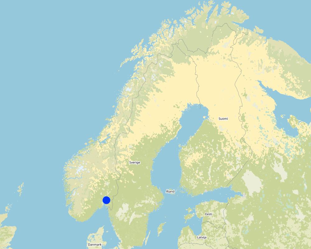
ນໍເວ
ພາກພື້ນ / ລັດ / ແຂວງ:
Viken county
ຂໍ້ມູນເພີ່ມເຕີມຂອງສະຖານທີ່:
The Vansjø-Hobøl catchment
ໃຫ້ລະບຸ ການແຜ່ຂະຫຍາຍ ເຕັກໂນໂລຢີ:
- ນໍາໃຊ້ໃນຈຸດສະເພາະ / ແນໃສ່ນໍາໃຊ້ໃນພື້ນທີ່ຂະໜາດນ້ອຍ
ສ່ວນຫຼາຍສະຖານທີ່ຕັ້ງຂອງເຕັກໂນໂລຢີ ແມ່ນ ຢູ່ໃນເຂດພື້ນທີ່ສະຫງວນບໍ?
ບໍ່ແມ່ນ
Map
×2.6 ວັນທີໃນການຈັດຕັ້ງປະຕິບັດ
ຖ້າຫາກວ່າ ບໍ່ຮູ້ຈັກ ປີທີ່ຊັດເຈນ ແມ່ນໃຫ້ປະມານ ວັນທີເອົາ:
- 10-50 ປີ ຜ່ານມາ
2.7 ການນໍາສະເໜີ ເຕັກໂນໂລຢີ
ໃຫ້ລະບຸ ເຕັກໂນໂລຢີ ໄດ້ຖືກຈັດຕັ້ງປະຕິບັດຄືແນວໃດ?
- ໂດຍຜ່ານໂຄງການ / ການຊ່ວຍເຫຼືອຈາກພາຍນອກ
- Regional Environmental Programme (RMP).
ຄວາມຄິດເຫັນ (ປະເພດ ໂຄງການ ແລະ ອື່ນໆ):
Grass cover or stubble on the areas prone to flooding is a measure eligible for subsidies in Regional Environmental Programme (RMP).
3. ການໃຈ້ແຍກ ເຕັກໂນໂລຢີ ໃນການຄຸ້ມຄອງ ດິນແບບຍືນຍົງ
3.1 ຈຸດປະສົງຫຼັກ (ຫຼາຍ) ຂອງເຕັກໂນໂລຢີ
- ຫຼຸດຜ່ອນ, ປ້ອງກັນ, ຟື້ນຟູ ການເຊື່ອມໂຊມຂອງດິນ
- ປົກປັກຮັກສານໍ້າ / ນໍ້າພື້ນທີ່ - ປະສົມປະສານກັບ ເຕັກໂນໂລຢີອື່ນໆ
- ປັບຕົວຕໍ່ກັບການປ່ຽນແປງດິນຟ້າອາກາດ / ທີ່ຮ້າຍແຮງ ແລະ ຜົນກະທົບ
3.2 ປະເພດການນໍາໃຊ້ທີ່ດິນ ໃນປະຈຸບັນ() ທີ່ເຕັກໂນໂລຢີ ໄດ້ຖືກນໍາໃຊ້
ການນຳໃຊ້ທີ່ດິນ ປະສົມພາຍໃນພື້ນທີ່ດຽວກັນ:
ບໍ່ແມ່ນ

ດິນທີ່ປູກພືດ
- ການປູກພືດປະຈໍາປີ
ການປູກພືດປະຈຳປີ - ລະບຸປະເພດພືດ:
- ທັນຍາພືດ-ພືດ ອື່ນໆ
- small grains
ຈໍານວນ ລະດູການ ປູກໃນປີໜຶ່ງ:
- 1

ປ່າໄມ້ / ປ່າ
- natural forest

ທິດທາງໄຫຼຂອງນໍ້າ, ນໍ້າ, ດິນທາມ
- ທໍ່ລະບາຍນໍ້າ, ທິດທາງນໍ້າ
3.3 ການນຳໃຊ້ທີ່ດິນ ມີການປ່ຽນແປງຍ້ອນການຈັດຕັ້ງທົດລອງເຕັກໂນໂລຢີ ແມ່ນບໍ່?
ການນຳໃຊ້ທີ່ດິນ ມີການປ່ຽນແປງຍ້ອນການຈັດຕັ້ງທົດລອງເຕັກໂນໂລຢີ ແມ່ນບໍ່?
- ແມ່ນ (ກະລຸນາຕື່ມໃສ່ ຄຳຖາມຂ້າງລຸ່ມນີ້ກ່ຽວກັບການນຳໃຊ້ທີ່ດິນ ກ່ອນການທົດລອງເຕັກໂນໂລຢີ)
ການນຳໃຊ້ທີ່ດິນ ປະສົມພາຍໃນພື້ນທີ່ດຽວກັນ:
ບໍ່ແມ່ນ
ດິນທີ່ປູກພືດ
- ການປູກພືດປະຈໍາປີ
ການປູກພືດປະຈຳປີ - ລະບຸປະເພດພືດ:
- ທັນຍາພືດ-ພືດ ອື່ນໆ
- small grains
ມີການເຝືກປູກພືດແບບສັບຫວ່າງບໍ່?
ບໍ່ແມ່ນ
ມີການເຝືກປູກພືດແບບໝູນວຽນບໍ່?
ບໍ່ແມ່ນ
ຄວາມຄິດເຫັນ:
In cases where grass replaces cereals
3.4 ການສະໜອງນ້ຳ
ການສະໜອງນໍ້າ ໃນພື້ນທີ່ ທີ່ໄດ້ນໍາໃຊ້ ເຕັກໂນໂລຢີ:
- ນໍ້າຝົນ
3.5 ການນໍາໃຊ້ເຕັກໂນໂລຢີ ທີ່ຢູ່ໃນກຸ່ມການຄຸ້ມຄອງ ທີ່ດິນແບບຍືນຍົງ
- ການປັບປຸງດິນ / ພືດຄຸມດິນ
- ການຄຸ້ມຄອງນໍ້າໜ້າດິນ (ນ້ຳຈາກພຸ, ແມ່ນໍ້າ, ທະເລສາບ, ທະເລ)
3.6 ມາດຕະການ ການຄຸ້ມຄອງ ທີ່ດິນແບບຍືນຍົງ ປະກອບດ້ວຍ ເຕັກໂນໂລຢີ

ມາດຕະການ ທາງການກະສິກໍາ
- A1: ພືດ / ການປົກຫຸ້ມຂອງດິນ

ມາດຕະການ ທາງດ້ານພືດພັນ
- V2: ຫຍ້າ ແລະ ພືດສະໝູນໄພທີ່ເປັນໄມ້ຢືນຕົ້ນ
- V3: ການຈັດການປູກພືດ
3.7 ປະເພດດິນເຊື່ອມໂຊມ ຫຼັກທີ່ໄດ້ນໍາໃຊ້ ເຕັກໂນໂລຢີ

ດິນເຊາະເຈື່ອນ ໂດຍນໍ້າ
- Wt: ການສູນເສຍຊັ້ນໜ້າດິນ / ການເຊາະເຈື່ອນຜິວໜ້າດິນ
- Wg: ການເຊາະເຈື່ອນຮ່ອງນ້ຳ / ຫ້ວຍ

ການເຊື່ອມໂຊມ ຂອງນໍ້າ
- Hp: ຄຸນນະພາບ ຂອງນ້ຳຊັ້ນໜ້າດິນຫຼຸດລົງ
3.8 ການປ້ອງກັນ, ການຫຼຸດຜ່ອນ, ຫຼືການຟື້ນຟູຂອງການເຊື່ອມໂຊມຂອງດິນ
ໃຫ້ລະບຸ ເປົ້າໝາຍ ເຕັກໂນໂລຢີ ທີ່ພົວພັນ ກັບຄວາມເຊື່ອມໂຊມຂອງດິນ:
- ປ້ອງກັນການເຊື່ອມໂຊມຂອງດິນ
- ຫຼຸດຜ່ອນການເຊື່ອມໂຊມຂອງດິນ
4. ຂໍ້ກໍາໜົດ, ກິດຈະກໍາການປະຕິບັດ, ວັດຖຸດິບ, ແລະຄ່າໃຊ້ຈ່າຍ
4.1 ເຕັກນິກ ໃນການແຕ້ມແຜນວາດ ເຕັກໂນໂລຢີ
ຄຸນລັກສະນະ ຂອງເຕັກນິກ (ທີ່ກ່ຽວຂ້ອງ ກັບການແຕ້ມແຜນວາດ ທາງດ້ານເຕັກນີກ):
n.a.
4.2 ຂໍ້ມູນທົ່ວໄປກ່ຽວກັບການຄິດໄລ່ປັດໃຈຂາເຂົ້າໃນການຜະລິດ ແລະ ມູນຄ່າອື່ນໆ
ລະບຸ ວິທີການ ຄຳໃຊ້ຈ່າຍ ແລະ ປັດໄຈນໍາເຂົ້າ ທີ່ໄດ້ຄິດໄລ່:
- ຕໍ່ພື້ນທີ່ ທີ່ໄດ້ຈັດຕັ້ງປະຕິບັດ ເຕັກໂນໂລຢີ
ໃຫ້ລະບຸຫົວໜ່ວຍ ຂະໜາດ ແລະ ເນື້ອທີ່:
daa of flood prone area
ຖ້ານໍາໃຊ້ຫົວໜ່ວຍ ເນື້ອທີ່ຕາມທ້ອງຖິ່ນ, ໃຫ້ປ່ຽບເປັນ 1 ເຮັກຕາ (ຕົວຢ່າງ: 1 ເຮັກຕາ = 4 ໄລ່ ): 1 ເຮັກຕາ = :
1 ha = 10 daa
ສະກຸນເງິນອື່ນໆ / ປະເທດອື່ນໆ (ລະບຸ):
NOK
ຖ້າກ່ຽວຂ້ອງ, ໃຫ້ລະບຸອັດຕາແລກປ່ຽນຈາກ USD ເປັນສະກຸນເງິນທ້ອງຖິ່ນ (ເຊັ່ນ: 1 USD = 79.9 Brazilian Real): 1 USD =:
8.99
ລະບຸ ຄ່າຈ້າງ ຄ່າແຮງງານສະເລ່ຍ ຕໍ່ ວັນ:
c.a. 3000 NOK (it is only the cost of the time assuming 8h work per day, 320-500 NOK/hour/ person. Machinery, equipment, materials not included)
4.3 ການສ້າງຕັ້ງກິດຈະກໍາ
| ກິດຈະກໍາ | Timing (season) | |
|---|---|---|
| 1. | Plowing | |
| 2. | Harrowing | |
| 3. | Sowing grass | |
| 4. | Harvesting grass |
4.4 ຕົ້ນທຶນ ແລະ ປັດໄຈຂາເຂົ້າທີ່ຈໍາເປັນໃນຈັດຕັ້ງປະຕິບັດ
ຖ້າຫາກຜູ້ນຳໃຊ້ທີ່ດິນ ນຳໃຊ້ມູນຄ່າຕ່ຳກວ່າ 100% ໃຫ້ລະບຸ ແມ່ນໃຜເປັນຜູ້ຊ່ວຍ ໃນລາຍຈ່າຍທີ່ເຫຼືອ:
Grass cover or stubble on the areas prone to flooding is a measure eligible for subsidies in Regional Environmental Programme (RMP)
ຄວາມຄິດເຫັນ:
The costs of establishment and management of grass cover on the areas prone to flooding are connected to sowing the area and reduced area for cereal production (in case of cereal production farm). The subsidies should be a compensation for such costs.
Within RMP for 2019-2022 the subside level for maintaining grass on areas prone of flooding is at the level of 210 kr/daa (c.a 233 USD/ha) in Viken region. For leaving such areas in stubble the subsidy level is 110 kr /daa (USD/ha) for areas with special regulations (drinking water quality) and 70 kr /daa (78 USD/ha) outside areas with special regulations.
4.5 ບໍາລຸງຮັກສາ / ແຜນຈັດຕັ້ງປະຕິບັດ ກິດຈະກໍາ
| ກິດຈະກໍາ | ໄລຍະເວລາ / ຄວາມຖີ່ | |
|---|---|---|
| 1. | Plowing | |
| 2. | Harrowing | |
| 3. | Sowing grass | |
| 4. | Harvesting grass |
4.6 ຄ່າໃຊ້ຈ່າຍ ແລະ ປັດໄຈນໍາເຂົ້າທີ່ຈໍາເປັນສໍາລັບການບໍາລຸງຮັກສາກິດຈະກໍາ / ແຜນປະຕິບັດ (ຕໍ່ປີ)
ຖ້າຫາກຜູ້ນຳໃຊ້ທີ່ດິນ ນຳໃຊ້ມູນຄ່າຕ່ຳກວ່າ 100% ໃຫ້ລະບຸ ແມ່ນໃຜເປັນຜູ້ຊ່ວຍ ໃນລາຍຈ່າຍທີ່ເຫຼືອ:
Grass cover or stubble on the areas prone to flooding is a measure eligible for subsidies in Regional Environmental Programme (RMP)
ຄວາມຄິດເຫັນ:
The costs of establishment and management of grass cover on the areas prone to flooding are connected to sowing the area and reduced area for cereal production (in case of cereal production farm). The subsidies should be a compensation for such costs.
Within RMP for 2019-2022 the subside level for maintaining grass on areas prone of flooding is at the level of 210 kr/daa (c.a 233 USD/ha) in Viken region. For leaving such areas in stubble the subsidy level is 110 kr /daa (USD/ha) for areas with special regulations (drinking water quality) and 70 kr /daa (78 USD/ha) outside areas with special regulations.
4.7 ປັດໄຈ ທີ່ສໍາຄັນ ທີ່ສົ່ງຜົນກະທົບ ຕໍ່ຄ່າໃຊ້ຈ່າຍ
ໃຫ້ອະທິບາຍ ປັດໃຈ ທີ່ສົ່ງຜົນກະທົບ ຕໍ່ຕົ້ນທຶນ ໃນການຈັດຕັ້ງປະຕິບັດ:
The costs of establishment and management of grass cover on the areas prone to flooding are not deviating for costs connected to regular crop land management. Therefore, implementation of grassed areas does not lead to any additional expenses for the land user.
The cost of the area management are depended on:
- area (daa) location and accessibility
- eligibility for subsidies in Regional Environmental Programme (RMP). For 2019-2022 the subside level for maintaining grass on areas prone of flooding is at the level of 210 kr/daa in Viken region- for areas with special regulations. For leaving such areas in stubble the subsidy level is 110 kr /daa for areas with special regulations (drinking water quality) and 70 kr /daa outside areas with special regulations.
5. ສະພາບແວດລ້ອມທໍາມະຊາດ ແລະ ມະນຸດ
5.1 ອາກາດ
ປະລິມານນໍ້າຝົນປະຈໍາປີ
- < 250 ມີລິແມັດ
- 251-500 ມີລິແມັດ
- 501-750 ມີລິແມັດ
- 751-1,000 ມີລິແມັດ
- 1,001-1,500 ມີລິແມັດ
- 1,501-2,000 ມີລິແມັດ
- 2,001-3,000 ມີລິແມັດ
- 3,001-4,000 ມີລິແມັດ
- > 4,000 ມີລິແມັດ
ເຂດສະພາບອາກາດກະສິກໍາ
- ເຄີ່ງຄວາມຊຸ່ມ
- ເຄິ່ງແຫ້ງແລ້ງ
Thermal climate class: temperate
Thermal climate class: boreal
5.2 ພູມິປະເທດ
ຄ່າສະເລ່ຍ ຄວາມຄ້ອຍຊັນ:
- ພື້ນທີ່ຮາບພຽງ (0-2%)
- ອ່ອນ (3-5 %)
- ປານກາງ (6-10 %)
- ມ້ວນ (11-15 %)
- ເນີນ(16-30%)
- ໍຊັນ (31-60%)
- ຊັນຫຼາຍ (>60%)
ຮູບແບບຂອງດິນ:
- ພູພຽງ / ທົ່ງພຽງ
- ສັນພູ
- ເປີ້ນພູ
- ເນີນພູ
- ຕີນພູ
- ຮ່ອມພູ
ເຂດລະດັບສູງ:
- 0-100 ແມັດ a.s.l.
- 101-500 ແມັດ a.s.l.
- 501-1,000 ແມັດ a.s.l.
- 1,001-1,500 ແມັດ a.s.l.
- 1,501-2,000 ແມັດ a.s.l.
- 2,001-2,500 ແມັດ a.s.l.
- 2,501-3,000 ແມັດ a.s.l.
- 3,001-4,000 ແມັດ a.s.l.
- > 4,000 ແມັດ a.s.l.
5.3 ດິນ
ຄວາມເລິກ ຂອງດິນສະເລ່ຍ:
- ຕື້ນຫຼາຍ (0-20 ຊັງຕີແມັດ)
- ຕື້ນ (21-50 ຊຕມ)
- ເລີກປານກາງ (51-80 ຊຕມ)
- ເລິກ (81-120 ຊມ)
- ເລິກຫຼາຍ (> 120 cm)
ເນື້ອດິນ (ໜ້າດິນ):
- ປານກາງ (ດິນໜຽວ, ດິນໂຄນ)
- ບາງລະອຽດ / ໜັກ (ໜຽວ)
ເນື້ອດິນ (ເລິກຈາກໜ້າດິນ ລົງໄປຫຼາຍກວ່າ 20 ຊັງຕິແມັດ):
- ປານກາງ (ດິນໜຽວ, ດິນໂຄນ)
- ບາງລະອຽດ / ໜັກ (ໜຽວ)
ຊັ້ນອິນຊີວັດຖຸ ເທິງໜ້າດິນ:
- ປານກາງ (1-3 %)
ຖ້າເປັນໄປໄດ້ ແມ່ນໃຫ້ຕິດຄັດ ການພັນລະນາດິນ ຫຼື ຂໍ້ມູນສະເພາະຂອງດິນ, ຕົວຢ່າງ, ຄຸນລັກສະນະ ປະເພດຂອງດິນ, ຄ່າຄວາມເປັນກົດ / ເປັນດ່າງຂອງດິນ, ສານອາຫານ, ດິນເຄັມ ແລະ ອື່ນໆ.
Soil fertility is medium-high
Soil drainage/infiltration is poor, artificially drainage is needed
Soil water storage capacity is very low-low
5.4 ມີນໍ້າ ແລະ ຄຸນນະພາບ
ລະດັບ ນໍ້າໃຕ້ດິນ:
< 5 ແມັດ
ການມີນໍ້າ ເທິງໜ້າດິນ:
ດີ
ຄຸນນະພາບນໍ້າ (ບໍ່ມີການບໍາບັດ):
ນຳໃຊ້ເຂົ້າໃນການຜະລິດກະສິກໍາພຽງຢ່າງດຽງ (ຊົນລະປະທານ)
ຄຸນນະພາບນ້ຳ ໝາຍເຖີງ:
ທັງນ້ຳໃຕ້ດິນ ແລະ ນ້ຳໜ້າດິນ
ມີບັນຫາ ກ່ຽວກັບນໍ້າເຄັມບໍ່?
ບໍ່ແມ່ນ
ເກີດມີນໍ້າຖ້ວມ ໃນພື້ນທີ່ບໍ່?
ແມ່ນ
5.5 ຊີວະນາໆພັນ
ຄວາມຫຼາກຫຼາຍ ທາງສາຍພັນ:
- ຕໍ່າ
ຄວາມຫຼາກຫຼາຍ ທາງດ້ານ ທີ່ຢູ່ອາໃສ ຂອງສິ່ງທີ່ມີຊີວິດ:
- ຕໍ່າ
5.6 ຄຸນລັກສະນະ ຂອງຜູ້ນໍາໃຊ້ທີ່ດິນ ທີ່ໄດ້ນໍາໃຊ້ເຕັກໂນໂລຢີ
ຢູ່ປະຈຳ ຫຼື ເຄື່ອນຍ້າຍຕະຫຼອດ:
- ບໍ່ເຄື່ອນໄຫວ
ລະບົບ ການຕະຫຼາດ ແລະ ຜົນຜະລິດ:
- ປະສົມປົນເປ( ກຸ້ມຕົນເອງ/ເປັນສິນຄ້າ)
- ການຄ້າ / ຕະຫຼາດ
ລາຍຮັບ ທີ່ບໍ່ໄດ້ມາຈາກ ການຜະລິດ ກະສິກໍາ:
- 10-50 % ຂອງລາຍຮັບທັງໝົດ
- > 50 % ຂອງລາຍຮັບທັງໝົດ
ລະດັບຄວາມຮັ່ງມີ:
- ສະເລ່ຍ
- ຮັ່ງມີ
ບຸກຄົນ ຫຼື ກຸ່ມ:
- ບຸກຄົນ / ຄົວເຮືອນ
ລະດັບ ການຫັນເປັນກົນຈັກ:
- ເຄື່ອງກົນຈັກ
ເພດ:
- ຜູ້ຍິງ
- ຜູ້ຊາຍ
ອາຍຸ ຂອງຜູ້ນໍາໃຊ້ທີ່ດິນ:
- ຊາວໜຸ່ມ
- ໄວກາງຄົນ
ໃຫ້ລະບຸ ຄຸນລັກສະນະ ຂອງຜູ້ນໍາໃຊ້ທີ່ດິນ:
Land users applying the Technology are mainly common / average land users
Population density: < 10 persons/km2
Annual population growth: < 0.5%
10% of the land users are rich and own 10% of the land.
90% of the land users are average wealthy and own 90% of the land.
5.7 ເນື້ອທີ່ສະເລ່ຍຂອງດິນ ທີ່ຜູ້ນຳໃຊ້ທີ່ດິນ ໃຊ້ເຮັດເຕັກໂນໂລຢີ
- <0.5 ເຮັກຕາ
- 0.5-1 ເຮັກຕາ
- 1-2 ເຮັກຕາ
- 2-5 ເຮັກຕາ
- 5-15 ເຮັກຕາ
- 15-50 ເຮັກຕາ
- 50-100 ເຮັກຕາ
- 100-500 ເຮັກຕາ
- 500-1,000 ເຮັກຕາ
- 1,000-10,000 ເຮັກຕາ
- > 10,000 ເຮັກຕາ
ຖືໄດ້ວ່າ ເປັນຂະໜາດນ້ອຍ, ກາງ ຫຼື ໃຫຍ່ (ອີງຕາມເງື່ອນໄຂ ສະພາບຄວາມເປັນຈິງ ຂອງທ້ອງຖີ່ນ)? :
- ຂະໜາດກາງ
5.8 ເຈົ້າຂອງທີ່ດິນ, ສິດໃຊ້ທີ່ດິນ, ແລະ ສິດທິການນໍາໃຊ້ນໍ້າ
ເຈົ້າຂອງດິນ:
- ບຸກຄົນ, ທີ່ມີຕໍາແໜ່ງ
ສິດທິ ໃນການນໍາໃຊ້ທີ່ດິນ:
- ຊຸມຊົນ (ທີ່ມີການຈັດຕັ້ງ)
- ບຸກຄົນ
ສິດທິ ໃນການນໍາໃຊ້ນໍ້າ:
- ເປີດກວ້າງ (ບໍ່ມີການຈັດຕັ້ງ)
5.9 ການເຂົ້າເຖິງການບໍລິການ ແລະ ພື້ນຖານໂຄງລ່າງ
ສຸຂະພາບ:
- ທຸກຍາກ
- ປານກາງ
- ດີ
ການສຶກສາ:
- ທຸກຍາກ
- ປານກາງ
- ດີ
ການຊ່ວຍເຫຼືອ ດ້ານວິຊາການ:
- ທຸກຍາກ
- ປານກາງ
- ດີ
ການຈ້າງງານ (ຕົວຢ່າງ, ການເຮັດກິດຈະກໍາອື່ນ ທີ່ບໍ່ແມ່ນ ການຜະລິດກະສິກໍາ):
- ທຸກຍາກ
- ປານກາງ
- ດີ
ຕະຫຼາດ:
- ທຸກຍາກ
- ປານກາງ
- ດີ
ພະລັງງານ:
- ທຸກຍາກ
- ປານກາງ
- ດີ
ຖະໜົນຫົນທາງ ແລະ ການຂົນສົ່ງ:
- ທຸກຍາກ
- ປານກາງ
- ດີ
ການດື່ມນໍ້າ ແລະ ສຸຂາພິບານ:
- ທຸກຍາກ
- ປານກາງ
- ດີ
ການບໍລິການ ທາງດ້ານການເງິນ:
- ທຸກຍາກ
- ປານກາງ
- ດີ
6. ຜົນກະທົບ ແລະ ລາຍງານສະຫຼຸບ
6.1 ການສະແດງຜົນກະທົບ ພາຍໃນພື້ນທີ່ ທີ່ໄດ້ຈັດຕັ້ງປະຕິບັດ ເຕັກໂນໂລຢີ
ຜົນກະທົບທາງເສດຖະກິດສັງຄົມ
ການຜະລິດ
ການຜະລິດພືດ
ຄວາມຄິດເຫັນ / ລະບຸແຈ້ງ:
Crop production will be reduced if there is permanent grass cover. However, with frequent flooding events the area is not 100% productive anyway.
ລາຍໄດ້ ແລະ ຄ່າໃຊ້ຈ່າຍ
ລາຍຮັບ ຈາກການຜະລີດ
ຄວາມຄິດເຫັນ / ລະບຸແຈ້ງ:
depending on subsidies or whether the grass are being harvested or not
ມີວຽກໜັກ
ຄວາມຄິດເຫັນ / ລະບຸແຈ້ງ:
The costs of establishment and management of grass cover on the areas prone to flooding are not deviating for costs connected to regular crop land management
ຜົນກະທົບຕໍ່ລະບົບນິເວດ
ວົງຈອນນໍ້າ / ນໍ້າ
ຄຸນນະພາບນໍ້າ
ການໄຫຼ ຂອງນໍ້າໜ້າດິນ
ການລະເຫີຍອາຍ
ດິນ
ການສູນເສຍດິນ
ການທັບຖົມຂອງດິນ
ຊີວະນານາພັນ: ສັດ, ພືດ
ການປົກຫຸ້ມຂອງພືດ
ຄວາມຄິດເຫັນ / ລະບຸແຈ້ງ:
In the areas with permanent grass cover
6.2 ຜົນກະທົບທາງອ້ອມ ຈາກການນໍາໃຊ້ເຕັກໂນໂລຢີ
ມົນລະພິດ ທາງນໍ້າ / ນໍ້າໄຕ້ດິນ
ຄວາມຄິດເຫັນ / ລະບຸແຈ້ງ:
Minimum that is expected, not measures/monitored yet.
ການປ້ອງກັນ / ຄວາມອາດສາມາດ ການກັ່ນຕອງ
ຄວາມຄິດເຫັນ / ລະບຸແຈ້ງ:
Minimum that is expected, not measures/monitored yet.
6.3 ການປ້ອງກັນ ແລະ ຄວາມບອບບາງ ຂອງເຕັກໂນໂລຢິ ໃນການປ່ຽນແປງສະພາບດິນຟ້າອາກາດ ແລະ ກ່ຽວຂ້ອງກັບອາກາດທີ່ມີການປ່ຽນແປງທີ່ຮຸນແຮງ / ໄພພິບັດທາງທໍາມະຊາດ (ຮັບຮູ້ໄດ້ໂດຍຜູ້ນໍາໃຊ້ທີ່ດິນ)
ການປ່ຽນແປງດິນຟ້າອາກາດ ເທື່ອລະກ້າວ
ການປ່ຽນແປງດິນຟ້າອາກາດ ເທື່ອລະກ້າວ
| ລະດູການ | ເພີ່ມຂື້ນ ຫຼື ຫຼຸດລົງ | ການນໍາໃຊ້ ເຕັກໂນໂລຢີ ສາມາດ ຮັບມື ໄດ້ຄືແນວໃດ? | |
|---|---|---|---|
| ອຸນຫະພູມປະຈໍາປີ | ເພີ່ມຂື້ນ | ດີ | |
| ປະລິມານນໍ້າຝົນປະຈໍາປີ | ເພີ່ມຂື້ນ | ດີ |
ອາກາດ ທີ່ກ່ຽວພັນກັບຄວາມຮຸນແຮງ (ໄພພິບັດທາງທໍາມະຊາດ)
ໄພພິບັດທາງອຸຕຸນິຍົມ
| ການນໍາໃຊ້ ເຕັກໂນໂລຢີ ສາມາດ ຮັບມື ໄດ້ຄືແນວໃດ? | |
|---|---|
| ພະຍຸຝົນ | ປານກາງ |
ໄພພິບັດທາງອຸທົກກະສາກ
| ການນໍາໃຊ້ ເຕັກໂນໂລຢີ ສາມາດ ຮັບມື ໄດ້ຄືແນວໃດ? | |
|---|---|
| ໂດຍທົ່ວໄປ (ແມ່ນໍ້າ) ນໍ້າຖ້ວມ | ດີ |
ຜົນສະທ້ອນສະພາບອາກາດອື່ນໆທີ່ກ່ຽວຂ້ອງ
ຜົນສະທ້ອນສະພາບອາກາດອື່ນໆທີ່ກ່ຽວຂ້ອງ
| ການນໍາໃຊ້ ເຕັກໂນໂລຢີ ສາມາດ ຮັບມື ໄດ້ຄືແນວໃດ? | |
|---|---|
| ໄລຍະເວລາການຂະຫຍາຍຕົວຫຼຸດລົງ | ດີ |
ຄວາມຄິດເຫັນ:
It is expected that climate change will:
- increase the growing season and not reduce the growing period - the technology will cope well with it.
- increase the frequency and intensity of flooding - the technology should cope well with it.
6.4 ການວິເຄາະຕົ້ນທຶນ ແລະ ຜົນປະໂຫຍດ
ຈະເຮັດປະໂຫຍດເພື່ອປຽບທຽບກັບຄ່າໃຊ້ຈ່າຍກັບສິ່ງກໍ່ສ້າງ (ຈາກທັດສະນະຂອງຜູ້ນຳໃຊ້ທີ່ດິນ) ໄດ້ແນວໃດ?
ຜົນຕອບແທນ ໃນໄລຍະສັ້ນ:
ປານກາງ
ຜົນຕອບແທນ ໃນໄລຍະຍາວ:
ປານກາງ
ຈະໄດ້ຮັບຜົນປະໂຫຍດເມື່ອປຽບທຽບກັບ / ຄ່າໃຊ້ຈ່າຍໃນການບຳລຸງຮັກສາທີເ່ກີດຂື້ນອິກ (ຈາກທັດສະນະຄະຕິຂອງຜູ້ນຳໃຊ້ທີ່ດິນ) ໄດ້ແນວໃດ?
ຜົນຕອບແທນ ໃນໄລຍະສັ້ນ:
ປານກາງ
ຜົນຕອບແທນ ໃນໄລຍະຍາວ:
ປານກາງ
ຄວາມຄິດເຫັນ:
The cost and income will depend on whether the farmer will harvest the grass covered area or not. If the area is not harvested it will reduce the area for production. The subsidies should partly compensate for costs.
6.5 ການປັບຕົວຮັບເອົາເຕັກໂນໂລຢີ
- 1-10%
ທັງໝົດນັ້ນ ແມ່ນໃຜ ໄດ້ປັບຕົວເຂົ້າ ໃນການນໍາໃຊ້ ເຕັກໂນໂລຢີ, ມີຈັກຄົນ ທີ່ສາມາດເຮັດເອງໄດ້, ຕົວຢ່າງ, ປາດສະຈາກ ການຊ່ວຍເຫຼືອ ທາງດ້ານອຸປະກອນ / ການຈ່າຍເປັນເງິນ?
- 0-10%
ຄວາມຄິດເຫັນ:
There is no trend towards spontaneous adoption of the Technology.
6.6 ການປັບຕົວ
ໄດ້ມີການດັດປັບ ເຕັກໂນໂລຢີ ເພື່ອໃຫ້ແທດເໝາະກັບເງື່ອນໄຂ ການປ່ຽນແປງບໍ?
ບໍ່ແມ່ນ
6.7 ຈຸດແຂງ / ຂໍ້ດີ / ໂອກາດ ໃນການນໍາໃຊ້ ເຕັກໂນໂລຢີ
| ຈຸດແຂງ / ຂໍ້ດີ / ໂອກາດໃນການນໍາໃຊ້ທີ່ດິນ |
|---|
| Less soil erosion, less loss of nutrients , less work with removing soil erosion pattern |
| ຈຸດແຂງ / ຈຸດດີ / ໂອກາດ ຈາກທັດສະນະຂອງຜູ້ປ້ອນຂໍ້ມູນ ຫຼື ບຸກຄົນສຳຄັນ |
|---|
| reduced soil erosion |
| reduced nutrient losses |
6.8 ຈຸດອ່ອນ / ຂໍ້ເສຍ / ຄວາມສ່ຽງ ໃນການນໍາໃຊ້ ເຕັກໂນໂລຢີ ແລະ ວິທີການແກ້ໄຂບັນຫາ
| ຈຸດອ່ອນ / ຂໍ້ເສຍ / ຄວາມສ່ຽງໃນມຸມມອງຂອງຜູ້ນໍາໃຊ້ທີ່ດິນ | ມີວິທີການແກ້ໄຂຄືແນວໃດ? |
|---|---|
| land removed from crop production | |
| maintenance needed |
| ຈຸດອ່ອນ/ຂໍ້ບົກຜ່ອງ/ຄວາມສ່ຽງ ຈາກທັດສະນະຂອງຜູ້ປ້ອນຂໍ້ມູນ ຫຼື ບຸກຄົນສຳຄັນ | ມີວິທີການແກ້ໄຂຄືແນວໃດ? |
|---|---|
| Not enough field based research about efficiency |
7. ເອກະສານອ້າງອີງ ແລະ ການເຊື່ອມຕໍ່
7.1 ວິທີການ / ແຫຼ່ງຂໍ້ມູນ
- ການລວບລວມ ບົດລາຍງານ ແລະ ເອກະສານ ອື່ນໆ ທີ່ມີຢູ່ແລ້ວ
see the references
ເມື່ອໃດທີ່ໄດ້ສັງລວມຂໍ້ມູນ (ຢູ່ພາກສະໜາມ)?
15/02/2022
7.2 ເອກກະສານອ້າງອີງທີ່ເປັນບົດລາຍງານ
ຫົວຂໍ້, ຜູ້ຂຽນ, ປີ, ISBN:
Blankenberg, A-G.B. and Skarbøvik E. 2019. Vegetasjon som miljøtiltak i jordbruket: Varianter, tilskudd og lovverk.NIBIO POP 5(10) 2019
ມີຢູ່ໃສ?ມູນຄ່າເທົ່າໃດ?
NIBIO website
ຫົວຂໍ້, ຜູ້ຂຽນ, ປີ, ISBN:
Kværnø S., Øygarden L., Bechmann M., Barneveld R. 2020. Tiltak mot erosjon på jordbruksareal. NIBIO POP 6(38)2020
ມີຢູ່ໃສ?ມູນຄ່າເທົ່າໃດ?
NIBIO website
7.3 ເຊື່ອມຕໍ່ກັບຂໍ້ມູນທີ່ກ່ຽວຂ້ອງໂດຍກົງ
ຫົວຂໍ້ / ພັນລະນາ:
Blankenberg, A-G.B. and Skarbøvik E. 2019. Vegetasjon som miljøtiltak i jordbruket: Varianter, tilskudd og lovverk.NIBIO POP 5(10) 2019
URL:
https://nibio.brage.unit.no/nibio-xmlui/bitstream/handle/11250/2590439/NIBIO_POP_2019_5_10.pdf?sequence=1&isAllowed=y
ຫົວຂໍ້ / ພັນລະນາ:
Kværnø S., Øygarden L., Bechmann M., Barneveld R. 2020. Tiltak mot erosjon på jordbruksareal. NIBIO POP 6(38)2020
URL:
https://nibio.brage.unit.no/nibio-xmlui/bitstream/handle/11250/2723843/NIBIO_POP_2020_6_38.pdf?sequence=4&isAllowed=y
7.4 ຄຳຄິດຄຳເຫັນທົ່ວໄປ
no remarks
ຂໍ້ມູນການເຊື່ອມຕໍ່ ແລະ ເນື້ອໃນ
ຂະຫຍາຍທັງໝົດ ຍຸບທັງໝົດການເຊື່ອມຕໍ່
Regional Environmental program [ນໍເວ]
Regulations and financial grants for reduction of pollution and promotion of the cultural landscape.
- ຜູ້ສັງລວມຂໍ້ມູນ: Kamilla Skaalsveen
ເນື້ອໃນ
ບໍ່ມີເນື້ອໃນ