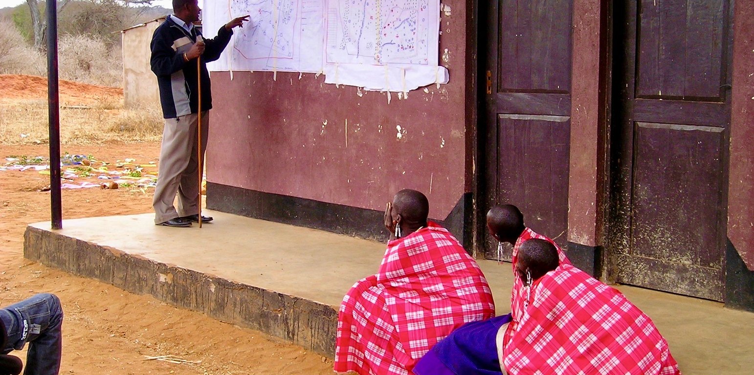
Participatory mapping of shared resources is the first step in the joint village land use planning approach. (Fiona Flintan)
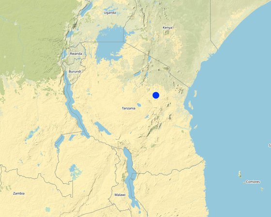
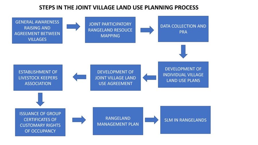
The Sustainable Rangeland Management Project (SRMP) is an initiative led by Tanzania’s Ministry of Livestock and Fisheries (MoLF), the International Livestock Research Institute (ILRI) and the National Land Use Planning Commission (NLUPC), with support from International Fund for Agricultural Development (IFAD), Irish Aid and the International Land Coalition (ILC). A key innovation of the project has been the development of joint village land use planning (JVLUP). The JVLUP process in Kiteto District, Manyara Region began in November 2013, and included the villages of Lerug, Ngapapa, and Orkitikiti. The three villages share boundaries and grazing resources, and in order to illustrate a single shared identity across the boundaries, the name OLENGAPA was chosen - incorporating part of each village’s name.
The total area of the three villages is (approx.) 59,000 hectares. The majority of inhabitants are Maasai pastoralists with some Ndorobo hunter-gatherers, and some farmers - most of whom are seasonal migrants. Mobility is central to the survival of the pastoralists and takes place across the three villages, as well as to locations in Kilindi, Gairo, and Bagamoyo Districts.
Average annual rainfall is between 800-1,000 mm per annum. There are no perennial rivers flowing through the OLENGAPA villages. The only permanent surface water source is Orkitikiti Dam, constructed in 1954.
In order to understand the different resources such as grazing areas, water points, cropping areas, livestock routes, and cultural places, SRMP supported participatory mapping. This assisted in developing a base map for the village land use planning process: it showed which resources were shared by the villages and where they were situated.
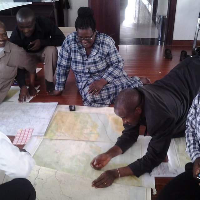
SRMP then helped village members to agree the individual village land use maps and plans - which zoned the village land into priority land uses - as well as the joint village land use map and plan, and the joint village land use agreement (JVLUA). These specified the grazing areas, water points, livestock routes and other shared resources. Reaching agreement was a protracted negotiation process between the villages, and within villages also - between different interest groups. It involved numerous community meetings and considerable investment of resources. Finally, each Village Assembly approved the JVLUA, which allocated approx. 20,700 ha of land for shared grazing –around 40% of the total village area. By-laws for management of the resources were developed and adopted.
Following approval of the JVLUA, the three OLENGAPA Village Councils established a Joint Grazing Land Committee made up of members from all three villages. This Committee is responsible for planning, management, enforcement of by-laws applicable to the OLENGAPA, and coordination of the implementation of both the OLENGAPA land use agreements and joint land use plan. In addition, a Livestock Keepers Association was established, including 53 founding members – but with most households from the three villages being associate members. A constitution was developed for the Association, which was officially registered on 11 September 2015.
In January 2016 the Ministry of Lands approved and registered the village land boundary maps and deed plans for the three villages. The District Council has issued the village land certificates, and the next step is for Village Councils to begin issuing Certificates of Customary Rights of Occupancy (CCROs). The shared grazing area will require three group CCROs to be issued to the Livestock Keepers Association – one from each village - for the part of the grazing area that falls under its jurisdiction. Signboards and beacons marking the shared grazing area are being put in place.
In November 2017 a fourth village joined OLENGAPA, expanding the shared grazing area to 30,000 ha. The villages are now working to develop a management plan to improve rangeland productivity.
Байршил: Kiteto District, Manyara Region, Бүгд Найрамдах Нэгдсэн Танзани Улс
Эхлэх огноо: 2010
Төгсөх жил: 2017
Арга барилын төрөл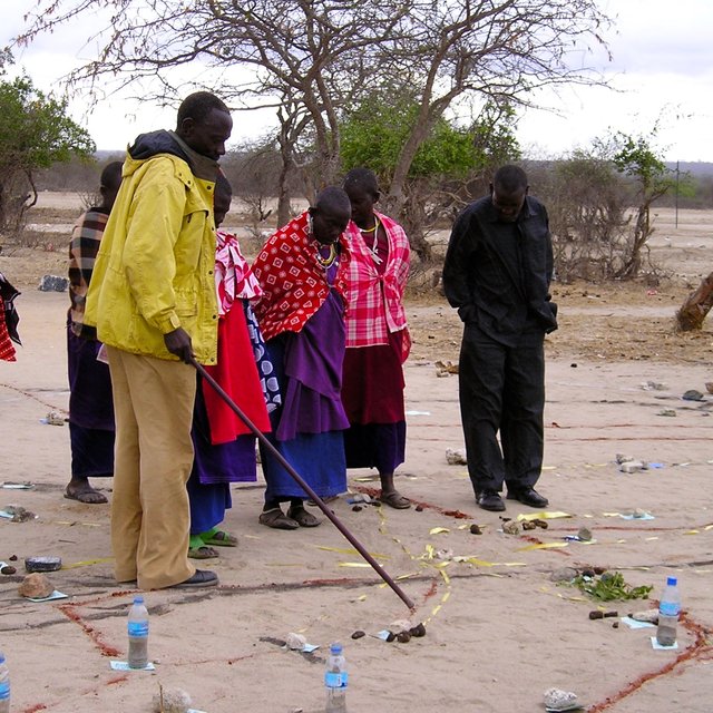
| Ямар оролцогч талууд / хэрэгжүүлэгч байгууллагууд арга барилд оролцож байсан бэ? | Оролцогч талуудыг тодорхойлно уу | Оролцогч талуудын үүргийг тайлбарлана уу |
| Орон нутгийн газар ашиглагч / орон нутгийн иргэд | Village members (Assembly) of three villages - Orikitiki, Lerug and Ngapapa. | All village members as the Village Assembly have an opportunity to contribute to the land use planning process and to approve it. |
| олон нийтэд түшиглэсэн байгууллагууд | Village Council, Village Land Use Management Committee (VLUMC), Rangeland Management Committee, Livestock Keepers Association. | Village government coordinated the planning process at local level. VLUMC develops plan. Village Council approves plans and issues CCROs. Rangeland Management Committee oversees development in rangelands. Livestock Keepers Association established made-up of all members of the villages that have livestock (nearly all village members) - they will be issued with CCROs as "owners" of the grazing land. |
| ГТМ-ийн мэргэжилтэн/ хөдөө аж ахуйн зөвлөх | Land use planning consultants | Provision of advice to the project team, local government and villagers on the JVLUP approach. |
| Судлаачид | International Livestock Research Institute (ILRI) | Identification of good practice in village land use planning in Tanzania and ways to adapt and incorporate good practice into joint village land use planning to improve the approach. Research on role of and impact on pastoral women. Undertaking of baseline studies. |
| ТББ | KINNAPA Development Association (supported originally by CARE and Tanzania Natural Resource Forum). | KINNAPA is the local CSO partner working as part of the project to implement the JVLUP with local communities |
| Орон нутгийн захиргаа | District Council including the PLUM (participatory land use management planning experts) | The District Council provides local government oversight of the planning process and approves the plan before submitting to national government body. The PLUM technically supports the development of the JVLUP working with the village government(s) and village committees. |
| Засгийн газар (шийдвэр гаргагч, төлөвлөгч) | Ministry of Livestock and Fisheries, National Land Use Planning Commission (NLUPC), Ministry of Lands, Housing and Human Settlements Development, | Ministry of Livestock and Fisheries leading the planning process with a sectoral interest in protecting rangelands. NLUPC provides technical oversight and guidance. Ministry of Lands is the national body that approves the final plan. |
| Олон улсын байгууллага | International Land Coalition (ILC) | ILC is the grant recipient for the funds from the donors. The project is implemented through ILC members such as ILRI. ILC coordinates its members work in Tanzania on land issues including the JVLUP through a national engagement strategy (NES). ILC also provides technical support to the process through its global/Africa programme - the ILC Rangelands Initiative. The ILC Rangelands Initiative is a platform for learning, sharing, influencing, and connecting on rangeland issues with the objective of making rangelands more secure. |
| Donors | IFAD and Irish Aid | Provide funds for the project. IFAD also provides technical support on land tenure issues. |
Steps in the Joint Village Land Use Planning Process
Шийдвэр гаргасан этгээд
Шийдвэр гаргах үндэслэл нь
Land users were trained in land related and other relevant laws and the JVLUP process. Field staff/advisers were trained in land laws, the JVLUP process, gender, and conflict resolution. Local government were trained in the JVLUP process, gender and conflict resolution.
Research was carried out to identify good practice (in terms of social, economic and environmental impacts) from which the JVLUP process was developed. In future phases the full impacts of this JVLUP in terms of social, economic and ecological impact are being researched.
Tanzanian policy and legislation states that all village should have a VLUP, therefore this was an incentive for stakeholders to invest in the process. In addition conflicts over land use are increasingly a problem in Tanzania - so the resolution of these was also an important incentive.
Local village communities now feel strongly empowered in protecting and managing their land. The process has brought different stakeholders together and strengthened commitment to make the process work.
The piloting of the JVLUP showed what is possible and the positive impacts realised (albeit they could have been better documented). On these results the process is being scaled-up.
The planning process has laid the foundations for improved rangeland management - what is now required is investment in that management.
Land users have greater knowledge of the potential and need for rangeland management based on a better understanding of their land and resources gained through the JVLUP process, but they still need skills and resources to put this knowledge into action.
National and local government have seen the potential of the JVLUP to resolve conflicts over land use, and their capacities to implement the JVLUP in this regard has been improved.
The approach is helping build relations between the Ministry Livestock and Fisheries and the NLUPC together with NGO(s) at national level, as well as between different stakeholders involved in JVLUP at local levels.
Through the process of JVLUP the roots of land use conflicts come to the surface and must be resolved before agreement is reached. This may cause tensions and even conflict along the way - but the outcome should be positive.
Pastoralists are often left out of village land use planning processes. This approach when implemented well gives greater opportunity for them to be involved. However this is still a challenge.
Women can be left out of village land use planning processes. This approach when implemented well gives greater opportunity for them to be involved. However this is still a challenge.
Youth can be left out of village land use planning processes. This approach when implemented well gives greater opportunity for them to be involved. However this is still a challenge.
By following the JVLUP process village land has been certified and secured, as well as the rights of access and use of livestock keepers to the grazing land.
This has not been specifically monitored but it assumed by having stronger security to land and resources, food security and nutrition will be improved.
This has not been specifically monitored but it assumed by having stronger security to land and resources, access to markets will be improved.
In terms of water for livestock the JVLUP process has secured rights for the three villages to shared water resources.
By having stronger security to land and resources local land users are better placed to adapt to climate change etc.
This has not been specifically monitored but it assumed by having stronger security to land and resources, income opportunities will be improved.


