Local dyke (Khampheng Bounyavong)
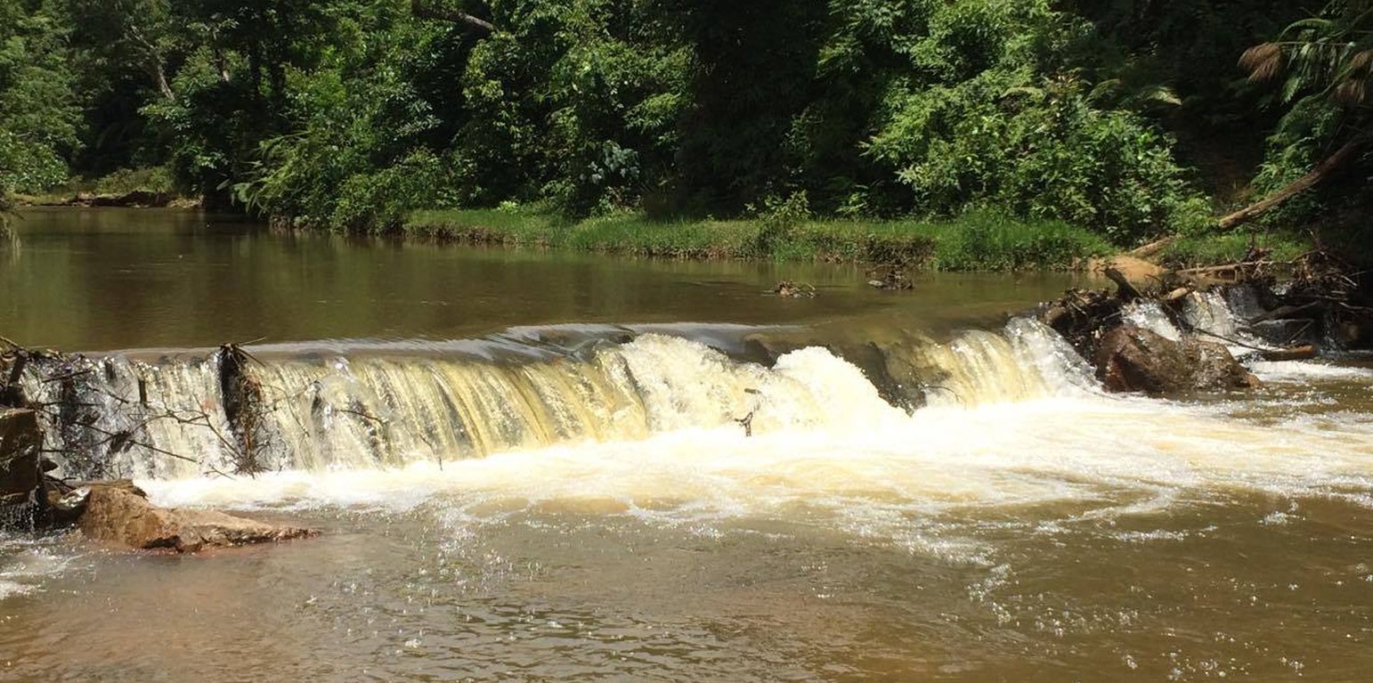
Local villagers initiated the construction and use of communal weir with locally available materials such as wood and stones to create structure and stabilize the weir. Previously, the local people had constructed several irrigation weirs on a particular stream with each one being adjacent to an individual farm. However this arrangement created water use conflicts, particularly during dry season. Therefore people decided to group together in 2003 in order to build a communal weir and vowed to maintain it on an annual basis. This was a significant commitment as often it is difficult to find the necessary construction materials for the weir’s upkeep.
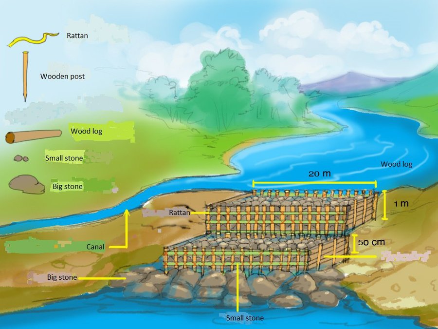
The main features and components of its framework should be prepared in the following manner: Firstly prior to beginning the weir’s construction one should gather rattan with length of 1-1.5 meters to tie the logs with each posts, as well as post with a diameter approximately 10 cm that should be cut to a length of 1.5 meters. The posts should then be sharpened at the end so that they can ideally be driven 50 cm into the ground, but this will depend on the conditions at the weir site. There should be a distance of 50 cm between each of the posts and these should be installed in two parallel rows with a space of 1 meter between the rows each rows width 1 meters and height 1 meter from the ground that cross the stream about 25 meters long.
Once this has been completed logs with diameter about 20 cm and a length of 4-5 meters should be slotted behind the rows posts and lay the another logs on the previous post until reach to the top of the post as the first layer. The second layer behind the logs should consist of small stones, soil, as well as branches and sticks. This procedure should be completed until the wall of horizontal logs has reached the height 1 meter of the top of the posts. Afterwards large stones should be placed as the top layer of the weir’s crest in order to strengthening the weir from flash flood. After that continue repeating the same process for the second row, driven the posts into the ground for 50 cm in front of the first row with distance of 1 meter and lower than first low for 50 cm, slotted behind the rows posts as the first layer. The second layer behind the logs (in front of the first row) consist small stones, soil, branch and sticks. Finally install large stones on the ground in front of the second row in order to strengthening and prevent leakages at bottom of the weir until reaching the required height. For instance, install the first row, then the second row is installed same as the first row in which the height of the second row is lower than the first row about 50 cm, and install large stones on ground of the third row to prevent leakages at bottom of the weir.
The main purpose of the weir is to provide an adequate water supply for agricultural activities in communal areas. Some households have also installed a dynamo (electric generator) with a production capacity of 1 Kwh. It should be noted that it is important to maintain the weir by regularly replacing the logs and adding more stones as required. One of the benefits of the weir is the ability to carry out agricultural activities in both the rainy and dry seasons. Furthermore water can be used for household gardening and the generation of electricity with the installation of a small dynamo where a channel with fast running water has been created. However, the weir does also have some drawbacks such as the significant numbers of logs that are required to firstly build and then maintain the weir annually. Therefore some land owners or land users may not choose this scheme due to these regular maintenance requirements with the need for logs which are declining in numbers and becoming increasingly difficult to source. At the same time this requirement may also affect forest resources and places time pressure on people to conduct the maintenance.
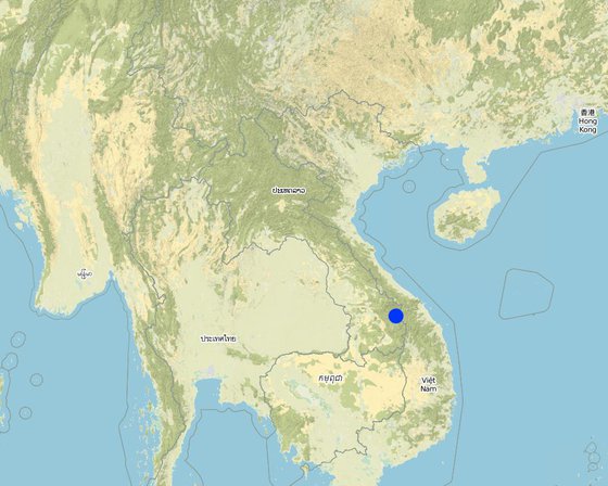
Localização: Tangnong village, Dakchaung district, Sekong province, República Democrática Popular do Laos
Nº de sites de tecnologia analisados: 2-10 locais
Difusão da tecnologia: Aplicado em pontos específicos/concentrado numa pequena área
Em uma área permanentemente protegida?:
Data da implementação: 2003; 10-50 anos atrás
Tipo de introdução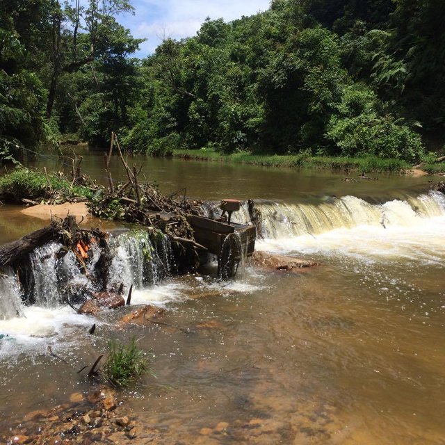


| Especifique a entrada | Unidade | Quantidade | Custos por unidade (Kip) | Custos totais por entrada (Kip) | % dos custos arcados pelos usuários da terra |
| Mão-de-obra | |||||
| Labour | person | 48,0 | 50000,0 | 2400000,0 | 100,0 |
| Equipamento | |||||
| Hummer | piece | 4,0 | 150000,0 | 600000,0 | 100,0 |
| Axes | piece | 10,0 | 100000,0 | 1000000,0 | 100,0 |
| Hoe | piece | 15,0 | 40000,0 | 600000,0 | 100,0 |
| Shovel | piece | 10,0 | 50000,0 | 500000,0 | 100,0 |
| Knife | piece | 10,0 | 25000,0 | 250000,0 | 100,0 |
| Material de construção | |||||
| Wood logs | piece | 10,0 | 50000,0 | 500000,0 | 100,0 |
| Rattan | line | 200,0 | 20000,0 | 4000000,0 | 100,0 |
| Stones | m3 | 50,0 | 40000,0 | 2000000,0 | 100,0 |
| Wood post | piece | 10,0 | 10000,0 | 100000,0 | 100,0 |
| Custos totais para a implantação da tecnologia | 11'950'000.0 | ||||
| Custos totais para o estabelecimento da Tecnologia em USD | 1'493.75 | ||||
| Especifique a entrada | Unidade | Quantidade | Custos por unidade (Kip) | Custos totais por entrada (Kip) | % dos custos arcados pelos usuários da terra |
| Mão-de-obra | |||||
| Labor | person | 48,0 | 50000,0 | 2400000,0 | 100,0 |
| Material de construção | |||||
| Wood logs | piece | 10,0 | 50000,0 | 500000,0 | 100,0 |
| Rattan | line | 200,0 | 10000,0 | 2000000,0 | 100,0 |
| Stones | m3 | 10,0 | 50000,0 | 500000,0 | 100,0 |
| Wood post | piece | 10,0 | 10000,0 | 100000,0 | 100,0 |
| Custos totais para a manutenção da tecnologia | 5'500'000.0 | ||||
| Custos totais de manutenção da Tecnologia em USD | 687.5 | ||||
Quantidade anterior à GST: 8 tons/ha
Quantidade posterior à GST: 2 tons/ha
Before gold mining company entered in the area the yield of rice raised to 8 tons/ha due to the aboundant irrigation water caused by the dike construction. But unfortunately actually (in 2017), due to gold excavating rice yield decreased to 2 tons/ha, only.
Some households also install dynamo ( electric generator ) with production capacity of 1 Kwh.
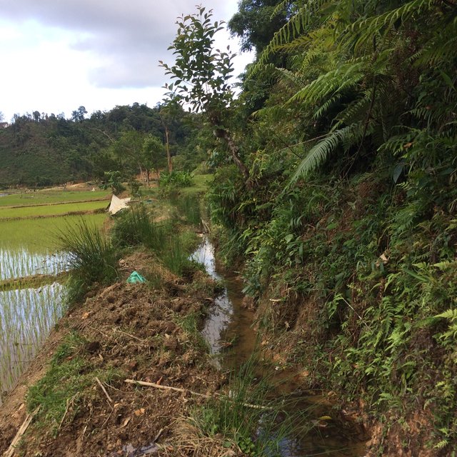
Before, water for cultivation was insufficient especially during dry season as the stream water level was too low , after the weir construction the stream water level got high enough to fill the canal leading to the production area all-year round.
Before dyke construction the villagers tried to bring water to their fields by small individual canals during dry season. This caused competition and conflicts on scares water scarcity. After the communal wire construction the conflicts situation have been been improved.
Even during dry season (and drought events) the farmers bring enough the water to the fields.
The weir stopped to some extent the natural water flow. This causes slower but still regular downstream water flow during dry season.


