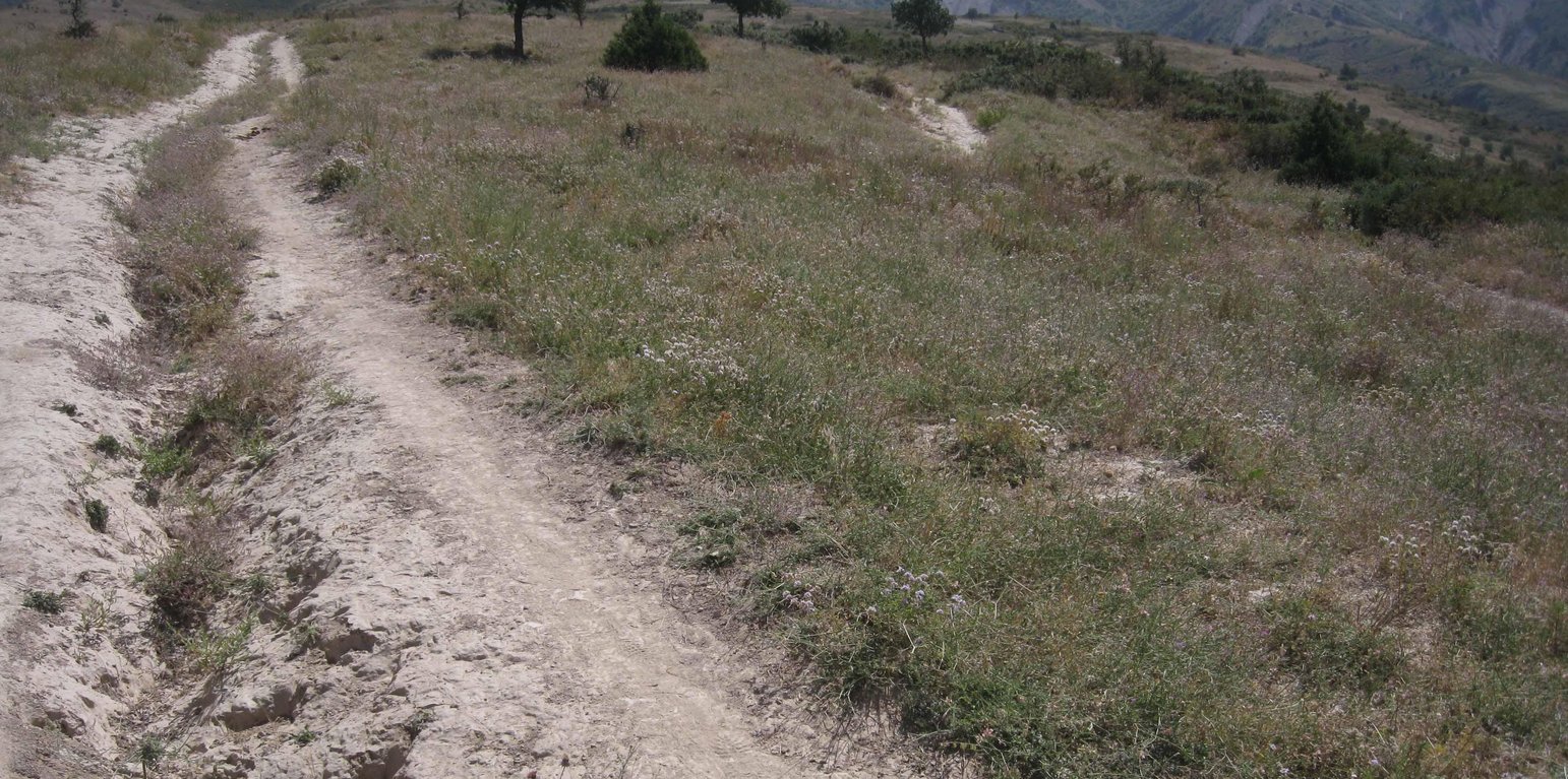
Eroded path through the pastureland (Malgorzata Conder)

Pasture management of a communal grazing land (Tajiquistão)

Descrição

Pasture management of a communal land through daily rotation

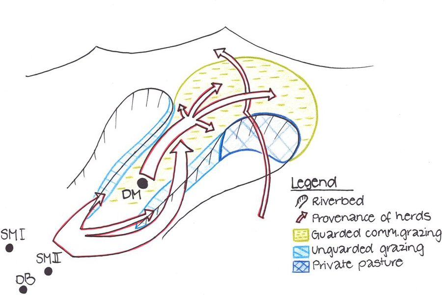
The total area of the pasture accounts for 300 – 500 ha. The pasture is property of the Doshmand village but it includes also some private properties, mainly potato and wheat crops. After the harvest, livestock is also grazing on these crops. Eighteen households are currently using the pasture with a total of 150 cows and 500 small animals. Additionally, three groups of herds from other villages graze irregularly on this pasture mainly on the lateral parts as it is less guarded by the villagers. The interviewee estimates that over 1000 cows, goats and sheep are coming from other villages. Other herds cross this pasture when migrating to or coming back from the summer pasture in spring and autumn, respectively. Nevertheless Doshmand residents claim that this intrusive grazing is accepted as “every animal has to be fed”. This shows the need of a pasture management not only on village but also on watershed level.
During Soviet time the inhabitants of Doshmand were forced to migrate to the valley. In 2003, the resettlement of the ancient location started with two families. Simultaneously, the pasture management was established and joined by each family who resettled. The controlled area is divided in 4 subparts. The herd switches daily within them. Every household looks after the herd for a day, which results in a rotational cycle of 18 days. There are no fixed and regular meetings for pasture management within the village pasture. However, two subsequent herders communicate to know where the herd has been grazing and where to graze the next time.

Purpose of the Technology: Purpose of the rotational grazing is to graze on one subpart, while the three other areas are resting. This reduces the impact of grazed and trampled areas per subpart and allows the growth and recovery of the vegetation in the other parts.
The task of herding is shared among the families. The rotational grazing is organized orally and freely, why it’s not sure if that approach is strictly binding. Discussions about pasture management rise only in case of need.

Establishment / maintenance activities and inputs: Doshmand village got the pasture in a good condition at the time of establishment. Vegetation cover was high. The only investment consisted in building a water point for the livestock. A further investment was to buy a water pipe and dig out a channel for the pipe to conduct the water from the water point to the village. Money was collected by the families and many villagers were involved in digging the channel.
No further input was and is required except coordination between the herders.

Natural / human environment: The pasture of Doshmand village is located in the middle and upper zone of the watershed. Thanks to the distance to other settlements, the pasture is less affected by overgrazing than other communal pastures in the watershed. Nevertheless, the pasture is heterogeneously grazed, with some areas which are difficult to access even for livestock and hence abundant vegetation. Other areas, especially those situated next to the village show a more bare vegetation cover.
Localização

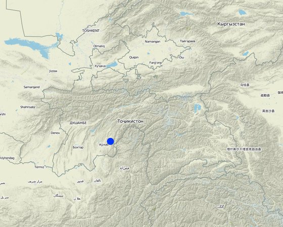
Localização: Muminabad, Khatlon, Tajikistan, Tajiquistão

Nº de sites de tecnologia analisados:

Geo-referência de locais selecionados
  • 70.04219, 38.01485

Difusão da tecnologia: Uniformemente difundida numa área (approx. 1-10 km2)

Em uma área permanentemente protegida?:

Data da implementação: 10-50 anos atrás

Tipo de introdução
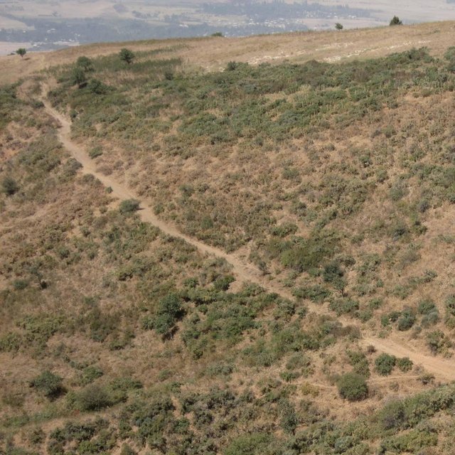
Heterogenous vegetation cover within the watershed (Malgorzata Conder)

Classificação da Tecnologia

Objetivo principal
  • Melhora a produção
  • Reduz, previne, recupera a degradação do solo
  • Preserva ecossistema
  • Protege uma bacia/zonas a jusante – em combinação com outra tecnologia
  • Preservar/melhorar a biodiversidade
  • Reduzir riscos de desastre
  • Adaptar a mudanças climáticas/extremos e seus impactos
  • Atenuar a mudanças climáticas e seus impactos
  • Criar impacto econômico benéfico
  • Cria impacto social benéfico
Uso da terra

  • Terra de cultivo
    • Cultura anual: cereais - trigo (primavera), cereais - trigo (inverno), culturas de raiz/tubérculos- batatas
    Número de estações de cultivo por ano: 1
  • Pastagem
    • Pastoralismo semi-nômade
    • rotational grazing

Abastecimento de água
  • Precipitação natural
  • Misto de precipitação natural-irrigado
  • Irrigação completa

Objetivo relacionado à degradação da terra
  • Prevenir degradação do solo
  • Reduzir a degradação do solo
  • Recuperar/reabilitar solo severamente degradado
  • Adaptar à degradação do solo
  • Não aplicável
Degradação abordada
  • Erosão do solo pela água - Wo: efeitos de degradação externa
  • Deteriorização química do solo - Cn: declínio de fertilidade e teor reduzido de matéria orgânica (não causado pela erosão)
  • Deteriorização física do solo - Pc: Compactação
  • Degradação biológica - Bc: redução da cobertura vegetal, Bs: Qualidade e composição de espécies/declínio de diversidade
Grupo de GST
  • Gestão de pastoralismo e pastagem
Medidas de GST
  • Medidas de gestão - M2: Mudança de gestão/nível de intensidade

Desenho técnico

Especificações técnicas
Livestock from Doshmand village (DM) is grazing in the four subparts of the communal pasture. Livestock from other villages, located in the valley Sarmadoni I (SMI) and II (SMII) and Dehibaland (DB), can invade the guarded and unguarded communal pasture of Doschmand. In spring and autumn also other livestock crosses Doshmand's pasture when migrating to or leaving the summer pasture.

Location: Chukurak watershed. Muminabad, Khatlon

Technical knowledge required for land users: low

Main technical functions: improvement of ground cover, increase of infiltration

Secondary technical functions: improvement of topsoil structure (compaction), stabilisation of soil (eg by tree roots against land slides), increase in organic matter

Change of land use practices / intensity level: Rotational grazing at village level
Author: Malgorzata Conder

Estabelecimento e manutenção: atividades, insumos e custos

Cálculo de insumos e custos
  • Os custos são calculados:
  • Moeda utilizada para o cálculo de custos: USD
  • Taxa de câmbio (para USD): 1 USD = n.a
  • Custo salarial médio da mão-de-obra contratada por dia: 12.40
Fatores mais importantes que afetam os custos
There are no costly factors, the most important input is a good planning, coordination and consistent execution of the rotational grazing system. The installation of a waterpoint would be needed but it is a very costly installation.
Atividades de implantação
  1. Coordination with villagers and herders (Periodicidade/frequência: Reestablishment of village)
Estabelecer insumos e custos
Especifique a entrada Unidade Quantidade Custos por unidade (USD) Custos totais por entrada (USD) % dos custos arcados pelos usuários da terra
Mão-de-obra
Coordination with villagers and herders - 1,0
Atividades de manutenção
  1. Consultation with village herders (Periodicidade/frequência: If needed)
Insumos e custos de manutenção
Especifique a entrada Unidade Quantidade Custos por unidade (USD) Custos totais por entrada (USD) % dos custos arcados pelos usuários da terra
Mão-de-obra
Consultation with village herders - 1,0

Ambiente natural

Média pluviométrica anual
  • <250 mm
  • 251-500 mm
  • 501-750 mm
  • 751-1.000 mm
  • 1.001-1.500 mm
  • 1.501-2.000 mm
  • 2.001-3.000 mm
  • 3.001-4.000 mm
  • > 4.000 mm
Zona agroclimática
  • úmido
  • Subúmido
  • Semiárido
  • Árido
Especificações sobre o clima
Annual rainfall (1,001-1,500 mm): Totally 800mm: 700mm in winter-spring, July-Sept dry season (At 1200mm asl, weather station Muminabad)

Annual rainfall (1,501-2,000 mm): Precipitation increases 60mm per 100m of altitude in average. Here up to 1600mm.
Thermal climate class: temperate

LPG from April until September
Inclinação
  • Plano (0-2%)
  • Suave ondulado (3-5%)
  • Ondulado (6-10%)
  • Moderadamente ondulado (11-15%)
  • Forte ondulado (16-30%)
  • Montanhoso (31-60%)
  • Escarpado (>60%)
Formas de relevo
  • Planalto/planície
  • Cumes
  • Encosta de serra
  • Encosta de morro
  • Sopés
  • Fundos de vale
Altitude
  • 0-100 m s.n.m.
  • 101-500 m s.n.m.
  • 501-1.000 m s.n.m.
  • 1.001-1.500 m s.n.m.
  • 1.501-2.000 m s.n.m.
  • 2.001-2.500 m s.n.m.
  • 2.501-3.000 m s.n.m.
  • 3.001-4.000 m s.n.m.
  • > 4.000 m s.n.m.
A tecnologia é aplicada em
  • Posições convexas
  • Posições côncavas
  • Não relevante
Profundidade do solo
  • Muito raso (0-20 cm)
  • Raso (21-50 cm)
  • Moderadamente profundo (51-80 cm)
  • Profundo (81-120 cm)
  • Muito profundo (>120 cm)
Textura do solo (superficial)
  • Grosso/fino (arenoso)
  • Médio (limoso, siltoso)
  • Fino/pesado (argila)
Textura do solo (>20 cm abaixo da superfície)
  • Grosso/fino (arenoso)
  • Médio (limoso, siltoso)
  • Fino/pesado (argila)
Teor de matéria orgânica do solo superior
  • Alto (>3%)
  • Médio (1-3%)
  • Baixo (<1%)
Lençol freático
  • Na superfície
  • < 5 m
  • 5-50 m
  • > 50 m
Disponibilidade de água de superfície
  • Excesso
  • Bom
  • Médio
  • Precário/nenhum
Qualidade da água (não tratada)
  • Água potável boa
  • Água potável precária (tratamento necessário)
  • apenas para uso agrícola (irrigação)
  • Inutilizável
A qualidade da água refere-se a:
A salinidade é um problema?
  • Sim
  • Não

Ocorrência de enchentes
  • Sim
  • Não
Diversidade de espécies
  • Alto
  • Médio
  • Baixo
Diversidade de habitat
  • Alto
  • Médio
  • Baixo

Características dos usuários da terra que utilizam a tecnologia

Orientação de mercado
  • Subsistência (autoabastecimento)
  • misto (subsistência/comercial)
  • Comercial/mercado
Rendimento não agrícola
  • Menos de 10% de toda renda
  • 10-50% de toda renda
  • >50% de toda renda
Nível relativo de riqueza
  • Muito pobre
  • Pobre
  • Média
  • Rico
  • Muito rico
Nível de mecanização
  • Trabalho manual
  • Tração animal
  • Mecanizado/motorizado
Sedentário ou nômade
  • Sedentário
  • Semi-nômade
  • Nômade
Indivíduos ou grupos
  • Indivíduo/unidade familiar
  • Grupos/comunidade
  • Cooperativa
  • Empregado (empresa, governo)
Gênero
  • Mulheres
  • Homens
Idade
  • Crianças
  • Jovens
  • meia-idade
  • idosos
Área utilizada por residência
  • < 0,5 ha
  • 0,5-1 ha
  • 1-2 ha
  • 2-5 ha
  • 5-15 ha
  • 15-50 ha
  • 50-100 ha
  • 100-500 ha
  • 500-1.000 ha
  • 1.000-10.000 ha
  • > 10.000 ha
Escala
  • Pequena escala
  • Média escala
  • Grande escala
Propriedade da terra
  • Estado
  • Empresa
  • Comunitário/rural
  • Grupo
  • Indivíduo, não intitulado
  • Indivíduo, intitulado
Direitos do uso da terra
  • Acesso livre (não organizado)
  • Comunitário (organizado)
  • Arrendado
  • Indivíduo
Direitos do uso da água
  • Acesso livre (não organizado)
  • Comunitário (organizado)
  • Arrendado
  • Indivíduo
Acesso a serviços e infraestrutura
Saúde

Pobre
Bom
Educação

Pobre
Bom
Assistência técnica

Pobre
Bom
Emprego (p. ex. não agrícola)

Pobre
Bom
Mercados

Pobre
Bom
Energia

Pobre
Bom
Vias e transporte

Pobre
Bom
Água potável e saneamento

Pobre
Bom
Serviços financeiros

Pobre
Bom

Impactos

Impactos socioeconômicos
Produção de forragens
diminuído
aumentado

Produção animal
diminuído
aumentado


Not the whole pastureland can be grazed at once

Disponibilidade de água para criação de animais
diminuído
aumentado

Qualidade da água para criação de animais
diminuído
aumentado

Impactos socioculturais
Segurança alimentar/auto-suficiência
Reduzido
Melhorado

Instituições comunitárias
Enfraquecido
Fortalecido

Livelihoods and human well-being
reduced
improved


Strenghtening of the community sense and awareness through increased coordination for rotational grazing between villagers. Higher fodder availability leads to healthier livestock.

Impactos ecológicos
Escoamento superficial
aumentado
diminuído

Evaporação
aumentado
diminuído

Umidade do solo
diminuído
aumentado

Ressecamento/ selagem do solo
aumentado
Reduzido

Compactação do solo
aumentado
Reduzido

Biomassa/carbono acima do solo
diminuído
aumentado

Risco de incêndio
aumentado
diminuído

Hazards towards adverse events
improved
reduced

Impactos fora do local
Sedimentação a jusante
aumentado
diminuído

Capacidade de tamponamento/filtragem (pelo solo, vegetação, zonas úmidas)
Reduzido
Melhorado

Danos na infraestrutura pública/privada
aumentado
Reduzido

Análise do custo-benefício

Benefícios em relação aos custos de estabelecimento
Retornos a curto prazo
muito negativo
muito positivo

Retornos a longo prazo
muito negativo
muito positivo

Benefícios em relação aos custos de manutenção
Retornos a curto prazo
muito negativo
muito positivo

Retornos a longo prazo
muito negativo
muito positivo

Mudança climática

Mudança climática gradual
Temperatura anual aumento

não bem em absoluto
muito bem
Extremos (desastres) relacionados ao clima
Temporal local

não bem em absoluto
muito bem
Tempestade de vento local

não bem em absoluto
muito bem
Seca

não bem em absoluto
muito bem
Inundação geral (rio)

não bem em absoluto
muito bem
Outras consequências relacionadas ao clima
Período de crescimento reduzido

não bem em absoluto
muito bem
Resposta: não conhecido

Adoção e adaptação

Porcentagem de usuários de terras na área que adotaram a Tecnologia
  • casos isolados/experimental
  • 1-10%
  • 11-50%
  • > 50%
De todos aqueles que adotaram a Tecnologia, quantos o fizeram sem receber incentivos materiais?
  • 0-10%
  • 11-50%
  • 51-90%
  • 91-100%
Número de residências e/ou área coberta
NA
A tecnologia foi recentemente modificada para adaptar-se as condições variáveis?
  • Sim
  • Não
A quais condições de mudança?
  • Mudança climática/extremo
  • Mercados dinâmicos
  • Disponibilidade de mão-de-obra (p. ex. devido à migração)

Conclusões e experiências adquiridas

Pontos fortes: visão do usuário de terra
  • No big input, coordination between farmers exists anyway
Pontos fortes: a visão do/a compilador/a ou de outra pessoa capacitada
  • In a rotational grazing system at village level every family is responsible for the sustainability of the pasture

    How can they be sustained / enhanced? Give more responsability and co-determination to individuals
  • High establishment potential as rotational grazing do not demand any costs, except coordination and organization on village level

    How can they be sustained / enhanced? Disseminate the idea of rotational grazing also on watershed level
  • Ecologic benefits as high vegetation cover, less erosion etc. can be achieved without monetary investment

    How can they be sustained / enhanced? Spread knowledge of long-term effects by rotational grazing
  • Being a pasture of a big area extent in the uphills, the good quality of the pasture plays an important role for all the settlements and cultivations downstream

    How can they be sustained / enhanced? Raise the awareness about the upstream-downstream interrelation in the watersheds
Pontos fracos/desvantagens/riscos: visão do usuário de terracomo superar
Pontos fracos/desvantagens/riscos: a visão do/a compilador/a ou de outra pessoa capacitadacomo superar
  • In reality, rotational grazing is not executed strictly enough Stricter separation of the subparts needed
  • Herds from other villages graze in the same pasture Strenghten coordination of grazing between and within villages
  • Some flanks show high vegetation because they are not accessible for livestock and not because of the rotational grazing

Referências

Compilador/a
  • Malgorzata Conder
Editores
Revisor
  • David Streiff
  • Alexandra Gavilano
Data da documentação: 15 de Janeiro de 2013
Última atualização: 6 de Agosto de 2019
Pessoas capacitadas
Descrição completa no banco de dados do WOCAT
Dados GST vinculados
A documentação foi facilitada por
Instituição Projeto
This work is licensed under Creative Commons Attribution-NonCommercial-ShareaAlike 4.0 International