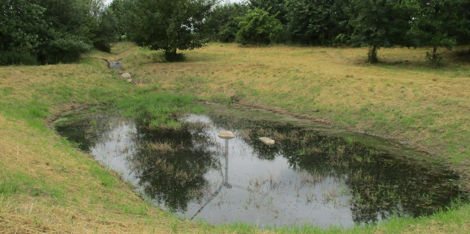
Detention pond (LISt Gesellschaft für Verkehrswesen und ingenieurtechnische Dienstleistungen mbH, Bereich Kompensationsmaßnahmenmanagement)

Detention ponds (Alemanha)

Rückhaltebecken

Descrição

Detention ponds are artificially excavated basins that collect stormwater runoff and eroded sediment from the upstream catchment. The water stored in these ponds is slowly released into a water body or it infiltrates into the groundwater – or both. Their primary functions are flood control, erosion control and water quality improvement.

This documentation focuses on a detention basin constructed to hold surface runoff at the lowest point of an agricultural catchment. A well-designed detention pond is an effective flood control and landscape management measure. It stores surface runoff and releases it through controlled flow, infiltration, or evaporation (or a combination), and reduces nutrient inputs to the adjacent water body by filtering out sediment and nutrients through particle deposition, or nutrient uptake by plants. On average, water treatment in a detention pond can remove about 50-60% of suspended solids, 30-35% of total phosphorus and total nitrogen, and 25-65% of metals. Ponds also provide habitat for terrestrial, riparian and aquatic species. In addition to their ecological impact, they have an aesthetic and cultural value to society, for example, as a demonstration of effective sustainable water management.
The detention basin described here was constructed by excavating a new depression and ditch system. It consists of a 450 m long inlet channel, a 250 m² pond, and an overflow channel that diverts excess water downstream to the nearest river (Schwarzer Schöps). However, there are no outlet structures for draining water that is captured in the pond (apart from the overflow). All the collected water seeps into the ground and soil particles settle. As a general rule, the size of such a pond should be 3-7% of the upstream catchment and should be able to hold at least the precipitation of a 1 in 30 year rainfall event. However, as the infiltration of the collected water is rather slow, the efficiency is reduced for successive events and overflowing is common. The depth should be between 1.2 m and 2.0 m. A deeper pond can lead to stratification and anoxic conditions, while a shallower pond may cause algal blooms and high biological activity in the summer. Water stored in the pond should remain for at least 20 days to ensure biological treatment.
The construction of the detention pond in this documentation was initiated as a compensation and replacement measure for the construction of a new road in 2016. Accordingly, the road construction authority, the landscape conservation association and a farmer were involved in the implementation.
As usual with such measures there are drawbacks as well as positive impact for landowners. The measure consumes a lot of land, which automatically results in yield losses. It is expensive to build and not easy to construct - and requires the help of an engineering firm while also being time-consuming to maintain. Maintenance is required to sustain the benefits of the technology. For a pond such as that documented here, the following maintenance activities are necessary: during the first three years, maintenance includes mowing the surrounding green area and the dried out pond and channel three times per year. After the fourth year, maintenance includes (a) an annual function check, (b) a check for pest infestation every two years, and (c) suppression of excess woody growth every eight to ten years. Twice a year (mid-June and late August), the grass around the pond and in the intake channel is mowed and the clippings are removed. Shrubs and woody plants are maintained, especially by pruning woody plants (every 8 to 10 years) and coppicing sections of shrubs (every 10 to 15 years). In the long term, it may be necessary to remove the deposited sediments in order to maintain the retention capacity.
Localização

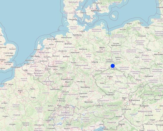
Localização: Reichenbach, Saxony, Alemanha

Nº de sites de tecnologia analisados: Local único

Geo-referência de locais selecionados
  • 14.7681, 51.1411

Difusão da tecnologia: Aplicado em pontos específicos/concentrado numa pequena área

Em uma área permanentemente protegida?: Não

Data da implementação: 10-50 anos atrás

Tipo de introdução
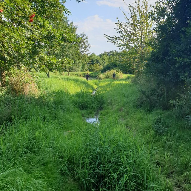
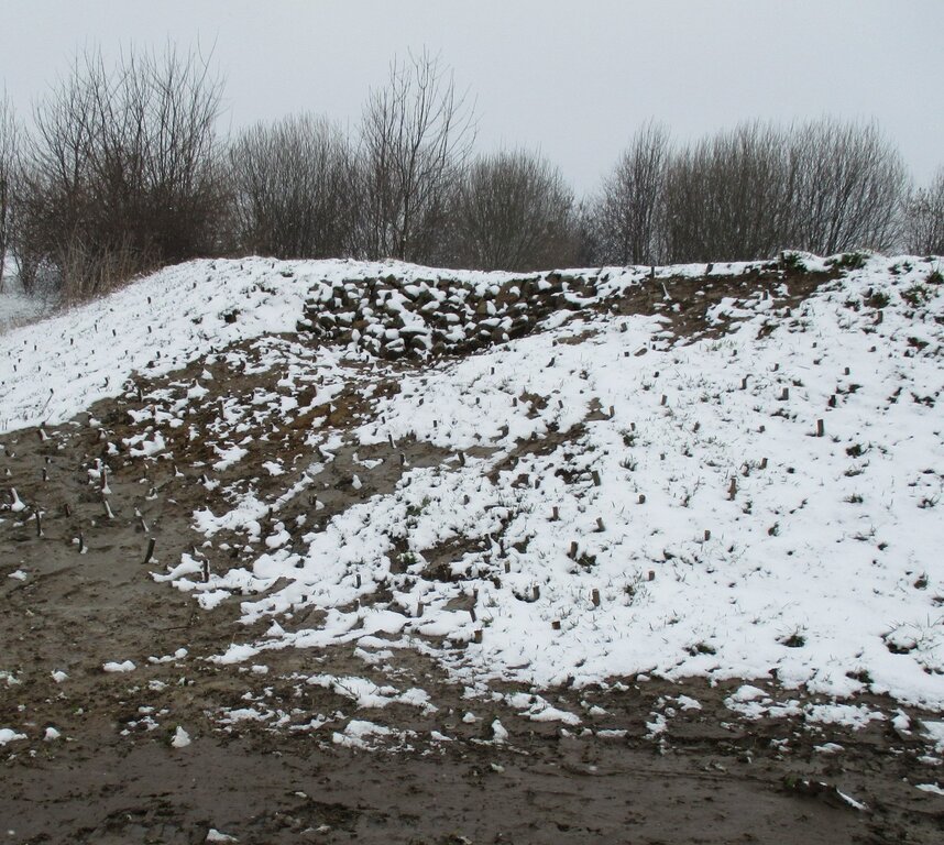
Overgrown inlet channel, three years after the opening title photo (in section 1.1) (Felix Witing)
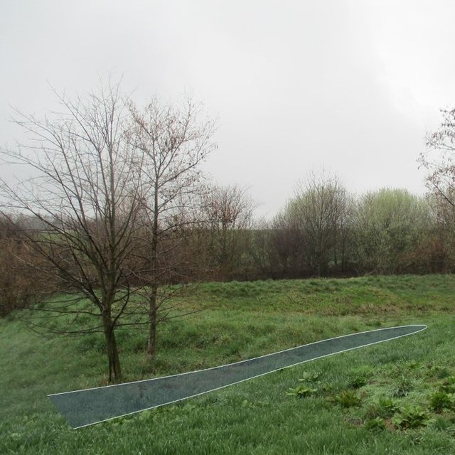
Overflow channel (LISt Gesellschaft für Verkehrswesen und ingenieurtechnische Dienstleistungen mbH, Bereich Kompensationsmaßnahmenmanagement)

Classificação da Tecnologia

Objetivo principal
  • Melhora a produção
  • Reduz, previne, recupera a degradação do solo
  • Preserva ecossistema
  • Protege uma bacia/zonas a jusante – em combinação com outra tecnologia
  • Preservar/melhorar a biodiversidade
  • Reduzir riscos de desastre
  • Adaptar a mudanças climáticas/extremos e seus impactos
  • Atenuar a mudanças climáticas e seus impactos
  • Criar impacto econômico benéfico
  • Cria impacto social benéfico
Uso da terra
Uso do solo misturado dentro da mesma unidade de terra: Não

  • Outros - Especifique: extensively farmed grassland
Abastecimento de água
  • Precipitação natural
  • Misto de precipitação natural-irrigado
  • Irrigação completa

Objetivo relacionado à degradação da terra
  • Prevenir degradação do solo
  • Reduzir a degradação do solo
  • Recuperar/reabilitar solo severamente degradado
  • Adaptar à degradação do solo
  • Não aplicável
Degradação abordada
  • Erosão do solo pela água - Wt: Perda do solo superficial/erosão de superfície, Wg: Erosão por ravinas/ravinamento
  • Degradação da água - Hs: mudança na quantidade de água de superfície, Hg: mudança no lençol freático/aquífero
Grupo de GST
  • Coleta de água
  • Redução de riscos de desastre baseada no ecossitema
Medidas de GST
  • Medidas estruturais - S5: Represa, bacia, lago

Desenho técnico

Especificações técnicas
Securing dam stability by willow sticks.
Author: LISt Gesellschaft für Verkehrswesen und ingenieurtechnische Dienstleistungen mbH, Bereich Kompensationsmaßnahmenmanagement
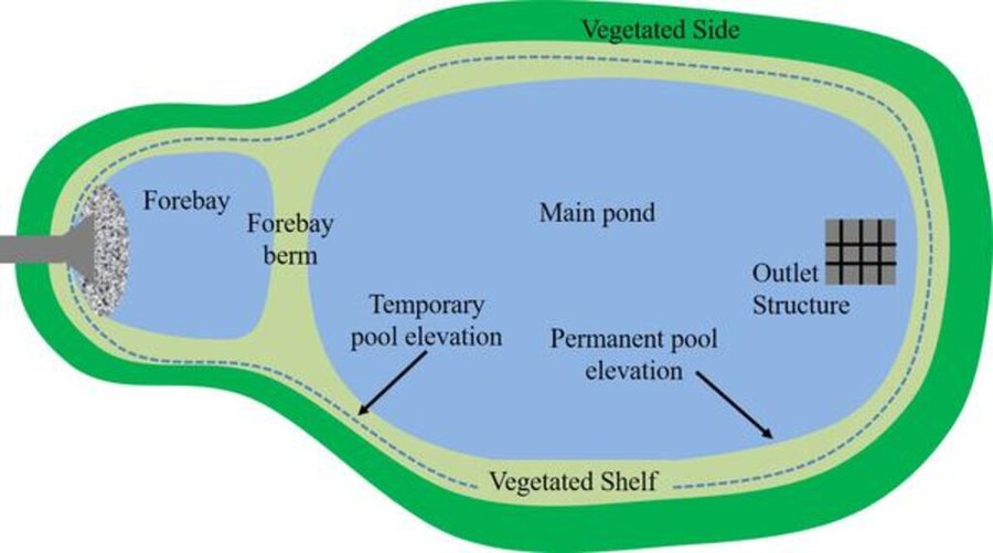
A detention pond (in genreral) consists of a sediment forebay (pretreatment system), a permanent pool that is intended to remain wet throughout the year (but may dry out), a temporary storage pond for flood attenuation, and a shallow zone or aquatic bench along the edge of the permanent pool to support wetland planting that provides ecological and safety benefits. It should be wedge-shaped with a length to width ratio of between 3:1 and 5:1. The side slope shouldn’t be steeper than 1:3 for public safety and maintenance access.
Author: Hunt et al. (2020)

Estabelecimento e manutenção: atividades, insumos e custos

Cálculo de insumos e custos
  • Os custos são calculados: Por unidade de tecnologia (unidade:Detention pond (as documented here) volume, length: 225 m², ca. 337,5 m³ (water depth of 1,5m))
  • Moeda utilizada para o cálculo de custos:
  • Taxa de câmbio (para USD): 1 USD = 0.91 €
  • Custo salarial médio da mão-de-obra contratada por dia: 18.70 € per hour
Fatores mais importantes que afetam os custos
From the government perspective: A budget must be set aside annually for necessary maintenance to ensure functional efficiency.
Atividades de implantação
  1. remove topsoil (Periodicidade/frequência: None)
  2. profile water body according to site plan (Standing water 1.5 m deep, ditch 0.5-1.5m deep) (Periodicidade/frequência: None)
  3. installing of inlet channel (Periodicidade/frequência: None)
  4. installing erosion protection on embankments (Periodicidade/frequência: None)
  5. cover the topsoil / terrain profiling (Periodicidade/frequência: None)
  6. planting of shrubs & aquatic plants along the shoreline (Periodicidade/frequência: None)
  7. ditch connection to Schwarzer-Schöps (Periodicidade/frequência: None)
  8. reprofiling ditches (90m) (Periodicidade/frequência: None)
  9. desilting of drainage ditch to Schwarzer-Schöps (Periodicidade/frequência: None)
  10. subsequent installation of a spillway (beak structure: 'Schnabelbauwerk') and willow sticks as an erosion control measure for the ditch connection to Schwarzer-Schöps. (Periodicidade/frequência: None)
Custos totais de estabelecimento (estimativa)
25250,0
Atividades de manutenção
  1. completion and development maintenance (mowing of the green area and the water-free water body) (Periodicidade/frequência: first three years: three times per year)
  2. functional check (Periodicidade/frequência: after the fourth year: every year)
  3. check for pest infestation (Periodicidade/frequência: after the fourth year : every other year)
  4. check to suppress unwanted woody growth (Periodicidade/frequência: after the fourth year: every 8 to 10 years)
  5. grass around the pond and in the intake channel is mowed and the clippings are removed (Periodicidade/frequência: after the fourth year: twice a year (mid-June and late August))
  6. pruning woody plants (Periodicidade/frequência: every 8 to 10 years)
  7. putting sections of shrubs on stock (Periodicidade/frequência: every 10 to 15 years)
Custos totais de manutenção (estimativa)
618,0

Ambiente natural

Média pluviométrica anual
  • <250 mm
  • 251-500 mm
  • 501-750 mm
  • 751-1.000 mm
  • 1.001-1.500 mm
  • 1.501-2.000 mm
  • 2.001-3.000 mm
  • 3.001-4.000 mm
  • > 4.000 mm
Zona agroclimática
  • úmido
  • Subúmido
  • Semiárido
  • Árido
Especificações sobre o clima
Average annual rainfall in mm: 750.82 mm/a
Name of the meteorological station: https://whh-kliwes.de/mapview
Length of growing period (LGP): 209 days
(https://www.umwelt.sachsen.de/dauer-der-vegetationsperiode-30631.html)
Inclinação
  • Plano (0-2%)
  • Suave ondulado (3-5%)
  • Ondulado (6-10%)
  • Moderadamente ondulado (11-15%)
  • Forte ondulado (16-30%)
  • Montanhoso (31-60%)
  • Escarpado (>60%)
Formas de relevo
  • Planalto/planície
  • Cumes
  • Encosta de serra
  • Encosta de morro
  • Sopés
  • Fundos de vale
Altitude
  • 0-100 m s.n.m.
  • 101-500 m s.n.m.
  • 501-1.000 m s.n.m.
  • 1.001-1.500 m s.n.m.
  • 1.501-2.000 m s.n.m.
  • 2.001-2.500 m s.n.m.
  • 2.501-3.000 m s.n.m.
  • 3.001-4.000 m s.n.m.
  • > 4.000 m s.n.m.
A tecnologia é aplicada em
  • Posições convexas
  • Posições côncavas
  • Não relevante
Profundidade do solo
  • Muito raso (0-20 cm)
  • Raso (21-50 cm)
  • Moderadamente profundo (51-80 cm)
  • Profundo (81-120 cm)
  • Muito profundo (>120 cm)
Textura do solo (superficial)
  • Grosso/fino (arenoso)
  • Médio (limoso, siltoso)
  • Fino/pesado (argila)
Textura do solo (>20 cm abaixo da superfície)
  • Grosso/fino (arenoso)
  • Médio (limoso, siltoso)
  • Fino/pesado (argila)
Teor de matéria orgânica do solo superior
  • Alto (>3%)
  • Médio (1-3%)
  • Baixo (<1%)
Lençol freático
  • Na superfície
  • < 5 m
  • 5-50 m
  • > 50 m
Disponibilidade de água de superfície
  • Excesso
  • Bom
  • Médio
  • Precário/nenhum
Qualidade da água (não tratada)
  • Água potável boa
  • Água potável precária (tratamento necessário)
  • apenas para uso agrícola (irrigação)
  • Inutilizável
A qualidade da água refere-se a: água de superfície
A salinidade é um problema?
  • Sim
  • Não

Ocorrência de enchentes
  • Sim
  • Não
Diversidade de espécies
  • Alto
  • Médio
  • Baixo
Diversidade de habitat
  • Alto
  • Médio
  • Baixo

Características dos usuários da terra que utilizam a tecnologia

Orientação de mercado
  • Subsistência (autoabastecimento)
  • misto (subsistência/comercial)
  • Comercial/mercado
Rendimento não agrícola
  • Menos de 10% de toda renda
  • 10-50% de toda renda
  • >50% de toda renda
Nível relativo de riqueza
  • Muito pobre
  • Pobre
  • Média
  • Rico
  • Muito rico
Nível de mecanização
  • Trabalho manual
  • Tração animal
  • Mecanizado/motorizado
Sedentário ou nômade
  • Sedentário
  • Semi-nômade
  • Nômade
Indivíduos ou grupos
  • Indivíduo/unidade familiar
  • Grupos/comunidade
  • Cooperativa
  • Empregado (empresa, governo)
Gênero
  • Mulheres
  • Homens
Idade
  • Crianças
  • Jovens
  • meia-idade
  • idosos
Área utilizada por residência
  • < 0,5 ha
  • 0,5-1 ha
  • 1-2 ha
  • 2-5 ha
  • 5-15 ha
  • 15-50 ha
  • 50-100 ha
  • 100-500 ha
  • 500-1.000 ha
  • 1.000-10.000 ha
  • > 10.000 ha
Escala
  • Pequena escala
  • Média escala
  • Grande escala
Propriedade da terra
  • Estado
  • Empresa
  • Comunitário/rural
  • Grupo
  • Indivíduo, não intitulado
  • Indivíduo, intitulado
Direitos do uso da terra
  • Acesso livre (não organizado)
  • Comunitário (organizado)
  • Arrendado
  • Indivíduo
Direitos do uso da água
  • Acesso livre (não organizado)
  • Comunitário (organizado)
  • Arrendado
  • Indivíduo
Acesso a serviços e infraestrutura
Saúde

Pobre
x
Bom
Educação

Pobre
x
Bom
Assistência técnica

Pobre
x
Bom
Emprego (p. ex. não agrícola)

Pobre
x
Bom
Mercados

Pobre
x
Bom
Energia

Pobre
x
Bom
Vias e transporte

Pobre
x
Bom
Água potável e saneamento

Pobre
x
Bom
Serviços financeiros

Pobre
x
Bom

Impactos

Impactos socioeconômicos
Disponibilidade de água para irrigação
diminuído
x
aumentado

Despesas com insumos agrícolas
aumentado
x
diminuído


not on agricultural inputs, but establishment and maintenance consume a lot of money.

Carga de trabalho
aumentado
x
diminuído

Impactos socioculturais
Impactos ecológicos
Qualidade de água
diminuído
x
aumentado


Improved water quality of subsequent river Schwarzer-Schöps.

Drenagem de excesso de água
Reduzido
x
Melhorado

Umidade do solo
diminuído
x
aumentado


Soil moisture next to the retention pond increased due to infiltration.

Diversidade vegetal
diminuído
x
aumentado


More plant diversity compared to normal farmed grassland.

Diversidade animal
diminuído
x
aumentado

Diversidade de habitat
diminuído
x
aumentado

Impactos da inundação
aumentado
x
diminuído

Impactos fora do local
disponibilidade de água (lençóis freáticos, nascentes)
diminuído
x
aumentado

Poluição de água subterrânea/rio
aumentado
x
Reduzido

Análise do custo-benefício

Benefícios em relação aos custos de estabelecimento
Retornos a curto prazo
muito negativo
x
muito positivo

Retornos a longo prazo
muito negativo
x
muito positivo

Benefícios em relação aos custos de manutenção
Retornos a curto prazo
muito negativo
x
muito positivo

Retornos a longo prazo
muito negativo
x
muito positivo

Mudança climática

Mudança climática gradual
Precipitação pluviométrica anual redução/diminuição

não bem em absoluto
x
muito bem
Extremos (desastres) relacionados ao clima
Temporal local

não bem em absoluto
x
muito bem
Onde de calor

não bem em absoluto
x
muito bem

Adoção e adaptação

Porcentagem de usuários de terras na área que adotaram a Tecnologia
  • casos isolados/experimental
  • 1-10%
  • 11-50%
  • > 50%
De todos aqueles que adotaram a Tecnologia, quantos o fizeram sem receber incentivos materiais?
  • 0-10%
  • 11-50%
  • 51-90%
  • 91-100%
A tecnologia foi recentemente modificada para adaptar-se as condições variáveis?
  • Sim
  • Não
A quais condições de mudança?
  • Mudança climática/extremo
  • Mercados dinâmicos
  • Disponibilidade de mão-de-obra (p. ex. devido à migração)

Conclusões e experiências adquiridas

Pontos fortes: visão do usuário de terra
  • temporary water-bearing habitat
  • biotopic network
  • buffer effect
Pontos fortes: a visão do/a compilador/a ou de outra pessoa capacitada
  • effective flood control and landscape management measure
  • Stores surface runoff, slows it down, and releases it incrementally through controlled runoff, infiltration, or evaporation. Reduces nutrient inputs to adjacent water bodies.
  • aesthetic and cultural value for the society
Pontos fracos/desvantagens/riscos: visão do usuário de terracomo superar
  • Danger of siltation and succession if not maintained regularly and professionally.
  • Difficult maintenance due to inaccessible terrain.
Pontos fracos/desvantagens/riscos: a visão do/a compilador/a ou de outra pessoa capacitadacomo superar
  • Consumes a lot of land, which means a loss of yield.
  • expensive to build and not easy to construct
  • requires the help of an engineering firm
  • time-consuming to maintain

Referências

Compilador/a
  • Felix Witing
Editores
  • Michael Strauch
  • Mona Pauer
Revisor
  • William Critchley
  • Rima Mekdaschi Studer
Data da documentação: 11 de Maio de 2022
Última atualização: 3 de Novembro de 2023
Pessoas capacitadas
Descrição completa no banco de dados do WOCAT
Dados GST vinculados
A documentação foi facilitada por
Instituição Projeto
Links para informação relevante que está disponível online
This work is licensed under Creative Commons Attribution-NonCommercial-ShareaAlike 4.0 International