Dugout Pond [Índia]
- Criação:
- Atualização:
- Compilador/a: Mulchand Kag
- Editor: –
- Revisor: Fabian Ottiger
Talawadi
technologies_1472 - Índia
Veja as seções
Expandir tudo Recolher tudo1. Informação geral
1.2 Detalhes do contato das pessoas capacitadas e instituições envolvidas na avaliação e documentação da tecnologia
1.3 Condições em relação ao uso da informação documentada através de WOCAT
Quando os dados foram compilados (no campo)?
30/09/2002
O/a compilador/a e a(s) pessoa(s) capacitada(s) aceitam as condições relativas ao uso de dados documentados através da WOCAT:
Sim
1.5 Referência ao(s) questionário(s) sobre as abordagens da GST
Comprehensive watershed development [Índia]
Participatory approach that includes a package of measures leading to empowerment of communities to implement and sustain watershed development.
- Compilador/a: David Gandhi
2. Descrição da tecnologia de GST
2.1 Descrição curta da tecnologia
Definição da tecnologia:
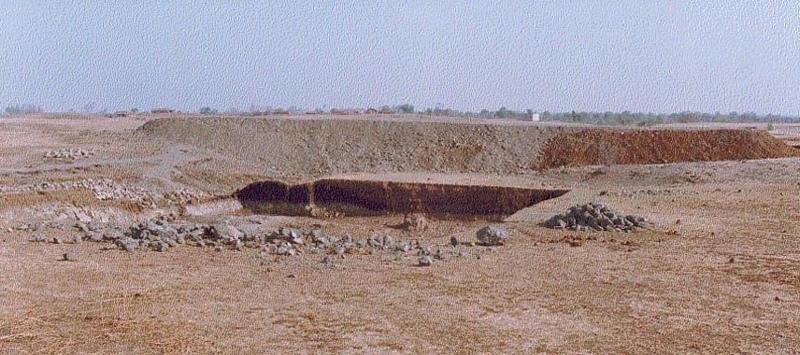
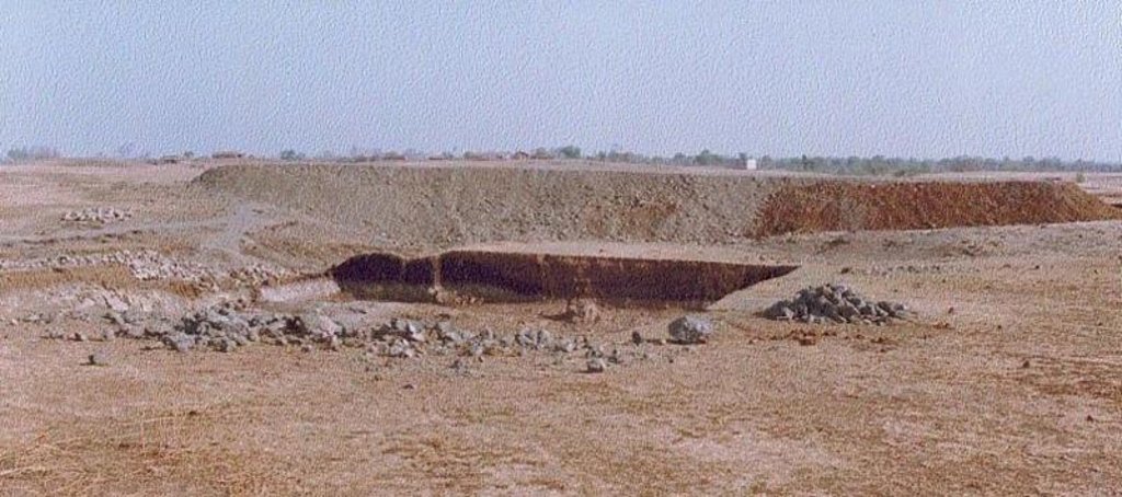
Dugout pond is a sunken water harvesting structure constructed along the rills in upper catchment for the purpose of storage of runoff and recharge of ground water.
2.2 Descrição detalhada da tecnologia
Descrição:
Dugout pond is a rectangular shape subsurface pond with the excavated material forming an embankment down stream. It is constructed in the upper catchment of the watershed, along the rill/shallow gully. The site for the pond should be where there is a depression. The size may vary from small to large depending on the size of catchment, needs of the farmers, availability of finance, bed rock strata.
Purpose of the Technology: 1- Storage of runoff. 2- Increase in water levels of shallow wells 'odees' through increased percolation. 3- Flood control through series of such structures. 4- Low cost, low risk alternative for poor community. 5- Benefits to community living in upper catchment.
Establishment / maintenance activities and inputs: 1- Site selection with community. 2- Design and preparation of estimate by the project staff. 3- Descussion with VWDC and community, identification of users, descussion regarding contribution, agreement, work plan. 4- Layout and construction under VWDC supervision with technical support from the project. 5- Treatment of catchment.
Natural / human environment: Responsibility of user group.
2.3 Fotos da tecnologia
2.5 País/região/locais onde a tecnologia foi aplicada e que estão cobertos nesta avaliação
País:
Índia
Região/Estado/Província:
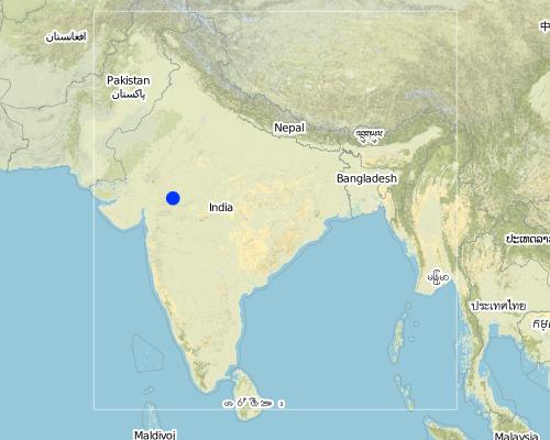
Madhya Pradesh
Map
×2.6 Data da implementação
Caso o ano exato seja desconhecido, indique a data aproximada:
- menos de 10 anos atrás (recentemente)
2.7 Introdução da tecnologia
Especifique como a tecnologia foi introduzida:
- através de projetos/intervenções externas
Comentários (tipos de projeto, etc.):
The technology has been developed by the project as modification/improvement to Dugout pond constructed under NWDPRA (National Watershed Development Program for Rainfed Areas).
3. Classificação da tecnologia de GST
3.1 Principal/principais finalidade(s) da tecnologia
- Adaptar a mudanças climáticas/extremos e seus impactos
3.2 Tipo(s) atualizado(s) de uso da terra onde a tecnologia foi aplicada

Pastagem
Comentários:
Major land use problems (compiler’s opinion): 1. Utilisation of slopy and stony (class VI) land for agriculture. 2. Agriculture practices along the slope, use of erosion permitting crop eg. Cotton, Maize. 3. Excessive grazing of grass land.
Major land use problems (land users’ perception): shallow soils, low soil moisture , low yields , non-availability of grazing land.
Type of cropping system and major crops comments: Monsoon - Cotton + Maize + Blackgram /Soyabean. Winter (with irrigation) - Wheat + Gram (excluding Cotton fields).
3.3 Mais informações sobre o uso da terra
Abastecimento de água para a terra na qual a tecnologia é aplicada:
- Precipitação natural
Comentários:
Water supply: Also mixed rainfed - irrigated
Número de estações de cultivo por ano:
- 2
Especifique:
Longest growing period in days: 150 Longest growing period from month to month: Nov - Mar Second longest growing period in days: 135 Second longest growing period from month to month: Jun - Sep
3.4 Grupo de GST ao qual pertence a tecnologia
- Coleta de água
- Gestão de irrigação (inclusive abastecimento de água, drenagem)
- Gestão do lençol freático
3.5 Difusão da tecnologia
Especifique a difusão da tecnologia:
- Uniformemente difundida numa área
Caso a tecnologia seja uniformemente difundida numa área, indique a área coberta aproximada:
- 10-100 km2
Comentários:
Total area covered by the SLM Technology is 48 m2.
The area comprises 36 villages with 1632 household mainly tribal. Villages comprise a larger settlement along with a number of hamlets. The topography is rolling and gently undulating. The area forms the catchment of the Larki stream, which forms the upper catchment of the river Mahi.
3.7 Principais tipos de degradação da terra abordados pela tecnologia

Erosão do solo pela água
- Wg: Erosão por ravinas/ravinamento

Degradação da água
- Ha: aridificação
Comentários:
Main type of degradation addressed: Ha: aridification
Secondary types of degradation addressed: Wg: gully erosion / gullying
Main causes of degradation: other human induced causes (specify) (Social causes - Lack of awareness and mobilisation amongst the communities.), Top down approach (Macro planning rather than micro (village level) planning.)
4. Especificações técnicas, implementação de atividades, entradas e custos
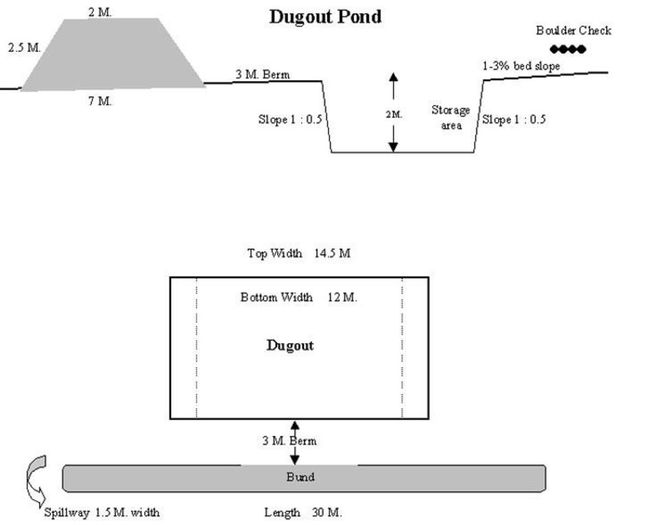
4.1 Desenho técnico da tecnologia
4.2 Especificações técnicas/ explicações do desenho técnico
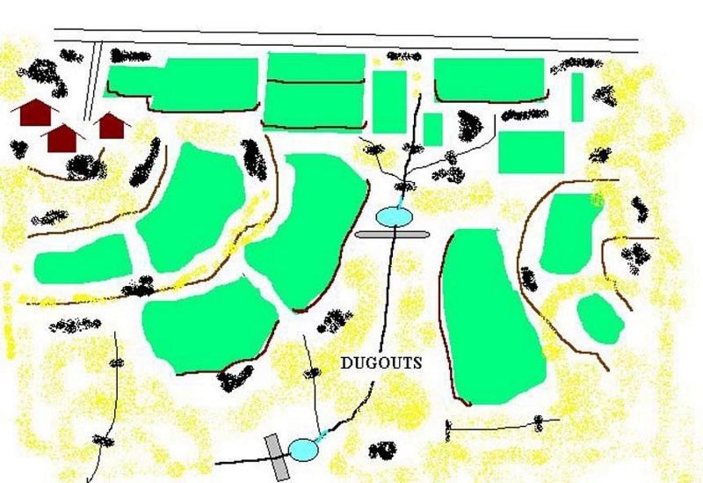
Technical Drawing of Dugout Pond
Technical knowledge required for field staff / advisors: moderate
Technical knowledge required for land users: low
Main technical functions: increase of infiltration
Secondary technical functions: control of dispersed runoff: retain / trap, water harvesting / increase water supply
Construction material (earth): Excavated material used for embankment.
Construction material (stone): Excavated stones used for pitching.
4.3 Informação geral em relação ao cálculo de entradas e custos
Outro/moeda nacional (especifique):
Rupees
Indique a taxa cambial do dólar norte americano para a moeda local (se relevante): 1 USD =:
48,85
Indique a média salarial da mão-de-obra contratada por dia:
1.00
4.4 Atividades de implantação
| Atividade | Tipo de medida | Periodicidade | |
|---|---|---|---|
| 1. | Discussion in VWDC meeting | Estrutural | March-April |
| 2. | Site selection | Estrutural | March-April |
| 3. | Identification of beneficiaries, users group formation | Estrutural | March-April |
| 4. | Design & estimate | Estrutural | March-April |
| 5. | Agreement with VWDC | Estrutural | March-April |
| 6. | Treatment of catchment area | Estrutural | April-May |
| 7. | Construction of dugout pond | Estrutural | April-May |
| 8. | Seeding of embankment | Estrutural | June-July |
4.5 Custos e entradas necessárias para a implantação
Comentários:
Duration of establishment phase: 12 month(s)
4.6 Atividades recorrentes/manutenção
| Atividade | Tipo de medida | Periodicidade/frequência | |
|---|---|---|---|
| 1. | Monitoring by users group | Estrutural | Year around/Regular |
| 2. | Report of damage, breakage in VWDC | Estrutural | Rainy season/After heavy shower |
| 3. | Decision regarding repair by VWDC/UG | Estrutural | Rainy season/After heavy shower |
| 4. | Necessary repaires carried out | Estrutural | Rainy season/After heavy shower |
| 5. | Desilting | Estrutural | Dry season/annual |
4.7 Custos e entradas necessárias pata a manutenção/atividades recorrentes (por ano)
Comentários:
The size of dugout described in 2.7.1 is :- Excavated area - 13m long X 12m wide X 2.5m Bund - 30m long X2.5m height X 2m top width X 7m bottom width
4.8 Fatores mais importantes que afetam os custos
Descreva os fatores mais determinantes que afetam os custos:
1- Cost of excavation increases with hardness of strata. 2- Non availability of stones locally for pitching.
5. Ambiente natural e humano
5.1 Clima
Precipitação pluviométrica anual
- <250 mm
- 251-500 mm
- 501-750 mm
- 751-1.000 mm
- 1.001-1.500 mm
- 1.501-2.000 mm
- 2.001-3.000 mm
- 3.001-4.000 mm
- > 4.000 mm
Especifique a média pluviométrica anual em mm (se conhecida):
800,00
Especificações/comentários sobre a pluviosidade:
However for the past 4 years the area has received below average rainfall.
Zona agroclimática
- Semiárido
90 - 120 days LGP - monsoon
5.2 Topografia
Declividade média:
- Plano (0-2%)
- Suave ondulado (3-5%)
- Ondulado (6-10%)
- Moderadamente ondulado (11-15%)
- Forte ondulado (16-30%)
- Montanhoso (31-60%)
- Escarpado (>60%)
Formas de relevo:
- Planalto/planície
- Cumes
- Encosta de serra
- Encosta de morro
- Sopés
- Fundos de vale
Zona de altitude:
- 0-100 m s.n.m.
- 101-500 m s.n.m.
- 501-1.000 m s.n.m.
- 1.001-1.500 m s.n.m.
- 1.501-2.000 m s.n.m.
- 2.001-2.500 m s.n.m.
- 2.501-3.000 m s.n.m.
- 3.001-4.000 m s.n.m.
- > 4.000 m s.n.m.
Comentários e outras especificações sobre a topografia:
Landforms: Ridges (ranked 1, gradually undulating topography) and hill slopes (ranked 2)
Slopes on average: Moderate (ranked 1, fields in upper catchment) and gentle (ranked 2, fields in valley portion)
5.3 Solos
Profundidade do solo em média:
- Muito raso (0-20 cm)
- Raso (21-50 cm)
- Moderadamente profundo (51-80 cm)
- Profundo (81-120 cm)
- Muito profundo (>120 cm)
Textura do solo (solo superficial):
- Médio (limoso, siltoso)
Matéria orgânica do solo superficial:
- Baixo (<1%)
Caso disponível anexe a descrição completa do solo ou especifique as informações disponíveis, p. ex. tipo de solo, PH/acidez do solo, nitrogênio, capacidade de troca catiônica, salinidade, etc.
Soil depth on average: Shallow (ranked 1, fields on ridge/slopes), very shallow (ranked 2, ridge portion) and moderately deep (ranked 3, fields in valley)
Soil fertility: Medium (ranked 1) and low (ranked 2, fields on ridge/slopes, grass land)
Soil drainage/infiltration: Good (ranked 1, sloping land, shallow soils) and medium (ranked 2, fields in valley)
Soil water storage capacity: Low (ranked 1, shallow soils) and medium (ranked 2, deep soils)
5.6 Características dos usuários da terra que utilizam a tecnologia
Rendimento não agrícola:
- 10-50% de toda renda
Nível relativo de riqueza:
- Pobre
- Média
Indique outras características relevantes dos usuários da terra:
Population density: 200-500 persons/km2
Annual population growth: > 4%
33% of the land users are average wealthy and own 33% of the land (Few farmers with wells, fields in valley.).
50% of the land users are poor and own 57% of the land (Majority of farmers.).
17% of the land users are poor and own 10% of the land (Very small holding.).
Off-farm income specification: While main income is from rainfed agriculture, significant income is obtained during migration, which increases during drought periods.
Level of mechanization: Animal traction (ranked 1, land preparation), manual labour (ranked 2, land preparation, weeding, harvesting) and mechanised (ranked 3, threshing)
5.8 Propriedade de terra, direitos de uso da terra e de uso da água
Propriedade da terra:
- Comunitário/rural
Direitos do uso da terra:
- Acesso livre (não organizado)
- Indivíduo
6. Impactos e declarações finais
6.4 Análise do custo-benefício
Como os benefícios se comparam aos custos de implantação (do ponto de vista dos usuários da terra)?
Retornos a curto prazo:
neutro/balanceado
Retornos a longo prazo:
positivo
Como os benefícios se comparam aos custos recorrentes/de manutenção(do ponto de vista dos usuários da terra)?
Retornos a curto prazo:
positivo
Retornos a longo prazo:
positivo
6.5 Adoção da tecnologia
Se disponível, determine a quantidade (número de unidades familiares e/ou área abordada):
1672
Comentários:
100% of land user families have adopted the Technology with external material support
1632 land user families have adopted the Technology with external material support
Comments on acceptance with external material support: estimates
40 land user families have adopted the Technology without any external material support
Comments on spontaneous adoption: survey results
There is a little trend towards spontaneous adoption of the Technology
Comments on adoption trend: The community is very poor and hence requires some financial support to offset loss of wages.
Links e módulos
Expandir tudo Recolher tudoLinks

Comprehensive watershed development [Índia]
Participatory approach that includes a package of measures leading to empowerment of communities to implement and sustain watershed development.
- Compilador/a: David Gandhi
Módulos
Não há módulos


