Micro irrigation in poplar plantation [Afeganistão]
- Criação:
- Atualização:
- Compilador/a: Aqila Haidery
- Editor: –
- Revisor: Deborah Niggli
Abyari joychayi
technologies_1603 - Afeganistão
Veja as seções
Expandir tudo Recolher tudo1. Informação geral
1.2 Detalhes do contato das pessoas capacitadas e instituições envolvidas na avaliação e documentação da tecnologia
Especialista em GST:
Especialista em GST:
Nome da(s) instituição(ões) que facilitou(ram) a documentação/ avaliação da Tecnologia (se relevante)
HELVETAS (Swiss Intercooperation)1.3 Condições em relação ao uso da informação documentada através de WOCAT
Quando os dados foram compilados (no campo)?
10/05/2014
O/a compilador/a e a(s) pessoa(s) capacitada(s) aceitam as condições relativas ao uso de dados documentados através da WOCAT:
Sim
1.4 Declaração de sustentabilidade da tecnologia descrita
A tecnologia descrita aqui é problemática em relação a degradação da terra de forma que não pode ser declarada uma tecnologia de gestão sustentável de terra?
Não
2. Descrição da tecnologia de GST
2.1 Descrição curta da tecnologia
Definição da tecnologia:
Micro irrigation canal system for supplying water to poplar plantations on sloping lands.
2.2 Descrição detalhada da tecnologia
Descrição:
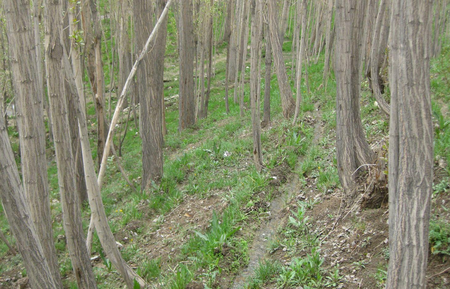
The Micro Irrigation system technology is documented by SLM Project/HELVETAS Swiss Intercooperation with financial support of Swiss Agency for Development and Cooperation (SDC). The presented micro-irrigation system, a structural SLM technology, was applied in Central Highland’s Province of Bamyan (Afghanistan). The micro-irrigation technology is applied to bring marginal land under cultivation for economic benefits, with the added benefit of rehabilitating degraded sloping land. The main irrigation canal also conveys water to agricultural land. It is a traditional technology applied by a land user without external support. It is also implemented by many other land users with some variations to the technology.
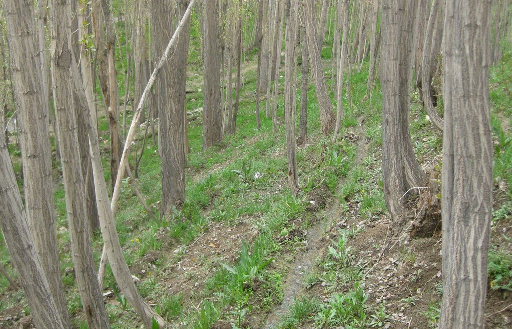
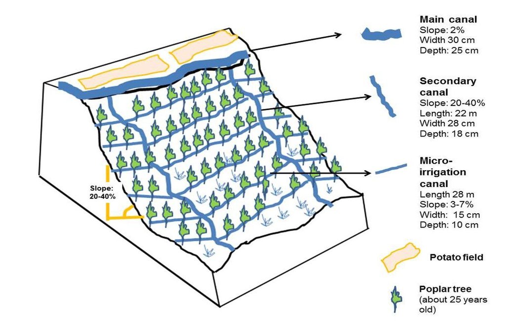
The technology consists of a network of main irrigation canal, secondary canals from which water is conveyed to sloping micro irrigation canals. The water reaches to the roots of each tree through infiltration/seepage.
The main canal has about 2% gradient and the micro-channels from 2-7% gradient. The slope of the site ranges between 20-40%. A micro irrigation canal is 28 m long, 15 cm wide and 10 cm deep. While the cross section remains same, the length can differ according to the land size.
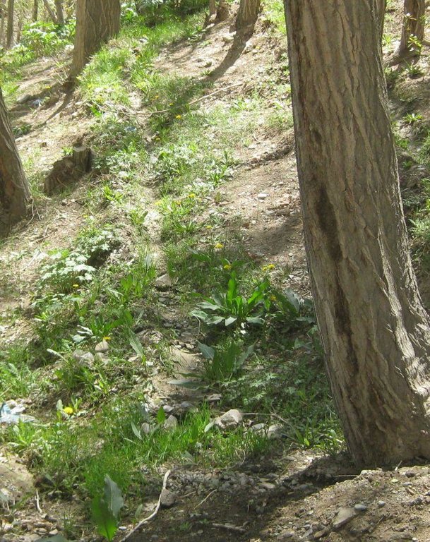
The site was originally a degraded site with gravel soil. According to the land user, the site was not at all suitable for agriculture due to soil degradation and bad water shortage possibilities. Approximately 25 years after the plantation of poplar trees, the site's physical and biological conditions of the slope have improved due to the establishment of poplar trees. The poplar trees can be used for timber for construction and firewood. The poplar timber has good market in Bamyan and can fetch up to 35 USD per tree.
The micro-irrigation systems, which help establishing poplar plantations, contribute to multiple benefits for the land user's family and also the environment. As the poplar plantations are irrigated, their growth increases and their mortality, due to water shortage, is reduced.
As a result of re-vegetating the relatively steep slope, soil erosion from the site has reduced and the fertility of the soil has improved. Improved soil moisture and fertility has also helped in establishment of a good ground canopy. Many birds visit the site for shelter. The plantation has reached its harvesting stage and the land user is planning to cut the trees for sale, expecting an income of about 10,500 USD from the site.
A close look at this technology shows that the system works well and that it is easily managed by the land user. Some minor improvements, such as reducing the slope gradient of the micro-irrigation canals for reducing canal erosion, construction of pits to capture sediments at the drainage points and planting suitable grasses with good roots along the canal bunds could make the system more effective and sustainable. The measures could also help in reducing the sensitivity of the micro-irrigation canals towards intense rainfall.
The farmers are applying this SLM technology without any external financial or technical support and there is growing trend towards spontaneous adoption. According to the land user's estimate, of about 400 families in his village, 80 families have applied the technology
The basic purpose of the micro-irrigation system is to supply irrigation water to the poplar trees for reducing plant mortality and increasing plant growth.
The main establishment activities include layout of the micro canals across the sloping land using shovels and pick axe without use of any alignment equipment. Approximately 150 persons-days/ha were employed for constructing the micro-irrigation canals and 5 person-days/ha sufficed for on-site maintenance works. About 970 USD/ha was spent on the construction and most of the cost for labour was covered by the family of the owner.
The site is owned by a land user with clear land use rights. The water rights are common and organized as there is a traditional social water management institution (Mirab), which ensures an equitable distribution of irrigation water to all the farmers taking water from the main canal. A command area on a turn-by-turn basis exists. Water users pay service fees to the Mirab mostly in kind. The land users mentioned that they give about 14 kg of wheat and/or potato each year to the Mirab for this site. The land user has to also participate in main canal repair works on a voluntary basis. Bamyan Centre receives about 230 mm rainfall per year. Most of the rain falls in the months of April and May. Winters are severe with temperatures falling below minus 20 degrees. The area receives snowfall up to 180 cm per year in normal years. Bamyan center has an arid and temperate climate with one main growing season of about 6 months, which is from April to September. The plantation site is located at an altitude of about 2300 m. It is north-facing slope with a soil depth of about 30-50 cm. The soil is sandy loam with a medium soil fertility.
2.3 Fotos da tecnologia
2.5 País/região/locais onde a tecnologia foi aplicada e que estão cobertos nesta avaliação
País:
Afeganistão
Região/Estado/Província:
Bamyan
Especificação adicional de localização:
Bamyan center
2.6 Data da implementação
Caso o ano exato seja desconhecido, indique a data aproximada:
- 10-50 anos atrás
2.7 Introdução da tecnologia
Especifique como a tecnologia foi introduzida:
- atráves de inovação dos usuários da terra
Comentários (tipos de projeto, etc.):
The technology is being applied on the site since about 25 years.
3. Classificação da tecnologia de GST
3.1 Principal/principais finalidade(s) da tecnologia
- Melhora a produção
3.2 Tipo(s) atualizado(s) de uso da terra onde a tecnologia foi aplicada

Floresta/bosques
Florestas/bosques (semi)naturais:
- Derrubada seletiva
Plantação de árvores, reflorestamento:
- Monocultura de variedade local
Produtos e serviços:
- Madeira
- Lenha
Comentários:
Major land use problems (compiler’s opinion): Gravely site, shortage of water for irrigation, sloping land affected by soil erosion. Heavy shrub harvesting for firewood and overgrazing on common/rangeland leading to land degradation.
Major land use problems (land users’ perception): Sloping land with sandy soil unsuitable for agriculture.
Plantation forestry: Plantation of poplar trees (mono culture)
Problems / comments regarding forest use: Land users do selective felling when they need cash. The trees are lopped for fuel wood.
Future (final) land use (after implementation of SLM Technology): Forests / woodlands: Fp: Plantations, afforestations
3.3 Mais informações sobre o uso da terra
Número de estações de cultivo por ano:
- 1
Especifique:
Longest growing period in days: 170, Longest growing period from month to month: April to September in the valley bottom
3.4 Grupo de GST ao qual pertence a tecnologia
- Gestão de irrigação (inclusive abastecimento de água, drenagem)
3.5 Difusão da tecnologia
Especifique a difusão da tecnologia:
- Uniformemente difundida numa área
Caso a tecnologia seja uniformemente difundida numa área, indique a área coberta aproximada:
- 0,1-1 km2
Comentários:
Total area covered by the SLM Technology is 0.16 m2.
3.6 Medidas de GST contendo a tecnologia

Medidas estruturais
- S3: Valas graduadas, canais, vias navegáveis
3.7 Principais tipos de degradação da terra abordados pela tecnologia

Degradação biológica
- Bc: redução da cobertura vegetal

Degradação da água
- Ha: aridificação
Comentários:
Main causes of degradation: over-exploitation of vegetation for domestic use (Particulary for firewood), overgrazing (Mainly by sheep and goats), population pressure, inputs and infrastructure: (roads, markets, distribution of water points, other, …) (Lack of irrigation water), governance / institutional (Specifically in the case of common lands)
Secondary causes of degradation: droughts
3.8 Redução, prevenção ou recuperação da degradação do solo
Especifique o objetivo da tecnologia em relação a degradação da terra:
- Reduzir a degradação do solo
4. Especificações técnicas, implementação de atividades, entradas e custos
4.1 Desenho técnico da tecnologia
4.2 Especificações técnicas/ explicações do desenho técnico
Technical specifications of micro-irrigation system for poplar plantation. The system comprises main canal, secondary canals and micro irrigation canals which receive water from and drain into secondary canals.
Location: Tape Chauni. Bamyan Centre
Date: 10 May 2014
Technical knowledge required for field staff / advisors: low
Technical knowledge required for land users: low
Main technical functions: water harvesting / increase water supply
Secondary technical functions: increase of biomass (quantity)
Vertical interval between structures (m): 0.22-0.6
Spacing between structures (m): 1.8-2
Depth of ditches/pits/dams (m): 0.1
Width of ditches/pits/dams (m): 0.15
Length of ditches/pits/dams (m): 0.28
Construction material (earth): Soil from the site is used for canal consturction
Slope (which determines the spacing indicated above): 20-40%
Lateral gradient along the structure: 3-7%
4.3 Informação geral em relação ao cálculo de entradas e custos
Outro/moeda nacional (especifique):
Afghani
Indique a taxa cambial do dólar norte americano para a moeda local (se relevante): 1 USD =:
57,0
Indique a média salarial da mão-de-obra contratada por dia:
70.00
4.4 Atividades de implantação
| Atividade | Tipo de medida | Periodicidade | |
|---|---|---|---|
| 1. | Construction of secondary and micro-irrigation canals | Estrutural | Spring |
4.5 Custos e entradas necessárias para a implantação
| Especifique a entrada | Unidade | Quantidade | Custos por unidade | Custos totais por entrada | % dos custos arcados pelos usuários da terra | |
|---|---|---|---|---|---|---|
| Mão-de-obra | labour | ha | 1,0 | 921,0 | 921,0 | 100,0 |
| Equipamento | tools | ha | 1,0 | 52,0 | 52,0 | 100,0 |
| Custos totais para a implantação da tecnologia | 973,0 | |||||
Comentários:
Duration of establishment phase: 0.25 month(s)
4.6 Atividades recorrentes/manutenção
| Atividade | Tipo de medida | Periodicidade/frequência | |
|---|---|---|---|
| 1. | Maintenance of canals | Estrutural | Spring/once per year |
4.7 Custos e entradas necessárias pata a manutenção/atividades recorrentes (por ano)
| Especifique a entrada | Unidade | Quantidade | Custos por unidade | Custos totais por entrada | % dos custos arcados pelos usuários da terra | |
|---|---|---|---|---|---|---|
| Mão-de-obra | labour | ha | 1,0 | 30,0 | 30,0 | 100,0 |
| Equipamento | tools | ha | 1,0 | 52,0 | 52,0 | 100,0 |
| Custos totais para a manutenção da tecnologia | 82,0 | |||||
Comentários:
Machinery/ tools: Pick axe and shovels
The presented costs were calculated on the basis of the exisiting local labour rate and the currency exchange rate which may vary from one year to another. For instance in 2010/11, 1 USD was 50 Afghani.
The cost of payment to the Mirab (Water distributor appointed by the land users) is not included. According to the land user, the Mirabs receive about 700 kg wheat/year from all the land users who use the main canal.
4.8 Fatores mais importantes que afetam os custos
Descreva os fatores mais determinantes que afetam os custos:
Labour is the most determinate factor affecting the costs. All the work is done manually.
5. Ambiente natural e humano
5.1 Clima
Precipitação pluviométrica anual
- <250 mm
- 251-500 mm
- 501-750 mm
- 751-1.000 mm
- 1.001-1.500 mm
- 1.501-2.000 mm
- 2.001-3.000 mm
- 3.001-4.000 mm
- > 4.000 mm
Especificações/comentários sobre a pluviosidade:
Most rainfall is in May. According to provincial agriculture department, Bamyan centre receives about 230 mm rain a year
Zona agroclimática
- Semiárido
Thermal climate class: temperate. Winter temperatures can go below minus 20 degree C and maximum in summer up to 34 degree C
5.2 Topografia
Declividade média:
- Plano (0-2%)
- Suave ondulado (3-5%)
- Ondulado (6-10%)
- Moderadamente ondulado (11-15%)
- Forte ondulado (16-30%)
- Montanhoso (31-60%)
- Escarpado (>60%)
Formas de relevo:
- Planalto/planície
- Cumes
- Encosta de serra
- Encosta de morro
- Sopés
- Fundos de vale
Zona de altitude:
- 0-100 m s.n.m.
- 101-500 m s.n.m.
- 501-1.000 m s.n.m.
- 1.001-1.500 m s.n.m.
- 1.501-2.000 m s.n.m.
- 2.001-2.500 m s.n.m.
- 2.501-3.000 m s.n.m.
- 3.001-4.000 m s.n.m.
- > 4.000 m s.n.m.
5.3 Solos
Profundidade do solo em média:
- Muito raso (0-20 cm)
- Raso (21-50 cm)
- Moderadamente profundo (51-80 cm)
- Profundo (81-120 cm)
- Muito profundo (>120 cm)
Textura do solo (solo superficial):
- Grosso/fino (arenoso)
- Médio (limoso, siltoso)
Matéria orgânica do solo superficial:
- Médio (1-3%)
5.4 Disponibilidade e qualidade de água
Lençol freático:
5-50 m
Disponibilidade de água de superfície:
Bom
Qualidade da água (não tratada):
apenas para uso agrícola (irrigação)
5.5 Biodiversidade
Diversidade de espécies:
- Médio
5.6 Características dos usuários da terra que utilizam a tecnologia
Orientação de mercado do sistema de produção:
- Misto (subsistência/comercial)
Rendimento não agrícola:
- 10-50% de toda renda
Nível relativo de riqueza:
- Média
Indivíduos ou grupos:
- Indivíduo/unidade familiar
Gênero:
- Homens
Indique outras características relevantes dos usuários da terra:
Land users applying the Technology are mainly common / average land users
Difference in the involvement of women and men: Women are however involved in other agriculture works but at the plantation site, they are not involved at all. The land user has about 0.4 ha irrigated crop land used for potato and wheat cultivation on a rotation basis.
Population density: 10-50 persons/km2
Annual population growth: 2% - 3%
Off-farm income specification: The land user family is food secure from its own production for up to 6 months only. For food security for 12 months, they have to depend on other sources of off farm income. The agriculture land is not enough to meet all the family needs.
5.7 Média da área de terra própria ou arrendada por usuários da terra que utilizam a tecnologia
- < 0,5 ha
- 0,5-1 ha
- 1-2 ha
- 2-5 ha
- 5-15 ha
- 15-50 ha
- 50-100 ha
- 100-500 ha
- 500-1.000 ha
- 1.000-10.000 ha
- > 10.000 ha
É considerado pequena, média ou grande escala (referente ao contexto local)?
- Pequena escala
5.8 Propriedade de terra, direitos de uso da terra e de uso da água
Propriedade da terra:
- Indivíduo, intitulado
Direitos do uso da terra:
- Arrendado
Direitos do uso da água:
- Comunitário (organizado)
Comentários:
For water distribution, there is a traditional system called as Mirab which is applied for the plantations as well. The land user applying the plantation/micro-irrigation technique have to participate in main irrigation canal repair and cleaning works. The land user also has to pay in kind or cash to the Mirab for his services.
5.9 Acesso a serviços e infraestrutura
Saúde:
- Pobre
- Moderado
- Bom
Educação:
- Pobre
- Moderado
- Bom
Assistência técnica:
- Pobre
- Moderado
- Bom
Emprego (p. ex. não agrícola):
- Pobre
- Moderado
- Bom
Mercados:
- Pobre
- Moderado
- Bom
Energia:
- Pobre
- Moderado
- Bom
Vias e transporte:
- Pobre
- Moderado
- Bom
Água potável e saneamento:
- Pobre
- Moderado
- Bom
Serviços financeiros:
- Pobre
- Moderado
- Bom
6. Impactos e declarações finais
6.1 Impactos no local mostrados pela tecnologia
Impactos socioeconômicos
Produção
Produção de forragens
Produção de madeira
Comentários/especificar:
Irrigation helps in Poplar establishment and growth
Risco de falha de produção
Comentários/especificar:
Important for reducing plant mortality
Área de produção
Comentários/especificar:
The area was degraded before
Geração de energia
Disponibilidade e qualidade de água
Disponibilidade de água para irrigação
Comentários/especificar:
For plantations
Renda e custos
Rendimento agrícola
Comentários/especificar:
From sale of poplar trees but only in the long term
Carga de trabalho
Comentários/especificar:
Irrigation needs more time and labour
Impactos socioculturais
Oportunidades de lazer
Conhecimento de GST/ degradação da terra
Comentários/especificar:
Other land users see and learn
Atenuação de conflitos
Fuel wood sufficiency
Comentários/especificar:
Lopped branches are used for fuel wood
contribution to human well-being
Comentários/especificar:
The technology contributes to increased household income in the long term and also towards increased production of fodder, fuel wood and timber.
Impactos ecológicos
Solo
Umidade do solo
Matéria orgânica do solo/carbono abaixo do solo
Comentários/especificar:
Due to build of humus and ground cover
Biodiversidade: vegetação, animais
Biomassa/carbono acima do solo
Comentários/especificar:
Due to plantations
Diversidade vegetal
Comentários/especificar:
due to increased soil moisture
Diversidade animal
Comentários/especificar:
habitat for birds
Controle de praga/doença
Clima e redução de riscos de desastre
Velocidade do vento
Comentários/especificar:
Due to plantations (indirect impact)
6.2 Impactos externos mostrados pela tecnologia
Capacidade de tamponamento/filtragem
Comentários/especificar:
Due to plantations
Sedimentos transportados pelo vento
Comentários/especificar:
Plantations impact
Danos na infraestrutura pública/privada
Comentários/especificar:
Due to less sedimentation and runoff from the site
6.3 Exposição e sensibilidade da tecnologia às mudanças climáticas graduais e extremos/desastres relacionados ao clima (conforme o ponto de vista dos usuários da terra)
Mudança climática gradual
Mudança climática gradual
| Estação do ano | Tipo de mudança climática/extremo | Como a tecnologia lida com isso? | |
|---|---|---|---|
| Temperatura anual | aumento | bem |
Extremos (desastres) relacionados ao clima
Desastres meteorológicos
| Como a tecnologia lida com isso? | |
|---|---|
| Temporal local | não bem |
Desastres climatológicos
| Como a tecnologia lida com isso? | |
|---|---|
| Seca | não bem |
Desastres hidrológicos
| Como a tecnologia lida com isso? | |
|---|---|
| Inundação geral (rio) | não bem |
Comentários:
Stabilize the technology with grasses and reduce the slope of the channels so that it is less sensitive to increase in rainfall intensities.
6.4 Análise do custo-benefício
Como os benefícios se comparam aos custos de implantação (do ponto de vista dos usuários da terra)?
Retornos a curto prazo:
negativo
Retornos a longo prazo:
muito positivo
Como os benefícios se comparam aos custos recorrentes/de manutenção(do ponto de vista dos usuários da terra)?
Retornos a curto prazo:
levemente negativo
Retornos a longo prazo:
muito positivo
Comentários:
The returns in the form of cash start coming after 10-12 years with this poplar variety following a selective felling and replanting approach.
6.5 Adoção da tecnologia
Entre todos aqueles que adotaram a tecnologia, quantos adotaram espontaneamente, ou seja, sem receber nenhum incentivo material/pagamentos?
- 90-100%
Comentários:
100% of land user families have adopted the Technology without any external material support
80 land user families have adopted the Technology without any external material support
The total area under this plantation in the village is estimated to be 16 ha (80 jerib)
There is a small growing trend towards the adoption of the technology by communities and individuals in the area. Adoption depends on (and is hampered by) the availability of a reliable water source near the sites with potential for plantation and also about the land.
6.7 Pontos fortes/vantagens/oportunidades da tecnologia
| Pontos fortes/vantagens/oportunidades na visão do usuário da terra |
|---|
| The technology helps successful establishment of poplar trees and also natural grasses on sloping lands. |
| Pontos fortes/vantagens/oportunidades na visão do/a compilador/a ou de outra pessoa capacitada |
|---|
| Micro-irrigation technology is important for the establishment and maintenance of poplar plantations. The technology is adapted for afforestation of sloping land. |
| The technology does not require much maintenance once the plantations are well established. A special attention need to be given to the secondary canals. |
| No external support for establishing or maintaining the technology. |
| The technology helps in improving the site's micro climate which leads to more plant and animal (bird) diversity. |
6.8 Pontos fracos, desvantagens/riscos da tecnologia e formas de superá-los
| Pontos fracos/desvantagens/riscos na visão do usuário da terra | Como eles podem ser superados? |
|---|---|
| There is no information available regarding the land user's view on the weaknesses of this technology. |
| Pontos fracos/vantagens/riscos na visão do/a compilador/a ou de outra pessoa capacitada | Como eles podem ser superados? |
|---|---|
| The canals break at some weak points. Also the slopes of the micro channels is more at many places leading to some soil erosion. | Proper alignment of micro-irrigation canals. |
| Rill and gully erosion due to rapid and uncontrolled flow of excessive drainage in secondary canals. | Plant grasses with robust root system along the canals. Strengthen points where water spills from the micro-irrigation canals into the secondary canals with vegetative measures and sediment pits. |
| Due to small sizes of the channels, irrigation needs more time and labour. | Improvements in micro irrigation canals will reduce this problem considering. Interested organisations could carry out action research on how to improve this system by also incorporating efficient water use measures. |
| The technology can be applied only when there is a reliable source of running water. | Action research on soil and water conservation techniques for plantations in areas where there is no easy access to irrigation water. |
7. Referências e links
7.1 Métodos/fontes de informação
- visitas de campo, pesquisas de campo
- entrevistas com usuários de terras
Links e módulos
Expandir tudo Recolher tudoLinks
Não há links
Módulos
Não há módulos


