Cyclopean concrete micro-dams [Mali]
- Criação:
- Atualização:
- Compilador/a: Dieter Nill
- Editor: –
- Revisor: Deborah Niggli
Micro-barrage en béton cyclopéen (French)
technologies_1634 - Mali
Veja as seções
Expandir tudo Recolher tudo1. Informação geral
1.2 Detalhes do contato das pessoas capacitadas e instituições envolvidas na avaliação e documentação da tecnologia
Especialista em GST:
Kone Mamadou Gallo
gallokone@yahoo.fr
IPRO-DB Bélédougou
Mali
Especialista em GST:
Schneider Ralf
ralf_schneider5@hotmail.com
IPRO-DB Bélédougou
Mali
Nome do projeto que facilitou a documentação/avaliação da Tecnologia (se relevante)
Manual of Good Practices in Small Scale Irrigation in the Sahel (GIZ )Nome da(s) instituição(ões) que facilitou(ram) a documentação/ avaliação da Tecnologia (se relevante)
Deutsche Gesellschaft für Internationale Zusammenarbeit (GIZ) GmbH (GIZ) - Alemanha1.3 Condições em relação ao uso da informação documentada através de WOCAT
Quando os dados foram compilados (no campo)?
01/07/2012
O/a compilador/a e a(s) pessoa(s) capacitada(s) aceitam as condições relativas ao uso de dados documentados através da WOCAT:
Sim
1.4 Declaração de sustentabilidade da tecnologia descrita
A tecnologia descrita aqui é problemática em relação a degradação da terra de forma que não pode ser declarada uma tecnologia de gestão sustentável de terra?
Não
2. Descrição da tecnologia de GST
2.1 Descrição curta da tecnologia
Definição da tecnologia:
A water reservoir for growing off-season increases the farmed area, yields and production. A second growing season thus becomes possible.
2.2 Descrição detalhada da tecnologia
Descrição:
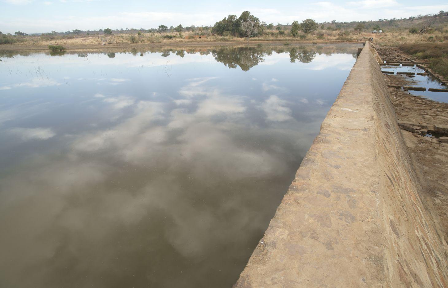
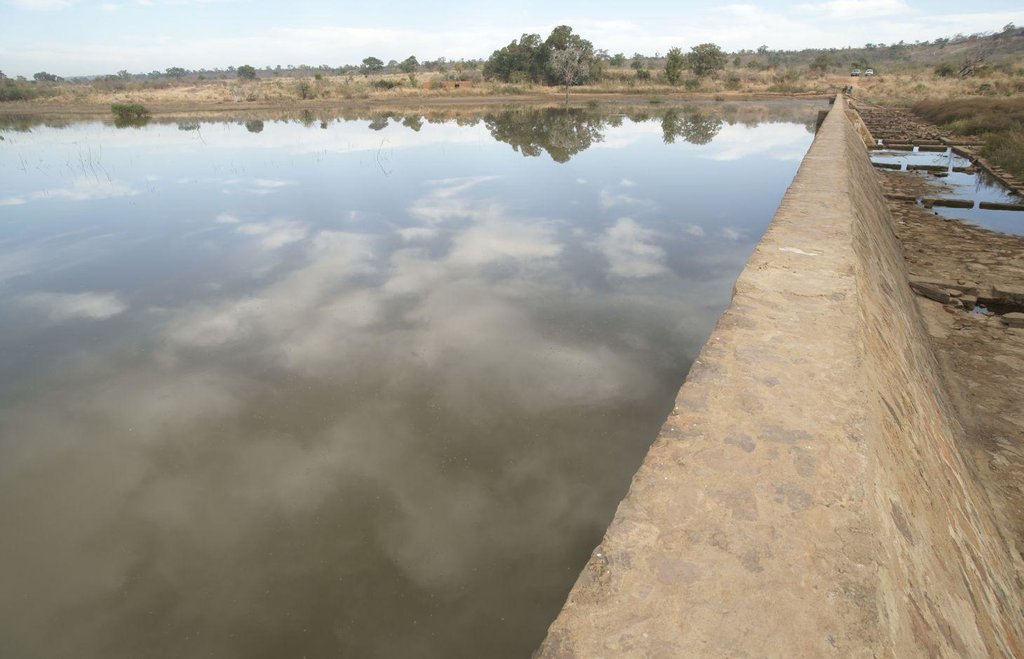
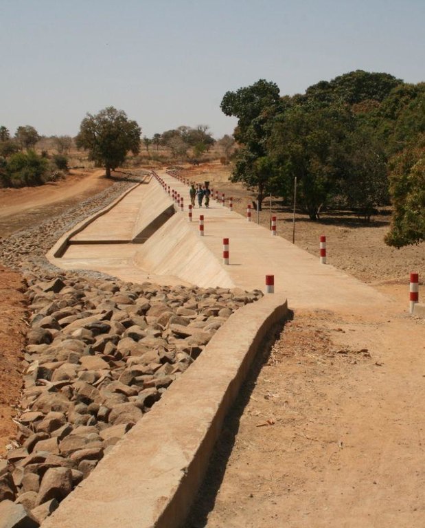
A cyclopean concrete micro-dam is built using dressed stone pointed with concrete. Cyclopean concrete is stronger than rubble stone masonry. The width of the crest is 0.75 metres. The length generally ranges from 150 to 250 metres depending on the site. The height varies between two and four metres. Micro-dams are equipped with buttresses and a stilling basin. The dam can be built in the form of a dam bridge. Each dam is has a stoplog sluice for draining away sediment during the first rains of the season and to regulate water levels. The use of stoplog gates is recommended instead of sluice gates, as the latter are more technically sophisticated and require more maintenance. The dam creates a water reservoir upstream covering an area of between 4 and 15 hectares.
Farming is carried out upstream and downstream in the rainy season and off-season.
The dam increases the amount of available surface water during the rainy season and groundwater during the off-season. Its effect on the water table depends on the depth of the scheme’s foundations: the deeper the foundations, the greater the recharge of ground water.
During the rainy season, the areas are used for rice growing. The wells used for irrigating market gardens are fed from the water table, meaning vegetables can be grown off-season. The water is also used for watering livestock, fish farming and, sometimes, domestic purposes. The dam increases the farmland areas, production and yields. Higher farming revenues lead to improved living conditions.
Initially, an information and awareness-raising workshop on the IPRO-DB approach is organised at the commune level, involving the villages affected by the project. Following this, a general meeting is held to secure the support of the whole village for the development request. The village chief and commune mayor then sign off the request. The project team carries out a scoping study and socio-economic surveys. If the outcomes of the scoping studies and socio-economic surveys are positive, the project team draws up the terms of reference for working with the consultancies. This stage is followed by the selection of consultancies through tender processes to carry out the technical studies and produce the invitation to tender document, all of which will be overseen by the project team. The village then makes its financial contribution towards the project, the management committee is set up, and organisational and technical training is provided to beneficiaries. The final stages comprise the partial acceptance of the building works (for example, foundations, wall, buttresses, stilling basin, gabion reinforcements, etc.), the monitoring of scheme building works by the project team, payment for activities on a unit-price basis, and interim acceptance leading to final acceptance after one year. A management committee takes charge of opening and closing the stoplog gates, organises the maintenance of the scheme and institutes additional measures to protect the scheme (gabions, stone bunds, etc.). It collects and manages maintenance fees, ensures the committee’s rules of procedure are adhered to and organises meetings of local producers. With minimum levels of maintenance, a scheme will remain functional for at least 20 years. Sustainable farming and management depend directly on employing a participatory approach.
Roles of the actors involved: Beneficiaries provide labour and financial resources, and conduct monitoring and the small-scale maintenance of the scheme. The project team provides funding, training and beneficiary support, carries out studies and capitalises on project data. The commune signs off the village request and repairs major damage (an activity that has so far been undertaken by the project team). Consultancies and contractors conduct surveys, carry out building work and are responsible for oversight. Rural engineers: quarterly inspections are carried out by the Regional Directorate of Rural Engineering and the Regional Directorate of Agriculture.
Since 2010, four dams were built so far in the Kolokani Circle (Tiembougou, Bamabougou, Korokabougou, Tienko). Others are currently being planned. The practice is recommended for areas lacking the right kind of stone for dressing (dolerite).
2.3 Fotos da tecnologia
2.5 País/região/locais onde a tecnologia foi aplicada e que estão cobertos nesta avaliação
País:
Mali
Região/Estado/Província:
Mali
Especificação adicional de localização:
Kolokani Circle (Tiembougou, Bamabougou, Korokabougou, Tienko)
2.6 Data da implementação
Caso o ano exato seja desconhecido, indique a data aproximada:
- menos de 10 anos atrás (recentemente)
2.7 Introdução da tecnologia
Especifique como a tecnologia foi introduzida:
- através de projetos/intervenções externas
Comentários (tipos de projeto, etc.):
since 2010 by IPRO-DB Bélédougou
3. Classificação da tecnologia de GST
3.1 Principal/principais finalidade(s) da tecnologia
- Melhora a produção
3.2 Tipo(s) atualizado(s) de uso da terra onde a tecnologia foi aplicada

Terra de cultivo
- Cultura anual

Misto (plantação, pastagem, árvores) inclusive agrofloresta
- Agropecuária
Comentários:
Major land use problems (compiler’s opinion): lack and loss of surface water and groundwater
3.3 Mais informações sobre o uso da terra
Abastecimento de água para a terra na qual a tecnologia é aplicada:
- Misto de precipitação natural-irrigado
Número de estações de cultivo por ano:
- 1
Especifique:
Longest growing period in days: 120, Longest growing period from month to month: August-November
Densidade animal (se relevante):
1-10 LU /km2
3.4 Grupo de GST ao qual pertence a tecnologia
- Gestão de irrigação (inclusive abastecimento de água, drenagem)
- Desvio e drenagem de água
- Gestão de água de superfície (nascente, rio, lagos, mar)
3.5 Difusão da tecnologia
Especifique a difusão da tecnologia:
- Uniformemente difundida numa área
Caso a tecnologia seja uniformemente difundida numa área, indique a área coberta aproximada:
- 0,1-1 km2
Comentários:
Four dams built so far. Others are currently being planned.
3.6 Medidas de GST contendo a tecnologia

Medidas estruturais
- S5: Represa, bacia, lago
3.7 Principais tipos de degradação da terra abordados pela tecnologia

Degradação biológica
- Bc: redução da cobertura vegetal

Degradação da água
- Ha: aridificação
- Hs: mudança na quantidade de água de superfície
- Hg: mudança no lençol freático/aquífero
Comentários:
Main causes of degradation: over abstraction / excessive withdrawal of water (for irrigation, industry, etc.)
3.8 Redução, prevenção ou recuperação da degradação do solo
Especifique o objetivo da tecnologia em relação a degradação da terra:
- Prevenir degradação do solo
- Recuperar/reabilitar solo severamente degradado
4. Especificações técnicas, implementação de atividades, entradas e custos
4.2 Especificações técnicas/ explicações do desenho técnico
Technical knowledge required for field staff / advisors: high
Technical knowledge required for land users: low
Main technical functions: increase of infiltration, increase / maintain water stored in soil, increase of groundwater level / recharge of groundwater, water harvesting / increase water supply, water spreading
Dam/ pan/ pond
Depth of ditches/pits/dams (m): 2-4
Width of ditches/pits/dams (m): 0.75
Length of ditches/pits/dams (m): 150-250
4.3 Informação geral em relação ao cálculo de entradas e custos
Outro/moeda nacional (especifique):
CFA Franc
Indique a taxa cambial do dólar norte americano para a moeda local (se relevante): 1 USD =:
517,0
4.4 Atividades de implantação
| Atividade | Tipo de medida | Periodicidade | |
|---|---|---|---|
| 1. | information and awareness-raising workshop on the IPRO-DB approach is organised at the commune level | Estrutural | |
| 2. | a general meeting is held to secure the support of the whole village for the development request | Estrutural | |
| 3. | The project team carries out a scoping study and socio-economic surveys | Estrutural | |
| 4. | draw up the terms of reference for working with the consultancies | Estrutural | |
| 5. | carry out the technical studies | Estrutural | |
| 6. | management committee is set up, and organisational and technical training is provided to beneficiaries | Estrutural | |
| 7. | building works (foundations, wall, buttresses, stilling basin, gabion reinforcements, etc.), | Estrutural |
4.5 Custos e entradas necessárias para a implantação
| Especifique a entrada | Unidade | Quantidade | Custos por unidade | Custos totais por entrada | % dos custos arcados pelos usuários da terra | |
|---|---|---|---|---|---|---|
| Outros | total construction | 1,0 | 271379,0 | 271379,0 | 100,0 | |
| Custos totais para a implantação da tecnologia | 271379,0 | |||||
4.6 Atividades recorrentes/manutenção
| Atividade | Tipo de medida | Periodicidade/frequência | |
|---|---|---|---|
| 1. | A management committee takes charge of opening and closing the stoplog gates, organises the maintenance of the scheme and institutes additional measures to protect the scheme (gabions, stone bunds, etc.). It collects and manages maintenance fees, ensures the committee’s rules of procedure are adhered to and organises meetings of local producers. | Estrutural |
4.8 Fatores mais importantes que afetam os custos
Descreva os fatores mais determinantes que afetam os custos:
Each dam costs between 100 and 140 million CFA francs (193'851-271'379 Dollar)
5. Ambiente natural e humano
5.1 Clima
Precipitação pluviométrica anual
- <250 mm
- 251-500 mm
- 501-750 mm
- 751-1.000 mm
- 1.001-1.500 mm
- 1.501-2.000 mm
- 2.001-3.000 mm
- 3.001-4.000 mm
- > 4.000 mm
Zona agroclimática
- Semiárido
Thermal climate class: tropics
5.2 Topografia
Declividade média:
- Plano (0-2%)
- Suave ondulado (3-5%)
- Ondulado (6-10%)
- Moderadamente ondulado (11-15%)
- Forte ondulado (16-30%)
- Montanhoso (31-60%)
- Escarpado (>60%)
Formas de relevo:
- Planalto/planície
- Cumes
- Encosta de serra
- Encosta de morro
- Sopés
- Fundos de vale
Zona de altitude:
- 0-100 m s.n.m.
- 101-500 m s.n.m.
- 501-1.000 m s.n.m.
- 1.001-1.500 m s.n.m.
- 1.501-2.000 m s.n.m.
- 2.001-2.500 m s.n.m.
- 2.501-3.000 m s.n.m.
- 3.001-4.000 m s.n.m.
- > 4.000 m s.n.m.
5.3 Solos
Profundidade do solo em média:
- Muito raso (0-20 cm)
- Raso (21-50 cm)
- Moderadamente profundo (51-80 cm)
- Profundo (81-120 cm)
- Muito profundo (>120 cm)
Textura do solo (solo superficial):
- Médio (limoso, siltoso)
- Fino/pesado (argila)
Matéria orgânica do solo superficial:
- Médio (1-3%)
- Baixo (<1%)
5.4 Disponibilidade e qualidade de água
Lençol freático:
5-50 m
Disponibilidade de água de superfície:
Médio
Qualidade da água (não tratada):
apenas para uso agrícola (irrigação)
5.5 Biodiversidade
Diversidade de espécies:
- Médio
5.6 Características dos usuários da terra que utilizam a tecnologia
Orientação de mercado do sistema de produção:
- Misto (subsistência/comercial)
Rendimento não agrícola:
- 10-50% de toda renda
Nível relativo de riqueza:
- Pobre
- Média
Nível de mecanização:
- Trabalho manual
Gênero:
- Homens
Indique outras características relevantes dos usuários da terra:
Population density: < 10 persons/km2
Annual population growth: 2% - 3%
10% of the land users are rich.
50% of the land users are average wealthy.
30% of the land users are poor.
10% of the land users are very poor.
5.7 Média da área de terra própria ou arrendada por usuários da terra que utilizam a tecnologia
- < 0,5 ha
- 0,5-1 ha
- 1-2 ha
- 2-5 ha
- 5-15 ha
- 15-50 ha
- 50-100 ha
- 100-500 ha
- 500-1.000 ha
- 1.000-10.000 ha
- > 10.000 ha
É considerado pequena, média ou grande escala (referente ao contexto local)?
- Pequena escala
5.8 Propriedade de terra, direitos de uso da terra e de uso da água
Comentários:
The irrigated land is allocated by the chief
5.9 Acesso a serviços e infraestrutura
Saúde:
- Pobre
- Moderado
- Bom
Educação:
- Pobre
- Moderado
- Bom
Assistência técnica:
- Pobre
- Moderado
- Bom
Emprego (p. ex. não agrícola):
- Pobre
- Moderado
- Bom
Mercados:
- Pobre
- Moderado
- Bom
Energia:
- Pobre
- Moderado
- Bom
Vias e transporte:
- Pobre
- Moderado
- Bom
Água potável e saneamento:
- Pobre
- Moderado
- Bom
Serviços financeiros:
- Pobre
- Moderado
- Bom
6. Impactos e declarações finais
6.1 Impactos no local mostrados pela tecnologia
Impactos socioeconômicos
Produção
Produção agrícola
Risco de falha de produção
Área de produção
Renda e custos
Rendimento agrícola
Impactos socioculturais
Segurança alimentar/auto-suficiência
Atenuação de conflitos
contribution to human well-being
Comentários/especificar:
Increased farming revenues lead to improved living conditions
Impactos ecológicos
Ciclo hídrico/escoamento
Quantidade de água
Colheita/recolhimento de água
Lençol freático/aquífero
Solo
Umidade do solo
6.3 Exposição e sensibilidade da tecnologia às mudanças climáticas graduais e extremos/desastres relacionados ao clima (conforme o ponto de vista dos usuários da terra)
Mudança climática gradual
Mudança climática gradual
| Estação do ano | Tipo de mudança climática/extremo | Como a tecnologia lida com isso? | |
|---|---|---|---|
| Temperatura anual | aumento | bem |
Extremos (desastres) relacionados ao clima
Desastres meteorológicos
| Como a tecnologia lida com isso? | |
|---|---|
| Temporal local | bem |
| Tempestade de vento local | bem |
Desastres climatológicos
| Como a tecnologia lida com isso? | |
|---|---|
| Seca | bem |
Desastres hidrológicos
| Como a tecnologia lida com isso? | |
|---|---|
| Inundação geral (rio) | bem |
Outras consequências relacionadas ao clima
Outras consequências relacionadas ao clima
| Como a tecnologia lida com isso? | |
|---|---|
| Período de crescimento reduzido | bem |
6.4 Análise do custo-benefício
Como os benefícios se comparam aos custos de implantação (do ponto de vista dos usuários da terra)?
Retornos a curto prazo:
positivo
Retornos a longo prazo:
positivo
Como os benefícios se comparam aos custos recorrentes/de manutenção(do ponto de vista dos usuários da terra)?
Retornos a curto prazo:
positivo
Retornos a longo prazo:
positivo
6.7 Pontos fortes/vantagens/oportunidades da tecnologia
| Pontos fortes/vantagens/oportunidades na visão do/a compilador/a ou de outra pessoa capacitada |
|---|
| The dam increases the amount of available surface water during the rainy season and groundwater during the off-season. The wells used for irrigating market gardens are fed from the water table, meaning vegetables can be grown off-season. The water is also used for watering livestock, fish farming and, sometimes, domestic purposes. |
| Generation of year-round employment results in a reduction of seasonal outmigration |
| Increased farming revenues lead to improved living conditions |
| Increased farmland areas, increased production and yields |
6.8 Pontos fracos, desvantagens/riscos da tecnologia e formas de superá-los
| Pontos fracos/vantagens/riscos na visão do/a compilador/a ou de outra pessoa capacitada | Como eles podem ser superados? |
|---|---|
| There is an occasional lack of monitoring and maintenance. |
7. Referências e links
7.1 Métodos/fontes de informação
- visitas de campo, pesquisas de campo
- entrevistas com usuários de terras
7.2 Referências às publicações disponíveis
Título, autor, ano, ISBN:
Manual of Good Practices in Small Scale Irrigation in the Sahel. Experiences from Mali. Published by GIZ in 2014.
Disponível de onde? Custos?
http://star-www.giz.de/starweb/giz/pub/servlet.starweb
Título, autor, ano, ISBN:
IPRO-DB (2007): Fiches techniques des barrages individuels. [Data sheets on individual dams]
Título, autor, ano, ISBN:
IPRO-DB: Module de formation pour la préparation des aménagements [Training module on preparing schemes] (available in French and Bambara)
Título, autor, ano, ISBN:
IPRO-DB: Module de formation sur l’entretien des ouvrages [Training module on scheme maintenance] (available inFrench and Bambara)
Título, autor, ano, ISBN:
IPRO-DB: Approches du projet de l’irrigation de proximité au Pays Dogon et dans le Bélédougou [Small-scale irrigation project approaches in Dogon Country and in the Bélédougou region], (O. Fritz, Technical Assistant, GIZ, December 2011)
Links e módulos
Expandir tudo Recolher tudoLinks
Não há links
Módulos
Não há módulos


