Adapted management of organic soils [Alemanha]
- Criação:
- Atualização:
- Compilador/a: Johanna Fick
- Editor: –
- Revisor: Fabian Ottiger
technologies_1697 - Alemanha
Veja as seções
Expandir tudo Recolher tudo1. Informação geral
1.2 Detalhes do contato das pessoas capacitadas e instituições envolvidas na avaliação e documentação da tecnologia
Especialista em GST:
Baum Sarah
+49 531 596 5237
sarah.baum@thuenen.de
Thünen Institute of Rural Studies
Bundesallee 50, D-38116 Braunschweig, Lower Saxony, Germany
Alemanha
Nome da(s) instituição(ões) que facilitou(ram) a documentação/ avaliação da Tecnologia (se relevante)
Thünen Institute (Thünen Institute) - AlemanhaNome da(s) instituição(ões) que facilitou(ram) a documentação/ avaliação da Tecnologia (se relevante)
CC-LandStraD - Alemanha1.3 Condições em relação ao uso da informação documentada através de WOCAT
Quando os dados foram compilados (no campo)?
29/07/2015
O/a compilador/a e a(s) pessoa(s) capacitada(s) aceitam as condições relativas ao uso de dados documentados através da WOCAT:
Sim
2. Descrição da tecnologia de GST
2.1 Descrição curta da tecnologia
Definição da tecnologia:
Re-wetting of organic soils and following adapted management suitable for wet conditions like extensive grazing land or paludiculture.
2.2 Descrição detalhada da tecnologia
Descrição:
In peat lands, formed over centuries, reducing the ground water level leads to min-eralization: this results in greenhouse gas (GHG) emissions and leaching of dis-solved organic nutrients into adjacent water bodies. Furthermore, drainage leads to the destruction of highly specialized ecosystems. Re-wetting, by removing of drain-age systems (etc.), means the restoration of a higher ground water level which can reduce GHG emissions in the long term. Re-wetting to a water-level of 10 cm below the soil surface is ideal for reducing GHG emissions and preventing peat mineraliza-tion. One prerequisite for re-wetting is that soil degradation and peat mineralization are not too advanced. An adequate water supply must be available. Re-wetting also affects adjacent areas so possible impacts such as flooding of settlements and in-frastructure must be considered.
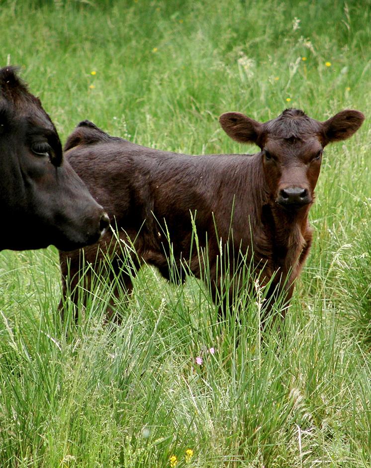
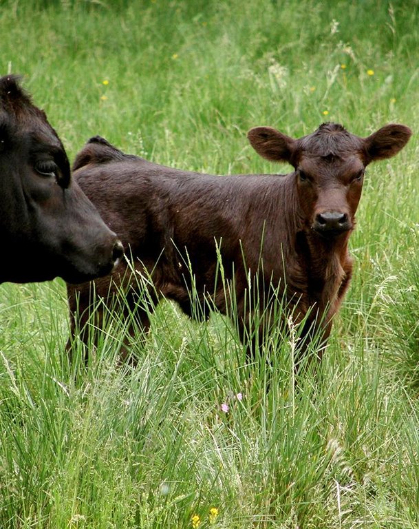
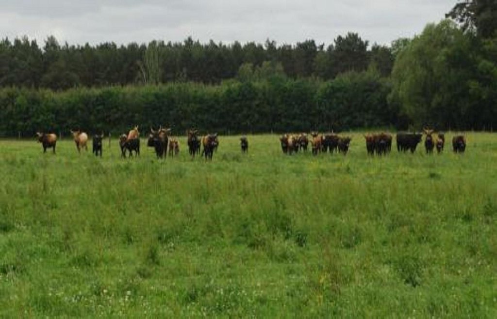
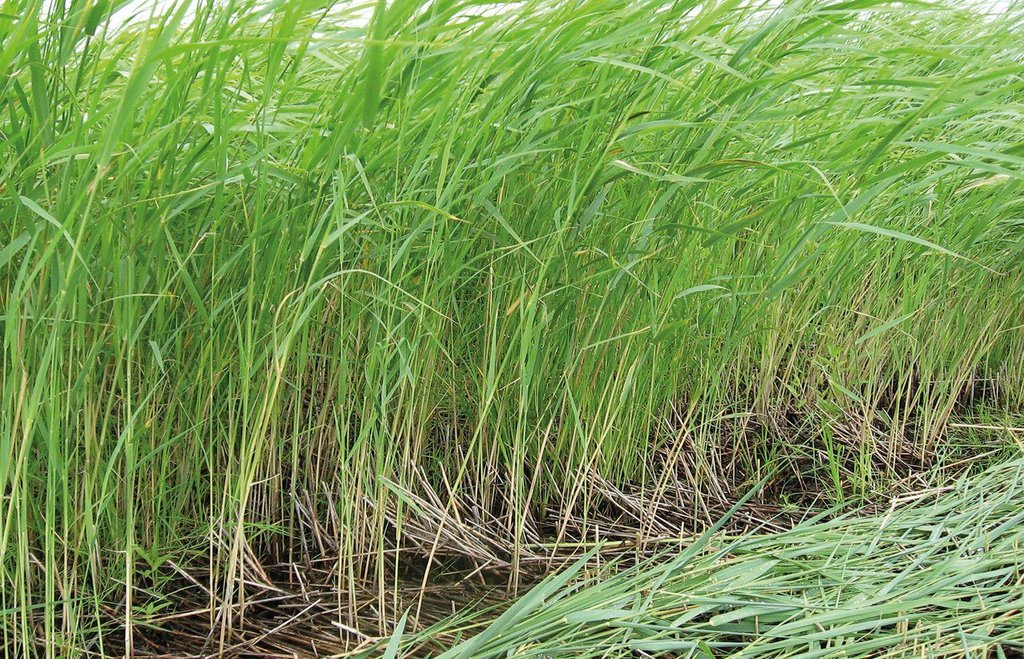
Purpose of the Technology: Land uses suitable for the soil conditions after re-wetting are extensive grazing, or paludiculture. Paludiculture is the cultivation of wet organic soils by preserving or renewing peat by planting and harvesting specific trees (e.g. alder), reeds and sedges. On fens, alder trees (for wood /biomass production) or plant species grown for their products (e.g. for thatch) or bioenergy, including the common reed, reed canary grass or cat’s-tail, can be cultivated. On peat bogs sphagnum farming as a peat substitute in horticulture, or as a medicinal plant, is possible. The first harvest of the common reed can take place four years post-establishment; thereafter annually. Alternatively, extensive livestock grazing with water buffalo or suitable breeds of cattle like Galloway or Heck has potential for re-wetted land. Year-round grazing is possible with a carrying capacity of up to 0.7 livestock units/ha.
Establishment / maintenance activities and inputs: Apart from avoiding huge amounts of GHG emissions and bringing land into alter-native production, further aims of re-wetting and adapting land use are:
- soil protection (soil structure, water content, peat protection);
- water protection (water quality, buffering / filtering water);
- protection of the landscape’s water regime and material balance (solute transport);
- biodiversity protection (retaining a sensitive ecosystem with specialized/ threatened species); and
- flood protection (organic soils can quickly absorb large amount of water).
There are many advantages for the environment while still creating a (modest) in-come for land users. Unlike most other bioenergy production chains (e.g. maize, rapeseed) which do not have these environmental co-benefits, paludiculture with the common reed can become a sustainable production system.
Natural / human environment: The Altmark region is located on the North German Plain. The region is predomi-nantly characterized by agriculture but has many forests too. Because of the high proportion of grassland, cattle are important. The use of biomass for bioenergy was increasing and many biogas plants were established in the last few years. Fens are mostly located in Altmark-County Salzwedel. Here, the average population density (42.7 inhabitants km2) is relatively low in the German context and the annual precipi-tation of 466mm is also below the overall German average.
2.3 Fotos da tecnologia
2.5 País/região/locais onde a tecnologia foi aplicada e que estão cobertos nesta avaliação
País:
Alemanha
Região/Estado/Província:
Germany, Saxony-Anhalt
Especificação adicional de localização:
Altmarkkreis Salzwedel and district Stendal (total area of region: 4744 km²)
Comentários:
Potential area: 288 km2 (~ 6% of the region). The area stated is the area that is potentially usable for the technology due to available geographical data; requirements: fen (Nieder- und Anmoor), area under agricultural land use, outside of nature protection areas (national parc, nature reserve, FFH area, SPA area, Ramsar). Due to re-wetting restrictions by factors like nowadays water level in the area, settlements etc., the effective area suitable will be lower.
Boundary points of the Technology area: 52.842906; 10.760956
52.351751; 11.858462
52.541514; 12.187856
52.870405; 12.231025
53.050502; 11.633261
2.6 Data da implementação
Caso o ano exato seja desconhecido, indique a data aproximada:
- menos de 10 anos atrás (recentemente)
2.7 Introdução da tecnologia
Especifique como a tecnologia foi introduzida:
- durante experiências/ pesquisa
Comentários (tipos de projeto, etc.):
answer refers to re-wetting
3. Classificação da tecnologia de GST
3.2 Tipo(s) atualizado(s) de uso da terra onde a tecnologia foi aplicada

Terra de cultivo
- Cultura anual

Pastagem
Pastagem extensiva:
- Fazenda pecuária
Principais espécies animais e produtos:
Main species: Water buffalo, adapted cattles (e.g. Heck cattle, Galloway)
Comentários:
Major land use problems (compiler’s opinion): Drainage causes mineralization, sagging and reduction of organic matter of organic soils as well as high GHG emissions, disturbed water regimes, destruction of valuable ecosystems and loss of ecosystem services.
Major land use problems (land users’ perception): Long term use of drained organic soils leads to soil degradation and lower productivity. Thus, more fertilizer is needed. Due to sagging of organic soils, ditches and drainages need to be renewed every 10-15 years.
Ranching: Water buffalo, adapted cattles (e.g. Heck cattle, Galloway)
Grazingland comments: extensive grassland use with mowing and/or grazing; or paludiculture (e.g. Common Reed)
Future (final) land use (after implementation of SLM Technology): Grazing land: Ge: Extensive grazing land
Type of grazing system comments: extensive grassland use with mowing and/or grazing; or paludiculture (e.g. Common Reed)
Caso o uso da terra tenha mudado devido a implementação da tecnologia, indique seu uso anterior à implementação da tecnologia:
Cropland: Ca: Annual cropping
3.3 Mais informações sobre o uso da terra
Comentários:
Water supply: rainfed, rainfed
Número de estações de cultivo por ano:
- 1
Especifique:
Longest growing period in days: 234Longest growing period from month to month: Spring-autumn
Densidade animal (se relevante):
50-100 LU /km2
3.4 Grupo de GST ao qual pertence a tecnologia
- Gestão/proteção de zonas úmidas
- Re-wetting of organic soils
3.5 Difusão da tecnologia
Comentários:
Total area covered by the SLM Technology is 288 m2.
Potential area: 288 km2 (~ 6% of the region). The area stated is the area that is potentially usable for the technology due to available geographical data; requirements: fen (Nieder- und Anmoor), area under agricultural land use, outside of nature protection areas (national parc, nature reserve, FFH area, SPA area, Ramsar). Due to re-wetting restrictions by factors like nowadays water level in the area, settlements etc., the effective area suitable will be lower.
3.6 Medidas de GST contendo a tecnologia

Medidas vegetativas
- V2: gramíneas e plantas herbáceas perenes
- V5: Outros

Medidas estruturais
- S11: Outros

Medidas de gestão
- M1: Mudança no tipo de uso da terra
- M2: Mudança de gestão/nível de intensidade
- M3: Disposição de acordo com o ambiente natural e humano
Comentários:
Main measures: vegetative measures, structural measures, management measures
Specification of other vegetative measures: paludiculture
Specification of other structural measures: removal of drainage system, dykes, etc. allowing rise in groundwater level
Type of vegetative measures: in blocks
3.7 Principais tipos de degradação da terra abordados pela tecnologia

Deteriorização química do solo
- Cn: declínio de fertilidade e teor reduzido de matéria orgânica (não causado pela erosão)

Deteriorização física do solo
- Pc: Compactação
- Ps: Subsidência de solos orgânico, sedimentação do solo
- Pu: perda da função bioprodutiva devido a outras atividades

Degradação biológica
- Bh: perda dos habitats
- Bs: Qualidade e composição de espécies/declínio de diversidade

Degradação da água
- Ha: aridificação
- Hg: mudança no lençol freático/aquífero
- Hq: declínio da qualidade do lençol freático
- Hw: redução da capacidade de tamponamento de zonas úmidas
Comentários:
Main type of degradation addressed: Pc: compaction, Ps: subsidence of organic soils, settling of soil, Pu: loss of bio-productive function due to other activities
Secondary types of degradation addressed: Cn: fertility decline and reduced organic matter content, Bh: loss of habitats, Bs: quality and species composition /diversity decline, Ha: aridification, Hg: change in groundwater / aquifer level, Hq: decline of groundwater quality, Hw: reduction of the buffering capacity of wetland areas
Main causes of degradation: soil management (drainage), disturbance of water cycle (infiltration / runoff) (drainage)
Secondary causes of degradation: crop management (annual, perennial, tree/shrub) (ploughing, fertilization)
3.8 Redução, prevenção ou recuperação da degradação do solo
Especifique o objetivo da tecnologia em relação a degradação da terra:
- Reduzir a degradação do solo
Comentários:
Main goals: mitigation / reduction of land degradation
4. Especificações técnicas, implementação de atividades, entradas e custos
4.1 Desenho técnico da tecnologia
Autor:
Sarah Baum, Thünen Institute of Rural Studies, Bundesallee 50, D-38116, Braunschweig, Germany
4.2 Especificações técnicas/ explicações do desenho técnico
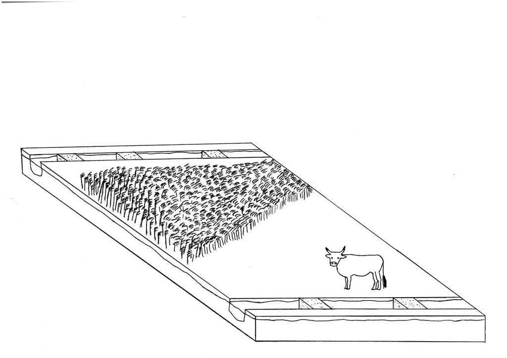
Re-wetting of a fen with adapted agricultural land use afterwards: extensive grazing with cattle and paludiculture in Common Reed production.
Date: 07/2015
Technical knowledge required for field staff / advisors: high
Technical knowledge required for land users: high
Technical knowledge required for planners: high (Re-wetting concerns large areas)
Main technical functions: increase in organic matter, increase / maintain water stored in soil, increase of groundwater level / recharge of groundwater, improvement of water quality, buffering / filtering water
In blocks
Vegetative material: G : grass, O : other
Number of plants per (ha): G: full coverage, O: 5000
Vertical interval within rows / strips / blocks (m): O: 2m
Width within rows / strips / blocks (m): O: 1m
Grass species: Grasses for extensive grassland use
Other species: Paludicultures like Common reed, Reed Canary grass
Slope (which determines the spacing indicated above): ~0%
Gradient along the rows / strips: ~0%
Structural measure: close/chamber ditches for groundwater level rise
Change of land use type: Crop land or intensive grassland to extensive grassland or paludiculture: see 2.5.2.2
Change of land use practices / intensity level: extensification
Layout change according to natural and human environment: Closed and chambered ditches/removed drainage systems: see 2.5.3.2
4.4 Atividades de implantação
| Atividade | Tipo de medida | Periodicidade | |
|---|---|---|---|
| 1. | For fen re-wetting, removal or blocking of drainage systems like ditches, pumping stations, dykes or drainages is necessary. Extent depends strongly on local site conditions! (examples chosen from Landesumweltamt Brandenburg (2004)). | Estrutural | |
| 2. | Extensive grassland or paludiculture | Gestão | |
| 3. | Extensive grassland: if field is not already used as grassland but as cropland: grassland sowing | Vegetativo | July/August |
| 4. | Extensive grassland: natural spread: no input | Vegetativo | |
| 5. | Paludiculture: planting Common Reed | Vegetativo | Spring |
4.5 Custos e entradas necessárias para a implantação
| Especifique a entrada | Unidade | Quantidade | Custos por unidade | Custos totais por entrada | % dos custos arcados pelos usuários da terra | |
|---|---|---|---|---|---|---|
| Mão-de-obra | Labour | ha | 1,0 | 300,0 | 300,0 | 100,0 |
| Equipamento | Machine use | ha | 1,0 | 400,0 | 400,0 | 100,0 |
| Material vegetal | Seedling | ha | 1,0 | 2500,0 | 2500,0 | 100,0 |
| Outros | Removal of drainage | ha | 1,0 | 200,0 | 200,0 | 100,0 |
| Outros | Ditch filling | ha | 1,0 | 100,0 | 100,0 | 100,0 |
| Outros | Make-ready and set-up cost | ha | 1,0 | 2500,0 | 2500,0 | 100,0 |
| Custos totais para a implantação da tecnologia | 6000,0 | |||||
4.6 Atividades recorrentes/manutenção
| Atividade | Tipo de medida | Periodicidade/frequência | |
|---|---|---|---|
| 1. | water level management: weir control ~once a week: efforts depends strongly on local conditions. Control is also necessary when weirs are used to ensure controlled water level. | Estrutural | |
| 2. | extensive grassland: mowing | Vegetativo | 2 times per year |
| 3. | extensive grassland: grazing with water buffalo, adapted cattles (e.g. Heck cattle, Galloway) | Vegetativo | year round |
| 4. | paludiculture (Common Reed): harvesting | Vegetativo | Winter (ideally: frozen ground)/first harvest 4 years after establishment, thereafter annually |
| 5. | management | Agronômico | yearly |
4.7 Custos e entradas necessárias pata a manutenção/atividades recorrentes (por ano)
| Especifique a entrada | Unidade | Quantidade | Custos por unidade | Custos totais por entrada | % dos custos arcados pelos usuários da terra | |
|---|---|---|---|---|---|---|
| Mão-de-obra | Labour | ha | 1,0 | 250,0 | 250,0 | 100,0 |
| Equipamento | Machine use | ha | 1,0 | 600,0 | 600,0 | 100,0 |
| Outros | Management | ha | 1,0 | 150,0 | 150,0 | 100,0 |
| Custos totais para a manutenção da tecnologia | 1000,0 | |||||
Comentários:
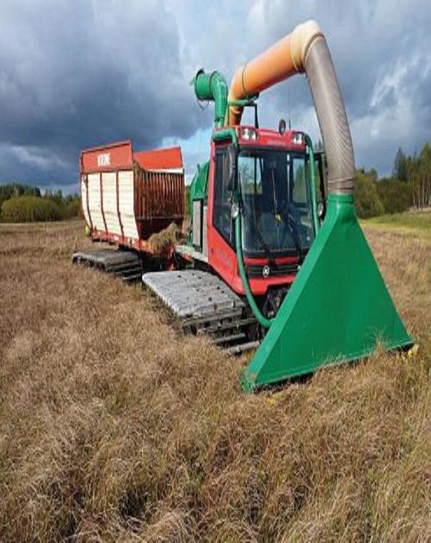
Machinery/ tools: paludiculture: harvest in winter (frozen soil): normal machinery. If soil is not frozen: special machinery: snow groomer (crawler chain) modified as harvester
4.8 Fatores mais importantes que afetam os custos
Descreva os fatores mais determinantes que afetam os custos:
Only rough estimates on costs and income can be given due to the very new and innovative technology. The technology is still in the introductory phase at present
5. Ambiente natural e humano
5.1 Clima
Precipitação pluviométrica anual
- <250 mm
- 251-500 mm
- 501-750 mm
- 751-1.000 mm
- 1.001-1.500 mm
- 1.501-2.000 mm
- 2.001-3.000 mm
- 3.001-4.000 mm
- > 4.000 mm
Especificações/comentários sobre a pluviosidade:
Annual rainfall: 500-750 mm, 750-1000 mm, 1000-1500 mm, 1500-2000 mm
250-500mm: This only characterises the Altmark region (average 460mm); more rainfall is possible!
Zona agroclimática
- úmido
- Subúmido
Thermal climate class: temperate. Altmark region
5.2 Topografia
Declividade média:
- Plano (0-2%)
- Suave ondulado (3-5%)
- Ondulado (6-10%)
- Moderadamente ondulado (11-15%)
- Forte ondulado (16-30%)
- Montanhoso (31-60%)
- Escarpado (>60%)
Formas de relevo:
- Planalto/planície
- Cumes
- Encosta de serra
- Encosta de morro
- Sopés
- Fundos de vale
Zona de altitude:
- 0-100 m s.n.m.
- 101-500 m s.n.m.
- 501-1.000 m s.n.m.
- 1.001-1.500 m s.n.m.
- 1.501-2.000 m s.n.m.
- 2.001-2.500 m s.n.m.
- 2.501-3.000 m s.n.m.
- 3.001-4.000 m s.n.m.
- > 4.000 m s.n.m.
Comentários e outras especificações sobre a topografia:
Altitudinal zone: 0-100 m a.s.l. (this only characterises the Altmark region), 500-1000 m a.s.l., 1000-1500 m a.s.l.
5.3 Solos
Profundidade do solo em média:
- Muito raso (0-20 cm)
- Raso (21-50 cm)
- Moderadamente profundo (51-80 cm)
- Profundo (81-120 cm)
- Muito profundo (>120 cm)
Matéria orgânica do solo superficial:
- Alto (>3%)
Caso disponível anexe a descrição completa do solo ou especifique as informações disponíveis, p. ex. tipo de solo, PH/acidez do solo, nitrogênio, capacidade de troca catiônica, salinidade, etc.
Soil depth on average: shallow (21-50 cm) (refers to histic layer), moderately deep (51-80 cm), deep (81-120 cm), very deep (> 120 cm)
Soil fertility is very low-low
Soil drainage/infiltration is good
Soil water storage capacity is very high
5.4 Disponibilidade e qualidade de água
Lençol freático:
Na superfície
Disponibilidade de água de superfície:
Excesso
Qualidade da água (não tratada):
apenas para uso agrícola (irrigação)
Comentários e outras especificações sobre a qualidade e a quantidade da água:
Seasonal fluctuations (surface water): Wet conditions throughout the year.
5.5 Biodiversidade
Diversidade de espécies:
- Alto
Comentários e outras especificações sobre biodiversidade:
Not high in number but in quality! Highly specified species. Depends on definition of Biodiversity
5.6 Características dos usuários da terra que utilizam a tecnologia
Orientação de mercado do sistema de produção:
- Comercial/mercado
Indivíduos ou grupos:
- Grupos/comunidade
Nível de mecanização:
- Mecanizado/motorizado
Gênero:
- Mulheres
- Homens
Indique outras características relevantes dos usuários da terra:
Population density: 10-50 persons/km2
Annual population growth: negative
Market orientation of production system: nature conservation
Market orientation of cropland production system: Comercial/market (cows for dairy farming and reed sold for bioenergy and thatching)
Market orientation of grazing land production system: Comercial/market (Grazing, mowing; paludiculture )
5.7 Média da área de terra própria ou arrendada por usuários da terra que utilizam a tecnologia
- < 0,5 ha
- 0,5-1 ha
- 1-2 ha
- 2-5 ha
- 5-15 ha
- 15-50 ha
- 50-100 ha
- 100-500 ha
- 500-1.000 ha
- 1.000-10.000 ha
- > 10.000 ha
5.8 Propriedade de terra, direitos de uso da terra e de uso da água
Propriedade da terra:
- Estado
- Comunitário/rural
- NGO
Direitos do uso da terra:
- Indivíduo
Direitos do uso da água:
- Indivíduo
Comentários:
Land owners can re-wet their land and manage it suitable for wet conditions afterwards. The state or NGO, for example, can buy land and re-wet it; normally followed by nature protection. This technology can not be done by one land user. It has major impacts off-sites and reflects normally more then one farmer.
6. Impactos e declarações finais
6.1 Impactos no local mostrados pela tecnologia
Impactos socioeconômicos
Produção
Produção agrícola
Produção de forragens
Qualidade da forragem
Produção animal
Risco de falha de produção
Área de produção
Gestão de terra
Disponibilidade e qualidade de água
Demanda por água para irrigação
Renda e custos
Despesas com insumos agrícolas
Comentários/especificar:
Thorugh extensification
Rendimento agrícola
Diversidade de fontes de rendimento
Comentários/especificar:
possibly
Disparidades econômicas
Carga de trabalho
Comentários/especificar:
Thorugh extensification
Impactos ecológicos
Ciclo hídrico/escoamento
Quantidade de água
Qualidade de água
Escoamento superficial
Lençol freático/aquífero
Solo
Umidade do solo
Cobertura do solo
Comentários/especificar:
In terms of former cropland
Perda de solo
Compactação do solo
Ciclo e recarga de nutrientes
Comentários/especificar:
Extensive usage
Matéria orgânica do solo/carbono abaixo do solo
Biodiversidade: vegetação, animais
Diversidade vegetal
Diversidade animal
Diversidade de habitat
Clima e redução de riscos de desastre
Emissão de carbono e gases de efeito estufa
Quantidade anterior à GST:
15-30
Quantidade posterior à GST:
0.8
Comentários/especificar:
Before conserv.: Ca. 15-30 tCO2eq/ha*a quantify (indicate unit) after conserv.: 0-8 tCO2equ/ha*a specify: mean reduction potential peat bogs: 15tCO2equ/ha*a; fens: 30tCO2equ/ha*a
Outros impactos ecológicos
Value for nature conservation/relevant species
6.2 Impactos externos mostrados pela tecnologia
Caudal confiável e estável em período seco
Comentários/especificar:
Perhaps
Cheias de jusante
Poluição de água subterrânea/rio
Capacidade de tamponamento/filtragem
Danos em áreas vizinhas
Comentários/especificar:
Re-wetting is only possible on larger scales
6.3 Exposição e sensibilidade da tecnologia às mudanças climáticas graduais e extremos/desastres relacionados ao clima (conforme o ponto de vista dos usuários da terra)
Mudança climática gradual
Mudança climática gradual
| Estação do ano | Tipo de mudança climática/extremo | Como a tecnologia lida com isso? | |
|---|---|---|---|
| Temperatura anual | aumento | não bem |
Extremos (desastres) relacionados ao clima
Desastres meteorológicos
| Como a tecnologia lida com isso? | |
|---|---|
| Temporal local | bem |
| Tempestade de vento local | não conhecido |
Desastres climatológicos
| Como a tecnologia lida com isso? | |
|---|---|
| Seca | não bem |
Desastres hidrológicos
| Como a tecnologia lida com isso? | |
|---|---|
| Inundação geral (rio) | bem |
Outras consequências relacionadas ao clima
Outras consequências relacionadas ao clima
| Como a tecnologia lida com isso? | |
|---|---|
| Período de crescimento reduzido | bem |
6.4 Análise do custo-benefício
Como os benefícios se comparam aos custos de implantação (do ponto de vista dos usuários da terra)?
Retornos a curto prazo:
muito negativo
Retornos a longo prazo:
negativo
Como os benefícios se comparam aos custos recorrentes/de manutenção(do ponto de vista dos usuários da terra)?
Retornos a curto prazo:
muito negativo
Retornos a longo prazo:
negativo
Comentários:
Depends strongly on subsidies and other incentive mechanisms as well as opportunity costs (regionally different). Further, if re-wetting is not financed by the land user the economic benefit is greater but even less as before re-wetting.
6.5 Adoção da tecnologia
Entre todos aqueles que adotaram a tecnologia, quantos adotaram espontaneamente, ou seja, sem receber nenhum incentivo material/pagamentos?
- 0-10%
Comentários:
100% of land user families have adopted the Technology with external material support
There is no trend towards spontaneous adoption of the Technology
Comments on adoption trend: There is no increasing trend to adopt the technology as it is not economically attractive for farmer. But for environment groups (NGOs), without an economical interest, this measure can be interesting.
6.7 Pontos fortes/vantagens/oportunidades da tecnologia
| Pontos fortes/vantagens/oportunidades na visão do/a compilador/a ou de outra pessoa capacitada |
|---|
|
By re-wetting organic soil huge amounts of GHG emissions can be avoided on a relatively small area How can they be sustained / enhanced? Financial incentives for farmers are needed e.g. based on GHG-mitigation potential. Alternatively, areas can be bought by e.g. NGOs or government for re-wetting/ nature protection |
|
Paludiculture on re-wetted soils allows an adapted agricultural land use How can they be sustained / enhanced? Financial incentives (e.g. subside payments) for farmers are needed |
|
Extensive grassland cultivation on re-wetted soils allows an adapted agricultural land use (grazing/mowing) How can they be sustained / enhanced? Financial incentives (e.g. subside payments) for farmers are needed |
| The use of fertilizer and manure inputs leads to pollution of water bodies. The water quality will be enhanced by less fertilizer/manure input through this technology compared to intensive agriculture. |
| Due to the technology, higher water retention, flood prevention and biodiversity can increase compared to use of drained organic soils. |
6.8 Pontos fracos, desvantagens/riscos da tecnologia e formas de superá-los
| Pontos fracos/desvantagens/riscos na visão do usuário da terra | Como eles podem ser superados? |
|---|---|
| On re-wetted soil land use options are very restricted due to wet soil conditions. | Financial incentives for farmers are needed. |
| Pontos fracos/vantagens/riscos na visão do/a compilador/a ou de outra pessoa capacitada | Como eles podem ser superados? |
|---|---|
| High opportunity cost for land users: income from intensive cropland on drained soils is higher than income from re-wetted soils with extensive land use. | The technology could be economically attractive if farmers get financial incentives for applying it (re-wetting and adapted extensive usage). It would become even more attractive if no incentives were paid for e.g. maize production on drained organic soils (those incentives are actually paid if the maize is used for bioenergy production). |
7. Referências e links
7.2 Referências às publicações disponíveis
Título, autor, ano, ISBN:
Bonn A, et al. (2014) Klimaschutz durch Wiedervernässung von kohlenstoffreichen Böden. In: Naturkapital und Klimapolitik-Synergien und Konflikte.
Disponível de onde? Custos?
Naturkapital Deutschland TEEB DE Report. Technische Universität Berlin Helmholtz-Zentrum für Umweltforschung-UFZ, Berlin, Leipzig
Título, autor, ano, ISBN:
Wichtmann W, Wichmann S (2011) Environmental, Social and Economic Aspects of a Sustainable Biomass Production.
Disponível de onde? Custos?
Journal of Sustainable Energy & Environment, Special Issue (2011):77-81
7.3 Links para informação relevante que está disponível online
URL:
http://www.duene-greifswald.de/de/projekte.php_enim.php
URL:
http://www.naturkapital-teeb.de/publikationen/projekteigene-publikationen.html
URL:
http://daten.ktbl.de/feldarbeit/home.html
URL:
https://www.stmelf.bayern.de/idb/default.html
URL:
ttps://www.google.de/search?q=Leitfaden+zur+Renaturierung+von+Feuchtgebieten+in+Brandenburg.+&ie=utf-8&oe=utf-8&gws_rd=cr&ei=btyoVebdJcGYsAH4tpWoCA
Links e módulos
Expandir tudo Recolher tudoLinks
Não há links
Módulos
Não há módulos


