Revitalization of Riparian Zones [Suíça]
- Criação:
- Atualização:
- Compilador/a: Nives Ramisberger
- Editores: Joana Eichenberger, Tatenda Lemann, Nadja Kollbrunner
- Revisores: Rima Mekdaschi Studer, William Critchley
(FR) revitalisation de la zone riparienne, (DE) Revitalisierung des Gewässerraums
technologies_6248 - Suíça
Veja as seções
Expandir tudo Recolher tudo1. Informação geral
1.2 Detalhes do contato das pessoas capacitadas e instituições envolvidas na avaliação e documentação da tecnologia
Pessoa(s) capacitada(s)
Especialista em GST:
Devanthéry Julien
CSDIngenieurs
Suíça
Especialista em GST:
Friedli Audrey
Broye Source de Vie
Suíça
Nome do projeto que facilitou a documentação/avaliação da Tecnologia (se relevante)
OPtimal strategies to retAIN and re-use water and nutrients in small agricultural catchments across different soil-climatic regions in Europe (OPTAIN)Nome da(s) instituição(ões) que facilitou(ram) a documentação/ avaliação da Tecnologia (se relevante)
CDE Centre for Development and Environment (CDE Centre for Development and Environment) - SuíçaNome da(s) instituição(ões) que facilitou(ram) a documentação/ avaliação da Tecnologia (se relevante)
University of Bern, Institute of Geography (GIUB) - Suíça1.3 Condições em relação ao uso da informação documentada através de WOCAT
O/a compilador/a e a(s) pessoa(s) capacitada(s) aceitam as condições relativas ao uso de dados documentados através da WOCAT:
Sim
1.4 Declaração de sustentabilidade da tecnologia descrita
A tecnologia descrita aqui é problemática em relação a degradação da terra de forma que não pode ser declarada uma tecnologia de gestão sustentável de terra?
Não
2. Descrição da tecnologia de GST
2.1 Descrição curta da tecnologia
Definição da tecnologia:
The riparian zone is the buffer area between a watercourse and the adjacent land. Healthy riparian ecosystems stabilise the banks, maintain the microclimate, protect against flooding, filter chemicals and improve both biodiversity and water quality.
2.2 Descrição detalhada da tecnologia
Descrição:
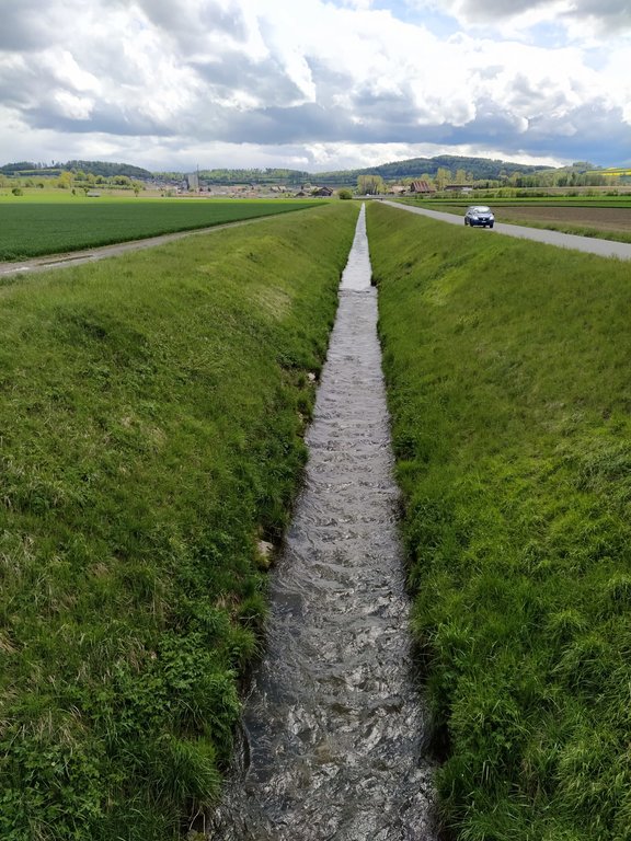
In the 19th and early 20th centuries nearly all Swiss rivers were "corrected" (straightened, channelised and diked) to reduce flood damage and reclaim land for agriculture. In the late 20th century the adverse effects of these corrections became increasingly clear, and there was a paradigm shift towards more sustainable river management. There are many current “revitalization” projects, among them the restoration of the Petite Glâne, which started in 2022 and is expected to be completed in 2026. The project perimeter consists of the last 7 kilometres of the Petite Glâne stream and the costs are estimated at CHF 21.5 million.
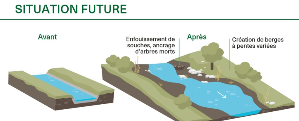
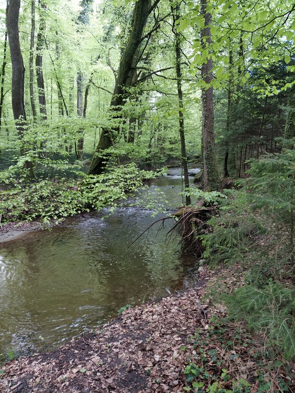
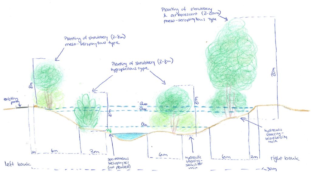
The main characteristics of revitalization are widening the riverbed and reducing the slopes of the riverbanks, thus giving the river space for meandering and changing the morphology in a natural way. Where riparian forests do not occur naturally anymore, it can make sense to re-establish them so that biodiversity can flourish. The planting of trees and bushes gives many animals a habitat and can serve as a wildlife corridor between different areas. Additionally, shading of the water reduces its temperature fluctuations which - especially in summer - is important to many species that are dependent on cold water for their survival. With climate change this threat will become even worse. The main purpose of revitalization is to recreate near-natural conditions in artificially straightened reaches to ensure provision of riparian ecosystem services.
Considerable planning is involved in implementing this technology in Switzerland partly because of legal reasons (watercourses are closely protected and land rights require negotiation) and because effects on downstream areas need to be taken into account. Depending on the length of the river segment where riparian forests are to be restored, there are many stakeholders involved, all of whom need to give their approval: this takes time and effort. Inputs are mostly in the form of trees and bushes. Depending on the degree of revitalization, built-up river sections need to be freed again and infrastructure like bridges, buildings and roads may be affected. In theory, there is no maintenance necessary because revitalized rivers are intended to reassume their natural form and be surrounded by natural vegetation. Nevertheless, in a highly modified and intensely used landscape, the cutting of grass and pruning of trees/bushes on a regular basis can be required. Wood harvesting may be an option. Driftwood might also have to be removed if there is danger of flooding or clogging of bottlenecks – for example under bridges.
Revitalization, theoretically, has larger effects on smaller rivers than on bigger ones due to a greater proportion of land draining into them compared to their size. Additionally, shading has larger effects on the water temperature of smaller rivers. Benefits accruing are mainly in regard to habitat provision and thus biodiversity enhancement, but also improvement of water quality (lower temperatures, less nutrient input) and water management in general as flooding is expected to be less frequent. A key disadvantage is that the measures are often implemented at the expense of agricultural land. Naturally, farmers are usually unhappy about the loss of land - even though alternative agricultural plots and direct payments are provided. In general, however, people appreciate the improvement in the quality of life (a pleasanter area for leisure) and improved biodiversity.
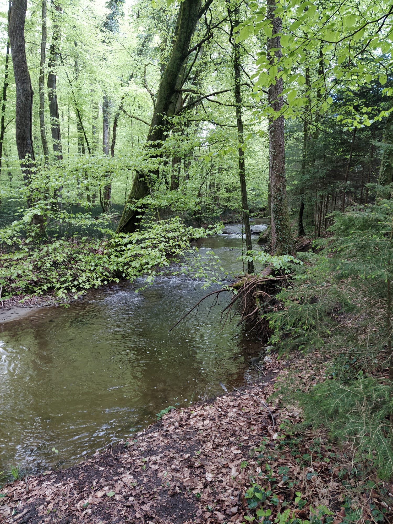
2.3 Fotos da tecnologia
2.5 País/região/locais onde a tecnologia foi aplicada e que estão cobertos nesta avaliação
País:
Suíça
Região/Estado/Província:
FR/VD
Especificação adicional de localização:
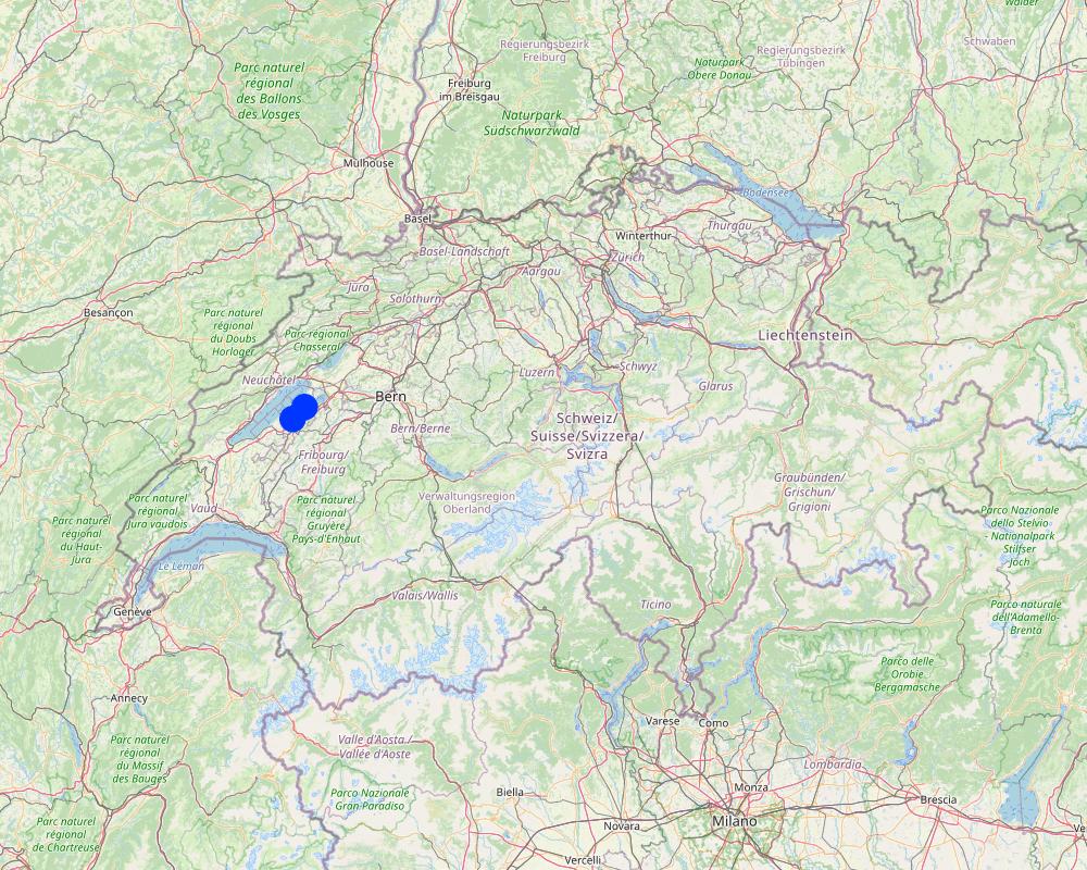
Petite Glâne watershed, 4 communities: Vallon, Missy, St. Aubin, Vully-le-Lac
Especifique a difusão da tecnologia:
- Uniformemente difundida numa área
Se a área precisa não for conhecida, indicar a área aproximada coberta:
- 0,1-1 km2
O(s) local(is) tecnológico(s) está(ão) localizado(s) em uma área permanentemente protegida?
Não
Comentários:
The average enlargement of the river will be 15 m and then 35 - 60 m of a riparian zone over a length of 7 km.
Map
×2.6 Data da implementação
Indique o ano de implementação:
2022
2.7 Introdução da tecnologia
Especifique como a tecnologia foi introduzida:
- através de projetos/intervenções externas
Comentários (tipos de projeto, etc.):
The communities wanted to improve the current situation with respect to the threat of flooding through more extreme rain events, and for improving the biodiversity in the area.
3. Classificação da tecnologia de GST
3.1 Principal/principais finalidade(s) da tecnologia
- Preserva ecossistema
- Protege uma bacia/zonas a jusante – em combinação com outra tecnologia
- Preservar/melhorar a biodiversidade
- Reduzir riscos de desastre
- Adaptar a mudanças climáticas/extremos e seus impactos
3.2 Tipo(s) atualizado(s) de uso da terra onde a tecnologia foi aplicada
Uso do solo misturado dentro da mesma unidade de terra:
Não

Floresta/bosques
- Florestas/bosques (semi)naturais
- Plantação de árvores, reflorestamento
Plantação de árvores, florestamento: Especificar a origem e composição das espécies:
- Variedades mistas
As árvores especificadas acima são decíduas ou perenes?
- decíduo
Produtos e serviços:
- Conservação/proteção da natureza
- Lazer/turismo
- Proteção contra desastres naturais

Vias navegáveis, corpo d'água, zonas úmidas
- Linhas de drenagem, vias navegáveis
3.3 O uso do solo mudou devido à implementação da Tecnologia?
O uso do solo mudou devido à implementação da Tecnologia?
- Sim (Por favor, preencha as perguntas abaixo com relação ao uso do solo antes da implementação da Tecnologia)
Uso do solo misturado dentro da mesma unidade de terra:
Não

Terra de cultivo
- Cultura anual
O rodízio de culturas é praticado?
Sim

Assentamentos, infraestrutura
- Tráfego: estradas, ferrovias
Observações:
bridges, agricultural roads

Vias navegáveis, corpo d'água, zonas úmidas
- Pântanos, zonas úmidas
3.4 Abastecimento de água
Abastecimento de água para a terra na qual a tecnologia é aplicada:
- Precipitação natural
3.5 Grupo de GST ao qual pertence a tecnologia
- Gestão natural e seminatural de floresta
- Gestão de água de superfície (nascente, rio, lagos, mar)
- Redução de riscos de desastre baseada no ecossitema
3.6 Medidas de GST contendo a tecnologia

Medidas vegetativas
- V1: cobertura de árvores/arbustos

Medidas estruturais
- S2: Barragens, bancos

Medidas de gestão
- M1: Mudança no tipo de uso da terra
- M2: Mudança de gestão/nível de intensidade
3.7 Principais tipos de degradação da terra abordados pela tecnologia

Erosão do solo pela água
- Wr: erosão das margens

Degradação biológica
- Bh: perda dos habitats
- Bs: Qualidade e composição de espécies/declínio de diversidade

Degradação da água
- Hs: mudança na quantidade de água de superfície
- Hp: declínio da qualidade de água de superfície
3.8 Redução, prevenção ou recuperação da degradação do solo
Especifique o objetivo da tecnologia em relação a degradação da terra:
- Prevenir degradação do solo
- Recuperar/reabilitar solo severamente degradado
4. Especificações técnicas, implementação de atividades, entradas e custos
4.1 Desenho técnico da tecnologia
Especificações técnicas (relacionada ao desenho técnico):
Between 2022 and 2026, the Petite Glâne is being revitalized on a length of 7 km with an average enlargement of the riparian zone of 15 m which totals in the riparian zone having a width between 35 and 60 m. 30,000 young trees and shrubs (from 37 species) and 100 larger trees are being planted. In addition, 200 small structures for wildlife will be provided. The very steep riverbanks are being reduced in their slope. Material used for the reconstruction of the river mainly comprises vegetation.
Autor:
Nives Ramisberger
Data:
13/07/2022
4.2 Informação geral em relação ao cálculo de entradas e custos
Especifique como custos e entradas foram calculados:
- por área de tecnologia
Indique o tamanho e a unidade de área:
33 ha (medium width of riparian area ((35+60)/2) * length of river reach (7km))
Outro/moeda nacional (especifique):
CHF
Se for relevante, indique a taxa de câmbio do USD para moeda local (por exemplo, 1 USD = 79,9 Real): 1 USD =:
0,98
4.3 Atividades de implantação
| Atividade | Periodicidade (estação do ano) | |
|---|---|---|
| 1. | communication (with communities etc.) and looking for sponsoring | 2018 |
| 2. | completion of studies | 2018 |
| 3. | survey/planning/project execution | 2018 |
| 4. | Delays due to the Corona pandemic, start of reconstruction was originally planned for 2020 | |
| 5. | search for company | 2022 |
| 6. | implementation | 2022-2025 |
Comentários:
This list is basically a list of the different steps that are involved in any project and show how long it took from first thinking about implementing the revitalization until now realizing. The implementation is not bound to any season and expected to be carried out continuously.
4.4 Custos e entradas necessárias para a implantação
| Especifique a entrada | Unidade | Quantidade | Custos por unidade | Custos totais por entrada | % dos custos arcados pelos usuários da terra | |
|---|---|---|---|---|---|---|
| Mão-de-obra | engineers, purchase of land | 1,0 | 3000000,0 | 3000000,0 | ||
| Material vegetal | trees, small structures | 30000,0 | 100,0 | 3000000,0 | ||
| Material de construção | terracing, bridges | 1,0 | 15000000,0 | 15000000,0 | ||
| Outros | unexpected | 1,0 | 500000,0 | 500000,0 | ||
| Custos totais para a implantação da tecnologia | 21500000,0 | |||||
| Custos totais para o estabelecimento da Tecnologia em USD | 21938775,51 | |||||
Se o usuário da terra arca com menos que 100% dos custos, indique quem cobre os custos remanescentes:
80% are paid by the federal government, 20% by the adjacent municipalities and local sponsors.
Comentários:
The total cost is known and a broad estimation possible of how much is used for what but it was not possible to break it down into more detail because it is a big project and many stakeholders involved.
4.5 Atividades recorrentes/manutenção
| Atividade | Periodicidade/frequência | |
|---|---|---|
| 1. | Checking riverbed | every 2-3 years |
| 2. | Mowing of grass | 1-2 per year |
| 3. | Cutting/ pruning of trees | every 5-10 years (usually around 30% of the area at once) |
| 4. | General maintenance period | 2025-2028 |
| 5. | Follow-up, control of revitalization effects | 2038 |
Comentários:
Grass needs to be cut 1-2 times a year. The other maintenance activities are not required so frequently. The watercourse must be checked every 2-3 years and every 5-10 years the trees may have to be cut. When cutting the trees 1/3 of the area should be done at once but not more to not disturb wildlife too much and give it space to retreat to. None of these activities are bound to any particular season. During the first 3 years after the finalization of the project, maintenance work will be carried out (checking if everything is still okay, how the river behaves, if plants grow, etc.).
4.6 Custos e entradas necessárias pata a manutenção/atividades recorrentes (por ano)
Comentários:
The project is not yet in a phase in which the costs for maintenance can be estimated because the implementation hasn't yet started and will not finish before 2025. Also, it depends on how much of the maintenance can be done by the farmers of the adjacent lands and how much will need to be done through community workers which would increase costs.
4.7 Fatores mais importantes que afetam os custos
Descreva os fatores mais determinantes que afetam os custos:
The most expensive feature of this project is the volume of earth that will be removed from the now steep riverbanks to widen the riverbed. The earth removed will directly be used again for small hills and what is not used directly in the riparian zone will be distributed on the agriculturally used fields next to the rivers. Also, there are several bridges that cross the Petite Glâne, and by enlarging the riverbed the bridges need to be rebuilt as well - which drives up the price greatly.
5. Ambiente natural e humano
5.1 Clima
Precipitação pluviométrica anual
- <250 mm
- 251-500 mm
- 501-750 mm
- 751-1.000 mm
- 1.001-1.500 mm
- 1.501-2.000 mm
- 2.001-3.000 mm
- 3.001-4.000 mm
- > 4.000 mm
Especifique a média pluviométrica anual em mm (se conhecida):
865,00
Indique o nome da estação meteorológica de referência considerada:
Payerne
Zona agroclimática
- Subúmido
- Semiárido
average maximum temperature 14.2°C, average minimum temperature 5.1°C
5.2 Topografia
Declividade média:
- Plano (0-2%)
- Suave ondulado (3-5%)
- Ondulado (6-10%)
- Moderadamente ondulado (11-15%)
- Forte ondulado (16-30%)
- Montanhoso (31-60%)
- Escarpado (>60%)
Formas de relevo:
- Planalto/planície
- Cumes
- Encosta de serra
- Encosta de morro
- Sopés
- Fundos de vale
Zona de altitude:
- 0-100 m s.n.m.
- 101-500 m s.n.m.
- 501-1.000 m s.n.m.
- 1.001-1.500 m s.n.m.
- 1.501-2.000 m s.n.m.
- 2.001-2.500 m s.n.m.
- 2.501-3.000 m s.n.m.
- 3.001-4.000 m s.n.m.
- > 4.000 m s.n.m.
Indique se a tecnologia é aplicada especificamente em:
- Posições côncavas
5.3 Solos
Profundidade do solo em média:
- Muito raso (0-20 cm)
- Raso (21-50 cm)
- Moderadamente profundo (51-80 cm)
- Profundo (81-120 cm)
- Muito profundo (>120 cm)
Textura do solo (solo superficial):
- Médio (limoso, siltoso)
Textura do solo (>20 cm abaixo da superfície):
- Médio (limoso, siltoso)
Matéria orgânica do solo superficial:
- Médio (1-3%)
5.4 Disponibilidade e qualidade de água
Lençol freático:
5-50 m
Disponibilidade de água de superfície:
Bom
Qualidade da água (não tratada):
apenas para uso agrícola (irrigação)
A qualidade da água refere-se a:
água de superfície
A salinidade da água é um problema?
Não
Ocorre inundação da área?
Sim
Regularidade:
Esporadicamente
Comentários e outras especificações sobre a qualidade e a quantidade da água:
The increasing threat of heavy rainfall events due to climate change enhances the threat of flooding which is why the revitalization is being implemented. Through enlargement of the riverbed and increasing surface roughness through vegetation, flooding of adjacent agricultural areas is expected to be less frequent. The effect of the plants directly on water quality/quantity are expected to be minor.
5.5 Biodiversidade
Diversidade de espécies:
- Baixo
Diversidade de habitat:
- Baixo
Comentários e outras especificações sobre biodiversidade:
Both are between low and medium, but low rather than medium.
5.6 Características dos usuários da terra que utilizam a tecnologia
Sedentário ou nômade:
- Sedentário
Orientação de mercado do sistema de produção:
- Comercial/mercado
Rendimento não agrícola:
- Menos de 10% de toda renda
Nível relativo de riqueza:
- Média
Indivíduos ou grupos:
- Grupos/comunidade
- Empregado (empresa, governo)
Nível de mecanização:
- Mecanizado/motorizado
Gênero:
- Mulheres
- Homens
Idade dos usuários da terra:
- meia-idade
Indique outras características relevantes dos usuários da terra:
The land users now are farmers that rent or own the land. For implementing the technology the lease agreement was terminated and the land up to now owned by the farmers has been bought by the communities.
5.7 Área média de terrenos utilizados pelos usuários de terrenos que aplicam a Tecnologia
- < 0,5 ha
- 0,5-1 ha
- 1-2 ha
- 2-5 ha
- 5-15 ha
- 15-50 ha
- 50-100 ha
- 100-500 ha
- 500-1.000 ha
- 1.000-10.000 ha
- > 10.000 ha
É considerado pequena, média ou grande escala (referente ao contexto local)?
- Média escala
Comentários:
The technology is applied by communities
5.8 Propriedade de terra, direitos de uso da terra e de uso da água
Propriedade da terra:
- Comunitário/rural
- Indivíduo, intitulado
Direitos do uso da terra:
- Comunitário (organizado)
Direitos do uso da água:
- Comunitário (organizado)
Os direitos de uso da terra são baseados em um sistema jurídico tradicional?
Sim
Especifique:
lease agreement
Comentários:
Where possible farmers got other areas to substitute for that lost by implementing the revitalization
5.9 Acesso a serviços e infraestrutura
Saúde:
- Pobre
- Moderado
- Bom
Educação:
- Pobre
- Moderado
- Bom
Assistência técnica:
- Pobre
- Moderado
- Bom
Emprego (p. ex. não agrícola):
- Pobre
- Moderado
- Bom
Mercados:
- Pobre
- Moderado
- Bom
Energia:
- Pobre
- Moderado
- Bom
Vias e transporte:
- Pobre
- Moderado
- Bom
Água potável e saneamento:
- Pobre
- Moderado
- Bom
Serviços financeiros:
- Pobre
- Moderado
- Bom
6. Impactos e declarações finais
6.1 Impactos no local mostrados pela tecnologia
Impactos socioeconômicos
Produção
Produção agrícola
Produção de madeira
Área de produção
Disponibilidade e qualidade de água
Disponibilidade de água para irrigação
Qualidade da água para irrigação
Renda e custos
Rendimento agrícola
Comentários/especificar:
In the short term it is expected to decrease due to loss of land, in the long term not because of more resilience towards floods
Diversidade de fontes de rendimento
Comentários/especificar:
State subsidies for biodiversity areas
Impactos socioculturais
Direitos do uso da terra/à água
Oportunidades culturais
Oportunidades de lazer
Comentários/especificar:
The landscape becomes more beautiful and new places to stay are made, but on the other hand many places are deliberately made inaccessible for the protection of flora & fauna.
Atenuação de conflitos
Comentários/especificar:
Simultaneously, the threat of flooding for farmers is decreased and enhancement of habitat created which is expected to lead to improved acceptance by all stakeholders
Impactos ecológicos
Ciclo hídrico/escoamento
Quantidade de água
Qualidade de água
Colheita/recolhimento de água
Escoamento superficial
Comentários/especificar:
Will be slightly improved through reducing the gradient of riverbanks
Drenagem de excesso de água
Lençol freático/aquífero
Evaporação
Comentários/especificar:
Less evaporation but more evapotranspiration expected
Solo
Umidade do solo
Cobertura do solo
Perda de solo
Biodiversidade: vegetação, animais
Cobertura vegetal
Biomassa/carbono acima do solo
Diversidade vegetal
Espécies exóticas invasoras
Diversidade animal
Espécies benéficas
Diversidade de habitat
Clima e redução de riscos de desastre
Impactos da inundação
Impactos da seca
Comentários/especificar:
It is not known yet if there will be any difference for after the implementation but it is expected that the difference will be negligible
Impactos de ciclones, temporais
Emissão de carbono e gases de efeito estufa
Velocidade do vento
Microclima
Especificar a avaliação dos impactos no local (medidas):
Observations, measurements and projections
6.2 Impactos externos mostrados pela tecnologia
Disponibilidade de água
Caudal confiável e estável em período seco
Cheias de jusante
Sedimentação a jusante
Poluição de água subterrânea/rio
Capacidade de tamponamento/filtragem
Sedimentos transportados pelo vento
Danos em áreas vizinhas
Danos na infraestrutura pública/privada
Especificar a avaliação dos impactos fora do local (medidas):
Observations, measurements and projections
6.3 Exposição e sensibilidade da tecnologia às mudanças climáticas graduais e extremos/desastres relacionados ao clima (conforme o ponto de vista dos usuários da terra)
Mudança climática gradual
Mudança climática gradual
| Estação do ano | aumento ou diminuição | Como a tecnologia lida com isso? | |
|---|---|---|---|
| Temperatura anual | aumento | moderadamente |
Extremos (desastres) relacionados ao clima
Desastres meteorológicos
| Como a tecnologia lida com isso? | |
|---|---|
| Trovoada local | bem |
| Tempestade de granizo local | moderadamente |
Desastres climatológicos
| Como a tecnologia lida com isso? | |
|---|---|
| Onde de calor | moderadamente |
| Seca | moderadamente |
Desastres hidrológicos
| Como a tecnologia lida com isso? | |
|---|---|
| Inundação geral (rio) | muito bem |
| Inundação súbita | muito bem |
6.4 Análise do custo-benefício
Como os benefícios se comparam aos custos de implantação (do ponto de vista dos usuários da terra)?
Retornos a curto prazo:
positivo
Retornos a longo prazo:
positivo
Como os benefícios se comparam aos custos recorrentes/de manutenção(do ponto de vista dos usuários da terra)?
Retornos a curto prazo:
positivo
Retornos a longo prazo:
positivo
Comentários:
The short term benefits (1-3 years after implementation) are considered positive as the technology shows positive effects on ecosystem services (e.g. flood protection) within a short period of time despite the high establishment costs.
6.5 Adoção da tecnologia
- casos isolados/experimental
Comentários:
The communities were initiating the revitalization and did not do so before finding sponsors and subventions
6.6 Adaptação
A tecnologia foi recentemente modificada para adaptar-se as condições variáveis?
Não
6.7 Pontos fortes/vantagens/oportunidades da tecnologia
| Pontos fortes/vantagens/oportunidades na visão do usuário da terra |
|---|
| Less flooding |
| Small improvement in soil quality |
| Pontos fortes/vantagens/oportunidades na visão do/a compilador/a ou de outra pessoa capacitada |
|---|
| Biodiversity |
| Positive measure against warming waters |
| Improvement of the landscape and therefore of the quality for recreational purposes |
| Flood protection |
6.8 Pontos fracos, desvantagens/riscos da tecnologia e formas de superá-los
| Pontos fracos/desvantagens/riscos na visão do usuário da terra | Como eles podem ser superados? |
|---|---|
| Loss of agricultural land |
Exchange of plots (next to river taken; elsewhere, another given) Financial compensation |
| Pontos fracos/vantagens/riscos na visão do/a compilador/a ou de outra pessoa capacitada | Como eles podem ser superados? |
|---|---|
| High costs | Sponsoring/subsidies needed |
7. Referências e links
7.1 Métodos/fontes de informação
- visitas de campo, pesquisas de campo
Visit with specialists
- entrevistas com especialistas em GST
2 key persons > engineers from different companies
Quando os dados foram compilados (no campo)?
13/07/2022
7.4 Comentários gerais
The municipality owns the land that is now used by the farmers. To make up for the lost land the municipality provided other plots for them to use. Nevertheless, the total loss of agricultural land amounts to 11 ha.
Links e módulos
Expandir tudo Recolher tudoLinks
Não há links
Módulos
Não há módulos


