Participatory mapping, database building, and monitoring of rangeland resources [Кения]
- Создание:
- Обновить:
- Составитель: IBRAHIM JARSO
- Редактор: Caroline King-Okumu
- Рецензенты: Hanspeter Liniger, Rima Mekdaschi Studer, Donia Mühlematter, Joana Eichenberger
Resource Mapping
approaches_3439 - Кения
- Полная аннотация в формате PDF
- Полная аннотация в формате PDF для вывода на печать
- Полная аннотация в формате интернет-страницы
- Полная аннотация (неотформатированно)
- Participatory mapping, database building, and monitoring of rangeland resources: 5 июля 2018 г. (inactive)
- Participatory mapping, database building, and monitoring of rangeland resources: 31 июля 2018 г. (inactive)
- Participatory mapping, database building, and monitoring of rangeland resources: 5 июля 2018 г. (inactive)
- Participatory mapping, database building, and monitoring of rangeland resources: 3 сентября 2018 г. (inactive)
- Participatory mapping, database building, and monitoring of rangeland resources: 22 мая 2018 г. (inactive)
- Participatory mapping, database building, and monitoring of rangeland resources: 13 мая 2018 г. (inactive)
- Participatory mapping, database building, and monitoring of rangeland resources: 2 ноября 2021 г. (public)
- Participatory mapping, database building, and monitoring of rangeland resources: 19 мая 2018 г. (inactive)
Просмотреть разделы
Развернуть все Свернуть все1. Общая информация
1.2 Контактные данные специалистов и организаций, участвующих в описании и оценке Подхода
землепользователь:
Konsole Hussein
+254 728 064578
saritehussein@yahoo.com
Garbatulla Ward Adaptation Planning Committee
P.O. BOX 1Garbatulla
Кения
Non-State Actor:
Abdullahi Shandey
+254 721109171
midp2003@gmail.com
Merti Integrated Development Program (MID-P)
Merti VillageIsiolo Kenya
Кения
Специалист по УЗП:
Название проекта, содействовавшего документированию/оценке Подхода (если применимо)
Strengthening Adaptation and Resilience to Climate Change in Kenya Plus (StARCK+)Название проекта, содействовавшего документированию/оценке Подхода (если применимо)
Book project: Guidelines to Rangeland Management in Sub-Saharan Africa (Rangeland Management)Название организации (-ий), содействовавших документированию/оценке Подхода (если применимо)
Resource Advocacy Programme (RAP) - Кения1.3 Условия, регламентирующие использование собранных ВОКАТ данных
Когда были собраны данные (на местах)?
16/01/2018
Составитель и ответственный/-ые специалист(-ы) согласны с условиями, регламентирующими использование собранных ВОКАТ данных:
Да
2. Описание Подхода УЗП
2.1 Краткое описание Подхода
Participatory mapping and monitoring of vegetation types and other natural resources in the rangelands. This involves convening stakeholder groups, reviewing conditions of rangeland, water and other resources under changing climatic conditions.
2.2 Подробное описание Подхода
Подробное описание Подхода:
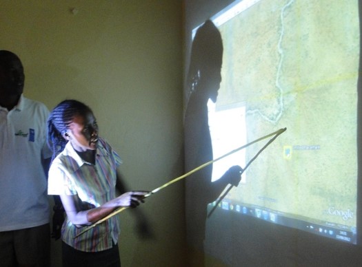
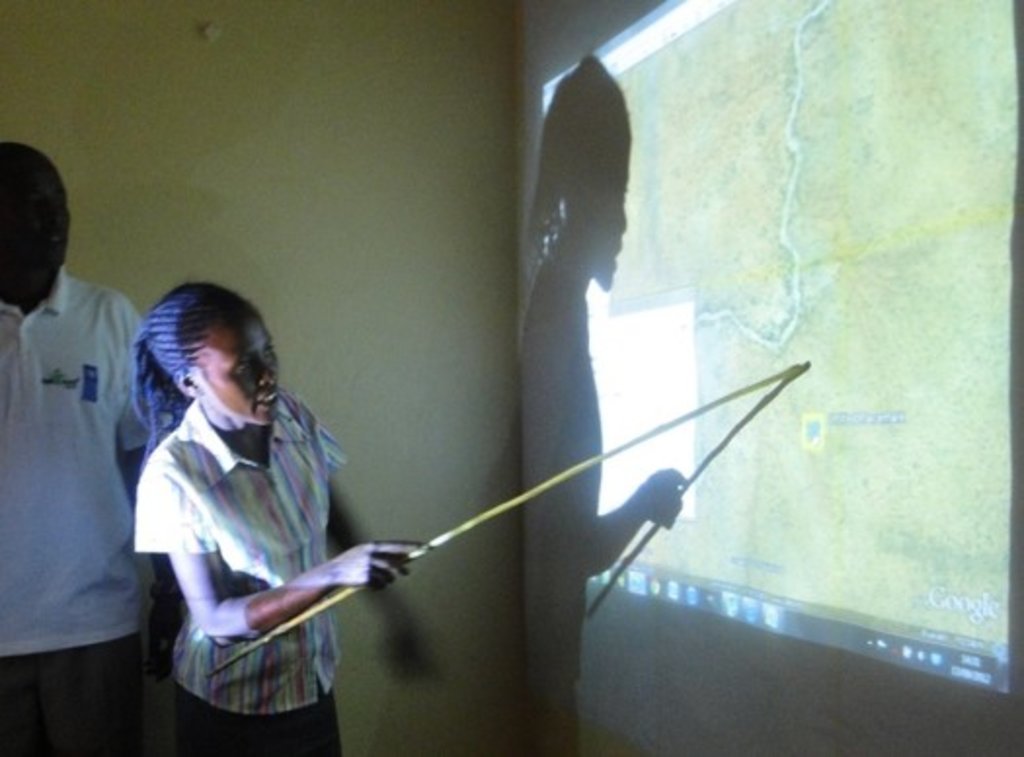
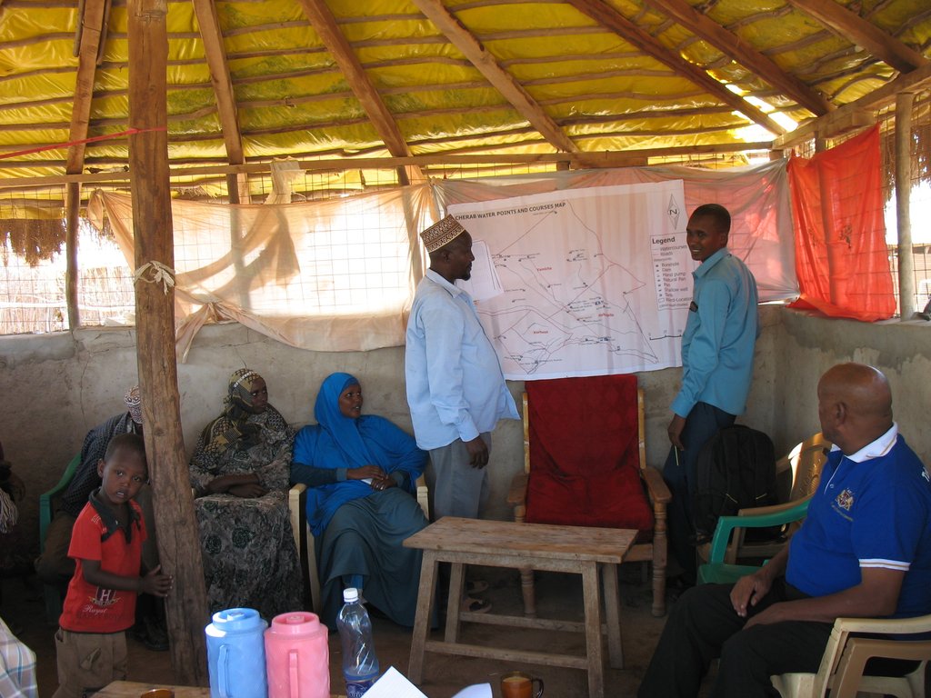
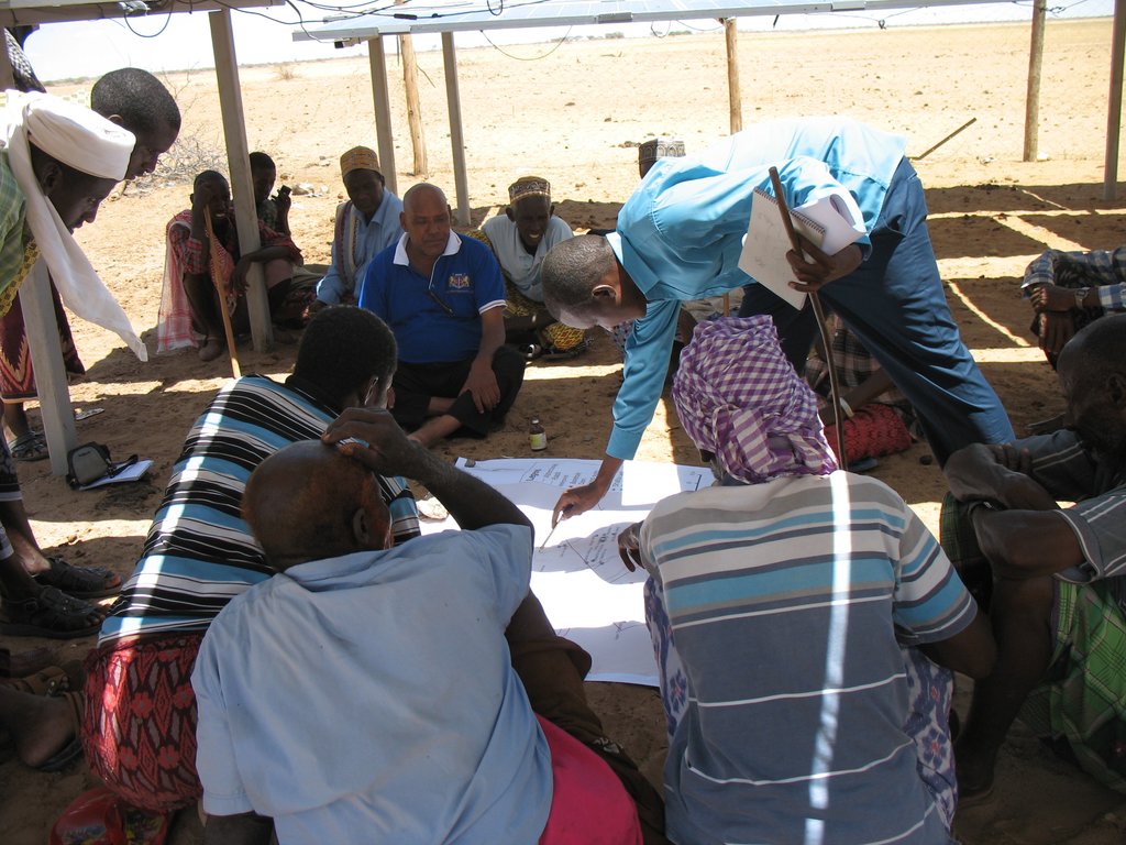
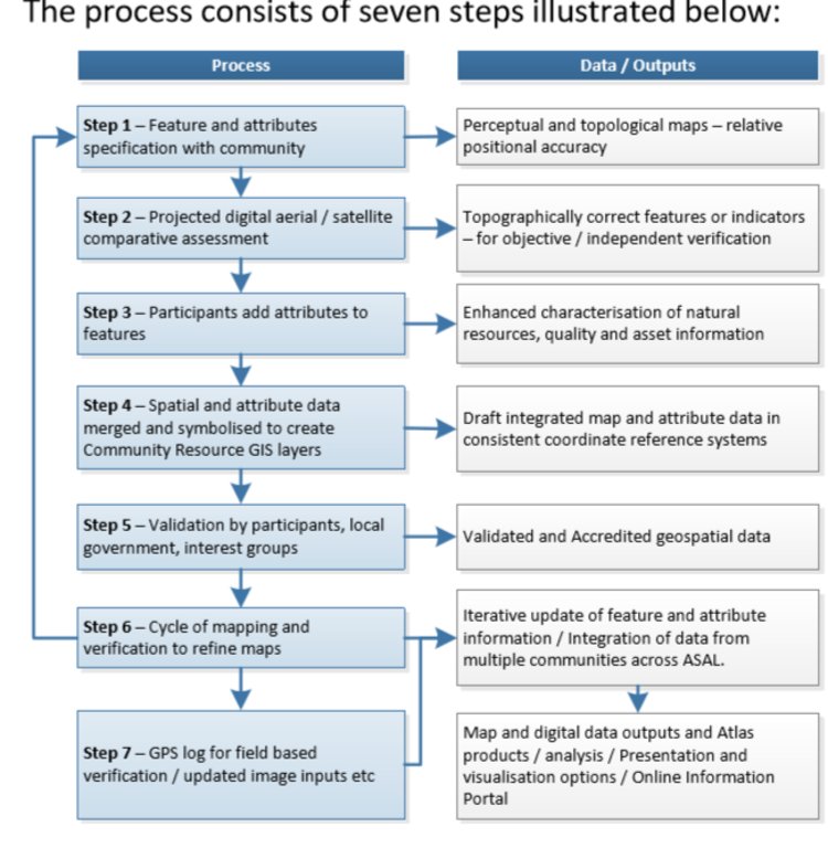
Participatory digital mapping using satellite imagery and digital earth and other open source Geographic Information Systems (GIS) is a practical tool that can bridge knowledge and communication gaps between pastoral communities and county government planners. It offers an effective ‘tool’ for participatory planning and decision-making in support of climate change adaptation efforts in the drylands of Kenya.The use of participatory mapping is not new in seeking to capture communities’ understanding and use of natural resources. These maps are typically drawn on the ground using stones, sticks and other locally available materials to depict key features such as schools, water points, and forest areas, etc. However the process used in Isiolo County combines digital mapping with community-drawn perception maps. This offers a number of extra benefits. While fully capturing the wealth of local knowledge, they contain an in-built coordinate system which corresponds to a global reference grid, enabling their linkage to maps used in formal systems. Furthermore, the coordinate system provides a geographically precise basis from which to discuss natural resource management, making outputs of participatory mapping more universally useable. These benefits, however, need to be carefully balanced to avoid the risk that through this process, pastoral resources – which are highly dynamic - are ‘frozen’ in time and space. Mapping processThe participatory mapping process has adopted GIS workflows within community workshops, enabling the creation of integrated, consistent and standardized geospatial information. The process follows seven steps:Step 1: Community level meetings to develop perception maps drawn on the ground and/or on paper. The product is a community perception map of those resources that are important for their livelihood systems. This map should be created in a community setting to enable the participation of a large group. Several maps may be produced by smaller sub-groups (women, the youth, elders etc) and then amalgamated. The final map is then copied onto paper. Step 2. Digital mapping is introduced. This step takes place in a workshop setting with a smaller group of key informants chosen by the community - as well as county government planners and technical staff. The presence of the latter is critical to the process of ‘legitimizing’ community knowledge. Following a quick explanation of satellite imagery, Google Earth is projected onto a wall alongside the perception maps developed under step 1. The use of Google Earth is only for orientation, and to enable participants to navigate the imagery and to cross-reference their paper-mapped key resources against the satellite imagery. Features that participants feel are important (e.g. water points, wet and dry season grazing areas, drought reserves, wildlife routes) are then captured digitally using open source applications: Quantum GIS (QGIS) and JOSM, the Open Street Map editing platform.This produces the coordinates that pinpoint the locations of natural resources in a manner that can be independently and objectively verified. The highly interactive process of geo-referencing local knowledge to a coordinate reference system allows resource maps to be produced to any scale, and in real-time, with the community. Step 3. Qualitative and quantitative attributes describing the key resources are collected. As participants add features to the map, they also describe their specified characteristics or attributes. Attribution data includes a fuller description of the physical characteristics of the resource (e.g. soil type, waterquantity and quality, pasture species) as well as issues concerning their management (e.g. under customary or modern management, land tenure status, negotiated or paid access, area of conflict). Updating this data on a regular basis adds temporal and trend data to the spatial database. This underlines the need to structure data systems well to manage time-based data and to record updates.Steps 4-6: Data verification cycles are integrated into the mapping process in order to capture community feedback and verify the records in the geospatial data and their attribute values against the specification. The mapping includes a series of validation, cross-checking and verification cycles, run with the community - and in a few instances on-the-ground verification termed ‘groundtruthing’. Step 7: Field validation. Field validation is carried out where the verification stages highlight gaps in information. Verification consists of targeted field visits to take GPS markers, or holding meetings with the local community to clarify particular issues.
2.3 Фотографии, иллюстрирующие Подход
2.5 Страна/ регион/ место, где применялся Подход
Страна:
Кения
Административная единица (Район/Область):
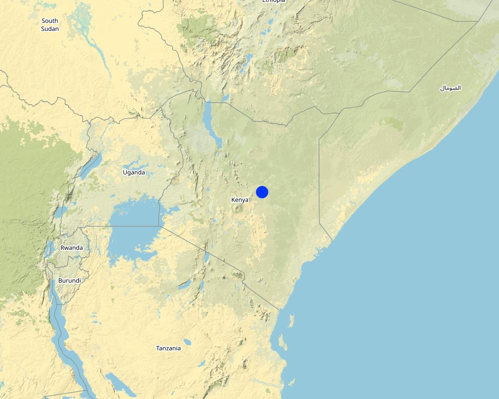
Isiolo
Более точная привязка места:
Pasturalist areas
Map
×2.6 Даты начала и окончания реализации Подхода
Год начала реализации:
2012
Год окончания (Если Подход больше не применяется):
2015
Комментарии:
The mapping process needs to be continuous as new community resources are identified and added
2.7 Тип Подхода
- в рамках проекта/ программы
2.8 Каковы цели/ задачи Подхода
- To allow participation for community groups to inform planners.- To provide the necessary precision for planners to use local knowledge effectively.- To make a ‘bridge’ for information to flow between customary and formal institutions.- To better share ideas through communication tools using powerful visual language.- To demonstrate the depth of local knowledge about natural resources and with that, demonstrate the importance of these resources.- To identify gaps and risks in the system being mapped.- To compare one plan with another to see how complimentary/contradictory they are.
2.9 Условия содействующие применению Технологии/ Технологий в рамках Подхода или затрудняющие его
Социальные/ культурные/ религиозные нормы и ценности
- содействуют
Communities are awed by the technology that allows them to see their resources while seated in a single specific location. The approach doesn't conflict with any community social, cultural, religious norms and values.
- затрудняют
Minimal local capacity is required to use the technology.
Наличие/ доступность финансовых ресурсов и услуг
- содействуют
A brief GIS training of four weeks can allow county government staff to develop, add and update the database.
- затрудняют
Short GIS training courses costs around $850 and facilitation of community engagement meetings may be costly to undertake.
Институциональные условия
- содействуют
The approach helps in improving planning at community and government levels, and is accepted by all stakeholders.
- затрудняют
Poor capacity and financial resources can be a challenge.
Сотрудничество/ координация действий
- содействуют
The product of the participatory mapping process is beneficial to all actors and many are willing to engage in implementation of the approach.
- затрудняют
Different mapping initiatives are undertaken by actors with various objectives.
Нормативно-правовая база (землевладение, права на земле- и водопользование)
- содействуют
The approach helps in land use planning and supports regulations meant to improve land governance such as a customary natural resource management bill.
- затрудняют
County governments can develop their own spatial plans, but there are only few initiatives underway to map county resources
Программные документы/ руководящие установки
- содействуют
Many policies and laws (including the national constitution) support the mapping of resources to improve land use planning.
- затрудняют
Conflicts over land undermines political will.
Управление земельными ресурсами (принятие решений, осуществление и контроль за выполнением)
- содействуют
The approach allows communities to develop their land use plans for resource utilisation, and digitize them - making the work of land governance easier.
- затрудняют
Competing claims over land and land-based resources in community lands means enforcement of the approach is often challenged. Resources along administrative boundaries are claimed by different communities.
Осведомленность в области УЗП, доступность технической поддержки
- содействуют
New graduates in dryland resource management, and communities' reception of the new technologies, help in acceptance and implementation of the technology.
- затрудняют
58% of the residents of the county (according to the Kenya National Bureau of Statistics socio-economic survey report of 2016) are illiterate and may have difficulties engaging properly with the technology.
Рынки (для приобретения материалов и услуг, продажи продукции) и цены
- содействуют
Free open source programmes are available to digitize local knowledge to geo-referenced products.
- затрудняют
Good programmes for mapping are expensive.
Объем работ, доступность рабочей силы
- содействуют
The technology makes the process simpler and reduces the workload.
- затрудняют
The processes can be tedious because of the paper maps involved, series of validation and verification of features.
3. Участие и распределение ролей заинтересованных сторон
3.1 Заинтересованные стороны, участвующие в реализации Подхода и их роли
- местные землепользователи/ местные сообщества
Jarsa Dedha (customary natural resource management institutions) Community Members (i.e. pastoralists).
Jarsa Dedha identify the most knowledgeable elders from different grazing areas to help in identifying features and providing grazing land management plans that are in place. Community members identify features and contribute to the attributes of the features.
- организации местных сообществ
Kinna Integrated community based initiative (KICBI)Ward Adaptation Planning Committees
They identify features and also contribute to attributes of the features
- эксперты по УЗП/ сельскому хозяйству
Ibrahim Jarso
Support mapping process and also add new features supporting updates to the products.
- общественные организации
Resource Advocacy Program (RAP)Merti Integrated Development Program (MID-P)Adaptation Consortium
Support the mapping process and mobilize communities and stakeholders for the approach to be implemented properly.
- местные власти
Isiolo County Government
Support the mapping process with intention to use product for planning purpose and own the product
- государственные власти (отвечающие за планирование или принятие решений)
Kenya's National Government
Support the planning process - also with the intention of using the product for planning.
- международные организации
International Institute for Environment and Development (IIED) and theUniversity of Southampton (Geodata Institute)
Support with funding to implement the approach and also provide technical expertise to undertake GIS processing of data.
Если участвовало несколько заинтересованных сторон, назовите ведущую организацию:
WAPC , ADA and IIED
3.2 Участие местных землепользователей/ местных сообществ на разных стадиях реализации Подхода
| Участие местных землепользователей/ местных сообществ | Перечислите участников и опишите их вовлеченность | |
|---|---|---|
| инициирование/ мотивация | пассивное | Resource Advocacy Programme (RAP) undertook discussions with the local community and also with the county and national government in shaping the idea for the approach. |
| планирование | интерактивное | All stakeholders (community, RAP, ADA, IIED, Geodata and Governments) were engaged in the planning for the implementation of the Approach. |
| выполнение | интерактивное | Community members and all stakeholders were involved in the implementation of the participatory mapping. |
| мониторинг/ оценка | пассивное | The county government and the actors (RAP, ADA and IIED) monitor the participatory mapping database and improves it. |
3.3 Схема реализации (если имеется)
Описание:
Participatory mapping of community resources has seven steps, which can be summarised under the main groupings of: consultations with the community where key features are identified and mapped on paper; digitization of community identified points by GIS specialists; processing of the data where community identified attributes are incorporated into the data; and feedback sessions for community validation and verification.
Автор:
Ibrahim Jarso
3.4 Принятие решений по выбору Технологии/ Технологий УЗП
Укажите, кто принимал решение по выбору применяемой Технологии/ Технологий:
- все участники как часть процесса совместных действий
Поясните:
The process requires inputs from all the relevant stakeholders. The community provide local knowledge of the features, GIS specialists provide technical expertise and the other local stakeholders provide their knowledge and experience of working in the communities for many years.
Поясните на чём было основано принятие решений:
- личный опыт и мнения (незадокументированные)
4. Техническая поддержка, повышение компетенций и управление знаниями
4.1 Повышение компетенций/ обучение
Проводилось ли обучение землепользователей/ других заинтересованных лиц?
Да
Укажите, кто проходил обучение:
- землепользователи
- местный персонал/консультанты
Если существенно, укажите гендерный и возрастной состав, статус, этническую принадлежность и т.д.
5 persons trained- One from County Government (Planning Unit), Two from National government (National Drought Management Authority and Kenya Meteorological Department (KMD)) and Two representative of Local NGOs (RAP and MID-P)
Тип обучения:
- в ходе работы
- курсы
Рассматриваемые темы:
Participatory GIS mapping techniquesInput of data using different platformsUse of GPS devicesValidation of dataData management
Комментарии:
The training was well done with seminars and practical sessions
4.2 Консультационные услуги
Есть ли у землепользователей возможность получать консультации?
Да
Укажите, где именно оказываются консультационные услуги:
- на полях землепользователей
Описание/ комментарий:
practical sessions were provided in the field and with communities
4.3 Институциональная (организационная) поддержка
В ходе реализации Подхода были ли организованы новые институциональные структуры или поддержаны уже существующие?
- да, умеренно
Укажите уровень, на котором структуры были укреплены или вновь созданы:
- местные
Опишите организацию, функции и ответственность, членство и т.д.
Local institutions were able to use the maps to advocate for improved planning.
Укажите тип поддержки:
- повышение компетенций/ обучение
Подробнее:
Courses/trainings were provided
4.4 Мониторинг и оценка
Являются ли мониторинг и оценка частью Подхода?
Да
Комментарии:
inputs were monitored
Если да, будет ли данный документ использоваться для мониторинга и оценки?
Да
Комментарии:
It was also used to mapped investments that were done to improve community livelihoods
4.5 Научные исследования
Были ли научные исследования частью Подхода?
Да
Укажите темы исследований:
- экология
Напишите подробнее и назовите тех, кто выполнял исследования:
Research on vegetation patterns in Isiolo’s rangelands were conducted by the University of Nairobi's Department of Land and Resource Management.
5. Финансирование и внешняя материальная поддержка
5.1 Годовой бюджет мероприятий по УЗП в рамках Подхода
Если точный годовой бюжет неизвестен, укажите примерный диапазон затрат:
- 10000-100000
Комментарий (например, основные источники финансирования/ ключевые доноры):
The approach was supported by RAP and IIED under the Adaptation Consortium with funding from UK's Department for International Development (DfID). The budget is used to convene sub-county level meetings and trainings sessions. Many of the participants costs and preparation costs are not covered.
5.2 Финансирование и внешняя материальная поддержка, предоставляемая землепользователям
Предоставлялась ли землепользователям финансовая/ материальная поддержка для применения Технологии /Технологий?
Нет
5.3 Субсидии на отдельные затраты (включая оплату труда)
- труд
| В какой степени | Опишите субсидии подробнее |
|---|---|
| профинансированы полностью | Community meetings were supported by the actors in the project (RAP, IIED and Adaptation Consortium). |
- оборудование
| Укажите, какие ресурсы были субсидированы | В какой степени | Опишите субсидии подробнее |
|---|---|---|
| техника | профинансированы полностью | Machinery used in the approach was purchased by the actors involved. |
| инвентарь/ инструменты | Tools used in the approach were purchased by the actors involved. | |
Если труд землепользователя был существенным вкладом, укажите, был ли этот вклад:
- добровольный
Комментарии:
Communities provided the local knowledge to support the approach.
5.4 Кредитование
Предоставлялись ли в рамках Подхода кредиты на мероприятия УЗП?
Нет
6. Анализ влияния и заключительные положения
6.1 Влияние Подхода
Сумел ли Подход расширить возможности местных землепользователей, повысить участие заинтересованных сторон?
- Нет
- Да, немного
- Да, умеренно
- Да, существенно
Yes, the approach strengthens community rights and management of resources.
Сумел ли Подход дать возможность принимать решения на основе подтвержденных фактов?
- Нет
- Да, немного
- Да, умеренно
- Да, существенно
Yes greatly – provided databases that did not previously exist.
Сумел ли Подход помочь землепользователям внедрить и поддерживать технологии УЗП?
- Нет
- Да, немного
- Да, умеренно
- Да, существенно
Strengthened the traditional system of management of land.
Сумел ли Подход улучшить согласованность действий и повысить рентабельность применения практик УЗП:
- Нет
- Да, немного
- Да, умеренно
- Да, существенно
Improved coordination among the partners and enabled monitoring of resource conditions.
Сумел ли Подход расширить знания и возможности землепользователей в применении практик УЗП?
- Нет
- Да, немного
- Да, умеренно
- Да, существенно
The technology provided digitized observation of resources, and communities realised their wealth of their resources.
Сумел ли Подход расширить знания и возможности других заинтересованных сторон?
- Нет
- Да, немного
- Да, умеренно
- Да, существенно
The Community resource atlas of Isiolo County has been online since July 2015.
Yes greatly, the Approach made local institutions stronger and enhanced their collaboration and data sharing.
Сумел ли Подход снизить остроту конфликтов?
- Нет
- Да, немного
- Да, умеренно
- Да, существенно
The Approach mapped conflict hotspots and improved the process of conflict resolution and analysis.
Сумел ли Подход содействать гендерному равенству и расширить права и возможности женщин и девочек?
- Нет
- Да, немного
- Да, умеренно
- Да, существенно
The process also engaged women in gathering local knowledge of resources and they made a very considerable contribution to the work.
Сумел ли Подход стимулировать молодежь/ будущее поколение землепользователей заниматься УЗП?
- Нет
- Да, немного
- Да, умеренно
- Да, существенно
The use of GIS fascinated young people and they felt attracted to the process.
Сумел ли Подход разрешить правовые проблемы землевладения/ землепользования, препятствующие использованию технологий УЗП?
- Нет
- Да, немного
- Да, умеренно
- Да, существенно
The approach guided use of land and also strengthened communities ownership and rights over their land and their available resources.
Сумел ли Подход улучшить санитарные условия и доступ к водоснабжению?
- Нет
- Да, немного
- Да, умеренно
- Да, существенно
The approach guided water investments in the community lands and improved placement of water infrastructure.
Сумел ли Подход привести к более эффективному использованию электроэнергии/ возобновляемых источников энергии?
- Нет
- Да, немного
- Да, умеренно
- Да, существенно
The approach mapped boreholes, and the energy used to extract water from them, as well as encouraging use of clean and green energy.
Сумел ли Подход улучшить способность землепользователей адаптироваться к изменениям климата и смягчать последствия катастрофических погодных явлений?
- Нет
- Да, немного
- Да, умеренно
- Да, существенно
The approach concretized the community land use plans and guided proper use of their pasture and water - enhancing the community's capacity to adapt to climate related disasters of drought and floods.
6.2 Основные причины, побуждающие землепользователей внедрять УЗП
- рост продуктивности
The Approach improved planning and management of resources leading to increased productivity
- снижение деградации земель
Mapping of Land use plans helped in reducing land degradation.Participatory Mapping Approach was used by International Union for Conservation of Nature (IUCN) to map out degaraded lands in the County and targetted interventions were undertaken with Dedha elders.
- снижение риска катастрофических погодных явлений
The approach allowed the communities to plan and prepare before disasters happen by identifying fall back areas and mapping them.Flood prone areas, Drought reserves and Conflict hotspots were mapped and deliberate interventions undertaken on addressing this.
- нормативно-правовое регулирование (штрафы)/ контроль
The Approach developed Maps which guided the enforcement of the traditional rules and regulations of accessing pasture and water during specific seasons.
- экологическая сознательность
The approach mapped key environmental resources like non-gazette forests with opportunity to enhance protection and conservation
- приобретение знаний и опыта в области УЗП
Supported the traditional systems of management of natural resources
- снижение остроты конфликтов
The approach mapped the conflict hotspots in the county with intention to resolve or mitigate conflicts
6.3 Долгосрочная устойчивость мероприятий в рамках Подхода
Могут ли землепользователи самостоятельно (без внешней поддержки) продолжать применение того, что было реализовано в рамках Подхода?
- нет уверенности
Если нет или нет уверенности, объясните почему:
The approach was implemented with support from donors and county government. Although in theory, it could be possible for resource users to auto-finance the Approach, this has not ever happened previously, and many of the resource users are not wealthy. Support is available for devolved development planning and mapping, but as yet this has not been assigned to participatory resource mapping.
6.4 Сильные стороны/ преимущества Подхода
| Сильные стороны/ преимущества/ возможности по мнению землепользователей |
|---|
| It is a promising new approach that builds on the legitimacy of local/indigenous knowledge, and enables the county government to fulfil its mandate of undertaking participatory planning with communities. |
| GIS technology helps in the acceptance of the approach by many land users. |
| The mobililty of the technology can provide an opportunity for all community members to add features as they come up |
| Сильные стороны/ преимущества/ возможности по мнению составителя или других ключевых специалистов |
|---|
| It is a user friendly approach accepted and recognized by Isiolo pastoralists for mapping their rangeland resources. |
| It provides an opportunity to map all investments of development partners in the county and avoid duplication of projects. |
| It is a powerful tool for communication and advocacy for community land rights. |
6.5 Слабые стороны/ недостатки Подхода и пути их преодоления
| Слабые стороны/ недостатки/ риски по мнению землепользователей | Возможные пути их преодоления/снижения? |
|---|---|
| It requires time and commitment from community members and county officers. | Systematic use of media (e.g. radio, websites, etc) to publicize the approach and its importance to the community. |
| It is difficult for illiterate community members to fully engage with the approach and make meaningful contributions. | Provide local translations and interpretation as well as producing good visual maps. |
| Слабые стороны/ недостатки/ риски по мнению составителя или ответственных специалистов | Возможные пути их преодоления/снижения? |
|---|---|
| There is a need for continuous updating | Engage local universities and students. |
| Observation of key features and resources are sometimes obscured by clouds and thus mapping precision is affected. | Ground truthing visits and observations need to be undertaken to improve precision. |
| Lack of legislation to support and enforce the use of the approach. | Formulate legislation to support enforcement. |
7. Справочные материалы и ссылки
7.1 Методы сбора/источники информации
- выезды на места, полевые обследования
Made 2 field visits in Kinna and Garbatulla Wards, engaged 20 community members
- опросы землепользователей
20 community members and 3 community based organization representatives
- опросы специалистов/экспертов по УЗП
Engaged 2 staff of MID-P and 2 staff of RAP
- данные, собранные из отчетов и достоверных документов
used Community Resource Mapping and Validation reports and Isiolo Community Resource Atlas 2015
7.2 Ссылки на опубликованные материалы
Название, автор, год публикации, ISBN:
Participatory Mapping using Digital Earth Tools, Imagery and Open Source GIS in the drylands of Kenya and Tanzania by Chris Hill, Tom Rowley, Homme Zwaagstra, Andrew Harfoot and Mike Clark
Где опубликовано? Стоимость?
Ada Consortium Website
7.3 Ссылки на материалы, доступные онлайн
Название/ описание:
Resource Atlas of Isiolo County, Kenya
Адрес в сети Интернет:
pubs.iied.org/pdfs/G03984.pdf
Ссылки и модули
Развернуть все Свернуть всеСсылки
Нет ссылок
Модули
Нет модулей


