Sub-Sarface Dams (SSD) [Кения]
- Создание:
- Обновить:
- Составитель: Guyo Roba
- Редактор: –
- Рецензенты: Donia Mühlematter, Rima Mekdaschi Studer, Brigitte Zimmermann
technologies_3340 - Кения
- Полная аннотация в формате PDF
- Полная аннотация в формате PDF для вывода на печать
- Полная аннотация в формате интернет-страницы
- Полная аннотация (неотформатированно)
- Sub-Sarface Dams (SSD): 22 июня 2018 г. (inactive)
- Sub-Sarface Dams (SSD): 7 мая 2018 г. (inactive)
- Sub-Sarface Dams (SSD): 17 июля 2018 г. (inactive)
- Sub-Sarface Dams (SSD): 15 августа 2018 г. (inactive)
- Sub-Surface Dams (SSD): 5 декабря 2018 г. (inactive)
- Sub-Sarface Dams (SSD): 3 сентября 2018 г. (inactive)
- Sub-Surface Dams (SSD): 2 ноября 2021 г. (public)
Просмотреть разделы
Развернуть все Свернуть все1. Общая информация
1.3 Условия, регламентирующие использование данных, собранных ВОКАТ
Когда были собраны данные (на местах)?
11/01/2018
Составитель и ответственный(-ые) специалист(-ы) согласны с условиями, регламентирующими использование собранных ВОКАТ данных:
Да
1.4 Декларация по устойчивости описываемой Технологии
Вызывает ли описанная здесь Технология проблемы деградации земель настолько, что ее нельзя назвать природосберегающей?
Нет
2. Описание Технологии УЗП
2.1 Краткое описание Технологии
Определение Технологии:
These are constructions stretching across the sand filled dry riverbed, down towards the impermeable floor of the riverbed. They are totally submerged into the ground. For example by fully covering after construction by sand. This are done along dry rivers with huge sand deposits, which has high yield potential and where water can be easily extracted. The aim is to raise groundwater tables and increase the storage capacity for water withdrawals.
2.2 Подробное описание Технологии
Описание:
The technology is applied in northern rangeland of Isiolo County which is managed under communal management systems. The aim of technology to reduce pasture and water availability imbalances. The dimensions of sub-surface dam include: a length of water spread (103m),width of the dam (15m), width of water spread (18m), effective dam height (2m), volume of retained sand (103 x 0.5(15 +18) x0.5 x2.0 = 5098.50m3) and the volume of water that can be abstracted from the sand bed (25/100x 5098.50m3 = 1274.6.36m3).
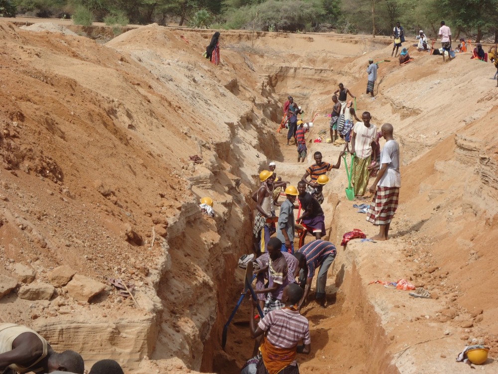
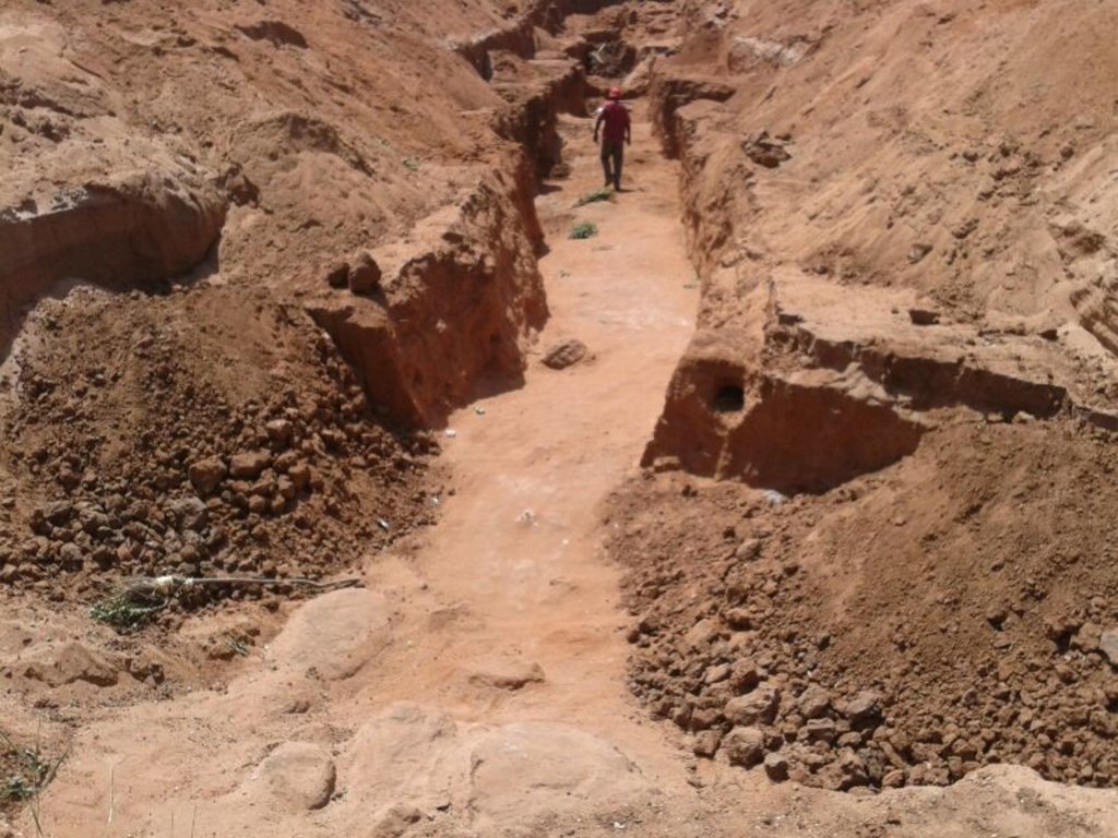
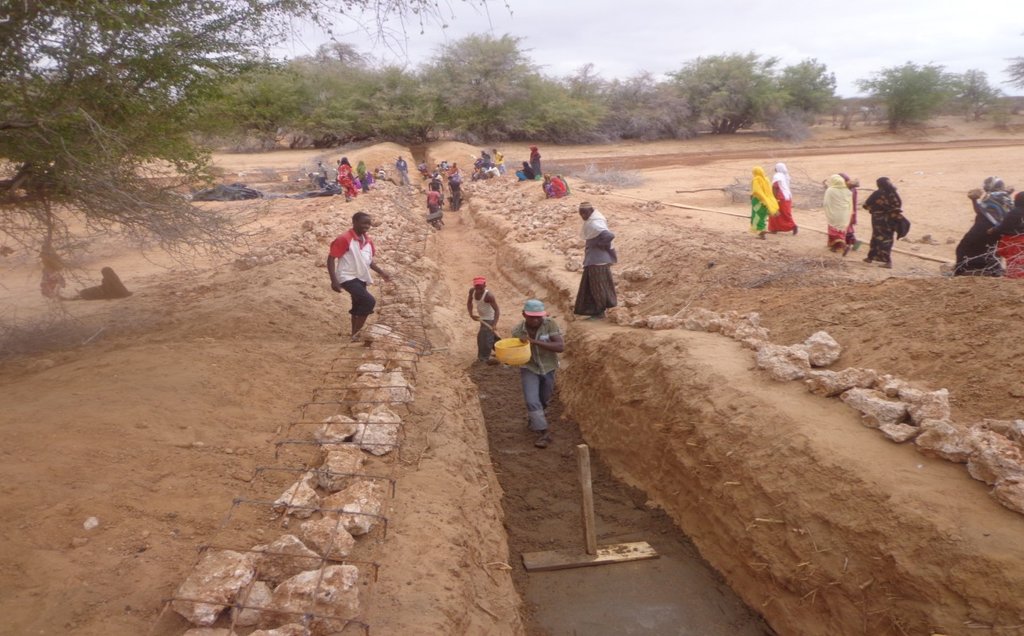
The technology functions as underground water storage infrastructure and the typical activities include, excavation of top porous soil, excavation of sample pits within the excavated area, checking filtration rates of soil, compaction of soil on which dam liners are laid, smoothing the sharp liners along which the dam liners are laid, making grooves to anchor the dam liner, laying the dam liner, anchoring the dam liner with a mixture of cement, water proof and sand with water (motor) and finally drying of the motor and filling back of sand.
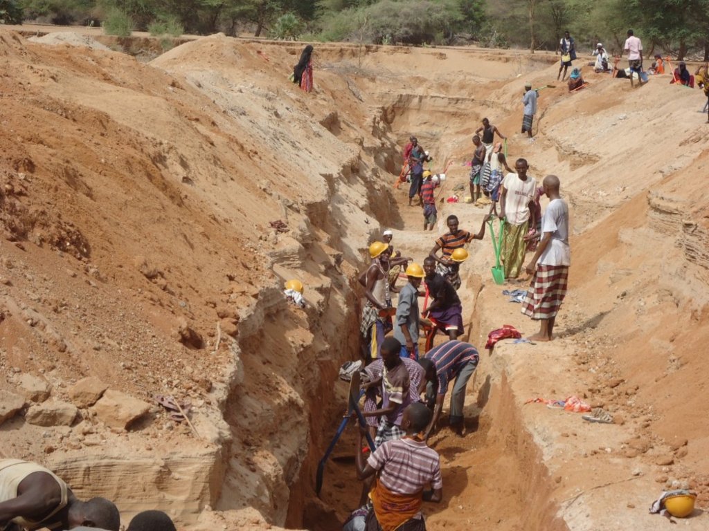
The development of Sub-Surface Dams (SSDs) was done through Cash for Work program where local labours comprising of 40-50 persons are engaged in excavation, compactions and developing the liners. Farm tools like jembe, panga, spades and human labour are required to develop the SSD. The technology improves water supply/availability, thereby extending the period of livestock grazing in areas where typically water is depleted before the pasture hence improves water access for livestock in ways that support wider management and utilization of the rangeland and as such strength the resilience of pastoralists to droughts. This effectively gives pastoral groups, an extra grazing time (typically 2 extra months), a period usually not too long to encourage land degradation through over-grazing but long enough to enable pastoralist utilize the remaining pasture in wet season grazing areas. In so doing, the technology enable balanced use of vast communal lands without livestock retreating to dry season grazing areas.
In the process of the landscape level participatory planning with the communities: i) they identified different challenges, including need for decommissioning certain water points that they consider are contributing to over grazing and also attracting other communities, hence drive frequent conflicts, secondly, ii) they mapped areas in the rangeland where there is mismatch between water and pasture availability, most of these areas are in wet season grazing areas. So the next discussion was on what strategic water infrastructures that will enable herders to graze for 2 -3 extra months to enable them utilize the grass before they migrate to the traditional dry season grazing areas. So by design, the technology should only yield water that can allow settling for those extra months, not longer to the detriment of the rangeland
The technology was instrumental in fostering both balanced utilization of land and strengthening sustainable use of the vast rangeland by ensuring that herders utilize available pastures in the wet seasons grazing areas before moving to dry seasons grazing areas. The water stored through the technology stays longer, in this case study, the water lasted for 5 months after the end of the rainy season .
The area receives bimodal rainfall, long rain in March-May and short rain in November-December. With changing seasons/climate, the dry seasons can last up to 1 year in case of rainfall failure. Typically, dry seasons are 6-7 months (May- November).
Normally, the water is depleted within 2 months after the rainy period. The technology is also cheap and easy to understand and construct (especially in areas with clay as the underlying impermeable material) with a possibility of the communities to be taught how to identify suitable site and the entire process of construction. However, in areas without clay soil, the excavation of clay and transportation can be labour intensive and expensive.
2.3 Фотографии, иллюстрирующие Технологию
2.5 Страна/ регион/ места, где применяется Технология, информация о которых собрана в данной Анкете
Страна:
Кения
Административная единица (Район/Область):
Northern Kenya
Более точная привязка места:
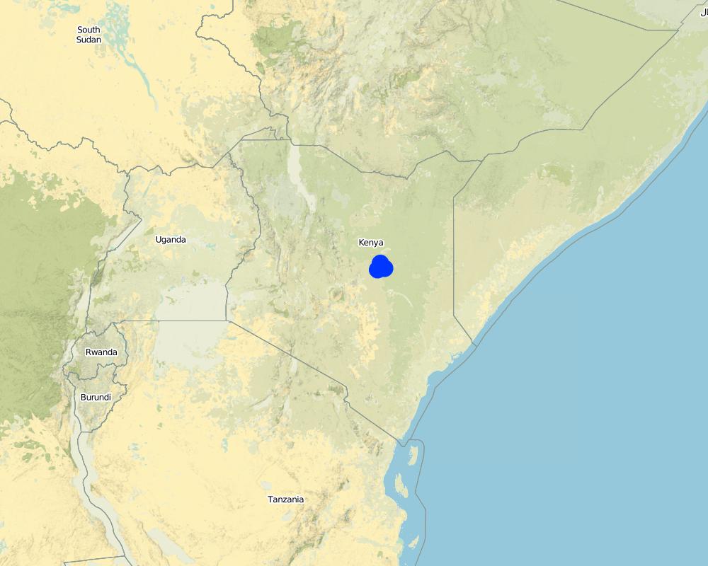
Garba Tula, Isiolo County
Map
×2.7 Внедрение Технологии
Укажите, как именно Технология УЗП была внедрена:
- через проекты/ внешнее вмешательство
3. Классификация Технологии УЗП
3.1 Основные цели и задачи реализации Технологии
- повышение производства
- снижение или предотвращение деградации земель, восстановление нарушенных земель
- адаптация к изменению климата / экстремальным погодным явлениям и их последствиям
- смягчение последствий изменения климата
- создание благоприятных экономических условий
- создание благоприятных социальных условий
3.2 Текущий(-ие) тип(-ы) землепользования на территории, где применяется Технология

Пастбищные угодья
Пастбищные земли, экстенсивный выпас:
- Полукочевое/ отгонное животноводство
Пояснения:
Communal grazing area that is shared by 2 and more pastoral groups
3.3 Дополнительная информация о землепользовании
Обеспеченность водой участков, где реализуется Технология :
- богарные земли
Поголовье скота на единицу площади (если применимо):
Fluctuates, depending on seasons and pasture availability
3.4 Категория УЗП, к которой относится Технология
- Кочевое животноводство и пастбищное хозяйство
3.5 Распределение Технологии по площади
Охарактеризуйте пространственное распространение Технологии :
- примененяется точечно/ на небольших участках
Пояснения:
Sub-Surface Dams are only suitable in areas along the river, with suitable density of sand deposits
3.6 Мероприятия УЗП, выполняемые в рамках Технологии

инженерные мероприятия
- И5: Дамбы, водохранилища, пруды
3.7 Основные проблемы деградации земель, на решение которых направлена Технология

другое
Пояснения:
Mismatch of pasture and water resources - there are areas where pastures are plenty but surface rain water is depleted earlier than pasture.
3.8 Предотвращение и снижение деградации земель, или восстановление нарушенных земель
Укажите цель Технологии по отношению к деградации земель :
- предотвращение деградации земель
- снижение деградации земель
Пояснения:
The SSD technology increase water availability is period immediately after the rain, hence ensuring better pasture utilization and more sustainable use of land.
4. Технические характеристики, мероприятия по практической реализации, вложения и стоимость
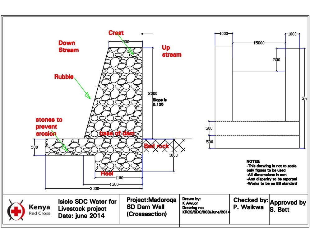
4.1 Технический рисунок, иллюстрирующий Технологию
4.2 Спецификация / пояснения к техническому рисунку
The SSD has initial excavation works. The construction of the SSD was constructed by 50 laborers. The area of excavation is subdivided into 45 square chambers of 4X2.3X2.2= 20.2M3 (not to scale). Each of the chambers were excavated by 5 laborers. The estimated time for excavation as per the plan was estimated to be five days. Excavation and transportation of the clay from the clay pit was estimated to take an approximate of five days while the compacting of the clay will follow one week later, and laying out of the concrete and refilling of the sand for another week. The liner will then be finally placed. In summary, the excavation of sand takes 5 days, and the excavation of clay soil takes another 5 days while concrete placing, compacting of clay as well as putting of liner and refilling of sand takes 10 days.
4.3 Общая информация по необходимым вложениям и стоимости
Уточните, как рассчитывались затраты и вложения:
- на технологическую единицу
Укажите единицу:
chamber
Укажите денежные единицы, использованные для подсчета затрат:
- Доллары США
Укажите среднюю дневную заработную плату наемных работников:
3.5 USD per day
4.4 Мероприятия, необходимые для начала реализации
| Деятельность | Тип мероприятия | Сроки | |
|---|---|---|---|
| 1. | Removing sand over dyke and man-days for excavating and transporting soil to dam site | Другие мероприятия | 21 days for 45 casual labourers |
| 2. | Building and compaction soil in dam wall | Инженерные | 3 days for 45 casual labourers |
| 3. | Supplying water for compaction | Другие мероприятия | 0.5 day for 45 casual labourers |
| 4. | Back-filling sand on dam | Другие мероприятия | 1 day for 45 casual labourers |
| 5. | Supplying water for compacting clay in dam wall | Другие мероприятия | 2 days for 45 casual labourers |
| 6. | Compacting soil and placing liners | Другие мероприятия | 12 days for 45 casual labourers |
Пояснения:
The construction of SSD was done through “Cash for work” which is participatory process that involves community mobilization, identification of beneficiaries and formation of “Cash for work” committees, registrations and verification of beneficiaries and implementation/supervision of the work.
4.5 Вложения и затраты, необходимые для начала реализации
| Опишите затраты | Единица | Количество | Затраты на единицу | Общая стоимость на единицу | % затрат, оплаченных землепользователями | |
|---|---|---|---|---|---|---|
| Оплата труда | tools - jembe, spade etc. | pieces | 80,0 | 5,33 | 426,4 | |
| Оплата труда | Removing sand over dyke and Man-days for excavating and transporting soil to dam site | per day | 945,0 | 4,0 | 3780,0 | |
| Оплата труда | Building and compaction soil in dam wall | per day | 135,0 | 4,0 | 540,0 | |
| Оборудование | Supplying water for compaction | per day | 22,5 | 4,0 | 90,0 | |
| Оборудование | Back-filling sand on dam | per day | 45,0 | 4,0 | 180,0 | |
| Оборудование | Supplying water for compacting soil in dam wall | per day | 90,0 | 4,0 | 360,0 | |
| Оборудование | Compacting soil and placing liners | per day | 540,0 | 4,0 | 2160,0 | |
| Общая стоимость запуска Технологии | 7536,4 | |||||
Пояснения:
As stated, the cash for work approach means that people get paid 4 USD per day for working on SSD until completion. There are phases where people participated in preliminary phases in meetings and consultation without payments but the actual work was done on cash for work basis.
4.6 Поддержание/ текущее обслуживание
| Деятельность | Тип мероприятия | Сроки/ повторяемость проведения | |
|---|---|---|---|
| 1. | Training of communities to manage and maintain the structures | Инженерные | yearly |
4.7 Стоимость поддержания/ текущего обслуживания ( в год)
| Опишите затраты | Единица | Количество | Затраты на единицу | Общая стоимость на единицу | % затрат, оплаченных землепользователями | |
|---|---|---|---|---|---|---|
| Оплата труда | Labour for site protection and maintenance of hygiene | per site | 10,0 | 100,0 | 1000,0 | |
| Общая стоимость поддержания Технологии | 1000,0 | |||||
Пояснения:
Water User Associations on the sites are trained on the management of the structures on behalf of the community e.g. on the protection of structure and hygiene maintenance.
4.8 Наиболее значимые факторы, влияющие на стоимость затрат
Опишите наиболее значимые факторы, влияющие на стоимость затрат:
Distance of the sub-surface dam from villages, extent of destruction by floods and human activities
5. Природные и социально-экономические условия
5.1 Климат
Среднегодовое количество осадков
- < 250 мм
- 251-500 мм
- 501-750 мм
- 751-1000 мм
- 1001-1500 мм
- 1501-2000 мм
- 2001-3000 мм
- 3001-4000 мм
- > 4000 мм
Пояснения/ комментарии по осадкам:
because of the climate change, the rainfall is becoming more erratic.
Укажите название соответствующей метеостанции:
Isiolo
Агроклиматическая зона
- полузасушливая
5.2 Рельеф
Склоны (преобладающие):
- пологие (0-2%)
- покатые (3-5%)
- покато-крутые (6-10%)
- крутые (11-15%)
- очень крутые (16-30%)
- чрезвычайно крутые (31-60%)
- обрывистые (>60%)
Формы рельефа:
- плато/ равнины
- гребни хребтов/холмов
- склоны гор
- склоны холмов
- подножья
- днища долин
Зона высотной поясности:
- 0-100 м над уровнем моря
- 101-500 м н.у.м.
- 501-1000 м н.у.м.
- 1001-1500 м н.у.м.
- 1501-2000 м н.у.м.
- 2001-2500 м н.у.м.
- 2501-3000 м н.у.м.
- 3001-4000 м н.у.м.
- > 4 тыс. м н.у.м.
Укажите, приурочено ли применение Технологии к специфическим условиям:
- в ситуациях вогнутого рельефа
5.3 Почвы
Средняя мощность почв:
- поверхностные (0-20 см)
- неглубокие (21-50 см)
- умеренно глубокие (51-80 см)
- глубокие (81-120 см)
- очень глубокие (> 120 см)
Гранулометрический состав (верхнего горизонта):
- грубый крупнозернистый/ лёгкий (песчаный)
Гранулометрический состав (на глубине более 20 см):
- грубый крупнозернистый/ лёгкий (песчаный)
Содержание органического вещества в верхнем горизонте:
- среднее (1-3%)
5.4 Доступность и качество воды
Уровень грунтовых вод:
5-50 м
Доступность поверхностных вод:
недостаточны/ отсутствуют
Качество воды (без обработки):
питьевая вода хорошего качества
Является ли солёность воды проблемой?
Нет
Происходят ли периодические затопления территории?
Нет
5.5 Биоразнообразие
Видовое разнообразие:
- высокое
Разнообразие местообитаний:
- высокое
5.6 Характеристика землепользователей, применяющих Технологию
Осёдлый или кочевой:
- Полукочевой
Рыночная ориентация производства:
- смешанное (самообеспечение/ товарное хозяйство
Доходы из других источников:
- < 10% всех доходов
Относительный уровень достатка:
- средний
Индивидуальное или коллективное хозяйство:
- группа/ община
Уровень механизации:
- ручной труд
Пол:
- мужчины
Возраст землепользователей:
- средний возраст
5.7 Средний размер земельных участков, арендуемых или находящихся в собственности землепользователей, применяющих Технологию
- < 0,5 га
- 0,5-1 га
- 1-2 га
- 2-5 га
- 5-15 га
- 15-50 га
- 50-100 га
- 100-500 га
- 500-1000 га
- 1000-10000 га
- > 10000 га
Считается ли это мелким, средним или крупным хозяйством (по местным масштабам)?
- крупное
5.8 Собственность на землю, права на земле- и водопользование
Землевладелец:
- общинная/ поселковая
Право землепользования:
- общинное (контролируемое)
Право водопользования:
- общинное (контролируемое)
5.9 Доступ к базовым услугам и инфраструктуре
медицинское обслуживание:
- плохой
- средний
- хорошая
образование:
- плохой
- средний
- хорошая
технические консультации:
- плохой
- средний
- хорошая
занятость (вне хозяйства):
- плохой
- средний
- хорошая
рынки:
- плохой
- средний
- хорошая
электроснабжение:
- плохой
- средний
- хорошая
транспорт и дорожная сеть:
- плохой
- средний
- хорошая
водоснабжение и канализация:
- плохой
- средний
- хорошая
финансовые услуги:
- плохой
- средний
- хорошая
6. Воздействия и заключительные положения
6.1 Влияние Технологии УЗП в пределах территории ее применения
Социально-экономическое воздействие
Продуктивность
производство продуктов животноводства
управление землями
Доступность и качество воды
доступность воды для скота
Экологическое воздействие
Климат и снижение риска стихийных бедствий
влияние засух
6.2 Влияние Технологии за пределами территории ее применения
доступность воды
6.3 Подверженность и чувствительность Технологии УЗП к постепенным изменениям климата и экстремальным погодным явлениям/ стихийным бедствиям, связанным с изменением климата (в понимании землепользователей)
Экстремальные явления, связанные с изменением климата (стихийные бедствия)
Стихийные бедствия климатического характера
| Насколько успешно Технология справляется с этим? | |
|---|---|
| засухи | хорошо |
Гидрологические стихийные бедствия
| Насколько успешно Технология справляется с этим? | |
|---|---|
| регулярные наводнения (выход рек из берегов) | хорошо |
Пояснения:
The technology copes very well with floods as the construction is embedded in the sand and thus very well protected.
6.4 Анализ эффективности затрат
Насколько получаемый результат сопоставим с первоначальными вложениями (с точки зрения землепользователей)?
Эффективность затрат в краткосрочной перспективе:
позитивное
Эффективность затрат в долгосрочной перспективе:
позитивное
Насколько получаемый результат сопоставим с текущими расходами по поддержанию технологии (с точки зрения землепользователей)?
Эффективность затрат в краткосрочной перспективе:
позитивное
Эффективность затрат в долгосрочной перспективе:
очень позитивное
Пояснения:
The technology has limited running and maintenance costs once its done fairly well.
6.5 Внедрение Технологии
- 1-10%
Среди применяющих Технологию землепользователей, какова доля лиц, применяющих её по собственной инициативе, т.е. без какого-либо материального стимулирования со стороны?
- 0-10%
6.6 Адаптация
Была ли Технология УЗП изменена в недавнее время с целью адаптации к меняющимся условиям среды?
Нет
6.7 Сильные стороны/ преимущества/ возможности Технологии
| Сильные стороны/ преимущества/ возможности по мнению землепользователей |
|---|
| The technology created opportunity to graze in wet season grazing areas for an averge extra 2 months period after rainy seasons. The technology has provided additional water that gave herders extra days to graze in wet season areas and utilize the pasture that would have been unutilized due to water constrains. In so doing, the land users utilized the pasture without retreating to traditional dry season grazing areas. |
| The extra grazing months has reduced overall livestock mortality during droughts and also improved resilience of pastoral community. |
| The distance travelled and effort required to access water was reduced. Community members reported reduced distances covered and time spent in search of water for livestock. In some instances the distance reduced from 12-15 Km to 3 Km. Community members also mentioned reduction in conflict incidences over water resources in some areas due to adequate supply of water as a result of construction of water infrastructure. |
| The balanced utilization of the grazing area through SSD water provision, enables herd to graze in wet season grazing for slightly longer period and utilize pasture optimally, this however, does not mean that during that garzing period, there will be overgrazing. The volume of water available restricts the number of animals sustained by the grazing area. |
| Сильные стороны/ преимущества/ возможности по мнению составителя или других ключевых специалистов |
|---|
| The technology has created an opportunity to optimally use the grazing area and overall reduced land degradation. The technology Improves access to water for livestock in ways which promote more sustainable management of rangeland resources and as such strengthening the resilience of local communities. |
| The validation process prior to construction of the SSD is draws critical lessons of identifying and agreeing on where to construct the SSD in a way that fit within broader sustainable rangeland management in a manner that ensured sustainable and efficient utilization of pasture and browse resources in targeted areas. The increase in water supply allowed livestock to graze additional 2-3 months in target areas before shifting to dry grazing areas where previously they migrated before exhausting the pasture and browse resources due to water scarcity. The dry season grazing area is towards Merti, in Kom and Sabarwawa where there are deep boreholes, under, lock and key and only opened during dry seasons. In typical year, the dry season period is about 7 months. But when one rain season fail it goes to about 11 months. |
6.8 Слабые стороны/ недостатки/ риски Технологии и пути их преодоления
| Слабые стороны/ недостатки/ риски по мнению землепользователей | Возможные пути их преодоления/снижения? |
|---|---|
| When the construction season for SSD is not well planned, there is likelihood/risks of the dams being washed away by flash floods. | Better planning and timing of the development of SDD, just slightly before the onset of rainfall. |
7. Справочные материалы и ссылки
7.1 Методы сбора/ источники информации
- данные, собранные из отчетов и достоверных документов
7.3 Ссылки на материалы, доступные онлайн
Название/ описание:
Promoting resilience by influencing water infrastructure development in community managed rangelands of Kenya
Адрес в сети Интернет:
https://portals.iucn.org/library/sites/library/files/documents/2014-088.pdf
Название/ описание:
Balancing water infrastructure in community-managed rangelands in the arid and semi-arid lands of Kenya
Адрес в сети Интернет:
https://portals.iucn.org/library/sites/library/files/documents/2014-089.pdf
Ссылки и модули
Развернуть все Свернуть всеСсылки
Нет ссылок
Модули
Нет модулей


