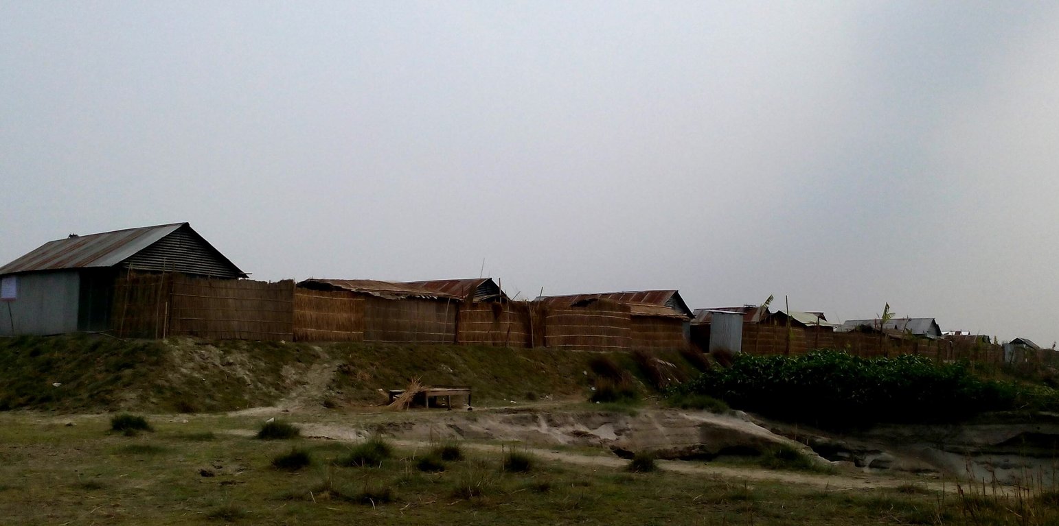
"Safe dwellings - raised foundation protect houses from floods" (Tuhin Samaddar)

Emergency infrastructure including shelter and linked transport infrastructure (บังกลาเทศ)

দুর্যোগ সহনশীন অবকাঠামো উন্নয়ন (Durjog-shahonshil abokathamo unnayon)

คำอธิบาย

Emergency infrastructure including shelter and linked transport infrastructure, consists in establishing specific flood shelters (for people and animals) including flood-proof collective water sources and communication infrastructure as well as health and school facilities that may serve at the same time as emergency shelters during floods.

The technology applies to the specific context of the ‘Char’ land in Bangladesh, characterised as riverine sandy Islands along the Jamuna River. More than 80% of the land in the intervention area can be classified as 'Char' and is inhabited by 60% of the population served by the project. Every year, especially during floods, the rivers deposit huge amount of silt sediment that makes the land fertile. At the same time, river action washes away some portion of the 'Char' which at times can be quite large and has a strong impact on people's lives and livelihoods. Before the intervention, people living on 'Char' land depended on their traditional early warning mechanisms and were frequently surprised by floods that destroyed their crops and put their lives in danger. Due to recurring floods, people didn’t have the means to improve their built environment. The 'Char' land is furthermore characterised by its lack of public infrastructure and remoteness to public services.

The technology consists of setting up an emergency infrastructure and ensuring community access to these infrastructures during times of floods. It has to be understood in close interrelation with the approach of setting up an early warning system. The emergency infrastructure includes specific flood shelters (for people and animals), flood-proof collective water sources and sanitation systems, transport infrastructure such as foot bridges and elevated rural roads, as well as flood-proof health and school facilities that also serve as emergency shelters during floods. The flood shelters are built on a raised bed of soil and located at sites selected by the communities that are relatively better protected from flood and river erosion within the 'Chars'. The purpose of the technology is to ensure safety of life and protection of assets during times of emergency and also to mitigate sufferings related to floods. The flood shelter is an elevated plane land which is on an average 220 square feet by size and at least five feet high from the existing ground level. The site is selected by the community and should be connected through an elevated road to the nearest community. This arrangement helps people to get easy access during times of floods. The shelter has collective hygienic latrine facilities and safe water sources. People generally dismantle their housing while evacuating and reinstall it on the flood shelter.
The major activities include facilitating the development of community-led risk reduction action plans and their implementation through community participation and engagement of local governance institutions. This includes maintenance of the built infrastructure as the joint responsibility of the community and the local government. Land use, especially sowing and harvesting, is increasingly linked to flood related forecasting measures which has led to significant adaptation in the timing of farming activities. This coupled with the creation and access to emergency infrastructure allows for a relatively safe and healthy living. The adopted technology and approach has led to adapted livelihoods, reduced health costs and increased income. The technology has furthermore led to mainstreaming disaster risk management in policies and approach of local government institutions. Increasingly the local government’s cash and food for work programmes are targeting establishment and/or reinforcement of emergency infrastructure that can cater to larger population. Increased investments are made especially towards flood shelters and improving communication and access to emergency infrastructure. Since the technology is based on local knowledge and has been developed in consultation with the involved communities, it is generally well accepted with a fair degree of ownership and involvement. However, parts of the region are also prone to river erosion and this has a destructive impact on built infrastructures. The technology does not assure any safeguard against this form of uncertain river action.
สถานที่

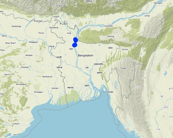
สถานที่: Kamarjani and Mollar Char Union (i.e. municipality) in Sadar Upazila and Haldia Union in Shaghata Upazila of Gaibandha District, North-Bengal, บังกลาเทศ

ตำนวนการวิเคราะห์เทคโนโลยี: > 1,000 แห่ง

ตำแหน่งทางภูมิศาสตร์ของสถานที่ที่ถูกเลือ
  • 89.66422, 25.34181
  • 89.66842, 25.37483
  • 89.62981, 25.09197
  • 89.61517, 25.09692
  • 89.63147, 25.40222
  • 89.65781, 25.37592
  • 89.57558, 25.06681
  • 89.57969, 25.07989

การเผยแพร่ของเทคโนโลยี: กระจายไปอย่างสม่ำเสมอในพื้นที่ (approx. 1-10 ตร.กม.)

In a permanently protected area?:

วันที่ในการดำเนินการ: 2014; น้อยกว่า 10 ปี (ไม่นานนี้)

ประเภทของการแนะนำ
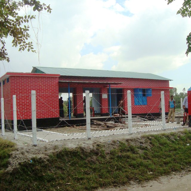
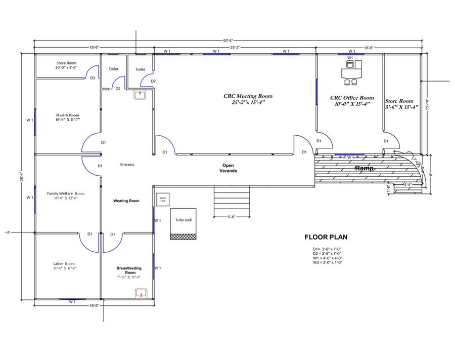
"Safety and heath arrives at the Char" - case of Community Resource Center and Community Clinic. The structures are built on elevated foundation to protect them from floods. (Tuhin Samaddar)
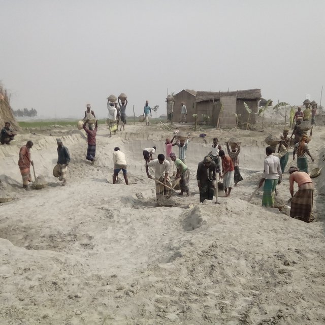
"Household Plinth Raising in Char" - the foundation of the households are raised to better protect them against flooding. (Tuhin Samaddar)

การจำแนกประเภทเทคโนโลยี

จุดประสงค์หลัก
  • ปรับปรุงการผลิตให้ดีขึ้น
  • ลด ป้องกัน ฟื้นฟู การเสื่อมโทรมของที่ดิน
  • อนุรักษ์ระบบนิเวศน์
  • ป้องกันพื้นที่ลุ่มน้ำ/บริเวณท้ายน้ำ โดยร่วมกับเทคโนโลยีอื่นๆ
  • รักษาสภาพหรือปรับปรุงความหลากหลายทางชีวภาพ
  • ลดความเสี่ยงของภัยพิบัติ
  • ปรับตัวเข้ากับการเปลี่ยนแปลงภูมิอากาศของโลก สภาพภูมิอากาศที่รุนแรงและผลกระทบ
  • ชะลอการเปลี่ยนแปลงภูมิอากาศของโลกและผลกระทบ
  • สร้างผลกระทบทางด้านเศรษฐกิจที่เป็นประโยชน์
  • สร้างผลกระทบทางด้านสังคมที่เป็นประโยชน์
การใช้ที่ดิน

  • พื้นที่ปลูกพืช
    • การปลูกพืชล้มลุกอายุปีเดียว: cereals - maize, cereals - other, cereals - rice (wetland), cereals - wheat (winter), legumes and pulses - other, root/tuber crops - sweet potatoes, yams, taro/cocoyam, other, vegetables - leafy vegetables (salads, cabbage, spinach, other), Kharif and Rabi (Cereals)
    • การปลูกพืชยืนต้นที่ไม่มีเนื้อไม้ : medicinal, aromatic, pesticidal plants - perennial
    จำนวนของฤดูเพาะปลูกต่อปี: 3
  • ทุ่งหญ้าเลี้ยงสัตว์
    • Every household have at least a pair or more of livestock.
    Animal type: buffalo, cattle - non-dairy beef, cattle - non-dairy working, goats, mules and asses, sheep
    Is integrated crop-livestock management practiced? ไม่ใช่
  • การตั้งถิ่นฐาน โครงสร้างพื้นฐาน - การตั้งถิ่นฐาน ตึกอาคาร, การจราจร ทางถนน รถไฟ
การใช้น้ำ
  • จากน้ำฝน
  • น้ำฝนร่วมกับการชลประทาน
  • การชลประทานแบบเต็มรูปแบบ

ความมุ่งหมายที่เกี่ยวข้องกับการเสื่อมโทรมของที่ดิน
  • ป้องกันความเสื่อมโทรมของที่ดิน
  • ลดความเสื่อมโทรมของดิน
  • ฟื้นฟูบำบัดที่ดินที่เสื่อมโทรมลงอย่างมาก
  • ปรับตัวกับสภาพความเสื่อมโทรมของที่ดิน
  • ไม่สามารถใช้ได้
ที่อยู่ของการเสื่อมโทรม
  • การกัดกร่อนของดินโดยน้ำ - Wr (Riverbank erosion): การกัดกร่อนริมฝั่งแม่น้ำ, Wo (Offsite degradation): ผลกระทบนอกพื้นที่
กลุ่ม SLM
  • Emergency infrastructure, shelter and linked transportation infrastructure
มาตรการ SLM
  • มาตรการอนุรักษ์ด้วยโครงสร้าง - S9: ที่พักพิงสำหรับพืชและสัตว์, S11: อื่น ๆ
  • มาตรการอนุรักษ์ด้วยการจัดการ - M4:  การเปลี่ยนแปลงช่วงเวลาให้เหมาะแก่การทำกิจกรรม

แบบแปลนทางเทคนิค

ข้อมูลจำเพาะด้านเทคนิค
The built structural mitigation options have following technical specification:
1. Flood shelter: Dimension: Length-220' x Width-220' x Height- 5.5', Slope: 1:1.5, Capacity: 350 families, Construction material used: soil and turfing (grass)
2. Raised school compound: Dimension: Length-112' x Width-75' x Height- 5.5', Slope: 1:1.5, Capacity: 540 person, Construction material used: soil and turfing (grass)
3. Community Resource Centre and Community Clinic (CRC-CC): Dimension: Length-60' x Width-38' x Height- 5.6', Slope: 1:1.5, Capacity: 1500 families from 5 villages, Construction material used: soil and grass plantation, bricks, sand, cement, rod, iron angel and CGI sheet.
4. Disaster resilient tube well: Dimension: Length-5' 10" x Width-5' x Height- 3', Boring: 100 feet, Capacity: 200 families, Construction material used: bricks, sand, cement, rod, tube well head, pvc pipe, cylinder, piston rod etc. Vertical intervals: 2 in each village.
5. Concrete platform for (existing) tube well: Dimension: Length-4' 10" x Width-4' x Height- 1', Capacity: 100 families, Construction material used: bricks, sand, cement, pvc pipe
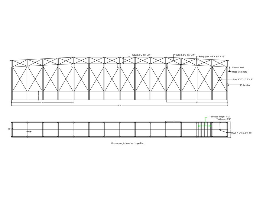
6. Wooden bridge: Dimension: Length-99' x Width-7' x Height- 12', Slope: 1:1.5, Capacity: 900 families approximately, Construction material used: wood, nails, tar, soil and grass plantation
7. Road construction/repair: Dimension: Length-925' x Width-12' x Height- 3' (from existing level), Slope: 1:1.5, Capacity: 3 villages (approx:1000 families), Construction material used: soil and turfing (grass).
Author: Abdur Razzak
None
Author: Abdur Razzak

การจัดตั้งและการบำรุงรักษา: กิจกรรม ปัจจัยและค่าใช้จ่าย

การคำนวนต้นทุนและค่าใช้จ่าย
  • ค่าใช้จ่ายถูกคำนวน ต่อหน่วยเทคโนโลยี (หน่วย: flood shelter, raised school compound, disaster resilient tube well, concrete platform for (existing) tube well, wooden bridge, road construction/repair volume, length: road: per meter)
  • สกุลเงินที่ใช้คำนวณค่าใช้จ่าย Bangladeshi Taka (BDT)
  • อัตราแลกเปลี่ยน (ไปเป็นดอลลาร์สหรัฐ) คือ 1 ดอลลาร์สหรัฐ = 79.0 Bangladeshi Taka (BDT)
  • ค่าจ้างเฉลี่ยในการจ้างแรงงานต่อวันคือ 350 BDT
ปัจจัยที่สำคัญที่สุดที่มีผลต่อค่าใช้จ่าย
Transportation of raw material from the mainland to the sites on the 'Char' Islands varies across seasons. In the dry season it is much higher compared to monsoon as the delivery of material is easier in the latter due to extended river outreach.
กิจกรรมเพื่อการจัดตั้ง
  1. Construction of Flood Shelter (ช่วงระยะเวลา/ความถี่: During dry season)
  2. Raising school compound (ช่วงระยะเวลา/ความถี่: During dry season)
  3. Construction of Community Resource Center (CRC) (ช่วงระยะเวลา/ความถี่: During dry season)
  4. Installation of disaster resilient tube well (ช่วงระยะเวลา/ความถี่: During dry season)
  5. Construction of concrete platform for (existing) tube well (ช่วงระยะเวลา/ความถี่: During dry season)
  6. Construction of wooden bridge (ช่วงระยะเวลา/ความถี่: During dry season)
  7. Road construction above flood level (ช่วงระยะเวลา/ความถี่: During dry season)
ปัจจัยและค่าใช้จ่ายของการจัดตั้ง (per flood shelter, raised school compound, disaster resilient tube well, concrete platform for (existing) tube well, wooden bridge, road construction/repair)
ปัจจัยนำเข้า หน่วย ปริมาณ ค่าใช้จ่ายต่อหน่วย (Bangladeshi Taka (BDT)) ค่าใช้จ่ายทั้งหมดต่อปัจจัยนำเข้า (Bangladeshi Taka (BDT)) %ของค่าใช้จ่ายที่ก่อให้เกิดขึ้นโดยผู้ใช้ที่ดิน
แรงงาน
Flood shelter: earth work m3 8000.0 64.0 512000.0 10.0
CRC: earth work m3 53.0 138.0 7314.0 10.0
CRC: sand filling m3 302.0 99.0 29898.0 10.0
Raised school compound: earth work m3 1790.0 64.0 114560.0 10.0
วัสดุด้านพืช
Flood shelter: grass plantation (turfing) m2 4620.0 13.0 60060.0 10.0
Flood shelter: seedlings piece 20.0 53.0 1060.0 10.0
CRC: grass plantation (turfing) m2 3890.0 13.0 50570.0 10.0
CRC: seedlings piece 50.0 53.0 2650.0 10.0
Raised school compound: grass plantation (turfing) m2 1390.0 13.0 18070.0 10.0
Raised school compound: seedlings piece 40.0 53.0 2120.0 10.0
วัสดุสำหรับก่อสร้าง
CRC: roof truss kg 4375.0 100.0 437500.0
CRC: grill and iron work m2 88.0 2091.0 184008.0
CRC: gypsum board m2 478.0 922.0 440716.0
CRC: RCC work m3 2.9 19557.0 56715.3
CRC: deformed bar kg 397.0 85.0 33745.0
CRC: boundary fencing m2 184.0 440.0 80960.0
CRC: brick work m3 44.0 5515.0 242660.0
อื่น ๆ
CRC: electric ware and solar panel lumpsum 1.0 73000.0 73000.0
CRC: water supply lumpusm 1.0 66150.0 66150.0
CRC: transportation lumpsum 1.0 89000.0 89000.0
ค่าใช้จ่ายทั้งหมดของการจัดตั้งเทคโนโลยี 2'502'756.3
Total costs for establishment of the Technology in USD 31'680.46
กิจกรรมสำหรับการบำรุงรักษา
  1. Construction of Flood Shelter (ช่วงระยะเวลา/ความถี่: During dry season)
  2. Raising school compound (ช่วงระยะเวลา/ความถี่: During dry season)
  3. Construction of Community Resource Center (CRC) (ช่วงระยะเวลา/ความถี่: During dry season)
  4. Installation of disaster resilient tube well (ช่วงระยะเวลา/ความถี่: During dry season)
  5. Construction of concrete platform ror (existing) tube well (ช่วงระยะเวลา/ความถี่: During dry season)
  6. Construction of wooden bridge (ช่วงระยะเวลา/ความถี่: During dry season)
  7. Road construction above flood level (ช่วงระยะเวลา/ความถี่: During dry season)
ปัจจัยและค่าใช้จ่ายของการบำรุงรักษา (per flood shelter, raised school compound, disaster resilient tube well, concrete platform for (existing) tube well, wooden bridge, road construction/repair)
ปัจจัยนำเข้า หน่วย ปริมาณ ค่าใช้จ่ายต่อหน่วย (Bangladeshi Taka (BDT)) ค่าใช้จ่ายทั้งหมดต่อปัจจัยนำเข้า (Bangladeshi Taka (BDT)) %ของค่าใช้จ่ายที่ก่อให้เกิดขึ้นโดยผู้ใช้ที่ดิน
แรงงาน
Earthwork m3 80.0 63.0 5040.0 10.0
Sand bag filling piece 50.0 15.0 750.0 10.0
Pipe fitting piece 2.0 300.0 600.0 10.0
Mason lumpsum 1.0 500.0 500.0 10.0
วัสดุด้านพืช
Grass plantation (turfing) m2 85.0 13.0 1105.0 10.0
Seedlings piece 15.0 53.0 795.0 10.0
วัสดุสำหรับก่อสร้าง
Plastic bag piece 50.0 10.0 500.0 10.0
PVC pipe m 15.0 120.0 1800.0 10.0
Polythene pipe kg 5.0 160.0 800.0 10.0
Ciment bag 0.5 540.0 270.0 10.0
Sand ft3 5.0 18.0 90.0 10.0
Caping socket piece 2.0 35.0 70.0 10.0
Tape etc. lumpsum 1.0 250.0 250.0 10.0
ค่าใช้จ่ายทั้งหมดของการบำรุงรักษาสภาพเทคโนโลยี 12'570.0
Total costs for maintenance of the Technology in USD 159.11

สิ่งแวดล้อมทางธรรมชาติ

ปริมาณน้ำฝนเฉลี่ยรายปี
  • < 250 ม.ม.
  • 251-500 ม.ม.
  • 501-750 ม.ม.
  • 751-1,000 ม.ม.
  • 1,001-1,500 ม.ม.
  • 1,501-2,000 ม.ม.
  • 2,001-3,000 ม.ม.
  • 3,001-4,000 ม.ม.
  • > 4,000 ม.ม.
เขตภูมิอากาศเกษตร
  • ชื้น
  • กึ่งชุ่มชื้น
  • กึ่งแห้งแล้ง
  • แห้งแล้ง
ข้อมูลจำเพาะเรื่องภูมิอากาศ
ปริมาณเฉลี่ยฝนรายปีในหน่วยมม. 2134.8
Rainy season: April- October
Occurrence of heavy rain: June-July
Length of dry period: November-March
ชื่อสถานีอุตุนิยมวิทยา 18 Gaibandha Sadar, Gaibandha
Tropical humid climatic zone.
Temperature: maximum 33.5°C, minimum 10.5°C
ความชัน
  • ราบเรียบ (0-2%)
  • ลาดที่ไม่ชัน (3-5%)
  • ปานกลาง (6-10%)
  • เป็นลูกคลื่น (11-15%)
  • เป็นเนิน (16-30%)
  • ชัน (31-60%)
  • ชันมาก (>60%)
ภูมิลักษณ์
  • ที่ราบสูง/ที่ราบ
  • สันเขา
  • ไหล่เขา
  • ไหล่เนินเขา
  • ตีนเนิน
  • หุบเขา
ความสูง
  • 0-100 เมตร
  • 101-500 เมตร
  • 501-1,000 เมตร
  • 1,001-1,500 เมตร
  • 1,501-2,000 เมตร
  • 2,001-2,500 เมตร
  • 2,501-3,000 เมตร
  • 3,001-4,000 เมตร
  • > 4,000 เมตร
เทคโนโลยีถูกประยุกต์ใช้ใน
  • บริเวณสันเขา (convex situations)
  • บริเวณแอ่งบนที่ราบ (concave situations)
  • ไม่เกี่ยวข้อง
ความลึกของดิน
  • ตื้นมาก (0-20 ซ.ม.)
  • ตื้น (21-50 ซ.ม.)
  • ลึกปานกลาง (51-80 ซ.ม.)
  • ลึก (81-120 ซ.ม.)
  • ลึกมาก (>120 ซ.ม.)
เนื้อดิน (ดินชั้นบน)
  • หยาบ/เบา (ดินทราย)
  • ปานกลาง (ดินร่วน ทรายแป้ง)
  • ละเอียด/หนัก (ดินเหนียว)
เนื้อดิน (> 20 ซม. ต่ำกว่าพื้นผิว)
  • หยาบ/เบา (ดินทราย)
  • ปานกลาง (ดินร่วน ทรายแป้ง)
  • ละเอียด/หนัก (ดินเหนียว)
สารอินทรียวัตถุในดิน
  • สูง (>3%)
  • ปานกลาง (1-3%)
  • ต่ำ (<1%)
น้ำบาดาล
  • ที่ผิวดิน
  • <5 เมตร
  • 5-50 เมตร
  • > 50 เมตร
ระดับน้ำบาดาลที่ผิวดิน
  • เกินพอ
  • ดี
  • ปานกลาง
  • ไม่ดีหรือไม่มีเลย
คุณภาพน้ำ (ยังไม่ได้รับการบำบัด)
  • เป็นน้ำเพื่อการดื่มที่ดี
  • เป็นน้ำเพื่อการดื่มที่ไม่ดี (จำเป็นต้องได้รับการบำบัด)
  • เป็นน้ำใช้เพื่อการเกษตรเท่านั้น (การชลประทาน)
  • ใช้ประโยชน์ไม่ได้
Water quality refers to:
ความเค็มของน้ำเป็นปัญหาหรือไม่?
  • ใช่
  • ไม่ใช่

การเกิดน้ำท่วม
  • ใช่
  • ไม่ใช่
ความหลากหลายทางชนิดพันธุ์
  • สูง
  • ปานกลาง
  • ต่ำ
ความหลากหลายของแหล่งที่อยู่
  • สูง
  • ปานกลาง
  • ต่ำ

ลักษณะเฉพาะของผู้ใช้ที่ดินที่ประยุกต์ใช้เทคโนโลยี

เป้าหมายทางการตลาด
  • เพื่อการยังชีพ (หาเลี้ยงตนเอง)
  • mixed (subsistence/ commercial)
  • ทำการค้า/การตลาด
รายได้จากภายนอกฟาร์ม
  • < 10% ของรายได้ทั้งหมด
  • 10-50% ของรายได้ทั้งหมด
  • > 50% ของรายได้ทั้งหมด
ระดับของความมั่งคั่งโดยเปรียบเทียบ
  • ยากจนมาก
  • จน
  • พอมีพอกิน
  • รวย
  • รวยมาก
ระดับของการใช้เครื่องจักรกล
  • งานที่ใช้แรงกาย
  • การใช้กำลังจากสัตว์
  • การใช้เครื่องจักรหรือเครื่องยนต์
อยู่กับที่หรือเร่ร่อน
  • อยู่กับที่
  • กึ่งเร่ร่อน
  • เร่ร่อน
เป็นรายบุคคลหรือกลุ่ม
  • เป็นรายบุคคล/ครัวเรือน
  • กลุ่ม/ชุมชน
  • สหกรณ์
  • ลูกจ้าง (บริษัท รัฐบาล)
เพศ
  • หญิง
  • ชาย
อายุ
  • เด็ก
  • ผู้เยาว์
  • วัยกลางคน
  • ผู้สูงอายุ
พื้นที่ที่ใช้ต่อครัวเรือน
  • < 0.5 เฮกตาร์
  • 0.5-1 เฮกตาร์
  • 1-2 เฮกตาร์
  • 2-5 เฮกตาร์
  • 5-15 เฮกตาร์
  • 15-50 เฮกตาร์
  • 50-100 เฮกตาร์
  • 100-500 เฮกตาร์
  • 500-1,000 เฮกตาร์
  • 1,000-10,000 เฮกตาร์
  • >10,000 เฮกตาร์
ขนาด
  • ขนาดเล็ก
  • ขนาดกลาง
  • ขนาดใหญ่
กรรมสิทธิ์ในที่ดิน
  • รัฐ
  • บริษัท
  • เป็นแบบชุมชนหรือหมู่บ้าน
  • กลุ่ม
  • รายบุคคล ไม่ได้รับสิทธิครอบครอง
  • รายบุคคล ได้รับสิทธิครอบครอง
สิทธิในการใช้ที่ดิน
  • เข้าถึงได้แบบเปิด (ไม่ได้จัดระเบียบ)
  • เกี่ยวกับชุมชน (ถูกจัดระเบียบ)
  • เช่า
  • รายบุคคล
สิทธิในการใช้น้ำ
  • เข้าถึงได้แบบเปิด (ไม่ได้จัดระเบียบ)
  • เกี่ยวกับชุมชน (ถูกจัดระเบียบ)
  • เช่า
  • รายบุคคล
เข้าถึงการบริการและโครงสร้างพื้นฐาน
สุขภาพ

จน
x
ดี
การศึกษา

จน
x
ดี
ความช่วยเหลือทางด้านเทคนิค

จน
x
ดี
การจ้างงาน (เช่น ภายนอกฟาร์ม)

จน
x
ดี
ตลาด

จน
x
ดี
พลังงาน

จน
x
ดี
ถนนและการขนส่ง

จน
x
ดี
น้ำดื่มและการสุขาภิบาล

จน
x
ดี
บริการด้านการเงิน

จน
x
ดี
Access to mobile phone and internet

จน
x
ดี

ผลกระทบ

ผลกระทบทางด้านเศรษฐกิจและสังคม
การผลิตพืชผล
ลดลง
x
เพิ่มขึ้น

จำนวนก่อน SLM: 3600 kg/hectare (maize)
หลังจาก SLM: 11400 kg/hectare (maize)
Crop production has increased thrice due to stability of household which has led to stable use of land in the chars.

การมีน้ำดื่มไว้ให้ใช้
ลดลง
x
เพิ่มขึ้น

จำนวนก่อน SLM: No safe drinking water source was available
หลังจาก SLM: More than 40% water source are safe
Collective water supply systems have groundwater sources and thus no treatment is needed. Further, aspects of availability, easy access and sustainable availability of sufficient water of acceptable quality are well considered. Families can access 10 litres per capita per day (LPCD) during emergencies (which is in line with Sphere standards) and during normal times 40 LPCD is what families can collect from these water sources. All such water sources are within a distance of 50 metres from the settlement as per Bangladesh standards.

คุณภาพน้ำดื่ม
ลดลง
x
เพิ่มขึ้น

จำนวนก่อน SLM: Reliable data not available
หลังจาก SLM: All households have access to safe drinking water as per govt. standard for rural areas
The collective water infrastructure built by the project ensures fulfillment of minimum standards set by the govt for safe drinking water.

รายได้จากฟาร์ม
ลดลง
x
เพิ่มขึ้น

จำนวนก่อน SLM: 25% families had farm income
หลังจาก SLM: 95% families have farm income
Cattle and poultries are safe during disaster

ผลกระทบด้านสังคมและวัฒนธรรม
สถานการณ์ด้านสุขภาพ
แย่ลง
x
ปรับปรุงดีขึ้น


The disaster mitigation measures has significantly improved the health situation of the target population.

สถาบันของชุมชน
อ่อนแอลง
x
เสริมให้แข็งแรง

จำนวนก่อน SLM: Few credit groups in intervention villages
หลังจาก SLM: 30 community based organisatons (i.e. village disaster management committees) and 3 Local Government Committees (Union disaster management committee)
Community based organisations and government mandated institutions have been promoted through project initiatives.

สถาบันแห่งชาติ
อ่อนแอลง
x
เสริมให้แข็งแรง


CRC is also being used for UDMC office which is an important committee of union parishad.

การบรรเทาความขัดแย้ง
แย่ลง
x
ปรับปรุงดีขึ้น

จำนวนก่อน SLM: Widespread
หลังจาก SLM: Rare
Conflict sensitive approach has significantly reduced the incidence of conflicts.

ผลกระทบด้านนิเวศวิทยา
ปริมาณน้ำ
ลดลง
x
เพิ่มขึ้น

จำนวนก่อน SLM: Data not available
หลังจาก SLM: Same
The disaster resilient tube well ensures year round drinking water.

ผลกระทบจากน้ำท่วม
เพิ่มขึ้น
x
ลดลง

จำนวนก่อน SLM: 95% families were effected from flood
หลังจาก SLM: 47% families are affected from flood
The above figures are from 2016 when Bangladesh experienced one of the worst floods in recent times.

ผลกระทบนอกพื้นที่ดำเนินการ

รายได้และค่าใช้จ่าย

ผลประโยชน์ที่ได้รับเปรียบเทียบกับค่าใช้จ่าย
ผลตอบแทนระยะสั้น
ด้านลบอย่างมาก
x
ด้านบวกอย่างมาก

ผลตอบแทนระยะยาว
ด้านลบอย่างมาก
x
ด้านบวกอย่างมาก

ผลประโยชน์ที่ได้รับเปรียบเทียบกับค่าใช้จ่ายในการบำรุงรักษา
ผลตอบแทนระยะสั้น
ด้านลบอย่างมาก
x
ด้านบวกอย่างมาก

ผลตอบแทนระยะยาว
ด้านลบอย่างมาก
x
ด้านบวกอย่างมาก

The limited returns that have been generated by the project is highly valued by the users from a cost - benefit perspective; especially when they understand that the project is not directly linked to land management practices. Thus, the indirect benefits are perceived to have high value.

การเปลี่ยนแปลงของสภาพภูมิอากาศ

สภาพรุนแรงของภูมิอากาศ (ภัยพิบัติ)
พายุฝนประจำท้องถิ่น

ไม่ดี
x
ดีมาก
พายุทรายหรือพายุฝุ่นประจำท้องถิ่น

ไม่ดี
x
ดีมาก
พายุลมประจำท้องถิ่น

ไม่ดี
x
ดีมาก
คลื่นความร้อน

ไม่ดี
x
ดีมาก
คลื่นความหนาว

ไม่ดี
x
ดีมาก
ภัยจากฝนแล้ง

ไม่ดี
x
ดีมาก
น้ำท่วมตามปกติ (แม่น้ำ)

ไม่ดี
x
ดีมาก
ดินถล่ม

ไม่ดี
x
ดีมาก

การน้อมเอาความรู้และการปรับใช้

เปอร์เซ็นต์ของผู้ใช้ที่ดินในพื้นที่ที่นำเทคโนโลยีไปใช้
  • ครั้งเดียวหรือเป็นการทดลอง
  • 1-10%
  • 11-50%
  • > 50%
จากทั้งหมดที่ได้รับเทคโนโลยีเข้ามามีจำนวนเท่าใดที่ทำแบบทันที โดยไม่ได้รับการจูงใจด้านวัสดุหรือการเงินใดๆ?
  • 0-10%
  • 11-50%
  • 51-90%
  • 91-100%
จำนวนหลังคาเรือนหรือขนาดพื้นที่รวมทั้งหมด
Out of a total of 8828 HHs targeted by the project, around five thousand HHs in three union have benefitted from the implementation of the technology.
เทคโนโลยีได้รับการปรับเปลี่ยนเร็วๆ นี้เพื่อให้ปรับตัวเข้ากับสภาพที่กำลังเปลี่ยนแปลงหรือไม่?
  • ใช่
  • ไม่ใช่
สภาพที่กำลังเปลี่ยนแปลงอันไหน?
  • การเปลี่ยนแปลงแบบค่อยเป็นค่อยไปและสภาพรุนแรงของภูมิอากาศ
  • การเปลี่ยนแปลงของตลาด
  • การมีแรงงานไว้ให้ใช้ (เนื่องจากการอพยพย้ายถิ่นฐาน)
Dredging machine has been used for building some emergency infrastructure at few sites due to unavailability of labour at the time of construction.

บทสรุปหรือบทเรียนที่ได้รับ

จุดแข็ง: มุมมองของผู้ใช้ที่ดิน
  • Emergency structures are collectively owned and have a multipurpose use; in 'normal' (non-emergency) times they are used for other purpose than safety and protection which includes community meeting, workshop and training
  • Expanded opportunities of communication during flood
จุดแข็ง: ทัศนคติของผู้รวบรวมหรือวิทยากรคนอื่นๆ
  • Community is aware and driven to implement flood preparedness and risk reduction measures on its own
  • Appropriate measures can significantly change people's mindset and behaviour
จุดด้อย/ข้อเสีย/ความเสี่ยง: มุมมองของผู้ใช้ที่ดินแก้ไขปัญหาได้อย่างไร
  • River erosion threatens built structures Careful site selection for construction work through in depth discussion with community people supported by scientific analysis
  • High investment needed for building physical structures (e.g. CRC building) in the char which the local government and community find difficult to finance without external support. Install portable semi-permanent structures in the char; Lobby for greater decentralisation of finances to local government
จุดด้อย/ข้อเสีย/ความเสี่ยง: ทัศนคติของผู้รวบรวมหรือวิทยากรคนอื่นๆแก้ไขปัญหาได้อย่างไร

การอ้างอิง

ผู้รวบรวม
  • TUHIN SAMADDAR
Editors
  • Anton Jöhr
ผู้ตรวจสอบ
  • Alexandra Gavilano
  • Hanspeter Liniger
  • Nicole Harari
วันที่จัดทำเอกสาร: 26 ตุลาคม 2016
การอัพเดทล่าสุด: 5 มีนาคม 2019
วิทยากร
คำอธิบายฉบับเต็มในฐานข้อมูล WOCAT
ข้อมูล SLM ที่ถูกอ้างอิง
การจัดทำเอกสารถูกทำโดย
องค์กร โครงการ
การอ้งอิงหลัก
  • Latrine and Tube well maintenance manual, SRC-BDRCS-DASCOH: SRC
This work is licensed under Creative Commons Attribution-NonCommercial-ShareaAlike 4.0 International