|
เทคโนโลยียังเป็นปัญหาเกี่ยวกับการเสื่อมโทรมของดิน ดังนั้นมันยังไม่ได้สามารถถูกยืนยันว่าเป็นเทคโนโลยีการจัดการดินที่ยั่งยืน
|
|||||||||||
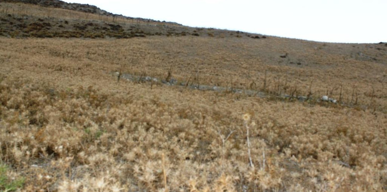
A sloping area used for intensive grazing in Crete (Costas Kosmas)
|
เทคโนโลยียังเป็นปัญหาเกี่ยวกับการเสื่อมโทรมของดิน ดังนั้นมันยังไม่ได้สามารถถูกยืนยันว่าเป็นเทคโนโลยีการจัดการดินที่ยั่งยืน
|
|||||||||||
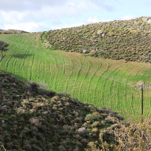
The technology is applied on semi-arid areas of Asteroussia Mountains of Crete used as grazing land with an annual rainfall between 501-750 mm. These areas are usually highly degraded, characterized by steep mountainous slopes (31-60%). This technology was mainly found in shallow (depth: 21-50 cm), moderately fine textured soils which moderate concentrations of soil organic matter (1-3%). The stock breeders in the region use a special regime for transferring livestock grazing rights from the communities to individuals. Nowadays the off farm income of breeders is between 10-50% of their total income.
Looking back, in the early 1950s to the 1980s the Asteroussia Mountains were a livestock-specialized area. Livestock production was based on controlled summer grazing in the mountains and overwintering in the lowlands. After the early 1960s, the area increasingly felt the impact of agricultural mechanization and - by consequence - excessive under-occupied rural labor force, which led to disproportionate out-migration from the area. In areas where limited natural capital was already fully utilized, such as in Asteroussia Mountains, further growth through increasing flocks was only possible by importing fodder. In a parallel, increasing intensification of agriculture in the nearby Messara plain limited the opportunities for the tradition of transhumance. Throughout the mid-1980s–2010s the economy remained livestock-dominated but the population decline continued. However, the presence of foreign migrants offering cheap labor from the early 1990s onwards contributed to keep many farms active.
Coming back to the technology, it consists of: (a) clearing natural vegetation, usually perennial shrubs accompanied with annual plants including mainly grasses, (b) sowing of high value palatable plant species for animals such as oat, vetch, etc. during winter, (c) allowing plants to grow adequately, and (d) grazing by the animals mainly during spring for a period of about one month, and (e) keeping the land bare until next wet cultivation period starts. The purpose is to increase the available biomass for the grazing animals in areas of low productivity of natural vegetation suitable for them. The major activities consists of clearing the land, plowing usually by a bulldoze type tractor, sowing the seeds and adding appropriate fertilizers. However, the establishment of this technology may face problems in clearing natural vegetation, if the existing Greek institutional framework does not allow doing it. Land degradation and desertification are very frequent processes in semi-arid areas and both processes have been enhanced in the last decades by climatic variations and human activities. The EU-funded research project DESIRE in Eastern and Western Europe, Latin America, Africa and Asia have identified soil erosion, forest fires, and overgrazing among the most important causes of land degradation. The main benefit of this technology therefore is the increase in the amount of high quality palatable biomass for the grazing animals in degraded lands. Land users like this technology, if the number of animals is high, as without the technology they face problems of feeding them. However, such an action increases the cost of animal production such as milk. In addition, soil erosion problems are expected since land remains bare for some period of the year especially after sowing the plants.
สถานที่: Asteroussia Mountain, Paranimfi, Crete, Heraklion province, กรีซ
ตำนวนการวิเคราะห์เทคโนโลยี: 10-100 แห่ง
การเผยแพร่ของเทคโนโลยี: กระจายไปอย่างสม่ำเสมอในพื้นที่ (approx. < 0.1 ตร.กม.(10 เฮกตาร์))
In a permanently protected area?:
วันที่ในการดำเนินการ: 10-50 ปี
ประเภทของการแนะนำ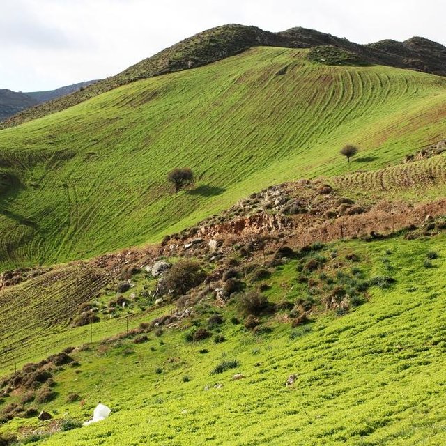


| ปัจจัยนำเข้า | หน่วย | ปริมาณ | ค่าใช้จ่ายต่อหน่วย (USD) | ค่าใช้จ่ายทั้งหมดต่อปัจจัยนำเข้า (USD) | %ของค่าใช้จ่ายที่ก่อให้เกิดขึ้นโดยผู้ใช้ที่ดิน |
| แรงงาน | |||||
| Clearing the field | person - days | 2.0 | 40.0 | 80.0 | 100.0 |
| อุปกรณ์ | |||||
| Tractor equiped with a mouldboard | 1 | 1.0 | 60.0 | 60.0 | 100.0 |
| ค่าใช้จ่ายทั้งหมดของการจัดตั้งเทคโนโลยี | 140.0 | ||||
| Total costs for establishment of the Technology in USD | 140.0 | ||||
| ปัจจัยนำเข้า | หน่วย | ปริมาณ | ค่าใช้จ่ายต่อหน่วย (USD) | ค่าใช้จ่ายทั้งหมดต่อปัจจัยนำเข้า (USD) | %ของค่าใช้จ่ายที่ก่อให้เกิดขึ้นโดยผู้ใช้ที่ดิน |
| แรงงาน | |||||
| Ploughing | person-days | 0.2 | 40.0 | 8.0 | 100.0 |
| Sowing | person-days | 0.2 | 40.0 | 8.0 | 100.0 |
| Fertilizing | person-days | 0.2 | 400.0 | 80.0 | 100.0 |
| อุปกรณ์ | |||||
| Tractor equiped with a mouldboard | 1 | 0.5 | 60.0 | 30.0 | 100.0 |
| วัสดุด้านพืช | |||||
| Seed | Kg/ha | 250.0 | 0.2 | 50.0 | 100.0 |
| ปุ๋ยและสารฆ่า/ยับยั้งการเจริญเติบโตของสิ่งมีชีวิต (ไบโอไซด์) | |||||
| Fertilization | Kg/ha | 350.0 | 0.4 | 140.0 | 100.0 |
| ค่าใช้จ่ายทั้งหมดของการบำรุงรักษาสภาพเทคโนโลยี | 316.0 | ||||
| Total costs for maintenance of the Technology in USD | 316.0 | ||||
Increase in biomass production for feeding the animals
In consequence of increased fodder production
There are not available data on surface runoff for the area.
Because the natural vegetation is cleared.
The soil sediments are transported in the low land of Messara valley or into the sea.


