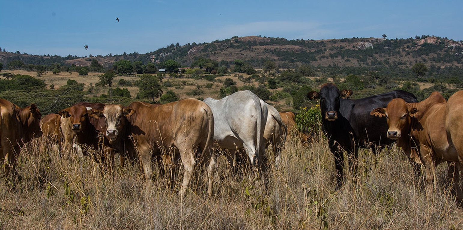
Cattle on Lolldaiga Ranch (Michael Herger)
Livestock production on Lolldaiga Hills ranch is managed under an extensive grazing system for dairy, beef, sheep and camel production, with strategic fattening and selling, in harmony with conservation principles. The conservancy is dedicated to the sustainable conservation of critical habitat and wildlife. The ranch serves also as a training ground for the British Army.
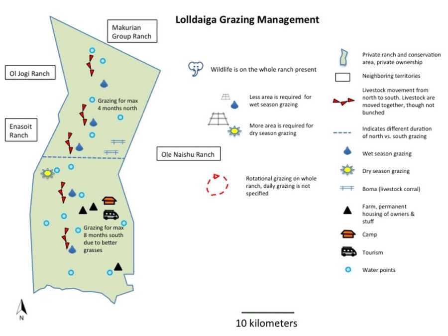
Grazing is managed without fixed blocks. Grazing areas vary considerably, depending on rainfall and location within the farm. Similarly, grazing duration in one area also varies significantly (from two weeks to eight months). Starting after the long rains (April to May), livestock are moved gradually from north to south: movement only occurs when areas are completely grazed. They stay for about four months in the north and eight months in the south - due to better grass in the southern part. Some of the dry season grazing is land set aside for later use. They use, for instance, highland forests in the west where zebra and other livestock are largely absent. During the rains, grazing takes place on a much smaller area than during the dry season, where water can be a major challenge. Livestock are kept together, though steers/heifers/breeding cows/resting bulls are separated into different herds of 90-150 units per herd. But these are not tightly “bunched” as in other ranches in the area which apply “Holistic Management” principles, since bunching is not appropriate due to strong wind erosion. The closer livestock are aggregated, the more damage – that is dust generated - in dry areas. As is typical of private ranches in Laikipia, Lolldaiga supports some of the highest densities of wildlife in Kenya. The wild herbivore biomass density on private ranches is estimated by Georgiadis (2007) at 14 ha /TLU.
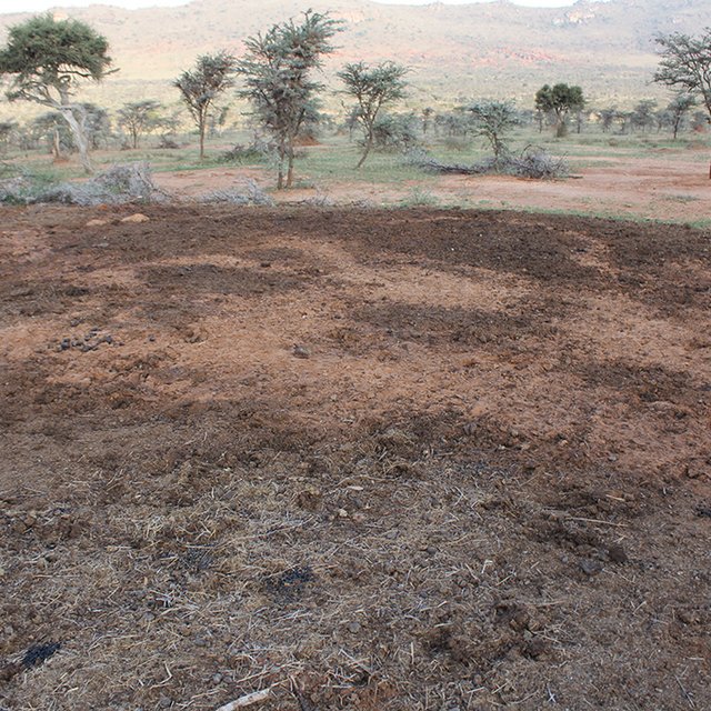
Whilst the livestock is moving, large bomas (corrals in Kiswahili) are constructed for the herds. Here, animals are closely together kept in protective enclosures overnight. Bomas are strategically sited on bare areas to recover the land through dung accumulation and breaking soil crusts by hooves. Currently, there are 20 bomas covering an area of 0.02 km2 (0.01% of their land). This can be taken to represent the area that can be restored each year. Boma sites are steadily but slightly shifted. On average, one boma is located on the same denuded patch for only one to two weeks during the dry season, and again for one week during the wet season.
In a single boma of 0.1 ha, 400 cows are corralled. Former bare patches with bomas have recovered well after just a few years. Results of a boma site comparison (see Herger 2018) have shown how bomas turn into ecological hotspots with a long-lasting effect. Amounts of soil organic carbon (SOC), as well as macro- and micronutrients in topsoil (especially) and subsoil of former boma sites were much higher than reference sites close-by. The chronology of former boma sites (1, 5, 9 years ago) also played a decisive role in soil parameters. Former boma sites from 5 and 9 years ago performed better than the most recent boma (1 year ago).
On the ranch, due to lack of rains, fodder supplements had to be purchased in 2016. However, it is usually water and not grazing that is the limiting factor on the rangeland.
Whereas cattle are sold to the leading meat producer "Farmer's Choice" (80% for domestic distribution, 20% for export to neighbouring countries and the Middle East), sheep are sold to East African Seafood (Nairobi) and camels to Somalis in town and local butcheries.
Lolldaiga also assists community grazing. The ranch helps neighbouring group ranches by allowing them access to their land for fattening purposes, but mostly as a grass bank during droughts (sometimes charging a small fee, sometimes none). During dry spells, they host on average 500-1000 heads from other communities. Along their fence informal (strictly "illegal") grazing of goats and sheep is tolerated.
สถานที่: Laikipia, เคนยา
ตำนวนการวิเคราะห์เทคโนโลยี: พื้นที่เดี่ยว
การเผยแพร่ของเทคโนโลยี: กระจายไปอย่างสม่ำเสมอในพื้นที่ (200.0 km²)
In a permanently protected area?:
วันที่ในการดำเนินการ: 10-50 ปี
ประเภทของการแนะนำ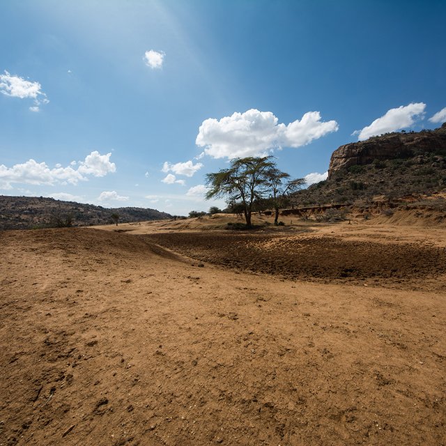

| Species | Count |
| sheep | 1800 |
| camels | 140 |


| ปัจจัยนำเข้า | หน่วย | ปริมาณ | ค่าใช้จ่ายต่อหน่วย (USD) | ค่าใช้จ่ายทั้งหมดต่อปัจจัยนำเข้า (USD) | %ของค่าใช้จ่ายที่ก่อให้เกิดขึ้นโดยผู้ใช้ที่ดิน |
| แรงงาน | |||||
| Herders/employees | Person*days | 36000.0 | 4.5 | 162000.0 | |
| อื่น ๆ | |||||
| Animals treatments | Per TLU | 3920.0 | 11.0 | 43120.0 | |
| ค่าใช้จ่ายทั้งหมดของการบำรุงรักษาสภาพเทคโนโลยี | 205'120.0 | ||||
| Total costs for maintenance of the Technology in USD | 205'120.0 | ||||


