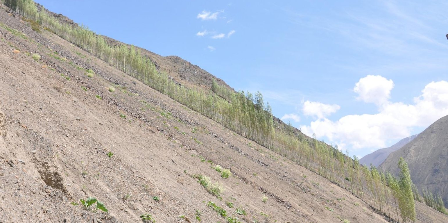
Cascading rock channel lined with poplar trees on the mountain slopes of Ayni. (S. Stevenson (Camp Kuhiston, Dushanbe))
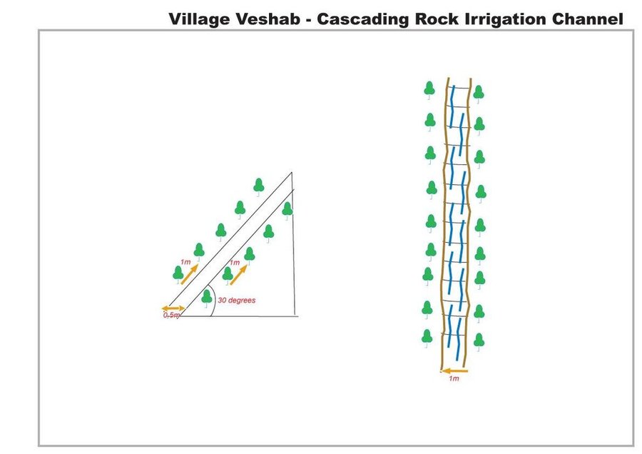
A one metre wide, 300m long, irrigation channel constructed of stones, that is built into the steep slope of a mountain gorge. The channel is 0.5m deep and is lined with poplar trees that help stabilise the structure. The water runs down the channel from the top mountains, with water splashing onto the poplar trees. At the foot of the channel the water is used to irrigated cultivated land and provide drinking water.
Purpose of the Technology: The main purpose of the cascading rock irrigation structure is to capture surface water run-off from the top of the mountain and channel it to where it can be utilised for human use such as drinking water, sanitation, and irrigation. The uneven surface of the rock channel slows the pace of the water thus preventing scouring at the foot of the channel. The channel also provides a suitable environment for the cultivation of poplar trees which in turn can help reduce water and wind erosion on the slopes, thus preventing rock and debris movement down onto the cultivated lands on the valley floor.
Establishment / maintenance activities and inputs: The channel is dug perpendicular to the steep slope and lined with stones gathered from the mountainous slopes. This activity is labour intensive, but can be more efficient with the use of donkeys. The stones are placed upon/on top of each other in the base of the channel, and used to line the sides of the channel to retain the water. The soil along the edge of the channel is cleared of debris and stone until it is suitable for the planting of poplar cuttings. The cutting are supplemented with organic fertiliser. The channel is financed by the land owner, with voluntary support from the community.
Natural / human environment: The cascading rock irrigation channel is located in a remote steep mountainous gorge where there is a shortage of land for cultivation. Water is in short supply, especially during the hot summer months. Subsequently the inhabitants have a high dependency on irrigated water from the top of the mountain range. The majority of the residents have a semi-subsistence living and are highly reliant upon the cultivated land where they grow a range of crops (e.g. wheat, potatoes. etc), fruits (e.g. apricots) and poplar trees for selling and construction purposes.
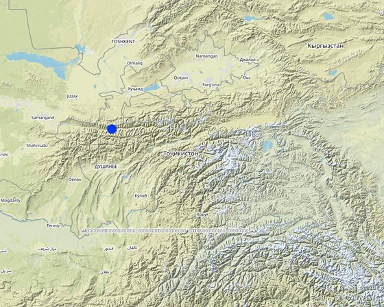
สถานที่: Ayni, Sogd region, ทาจิกิสถาน
ตำนวนการวิเคราะห์เทคโนโลยี:
การเผยแพร่ของเทคโนโลยี: กระจายไปอย่างสม่ำเสมอในพื้นที่ (approx. < 0.1 ตร.กม.(10 เฮกตาร์))
In a permanently protected area?:
วันที่ในการดำเนินการ: 10-50 ปี
ประเภทของการแนะนำ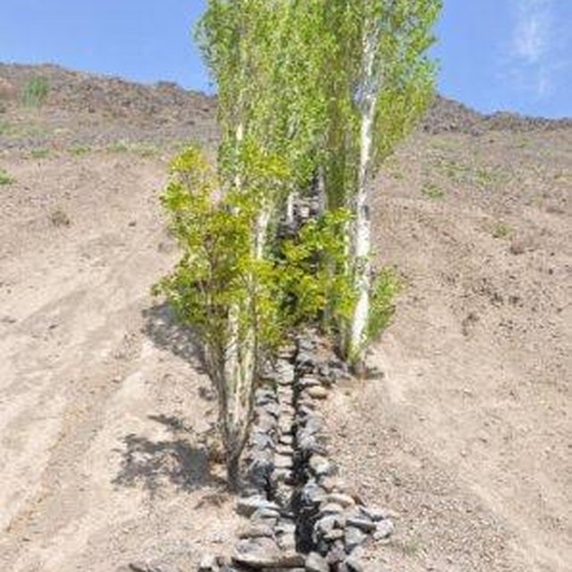


| ปัจจัยนำเข้า | หน่วย | ปริมาณ | ค่าใช้จ่ายต่อหน่วย (Somoni) | ค่าใช้จ่ายทั้งหมดต่อปัจจัยนำเข้า (Somoni) | %ของค่าใช้จ่ายที่ก่อให้เกิดขึ้นโดยผู้ใช้ที่ดิน |
| แรงงาน | |||||
| Planting Poplars | Persons/day | 10.0 | 25.0 | 250.0 | 100.0 |
| Construction of rock irrigation channel | Persons/day | 60.0 | 25.0 | 1500.0 | 100.0 |
| อุปกรณ์ | |||||
| Tools | Pieces | 3.0 | 20.0 | 60.0 | 100.0 |
| Donkey | Donkey/day | 20.0 | 22.5 | 450.0 | 100.0 |
| วัสดุด้านพืช | |||||
| Seedlings | Unit | 1.0 | 266.0 | 266.0 | 100.0 |
| ปุ๋ยและสารฆ่า/ยับยั้งการเจริญเติบโตของสิ่งมีชีวิต (ไบโอไซด์) | |||||
| Composte | per tree | 250.0 | 1.0 | 250.0 | 100.0 |
| วัสดุสำหรับก่อสร้าง | |||||
| Stone | tons | 50.0 | 20.0 | 1000.0 | 100.0 |
| ค่าใช้จ่ายทั้งหมดของการจัดตั้งเทคโนโลยี | 3'776.0 | ||||
| Total costs for establishment of the Technology in USD | 839.11 | ||||
| ปัจจัยนำเข้า | หน่วย | ปริมาณ | ค่าใช้จ่ายต่อหน่วย (Somoni) | ค่าใช้จ่ายทั้งหมดต่อปัจจัยนำเข้า (Somoni) | %ของค่าใช้จ่ายที่ก่อให้เกิดขึ้นโดยผู้ใช้ที่ดิน |
| แรงงาน | |||||
| Tree tending | Persons/day | 7.0 | 25.0 | 175.0 | 100.0 |
| Maintenance of channel | Persons/day | 10.0 | 25.0 | 250.0 | 100.0 |
| ค่าใช้จ่ายทั้งหมดของการบำรุงรักษาสภาพเทคโนโลยี | 425.0 | ||||
| Total costs for maintenance of the Technology in USD | 94.44 | ||||
This includes wood for construction, improved water supply for irrigation and improved water quality for drinking and sanitation.


