Peatland rewetting in the Netherlands (Swinckels)
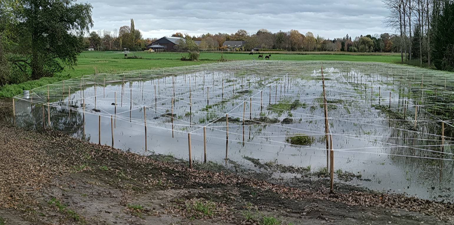
Peatland rewetting is increasingly being applied in the Netherlands, particularly in the province of Zuid Holland, as a critical environmental management strategy. This technology is implemented in agricultural fields on peatland soil, representing an important shift in land management practices. The method can be characterised by raising and maintaining a high water table in peatland areas through the implementation and careful control of a sophisticated drainage system.
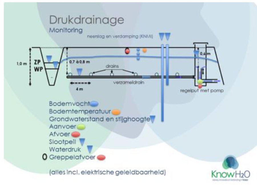
The system's technical infrastructure includes an integrated network of pipes, pumps (including innovative solar-powered options), and strategically placed ditches to control the water level. Advanced monitoring equipment is installed to track water table levels with precision, ensuring optimal management of the wetland conditions. The primary purpose of peatland rewetting is to mitigate climate change by reducing soil subsidence and consequent CO2 emissions from drained peatlands, which globally contribute around 2 Gt of CO2 annually.
Implementation requires several key components and activities. The initial phase involves comprehensive site assessment and installation of the drainage system, including careful placement of monitoring equipment and, where applicable, solar panels for sustainable pump operation. Ongoing maintenance activities are crucial and involve regular system monitoring, component repairs, and water level adjustments to maintain optimal conditions between -10 and +20 cm, as demonstrated in projects like the Swinkels case study.
The benefits and impacts of peatland rewetting are multifaceted. Primary environmental benefits include significant reduction in CO2 emissions by preventing peat oxidation, preservation of valuable peatland habitats and biodiversity, and improved regional water management. The practice also helps avoid substantial costs associated with soil subsidence, such as infrastructure repairs and dam reinforcement that would otherwise be necessary in degraded peatland areas.
From the land user's (farmer's) perspective, the transition to peatland rewetting presents both opportunities and challenges. The main benefits include access to potential subsidies, avoided costs due to soil subsidence, and the opportunity to participate in innovative agricultural practices like paludiculture - the cultivation of wet-tolerant crops such as cattail, which can be used for various applications including fodder. However, farmers may face challenges including significant initial investment costs, the necessity to adapt to new farming techniques and business models, and potential yield impacts during the transition period as they navigate the learning curve of wet agriculture.
Some environmental considerations require careful management. While peatland rewetting generally provides positive environmental outcomes, there can be challenges with nutrient leaching affecting water quality, which necessitates careful monitoring and management strategies. Additionally, stakeholders express concerns about the lack of consistent long-term subsidies and policy support for maintaining these practices, highlighting the need for more robust institutional frameworks to support sustainable peatland management.
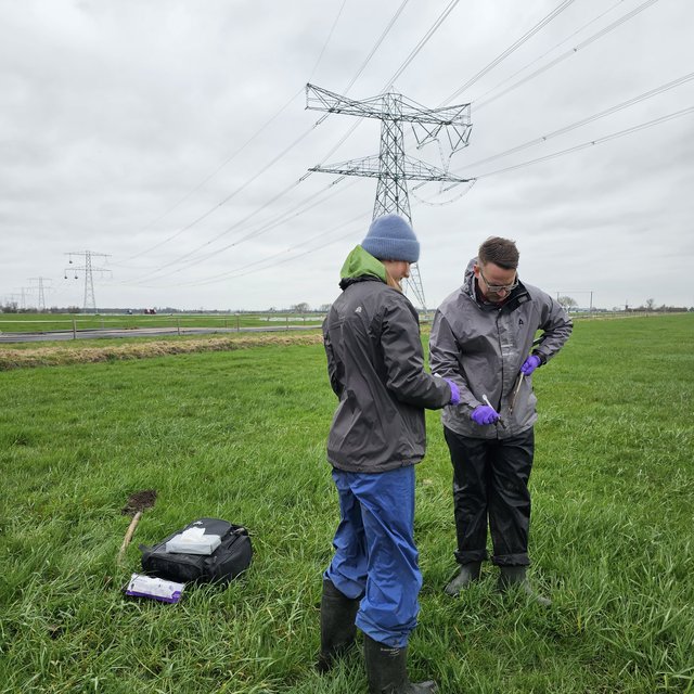
Scientific monitoring of these sites, as demonstrated in the LANDMARC project, includes sophisticated tools such as soil sampling for physical and chemical analysis, molecular microbial identification, greenhouse gas measurements, and the use of satellite data and field mapping to track progress and impact. This comprehensive monitoring approach helps ensure the effectiveness of rewetting initiatives and provides valuable data for scaling up these solutions to national and continental levels.
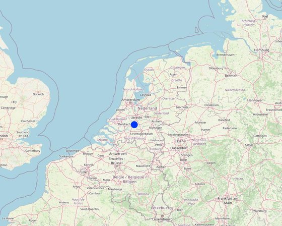
สถานที่: Alblasserwaard-Vijfheerenlanden, South Holland, เนเธอร์แลนด์
ตำนวนการวิเคราะห์เทคโนโลยี: 2-10 แห่ง
การเผยแพร่ของเทคโนโลยี: ใช้ ณ จุดที่เฉพาะเจาะจงหรือเน้นไปยังบริเวณพื้นที่ขนาดเล็ก
In a permanently protected area?: ไม่ใช่
วันที่ในการดำเนินการ: 2022
ประเภทของการแนะนำ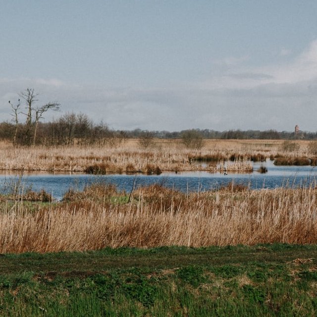

| Species | Count |
| cattle - dairy | n.a. |


| ปัจจัยนำเข้า | หน่วย | ปริมาณ | ค่าใช้จ่ายต่อหน่วย (EUR) | ค่าใช้จ่ายทั้งหมดต่อปัจจัยนำเข้า (EUR) | %ของค่าใช้จ่ายที่ก่อให้เกิดขึ้นโดยผู้ใช้ที่ดิน |
| แรงงาน | |||||
| installation | |||||
| maintenance | |||||
| อุปกรณ์ | |||||
| drainage and collection pipes | |||||
| pumps and solar panels | |||||
| control wells | |||||
| monitoring equipment (soil moisture sensors, etc.) | |||||
| ปัจจัยนำเข้า | หน่วย | ปริมาณ | ค่าใช้จ่ายต่อหน่วย (EUR) | ค่าใช้จ่ายทั้งหมดต่อปัจจัยนำเข้า (EUR) | %ของค่าใช้จ่ายที่ก่อให้เกิดขึ้นโดยผู้ใช้ที่ดิน |
| แรงงาน | |||||
| Systems operation and monitoring | |||||
| Maintenance and potential replacement of equipment | |||||
| Data analysis and reporting costs | |||||
| ecological survey costs | |||||
| อื่น ๆ | |||||
| Energy costs for pumps (some are solar) | |||||
Peatland rewetting aims to maintain or slightly improve grass yields
Aims to improve biodiversity, especially for wading birds and aquatic life
helps manage drought and heavy rainfall situations
Reduces greenhouse gas emissions
Rewetting improves regional hydrology by keeping water longer in the landscape, enhancing water retention capacity.
Water retention in rewetted peatlands helps maintain more stable water flows during dry periods.
Restored peatlands act as natural water buffers, reducing peak flows and downstream flooding risks.
Rewetting reduces nutrient runoff (particularly nitrate) into groundwater and surface waters, improving water quality.
Restored wetland conditions enhance the natural filtering capacity of peatlands, improving water quality in the wider landscape.
Rewetting helps reduce soil subsidence which otherwise damages roads, buildings and other infrastructure.
Measurements show significant reduction in greenhouse gas emissions, from 19-50 t CO2 per hectare annually to approximately half those levels through water management.


