Securing the mobility of pastoralism through consultation and access to water sources [ชาด]
- ผู้สร้างสรรค์:
- การอัพเดท:
- ผู้รวบรวม: Bonnet Bernard
- ผู้เรียบเรียง: –
- ผู้ตรวจสอบ: Donia Mühlematter, Rima Mekdaschi Studer, Simone Verzandvoort, Joana Eichenberger
Projet Almy Al Afia
technologies_3356 - ชาด
- บทสรุปทั้งหมดในรูปแบบของ PDF
- บทสรุปทั้งหมดในรูปแบบของ PDF เพื่อพิมพ์
- บทสรุปทั้งหมดในรูปหน้าเว็บ
- บทสรุปทั้งหมด (ไม่มีการจัดเรียง)
- Securing the mobility of pastoralism through consultation and access to water sources: 12 มีนาคม 2019 (inactive)
- Securing the mobility of pastoralists through consultation and access to water sources: 9 พฤษภาคม 2018 (inactive)
- Securing the mobility of pastoralism through consultation and access to water sources: 2 พฤศจิกายน 2021 (public)
- Securing the mobility of pastoralism through consultation and access to water sources: 28 พฤษภาคม 2018 (inactive)
- Securing the mobility of pastoralists through consultation and access to water sources: 13 พฤษภาคม 2018 (inactive)
- Securing the mobility of pastoralists through consultation and access to water sources: 9 พฤษภาคม 2018 (inactive)
ดูส่วนย่อย
ขยายทั้งหมด ย่อทั้งหมด1. ข้อมูลทั่วไป
1.2 รายละเอียดที่ติดต่อได้ของผู้รวบรวมและองค์กรที่เกี่ยวข้องในการประเมินและการจัดเตรียมทำเอกสารของเทคโนโลยี
วิทยากรหลัก
ผู้เชี่ยวชาญ SLM:
Bernard BONNET
IRAM
ฝรั่งเศส
ชื่อของโครงการซึ่งอำนวยความสะดวกในการทำเอกสารหรือการประเมินเทคโนโลยี (ถ้าเกี่ยวข้อง)
Book project: Guidelines to Rangeland Management in Sub-Saharan Africa (Rangeland Management)1.3 เงื่อนไขการใช้ข้อมูลที่ได้บันทึกผ่านทาง WOCAT
ผู้รวบรวมและวิทยากรหลักยอมรับเงื่อนไขเกี่ยวกับการใช้ข้อมูลที่ถูกบันทึกผ่านทาง WOCAT:
ใช่
1.4 การเปิดเผยเรื่องความยั่งยืนของเทคโนโลยีที่ได้อธิบายไว้
เทคโนโลยีที่ได้อธิบายไว้นี้เป็นปัญหาของความเสื่อมโทรมโทรมของที่ดินหรือไม่ จึงไม่ได้รับการยอมรับว่าเป็นเทคโนโลยีเพื่อการจัดการที่ดินอย่างยั่งยืน:
ไม่ใช่
แสดงความคิดเห็น:
Degradation of natural resources is taken into account in the management of water resources for pastoral land, and in the social approach prior to the development of the technology. For example, the locations of new sites for water supply structures should correspond to the capacity of the grazing land in terms of the period of access, the quantity of available resources and the integration of the area into a larger coherent landscape (especially the complementary relationship between the agropastoral zones in the south and the pastoral zones in the north). Several impact assessments and preliminary analyses have been carried out, including diagnoses of the pastoralist system with regard to the logistics of the movements of the herds, the social organisation related to the management of the areas, diagnoses of the grasslands, geophysical analyses, etc.
2. การอธิบายลักษณะของเทคโนโลยี SLM
2.1 การอธิบายแบบสั้น ๆ ของเทคโนโลยี
คำจำกัดความของเทคโนโลยี:
Securing the mobility of pastoralism through access to water sources (open wells and ponds in pastoral areas) and marking the livestock routes for transhumance: the case of the project Almy Al Afia in Chad and its consultative approach.
2.2 การอธิบายแบบละเอียดของเทคโนโลยี
คำอธิบาย:
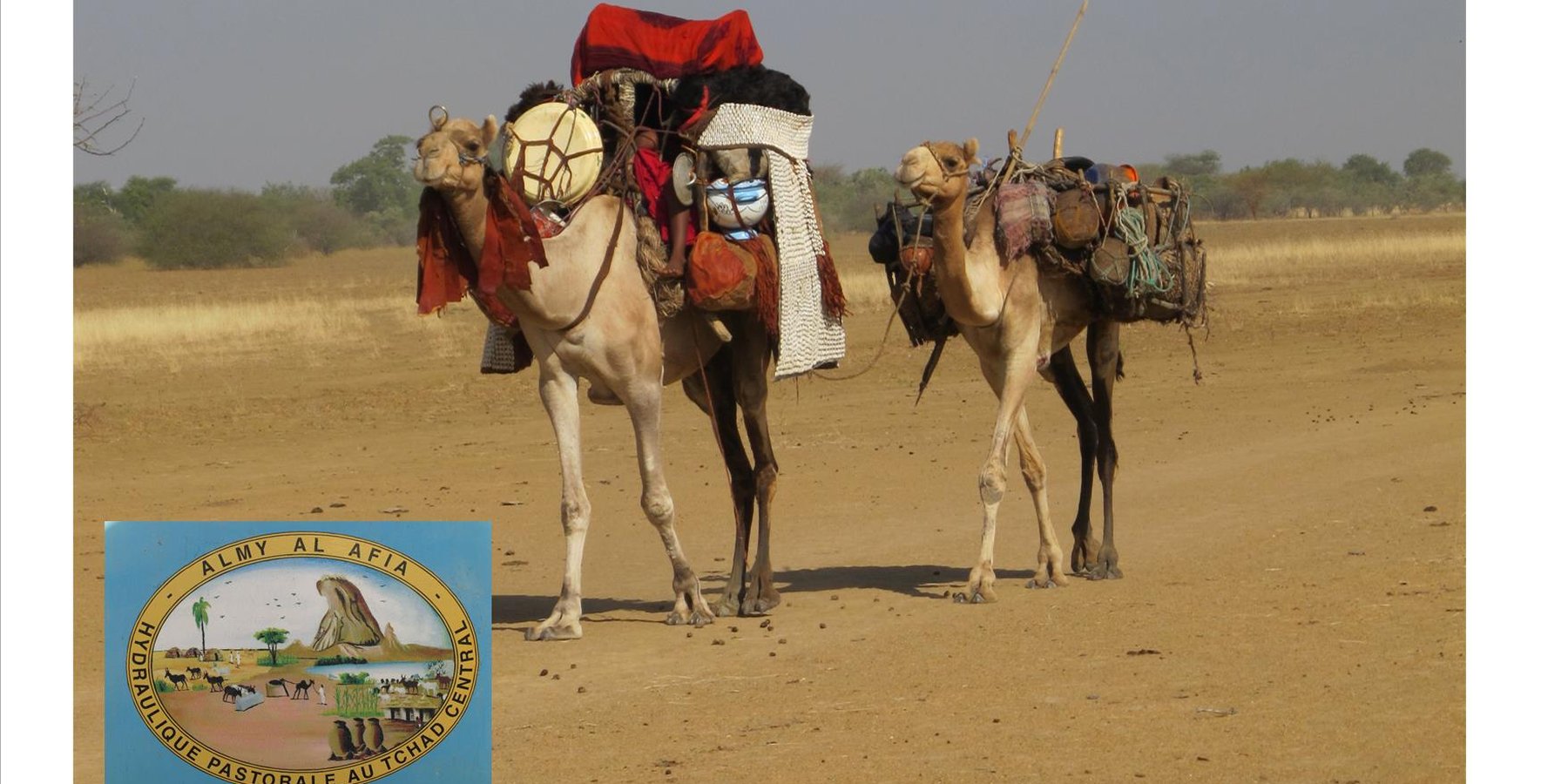
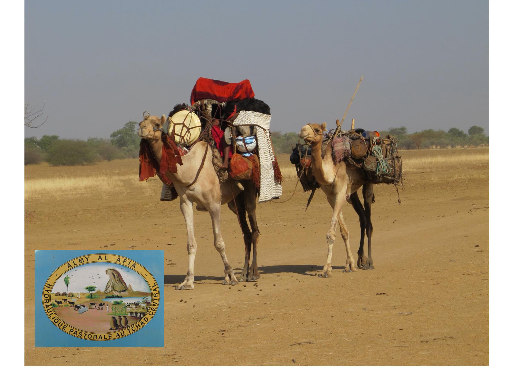
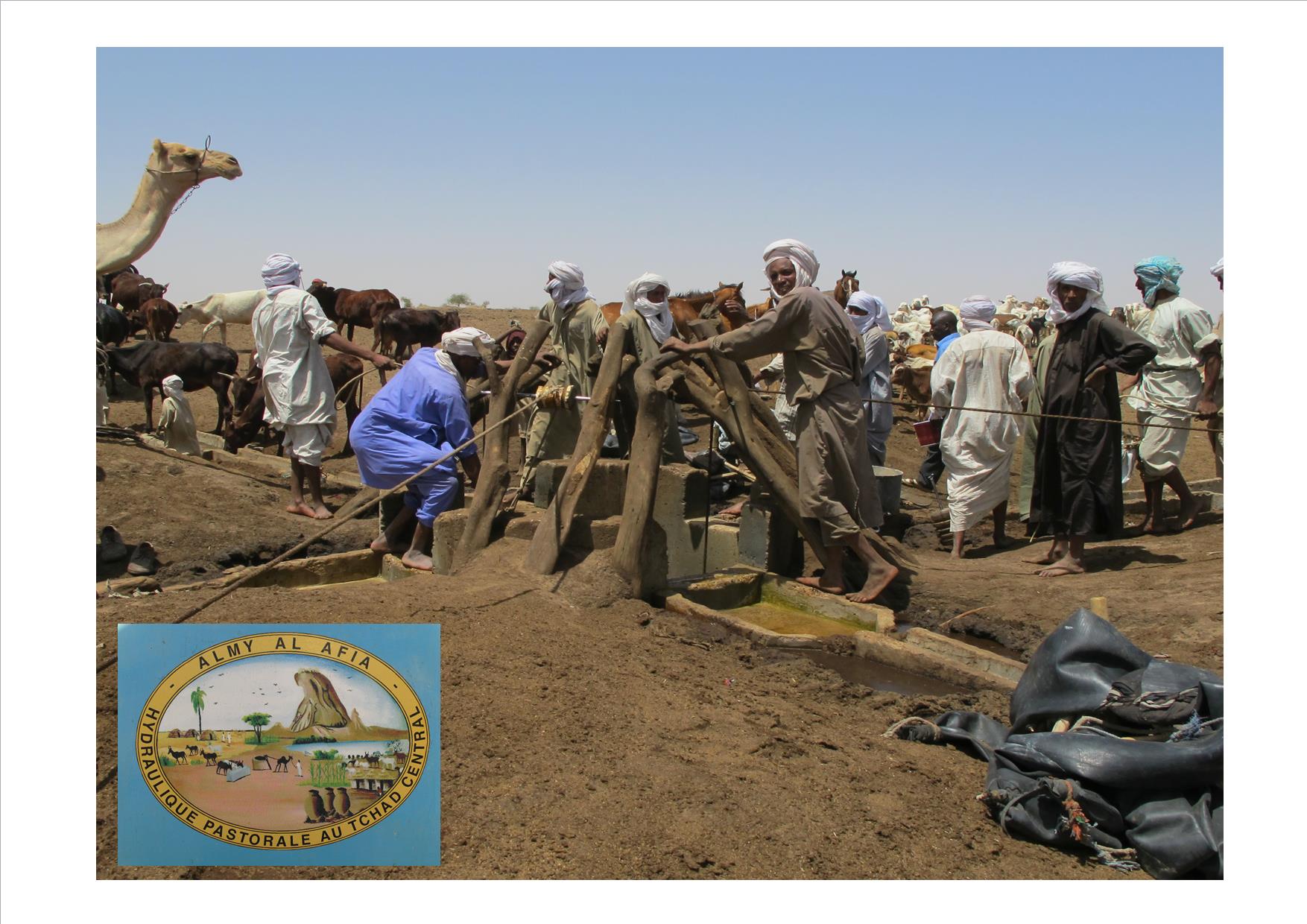
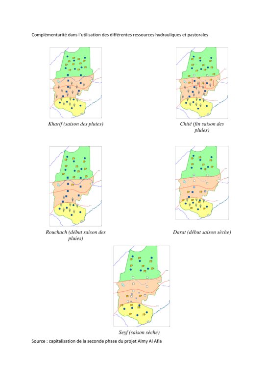
Livestock keeping is one of the main economic resources in Chad (in support of 40% of the population and 18% of the GDP, Ministry of Livestock, General census). Pastoralism in the country is based on the mobility of herds in a context of irregular precipitation and variable forage resources in time and space, and benefits from complementary relationships between the different ecological zones. In Chad, herds are taken in regular movements with the seasons between the Sahelian and the Sudanese grazing areas. The former are nutritious but limited in quantity, while the latter are more abundant but of lower quality, and not accessible until the fields are cleared after the harvest (meta-evaluation of projects on pastoral water sources, IIED, 2013). Thus, pastoral livestock keeping is founded on mobility and rangeland management, and on building complementary relationships and trade around farming systems and cultivated areas. The pastoralist systems are economically competitive (limited use of food inputs), and occur in marginal land which is characterized by conflicts, riots and a high level of insecurity (Conference of N'Djamena: 'Pastoral livestock keeping: a sustainable contribution to development and security in Saharan and Sahelian regions'). In the pastoral zone of Chad, where access to water is limited, the management and control of water sources by a social group in practice also leads to the monitoring and control of the use of grazing land which becomes available when water is present.
The project Almy Al Afia (2004-2016), developed by a partnership between the AFD and the Ministry of Water of Chad, operated in two regions of central Chad. The project Almy Al Afia was based on an entry 'development', concurrently with a process to consult and involve joint agencies. The project has improved approaches of preceding initiatives: concerted action and identification of water sources derived from the dialogue between users and authorities, and development of the local management of infrastructures and rangeland. The latter counteracts an exclusively private management or, instead, an ineffective public management which promotes free access to water sources and grazing land.
The project has enabled to address the following points:
1. Support mobility in pastoralism by enhancing the access to water (rehabilitation and construction of 160 wells; digging of 31 ponds for pastoral use);
2. Maintain or build processes of consultation and restoring security (joint committees for consultation and prevention of conflicts during transhumance);
3. Promote the proper use of water supply structures, in time and space (rehabilitated and new wells, excavated ponds) by context-specific management (strengthening of traditional management systems) and encourage the maintenance of infrastructure.
The pastoral ponds should be constructed in locations of existing water sources (natural ponds in suitable places, i.e. with a clayey soil capable to retain water). The existing water source is enlarged and improved by rural engineering (enlargement of the surface, deepening).
The wells are rehabilitated. Most wells were constructed several decades ago and are severely damaged. The water supply structures all have different and complementary functions. The deep wells in the pastoral zone are generally used throughout the year, and are overexploited. The way in which these structures are managed is strongly anchored in the region. The District officer delegates the management to 'Heads of Wells'. These old wells, which are used day and night, are often in a poor condition. Rehabilitating degraded wells is given priority over digging new wells because of the substantial potential for conflict. The water supply structures in areas of dry forest are less old and smaller in number. These wells are less frequently used and function as an alternative water source when the traditional ponds, water reservoirs and wells have dried up. They allow to delay the movement of the herds towards grazing areas in the Sahelian zone.
The strip between these two zones is used for agropastoralism. Herds cannot remain there. Therefore the project has facilitated the movement of the herds to the zones further south. The pastoral ponds close to the livestock routes for the transhumance were created in a way to be easily used by the herders, but also to encourage short stays.
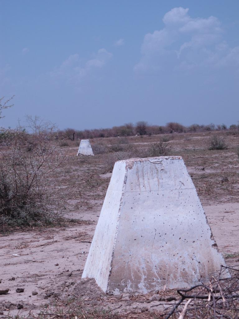
The approach was combined with consultation through joint committees for the prevention of conflicts, and at a later stage by marking of sections of the livestock routes for the transhumance. Many meetings were held with the users of the land management structures and policy makers, with the aim to identify and negotiate the target sites and to anticipate methods for the management and maintenance of the structures. This has enabled to maintain an atmosphere of social stability conducive to cooperation. Along almost 550 km of the livestock routes for the transhumance, sections were marked ('mourhals' in Chadian Arabic). The demarcation was not intended to enclose the herds in the livestock corridors (from which they can move freely outside the growing seasons for agricultural crops), but rather to implement the results of the consultations on the land use on the ground. The committees for the prevention of conflicts, which were supported by the project, also played a major role.
2.3 รูปภาพของเทคโนโลยี
อัลบั้มสื่อบันทึก
2.4 วีดีโอของเทคโนโลยี
2.5 ประเทศภูมิภาค หรือสถานที่ตั้งที่เทคโนโลยีได้นำไปใช้และได้รับการครอบคลุมโดยการประเมินนี้
ประเทศ:
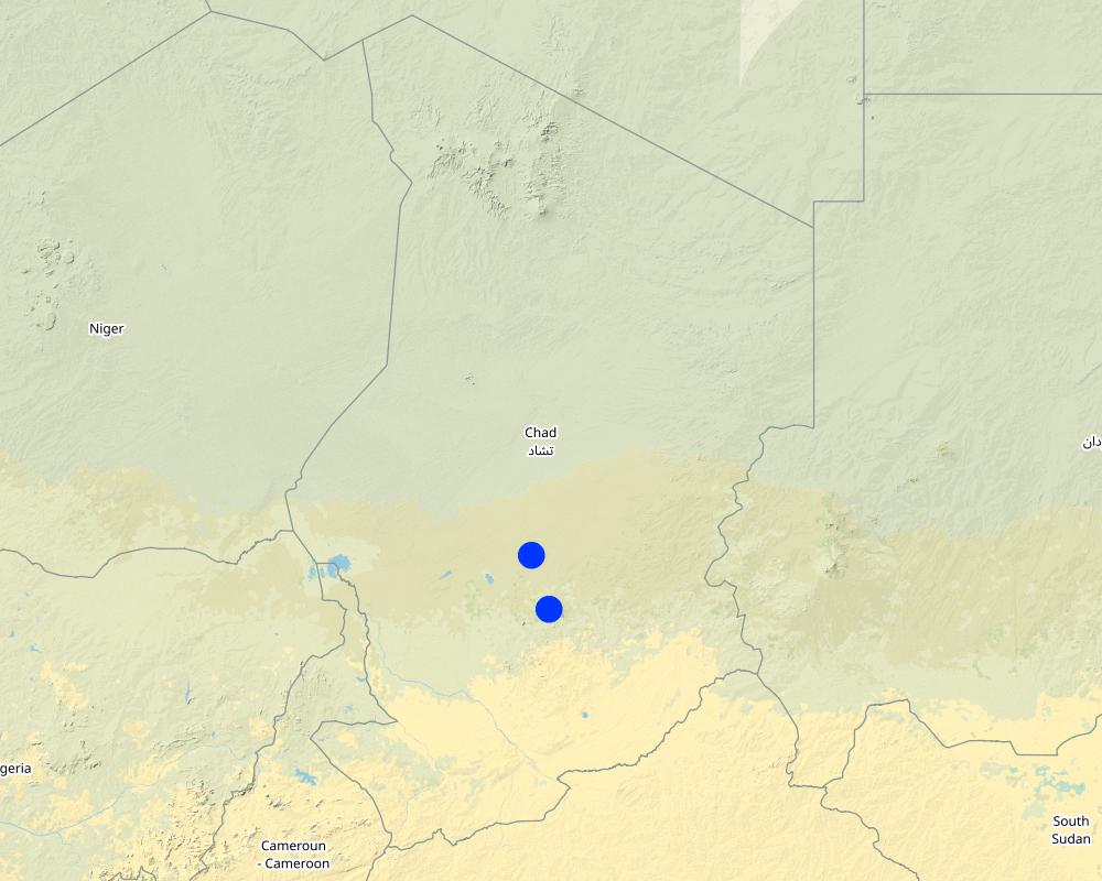
ชาด
ภูมิภาค/รัฐ/จังหวัด:
Regions of Batha and of Guéra
ข้อมูลจำเพาะเพิ่มเติมของสถานที่ตั้ง :
Although the sites where the technology was applied are at the local scale, the project has considered pastoralism and the relationships between the two regions at the broader landscape scale.
ระบุการกระจายตัวของเทคโนโลยี:
- กระจายไปอย่างสม่ำเสมอในพื้นที่
If precise area is not known, indicate approximate area covered:
- 10-100 ตร.กม.
แสดงความคิดเห็น:
Main towns of the two relevant regions (Ati for the region of Batha and Mongo for the region of Guéra).
The water sources constitute an anchorage point for the herds. The surrounding grazing land is controlled by the access to the water supply points (impact zone with a radius of 15 to 20 km around the wells). Apart from the area directly influenced by the technology, complementary relationships between the zones provide an added value: hence the zone targeted by the decision-making process of the herders is very large.
Map
×2.6 วันที่การดำเนินการ
ระบุปีที่ใช้:
2018
2.7 คำแนะนำของเทคโนโลยี
ให้ระบุว่าเทคโนโลยีถูกแนะนำเข้ามาอย่างไร:
- ด้วยการริเริ่มของผู้ใช้ที่ดินเอง
- เป็นส่วนหนึ่งของระบบแบบดั้งเดิมที่ทำก้นอยู่ (> 50 ปี)
ความคิดเห็น (ประเภทของโครงการ เป็นต้น) :
Projects on pastoral water resources like the project Almy Al Afia primarily focus on the development of water sources for pastoralism. The phases preceding the implementation are extremely important, because they are based on consultation and on the appreciation of local management systems. These phases include registration, selection of construction sites and the development of guidelines.
3. การจัดประเภทของเทคโนโลยี SLM
3.1 วัตถุประสงค์หลักของเทคโนโลยี
- ลด ป้องกัน ฟื้นฟู การเสื่อมโทรมของที่ดิน
- อนุรักษ์ระบบนิเวศน์
- ป้องกันพื้นที่ลุ่มน้ำ/บริเวณท้ายน้ำ โดยร่วมกับเทคโนโลยีอื่นๆ
- รักษาสภาพหรือปรับปรุงความหลากหลายทางชีวภาพ
- ลดความเสี่ยงของภัยพิบัติ
- สร้างผลกระทบทางด้านเศรษฐกิจที่เป็นประโยชน์
- สร้างผลกระทบทางด้านสังคมที่เป็นประโยชน์
3.2 ประเภทของการใช้ที่ดินในปัจจุบันที่ได้นำเทคโนโลยีไปใช้

ทุ่งหญ้าเลี้ยงสัตว์
Extensive grazing:
- การเลี้ยงสัตว์แบบเร่ร่อนไปตามที่ต่าง ๆ (Nomadism)
- กึ่งโนแมนดิซึ่มหรือแพสโตแรลลิซึ่ม (Semi-nomadism/pastoralism)
Animal type:
- camels
แสดงความคิดเห็น:
Number of growing seasons per year: 1
Livestock density: Variable depending on zones and seasons.
3.4 การใช้น้ำ
การใช้น้ำของที่ดินที่มีการใช้เทคโนโลยีอยู่:
- จากน้ำฝน
แสดงความคิดเห็น:
In these zones, rainfall is erratic in terms of spatial distribution and in quantity. Hence, grazing areas are not uniformly covered from year to year. The mobility of herds is the only way to adapt to this variability.
3.5 กลุ่ม SLM ที่ตรงกับเทคโนโลยีนี้
- การจัดการปศุสัตว์และทุ่งหญ้าเลี้ยงสัตว์
- การจัดการน้ำบาดาล
3.6 มาตรการ SLM ที่ประกอบกันเป็นเทคโนโลยี

มาตรการอนุรักษ์ด้วยโครงสร้าง
- S8: การสุขาภิบาลหรือโครงสร้างเกี่ยวกับน้ำเสีย

มาตรการอนุรักษ์ด้วยการจัดการ
- M2: การเปลี่ยนแปลงของการจัดการหรือระดับความเข้มข้น
- M3: การวางผังตามสิ่งแวดล้อมทางธรรมชาติและสิ่งแวดล้อมของมนุษย์
3.7 รูปแบบหลักของการเสื่อมโทรมของที่ดินที่ได้รับการแก้ไขโดยเทคโนโลยี

การกัดกร่อนของดินโดยน้ำ
- Wt (Loss of topsoil): การสูญเสียดินชั้นบนหรือการกัดกร่อนที่ผิวดิน

การกัดกร่อนของดินโดยลม
- Et (Loss of topsoil): การสูญเสียดินชั้นบน
- Eo (Offsite degradation effect): ผลกระทบนอกพื้นที่

การเสื่อมโทรมของดินทางด้านกายภาพ
- Ps (Subsidence of organic soils): การยุบตัวของดินอินทรีย์ การทรุดตัวของดิน

การเสื่อมโทรมของดินทางด้านชีวภาพ
- Bc (Reduction of vegetation cover): การลดลงของจำนวนพืชที่ปกคลุมดิน
- Bq (Quantity/biomass decline): การลดลงของปริมาณหรือมวลชีวภาพ

การเสื่อมโทรมของน้ำ
- Hs (Change in quantity of surface water): การเปลี่ยนแปลงปริมาณของน้ำที่ผิวดิน
- Hg (Change in groundwater): การเปลี่ยนแปลงของน้ำบาดาลหรือระดับน้ำในแอ่งน้ำบาดาล
- Hp (Decline of surface water quality): การลดลงของคุณภาพน้ำที่ผิวดิน
- Hq (Decline of groundwater quality): การลดลงของคุณภาพน้ำบาดาล
3.8 การป้องกัน การลดลง หรือการฟื้นฟูความเสื่อมโทรมของที่ดิน
ระบุเป้าหมายของเทคโนโลยีกับความเสื่อมโทรมของที่ดิน:
- ป้องกันความเสื่อมโทรมของที่ดิน
- ลดความเสื่อมโทรมของดิน
4. ข้อมูลจำเพาะด้านเทคนิค กิจกรรมการนำไปปฏิบัติใช้ ปัจจัยนำเข้า และค่าใช้จ่าย
4.1 แบบแปลนทางเทคนิคของเทคโนโลยี
ข้อมูลจำเพาะด้านเทคนิค (แบบแปลนทางเทคนิคของเทคโนโลยี):
The wells (new and rehabilitated) and the demarcation of the livestock routes are the outcome of a long process of outreach. The communications between the local level (taking account of the views of future users) and the level of decision-making (administration) enable social agreements to be formalized. These agreements set the rules for the selection of the locations of the water supply structures, their management and maintenance.
ผู้เขียน:
Project Almy Al Afia
วันที่:
2016
4.2 ข้อมูลทั่วไปเกี่ยวกับการคำนวณปัจจัยนำเข้าและค่าใช้จ่าย
ให้ระบุว่าค่าใช้จ่ายและปัจจัยนำเข้าได้รับการคำนวณอย่างไร:
- ต่อหน่วยเทคโนโลยี
โปรดระบุหน่วย:
Structure (new well, rehabilitation or km of markings)
อื่นๆ หรือสกุลเงินประจำชาติ (ระบุ):
FCFA
ระบุค่าเฉลี่ยของค่าจ้างในการจ้างแรงงานต่อวัน:
1000 FCFA
4.3 กิจกรรมเพื่อการจัดตั้ง
| กิจกรรม | Timing (season) | |
|---|---|---|
| 1. | Outreach / awareness raising | Four to six meetings prior to the signing of the social agreements |
| 2. | Construction of the facilities | Four to six months, depending on the type of structure and its depth |
| 3. | Monitoring the management | Regular visits of the project team to support the implementation of adapted management practices |
แสดงความคิดเห็น:
The implementation of the different phases varies greatly in terms of the location of the outreach activities and the duration of the construction work.
4.4 ค่าใช้จ่ายของปัจจัยนำเข้าที่จำเป็นสำหรับการจัดตั้ง
| ปัจจัยนำเข้า | หน่วย | ปริมาณ | ค่าใช้จ่ายต่อหน่วย | ค่าใช้จ่ายทั้งหมดต่อปัจจัยนำเข้า | %ของค่าใช้จ่ายที่ก่อให้เกิดขึ้นโดยผู้ใช้ที่ดิน | |
|---|---|---|---|---|---|---|
| วัสดุสำหรับก่อสร้าง | Rehabilitated wells (mean depth 56 m) | 1 | 93.0 | 10497939.0 | 976308327.0 | |
| วัสดุสำหรับก่อสร้าง | Geophysical assessment for new wells | 1 | 158.0 | 17979914.0 | 2840826412.0 | |
| วัสดุสำหรับก่อสร้าง | Exploration drilling for new wells (mean depth 96 m) | 1 | 220.0 | 6005415.0 | 1321191300.0 | |
| วัสดุสำหรับก่อสร้าง | New wells (mean depth 45 m) | 1 | 62.0 | 45145740.0 | 2799035880.0 | |
| วัสดุสำหรับก่อสร้าง | Pastoral ponds (6000 m3 on average) | 1 | 31.0 | 23008065.0 | 713250015.0 | |
| วัสดุสำหรับก่อสร้าง | Markers (8 signs / km) | 1 | 492.0 | 1069203.0 | 526047876.0 | |
| อื่น ๆ | Outreach on new wells (/site) | 1 | 62.0 | 213428.0 | 13232536.0 | |
| อื่น ๆ | Outreach on rehabilitation (/site) | 1 | 93.0 | 248695.0 | 23128635.0 | |
| อื่น ๆ | Outreach on marking (/km) | 1 | 492.0 | 52088.0 | 25627296.0 | |
| อื่น ๆ | None | None | ||||
| ค่าใช้จ่ายทั้งหมดของการจัดตั้งเทคโนโลยี | 9238648277.0 | |||||
| Total costs for establishment of the Technology in USD | 9238648277.0 | |||||
แสดงความคิดเห็น:
The context of pastoralism has taken the project approach to not ask compensation from users: if the users are never the same, then who should be charged? Who will collect the payments and manage the collected funds? In addition, most of the water supply structures are far from financial institutions, which causes problems in securing these funds. Therefore the users contribute in terms of day-to-day maintenance of structures, by mobilizing labour in particular.
4.5 การบำรุงรักษาสภาพหรือกิจกรรมที่เกิดขึ้นเป็นประจำ
| กิจกรรม | ช่วงระยะเวลา/ความถี่ | |
|---|---|---|
| 1. | Mobilising indigenous groups for day-to-day maintenance of structures (dredging, cleaning) | Depending on the type of structure (generally monthly) |
4.6 ค่าใช้จ่ายของปัจจัยนำเข้าและกิจกรรมที่เกิดขึ้นเป็นประจำที่ต้องการการบำรุงรักษา (ต่อปี)
| ปัจจัยนำเข้า | หน่วย | ปริมาณ | ค่าใช้จ่ายต่อหน่วย | ค่าใช้จ่ายทั้งหมดต่อปัจจัยนำเข้า | %ของค่าใช้จ่ายที่ก่อให้เกิดขึ้นโดยผู้ใช้ที่ดิน | |
|---|---|---|---|---|---|---|
| แรงงาน | Support missions for the management and maintenance of the water supply structures (2 missions per structure for the entire project) | 1 | 155.0 | 53000.0 | 8215000.0 | |
| แรงงาน | Support mission for the management and maintenance of the markings | 1 | 100.0 | 53000.0 | 5300000.0 | |
| ค่าใช้จ่ายทั้งหมดของการบำรุงรักษาสภาพเทคโนโลยี | 13515000.0 | |||||
| Total costs for maintenance of the Technology in USD | 13515000.0 | |||||
แสดงความคิดเห็น:
The amount of financial support varied with the type of structure (more support for management and maintenance is needed for new structures than for rehabilitated structures) and with their location or specific problem (in the case of structures located in the agropastoral zones). Financial support to the markings of the livestock corridors was indirectly provided through the committees for the prevention and management of conflicts.
4.7 ปัจจัยสำคัญที่สุดที่มีผลกระทบต่อค่าใช้จ่าย
ปัจจัยสำคัญที่สุดที่มีผลกระทบต่อค่าใช้จ่ายต่างๆ:
The costs of the constructions are highly dependent on their location (costs for the supply and disposal of equipment and materials), on the price of inputs (cement, etc.), and especially on the type of structure (depth of the wells, geological environment). The costs of the supply and disposal of equipment and materials include costs for the installation of the structures (water, cement, labour, machinery) on the construction sites (which are often far away from routes and towns), and costs for the disposal of the equipment after the construction is completed. The costs of supply and disposal can be significant with respect to the costs of the structure itself.
5. สิ่งแวดล้อมทางธรรมชาติและของมนุษย์
5.1 ภูมิอากาศ
ฝนประจำปี
- < 250 ม.ม.
- 251-500 ม.ม.
- 501-750 ม.ม.
- 751-1,000 ม.ม.
- 1,001-1,500 ม.ม.
- 1,501-2,000 ม.ม.
- 2,001-3,000 ม.ม.
- 3,001-4,000 ม.ม.
- > 4,000 ม.ม.
ข้อมูลจำเพาะ/ความคิดเห็นเรื่องปริมาณน้ำฝน:
One rainy season per year (from June to September)
ระบุชื่อของสถานีตรวดวัดอากาศที่ใช้อ้างอิงคือ:
Ati
เขตภูมิอากาศเกษตร
- กึ่งแห้งแล้ง
- แห้งแล้ง
The target region includes large areas extending over important gradients (encompassing boundaries of the desert zone, the forested zone and the cotton-growing zone).
5.2 สภาพภูมิประเทศ
ค่าเฉลี่ยความลาดชัน:
- ราบเรียบ (0-2%)
- ลาดที่ไม่ชัน (3-5%)
- ปานกลาง (6-10%)
- เป็นลูกคลื่น (11-15%)
- เป็นเนิน (16-30%)
- ชัน (31-60%)
- ชันมาก (>60%)
ธรณีสัณฐาน:
- ที่ราบสูง/ที่ราบ
- สันเขา
- ไหล่เขา
- ไหล่เนินเขา
- ตีนเนิน
- หุบเขา
ระดับความสูง:
- 0-100 เมตร
- 101-500 เมตร
- 501-1,000 เมตร
- 1,001-1,500 เมตร
- 1,501-2,000 เมตร
- 2,001-2,500 เมตร
- 2,501-3,000 เมตร
- 3,001-4,000 เมตร
- > 4,000 เมตร
ให้ระบุถ้าเทคโนโลยีได้ถูกนำไปใช้:
- ไม่เกี่ยวข้อง
5.3 ดิน
ค่าเฉลี่ยความลึกของดิน:
- ตื้นมาก (0-20 ซ.ม.)
- ตื้น (21-50 ซ.ม.)
- ลึกปานกลาง (51-80 ซ.ม.)
- ลึก (81-120 ซ.ม.)
- ลึกมาก (>120 ซ.ม.)
เนื้อดิน (ดินชั้นบน):
- หยาบ/เบา (ดินทราย)
เนื้อดินล่าง (> 20 ซ.ม.ต่ำจากผิวดิน):
- หยาบ/เบา (ดินทราย)
อินทรียวัตถุในดิน:
- ต่ำ (<1%)
5.4 ความเป็นประโยชน์และคุณภาพของน้ำ
ระดับน้ำใต้ดิน:
> 50 เมตร
น้ำไหลบ่าที่ผิวดิน:
ไม่ดีหรือไม่มีเลย
คุณภาพน้ำ (ที่ยังไม่ได้บำบัด):
เป็นน้ำเพื่อการดื่มที่ดี
ความเค็มของน้ำเป็นปัญหาหรือไม่:
ใช่
ระบุ:
Depending on the zones: presence of sodium carbonate.
กำลังเกิดน้ำท่วมในพื้นที่หรือไม่:
ไม่ใช่
5.5 ความหลากหลายทางชีวภาพ
ความหลากหลายทางชนิดพันธุ์:
- ปานกลาง
ความหลากหลายของแหล่งที่อยู่:
- ปานกลาง
5.6 ลักษณะของผู้ใช้ที่ดินที่นำเทคโนโลยีไปปฏิบัติใช้
อยู่กับที่หรือเร่ร่อน:
- กึ่งเร่ร่อน
- เร่ร่อน
แนวทางการตลาดของระบบการผลิต:
- mixed (subsistence/ commercial)
รายได้ที่มาจากนอกฟาร์ม:
- < 10% ของรายได้ทั้งหมด
ระดับของความมั่งคั่งโดยเปรียบเทียบ:
- ยากจนมาก
- จน
เป็นรายบุคคล/ครัวเรือน:
- กลุ่ม/ชุมชน
ระดับของการใช้เครื่องจักรกล:
- งานที่ใช้แรงกาย
เพศ:
- หญิง
- ชาย
อายุของผู้ใช้ที่ดิน:
- ผู้เยาว์
- วัยกลางคน
5.7 Average area of land used by land users applying the Technology
- < 0.5 เฮกตาร์
- 0.5-1 เฮกตาร์
- 1-2 เฮกตาร์
- 2-5 เฮกตาร์
- 5-15 เฮกตาร์
- 15-50 เฮกตาร์
- 50-100 เฮกตาร์
- 100-500 เฮกตาร์
- 500-1,000 เฮกตาร์
- 1,000-10,000 เฮกตาร์
- >10,000 เฮกตาร์
พิจารณาว่าเป็นขนาดเล็ก กลาง หรือขนาดใหญ่ (ซึ่งอ้างอิงถึงบริบทระดับท้องถิ่น):
- ขนาดใหญ่
แสดงความคิดเห็น:
Transhumance, and more generally pastoral mobility, applies to large geographical scales and long periods. The areas involved are very large, far above 10.000 ha.
5.8 กรรมสิทธิ์ในที่ดิน สิทธิในการใช้ที่ดินและสิทธิในการใช้น้ำ
กรรมสิทธิ์ในที่ดิน:
- กลุ่ม
สิทธิในการใช้ที่ดิน:
- เกี่ยวกับชุมชน (ถูกจัดระเบียบ)
สิทธิในการใช้น้ำ:
- เกี่ยวกับชุมชน (ถูกจัดระเบียบ)
5.9 การเข้าถึงบริการและโครงสร้างพื้นฐาน
สุขภาพ:
- จน
- ปานกลาง
- ดี
การศึกษา:
- จน
- ปานกลาง
- ดี
ความช่วยเหลือทางด้านเทคนิค:
- จน
- ปานกลาง
- ดี
การจ้างงาน (เช่น ภายนอกฟาร์ม):
- จน
- ปานกลาง
- ดี
ตลาด:
- จน
- ปานกลาง
- ดี
พลังงาน:
- จน
- ปานกลาง
- ดี
ถนนและการขนส่ง:
- จน
- ปานกลาง
- ดี
น้ำดื่มและการสุขาภิบาล:
- จน
- ปานกลาง
- ดี
บริการด้านการเงิน:
- จน
- ปานกลาง
- ดี
6. ผลกระทบและสรุปคำบอกกล่าว
6.1 ผลกระทบในพื้นที่ดำเนินการ (On-site) จากการใช้เทคโนโลยี
ผลกระทบทางด้านเศรษฐกิจและสังคม
ความเป็นประโยชน์และคุณภาพของน้ำ
การมีน้ำไว้ให้ปศุสัตว์
จำนวนก่อน SLM:
n/a
หลังจาก SLM:
n/a
แสดงความคิดเห็น/ระบุ:
Expansion of the areas covered by water supply points. Reduced closure of water supply points (rehabilitation), opening-up of new grazing land, securing the movement of livestock and people.
คุณภาพน้ำสำหรับปศุสัตว์
จำนวนก่อน SLM:
n/a
หลังจาก SLM:
n/a
ผลกระทบด้านสังคมวัฒนธรรมอื่น ๆ
ความมั่นคงด้านอาหาร / พึ่งตนเองได้
แสดงความคิดเห็น/ระบุ:
Preserving the capacity of herders and their families to move, to choose their trajectories rather than responding to imposed conditions.
การใช้ที่ดิน / สิทธิในการใช้น้ำ
จำนวนก่อน SLM:
n/a
หลังจาก SLM:
n/a
แสดงความคิดเห็น/ระบุ:
Upgrading of traditional management systems of water supply structures.
สถาบันของชุมชน
การบรรเทาความขัดแย้ง
สถานการณ์ของกลุ่มด้อยโอกาส ทางด้านสังคมและเศรษฐกิจ
ผลกระทบด้านนิเวศวิทยา
ดิน
สิ่งปกคลุมดิน
แสดงความคิดเห็น/ระบุ:
Reduction of the impacts of the concentration of livestock and people in small areas. Promotes the complementary relations between the zones (pressure relief in some zones and use and maintenance of other zones), and over the seasons.
อินทรียวัตถุในดิน/ต่ำกว่าดินชั้น C
ความหลากหลายทางชีวภาพของพืชและสัตว์
การปกคลุมด้วยพืช
ความหลากหลายทางชีวภาพของพืช
ลดความเสี่ยงของภัยพิบัติ
ผลกระทบจากภัยแล้ง
6.2 ผลกระทบนอกพื้นที่ดำเนินการ (Off-site) จากการใช้เทคโนโลยี
น้ำที่ใช้ประโยชน์ได้
จำนวนก่อน SLM:
n/a
หลังจาก SLM:
n/a
แสดงความคิดเห็น/ระบุ:
Increased access to groundwater through the rehabilitation of wells and the construction of new wells.
Specify assessment of off-site impacts (measurements):
As explained above, in these zones with low rainfall and scarce natural water sources of temporary character (ponds), it is essential to combine the use of surface water with the use of water from deep permanent groundwater bodies. When they have the choice, herders almost exclusively choose sources with surface water (avoiding effort to extract the water). But when these sources run dry, they fall back on using wells (and deep groundwater). The rehabilitation of old wells and the construction of new wells in zones without wells contributes to increasing the availability of water.
6.3 การเผชิญและความตอบสนองของเทคโนโลยีต่อการเปลี่ยนแปลงสภาพภูมิอากาศที่ค่อยเป็นค่อยไป และสภาพรุนแรงของภูมิอากาศ / ภัยพิบัติ (ที่รับรู้ได้โดยผู้ใช้ที่ดิน)
การเปลี่ยนแปลงสภาพภูมิอากาศที่ค่อยเป็นค่อยไป
การเปลี่ยนแปลงสภาพภูมิอากาศที่ค่อยเป็นค่อยไป
| ฤดู | increase or decrease | เทคโนโลยีมีวิธีการรับมืออย่างไร | |
|---|---|---|---|
| ฝนประจำปี | ลดลง | ไม่ค่อยดี | |
| ฝนตามฤดู | ฤดูฝน | ลดลง | ไม่ค่อยดี |
สภาพรุนแรงของภูมิอากาศ (ภัยพิบัติ)
ภัยพิบัติจากสภาพภูมิอากาศ
| เทคโนโลยีมีวิธีการรับมืออย่างไร | |
|---|---|
| ภัยจากฝนแล้ง | ดี |
6.4 การวิเคราะห์ค่าใช้จ่ายและผลประโยชน์ที่ได้รับ
ผลประโยชน์ที่ได้รับเปรียบเทียบกับค่าใช้จ่ายในการจัดตั้งเป็นอย่างไร (จากมุมมองของผู้ใช้ที่ดิน)
ผลตอบแทนระยะสั้น:
ด้านบวก
ผลตอบแทนระยะยาว:
ด้านบวกอย่างมาก
ผลประโยชน์ที่ได้รับเปรียบเทียบกับค่าใช้จ่ายในการบำรุงรักษาหรือต้นทุนที่เกิดขึ้นซ้ำอีก เป็นอย่างไร (จากมุมมองของผู้ใช้ที่ดิน)
ผลตอบแทนระยะสั้น:
ด้านบวก
ผลตอบแทนระยะยาว:
ด้านบวก
แสดงความคิดเห็น:
The profitability is considered in relation to the number of animals/herds involved. The costs of construction and rehabilitation are certainly significant, but the water supply structures are used for thousands of animals (in case of the most heavily used wells); most animals drink every two days. Therefore the costs per head of livestock are limited. The wells are long lasting, and therefore the returns are positive in the short and the long term.
6.5 การปรับตัวของเทคโนโลยี
- > 50%
ถ้ามีข้อมูลให้บอกปริมาณด้วย (จำนวนของครัวเรือนหรือครอบคลุมพื้นที่):
The technology responds to a substantial need, but also corresponds to the capacity of land users to use and maintain the structures. The energy supply is provided by animal traction, and does not require external energy sources.
Of all those who have adopted the Technology, how many did so spontaneously, i.e. without receiving any material incentives/ payments?
- 91-100%
แสดงความคิดเห็น:
Access to water is such a large problem that it requires all the land users who enter the zone to be informed when a water supply structure is rehabilitated or constructed. The involvement of traditional leaders in the management of the structures, and the system of representatives of the traditional leadership in the various other zones (Khalifas) contributes to the spontaneous dissemination of the information.
6.6 การปรับตัว
เทคโนโลยีได้รับการปรับเปลี่ยนเมื่อเร็วๆนี้ เพื่อให้ปรับตัวเข้ากับสภาพที่กำลังเปลี่ยนแปลงหรือไม่:
ไม่ใช่
6.7 จุดแข็ง / ข้อได้เปรียบ / โอกาสของเทคโนโลยี
| จุดแข็ง / ข้อได้เปรียบ / โอกาสในทัศนคติของผู้ใช้ที่ดิน |
|---|
| Permanent access to water. |
| Reopening of water supply structures and consolidation of access to water at some degraded sites. |
| Agencies and authorities for conflict prevention. |
| Marking of sections of livestock corridors with conflict situations. |
| จุดแข็ง / ข้อได้เปรียบ / โอกาสในทัศนคติของผู้รวบรวมหรือวิทยากรหลัก |
|---|
| Full commitment of groups (access to water is a major problem). |
| Continuation of the approach through the development of other projects and inclusion at the national level. |
6.8 จุดอ่อน / ข้อเสียเปรียบ / ความเสี่ยงของเทคโนโลยีและวิธีการแก้ไข
| จุดอ่อน / ข้อเสียเปรียบ / ความเสี่ยงในทัศนคติของผู้ใช้ที่ดิน | มีวิธีการแก้ไขได้อย่างไร |
|---|---|
| Interventions are limited with regard to the needs (rehabilitation in particular). | By larger investments and better integration of the approach in public action. |
| There is a need to extend the approach, in particular the support to the consultative bodies. | Formalize support to the consultation process. |
| จุดอ่อน / ข้อเสียเปรียบ / ความเสี่ยงในทัศนคติของผู้รวบรวมหรือวิทยากรหลัก | มีวิธีการแก้ไขได้อย่างไร |
|---|---|
|
Recognition of the experiences, the approach and the methodology in other interventions. Outreach and awareness raising are performed during the project, but at the end the management of the infrastructure is no longer supported. The government should be able to follow up on the support (mechanism for monitoring and maintenance). |
Formalize support to the consultation process. |
| There is a need to mainstream outreach and consultation (lengthy process). | Formalize support to the consultation process. |
7. การอ้างอิงและการเชื่อมต่อ
7.1 วิธีการและแหล่งข้อมูล
- ไปเยี่ยมชมภาคสนาม การสำรวจพื้นที่ภาคสนาม
Progress reports and thematic reports of the project Almy Al Afia
- การสัมภาษณ์กับผู้ใช้ที่ดิน
Follow-up and evaluation of the project activities (logbook, annual update)
- การเก็บรวบรวมมาจากรายงานและเอกสารที่มีอยู่
Creating value from lessons learned in the project Almy Al Afia (Republic of Chad, Ministry of Water)
วันที่เก็บรวบรวมข้อมูล(ภาคสนาม) :
2016
7.2 การอ้างอิงถึงสิ่งตีพิมพ์
หัวข้อ, ผู้เขียน, ปี, หมายเลข ISBN:
Capitalisation des enseignements de la deuxième phase du projet Almy Al Afia, Main document, DHP, Antea/Iram, March 2016
ชื่อเรื่อง ผู้เขียน ปี ISBN:
Republic of Chad, General Secretariat, Ministry of Water, Directorate of Pastoral Water Resources
หัวข้อ, ผู้เขียน, ปี, หมายเลข ISBN:
Document de Suivi-Evaluation des activités du PHPTC II, tableau de bord des activités du projet, DHP, Antea/Iram, mars 2016
ชื่อเรื่อง ผู้เขียน ปี ISBN:
Republic of Chad, General Secretariat, Ministry of Water, Directorate of Pastoral Water Resources
หัวข้อ, ผู้เขียน, ปี, หมายเลข ISBN:
Note Entretiens Techniques du PRAPS, Accès et gestion durable des espaces pastoraux (chemins de transhumance, aires de pâturages et de repos), PRAPS, 2016, B. Bonnet, A. H. Dia, P. Ndiaye, I. Touré
ชื่อเรื่อง ผู้เขียน ปี ISBN:
Republic of Chad, General Secretariat, Ministry of Water, Directorate of Pastoral Water Resources
หัวข้อ, ผู้เขียน, ปี, หมายเลข ISBN:
Evaluation et capitalisation de 20 ans d’intervention du Groupe AFD portant sur le secteur de l’Hydraulique Pastorale au Tchad, IIED, May 2013, S. Krätli, M. Monimart, B. Jallo, J. Swift, C. Hesse
ชื่อเรื่อง ผู้เขียน ปี ISBN:
Republic of Chad, General Secretariat, Ministry of Water, Directorate of Pastoral Water Resources
7.3 Links to relevant online information
ชื่อเรื่องหรือคำอธิบาย:
Platform on pastoralism in Chad
URL:
www.plateforme-pastorale-tchad.org/
ชื่อเรื่องหรือคำอธิบาย:
Website of PRAPS-TD
URL:
www.praps.cilss.int/index.php/praps-pays-tchad/
ชื่อเรื่องหรือคำอธิบาย:
Website of Iram
URL:
https://www.iram-fr.org/elevage-pastoralisme-et-hydraulique-pastorale.html
ชื่อเรื่องหรือคำอธิบาย:
AFD in Chad
URL:
http://www.afd.fr/fr/page-region-pays/tchad
ลิงก์และโมดูล
ขยายทั้งหมด ย่อทั้งหมดลิงก์
ไม่มีลิงก์
โมดูล
ไม่มีโมดูล