Hararghie Soil Bund [Ethiopia]
- Creation:
- Update:
- Compiler: Unknown User
- Editor: –
- Reviewers: Fabian Ottiger, Alexandra Gavilano
Daga Biyye (Oromigna)
technologies_1045 - Ethiopia
View sections
Expand all Collapse all1. General information
1.2 Contact details of resource persons and institutions involved in the assessment and documentation of the Technology
Key resource person(s)
SLM specialist:
Nigusie Tshome
Natural Resources Development and Environmental Protection Authority
Ethiopia
1.3 Conditions regarding the use of data documented through WOCAT
The compiler and key resource person(s) accept the conditions regarding the use of data documented through WOCAT:
Yes
2. Description of the SLM Technology
2.1 Short description of the Technology
Definition of the Technology:
an embankment of soil constructed along the contour to reduce runoff and maintain soil moisture.
2.2 Detailed description of the Technology
Description:
Soil bund is an earth embankment constructed along the contour inorder to avoid runoff down slope and shorten the slope length. Ditch/basin is dig at the upper side of the bund.
Purpose of the Technology: To obtain the maximum sustainable level of production from a given area of land by reducing soil loss below a thrushold level and maintaining soil moisture.
Establishment / maintenance activities and inputs: During establishment and maintenance the materials needed are graduated poles, pegs, plastic string and water level and other materials related to the work.
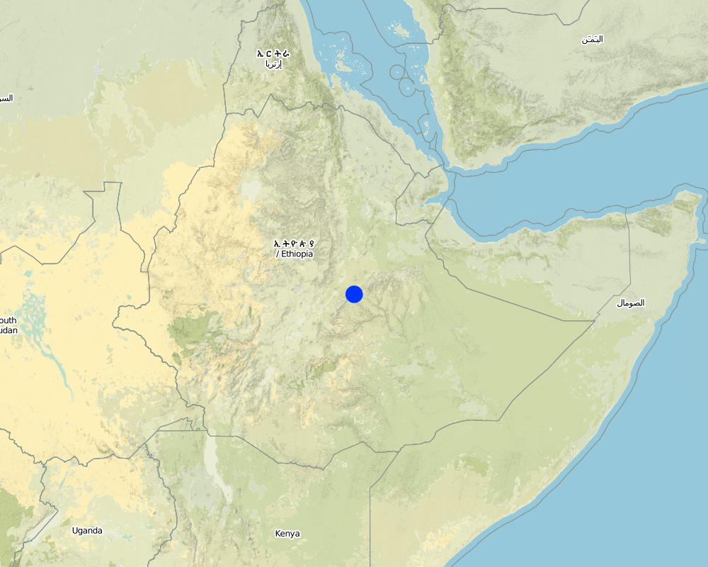
2.5 Country/ region/ locations where the Technology has been applied and which are covered by this assessment
Country:
Ethiopia
Region/ State/ Province:
West Hareghe/Oromia
Further specification of location:
Habro
Comments:
Total area covered by the SLM Technology is 1.68 km2.
the SWC technology area is defined by sub-watershed. It is implemented by programmee
Map
×2.6 Date of implementation
If precise year is not known, indicate approximate date:
- more than 50 years ago (traditional)
2.7 Introduction of the Technology
Specify how the Technology was introduced:
- through projects/ external interventions
Comments (type of project, etc.):
through the extension programme
3. Classification of the SLM Technology
3.2 Current land use type(s) where the Technology is applied

Cropland
- Annual cropping
- Tree and shrub cropping
Annual cropping - Specify crops:
- cereals - maize
- cereals - sorghum
- haricot bean, teff, chickpea
Tree and shrub cropping - Specify crops:
- coffee, open grown
- Catha edulis
Number of growing seasons per year:
- 1
Specify:
Longest growing period in days: 120 Longest growing period from month to month: Mar - Jul
Is intercropping practiced?
Yes
If yes, specify which crops are intercropped:
maize and haricot beans

Grazing land
Extensive grazing:
- Semi-nomadic pastoralism
- free grazing, stall feeding
Comments:
Major land use problems (compiler’s opinion): low productivity, gully formation
Major land use problems (land users’ perception): erosion, low soil fertility, high runoff, low production
Type of cropping system and major crops comments: in the case of intercropping maize is sown in rows and between the rows harcot bean is sown
3.4 Water supply
Water supply for the land on which the Technology is applied:
- rainfed
3.5 SLM group to which the Technology belongs
- cross-slope measure
3.6 SLM measures comprising the Technology
3.7 Main types of land degradation addressed by the Technology

soil erosion by water
- Wt: loss of topsoil/ surface erosion
- Wg: gully erosion/ gullying

water degradation
- Ha: aridification
Comments:
Main type of degradation addressed: Wt: loss of topsoil / surface erosion
Secondary types of degradation addressed: Wg: gully erosion / gullying, Ha: aridification
Main causes of degradation: other human induced causes (specify) (agricultural causes), education, access to knowledge and support services (lack of knowledge)
Secondary causes of degradation: deforestation / removal of natural vegetation (incl. forest fires), over-exploitation of vegetation for domestic use, poverty / wealth (lack of captial), land subdivision
3.8 Prevention, reduction, or restoration of land degradation
Specify the goal of the Technology with regard to land degradation:
- prevent land degradation
- reduce land degradation
Comments:
Main goals: mitigation / reduction of land degradation
Secondary goals: prevention of land degradation
4. Technical specifications, implementation activities, inputs, and costs
4.1 Technical drawing of the Technology
Technical specifications (related to technical drawing):
Oromia
Technical knowledge required for field staff / advisors: high
Technical knowledge required for land users: high
Main technical functions: control of dispersed runoff: retain / trap
Secondary technical functions: reduction of slope angle, reduction of slope length, increase / maintain water stored in soil
Relay cropping
Material/ species: maize, teff and chick pea
Mixed cropping / intercropping
Material/ species: haricot bean and maize
Bund/ bank: level
Vertical interval between structures (m): 1m
Spacing between structures (m): 10m
Depth of ditches/pits/dams (m): 0.5m
Width of ditches/pits/dams (m): 0.5m
Height of bunds/banks/others (m): 0.5m
Width of bunds/banks/others (m): 0.5m
Slope (which determines the spacing indicated above): 12%
Lateral gradient along the structure: 0%
4.2 General information regarding the calculation of inputs and costs
other/ national currency (specify):
Birr
If relevant, indicate exchange rate from USD to local currency (e.g. 1 USD = 79.9 Brazilian Real): 1 USD =:
8.5
Indicate average wage cost of hired labour per day:
0.94
4.3 Establishment activities
| Activity | Timing (season) | |
|---|---|---|
| 1. | surveying and layout | dry season |
| 2. | excavation work | onset of rain |
4.4 Costs and inputs needed for establishment
| Specify input | Unit | Quantity | Costs per Unit | Total costs per input | % of costs borne by land users | |
|---|---|---|---|---|---|---|
| Labour | Labour | ha | 1.0 | 89.0 | 89.0 | 100.0 |
| Equipment | Animal traction | ha | 1.0 | 67.0 | 67.0 | |
| Equipment | Tools | ha | 1.0 | 23.5 | 23.5 | 100.0 |
| Plant material | Seeds | ha | 1.0 | 18.8 | 18.8 | |
| Fertilizers and biocides | Fertilizer | Ha | 1.0 | 35.3 | 35.3 | |
| Other | cultivation cost | ha | 1.0 | 36.5 | 36.5 | |
| Total costs for establishment of the Technology | 270.1 | |||||
| Total costs for establishment of the Technology in USD | 31.78 | |||||
Comments:
Duration of establishment phase: 12 month(s)
4.5 Maintenance/ recurrent activities
| Activity | Timing/ frequency | |
|---|---|---|
| 1. | ploughing along the contour | dry season / 4 times |
| 2. | Sowing | onset of rain / each cropping season |
| 3. | Digging the ditch/basin | dry season/two times |
| 4. | maintain the height of the bund | dry season/two times |
4.6 Costs and inputs needed for maintenance/ recurrent activities (per year)
| Specify input | Unit | Quantity | Costs per Unit | Total costs per input | % of costs borne by land users | |
|---|---|---|---|---|---|---|
| Labour | Labour | ha | 1.0 | 11.75 | 11.75 | 100.0 |
| Equipment | Animal traction | ha | 1.0 | 56.0 | 56.0 | 100.0 |
| Equipment | Tools | ha | 1.0 | 2.3 | 2.3 | 100.0 |
| Other | cultivation cost | ha | 1.0 | 109.4 | 109.4 | |
| Total costs for maintenance of the Technology | 179.45 | |||||
| Total costs for maintenance of the Technology in USD | 21.11 | |||||
Comments:
Machinery/ tools: 5 shovel, 5 hoe
the cost is culculated based on the spesification of structures (length, width and height), tools required. For the cost given above we assumed 1 km of soil bund per hectar of cultivated land
4.7 Most important factors affecting the costs
Describe the most determinate factors affecting the costs:
excavation work requires more labour and it affects the cost of construction and maintenance
5. Natural and human environment
5.1 Climate
Annual rainfall
- < 250 mm
- 251-500 mm
- 501-750 mm
- 751-1,000 mm
- 1,001-1,500 mm
- 1,501-2,000 mm
- 2,001-3,000 mm
- 3,001-4,000 mm
- > 4,000 mm
Agro-climatic zone
- sub-humid
5.2 Topography
Slopes on average:
- flat (0-2%)
- gentle (3-5%)
- moderate (6-10%)
- rolling (11-15%)
- hilly (16-30%)
- steep (31-60%)
- very steep (>60%)
Landforms:
- plateau/plains
- ridges
- mountain slopes
- hill slopes
- footslopes
- valley floors
Altitudinal zone:
- 0-100 m a.s.l.
- 101-500 m a.s.l.
- 501-1,000 m a.s.l.
- 1,001-1,500 m a.s.l.
- 1,501-2,000 m a.s.l.
- 2,001-2,500 m a.s.l.
- 2,501-3,000 m a.s.l.
- 3,001-4,000 m a.s.l.
- > 4,000 m a.s.l.
5.3 Soils
Soil depth on average:
- very shallow (0-20 cm)
- shallow (21-50 cm)
- moderately deep (51-80 cm)
- deep (81-120 cm)
- very deep (> 120 cm)
Soil texture (topsoil):
- coarse/ light (sandy)
- medium (loamy, silty)
Topsoil organic matter:
- medium (1-3%)
If available, attach full soil description or specify the available information, e.g. soil type, soil PH/ acidity, Cation Exchange Capacity, nitrogen, salinity etc.
Soil fertility is medium-low
Soil drainage/infiltration is good
Soil water storage capacity is low-medium
5.6 Characteristics of land users applying the Technology
Market orientation of production system:
- subsistence (self-supply)
- mixed (subsistence/ commercial)
Relative level of wealth:
- poor
- average
Level of mechanization:
- manual work
- animal traction
Indicate other relevant characteristics of the land users:
Population density: 100-200 persons/km2
Annual population growth: 2% - 3%
1% of the land users are very rich and own 5% of the land.
60% of the land users are average wealthy and own 70% of the land.
30% of the land users are poor and own 20% of the land.
9% of the land users are poor and own 5% of the land.
Off-farm income specification: no other forms of income generating means
5.7 Average area of land used by land users applying the Technology
- < 0.5 ha
- 0.5-1 ha
- 1-2 ha
- 2-5 ha
- 5-15 ha
- 15-50 ha
- 50-100 ha
- 100-500 ha
- 500-1,000 ha
- 1,000-10,000 ha
- > 10,000 ha
6. Impacts and concluding statements
6.1 On-site impacts the Technology has shown
Socio-economic impacts
Production
crop production
production area
land management
Income and costs
farm income
workload
Ecological impacts
Water cycle/ runoff
surface runoff
Quantity before SLM:
20
Quantity after SLM:
10
excess water drainage
Soil
soil moisture
soil loss
Quantity before SLM:
42
Quantity after SLM:
20
Other ecological impacts
Soil fertility
Waterlogging
6.2 Off-site impacts the Technology has shown
reliable and stable stream flows in dry season
downstream flooding
downstream siltation
groundwater/ river pollution
6.4 Cost-benefit analysis
How do the benefits compare with the establishment costs (from land users’ perspective)?
Short-term returns:
slightly negative
Long-term returns:
positive
How do the benefits compare with the maintenance/ recurrent costs (from land users' perspective)?
Short-term returns:
neutral/ balanced
Long-term returns:
positive
6.5 Adoption of the Technology
Of all those who have adopted the Technology, how many did so spontaneously, i.e. without receiving any material incentives/ payments?
- 91-100%
Comments:
625 land user families have adopted the Technology without any external material support
Comments on spontaneous adoption: survey results
There is a little trend towards spontaneous adoption of the Technology
Comments on adoption trend: the majority of the farming communities are poor and they are not able to pay for SWC activities and incentive is required in some cases
6.7 Strengths/ advantages/ opportunities of the Technology
| Strengths/ advantages/ opportunities in the land user’s view |
|---|
|
reduce soil erosion How can they be sustained / enhanced? frequent maintenance of the structure |
|
maintain soil moisture How can they be sustained / enhanced? upgrading of ditches and embankment |
|
increase production How can they be sustained / enhanced? increasing the productivity of land per unit area |
| Strengths/ advantages/ opportunities in the compiler’s or other key resource person’s view |
|---|
|
erosion control How can they be sustained / enhanced? frequent maintenance of the structure |
|
moisture maintenance How can they be sustained / enhanced? frequent maintenance of the ditches |
| reduction of slope length |
| increasing of infltration rate |
7. References and links
7.1 Methods/ sources of information
Links and modules
Expand all Collapse allLinks
No links
Modules
No modules