Stone-faced Soil Bund Stablized with Grass [Ethiopia]
- Creation:
- Update:
- Compiler: Daniel Danano
- Editor: –
- Reviewers: Fabian Ottiger, Alexandra Gavilano
Dhaga (oromifa)
technologies_1077 - Ethiopia
View sections
Expand all Collapse all1. General information
1.2 Contact details of resource persons and institutions involved in the assessment and documentation of the Technology
Name of the institution(s) which facilitated the documentation/ evaluation of the Technology (if relevant)
FAO Food and Agriculture Organization (FAO Food and Agriculture Organization) - Italy1.3 Conditions regarding the use of data documented through WOCAT
The compiler and key resource person(s) accept the conditions regarding the use of data documented through WOCAT:
Yes
2. Description of the SLM Technology
2.1 Short description of the Technology
Definition of the Technology:
Stone faced terraces are commonly constructed on cultivated lands. These are structural measural measures placed along the contour to control soil erosion and trap runoff.
2.2 Detailed description of the Technology
Description:
Stone-faced soil bund is constructed during the dry period when the field is free from crops (after crop harvest). Soils in the woreda are light and are easily eroded. A contour line is marked on the ground first and a foundation placing stones is dug. The stone wall is placed in the foundation and the wall is raised until it attains a height of 0.50m at minimum. Then earth is dug on the upslope side by removing soil from it and make an embankment of soil on the upper side to support the stone wall. In the same way the stone is supported by the soil from the upper side. The embanked soil is lightly compacted to avoid collapse. The objective is to control concentrated runoff from causing soil erosion and to retain as much rainwater as possible in the soil for mazimizing crop production. Livestock are not let on the terraced land. Most land users feed their animals tethered. The bund is then stablized by planting grass. The most commonly used grasses for stablizing bunds in the area are phalaris and elephant grass. The purpose is to control runoff and soil erosion from cultivated lands. Grass is planted to stablize the bund and also help in providing fodder for animals. Some land users stablize the stone-faced bunds by planting fruit trees. Fruit trees are often planted at the homesteads for better management and protection. The income obtaoned from fruit trees is high. Sorghum fields are predominantly treated by stone-faced bunds while chat and coffee fields are treated by ridges and basins. Frequent maintenance and upgrading is required until bench is formed. Currently most of the fields in the woreda have a properly stablized terraces and as a result loss of soil and water by erosion is decreasing. Maintenance is done continuously until the structure stablizes well and inparticular after heavy rains, every time after tillage and cropping. The technology is suitable in areas where stones are avialable and soils are light.
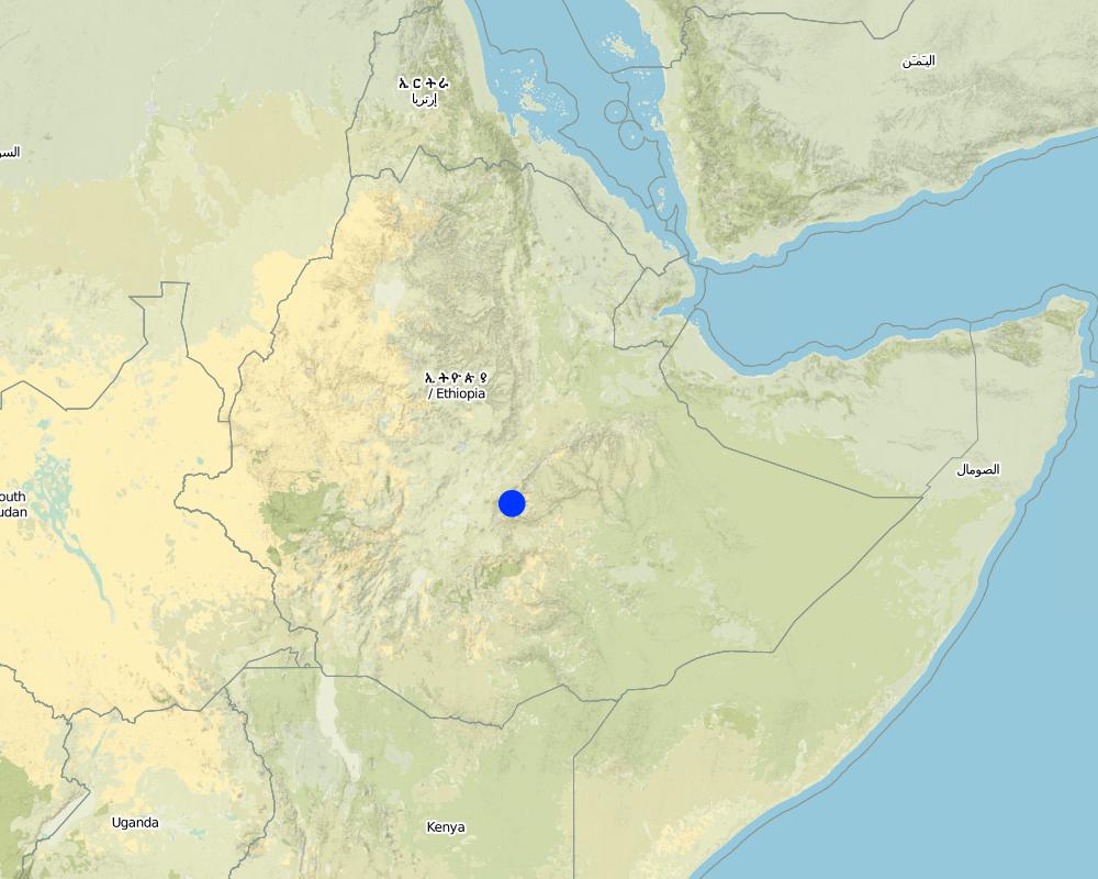
2.5 Country/ region/ locations where the Technology has been applied and which are covered by this assessment
Country:
Ethiopia
Region/ State/ Province:
Oromia National Regional State
Further specification of location:
Tullo
Specify the spread of the Technology:
- evenly spread over an area
If precise area is not known, indicate approximate area covered:
- 100-1,000 km2
Comments:
Total area covered by the SLM Technology is 80 km2.
Information obtaned from annual activities and achievements reports. But at present the total technology area is more than the amount shown here and estimate is indicated as follows:
Map
×2.6 Date of implementation
If precise year is not known, indicate approximate date:
- less than 10 years ago (recently)
2.7 Introduction of the Technology
Specify how the Technology was introduced:
- through projects/ external interventions
Comments (type of project, etc.):
The technology was initially introduced by the extension implementation project of the Ministry of Agriculture and modified in the process of implementing the National Soil and Water Conservation Program in the country in the various phases of the land rehabilitation and afforestation project of the MERETproject (MOARD/WFP)
3. Classification of the SLM Technology
3.1 Main purpose(s) of the Technology
- improve production
- reduce, prevent, restore land degradation
3.2 Current land use type(s) where the Technology is applied

Cropland
- Annual cropping
- Perennial (non-woody) cropping
- Tree and shrub cropping
Annual cropping - Specify crops:
- cereals - maize
- cereals - sorghum
- legumes and pulses - beans
- teff
- chat, elephant grass, phalaris
Tree and shrub cropping - Specify crops:
- avocado
- coffee, open grown
- fruits, other
- mango, mangosteen, guava
- grevillea, cordia
Number of growing seasons per year:
- 2
Specify:
Longest growing period in days: 240 Longest growing period from month to month: Apr - NovSecond longest growing period in days: 150Second longest growing period from month to month: Feb - Jun
Is intercropping practiced?
Yes
If yes, specify which crops are intercropped:
maize-haricot beans, chat-beans

Grazing land
Intensive grazing/ fodder production:
- Cut-and-carry/ zero grazing
Comments:
Major land use problems (compiler’s opinion): Land use problem is the result mainly of high population growth, improper land use and poor farming practices. Land not suitable for cultivation is put under use. Steepslopes on hillsides and mountain escarpments are cultivated. These have resulted in high runoff and sediment movment from the upper catchments which are dominantly devoid of vegetation and no conservation measures practiced.
Major land use problems (land users’ perception): land shortage, loss of fertility and soil erosion on lands with no conservation measures.
Cut-and-carry/ zero grazing: grazing land is seriously shriniking owing
Type of cropping system and major crops comments: sorghum-beans or chat - sorghum, maize-beans
3.4 Water supply
Water supply for the land on which the Technology is applied:
- rainfed
3.5 SLM group to which the Technology belongs
- cross-slope measure
3.6 SLM measures comprising the Technology
3.7 Main types of land degradation addressed by the Technology

soil erosion by water
- Wt: loss of topsoil/ surface erosion

chemical soil deterioration
- Cn: fertility decline and reduced organic matter content (not caused by erosion)
Comments:
Main type of degradation addressed: Wt: loss of topsoil / surface erosion
Secondary types of degradation addressed: Cn: fertility decline and reduced organic matter content
3.8 Prevention, reduction, or restoration of land degradation
Specify the goal of the Technology with regard to land degradation:
- prevent land degradation
- reduce land degradation
Comments:
Main goals: mitigation / reduction of land degradation
Secondary goals: prevention of land degradation
4. Technical specifications, implementation activities, inputs, and costs
4.1 Technical drawing of the Technology
Technical specifications (related to technical drawing):
Technical knowledge required for field staff / advisors: moderate
Technical knowledge required for land users: moderate
Main technical functions: reduction of slope length
Secondary technical functions: control of concentrated runoff: retain / trap, reduction of slope angle, increase of infiltration, increase / maintain water stored in soil
Early planting
Material/ species: sorghum, maize, chat
Remarks: on contour and row planting
Mixed cropping / intercropping
Material/ species: maize-haricot beans, chat-beans
Remarks: row planting and broadcasting
Contour planting / strip cropping
Material/ species: land tillage and cultivation
Remarks: contour cultivation
Legume inter-planting
Remarks: contour
Manure / compost / residues
Material/ species: animal dung and crop residue farming
Quantity/ density: 30-40 t/ha
Remarks: applied in between rows
Mineral (inorganic) fertilizers
Material/ species: chemical fertilizers (DAP and Urea)
Remarks: broadcasting
Contour tillage
Remarks: along the contour and made by oxen plough
Aligned: -contour
Vegetative material: T : trees / shrubs, F : fruit trees / shrubs
Number of plants per (ha): 400-500
Vertical interval between rows / strips / blocks (m): 1
Spacing between rows / strips / blocks (m): 10 m
Width within rows / strips / blocks (m): 3 x 3
Vegetative measure: aligned: contour
Vegetative material: G : grass
Number of plants per (ha): 5000
Vertical interval between rows / strips / blocks (m): 1
Spacing between rows / strips / blocks (m): 110 m
Width within rows / strips / blocks (m): 0.3 x 0.3
Vegetative measure: Vegetative material: G : grass
Vegetative measure: Vegetative material: G : grass
Vegetative measure: Vegetative material: G : grass
Trees/ shrubs species: grevillea, cordia
Fruit trees / shrubs species: guava, avocado
Grass species: elephant, phalaris
Slope (which determines the spacing indicated above): 10.00%
If the original slope has changed as a result of the Technology, the slope today is (see figure below): 3.00%
Gradient along the rows / strips: 0.00%
4.3 Establishment activities
| Activity | Timing (season) | |
|---|---|---|
| 1. | seed collection | dry season |
| 2. | seedling production | dry season |
| 3. | seedling planting | during rains |
| 4. | weeding and cultivation | during rains |
4.4 Costs and inputs needed for establishment
| Specify input | Unit | Quantity | Costs per Unit | Total costs per input | % of costs borne by land users | |
|---|---|---|---|---|---|---|
| Labour | Labour | ha | 1.0 | 125.0 | 125.0 | |
| Equipment | Animal traction | ha | 1.0 | 46.6 | 46.6 | |
| Equipment | Tools | ha | 1.0 | 5.5 | 5.5 | |
| Plant material | Seeds | ha | 1.0 | 2.8 | 2.8 | |
| Plant material | Seedlings | ha | 1.0 | 30.0 | 30.0 | |
| Fertilizers and biocides | Fetilizer | ha | 1.0 | 33.3 | 33.3 | |
| Total costs for establishment of the Technology | 243.2 | |||||
| Total costs for establishment of the Technology in USD | 243.2 | |||||
Comments:
Duration of establishment phase: 60 month(s)
4.5 Maintenance/ recurrent activities
| Activity | Timing/ frequency | |
|---|---|---|
| 1. | primary tillage | onset of rains |
| 2. | secondary tillage and seed bed preparation | in the middle of early rains and main rains |
| 3. | weeding and cultivation | after germination |
| 4. | thinning | after rains |
4.6 Costs and inputs needed for maintenance/ recurrent activities (per year)
| Specify input | Unit | Quantity | Costs per Unit | Total costs per input | % of costs borne by land users | |
|---|---|---|---|---|---|---|
| Labour | Labour | ha | 1.0 | 12.5 | 12.5 | |
| Equipment | Tools | ha | 1.0 | 0.5 | 0.5 | |
| Plant material | Seedlings | ha | 1.0 | 3.0 | 3.0 | |
| Fertilizers and biocides | Fertilizer | ha | 1.0 | 33.3 | 33.3 | |
| Total costs for maintenance of the Technology | 49.3 | |||||
| Total costs for maintenance of the Technology in USD | 49.3 | |||||
Comments:
length of stone faced bunds and the number of trees planted
4.7 Most important factors affecting the costs
Describe the most determinate factors affecting the costs:
Slope: In steep slopes terraces get closer and the length of terrace per unit area /hectar/ increases and this increases the cost of construction. On soils of shallow soils digging becomes tough and this leads to increased costs
5. Natural and human environment
5.1 Climate
Annual rainfall
- < 250 mm
- 251-500 mm
- 501-750 mm
- 751-1,000 mm
- 1,001-1,500 mm
- 1,501-2,000 mm
- 2,001-3,000 mm
- 3,001-4,000 mm
- > 4,000 mm
Agro-climatic zone
- sub-humid
Almost over 65% of the SWC area
5.2 Topography
Slopes on average:
- flat (0-2%)
- gentle (3-5%)
- moderate (6-10%)
- rolling (11-15%)
- hilly (16-30%)
- steep (31-60%)
- very steep (>60%)
Landforms:
- plateau/plains
- ridges
- mountain slopes
- hill slopes
- footslopes
- valley floors
Altitudinal zone:
- 0-100 m a.s.l.
- 101-500 m a.s.l.
- 501-1,000 m a.s.l.
- 1,001-1,500 m a.s.l.
- 1,501-2,000 m a.s.l.
- 2,001-2,500 m a.s.l.
- 2,501-3,000 m a.s.l.
- 3,001-4,000 m a.s.l.
- > 4,000 m a.s.l.
Comments and further specifications on topography:
Altitudinal zone: 1501-2000 m a.s.l. (dominant elevation, ranked 1) and 1,001-1,500 m a.s.l. (very small area, ranked 2)
Landforms: Mountain slopes (the dominant landform, ranked 1), foot slopes (dominanatly cultivated lands, ranked 2) and valley floor (mostly cultivated, ranked 2)
Slopes on average: Hilly (planted forestsand shrublands with degraded natural forests, ranekd 1), Rolling ( cultivated lands with perennial crops, ranked 2), moderate (cultivated lands with cereals (sorghum and maize) ranked 3), getnle (cultivated with teff and sweet potato, ranked 3)
5.3 Soils
Soil depth on average:
- very shallow (0-20 cm)
- shallow (21-50 cm)
- moderately deep (51-80 cm)
- deep (81-120 cm)
- very deep (> 120 cm)
Soil texture (topsoil):
- coarse/ light (sandy)
Topsoil organic matter:
- medium (1-3%)
- low (<1%)
If available, attach full soil description or specify the available information, e.g. soil type, soil PH/ acidity, Cation Exchange Capacity, nitrogen, salinity etc.
Soil depth on average: Shallow (soils on mountain slopes , ranked 1), moderately deep (soils on foot slopes, ranked 2), deep ( soils on valley floors, ranked 3) and very deep (soils around homesteads, ranked 3)
Soil texture: Coarse/light (mountain slopes and foot slopes, ranked 1), medium (foot slopes, ranked 2) and fine/heavy (valley floor, ranked 3)
Soil fertility is low (mountain slopes, ranked 1), medium (foot slopes, ranked 2) and high (valley floor, ranked 3)
Topsoil organic matter is medium (impressions: on valley floors of cultivated lands, ranked 1) and low ( impressions:mountain slopes, ranked 2)
Soil drainage/infiltration is good (most of the mountain slopes and foot slopes, ranked 1) and medium (on valley floors, ranked 2)
Soil water storage capacity is low (on mountain slopes because of shallow soils, ranked 1) and medium (on foot slopes and valley floors, ranked 2)
5.6 Characteristics of land users applying the Technology
Market orientation of production system:
- subsistence (self-supply)
Off-farm income:
- > 50% of all income
Relative level of wealth:
- average
- rich
Level of mechanization:
- manual work
- animal traction
Indicate other relevant characteristics of the land users:
Population density: 200-500 persons/km2
Annual population growth: 2% - 3%
(The rich hire labour).
(could get orgainzed in groups for labour sahring).
Off-farm income specification: The rich and average land users get engaged in other non farm activities because they have financial means
Level of mechanization: Animal traction (cereal crop fields are ploughed and cultivated by oxen plough, ranked 1) and manual work (chat and coffee plants are manually cultivated by hoe, ranked 2)
Market orientation of grazing land: Subsistence (self-supply). Animals are predominanatly kept for draft power requiremen and milk production.
5.7 Average area of land used by land users applying the Technology
- < 0.5 ha
- 0.5-1 ha
- 1-2 ha
- 2-5 ha
- 5-15 ha
- 15-50 ha
- 50-100 ha
- 100-500 ha
- 500-1,000 ha
- 1,000-10,000 ha
- > 10,000 ha
Comments:
0.5-1 ha (The poor are many and they have a very small holdings, ranked 1)
1-2 ha (The average land users)
5.8 Land ownership, land use rights, and water use rights
Land ownership:
- state
Land use rights:
- open access (unorganized)
- individual
6. Impacts and concluding statements
6.1 On-site impacts the Technology has shown
Socio-economic impacts
Production
crop production
Comments/ specify:
due to increase in soil misture and erosion control due to measures
fodder production
Comments/ specify:
planataion on the hillsides and on bunds
fodder quality
Comments/ specify:
planataion on the hillsides and on bunds
wood production
Comments/ specify:
area closures and hillside planataions
Income and costs
farm income
Comments/ specify:
crop production increased
Socio-cultural impacts
community institutions
Comments/ specify:
farmers get organized in groups for conservation activities
SLM/ land degradation knowledge
Comments/ specify:
land users appreciating conservation interventions increasing
Ecological impacts
Water cycle/ runoff
surface runoff
Quantity before SLM:
50
Quantity after SLM:
0
Soil
soil moisture
Comments/ specify:
ruinoff trapped
soil loss
Quantity before SLM:
60
Quantity after SLM:
4
Comments/ specify:
because of measures
6.4 Cost-benefit analysis
How do the benefits compare with the establishment costs (from land users’ perspective)?
Short-term returns:
neutral/ balanced
Long-term returns:
positive
How do the benefits compare with the maintenance/ recurrent costs (from land users' perspective)?
Short-term returns:
slightly positive
Long-term returns:
positive
6.5 Adoption of the Technology
Comments:
90 % of land user families have adopted the Technology with external material support
1150 land user families have adopted the Technology with external material support
Comments on acceptance with external material support: estimates
10% of land user families have adopted the Technology without any external material support
Comments on spontaneous adoption: estimates
7. References and links
7.1 Methods/ sources of information
Links and modules
Expand all Collapse allLinks
No links
Modules
No modules