Hararghie Stone Faced Soil Bund [Ethiopia]
- Creation:
- Update:
- Compiler: Unknown User
- Editor: –
- Reviewers: Fabian Ottiger, Alexandra Gavilano
Daaga Dhakaa (Oromifa)
technologies_1468 - Ethiopia
View sections
Expand all Collapse all1. General information
1.2 Contact details of resource persons and institutions involved in the assessment and documentation of the Technology
Key resource person(s)
SLM specialist:
1.3 Conditions regarding the use of data documented through WOCAT
The compiler and key resource person(s) accept the conditions regarding the use of data documented through WOCAT:
Yes
2. Description of the SLM Technology
2.1 Short description of the Technology
Definition of the Technology:
Stone faced embankment constructed along the contour to reduce soil loss
2.2 Detailed description of the Technology
Description:
It is a structural measure constructed from stone and soil and aligned along the contour. The structure is placed on a foundation having channel on the upper side of the embankment with ridges having an interval of 10 m. A space (berm) of about 15 cm is left between the embankment and the channel.
Purpose of the Technology: To reduce soil erosion, increase soil moisture, reduce slope length and steepnss.
Establishment / maintenance activities and inputs: Construction of stone wall riser starting from the foundation and compaction of the embankment to attain the given standard. Ditches are excavated and forming a tied ridges at an interval of 10 cm.
Natural / human environment: It is more applicable in areas where land degradation is serious and stone is avialable.
2.5 Country/ region/ locations where the Technology has been applied and which are covered by this assessment
Country:
Ethiopia
Region/ State/ Province:
Deder/Oromia
Further specification of location:
Wabe/Gelan Sedi
Comments:
Total area covered by the SLM Technology is 10.6 km2.
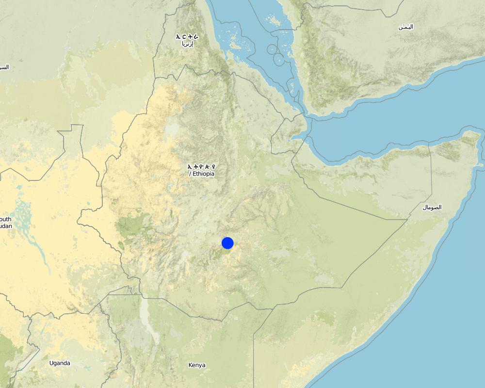
Map
×3. Classification of the SLM Technology
3.1 Main purpose(s) of the Technology
- reduce, prevent, restore land degradation
3.2 Current land use type(s) where the Technology is applied

Cropland
- Annual cropping
Annual cropping - Specify crops:
- cereals - barley
- cereals - maize
Number of growing seasons per year:
- 2
Specify:
Longest growing period in days: 180 Longest growing period from month to month: Apr - SepSecond longest growing period in days: 95 Second longest growing period from month to month: Jun - Sep

Grazing land
Extensive grazing:
- Semi-nomadic pastoralism
Intensive grazing/ fodder production:
- Cut-and-carry/ zero grazing
- Mixed
Animal type:
- cattle - dairy
- oxen
Comments:
Major land use problems (compiler’s opinion): Population pressure, land fragmentation, small land holding size, land taken by the structures.
Major land use problems (land users’ perception): Soil erosion, population pressure
Semi-nomadism / pastoralism: Yes
Mixed: (eg agro-pastoralism, silvo-pastoralism): they leave small plot of land along the farm boundary growing grass to be cut and carried home to feed oxen and milking cows.
Grazingland comments: Grazing land size is getting reduced from time to time. Livestock production should be integrated with other agricultural and environmental protection activities. Livestock production should be supported with improved management systems.
Type of cropping system and major crops comments: Maize-barley-maize
3.4 Water supply
Water supply for the land on which the Technology is applied:
- rainfed
3.5 SLM group to which the Technology belongs
- cross-slope measure
3.6 SLM measures comprising the Technology
3.7 Main types of land degradation addressed by the Technology

soil erosion by water
- Wt: loss of topsoil/ surface erosion

chemical soil deterioration
- Cn: fertility decline and reduced organic matter content (not caused by erosion)

water degradation
- Ha: aridification
Comments:
Main type of degradation addressed: Wt: loss of topsoil / surface erosion
Secondary types of degradation addressed: Cn: fertility decline and reduced organic matter content, Ha: aridification
3.8 Prevention, reduction, or restoration of land degradation
Specify the goal of the Technology with regard to land degradation:
- prevent land degradation
- reduce land degradation
Comments:
Main goals: mitigation / reduction of land degradation
Secondary goals: prevention of land degradation
4. Technical specifications, implementation activities, inputs, and costs
4.1 Technical drawing of the Technology
Technical specifications (related to technical drawing):
Oromia
Main technical functions: control of dispersed runoff: retain / trap
Secondary technical functions: control of dispersed runoff: impede / retard, control of concentrated runoff: retain / trap, reduction of slope angle, reduction of slope length, improvement of ground cover, increase of infiltration
Aligned: -contour
Vegetative material: G : grass
Number of plants per (ha): 20000
Vertical interval within rows / strips / blocks (m): 0.1m
Width within rows / strips / blocks (m): 0.15
Terrace: bench level
Vertical interval between structures (m): 1.5
Spacing between structures (m): 10
Depth of ditches/pits/dams (m): 0.5
Width of ditches/pits/dams (m): 0.5
Length of ditches/pits/dams (m): 80
Height of bunds/banks/others (m): 0.75
Width of bunds/banks/others (m): 0.75
Length of bunds/banks/others (m): 80
Slope (which determines the spacing indicated above): 20%
Lateral gradient along the structure: 0%
4.2 General information regarding the calculation of inputs and costs
other/ national currency (specify):
Birr
If relevant, indicate exchange rate from USD to local currency (e.g. 1 USD = 79.9 Brazilian Real): 1 USD =:
8.6
Indicate average wage cost of hired labour per day:
0.80
4.3 Establishment activities
| Activity | Timing (season) | |
|---|---|---|
| 1. | layout of raws | rainy season |
| 2. | Preparation of grass split | rainy season |
| 3. | Plantation | rainy season |
| 4. | Site selection | dry season |
| 5. | Surveying | dry season |
| 6. | Layout of yhe structure | dry season |
| 7. | Excavation of the foundation | dry season |
| 8. | Digging the ditches | dry season |
| 9. | Construction of the stone wall | dry season |
4.4 Costs and inputs needed for establishment
| Specify input | Unit | Quantity | Costs per Unit | Total costs per input | % of costs borne by land users | |
|---|---|---|---|---|---|---|
| Labour | Labour | ha | 1.0 | 244.0 | 244.0 | |
| Equipment | Tools | ha | 1.0 | 1.5 | 1.5 | 100.0 |
| Equipment | Animal traction | ha | 1.0 | 25.0 | 25.0 | 100.0 |
| Plant material | Seeds | ha | 1.0 | 12.0 | 12.0 | 100.0 |
| Fertilizers and biocides | Fertilizer | ha | 1.0 | 40.0 | 40.0 | 100.0 |
| Total costs for establishment of the Technology | 322.5 | |||||
| Total costs for establishment of the Technology in USD | 37.5 | |||||
Comments:
Duration of establishment phase: 12 month(s)
4.5 Maintenance/ recurrent activities
| Activity | Timing/ frequency | |
|---|---|---|
| 1. | Weeding & cultivation | |
| 2. | Repair the broken parts | annual |
4.6 Costs and inputs needed for maintenance/ recurrent activities (per year)
| Specify input | Unit | Quantity | Costs per Unit | Total costs per input | % of costs borne by land users | |
|---|---|---|---|---|---|---|
| Labour | Labour | ha | 1.0 | 25.0 | 25.0 | 100.0 |
| Total costs for maintenance of the Technology | 25.0 | |||||
| Total costs for maintenance of the Technology in USD | 2.91 | |||||
Comments:
The cost is calculated for a length of structure per hectare of land
4.7 Most important factors affecting the costs
Describe the most determinate factors affecting the costs:
slope of the land, foundation and dimension of the structure, soil depth and excavation of the ditches.
5. Natural and human environment
5.1 Climate
Annual rainfall
- < 250 mm
- 251-500 mm
- 501-750 mm
- 751-1,000 mm
- 1,001-1,500 mm
- 1,501-2,000 mm
- 2,001-3,000 mm
- 3,001-4,000 mm
- > 4,000 mm
Agro-climatic zone
- humid
- sub-humid
- semi-arid
5.2 Topography
Slopes on average:
- flat (0-2%)
- gentle (3-5%)
- moderate (6-10%)
- rolling (11-15%)
- hilly (16-30%)
- steep (31-60%)
- very steep (>60%)
Landforms:
- plateau/plains
- ridges
- mountain slopes
- hill slopes
- footslopes
- valley floors
Altitudinal zone:
- 0-100 m a.s.l.
- 101-500 m a.s.l.
- 501-1,000 m a.s.l.
- 1,001-1,500 m a.s.l.
- 1,501-2,000 m a.s.l.
- 2,001-2,500 m a.s.l.
- 2,501-3,000 m a.s.l.
- 3,001-4,000 m a.s.l.
- > 4,000 m a.s.l.
Comments and further specifications on topography:
Altitudinal zone: 2001-2500 m a.s.l. (ranked 1), 2501-3000 m a.s.l. (ranked 2) and 1501-2000 m a.s.l. (ranked 3)
Landforms: Hill slopes (ranked 1), foot slopes (ranked 2) and mountain slopes (ranked 3)
Slopes on average: Hilly (ranked 1), steep and very steep (ranked 2) and moderate and rolling (ranked 3)
5.3 Soils
Soil depth on average:
- very shallow (0-20 cm)
- shallow (21-50 cm)
- moderately deep (51-80 cm)
- deep (81-120 cm)
- very deep (> 120 cm)
Soil texture (topsoil):
- medium (loamy, silty)
Topsoil organic matter:
- low (<1%)
If available, attach full soil description or specify the available information, e.g. soil type, soil PH/ acidity, Cation Exchange Capacity, nitrogen, salinity etc.
Soil depth on average: Shallow (ranked 1), moderately deep (ranked 2) and very shallow (ranked 3)
Soil texture: Also fine/heavy (ranked 2) and coarse/light (ranked 3)
Soil fertility: Low, medium (ranked 2) and high and very low (both ranked 3)
Topsoil organic matter: Also medium (ranked 2) and high (ranked 3)
Soil drainage/infiltration: Poor (ranked 1), medium (ranked 2) and good (ranked 3)
Soil water storage capacity: High (ranked 1), medium (ranked 2) and low (ranked 3)
5.6 Characteristics of land users applying the Technology
Market orientation of production system:
- subsistence (self-supply)
Off-farm income:
- less than 10% of all income
Relative level of wealth:
- very poor
- poor
Level of mechanization:
- manual work
- animal traction
Indicate other relevant characteristics of the land users:
Population density: 100-200 persons/km2
2% of the land users are very rich and own 2% of the land.
3% of the land users are rich and own 3% of the land.
5% of the land users are average wealthy and own 5% of the land.
10% of the land users are poor and own 10% of the land.
80% of the land users are poor and own 80% of the land.
Off-farm income specification: It is insignificant and they get incentives of FFW.
Market orientation grazing land: Subsistence (ranked 1) and mixed ( they leave small plot of land along the farm boundary growing grass to be cut and carried home to feed oxen and milking cows, ranked 2)
5.7 Average area of land used by land users applying the Technology
- < 0.5 ha
- 0.5-1 ha
- 1-2 ha
- 2-5 ha
- 5-15 ha
- 15-50 ha
- 50-100 ha
- 100-500 ha
- 500-1,000 ha
- 1,000-10,000 ha
- > 10,000 ha
Comments:
Cropland: 0.5 ha
Grazing land: In most cases the holding size is about 0.25 ha
5.8 Land ownership, land use rights, and water use rights
Land ownership:
- state
Land use rights:
- individual
6. Impacts and concluding statements
6.1 On-site impacts the Technology has shown
Socio-economic impacts
Production
crop production
fodder production
fodder quality
production area
Comments/ specify:
The land which is occupied by the structure
land management
Comments/ specify:
in few cases the spacing is not suitable for oxen cultivation
Income and costs
workload
Comments/ specify:
in farming operation
Socio-cultural impacts
community institutions
national institutions
SLM/ land degradation knowledge
Ecological impacts
Water cycle/ runoff
surface runoff
Quantity before SLM:
70
Quantity after SLM:
30
excess water drainage
Soil
soil moisture
soil cover
soil loss
Quantity before SLM:
4
Quantity after SLM:
3
Other ecological impacts
Soil fertility
6.2 Off-site impacts the Technology has shown
reliable and stable stream flows in dry season
downstream flooding
downstream siltation
6.4 Cost-benefit analysis
How do the benefits compare with the establishment costs (from land users’ perspective)?
Short-term returns:
slightly positive
Long-term returns:
positive
How do the benefits compare with the maintenance/ recurrent costs (from land users' perspective)?
Short-term returns:
slightly positive
Long-term returns:
positive
6.5 Adoption of the Technology
Of all those who have adopted the Technology, how many did so spontaneously, i.e. without receiving any material incentives/ payments?
- 0-10%
Comments:
90% of land user families have adopted the Technology with external material support
Comments on acceptance with external material support: estimates
5% of land user families have adopted the Technology without any external material support
There is a little trend towards spontaneous adoption of the Technology
6.7 Strengths/ advantages/ opportunities of the Technology
| Strengths/ advantages/ opportunities in the land user’s view |
|---|
|
Conserve the soil How can they be sustained / enhanced? Continous maintenance and improving the heigh of the structure. |
|
Forage production How can they be sustained / enhanced? Introduce multipurpose plant/grass species |
|
Improve soil moisture How can they be sustained / enhanced? maintain the channels |
| Strengths/ advantages/ opportunities in the compiler’s or other key resource person’s view |
|---|
|
It conserves the soil How can they be sustained / enhanced? Increasing the height and maintenance |
|
Improves soil moisture How can they be sustained / enhanced? Stablizing the bund |
|
Suitable for grass planting How can they be sustained / enhanced? Avoid free grazing |
6.8 Weaknesses/ disadvantages/ risks of the Technology and ways of overcoming them
| Weaknesses/ disadvantages/ risks in the land user’s view | How can they be overcome? |
|---|---|
| Suitable for rodent harbouring | provision of rodent controlling mechanisms |
| Interference of running grasses in the cultivated land | continous weeding |
| Obstacle for crossing yoked oxen |
7. References and links
7.1 Methods/ sources of information
Links and modules
Expand all Collapse allLinks
No links
Modules
No modules