Shelterbelts [India]
- Creation:
- Update:
- Compiler: Unknown User
- Editor: –
- Reviewers: Fabian Ottiger, Alexandra Gavilano
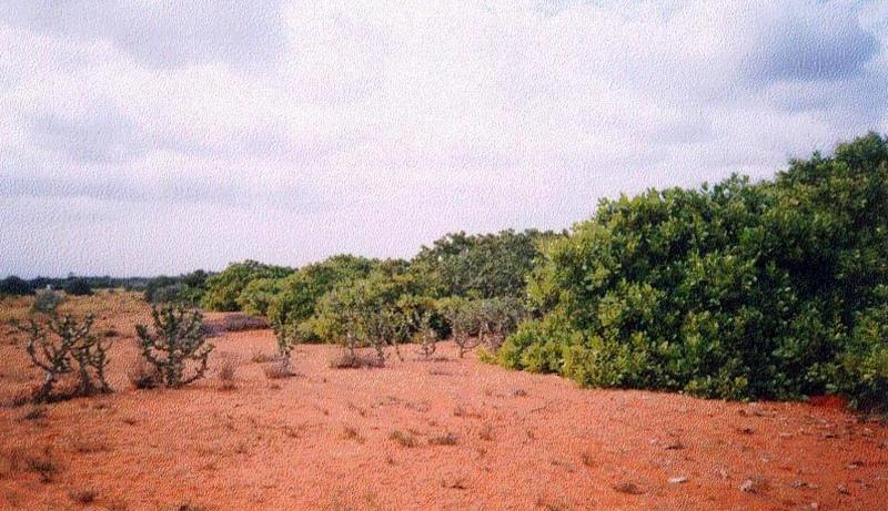
Line, Shelterbelts in Theri land
technologies_1473 - India
View sections
Expand all Collapse all1. General information
1.3 Conditions regarding the use of data documented through WOCAT
The compiler and key resource person(s) accept the conditions regarding the use of data documented through WOCAT:
Yes
2. Description of the SLM Technology
2.1 Short description of the Technology
Definition of the Technology:
Cultivation of tree belts across the direction of wind at appropriate intervals in the deposition zone, with a view to arrest wind erosion and facilitate stabilisation of dunes through interbelt development.
2.2 Detailed description of the Technology
Description:
The technology comprises establishment of 5 row shelterbelts at 160 m intervals. 3 row intermediary shelterbelts are introduced in between existing shelterbelts at 80 m interval. Land owners are encouraged to cultivate tree crops in between the belts.
Purpose of the Technology: Shelterbelts are useful in reducing wind velocity, there by arresting shifting of sand dunes, deposition of sand on fields, habitation, wells, roads etc. Cultivation of area between tree belts is made possible leading to increase in productivity from these lands.
Establishment / maintenance activities and inputs: The shelterbelts comprise tree species of different heights planted in rows (5 and 3 row deep) in a straight line across the wind direction. Six month old seedlings are planted in pits of volume 1 cuft to 1.5 cuft, which are filled with tank silt. One borewell is provided for one km length for life saving irrigation.
Natural / human environment: The environment is arid and forms the deposition zone wherein sand lifted from the impact zone is deposited. Sand dunes cover the area.
2.3 Photos of the Technology
Media Gallery
2.5 Country/ region/ locations where the Technology has been applied and which are covered by this assessment
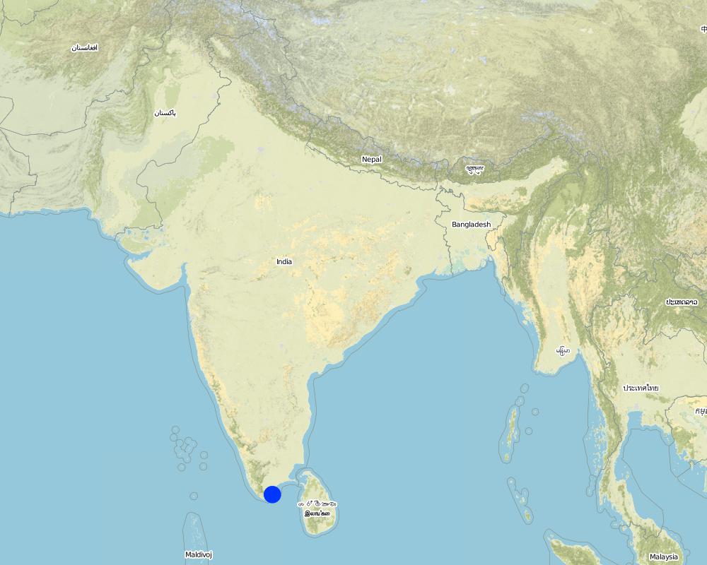
Country:
India
Region/ State/ Province:
Tirunelveli district, Tamil nadu state
Comments:
Total area covered by the SLM Technology is 100 km2.
The technology was implemented in the sand dune belt locally known as 'theri', located between the western mountain range and east coast of south India. The technology was initially implemented by the Government of Tamil nadu state in 1978 till 1985. The Danida supported project implemented by the department of Agricultural Engineering began activities to strengthen existing shelter belts, introduce inter belts and mass plantation from 1991 till 1999. The technology was initially implemented in an area much wider than the their lands, but experience showed that the shelterbelts was not the best methodology for low wind agricultural areas, so a shift to agro forestry and mass planting occurred.
Map
×2.6 Date of implementation
If precise year is not known, indicate approximate date:
- less than 10 years ago (recently)
2.7 Introduction of the Technology
Specify how the Technology was introduced:
- through projects/ external interventions
Comments (type of project, etc.):
The Department of Agriculture Engineering implemented shelterbelts since 1958 in neighbouring Madurai district. The technology was introduced to Tirunelveli district by the department in 1978 wherein 5 row shelterbelts were established.
3. Classification of the SLM Technology
3.1 Main purpose(s) of the Technology
- improve production
- conserve ecosystem
3.2 Current land use type(s) where the Technology is applied
Land use mixed within the same land unit:
Yes
Specify mixed land use (crops/ grazing/ trees):
- Agro-silvopastoralism

Cropland
Number of growing seasons per year:
- 1
Specify:
Longest growing period in days: 100 Longest growing period from month to month: Oct - Dec

Grazing land

Forest/ woodlands
- Tree plantation, afforestation
Products and services:
- Protection against natural hazards
Comments:
Major land use problems (compiler’s opinion): Crops cannot be cultivated due to sand deposition. Grass cover cannot develop due to shifting of dunes. Hence the area is neglected and degrades further. Only hardy species (ef. Palymra) and coarse grasses survive. Predominant land use is open grazing.
Major land use problems (land users’ perception): Land cannot be cultivated economically due to arid conditions, shifting dunes and open grazing.
Type of cropping system and major crops comments: Cultivation is practiced only in years of good rainfall. Single crop of pulse (black gram ) is taken.
3.4 Water supply
Water supply for the land on which the Technology is applied:
- rainfed
Comments:
Water supply: Also mixed rainfed - irrigated (ranked 2)
3.5 SLM group to which the Technology belongs
- windbreak/ shelterbelt
3.7 Main types of land degradation addressed by the Technology

soil erosion by wind
- Ed: deflation and deposition
- Eo: offsite degradation effects
Comments:
Main type of degradation addressed: Eo: offsite degradation effects
Secondary types of degradation addressed: Ed: deflation and deposition
4. Technical specifications, implementation activities, inputs, and costs
4.1 Technical drawing of the Technology
Technical specifications (related to technical drawing):
Technical Drawing - Shelterbelt
Technical knowledge required for field staff / advisors: high
Technical knowledge required for land users: moderate
Main technical functions: reduction in wind speed
Secondary technical functions: improvement of ground cover, arresting movement of sand
Slope (which determines the spacing indicated above): 2.00%
Author:
David Gandhi, India
4.2 General information regarding the calculation of inputs and costs
other/ national currency (specify):
Indian Rupee
If relevant, indicate exchange rate from USD to local currency (e.g. 1 USD = 79.9 Brazilian Real): 1 USD =:
48.85
Indicate average wage cost of hired labour per day:
1.00
4.3 Establishment activities
| Activity | Timing (season) | |
|---|---|---|
| 1. | Nursery raising | May-Nov |
| 2. | Pitting | Oct-Nov |
| 3. | Filling of pits | Nov-Dec at plantation |
| 4. | Life watering | Nov-Dec at plantation |
| 5. | Periodic watering | weekly during 1st year, except monsoon |
| 6. | Provision of shade to saplings | at planting |
4.4 Costs and inputs needed for establishment
Comments:
Duration of establishment phase: 60 month(s)
4.5 Maintenance/ recurrent activities
| Activity | Timing/ frequency | |
|---|---|---|
| 1. | Watering | 2 & 3rd year after plantation /fortnightly, except monsoon |
| 2. | Casualty replacement | 2nd year /monsoon |
| 3. | Watch & ward | upto 5th year /full time watchman |
4.7 Most important factors affecting the costs
Describe the most determinate factors affecting the costs:
The above costs cover an establishment period of 5 years for 1 hectare (250 plants) of shelterbelt; year 1: pitting, planting, watering. Year 2 & 3: periodic watering, watch and ward, prunng, gap filling. Year 4 & 5: watch and ward, pruning. Of the total number of 391 mandays/ha. of shelterbelt, 288 mandays go towards periodic watering over the first 3 years. Watering of plants is essential due to the semi-arid climate and sandy soil. In addition, as supportive technology for provision of water, one borewell with handpump was established per kilometer of shelterbelt.
5. Natural and human environment
5.1 Climate
Annual rainfall
- < 250 mm
- 251-500 mm
- 501-750 mm
- 751-1,000 mm
- 1,001-1,500 mm
- 1,501-2,000 mm
- 2,001-3,000 mm
- 3,001-4,000 mm
- > 4,000 mm
Specify average annual rainfall (if known), in mm:
559.00
Specifications/ comments on rainfall:
30 years average
Agro-climatic zone
- semi-arid
Since past few years, arid conditions prevail
5.2 Topography
Slopes on average:
- flat (0-2%)
- gentle (3-5%)
- moderate (6-10%)
- rolling (11-15%)
- hilly (16-30%)
- steep (31-60%)
- very steep (>60%)
Landforms:
- plateau/plains
- ridges
- mountain slopes
- hill slopes
- footslopes
- valley floors
Altitudinal zone:
- 0-100 m a.s.l.
- 101-500 m a.s.l.
- 501-1,000 m a.s.l.
- 1,001-1,500 m a.s.l.
- 1,501-2,000 m a.s.l.
- 2,001-2,500 m a.s.l.
- 2,501-3,000 m a.s.l.
- 3,001-4,000 m a.s.l.
- > 4,000 m a.s.l.
Comments and further specifications on topography:
Landforms: Plateau/plains (undulating terrain)
Slopes on average: Gentle (undulating)
5.3 Soils
Soil depth on average:
- very shallow (0-20 cm)
- shallow (21-50 cm)
- moderately deep (51-80 cm)
- deep (81-120 cm)
- very deep (> 120 cm)
Soil texture (topsoil):
- coarse/ light (sandy)
Topsoil organic matter:
- low (<1%)
If available, attach full soil description or specify the available information, e.g. soil type, soil PH/ acidity, Cation Exchange Capacity, nitrogen, salinity etc.
Soil depth on average: Very deep (due to deposition by wind)
Soil texture: Coarse/light (sandy soil),
Soil fertility: Very low (low organic matter)
Topsoil organic matter: Low (low vegetative cover)
Soil drainage/infiltration: Good (permeability is high)
Soil water storage capacity: Very low (sandy soil, low organic matter)
5.6 Characteristics of land users applying the Technology
Off-farm income:
- > 50% of all income
Relative level of wealth:
- poor
- average
Level of mechanization:
- manual work
Indicate other relevant characteristics of the land users:
Population density: 50-100 persons/km2
Annual population growth: 1% - 2%
38% of the land users are average wealthy (traders, labor).
42% of the land users are poor (small farmers, without water source).
20% of the land users are poor (small farmers, without water source).
Off-farm income specification: traders, employed in cashew processing plants, small industries, nearby towns, migration.
Level of mechanization: Manual work (in addition bullocks are used for ploughing)
5.8 Land ownership, land use rights, and water use rights
Land ownership:
- individual, titled
Land use rights:
- open access (unorganized)
6. Impacts and concluding statements
6.4 Cost-benefit analysis
How do the benefits compare with the establishment costs (from land users’ perspective)?
Short-term returns:
very negative
Long-term returns:
positive
How do the benefits compare with the maintenance/ recurrent costs (from land users' perspective)?
Short-term returns:
slightly negative
Long-term returns:
very positive
6.5 Adoption of the Technology
Of all those who have adopted the Technology, how many did so spontaneously, i.e. without receiving any material incentives/ payments?
- 0-10%
Comments:
100% of land user families have adopted the Technology with external material support
5000 land user families have adopted the Technology with external material support
Comments on acceptance with external material support: estimates
There is a little trend towards spontaneous adoption of the Technology
Comments on adoption trend: Farmers are in favour of raising orchards to combat wind erosion and increase production in place of shelterbelts..
7. References and links
7.1 Methods/ sources of information
7.2 References to available publications
Title, author, year, ISBN:
Review Reports
Available from where? Costs?
Chief Engineer, Agriculture Engineering Department, Anna Salai-439, Nandanam, Chennai-600035
Title, author, year, ISBN:
Project Implementation Plans, Project documents
Available from where? Costs?
Programme Coordinator, WDCU, 11/1 Sarvapriya Vihar, New Delhi-110016.
Links and modules
Expand all Collapse allLinks
No links
Modules
No modules