Conservation Farming Basins In Annual Crops For Water Conservation [Uganda]
- Creation:
- Update:
- Compiler: Sunday Balla Amale
- Editors: Kamugisha Rick Nelson, JOY TUKAHIRWA
- Reviewers: Udo Höggel, Luigi Piemontese, John Stephen Tenywa, Nicole Harari, Joana Eichenberger
Tongo basin
technologies_3307 - Uganda
View sections
Expand all Collapse all1. General information
1.2 Contact details of resource persons and institutions involved in the assessment and documentation of the Technology
Name of project which facilitated the documentation/ evaluation of the Technology (if relevant)
Scaling-up SLM practices by smallholder farmers (IFAD)Name of the institution(s) which facilitated the documentation/ evaluation of the Technology (if relevant)
Makerere University (Makerere University) - Uganda1.3 Conditions regarding the use of data documented through WOCAT
The compiler and key resource person(s) accept the conditions regarding the use of data documented through WOCAT:
Yes
1.4 Declaration on sustainability of the described Technology
Is the Technology described here problematic with regard to land degradation, so that it cannot be declared a sustainable land management technology?
No
1.5 Reference to Questionnaire(s) on SLM Approaches (documented using WOCAT)
Peer farmers as a village resource person for … [Uganda]
A prosocial behavior approach, where a peer farmer identified by other local farmers is trained on a technology and then used as a trainer for the fellow farmers (farmer group or neighbors).
- Compiler: Sunday Balla Amale
2. Description of the SLM Technology
2.1 Short description of the Technology
Definition of the Technology:
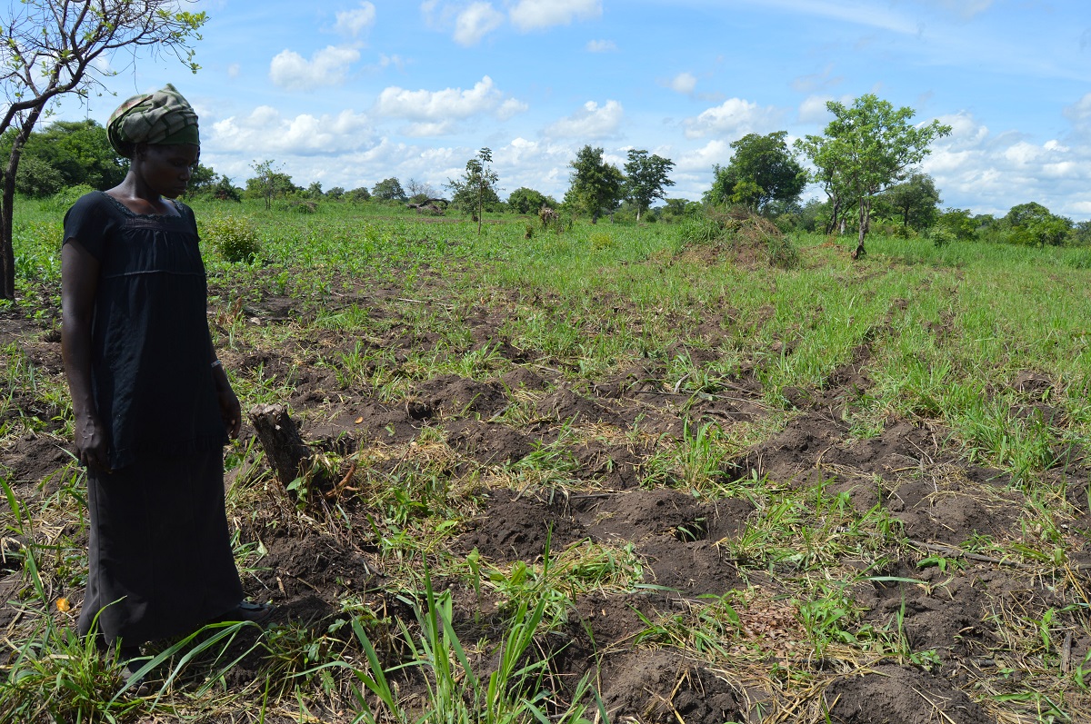
CF basins are constructed in the field to act as water storage containers. Water is conserved within the basins and plants can survive with this conserved water during periods of little rainfall and dry spells.
2.2 Detailed description of the Technology
Description:
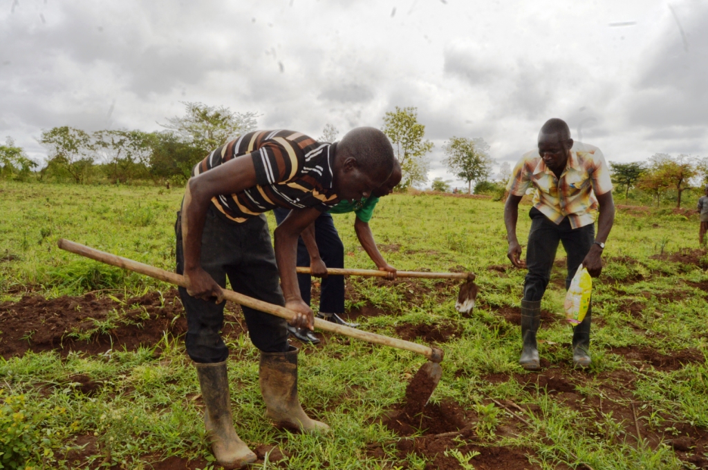
Farmers in Northern Uganda are observing changes in weather patterns. Rainfall has become unpredictable and unreliable for sustainable farming This forces farmers to adapt to these changes using available conservation farming technologies such as Conservation Farming (CF) basins.
CF basins are water conservation structures constructed in the garden during dry seasons. The basins store rainwater during rainy seasons and ensure water availability for plants during periods of little or no rainfall.
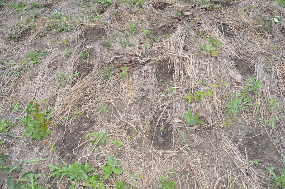
During construction of the basins, plant residues in the field are slashed and retained within the garden. A common hoe is used to excavate rectangular holes of about 30cm x 20cm, having a depth of 15cm. The top soil is put on one side of the basin while the subsoil is put on the other side. When the basin is ready, the top soil is put back into the hole to cover about half of the total basin depth. The basin is now ready for planting at the onset of rains. The spacing between basins depends on the type of crop to be planted. For groundnuts (Arachis hypogaea) it's 30cm x 30cm. The number of seeds per hole (seed rate) also depends on the crop. For maize, 3 plants per hole are to be planted, for groundnut, 6-8 plants per hole and for beans 6-8 plants per hole.
The basins are particularly important during critical growth periods such as germination, flowering and fruit seting if a sudden drought occurs. The basins conserve water, reduce surface runoff and support extended crop growth during dry seasons. After harvesting crop residues are put back into the basin to decompose so to build up humus in to basin.
Farmers who practice this technology have reported healthy crop growth and reduced risk of crop failure. However, construction of CF basins is labour intensive because good basins need to be constructed in the dry season when the soil is hard. However, this challenge is outweighed by the fact that basins only need to be constructed once every 3-4 years.
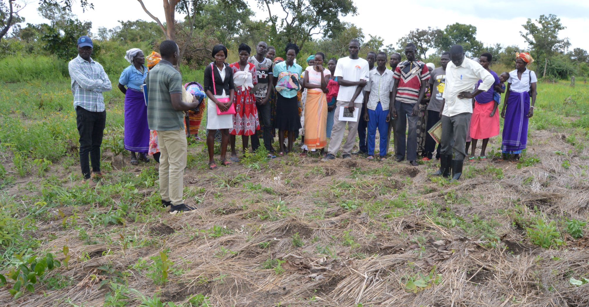
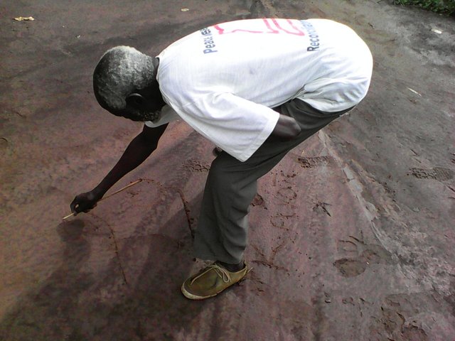
2.3 Photos of the Technology
Media Gallery
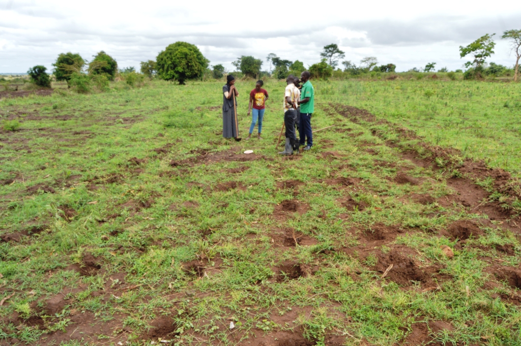
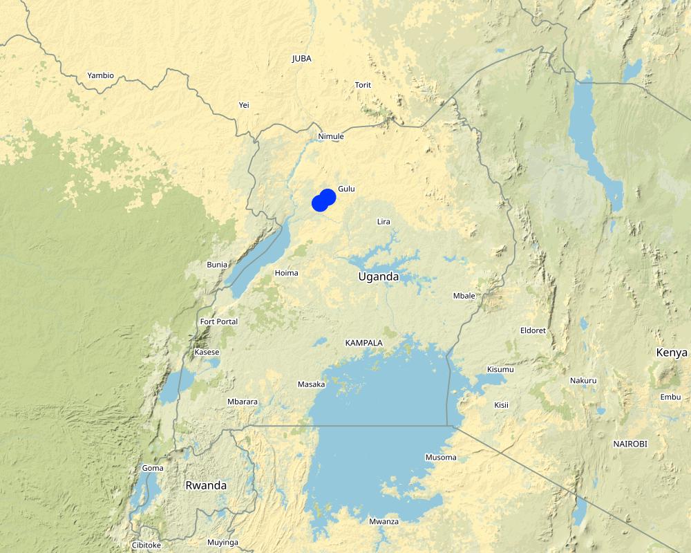
2.5 Country/ region/ locations where the Technology has been applied and which are covered by this assessment
Country:
Uganda
Region/ State/ Province:
Northern
Further specification of location:
Nwoya District
Specify the spread of the Technology:
- applied at specific points/ concentrated on a small area
Comments:
Location where the CF basin technology was implemented
Map
×2.6 Date of implementation
Indicate year of implementation:
2016
2.7 Introduction of the Technology
Specify how the Technology was introduced:
- during experiments/ research
Comments (type of project, etc.):
Funded through CIAT (International Center for Tropical Agriculture)
3. Classification of the SLM Technology
3.1 Main purpose(s) of the Technology
- improve production
- reduce, prevent, restore land degradation
- adapt to climate change/ extremes and its impacts
- create beneficial economic impact
3.2 Current land use type(s) where the Technology is applied

Cropland
- Annual cropping
Number of growing seasons per year:
- 2
3.4 Water supply
Water supply for the land on which the Technology is applied:
- rainfed
3.5 SLM group to which the Technology belongs
- water harvesting
- surface water management (spring, river, lakes, sea)
3.6 SLM measures comprising the Technology

agronomic measures
- A2: Organic matter/ soil fertility

structural measures
- S4: Level ditches, pits

management measures
- M2: Change of management/ intensity level
3.7 Main types of land degradation addressed by the Technology

soil erosion by water
- Wt: loss of topsoil/ surface erosion

soil erosion by wind
- Et: loss of topsoil

biological degradation
- Bl: loss of soil life

water degradation
- Hs: change in quantity of surface water
3.8 Prevention, reduction, or restoration of land degradation
Specify the goal of the Technology with regard to land degradation:
- reduce land degradation
- adapt to land degradation
4. Technical specifications, implementation activities, inputs, and costs
4.1 Technical drawing of the Technology
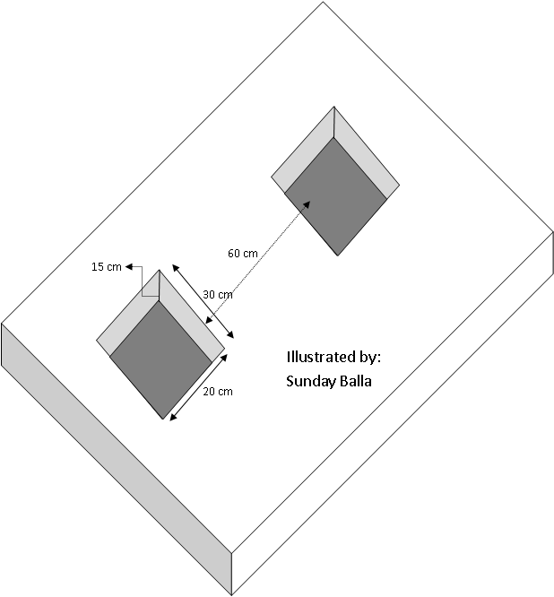
Author:
Sunday Balla
Date:
04/02/2018
4.2 General information regarding the calculation of inputs and costs
Specify how costs and inputs were calculated:
- per Technology area
Indicate size and area unit:
Acre
other/ national currency (specify):
Uganda Shillings
If relevant, indicate exchange rate from USD to local currency (e.g. 1 USD = 79.9 Brazilian Real): 1 USD =:
3600.0
Indicate average wage cost of hired labour per day:
5000
4.3 Establishment activities
| Activity | Timing (season) | |
|---|---|---|
| 1. | Slashing the field (clearence) | dry season |
| 2. | Constructing basins | dry season |
| 3. | Planting crops | onset of rains |
4.4 Costs and inputs needed for establishment
| Specify input | Unit | Quantity | Costs per Unit | Total costs per input | % of costs borne by land users | |
|---|---|---|---|---|---|---|
| Labour | Slashing | person days | 15.0 | 5000.0 | 75000.0 | 100.0 |
| Labour | Construction of basins | person days | 30.0 | 3000.0 | 90000.0 | 100.0 |
| Labour | Planting | person days | 15.0 | 5000.0 | 75000.0 | 100.0 |
| Equipment | CF hoe | no | 5.0 | 12000.0 | 60000.0 | 100.0 |
| Equipment | Slashers | no | 5.0 | 6000.0 | 30000.0 | 100.0 |
| Plant material | Seeds | kg | 30.0 | 5000.0 | 150000.0 | 100.0 |
| Total costs for establishment of the Technology | 480000.0 | |||||
4.5 Maintenance/ recurrent activities
| Activity | Timing/ frequency | |
|---|---|---|
| 1. | Clearing soil from basins | 3 years of establishment |
4.6 Costs and inputs needed for maintenance/ recurrent activities (per year)
| Specify input | Unit | Quantity | Costs per Unit | Total costs per input | % of costs borne by land users | |
|---|---|---|---|---|---|---|
| Labour | Labour | person days | 15.0 | 3000.0 | 45000.0 | 100.0 |
| Total costs for maintenance of the Technology | 45000.0 | |||||
4.7 Most important factors affecting the costs
Describe the most determinate factors affecting the costs:
Labour for digging during establishment and clearing soil from basins during maintenance
5. Natural and human environment
5.1 Climate
Annual rainfall
- < 250 mm
- 251-500 mm
- 501-750 mm
- 751-1,000 mm
- 1,001-1,500 mm
- 1,501-2,000 mm
- 2,001-3,000 mm
- 3,001-4,000 mm
- > 4,000 mm
Agro-climatic zone
- sub-humid
5.2 Topography
Slopes on average:
- flat (0-2%)
- gentle (3-5%)
- moderate (6-10%)
- rolling (11-15%)
- hilly (16-30%)
- steep (31-60%)
- very steep (>60%)
Landforms:
- plateau/plains
- ridges
- mountain slopes
- hill slopes
- footslopes
- valley floors
Altitudinal zone:
- 0-100 m a.s.l.
- 101-500 m a.s.l.
- 501-1,000 m a.s.l.
- 1,001-1,500 m a.s.l.
- 1,501-2,000 m a.s.l.
- 2,001-2,500 m a.s.l.
- 2,501-3,000 m a.s.l.
- 3,001-4,000 m a.s.l.
- > 4,000 m a.s.l.
Indicate if the Technology is specifically applied in:
- concave situations
5.3 Soils
Soil depth on average:
- very shallow (0-20 cm)
- shallow (21-50 cm)
- moderately deep (51-80 cm)
- deep (81-120 cm)
- very deep (> 120 cm)
Soil texture (topsoil):
- medium (loamy, silty)
Soil texture (> 20 cm below surface):
- fine/ heavy (clay)
Topsoil organic matter:
- medium (1-3%)
5.4 Water availability and quality
Ground water table:
5-50 m
Availability of surface water:
medium
Water quality (untreated):
good drinking water
Is water salinity a problem?
No
Is flooding of the area occurring?
No
5.5 Biodiversity
Species diversity:
- medium
Habitat diversity:
- medium
5.6 Characteristics of land users applying the Technology
Sedentary or nomadic:
- Sedentary
Market orientation of production system:
- mixed (subsistence/ commercial)
Off-farm income:
- less than 10% of all income
Relative level of wealth:
- poor
Individuals or groups:
- individual/ household
Level of mechanization:
- manual work
- animal traction
Gender:
- women
- men
Age of land users:
- youth
- middle-aged
5.7 Average area of land used by land users applying the Technology
- < 0.5 ha
- 0.5-1 ha
- 1-2 ha
- 2-5 ha
- 5-15 ha
- 15-50 ha
- 50-100 ha
- 100-500 ha
- 500-1,000 ha
- 1,000-10,000 ha
- > 10,000 ha
Is this considered small-, medium- or large-scale (referring to local context)?
- small-scale
5.8 Land ownership, land use rights, and water use rights
Land ownership:
- individual, not titled
- individual, titled
Land use rights:
- communal (organized)
- individual
Water use rights:
- communal (organized)
5.9 Access to services and infrastructure
health:
- poor
- moderate
- good
education:
- poor
- moderate
- good
technical assistance:
- poor
- moderate
- good
employment (e.g. off-farm):
- poor
- moderate
- good
markets:
- poor
- moderate
- good
energy:
- poor
- moderate
- good
roads and transport:
- poor
- moderate
- good
drinking water and sanitation:
- poor
- moderate
- good
financial services:
- poor
- moderate
- good
6. Impacts and concluding statements
6.1 On-site impacts the Technology has shown
Socio-economic impacts
Production
crop production
crop quality
risk of production failure
land management
Water availability and quality
demand for irrigation water
Comments/ specify:
Water conserved in basins
6.2 Off-site impacts the Technology has shown
water availability
6.3 Exposure and sensitivity of the Technology to gradual climate change and climate-related extremes/ disasters (as perceived by land users)
Gradual climate change
Gradual climate change
| Season | increase or decrease | How does the Technology cope with it? | |
|---|---|---|---|
| annual temperature | increase | well | |
| seasonal temperature | wet/ rainy season | increase | moderately |
| annual rainfall | decrease | very well | |
| seasonal rainfall | wet/ rainy season | decrease | very well |
Climate-related extremes (disasters)
Climatological disasters
| How does the Technology cope with it? | |
|---|---|
| drought | very well |
6.4 Cost-benefit analysis
How do the benefits compare with the establishment costs (from land users’ perspective)?
Short-term returns:
slightly negative
Long-term returns:
very positive
How do the benefits compare with the maintenance/ recurrent costs (from land users' perspective)?
Short-term returns:
positive
Long-term returns:
very positive
6.5 Adoption of the Technology
- 1-10%
Of all those who have adopted the Technology, how many did so spontaneously, i.e. without receiving any material incentives/ payments?
- 91-100%
6.6 Adaptation
Has the Technology been modified recently to adapt to changing conditions?
No
6.7 Strengths/ advantages/ opportunities of the Technology
| Strengths/ advantages/ opportunities in the land user’s view |
|---|
| Constructed once every 3-4 years |
| Does not require technical skills or sophisticated equipment to construct the basins |
| Reduced chances of crop failures due to droughts |
| Strengths/ advantages/ opportunities in the compiler’s or other key resource person’s view |
|---|
| Water storage efficiency is high |
| Plant roots can easily access water from the soil |
| Crop residues have additional functions to retain soil moisture |
6.8 Weaknesses/ disadvantages/ risks of the Technology and ways of overcoming them
| Weaknesses/ disadvantages/ risks in the land user’s view | How can they be overcome? |
|---|---|
| Difficult to construct the basins | Use a CF hoe |
7. References and links
7.1 Methods/ sources of information
- interviews with land users
3
- interviews with SLM specialists/ experts
2
- compilation from reports and other existing documentation
1
When were the data compiled (in the field)?
17/07/2017
Links and modules
Expand all Collapse allLinks
Peer farmers as a village resource person for … [Uganda]
A prosocial behavior approach, where a peer farmer identified by other local farmers is trained on a technology and then used as a trainer for the fellow farmers (farmer group or neighbors).
- Compiler: Sunday Balla Amale
Modules
No modules