Small Irrigation System for Highland Rice Terraces [Thailand]
- Creation:
- Update:
- Compiler: Pitayakon Limtong
- Editor: –
- Reviewers: Rima Mekdaschi Studer, William Critchley
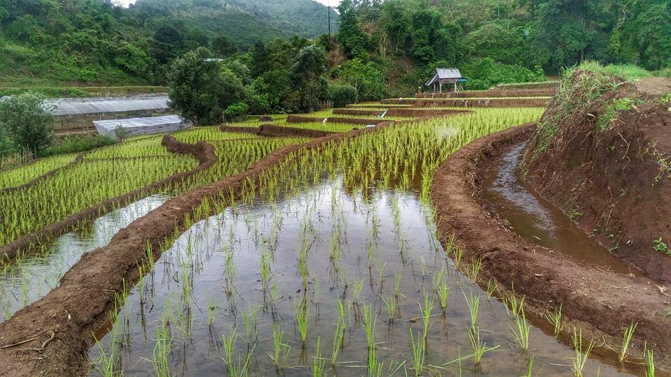
Checkdam for highland rice terrace
technologies_4114 - Thailand
View sections
Expand all Collapse all1. General information
1.2 Contact details of resource persons and institutions involved in the assessment and documentation of the Technology
Key resource person(s)
SLM specialist:
Srisomkhew Sasirin
662 579 1409 / 669 8269 6410
sasirin0928@gmail.com / sasirin0928@gmail.com
Land Development Department
Paholyothin Road, Chatuchak, Bangkok 10999, Thailand
Thailand
SLM Consultant:
Limtong Pitayakon
66 89 444 6599
pitaya@ldd.go.th / pitaya49@msn.com
Land Development Department
Paholyothin Road, Chatuchak, Bangkok 10999, Thailand
Thailand
land user:
Kayanyaiyie Mr.Vitoon
668 7188 0798
Soil Doctor Volunteer
Moo 5, Ban Don Village, Mae La Noi Sub-district, Huay Hom District, Mae Hong Son Province 58120
Thailand
land user:
Kongvili Mr.Boonpan
668 4740 1550
47 Moo 5, Ban Don Village, Mae La Noi Sub-district, Huay Hom District, Mae Hong Son Province 58120
Thailand
land user:
khangJing Mr.Suchat
668 3660 0272
1/2 Moo 5, Ban Don Village, Mae La Noi Sub-district, Huay Hom District, Mae Hong Son Province 58120
Thailand
land user:
KangJing Mr.Somnuek
668 8764 1683
Village Headman
1 Moo 5, Ban Don Village, Mae La Noi Sub-district, Huay Hom District, Mae Hong Son Province 58120
Thailand
1.3 Conditions regarding the use of data documented through WOCAT
When were the data compiled (in the field)?
11/09/2018
The compiler and key resource person(s) accept the conditions regarding the use of data documented through WOCAT:
Yes
1.4 Declaration on sustainability of the described Technology
Is the Technology described here problematic with regard to land degradation, so that it cannot be declared a sustainable land management technology?
No
Comments:
Water supply systems in the high landscape rice terraces can prevent land degradation and also land users can utilize this area for producing rice in limited agricultural land. Because this system slows down the water flow, it reduces soil erosion into water courses and controls the amount of water that flows from the forest upstream to the rice terraces. This system increases water available to the rice terraces and improves the utilization of water, thus maximizing benefits for growth and yield of rice.
2. Description of the SLM Technology
2.1 Short description of the Technology
Definition of the Technology:
An irrigation distribution system to highland rice terraces is required for agriculture on these highland slopes. It is based on the principles of water management in the area by diversion of water from natural watersheds upstream to the agricultural land - with regulation by village community consensus.
2.2 Detailed description of the Technology
Description:
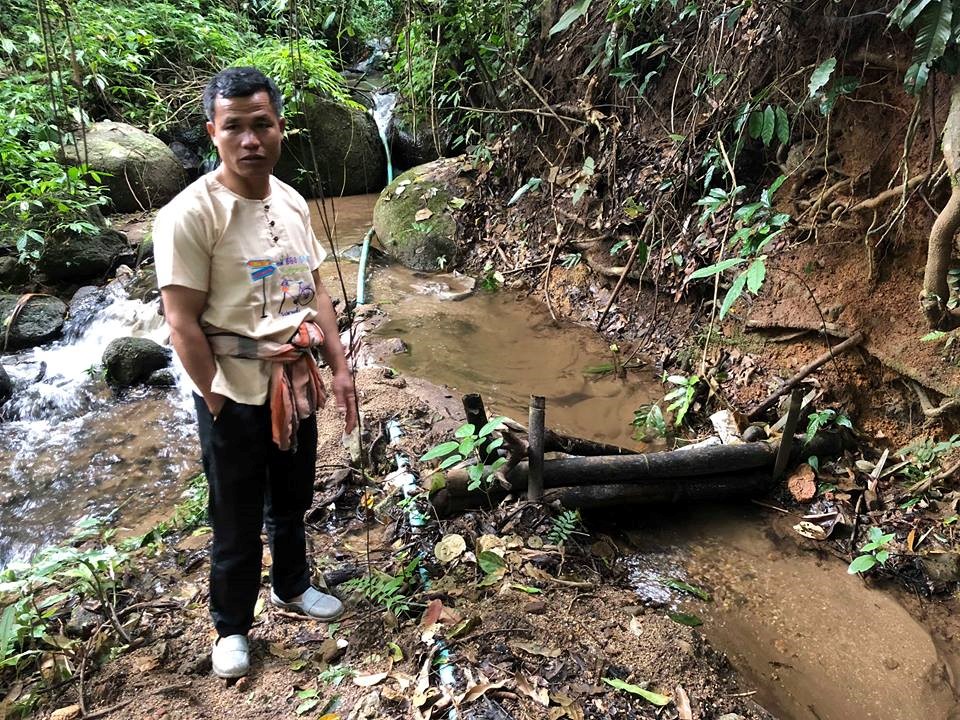
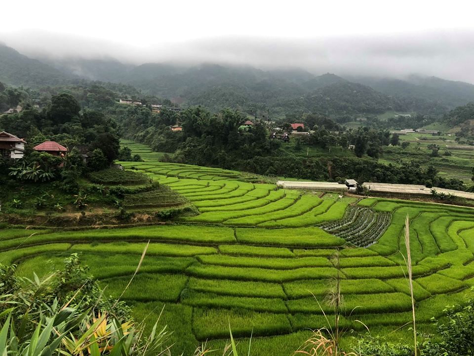
The topography of this mountainous area, Mae La Noi District, Mae Hong Son Province, is complex. The height ranges from 994 -1,100 m above sea level (m asl). The main river is Mae La Noi. The climate is cool all year round. The annual average temperature is 25 degrees Celsius (⁰C), maximum temperature is 37⁰C in April, and minimum temperature is 8⁰C during December. The annual average rainfall is 1,500 mm and lasts from June to October. The number of households is 147, with total population of approx 763, 400 (Mae La Noi Royal Project Development Center, 2561). An irrigation distribution system to highland rice terraces is required for agriculture on these highland slopes. It is based on the principles of water management in the area by diversion of water from natural watersheds in the upstream areas to the agricultural land - with regulation by village community consensus. The steps of preparation are as follows. 1. Site selection: Rice terraces should be on suitable slopes, not more than 60 degrees, otherwise it will be difficult to excavate the slope and rice fields become very narrow. 2. Reshaping and leveling the slope: The sloping land for rice terrace should be reshaped and levelled by either manpower or mechanical means. The terraces can extend up to 50 m long, be as little as 1 m wide and 0.5 m deep, depending on the slope. The leveling of soil surface in the plot is done by releasing water into that plot and adjust the soil surface until a good level is attained. 3. Soil improvement: Generally, soil structure and fertility in the plots is very low because of reshaping and leveling. It is therefore necessary to restore and improve by application of organic matter, compost, animal manure, legumes, etc. Soil pH must be adjusted, and nutrients such as phosphorus and potassium should be added based on soil analytical results. 4. Rice cultivation: In the first years of cultivation, the terraces may not store water at the desired level, so rice is planted in small holes. Normally, farmers plant rice seedlings (3-5 seedlings per hole) at a spacing of 20 x 20 cm. 5. Fertilizer application: In this highland area focus should be on organic fertilizers to reduce costs, because people can find materials locally such as animal manure and plant residues. 6. Water supply system: Distribution of water to the rice terraces is managed by small dams or weirs to release suitable amount of water through a small water channel to rice terraces. This water distribution system will spread water to all land users in this area, and there is sufficient water for farming throughout the year. 7. Disease and insect control: Most rice varieties are native, so they have high resistance. But there could be some disease/insect outbreaks; they have to be protected according to instructions. The submerged condition in the paddy field can help control weeds, but some labour is still needed. 8. Maintenance: For small dams or weirs, small water channels and terraces, it is necessary to restore and maintain twice a year, i.e. before and after harvest.
2.3 Photos of the Technology
Media Gallery


2.4 Videos of the Technology
Date:
11/09/2018
Location:
Mae La Noi District, Mae Hong Son Province, Thailand
Name of videographer:
Ms.Sasirin Srisomkhew
Date:
21/03/2018
Location:
Mae La Noi District, Mae Hong Son Province, Thailand
Date:
11/09/2018
Location:
Mae La Noi District, Mae Hong Son Province, Thailand
Name of videographer:
Ms.Sasirin Srisomkhew
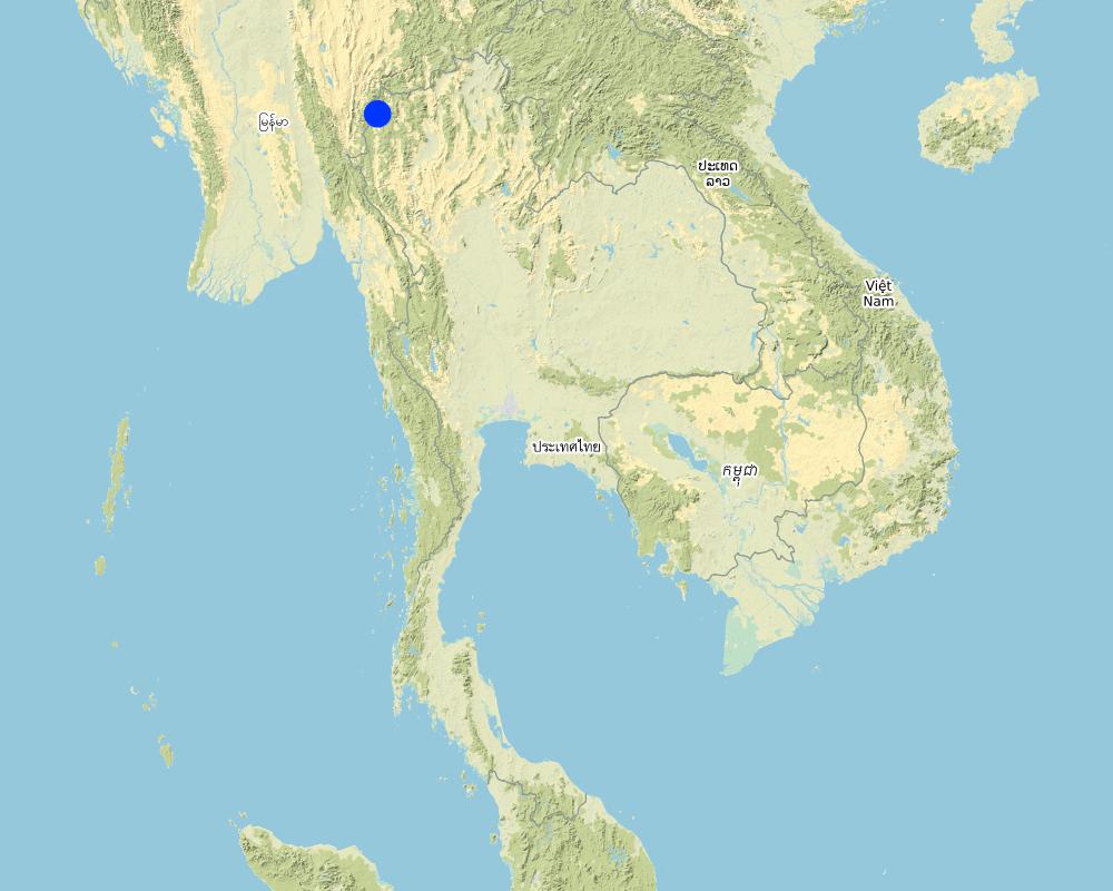
2.5 Country/ region/ locations where the Technology has been applied and which are covered by this assessment
Country:
Thailand
Region/ State/ Province:
Mae La Noi District, Mae Hong Son Province, Thailand
Map
×2.6 Date of implementation
If precise year is not known, indicate approximate date:
- more than 50 years ago (traditional)
2.7 Introduction of the Technology
Specify how the Technology was introduced:
- as part of a traditional system (> 50 years)
3. Classification of the SLM Technology
3.1 Main purpose(s) of the Technology
- reduce, prevent, restore land degradation
- protect a watershed/ downstream areas – in combination with other Technologies
- reduce risk of disasters
- adapt to climate change/ extremes and its impacts
- mitigate climate change and its impacts
3.2 Current land use type(s) where the Technology is applied

Cropland
- Annual cropping
Main crops (cash and food crops):
Paddy rice and vegetables such as chili, cabbage

Waterways, waterbodies, wetlands
- Drainage lines, waterways
Main products/ services:
Small dams or weirs with small water channels to supply/distribute water to rice terraces.
Comments:
Farmers in the area will grow rice in the rainy season for household consumption. The duration of cultivation until harvesting is about 6 months. In the dry season, the farms are converted to several kind of vegetables under support by the Royal Project Foundation.
3.3 Further information about land use
Water supply for the land on which the Technology is applied:
- rainfed
Comments:
The system of water supply of this technology distributes water resources from forest upstream to the rice terrace.
Number of growing seasons per year:
- 3
Specify:
Paddy rice once a year and vegetables 1-2 crops a year
3.4 SLM group to which the Technology belongs
- cross-slope measure
- water diversion and drainage
3.5 Spread of the Technology
Specify the spread of the Technology:
- applied at specific points/ concentrated on a small area
Comments:
This water system covered around 200 households, each household covers an area of 0.5 hectare.
3.6 SLM measures comprising the Technology

structural measures
- S1: Terraces

management measures
- M7: Others
3.7 Main types of land degradation addressed by the Technology

soil erosion by water
3.8 Prevention, reduction, or restoration of land degradation
Specify the goal of the Technology with regard to land degradation:
- prevent land degradation
4. Technical specifications, implementation activities, inputs, and costs
4.1 Technical drawing of the Technology
Author:
Ms.Sasirin Srisomkhew
Date:
25/09/2018
4.2 Technical specifications/ explanations of technical drawing
The irrigation water distribution system for highland rice terraces by farmers in the village is suitable for highland, sloping agriculture, with slopes ranging from 5-60 degrees. It is based on the principles of water management in the area by diversion of water from natural watersheds in the upstream zone to the agricultural land through the consensus of community members. Distribution of water to the rice terraces is managed by small dams or weir which are used to divert and release suitable amount of water through small water channels to rice terraces. The terraces can extend up to 50m long, 1m (or more) wide and 0.5m deep, depending on the degree of the slope. This water distribution system will spread water to all land users in this area, and there is sufficient water for farming throughout the year.
4.3 General information regarding the calculation of inputs and costs
Specify how costs and inputs were calculated:
- per Technology area
Indicate size and area unit:
0.48 hectare for each farmer
other/ national currency (specify):
Baht (THB)
Indicate exchange rate from USD to local currency (if relevant): 1 USD =:
32.0
Indicate average wage cost of hired labour per day:
300
4.4 Establishment activities
| Activity | Type of measure | Timing | |
|---|---|---|---|
| 1. | prepare small dam and water canal | Structural | in the first year |
| 2. | prepare terraces and land leveling | Structural | in the first year |
| 3. | cultivation | Structural | before rainny season |
| 4. | soil improvement | Management | after preparing and cultivating the soil |
| 5. | rice planting | Vegetative | rainy season |
| 6. | fertilizer application | Management | after planting |
| 7. | irrigation | Management | after planting |
| 8. | disease, pest and weed control | Management | after planting |
| 9. | havesting | Agronomic | when rice grains are mature |
| 10. | None | None |
4.5 Costs and inputs needed for establishment
If possible, break down the costs of establishment according to the following table, specifying inputs and costs per input. If you are unable to break down the costs, give an estimation of the total costs of establishing the Technology:
98100.0
| Specify input | Unit | Quantity | Costs per Unit | Total costs per input | % of costs borne by land users | |
|---|---|---|---|---|---|---|
| Labour | prepare dam and canal | 7x10 | 70.0 | 300.0 | 21000.0 | 100.0 |
| Labour | planting | 7x1 | 7.0 | 300.0 | 2100.0 | 100.0 |
| Labour | maintainance | 20x2 | 40.0 | 300.0 | 12000.0 | 100.0 |
| Labour | harvesting | 20x7 | 140.0 | 300.0 | 42000.0 | 100.0 |
| Equipment | tractor | set | 1.0 | 3000.0 | 3000.0 | 100.0 |
| Equipment | fuel | liter | 20.0 | 30.0 | 600.0 | 100.0 |
| Plant material | rice seed | bag | 3.0 | 100.0 | 300.0 | 100.0 |
| Plant material | chili seed | plant | 5000.0 | 2.0 | 10000.0 | 100.0 |
| Fertilizers and biocides | fertilizer 21-0-0 | bag | 3.0 | 400.0 | 1200.0 | 100.0 |
| Fertilizers and biocides | fertilizer 15-15-15 | bag | 3.0 | 700.0 | 2100.0 | 100.0 |
| Fertilizers and biocides | fertilizer 16-20-0 | bag | 3.0 | 600.0 | 1800.0 | 100.0 |
| Fertilizers and biocides | animal manure | bag | 10.0 | 200.0 | 2000.0 | 100.0 |
| Total costs for establishment of the Technology | 98100.0 | |||||
Comments:
Labour of small and canal preparation was paid in the first year, after that paid for maintain all of these structuer.
4.6 Maintenance/ recurrent activities
| Activity | Type of measure | Timing/ frequency | |
|---|---|---|---|
| 1. | restoration and maintain dam, canal and terrace | Structural | 2 times a year |
4.7 Costs and inputs needed for maintenance/ recurrent activities (per year)
If possible, break down the costs of maintenance according to the following table, specifying inputs and costs per input. If you are unable to break down the costs, give an estimation of the total costs of maintaining the Technology:
1800.0
| Specify input | Unit | Quantity | Costs per Unit | Total costs per input | % of costs borne by land users | |
|---|---|---|---|---|---|---|
| Labour | restoring and maintaining the dam, water canal and terraces | 2dx3m | 6.0 | 300.0 | 1800.0 | 100.0 |
| Total costs for maintenance of the Technology | 1800.0 | |||||
If land user bore less than 100% of costs, indicate who covered the remaining costs:
Land user spend their money for 100% of costs
4.8 Most important factors affecting the costs
Describe the most determinate factors affecting the costs:
The most important factors that affect the costs is the labour factor, where farmers need to hire labourers for rice cultivation such as planting, fertilizer application, maintaining the system and harvesting, including, the excavation and restoration of the small dam, water channels and terraces.
5. Natural and human environment
5.1 Climate
Annual rainfall
- < 250 mm
- 251-500 mm
- 501-750 mm
- 751-1,000 mm
- 1,001-1,500 mm
- 1,501-2,000 mm
- 2,001-3,000 mm
- 3,001-4,000 mm
- > 4,000 mm
Specify average annual rainfall (if known), in mm:
1500.00
Agro-climatic zone
- sub-humid
5.2 Topography
Slopes on average:
- flat (0-2%)
- gentle (3-5%)
- moderate (6-10%)
- rolling (11-15%)
- hilly (16-30%)
- steep (31-60%)
- very steep (>60%)
Landforms:
- plateau/plains
- ridges
- mountain slopes
- hill slopes
- footslopes
- valley floors
Altitudinal zone:
- 0-100 m a.s.l.
- 101-500 m a.s.l.
- 501-1,000 m a.s.l.
- 1,001-1,500 m a.s.l.
- 1,501-2,000 m a.s.l.
- 2,001-2,500 m a.s.l.
- 2,501-3,000 m a.s.l.
- 3,001-4,000 m a.s.l.
- > 4,000 m a.s.l.
Indicate if the Technology is specifically applied in:
- convex situations
5.3 Soils
Soil depth on average:
- very shallow (0-20 cm)
- shallow (21-50 cm)
- moderately deep (51-80 cm)
- deep (81-120 cm)
- very deep (> 120 cm)
Soil texture (topsoil):
- medium (loamy, silty)
Soil texture (> 20 cm below surface):
- medium (loamy, silty)
Topsoil organic matter:
- high (>3%)
5.4 Water availability and quality
Ground water table:
on surface
Availability of surface water:
good
Water quality (untreated):
good drinking water
Is water salinity a problem?
No
Is flooding of the area occurring?
No
5.5 Biodiversity
Species diversity:
- medium
Habitat diversity:
- medium
5.6 Characteristics of land users applying the Technology
Sedentary or nomadic:
- Sedentary
Market orientation of production system:
- subsistence (self-supply)
- commercial/ market
Off-farm income:
- 10-50% of all income
Relative level of wealth:
- average
Individuals or groups:
- individual/ household
Level of mechanization:
- manual work
- mechanized/ motorized
Gender:
- women
- men
Age of land users:
- middle-aged
- elderly
5.7 Average area of land owned or leased by land users applying the Technology
- < 0.5 ha
- 0.5-1 ha
- 1-2 ha
- 2-5 ha
- 5-15 ha
- 15-50 ha
- 50-100 ha
- 100-500 ha
- 500-1,000 ha
- 1,000-10,000 ha
- > 10,000 ha
Is this considered small-, medium- or large-scale (referring to local context)?
- medium-scale
5.8 Land ownership, land use rights, and water use rights
Land ownership:
- individual, not titled
Land use rights:
- communal (organized)
Water use rights:
- communal (organized)
5.9 Access to services and infrastructure
employment (e.g. off-farm):
- poor
- moderate
- good
energy:
- poor
- moderate
- good
- poor
- moderate
- good
6. Impacts and concluding statements
6.1 On-site impacts the Technology has shown
Socio-economic impacts
Production
crop production
crop quality
Water availability and quality
drinking water availability
drinking water quality
irrigation water availability
irrigation water quality
Income and costs
expenses on agricultural inputs
workload
Socio-cultural impacts
food security/ self-sufficiency
health situation
land use/ water rights
cultural opportunities
recreational opportunities
community institutions
SLM/ land degradation knowledge
Ecological impacts
Water cycle/ runoff
water quantity
water quality
harvesting/ collection of water
surface runoff
excess water drainage
groundwater table/ aquifer
Soil
soil loss
soil accumulation
soil organic matter/ below ground C
acidity
Biodiversity: vegetation, animals
biomass/ above ground C
plant diversity
animal diversity
beneficial species
Climate and disaster risk reduction
flood impacts
drought impacts
emission of carbon and greenhouse gases
6.2 Off-site impacts the Technology has shown
water availability
reliable and stable stream flows in dry season
downstream flooding
downstream siltation
groundwater/ river pollution
impact of greenhouse gases
6.3 Exposure and sensitivity of the Technology to gradual climate change and climate-related extremes/ disasters (as perceived by land users)
Gradual climate change
Gradual climate change
| Season | Type of climatic change/ extreme | How does the Technology cope with it? | |
|---|---|---|---|
| annual temperature | moderately | ||
| seasonal temperature | summer | not well | |
| annual rainfall | well |
Climate-related extremes (disasters)
Meteorological disasters
| How does the Technology cope with it? | |
|---|---|
| local rainstorm | moderately |
| local thunderstorm | moderately |
| local hailstorm | moderately |
Climatological disasters
| How does the Technology cope with it? | |
|---|---|
| forest fire | moderately |
Biological disasters
| How does the Technology cope with it? | |
|---|---|
| epidemic diseases | not well at all |
| insect/ worm infestation | not well at all |
6.4 Cost-benefit analysis
How do the benefits compare with the establishment costs (from land users’ perspective)?
Long-term returns:
very positive
How do the benefits compare with the maintenance/ recurrent costs (from land users' perspective)?
Long-term returns:
very positive
6.5 Adoption of the Technology
- more than 50%
Of all those who have adopted the Technology, how many have did so spontaneously, i.e. without receiving any material incentives/ payments?
- 90-100%
6.6 Adaptation
Has the Technology been modified recently to adapt to changing conditions?
No
6.7 Strengths/ advantages/ opportunities of the Technology
| Strengths/ advantages/ opportunities in the land user’s view |
|---|
| The villagers are self-reliant by living in balance between demand and supply to meet their own needs. So every household will grow rice for their consumption and solve some problems in water management of these rice terraces by their community. |
| Villagers have knowledge and technology of water management and systematically and continuously transfer to other land users from generation to generation, causing a connection between kinship and community. There are groups to solve the main problems of the community. |
| Villagers have a stable and strong mental state with the hard thinking to fight the obstacle in the way of living, to achieve a more prosperous life. Individual communities have strength in self-reliance, and also have strong mind in learning, having virtue and rationality in thinking and decision-making. |
| They have the ability to promote agriculture with natural resources and ecological tourism and develop the communication system for visitors to access the local information and facilities. |
| Strengths/ advantages/ opportunities in the compiler’s or other key resource person’s view |
|---|
| The selection of appropriate technology can solve the problem of soil degradation, reduce soil erosion and manage adequate water supply to agricultural area for the whole year. |
| The villagers have to rely and trust on each other with high willingness to share their knowledge and experience. |
| Communities have the ability to use existing natural resources in maximizing benefits, and at the same time they try to conserve and prevent soil degradation in this area. |
| Community networking allows them to conduct activities to achieve self-reliance. |
6.8 Weaknesses/ disadvantages/ risks of the Technology and ways of overcoming them
| Weaknesses/ disadvantages/ risks in the land user’s view | How can they be overcome? |
|---|---|
| Land users’ lack of ownership of the land that cannot be legally owned by individuals, as the area is located in a preserved forest. The villagers therefore might be afraid to move out of the area in the future. | The community leaders and villagers need to solve this problem, one thing being that they should ask the government to help. |
| Lack of opportunities for children to have education caused by the poverty of their parents. | Schools in the area have increased educational opportunities for poor children by sponsoring underprivileged children. |
| Lack of social and health welfare because this area is far from the city. Villagers will not be able to reach the hospital in time in the case of emergency. | Villagers take the right treatment from the gold card or project 30 baht free treatment of all diseases for emergency situations. |
| Lack the coverage of energy and communication system in this area. Some areas still lack electricity, telephone and internet facilities. | Some villagers purchased and installed solar panels for their own use. |
| Weaknesses/ disadvantages/ risks in the compiler’s or other key resource person’s view | How can they be overcome? |
|---|---|
| The villagers lack the ownership of the land, which located in the conserved forest. That means they do not have right to hold the land. | The government has a policy to solve these problems, and at the same time serve and arrange this preserved forest as natural resource. |
| Lack of educational opportunities, The study site is located in a remote area. Children living there lack opportunities in education. | The government has a policy to give underprivileged children equal education to children. |
| Villagers lack social and health welfare because of the remoteness of the place that they live. It is difficult to access medical treatment and hospital. | The government has set up and supported the budget to develop district health promotion hospitals in the sub-district level. |
7. References and links
7.1 Methods/ sources of information
- field visits, field surveys
- interviews with land users
- interviews with SLM specialists/ experts
- compilation from reports and other existing documentation
7.3 Links to relevant information which is available online
Title/ description:
Ecological tourism of Mae La Noi Development Center, Royal Project
URL:
https://www.youtube.com/watch?v=818zn7JMKsU
Title/ description:
Mae La Noi Royal Project Foundation
URL:
https://www.youtube.com/watch?v=M8pFfl18fC8
Title/ description:
Mae La Noi Development Center of Royal Project Foundation
URL:
http://www.mhsdc.org/interest510.htm
Title/ description:
History of Mae La Noi Development Center
URL:
http://www.mhsdc.org/rypmaenoi.htm
Title/ description:
Mae La Noi Project for tourism of beautiful paddy rice terrace
URL:
https://mgronline.com/travel/detail/9590000106920
Title/ description:
Mae La Noi Development Center of Royal Project Foundation
URL:
http://royalprojectthailand.com/maelanoi
Title/ description:
Rice terrace in highland
URL:
http://www.ricethailand.go.th/rkb/management/index.php
Links and modules
Expand all Collapse allLinks
No links
Modules
No modules