Land Use Change from Rice to Vegetables [Thailand]
- Creation:
- Update:
- Compiler: supranee sritumboon
- Editor: –
- Reviewers: Samran Sombatpanit, Rima Mekdaschi Studer, William Critchley
Growing Vegetables
technologies_4161 - Thailand
View sections
Expand all Collapse all1. General information
1.2 Contact details of resource persons and institutions involved in the assessment and documentation of the Technology
Key resource person(s)
land user:
Noithong Bualai
Farmer of Ban Kaonoi
Thailand
Volunteer soil doctor:
Sommakate Boonmee
Volunteer soil doctor who is a farmer in a community; he volunteers and collaborates with the Regional Office of Land Development Department.
Thailand
SLM specialist:
Rhophandung Weera
Land Development Department Region 5
Thailand
SLM specialist:
SLM specialist:
Phothinam Pornpana
Land Development Department Region 5
Thailand
SLM specialist:
Jakkarach Usa
Land Development Department Region 5
Thailand
SLM specialist:
Wangkaew Areerat
Land Development Department
Thailand
national consultant:
1.3 Conditions regarding the use of data documented through WOCAT
The compiler and key resource person(s) accept the conditions regarding the use of data documented through WOCAT:
Yes
1.4 Declaration on sustainability of the described Technology
Is the Technology described here problematic with regard to land degradation, so that it cannot be declared a sustainable land management technology?
No
Comments:
The alteration of an inappropriate area from rice to vegetables, with a pump well installed for irrigation. Farmers could rotate the vegetables with paddy rice.
2. Description of the SLM Technology
2.1 Short description of the Technology
Definition of the Technology:
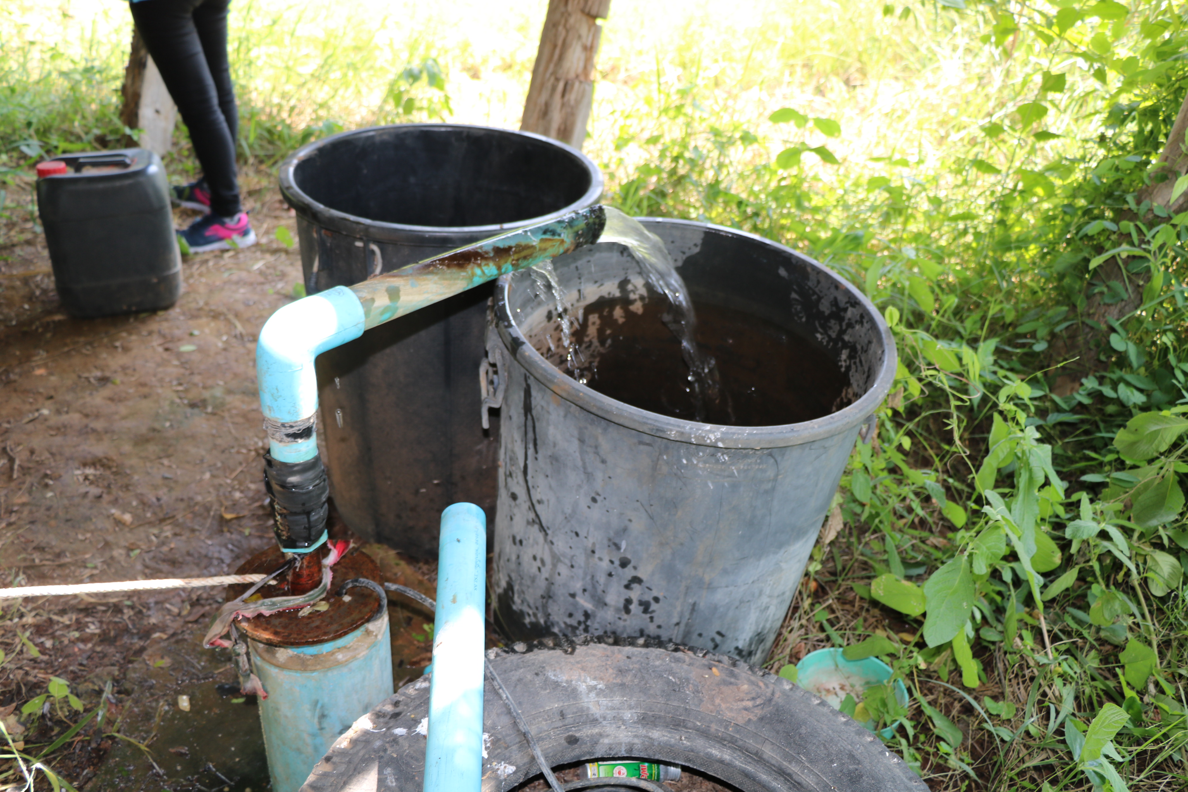
Land use change from rice to vegetables was started by a group of farmers with the help of the LDD who provided irrigation from groundwater through a 28m deep bore hole. This enables the groundwater level to be lowered preventing salination in the discharge area lower down.
2.2 Detailed description of the Technology
Description:
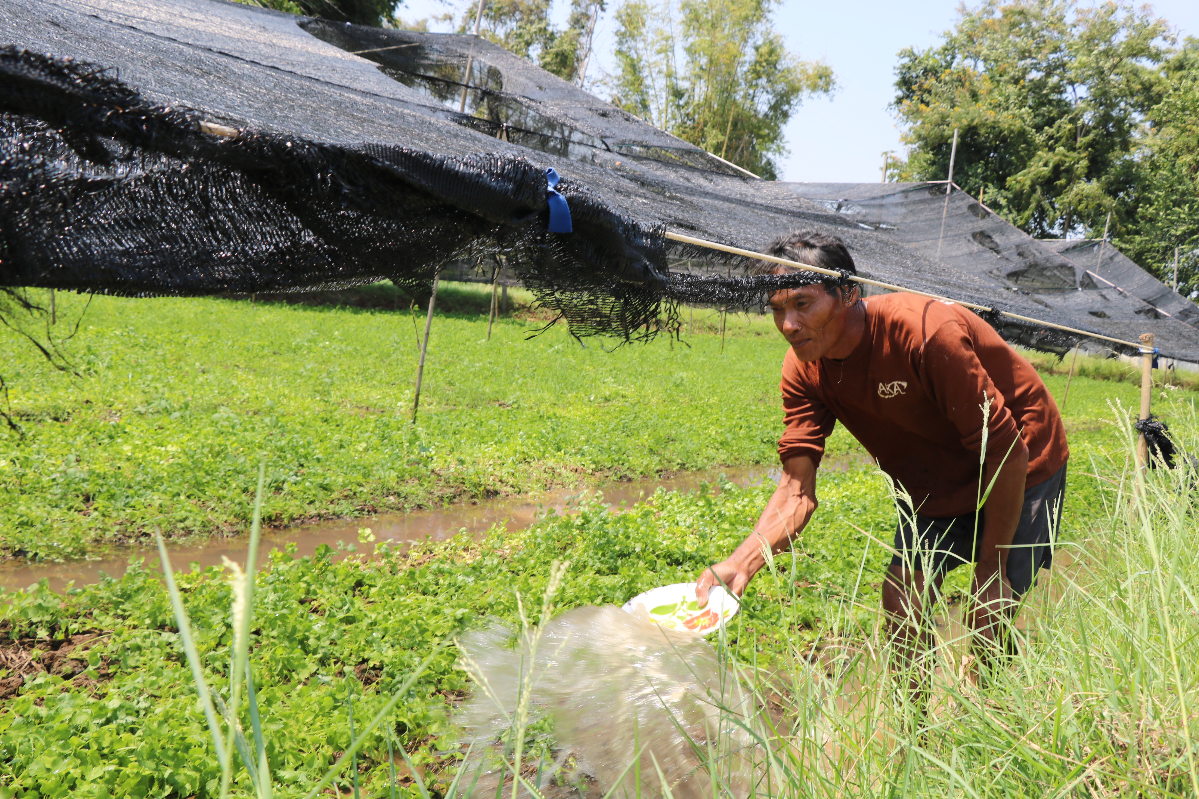
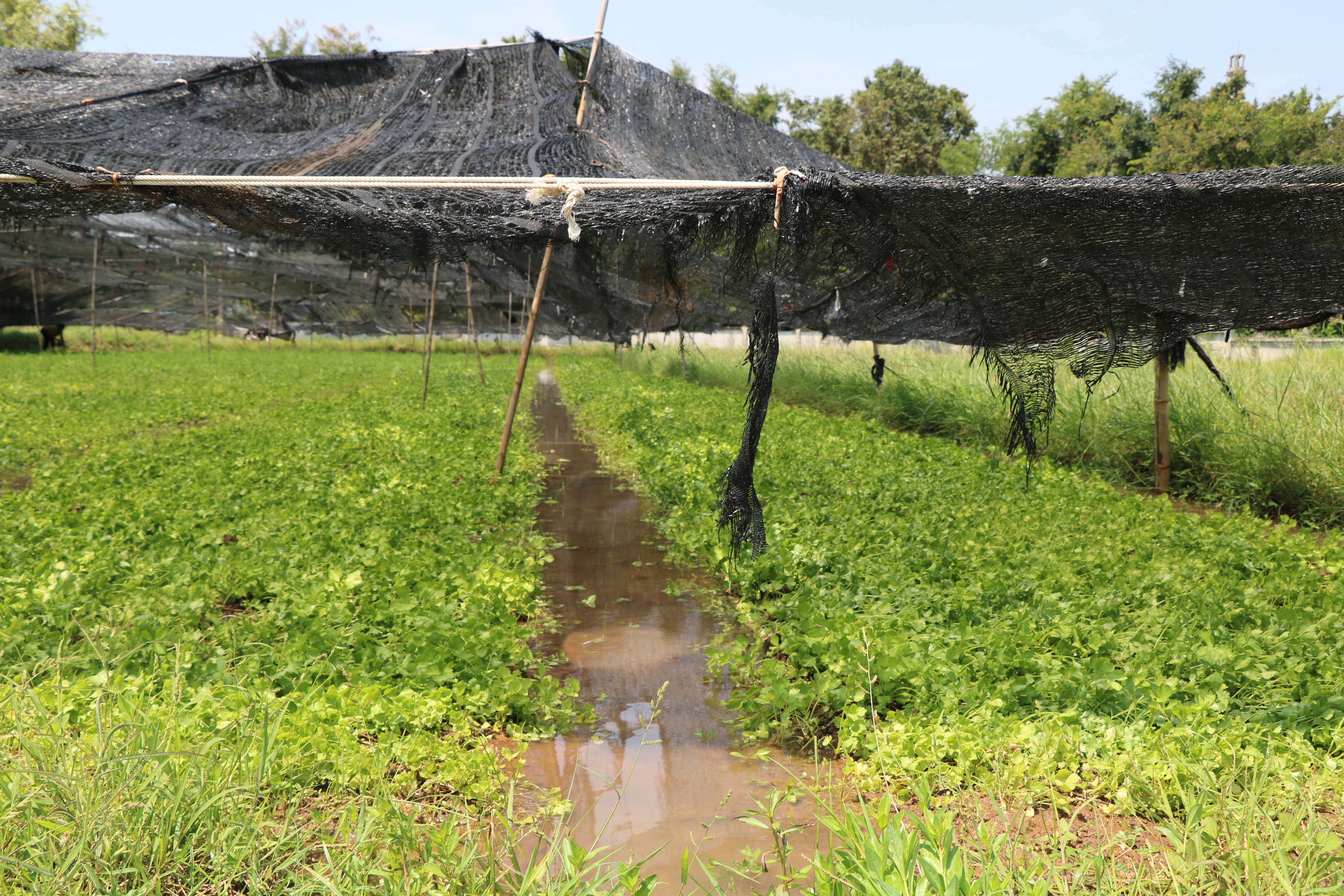
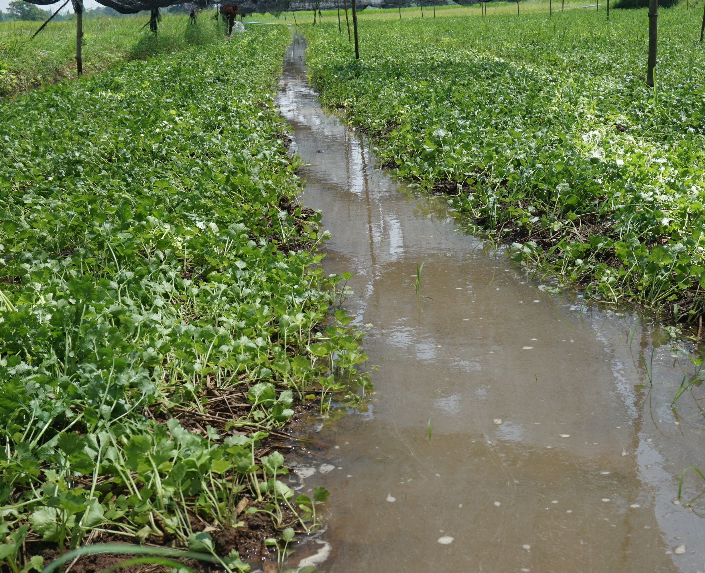
Changing flooded rice to salt-tolerant vegetable production as recommended by LDD researchers was started 25 years ago by a group of farmers at Ban Kaonoi Village, Pueaiyai Sub-district, Non Sila District, Khon Kaen Province. The land is located in the recharge area, which is nonsaline, with groundwater that has a salinity level of 0.7 dS/m. Groundwater that moves downslope picks up salt - and deposits salt in low-lying areas, causing off-site salinization. The LDD supports the land use change from rice to vegetables for higher income while at the same time lowering groundwater levels. When rice is grown through flood irrigation the groundwater level rises. With vegetables, farmers try to use minimal amounts of water to prevent salt accumulation – a weekly rate of 90 m3/rai (560 m3/ hectare). The objectives of changing rice to vegetables are to (a) decrease water use (b) get higher incomes from growing salt-tolerant vegetables, and (c) prevent off-site salinization. Without a drainage system, the following slightly to moderately salt-tolerant vegetables are recommended: varieties of basil (Ocimum spp), celery (Apium graviolens) and coriander (Coriandrum sativum). Planting starts with land preparation and making beds 1 m wide and 0.3 m high, mixed with 500 kg/rai (3125 kg/hectare cow dung, with 0.3m wide irrigation furrows between the beds.
The vegetables are divided into two groups: long- and short-duration crops. Long-duration crops (e.g. basil) take 5 months before harvest. The first crop is planted mid-January and harvested at the end of May; the second crop is planted mid-July, and harvested mid-December. The short-duration crops of coriander and Chinese celery need a 75-80 day growing period. The first sowing starts late January/ February and harvest is mid-April; the second sowing is late July, with harvest early October. Only short-duration crops can be planted after the rice harvest in December or earlier. Maintenance includes weeding (by hand) and fertilizer application. Labour is required for supplementary irrigation - by spraying water on the leaves as required – and once a week irrigation is applied through the furrows. The costs and benefits are calculated; the costs include seed, fertilizer, and labour for land preparation, planting, irrigation, maintenance, and harvesting. The farmers favor the technology because the crops can grow well in such circumstances and the products meet the market’s demand. In such way, farmers get higher income compared with rice, while crop residues and weeds can be used as animal feed.
2.3 Photos of the Technology
Media Gallery

General remarks regarding photos:
The images show the process of vegetable cultivation in a village that farmers developed from their experience.
2.4 Videos of the Technology
Date:
02/10/2018
Location:
Ban Kaonoi
Name of videographer:
Supranee Sritumboon
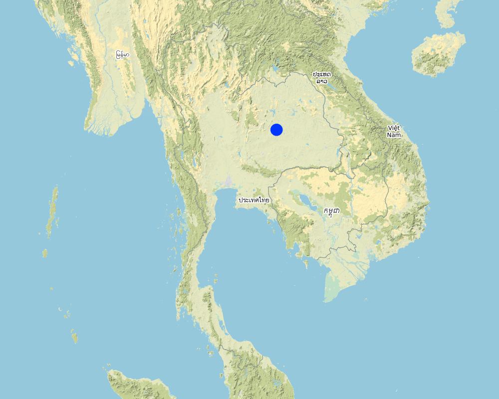
2.5 Country/ region/ locations where the Technology has been applied and which are covered by this assessment
Country:
Thailand
Region/ State/ Province:
Northeast/Khon Kaen
Further specification of location:
Ban Kaonoi is in Non Sila Sub-district, Banphai District, Khon Kaen Province.
Specify the spread of the Technology:
- evenly spread over an area
If precise area is not known, indicate approximate area covered:
- 1-10 km2
Is/are the technology site(s) located in a permanently protected area?
No
Comments:
This technology is distributed in a paddy area with slight salinity, which is within a recharge area.
Map
×2.6 Date of implementation
If precise year is not known, indicate approximate date:
- 10-50 years ago
2.7 Introduction of the Technology
Specify how the Technology was introduced:
- through land users' innovation
- through projects/ external interventions
- as part of a traditional system over 25 years
Comments (type of project, etc.):
Technology was developed by the farmers and disseminated in the area as a traditional system and then further developed and disseminated through the project by Land Development Department Region 5.
3. Classification of the SLM Technology
3.1 Main purpose(s) of the Technology
- improve production
- adapt to climate change/ extremes and its impacts
- create beneficial economic impact
3.2 Current land use type(s) where the Technology is applied

Cropland
- Annual cropping
Annual cropping - Specify crops:
- cereals - rice (wetland)
- paddy rice and vegetables
Number of growing seasons per year:
- 3
Specify:
1 crop of paddy rice and 2 crops of vegetables but only in the lower level fields with a better water supply
Is crop rotation practiced?
Yes
If yes, specify:
The vegetables as Apium gravcolens L., and Coriandrum sativum L. will be grown after rice harvesting.

Waterways, waterbodies, wetlands
- Pump well
Main products/ services:
Farmers use water from a pump well for vegetables; the well should not be deeper than 30 m.
Comments:
Farmer constructed the pump well where they plant vegetables. Also, they can use the pump well for paddy rice in a drought year such as in 2018.
3.3 Has land use changed due to the implementation of the Technology?
Has land use changed due to the implementation of the Technology?
- Yes (Please fill out the questions below with regard to the land use before implementation of the Technology)
Land use mixed within the same land unit:
No
Cropland
- Annual cropping
- Paddy rice and vegetables (Ocimum basilicum L., Ocimum tenuiflorum L., Ocimum x africanum Lour.)
Is crop rotation practiced?
Yes
If yes, specify:
Vegetables (Apium gravcolens L. and Coriandrum sativum L.) will be rotated with paddy rice.
Comments:
Vegetables were mainly growing in some paddy areas in the uplands. Moreover, farmers will grow vegetables after rice harvesting in lowland fields.
3.4 Water supply
Water supply for the land on which the Technology is applied:
- mixed rainfed-irrigated
Comments:
The area is under rainfed agriculture but farmers set up the pump well to support cultivation.
3.5 SLM group to which the Technology belongs
- rotational systems (crop rotation, fallows, shifting cultivation)
- integrated crop-livestock management
- ground water management
3.6 SLM measures comprising the Technology

agronomic measures
- A1: Vegetation/ soil cover
- A2: Organic matter/ soil fertility

structural measures
- S7: Water harvesting/ supply/ irrigation equipment

management measures
- M6: Waste management (recycling, re-use or reduce)
Comments:
Farmers applied farmyard manure for soil improvement in the vegetable area. All or most households keep cattle so they have manure for such use.
3.7 Main types of land degradation addressed by the Technology

chemical soil deterioration
- Cs: salinization/ alkalinization

physical soil deterioration
- Pc: compaction
- Pk: slaking and crusting

biological degradation
- Bc: reduction of vegetation cover
- Bq: quantity/ biomass decline
- Bl: loss of soil life

water degradation
- Hq: decline of groundwater quality
Comments:
The area where such technology is applied is located in a slightly saline and recharge zone.
3.8 Prevention, reduction, or restoration of land degradation
Specify the goal of the Technology with regard to land degradation:
- reduce land degradation
- adapt to land degradation
Comments:
Reducing and adapting to land degradation and climate change.
4. Technical specifications, implementation activities, inputs, and costs
4.1 Technical drawing of the Technology
Technical specifications (related to technical drawing):
Schematic cross-section of groundwater flow from downward movement in the recharge zone with salt pick up along the pathway and salt deposit in the discharge area by upward movement.
4.2 General information regarding the calculation of inputs and costs
Specify how costs and inputs were calculated:
- per Technology area
Indicate size and area unit:
1 rai
If using a local area unit, indicate conversion factor to one hectare (e.g. 1 ha = 2.47 acres): 1 ha =:
1 ha = 6.25 rai
other/ national currency (specify):
THB
If relevant, indicate exchange rate from USD to local currency (e.g. 1 USD = 79.9 Brazilian Real): 1 USD =:
32.0
Indicate average wage cost of hired labour per day:
300
4.3 Establishment activities
| Activity | Timing (season) | |
|---|---|---|
| 1. | Drilling a pump well | May-July |
| 2. | Preparation of plots to produce vegetable seedlings | May-July |
| 3. | Vegetable planting | May-July |
| 4. | Fertilizer application | before planting |
4.4 Costs and inputs needed for establishment
| Specify input | Unit | Quantity | Costs per Unit | Total costs per input | % of costs borne by land users | |
|---|---|---|---|---|---|---|
| Labour | Preparing vegetable garden | rai | 1.0 | 1200.0 | 1200.0 | |
| Labour | Harvesting cost | person | 12.0 | 300.0 | 3600.0 | |
| Plant material | Parsley seeds | gram | 300.0 | 0.183 | 54.9 | |
| Plant material | Celery seeds | gram | 400.0 | 1.375 | 550.0 | |
| Plant material | Sweet basil seeds | gram | 800.0 | 0.25 | 200.0 | |
| Fertilizers and biocides | Compost 1.25 THB/kg, application rate 1,000 kg/rai | time | 1.0 | 1252.0 | 1252.0 | |
| Fertilizers and biocides | Urea fertilizer 12 THB/kg, application rate 50 kg/rai | time | 1.0 | 600.0 | 600.0 | |
| Total costs for establishment of the Technology | 7456.9 | |||||
| Total costs for establishment of the Technology in USD | 233.03 | |||||
If land user bore less than 100% of costs, indicate who covered the remaining costs:
Land Development Department
Comments:
Note: where a well is dug the cost is USD 310 (approx)
4.5 Maintenance/ recurrent activities
| Activity | Timing/ frequency | |
|---|---|---|
| 1. | Fertilizer application | 2 times/crop |
| 2. | Irrigation for parsley and celery | 90 days/crop |
| 3. | Irrigation for sweet basil | 180 days/crop |
4.6 Costs and inputs needed for maintenance/ recurrent activities (per year)
| Specify input | Unit | Quantity | Costs per Unit | Total costs per input | % of costs borne by land users | |
|---|---|---|---|---|---|---|
| Labour | Irrigation for parsley and celery | day | 16.875 | 300.0 | 5062.5 | |
| Labour | Irrigation for sweet basil | day | 11.25 | 300.0 | 3375.0 | |
| Fertilizers and biocides | Urea fertilizer 12 THB/kg, application rate 25 kg/rai | time | 5.0 | 300.0 | 1500.0 | |
| Total costs for maintenance of the Technology | 9937.5 | |||||
| Total costs for maintenance of the Technology in USD | 310.55 | |||||
4.7 Most important factors affecting the costs
Describe the most determinate factors affecting the costs:
Drilling a pump well because water is the most important factor for the production.
5. Natural and human environment
5.1 Climate
Annual rainfall
- < 250 mm
- 251-500 mm
- 501-750 mm
- 751-1,000 mm
- 1,001-1,500 mm
- 1,501-2,000 mm
- 2,001-3,000 mm
- 3,001-4,000 mm
- > 4,000 mm
Specify average annual rainfall (if known), in mm:
1200.00
Indicate the name of the reference meteorological station considered:
Upper Northeastern Meteorological Center
Agro-climatic zone
- humid
5.2 Topography
Slopes on average:
- flat (0-2%)
- gentle (3-5%)
- moderate (6-10%)
- rolling (11-15%)
- hilly (16-30%)
- steep (31-60%)
- very steep (>60%)
Landforms:
- plateau/plains
- ridges
- mountain slopes
- hill slopes
- footslopes
- valley floors
Altitudinal zone:
- 0-100 m a.s.l.
- 101-500 m a.s.l.
- 501-1,000 m a.s.l.
- 1,001-1,500 m a.s.l.
- 1,501-2,000 m a.s.l.
- 2,001-2,500 m a.s.l.
- 2,501-3,000 m a.s.l.
- 3,001-4,000 m a.s.l.
- > 4,000 m a.s.l.
Indicate if the Technology is specifically applied in:
- not relevant
5.3 Soils
Soil depth on average:
- very shallow (0-20 cm)
- shallow (21-50 cm)
- moderately deep (51-80 cm)
- deep (81-120 cm)
- very deep (> 120 cm)
Soil texture (topsoil):
- fine/ heavy (clay)
Soil texture (> 20 cm below surface):
- fine/ heavy (clay)
Topsoil organic matter:
- low (<1%)
5.4 Water availability and quality
Ground water table:
5-50 m
Availability of surface water:
medium
Water quality (untreated):
for agricultural use only (irrigation)
Water quality refers to:
both ground and surface water
Is water salinity a problem?
Yes
Is flooding of the area occurring?
No
5.5 Biodiversity
Species diversity:
- medium
Habitat diversity:
- medium
5.6 Characteristics of land users applying the Technology
Sedentary or nomadic:
- Sedentary
Market orientation of production system:
- commercial/ market
Off-farm income:
- less than 10% of all income
Relative level of wealth:
- rich
Individuals or groups:
- groups/ community
Level of mechanization:
- manual work
- mechanized/ motorized
Gender:
- women
- men
Age of land users:
- middle-aged
- elderly
5.7 Average area of land used by land users applying the Technology
- < 0.5 ha
- 0.5-1 ha
- 1-2 ha
- 2-5 ha
- 5-15 ha
- 15-50 ha
- 50-100 ha
- 100-500 ha
- 500-1,000 ha
- 1,000-10,000 ha
- > 10,000 ha
Is this considered small-, medium- or large-scale (referring to local context)?
- medium-scale
5.8 Land ownership, land use rights, and water use rights
Land ownership:
- individual, titled
Land use rights:
- open access (unorganized)
Water use rights:
- open access (unorganized)
Are land use rights based on a traditional legal system?
Yes
5.9 Access to services and infrastructure
health:
- poor
- moderate
- good
education:
- poor
- moderate
- good
technical assistance:
- poor
- moderate
- good
employment (e.g. off-farm):
- poor
- moderate
- good
markets:
- poor
- moderate
- good
energy:
- poor
- moderate
- good
roads and transport:
- poor
- moderate
- good
drinking water and sanitation:
- poor
- moderate
- good
financial services:
- poor
- moderate
- good
6. Impacts and concluding statements
6.1 On-site impacts the Technology has shown
Socio-economic impacts
Production
crop production
Comments/ specify:
An increase in production because the famers get greater yields and have more diversified crops.
crop quality
product diversity
production area
land management
Water availability and quality
drinking water availability
Comments/ specify:
Water for livestock and irrigation increases - but no difference to drinking water
drinking water quality
water availability for livestock
irrigation water availability
irrigation water quality
Income and costs
farm income
Comments/ specify:
Large increase because of more water availability for irrigation.
diversity of income sources
Socio-cultural impacts
food security/ self-sufficiency
health situation
SLM/ land degradation knowledge
Ecological impacts
Water cycle/ runoff
water quantity
water quality
Soil
soil moisture
soil cover
nutrient cycling/ recharge
salinity
Biodiversity: vegetation, animals
Vegetation cover
plant diversity
animal diversity
Climate and disaster risk reduction
drought impacts
6.2 Off-site impacts the Technology has shown
water availability
6.3 Exposure and sensitivity of the Technology to gradual climate change and climate-related extremes/ disasters (as perceived by land users)
Gradual climate change
Gradual climate change
| Season | increase or decrease | How does the Technology cope with it? | |
|---|---|---|---|
| annual temperature | decrease | well | |
| annual rainfall | increase | well |
Climate-related extremes (disasters)
Climatological disasters
| How does the Technology cope with it? | |
|---|---|
| drought | well |
6.4 Cost-benefit analysis
How do the benefits compare with the establishment costs (from land users’ perspective)?
Short-term returns:
positive
Long-term returns:
very positive
How do the benefits compare with the maintenance/ recurrent costs (from land users' perspective)?
Short-term returns:
positive
Long-term returns:
very positive
6.5 Adoption of the Technology
- > 50%
Of all those who have adopted the Technology, how many did so spontaneously, i.e. without receiving any material incentives/ payments?
- 51-90%
6.6 Adaptation
Has the Technology been modified recently to adapt to changing conditions?
Yes
If yes, indicate to which changing conditions it was adapted:
- labour availability (e.g. due to migration)
6.7 Strengths/ advantages/ opportunities of the Technology
| Strengths/ advantages/ opportunities in the land user’s view |
|---|
| Get higher income from land use change from rice to vegetables. |
| Decrease water use compared to rice cultivation. |
| Strengths/ advantages/ opportunities in the compiler’s or other key resource person’s view |
|---|
| Lowering groundwater level. |
| Increasing farmer income. |
| Prevents salination at the discharged low-lying area. |
6.8 Weaknesses/ disadvantages/ risks of the Technology and ways of overcoming them
| Weaknesses/ disadvantages/ risks in the land user’s view | How can they be overcome? |
|---|---|
| Farmers need to find the market by themselves. | Expanding the vegetable plantation area will draw merchants to come and buy in the community. |
| Weaknesses/ disadvantages/ risks in the compiler’s or other key resource person’s view | How can they be overcome? |
|---|---|
| Some farmers prefer rice cultivation to growing vegetables. | Provide more information on land use change and create understanding of salination effects by the farmer. |
7. References and links
7.1 Methods/ sources of information
- field visits, field surveys
Visit 2 land user's land
- interviews with land users
Interview with group of 7 farmers
- interviews with SLM specialists/ experts
A Land Development Department officer
7.2 References to available publications
Title, author, year, ISBN:
Land Development Department
Available from where? Costs?
http://www.ldd.go.th/
7.3 Links to relevant online information
Title/ description:
where the land is greener - Case Studies and Analysis of Soil and Water Conservation Initiatives Worldwide
URL:
https://www.wocat.net/library/media/27/
Title/ description:
where people and their land are safer - A Compendium of Good Practices in Disaster Risk Reduction (DRR) (where people and their land are safer)
URL:
https://www.wocat.net/en/projects-and-countries/projects/drr
7.4 General comments
The questionnaire is very complicated.
Links and modules
Expand all Collapse allLinks
No links
Modules
No modules