E-Prakriti - An Approach Towards GIS Based Planning For Natural Farming [印度]
- 创建:
- 更新:
- 编制者: Santosh Gupta
- 编辑者: Noel Templer, Stephanie Katsir
- 审查者: Rima Mekdaschi Studer, Udo Höggel, Joana Eichenberger
E-Prakriti
approaches_6726 - 印度
查看章节
全部展开 全部收起1. 一般信息
1.2 参与方法评估和文件编制的资源人员和机构的联系方式
有助于对方法进行记录/评估的项目名称(如相关)
Soil protection and rehabilitation for food security (ProSo(i)l)有助于对方法进行记录/评估的机构名称(如相关)
Deutsche Gesellschaft für Internationale Zusammenarbeit (GIZ)有助于对方法进行记录/评估的机构名称(如相关)
Alliance Bioversity and International Center for Tropical Agriculture (Alliance Bioversity-CIAT) - 肯尼亚有助于对方法进行记录/评估的机构名称(如相关)
Ecociate Consultants (Ecociate Consultants) - 印度1.3 关于使用通过WOCAT记录的数据的条件
编制者和关键资源人员接受有关使用通过WOCAT记录数据的条件。:
是
2. SLM方法的描述
2.1 该方法的简要说明
The e-Prakriti approach is a GIS-based planning approach that integrates natural farming interventions for effective management, monitoring, and conservation of natural resources at the landscape level. It can be applied for projects such as soil and water management, land reclamation, crop and seed systems design and agri-infrastructure mapping. To establish and maintain an e-Prakriti system, it is necessary to collect and manage data effectively, to build capacity among stakeholders, to have the appropriate technology infrastructure in place and to promote the engagement of local communities with conservation organizations.
2.2 该方法的详细说明
该方法的详细说明:
The e-Prakriti approach is a planning method that utilizes GIS tools to integrate ecosystem-based natural farming interventions into agricultural operations. It focuses on creating scientific and efficient planning techniques that consider the landscape as a unit, such as a Village, Block, District and watersheds or river basins. This approach uses open-source datasets, including spatial and non-spatial data, to develop a comprehensive activity plan for natural resource management at a landscape level and having natural farming approaches as its core.
To facilitate the planning process using the various open-source platforms, GIZ has developed a comprehensive guide cum training module under the Pro-Soil Project. This guide comprehensively captures the different open-source platforms and their application to the local context, so to plan and implement natural-farming based interventions. The guide can be used to build the capacity of local-community resource persons, members of local self-governance (Panchayati Raj) institutions and other projects working at the village or cluster level.
The primary purpose of e-Prakriti is to enable effective and efficient management, monitoring, and conservation of natural resources, including sustainable soil management, water management, degraded land reclamation, crop and seed system design, bio-resource and fodder assessment, agro-infrastructure mapping, and the planning of sustainable enterprises. This e-Prakriti approach is used to conduct inventory and management of natural resources, such as forests, wetlands, and wildlife habitats, by mapping the extent and distribution of these resources and tracking their use and status over time. The e-Prakriti approach monitors changes in natural resources, evaluates the effectiveness of conservation measures, and identifies areas that require further intervention. Additionally, e-Prakriti technology can support planning and decision-making related to natural resource management by identifying areas most suitable for conservation or development activities.
Establishing and maintaining an e-Prakriti approach requires data collection on natural resources, effective data management, building capacity among stakeholders, appropriate technology infrastructure and institutional support. The benefits and impacts of the e-Prakriti approach include promoting sustainable development, improving natural resource management, reducing disaster risks, increasing community participation, improving policy and decision-making and conserving biodiversity. Land users' perceptions and experiences of e-Prakriti may vary depending on factors such as socio-economic background, level of education, cultural values and their relationship with natural resources. It is important to consider these factors when designing and implementing e-Prakriti approaches to meet the needs and expectations of land users.
GIZ has collaborated with the State Rural Livelihood Mission of Madhya Pradesh (MP-SRLM) for the practical application of the e-Prakriti approach in the planning process by the local community resource persons. GIZ provides training and operational support to team members for the successful application of e-Prakriti approaches in day-to-day work.
2.3 该方法的照片
媒体库


关于照片的一般说明:
e-Prakriti proposes comprehensive planning by the adequate blending of technology with sustainability approaches, local wisdom, community participation, and departmental convergence.
2.5 采用该方法的国家/地区/地点
国家:
印度
区域/州/省:
Madhya Pradesh
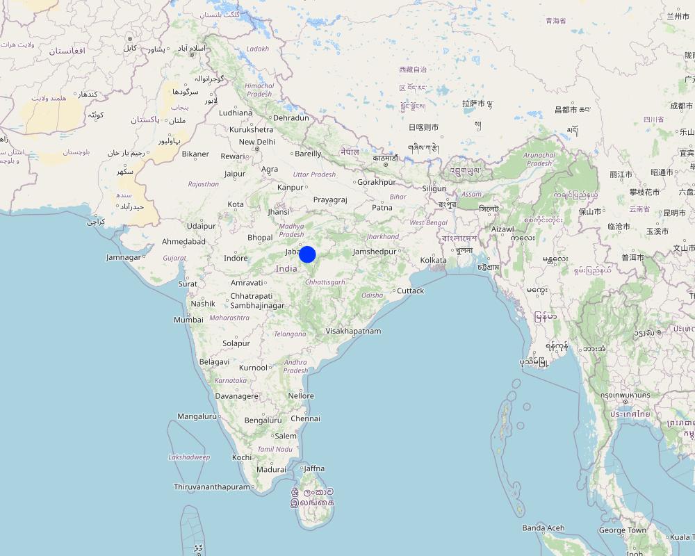
有关地点的进一步说明:
Changariya village, Bichiya block,
注释:
The Changariya village is a sample site to understand the E-prakriti workbook approach
Map
×2.6 该方法的开始和终止日期
若不知道准确的年份,请注明该方法的大致开始日期。:
不到10年前(最近)
终止年份(若不再采用该方法):
2023
注释:
This approach for landscape management considers the landscape as an administrative and natural unit and includes various levels such as Village, Block, District, and geo-hydrological landscapes. It provides a comprehensive activity plan for the management of natural resources, with a focus on natural farming as a core component. The approach is easy to understand and can be used for project implementation.
2.7 方法的类型
- 基于项目/方案
2.8 该方法的主要目的/目标
The objective of this tool is to create a scientific and efficient approach for planning natural farming interventions through the use of GIS-based mapping
2.9 推动或妨碍实施本办法所适用的技术的条件
社会/文化/宗教规范和价值观
- 启动
E-prakriti proposes comprehensive planning by the adequate blending of technology with sustainability approaches, local wisdom, community participation and departmental convergence
机构设置
- 启动
The effective cooperation of actors like communities, Government Departments and other institutions is enabled by natural-farming planning approaches using GIS Tools.
参与者的的协作/协调
- 启动
The validation of GIS data is done through on-ground validation and extensive interpretation from maps. Community consultations are crucial in the planning process and convergence planning with the concerned Government Departments is necessary for comprehensive planning. Technical training in basic GIS-based software handling is essential for departmental engineers and other technically competent functionaries.
了解SLM,获得技术支持
- 启动
工作量、人力资源可用性
- 启动
e-Prakriti can significantly reduce the workload of planners and implementers as it reduces the need for physical visits to each and every village to collect ground-level data. A lot of data with very high accuracy can be collected from the satellite-based imaging systems.
3. 相关利益相关者的参与和角色
3.1 该方法涉及的利益相关者及其职责
- 当地土地使用者/当地社区
Local community members, farmers
They have provided the data and information during the ground proofing exercises
- 社区组织
Local Community - Participation of local groups in implementing the program activities.
Community representatives from villages - support/drive the program's activities.
Community consultations are critical in promoting sustainable development interventions. It is vital to adequately prepare the community for the actions required, and community representatives must be involved at all planning levels, starting from the ground level. The principles of inclusivity and cooperation are crucial in building trust and promoting effective collaboration among community members.
The community's input is essential in creating a suitable action plan and developing maps at the beginning and end of the planning process through larger community consultations. By involving the community in this way, the intervention is more likely to be successful, sustainable and aligned with the community's needs and aspirations. This approach ensures that the community is adequately prepared to undertake the required actions and the intervention is more likely to have a positive impact on the community's well-being in the long run.
- SLM专家/农业顾问
1. Team from GIZ and consultants who developed the e-Prakriti module
2. Specialist from project implementing team
SLM specialists from GIZ, from the implementing agency, other consultants from the domain of GIS and satellite-based applications have developed the e-Prakriti module. They have looked into the specific requirements for planning the natural farming interventions and available open source platforms to meet that requirement. Once this is developed they also did some ground truthing exercises in the field to observe the accuracy of collected data along with application in the field.
- 教师/学龄儿童/学生
Local Community Representative (Community Resource Person)
The CRP is trained to use the E-Prakriti tools for planning natural farming practices. He/she engages with village groups and the program team for planning, implementation and execution. They are considered the most important stakeholders in the process as it is expected that CRPs will use this tool in the planning of their activities.
- NGO
Foundation for Ecological Security (FES) NGO
FES is involved in piloting the approach in villages, handholding for the implementation and monitoring the work. Scaling up plans with different agencies is undertaken once the piloting is successful and evidence is generated.
- 地方政府
Gram Panchayat (village self governing body)
Liaison with different government departments concerned viz. Departments like Water
Resource, NREGS, Animal Husbandry, Agriculture, Horticulture, Panchayat etc.
Convergence planning is crucial for the successful implementation of natural farming as it extensively relies on the utilization of common natural resources. This can only be achieved through the integrated effort of various concerned Departments, such as Water Resources, NREGS, Animal Husbandry, Agriculture, Horticulture, Panchayat, etc.
Therefore, it is essential to hold joint consultations with these departments to ensure that everyone is on the same page and has a shared understanding of the objectives and strategies for natural farming. These consultations can help to identify the potential areas of collaboration and the specific roles and responsibilities of each department in the implementation of natural farming practices.
In addition to engaging with the relevant departments, it is equally important to involve the district administration in the planning process. The District Collector, CEO of Zila, and Block Panchayat can play a facilitative role in bringing together the various departments and stakeholders involved in natural farming, promoting collaboration and convergence among them.
Through effective convergence planning, it is possible to achieve better coordination and utilization of resources, resulting in improved outcomes for natural farming. This will also contribute to the sustainable development of rural communities and the conservation of natural resources in the long run.
- 国际组织
Deutsche Gesellschaft für Internationale Zusammenarbeit (GIZ) GmbH
Collated the experiences and prepared the workbook that gives an
overview of planning for natural farming using open-source data
3.2 当地土地使用者/当地社区参与该方法的不同阶段
| 当地土地使用者/当地社区的参与 | 指定参与人员并描述活动 | |
|---|---|---|
| 启动/动机 | 被动 | They have been discussed to understand their specific needs, resources availability and applications for developing the basic understanding |
| 计划 | 互动 | Local community institutions were involved in the process of planning to understand the local cost specifications, local cropping patterns and to collect and validate the data points |
| 实施 | 自我动员 | Local community institutions did implement the interventions with technical guidance from the project implementing team |
| 监测/评估 | 互动 | During the monitoring process images and data points collected from the satellites were physically validated from the community members. Also, discussions are held with communities to understand the social and economic impact of the project interventions. |
3.3 流程图(如可用)

具体说明:
In order to effectively plan for natural farming using GIS tools, it is important to involve the larger systems around the community and the community itself. The first step is to identify and define a unit of intervention, such as a village. Open-source satellite data can then be used to understand and estimate various factors such as geomorphology and geohydrology. This data can be complemented with other available data from sources such as the Ground Water Board or the NREGS portal.
Using QGIS tool, the various data sets can be superimposed to find relationships between them. On-ground validation (truthing) of the GIS data is also necessary to ensure its accuracy. Once the data sets are gathered, an extensive interpretation from maps is undertaken, and the data is translated into easily understandable and implementable material for the community.
Community consultations are a critical part of the intervention, with community representatives being involved at all levels of planning. Inclusivity and cooperation are key principles in engaging the community and government departments and institutions for the judicious use of common resources. Larger community consultations are held at the beginning and end of the planning process to arrive at a suitable action plan using the prepared maps.
The planned actions and locations are plotted on maps on Google Earth, and convergence planning is necessary for the integrated efforts of several concerned departments. Joint consultations are held with these departments, and the district administration can play a facilitative role in bringing everyone on the same page. Lastly, it is important to train departmental engineers, Rozgar Sahayaks, and other technically competent functionaries in basic GIS-based software such as Bhuvan, QGIS, India-WRIS, and Bhuvan Panchayat to extract necessary data.
作者:
Deutsche Gesellschaft für Internationale Zusammenarbeit (GIZ) GmbH
3.4 有关SLM技术选择的决策
具体说明谁有权决定选择要实施的技术:
- 所有相关参与者,作为参与式方法的一部分
明确做出决策的依据:
- 研究结果
- 个人经验和意见(无记录)
4. 技术支持、能力建设和知识管理
4.1 能力建设/培训
是否为土地使用者/其他利益相关者提供培训?:
是
明确受训人员:
- 现场工作人员/顾问
如果相关,请说明性别、年龄、地位、种族等。:
The Community resource person is trained on different maps and related interpretations. The first level of planning is made using open GIS sources which are later validated by the CRP along with the community in the village. Once the plan is finalized in a participatory manner, the program is implemented and monitored using the GIS tool.
培训形式:
- 在职
- 示范区域
- 课程
涵盖的主题:
1 Village boundaries
2 Village Assets and Infrastructure
3 Watershed / Sub-basin Map
4 Natural Drainage line
8 Availability of groundwater
5 Further resources on Water
5 Geomorphology
6 Slopes within the topography
7 Lineaments- cracks in the land for the generation of aquifiers
8 Soil Erosion
10 Soil kinds/data
11 Land usage pattern
12 Crop season land
13 Wastelands Map
注释:
E-Prakriti is a training module which can be used by various stakeholders for the training and handholding of field team members.
4.2 咨询服务
土地使用者有权使用咨询服务吗?:
是
指明是否提供了咨询服务:
- 在土地使用者的土地上
4.3 机构强化(组织发展)
是否通过这种方法建立或加强了机构?:
- 否
4.4 监测和评估
监测和评估是该方法的一部分吗?:
是
注释:
This tool can be used for monitoring the project interventions by having the pre- and post-project images from the satellite
若是,该文件是否用于监测和评估?:
否
4.5 研究
研究是该方法的一部分吗?
否
5. 融资和外部物质支持
5.1 该方法中SLM组成部分的年度预算
如果不知道准确的年度预算,请给出一个范围:
- < 2,000
注释(例如主要的资助来源/主要捐助者):
The major cost involved is in developing the e-Prakriti module, the cost of which was incurred by the GIZ.
Another important cost component is capacity building of the stakeholders.
5.2 为土地使用者提供财政/物质支援
土地使用者是否获得实施该技术的财政/物质支持?:
否
5.3 对特定投入的补贴(包括劳动力)
- 无
5.4 信用
是否根据SLM活动的方法给予信用值?:
否
5.5 其它激励或手段
是否有其他激励措施或工具用于促进SLM技术的实施?:
是
如果是,请具体说明:
Training and handholding of stakeholders
6. 影响分析和结论性陈述
6.1 方法的影响
该方法是否有助于当地土地使用者,提高利益相关者的参与度?:
- 否
- 是,很少
- 是,中等
- 是,支持力度很大
The targeted areas that specifically needed conservation work were focused on
这种方法是否有助于基于证据的决策?:
- 否
- 是,很少
- 是,中等
- 是,支持力度很大
This has been the most important purpose of this approach. The use of various spatial tools ensured evidence-based decision-making
该方法是否帮助土地使用者实施和维护SLM技术?:
- 否
- 是,很少
- 是,中等
- 是,支持力度很大
The approach may be a great tool for effective and efficient natural farming-based practices and other SLM technologies
该方法是否提高了SLM的协调性和成本效益?:
- 否
- 是,很少
- 是,中等
- 是,支持力度很大
Yes. It has been of great use
该方法是否调动/改善了使用财务资源实施SLM的途径?:
- 否
- 是,很少
- 是,中等
- 是,支持力度很大
Developing projects using the technology has ensured effective financial planning for the planned interventions
该方法是否提高了土地使用者实施土地管理的知识和能力?:
- 否
- 是,很少
- 是,中等
- 是,支持力度很大
Land users and local community resource persons learned about the various tools and technologies available for scientific planning
该方法是否提高了其他利益相关者的知识和能力?:
- 否
- 是,很少
- 是,中等
- 是,支持力度很大
Community resource persons
该方法是否建立/加强了机构、利益相关者之间的合作?:
- 否
- 是,很少
- 是,中等
- 是,支持力度很大
Stakeholders like farmers, FPOs, local community resource persons, NGOs, Government institutions all are in a position to apply a coordinated approach by using this tool
该方法是否缓解了冲突?:
- 否
- 是,很少
- 是,中等
- 是,支持力度很大
Better mapping of resources could mitigate some conflicts among the community members
该方法是否改善了性别平等并赋予女性权力?:
- 否
- 是,很少
- 是,中等
- 是,支持力度很大
The promotion of natural farming empowers women members as they are core to it. Families get an access to safe and healthy foods as well.
该方法是否鼓励年轻人/下一代土地使用者参与SLM?:
- 否
- 是,很少
- 是,中等
- 是,支持力度很大
该方法是否带来了更可持续的能源使用?:
- 否
- 是,很少
- 是,中等
- 是,支持力度很大
该方法是否提高了土地使用者适应气候变化/极端情况和减轻气候相关灾害的能力?:
- 否
- 是,很少
- 是,中等
- 是,支持力度很大
6.2 土地使用者实施SLM的主要动机
- 减少工作量
The approach reduces the work load during the planning and monitoring stages
- 环境意识
Natural farming, watershed management, efficient use of the resources
- 提高SLM知识和技能
6.3 方法活动的可持续性
土地使用者能否维持通过该方法实施的措施(无外部支持的情况下)?:
- 是
若是,请说明如何维持:
The approach developed is a guidebook, which can be used by anyone using the available open-access platform which is free to use
6.4 该方法的长处/优点
| 土地使用者眼中的长处/优势/机会 |
|---|
| Efficient mapping of the resources available to different stakeholders which sometimes community members may not be aware of |
| Convergence opportunities with different line departments once resources are mapped and activities are finalised |
| Reduced workload of the community members and their institutions as they need not be physically present every time |
| 编制者或其他关键资源人员认为的长处/优势/机会 |
|---|
| Scientific and evidence based method of planning with a lot of saving in time and resources with better accuracy. Sometimes connecting with communities as well as visiting field areas take a lot of time. |
| The approach can also be used for developing the financial outlays for the shortlisted interventions by getting the physical inputs, conducting the assessments through images and maps collected from open access platforms |
| The e-Prakriti approach can be very effective in the monitoring of the project interventions as satellite-based maps of pre- and post-interventions or geotagged images may provide scientific evidences |
6.5 该方法的弱点/缺点以及克服它们的方法
| 土地使用者认为的弱点/缺点/风险 | 如何克服它们? |
|---|---|
| Not much exposed to this approach for planning | Handholding through demonstrations |
| Availability of computer devices to access the maps | Although computers are available at affordable prices in some cases, there may be financial support from the project or government agencies |
| 编制者或其他关键资源人员认为的弱点/缺点/风险 | 如何克服它们? |
|---|---|
| Technology keeps on updating thus the users need to update and upgrade themselves to ensure the usages at ground | Regular training and handholding of the users either physically or remotely |
| Availability of high speed internet for using the platforms; Currently most land users and CRPs do use internet using their mobile hotspots, access to wi-fi may may not be there | Identified planners or CRPs can be provided with internet devices or they can be linked with Wi-Fi available at different Government bodies |
7. 参考和链接
7.1 方法/信息来源
- 与SLM专业人员/专家的访谈
2
- 根据报告和其他现有文档进行编译
2
7.3 链接到网络上可用的相关信息
标题/说明:
e-Prakriti for comprehensive planning of natural farming practices
URL:
Physical copy shared by GIZ
链接和模块
全部展开 全部收起链接
无链接
模块
无模块