Improved terraces [尼泊尔]
- 创建:
- 更新:
- 编制者: Madhav Dhakal
- 编辑者: –
- 审查者: David Streiff
GARA SUDHAR- Nepali
technologies_1499 - 尼泊尔
查看章节
全部展开 全部收起1. 一般信息
1.2 参与该技术评估和文件编制的资源人员和机构的联系方式
SLM专业人员:
SLM专业人员:
Shreshta Bhubhan
977015525313
bhshreshta@icimod.org.np
PARDYP/ICIMOD
GPO Box. 3226 Kathmandu Nepal
尼泊尔
SLM专业人员:
Nakarmi Gopal
977015525313
gnakarmi@icimod.org.np
PARDYP/ICIMOD
GPO Box. 3226 Kathmandu Nepal
尼泊尔
SLM专业人员:
Merz Juerg
977015525313
jmerz@icimod.org.np
PARDYP/ICIMOD
GPO Box. 3226 Kathmandu Nepal
瑞士
SLM专业人员:
Shrestha Smriti
977015525313
smshrestha@icimod.org.np
PARDYP/ICIMOD
GPO Box. 3226 Kathmandu Nepal
尼泊尔
SLM专业人员:
Adhikari Krishna.Raj
977015525313
mdhakal@icimod.org.np
PARDYP/ICIMOD
GPO Box. 3226 Kathmandu Nepal
尼泊尔
SLM专业人员:
Shah P.B.
977015525313
pshah@icimod.org.np
PARDYP/ICIMOD
GPO Box. 3226 Kathmandu Nepal
尼泊尔
SLM专业人员:
Bhuchar Sanjeev
977015525313
sbhuchar@icimod.org.np
PARDYP/ICIMOD
GPO Box. 3226 Kathmandu Nepal
尼泊尔
SLM专业人员:
Singh Bijendra K
bijendra@hotmail.com
District Soil Conservation Office Dhulikhel
Kavrepalanchowk, Nepal
尼泊尔
土地使用者:
Thapa Kalpana
Hokse VDC, Kubinde
尼泊尔
土地使用者:
Thapa Gore
Hokse VDC, Kubinde
尼泊尔
土地使用者:
Thapa Leela
Hokse VDC, Kubinde
尼泊尔
土地使用者:
Tamang Indra
Hokse VDC, Kubinde
尼泊尔
SLM专业人员:
有助于对技术进行记录/评估的项目名称(如相关)
People and Resource Dynamics Project, Nepal (PARDYP)有助于对技术进行记录/评估的机构名称(如相关)
ICIMOD International Centre for Integrated Mountain Development (ICIMOD) - 尼泊尔有助于对技术进行记录/评估的机构名称(如相关)
District Soil Conservation Office (DSCO) - 尼泊尔1.3 关于使用通过WOCAT记录的数据的条件
(现场)数据是什么时候汇编的?:
07/02/2003
编制者和关键资源人员接受有关使用通过WOCAT记录数据的条件。:
是
2. SLM技术的说明
2.1 技术简介
技术定义:
Hillside forward-sloping terracing and stabilisation using structural and vegetative measures
2.2 技术的详细说明
说明:
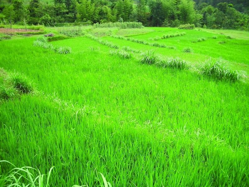
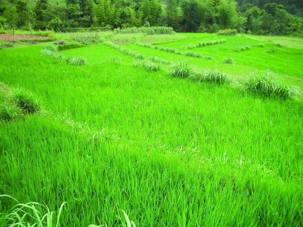
This technology addresses the soil erosion and water runoff problems associated with traditional outward-sloping terraces by reshaping the land into a series of level or gently sloping platforms across the slope. This technology is a variant of sloping land agricultural technology (SALT) or contour hedgerow technology. Nitrogen-fixing hedgerow species and quality fodder grass species, which bind the soil, are cultivated along terrace riser margins to improve terrace stability. This also enhances soil fertility and increases fodder availability. The plants are grown in either single or multiple layers. The practice is applied under rainfed conditions and is culturally acceptable and affordable. After establishment, the technology also addresses the problems of fodder scarcity making it easier and less time consuming for women and
girls to gather fodder.
The hedgerow and grass species are established between January and June. Complete establishment of this technology may take one year. The first step in creating the terraces is to build retaining walls using cement bags filled with soil which are then supported with bamboo cuttings along the contour (= future terrace risers). This divides the land into the planned terrace sections. The length and width of the terraces depends on the size and shape of the original field. Secondly, the soil is excavated from the upper part of the terraces and is used to build up the lower part above and behind the terrace riser wall to create a level bed. The fertile top soil must be kept aside and later spread over the newly terraced fields. The final step is to plant grass and hedgerow species on the outermost margins of the terrace above the risers.
Maintenance involves slicing the terrace risers once or twice a year with a spade, and smoothing off rills that appear on the surface of terraces after the premonsoon and monsoon periods. Hedgerows should be cut regularly but not more than twice a year, normally to a height of about 50 cm. Grasses should be cut about once to twice a month depending on their rate of growth.
The technology is applied under humid subtropical climate conditions (1300 mm annual rainfall with about 80% of it falling in the monsoon months of June - September). The case study area has hill slopes of 16-30% that are mostly highly erodible red soils (FAO classification: luvisols).
2.3 技术照片
2.5 已应用该技术的、本评估所涵盖的国家/地区/地点
国家:
尼泊尔
有关地点的进一步说明:
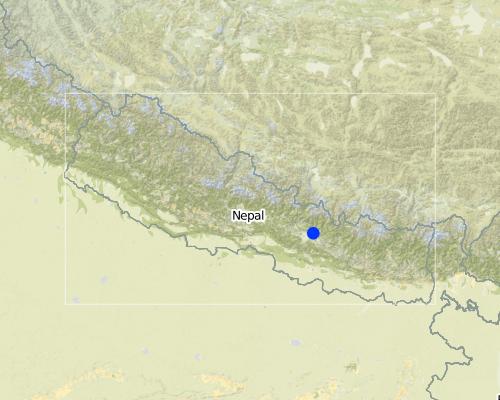
Hokse VDC ward no2
Map
×2.6 实施日期
如果不知道确切的年份,请说明大概的日期:
- 50多年前(传统)
2.7 技术介绍
详细说明该技术是如何引入的:
- 通过项目/外部干预
注释(项目类型等):
It is a combination of traditional knowledge and practice along with new scientific research findings from within the region and elsewhere, e.g., N-fixing fodder species related information from Phillipines.
3. SLM技术的分类
3.1 该技术的主要目的
- 减少、预防、恢复土地退化
3.2 应用该技术的当前土地利用类型

农田
- 一年一作
主要农作物(经济作物及粮食作物):
major cash crop: Potato and tomato
major food crop: Maize and wheat
other: Beans and chilli
注释:
Major land use problems (compiler’s opinion): The major land use problem in the area documented is the small per capita cropping landholding size. The fields are mostly rainfed and have low soil fertility and acidity problems and are susceptible to erosion. The high intensity of rainfall leads to considerable soil loss (rill and gully erosion) at the beginning of rainy seasons.
Major land use problems (land users’ perception): The production of the cultivable land is declining. Management of slopes is inappropriate, the farmers experience serious constraints in terms of adopting better farming options, e.g., cash crops (due to fertility / erosion and soil moisture problems).
Type of cropping system and major crops comments: Rice Premonsoon and monsoon( March- Novevember ) or Maize intercropped with Beans (April to August) ,Wheat and Potato ( September to January/ February) ,Tomato (January/February- April )
3.3 有关土地利用的更多信息
该技术所应用土地的供水:
- 雨养
每年的生长季节数:
- 3
具体说明:
Longest growing period in days: 150; Longest growing period from month to month: Jun - Oct; Second longest growing period in days: 120; Second longest growing period from month to month: Nov - Feb
3.4 该技术所属的SLM组
- 横坡措施
- 引水和排水
3.5 技术传播
具体说明该技术的分布:
- 均匀地分布在一个区域
如果该技术均匀地分布在一个区域上,请注明覆盖的大致区域。:
- < 0.1 平方千米(10 公顷)
注释:
Total area covered by the SLM Technology is 0.0126 km2.
The technology has been evaluated on the bases of village as a unit. Therefore the values calculated in terms of land use percentages is on the bases of village( Kubinde) data.
3.6 包含该技术的可持续土地管理措施

植物措施
- V1:乔木和灌木覆盖层

结构措施
- S1:阶地
3.7 该技术强调的主要土地退化类型

土壤水蚀
- Wt:表土流失/地表侵蚀
- Wg:冲沟侵蚀/沟蚀

水质恶化
- Ha:干旱化
注释:
Main type of degradation addressed: Wt: loss of topsoil / surface erosion, Wg: gully erosion / gullying
Secondary types of degradation addressed: Ha: aridification
Main causes of degradation: other natural causes (avalanches, volcanic eruptions, mud flows, highly susceptible natural resources, extreme topography, etc.) specify (Soil erosion due to high intensity rainfall during rainy season and uneven distribution of rainfall during lean season.), education, access to knowledge and support services (lack of knowledge - with regards to SWC measures)
Secondary causes of degradation: other human induced causes (specify) (agricultural causes - lack of improved farming options), poverty / wealth (lack of captial - realted to inmproved seeds, technologies etc.)
3.8 防止、减少或恢复土地退化
具体数量名该技术与土地退化有关的目标:
- 减少土地退化
4. 技术规范、实施活动、投入和成本
4.1 该技术的技术图纸
4.2 技术规范/技术图纸说明
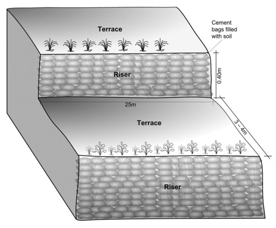
Schematric view after intervention
[terracing and vegetative measures]
Riser slope: 75 degree
Terrace slope: ~ 2 degree
Location: Kubinde
Technical knowledge required for field staff / advisors: high
Technical knowledge required for land users: moderate
Main technical functions: control of concentrated runoff: impede / retard, reduction of slope angle, reduction of slope length
Secondary technical functions: increase of infiltration, increase / maintain water stored in soil, increase in soil fertility
Vegetative measure: on risers
Vegetative material: T : trees / shrubs, G : grass
Number of plants per (ha): 2500
Vertical interval between rows / strips / blocks (m): 1.5
Spacing between rows / strips / blocks (m): 3 to 4
Vertical interval within rows / strips / blocks (m): 0.25
Vegetative measure: Vegetative material: T : trees / shrubs, G : grass
Vegetative measure: Vegetative material: T : trees / shrubs, G : grass
Vegetative measure: Vegetative material: T : trees / shrubs, G : grass
Trees/ shrubs species: Sunhemp(Crotalaria juncea),Tephrosia (Tephrosia candida) and Flemingia (Flemingia microphylla)
Grass species: Napier(Pennisetum purpureum),Molasses (Melinis minutiflora) and Stylo(Stylosanthes guianensis)
Slope (which determines the spacing indicated above): 5.00%
If the original slope has changed as a result of the Technology, the slope today is (see figure below): 5.00%
Gradient along the rows / strips: 75.00%
Terrace: bench level
Vertical interval between structures (m): 1.5
Width of ditches/pits/dams (m): 3-4
Length of ditches/pits/dams (m): 10-15
Construction material (earth): Cement bag filled with soil, Bamboo nets were used to make risers.
Slope (which determines the spacing indicated above): 30%
If the original slope has changed as a result of the Technology, the slope today is: 5%
Vegetation is used for stabilisation of structures.
4.3 有关投入和成本计算的一般信息
具体说明成本计算所用货币:
- 美元
注明美元与当地货币的汇率(如相关):1美元=:
-1.0
注明雇用劳工的每日平均工资成本:
1.40
4.4 技术建立活动
| 活动 | 措施类型 | 时间 | |
|---|---|---|---|
| 1. | Area estimation ( for vegetative measures) | 植物性的 | before rainy seasonn/lean period (February) |
| 2. | Selection of fodder grass species | 植物性的 | Before rainy season (Feb) |
| 3. | Planting of grasses and hedgerow species on the outward margins | 植物性的 | During rainy season. |
| 4. | Establishment of riser, using cement bags (filled with soil) and bamboo culms for terrace stabilisation | 结构性的 | Beginning of rainy season(May) |
| 5. | Terrace leveling:The length and width of the terraces depends on the size and shape of the field. Excavate soil from the upper part of the terrace field and use it to build up the lower part behind the terrace riser wallt creat a level plateform/bed. | 结构性的 | Beginning of rainy season(May) |
4.5 技术建立所需要的费用和投入
| 对投入进行具体说明 | 单位 | 数量 | 单位成本 | 每项投入的总成本 | 土地使用者承担的成本% | |
|---|---|---|---|---|---|---|
| 劳动力 | Labour | ha | 1.0 | 970.0 | 970.0 | 50.0 |
| 设备 | Total costs | ha | 1.0 | 92.0 | 92.0 | 100.0 |
| 植物材料 | Seeds | ha | 1.0 | 25.0 | 25.0 | |
| 植物材料 | Seedlings | ha | 1.0 | 30.0 | 30.0 | |
| 植物材料 | Bamboo | culms | 80.0 | 1.0 | 80.0 | 50.0 |
| 施工材料 | Cement bags | ha | 1.0 | 80.0 | 80.0 | 50.0 |
| 其它 | Supervision charge | ha | 1.0 | 10.5 | 10.5 | |
| 技术建立所需总成本 | 1287.5 | |||||
注释:
Duration of establishment phase: 12 month(s)
4.6 维护/经常性活动
| 活动 | 措施类型 | 时间/频率 | |
|---|---|---|---|
| 1. | Hedgerow/grass maintenance: Hedgerows are cut regularly but not | 植物性的 | Grass is cut once or twice a month. |
| 2. | (Re)plantation of hedge species if necessary | 植物性的 | Before monsoon /1*/year |
| 3. | Surface and riser maintenance: smooth the surface/rills on the | 结构性的 | after pre monsoon and after monsoon/2 */ year ,Jun |
4.7 维护/经常性活动所需要的费用和投入(每年)
| 对投入进行具体说明 | 单位 | 数量 | 单位成本 | 每项投入的总成本 | 土地使用者承担的成本% | |
|---|---|---|---|---|---|---|
| 劳动力 | Labour | ha | 1.0 | 310.0 | 310.0 | 100.0 |
| 设备 | Tools total costs | ha | 1.0 | 20.0 | 20.0 | 100.0 |
| 植物材料 | Seeds | ha | 1.0 | 6.0 | 6.0 | 100.0 |
| 植物材料 | Seedlings | ha | 1.0 | 6.0 | 6.0 | 100.0 |
| 技术维护所需总成本 | 342.0 | |||||
注释:
Machinery/ tools: Spade, Shovel, spade
All costs and amounts... are very roughly estimated by the technicians and authors.
Costs for structural measures are calculated considering the volume of excavated earth. 1 cubic meter excavated earth = 0.69 USD (labour cost). For vegetative measures it is normally based on daily wage = 1.4 USD as in 2006.
Labour cost is the major expenditure in the initial stage.
costs for tools for establishment are representative for the situation when tools for implementation of the SWC technology are not available (normally they are since the technology does not require very specific tools).
4.8 影响成本的最重要因素
描述影响成本的最决定性因素:
In case of projects interested in promoting this technology in the region, the labour cost is the major expenditure in the initial stage.The labour charges are decided by the district soil conservation office.
5. 自然和人文环境
5.1 气候
年降雨量
- < 250毫米
- 251-500毫米
- 501-750毫米
- 751-1,000毫米
- 1,001-1,500毫米
- 1,501-2,000毫米
- 2,001-3,000毫米
- 3,001-4,000毫米
- > 4,000毫米
指定年平均降雨量(若已知),单位为mm:
1304.00
农业气候带
- 潮湿的
Thermal climate class: subtropics
5.2 地形
平均坡度:
- 水平(0-2%)
- 缓降(3-5%)
- 平缓(6-10%)
- 滚坡(11-15%)
- 崎岖(16-30%)
- 陡峭(31-60%)
- 非常陡峭(>60%)
地形:
- 高原/平原
- 山脊
- 山坡
- 山地斜坡
- 麓坡
- 谷底
垂直分布带:
- 0-100 m a.s.l.
- 101-500 m a.s.l.
- 501-1,000 m a.s.l.
- 1,001-1,500 m a.s.l.
- 1,501-2,000 m a.s.l.
- 2,001-2,500 m a.s.l.
- 2,501-3,000 m a.s.l.
- 3,001-4,000 m a.s.l.
- > 4,000 m a.s.l.
5.3 土壤
平均土层深度:
- 非常浅(0-20厘米)
- 浅(21-50厘米)
- 中等深度(51-80厘米)
- 深(81-120厘米)
- 非常深(> 120厘米)
土壤质地(表土):
- 细粒/重质(粘土)
表土有机质:
- 中(1-3%)
- 低(<1%)
如有可能,附上完整的土壤描述或具体说明可用的信息,例如土壤类型、土壤酸碱度、阳离子交换能力、氮、盐度等。:
Soil texture (topsoil): Clay loam
Soil fertility is low
Soil drainage / infiltration is good but when rigid surface, then low infiltration
Soil water storage capacity is low - medium
5.4 水资源可用性和质量
地表水的可用性:
匮乏/没有
水质(未处理):
不良饮用水(需要处理)
关于水质和水量的注释和进一步规范:
Availability of surface water: Sloping land , water available at downstream
Water quality (untreated): More in rainy season (June- September), less in April/May; source: natural spring
5.6 应用该技术的土地使用者的特征
生产系统的市场定位:
- 生计(自给)
- 混合(生计/商业
非农收入:
- 收入的10-50%
相对财富水平:
- 贫瘠
- 平均水平
个人或集体:
- 个人/家庭
机械化水平:
- 手工作业
- 畜力牵引
性别:
- 女人
- 男人
说明土地使用者的其他有关特征:
Land users applying the Technology are mainly common / average land users
Population density: 200-500 persons/km2
Annual population growth: 2% - 3%
2% of the land users are rich and own 10% of the land.
3% of the land users are average wealthy and own 15% of the land (off farm employment).
95% of the land users are poor and own 75% of the land.
Off-farm income specification: In most farm households off-farm income plays at least a minor and increasingly a major role. Occasional opportunities for off-farm income present themselves in the form of daily
Market orientation of production system: For subsistence there is: Rice, maize and wheat. Potato and tomato are for market or subsitence as well.
Level of mechanization: Land preparaion, planting,weeding and harvest is manual labour, but land preparation can also happen with animal traction.
5.7 应用该技术的土地使用者拥有或租用的平均土地面积
- < 0.5 公顷
- 0.5-1 公顷
- 1-2 公顷
- 2-5公顷
- 5-15公顷
- 15-50公顷
- 50-100公顷
- 100-500公顷
- 500-1,000公顷
- 1,000-10,000公顷
- > 10,000公顷
这被认为是小规模、中规模还是大规模的(参照当地实际情况)?:
- 中等规模的
注释:
Land fragmentation due to poulation growth, mostly of rainfed type
5.8 土地所有权、土地使用权和水使用权
土地所有权:
- 个人,有命名
土地使用权:
- 个人
6. 影响和结论性说明
6.1 该技术的现场影响
社会经济效应
生产
作物生产
注释/具体说明:
maize crop by 100%
饲料生产
注释/具体说明:
households of neighbouring village benefitted.
饲料质量
生产区域
收入和成本
农业收入
注释/具体说明:
by >100% due to higher
社会文化影响
社区机构
注释/具体说明:
terrace improvement group was formed
Livelihood and human well-being
注释/具体说明:
Cropping pattern changed due to which, land users were able to produce more. Farm income and price of land increased.
生态影响
土壤
土壤水分
注释/具体说明:
nearby hedgerows
土壤覆盖层
注释/具体说明:
along risers
土壤流失
注释/具体说明:
due to levelled surface and hedgerow barrier
其它生态影响
Appearance of pests like rats due to introduction of planted
6.2 该技术的场外影响已经显现
下游洪水
注释/具体说明:
Bigger area needs swc measures
下游淤积
Fodder grass seed distribution
注释/具体说明:
through farmer to farmer dissemination
Nutrients downstream
注释/具体说明:
due to reduced nutrients leaching on-site
6.3 技术对渐变气候以及与气候相关的极端情况/灾害的暴露和敏感性(土地使用者认为的极端情况/灾害)
渐变气候
渐变气候
| 季节 | 气候变化/极端天气的类型 | 该技术是如何应对的? | |
|---|---|---|---|
| 年温度 | 增加 | 好 |
气候有关的极端情况(灾害)
气象灾害
| 该技术是如何应对的? | |
|---|---|
| 局地暴雨 | 不好 |
| 局地风暴 | 好 |
气候灾害
| 该技术是如何应对的? | |
|---|---|
| 干旱 | 不好 |
水文灾害
| 该技术是如何应对的? | |
|---|---|
| 比较和缓的(河道)洪水 | 不好 |
其他气候相关的后果
其他气候相关的后果
| 该技术是如何应对的? | |
|---|---|
| 缩短生长期 | 好 |
6.4 成本效益分析
技术收益与技术建立成本相比如何(从土地使用者的角度看)?
短期回报:
中性/平衡
长期回报:
积极
技术收益与技术维护成本/经常性成本相比如何(从土地使用者的角度看)?
短期回报:
积极
长期回报:
非常积极
注释:
The initial investment is high, but can be recovered within a short period
due to yield increment and cash crop production.
6.5 技术采用
- 大于 50%
如若可行,进行量化(住户数量和/或覆盖面积):
16 households in an area of 0.0126 sq km
在所有采用这项技术的人当中,有多少人是自发地采用该技术,即未获得任何物质奖励/付款?:
- 50-90%
注释:
6 land user families have adopted the Technology with external material support
10 land user families have adopted the Technology without any external material support
Comments on spontaneous adoption: survey results
There is a little trend towards spontaneous adoption of the Technology
Comments on adoption trend: The number of farmers applying the technology is increasing without further incentives being provided. Others have shown increasing interest in the technology without implementing it due to lack of incentives.
6.7 该技术的优点/长处/机会
| 土地使用者眼中的长处/优势/机会 |
|---|
|
The price of land increased considerably from NRs 30,000 in 2001 (for 1 ropani – 508.5 sq. m) to between NRs 100, 000 and NRs 150,000 per ropani after the technology was established How can they be sustained / enhanced? The price would increase further if irrigation facilities were installed |
| Pedicels of Tephosia and Sunhemp can be used for firewood. |
| Instead of planting only maize a farmer started planting rice (primary crop) and cash crops like potato / tomato (secondary crops). |
| 编制者或其他关键资源人员认为的长处/优势/机会 |
|---|
|
The area of levelled terraces nearly doubled in Kubinde village from 2001 to 2003, which is an indicator of increased awareness of the benefi ts of soil and water conservation. How can they be sustained / enhanced? Experience sharing would help expand the area under improved terraces. |
|
Land productivity increased, maize, potato and bean production increased, vegetables and rice production started. How can they be sustained / enhanced? Irrigation facility could increase the production capacity of the terraces. |
|
Availability of grass/fodder (nitrogen fixing) increased. How can they be sustained / enhanced? Planting horticultural fruits could increase farm incomes and so it should be promoted and more nitrogen fi xing species (preferably local) should be tried out |
6.8 技术的弱点/缺点/风险及其克服方法
| 土地使用者认为的弱点/缺点/风险 | 如何克服它们? |
|---|---|
| In the fi rst year of implementation, maize production was reduced due to soil amendment |
a phenomenon which is likely to occur with new terrace formation |
| 编制者或其他关键资源人员认为的弱点/缺点/风险 | 如何克服它们? |
|---|---|
| Presently the vegetative technology is confined to terrace margins | it should be extended to the risers also. |
7. 参考和链接
7.2 参考可用出版物
标题、作者、年份、ISBN:
ICIMOD (2002) Hydro-meteorological Year Book of Jhikhu Khola Watershed. Kathmandu: ICIMOD
可以从哪里获得?成本如何?
ICIMOD
标题、作者、年份、ISBN:
Mathema, P.; Singh, B.K. (2003) Soil ErosionStudies in Nepal: Results and Implications. Kathmandu: Government of Nepal, Department of Soil Conservation and Watershed Management
标题、作者、年份、ISBN:
Mathema, P. (2003) Watershed Managementin South Asia. Kathmandu: Government of Nepal, Department of Soil Conservation and Watershed Management
链接和模块
全部展开 全部收起链接
无链接
模块
无模块


