Index Based Livestock Insurance [肯尼亚]
- 创建:
- 更新:
- 编制者: Duncan Collins Khalai
- 编辑者: –
- 审查者: Rima Mekdaschi Studer, Donia Mühlematter, Hanspeter Liniger
IBLI
technologies_3361 - 肯尼亚
- Index Based Livestock Insurance: May 9, 2019 (inactive)
- Index Based Livestock Insurance: Sept. 3, 2018 (inactive)
- Index Based Livestock Insurance: Nov. 2, 2021 (public)
- Index Based Livestock Insurance: June 7, 2018 (inactive)
- Index Based Livestock Insurance: May 13, 2018 (inactive)
- Index Based Livestock Insurance: Jan. 25, 2018 (inactive)
查看章节
全部展开 全部收起1. 一般信息
1.2 参与该技术评估和文件编制的资源人员和机构的联系方式
关键资源人
SLM专业人员:
有助于对技术进行记录/评估的项目名称(如相关)
Index Based Livestock Insurance, Kenya (IBLI)有助于对技术进行记录/评估的机构名称(如相关)
ILRI International Livestock Research Institute (ILRI) - 肯尼亚1.3 关于使用通过WOCAT记录的数据的条件
(现场)数据是什么时候汇编的?:
24/01/2018
编制者和关键资源人员接受有关使用通过WOCAT记录数据的条件。:
是
1.4 所述技术的可持续性声明
这里所描述的技术在土地退化方面是否存在问题,导致无法被认为是一种可持续的土地管理技术?:
否
2. SLM技术的说明
2.1 技术简介
技术定义:
Index-Based Livestock Insurance (IBLI) is a product that was designed to help protect pastoralists and their livestock against the effects of prolonged forage scarcity. IBLI triggers payment to pastoralists when the forage situation deteriorates to levels considered to be severe, as compared to historical conditions over time.
2.2 技术的详细说明
说明:
In the event of severe seasonal drought, forage and grazing resources are depleted and livestock may die because of starvation. Index Based Livestock Insurance (IBLI) is the technology applied in the provision of forage based livestock (asset) protection insurance. IBLI uses Normalized Difference Vegetation Index (NDVI), a satellite-derived indicator of the amount and vigor of vegetation, based on the observed level of photosynthetic activity (Tucker et al., 2005). NDVI is derived from 10-day composites of 250m filtered eMODIS processed by the United States’ National Aeronautics and Space Administration (NASA) and transformed by The Earth Resources Observation Systems (EROS) Data Center (EDC) of the US Geological Survey (USGS). NDVI data from the AQUA satellite platform are available from July 2002 to present at https://lta.cr.usgs.gov/emodis.
In the case of IBLI, the index is a deviation of cumulative forage availability (ZCumNDVI) in the insured season. It measures forage conditions over a defined time period and compares the observed NDVI over a particular season, with the observed NDVI over a given historical period (e.g. 15 years). A set threshold below which payouts must be made is called the trigger level. Therefore, when the forage situation in a given season is worse than the 20th worst season in the last 15 years, a payout is triggered. In other words, IBLI will compensate if the forage conditions fall below the worst 20th percentile of seasonal pasture levels cumulated over the historical drought seasons in the past 15 years. IBLI therefore uses the satellite-based vegetation index to measure forage availability and to trigger timely payouts to pastoralists based on the costs of providing supplementary feeds to the animals for the specific season that a drought is triggered.
For precision and proper administration each insured county is broken down into smaller units of insurance which are referred to as Unit Areas of Insurance (UAIs). Each UAI represents a geographical area whose forage availability index data are aggregated as one unit for insurance purposes. The identification of the geographic areas that constitute UAIs is a key step in IBLI contract design because the use of average NDVI over insurable units is based on the premise that drought is a covariate shock and that pastoral communities affected in a particular area are deemed to suffer in equal measure.Thus, for accuracy and acceptability, the index should be tightly correlated with forage scarcity and reflect relative conditions on the ground. Also forage access should be relatively homogeneous for herders residing in the same insurable unit. The process of demarcating UAIs is known as clustering. It is done through a combination of active participatory community engagement and scientific methods .
Insured pastoralists are not always paid when there is drought. They are only paid when drought is so severe that the amount of forage falls below the strike level. Insured pastoralists will not receive payments if the forage availability is more than the strike level. This is an annual policy which covers forage availability as measured by satellite Normalized Difference Vegetation Index (NDVI) in up to 2 rainy seasons as per the bimodal rain patterns in Kenya. Pastoralists who do not hold insurance contracts are not covered by under, and therefore do not receive payments, even if they live in the same UAIs as the ones who have insured their livestock.
2.3 技术照片
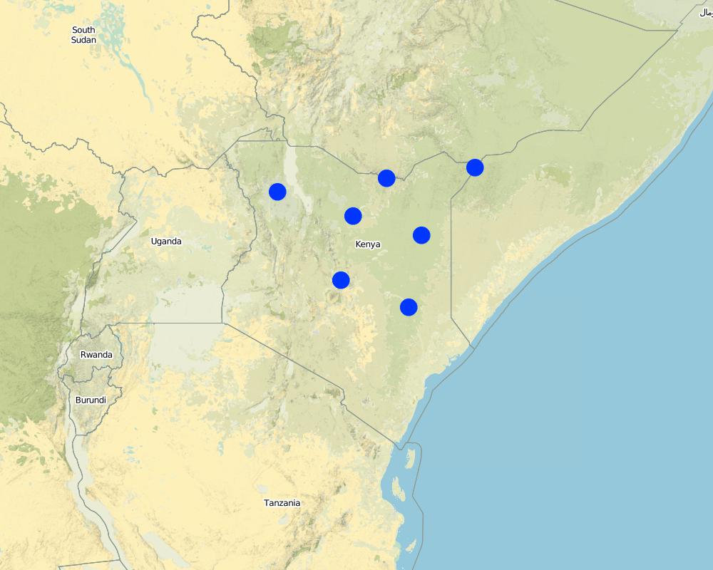
2.5 已应用该技术的、本评估所涵盖的国家/地区/地点
国家:
肯尼亚
Map
×2.6 实施日期
如果不知道确切的年份,请说明大概的日期:
- 不到10年前(最近)
2.7 技术介绍
详细说明该技术是如何引入的:
- 在实验/研究期间
3. SLM技术的分类
3.1 该技术的主要目的
- 降低灾害风险
- 适应气候变化/极端天气及其影响
- 创造有益的经济影响
3.2 应用该技术的当前土地利用类型

牧场
粗放式放牧场:
- 游牧
- 半游牧/游牧
主要动物种类及产品:
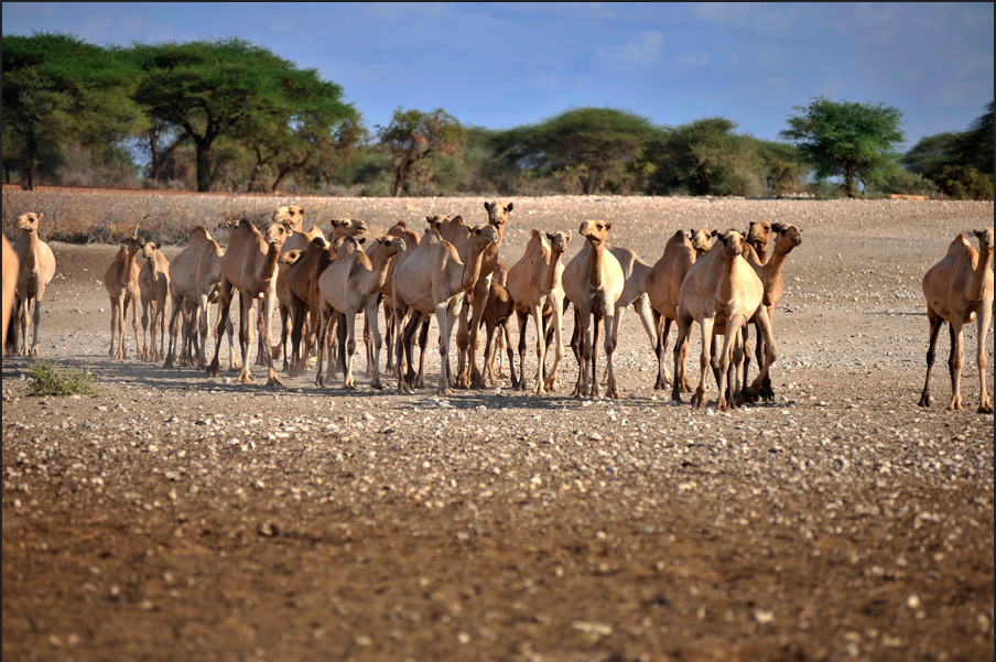
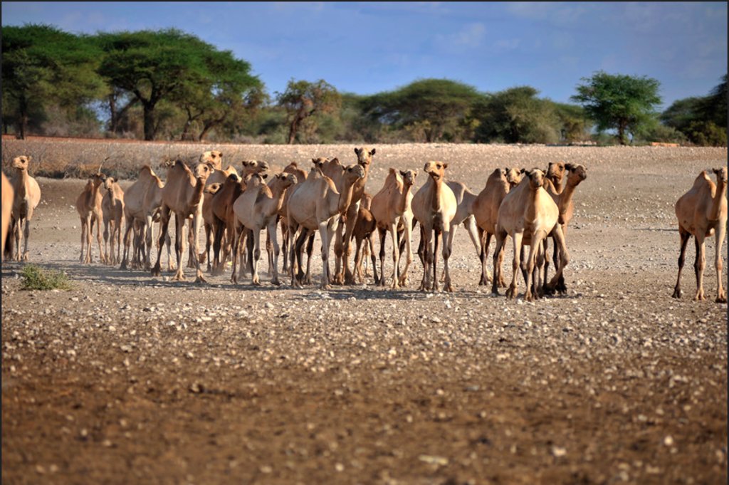
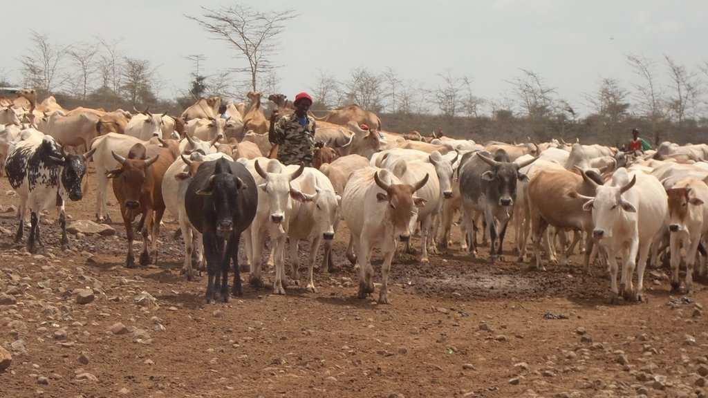
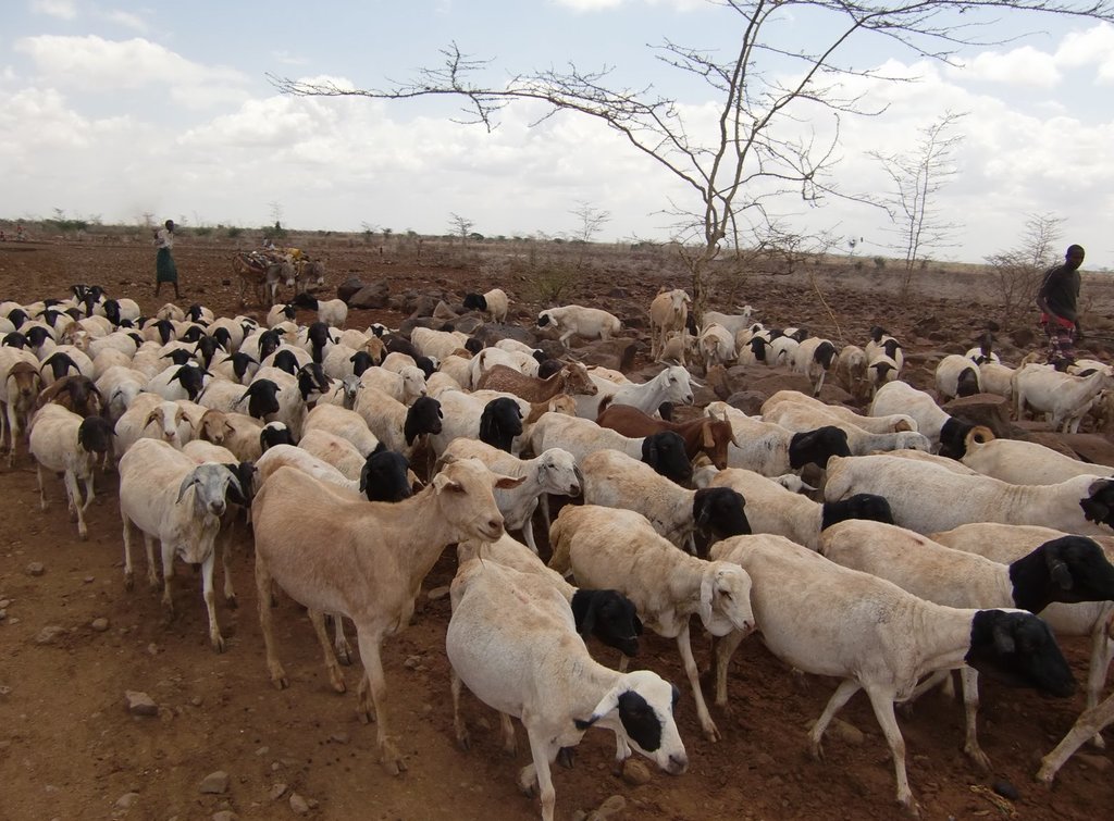
Cattle, Goats, Sheep and Camels.
3.3 有关土地利用的更多信息
该技术所应用土地的供水:
- 雨养
每年的生长季节数:
- 2
3.4 该技术所属的SLM组
- 畜牧业和牧场管理
3.5 技术传播
具体说明该技术的分布:
- 均匀地分布在一个区域
如果该技术均匀地分布在一个区域上,请注明覆盖的大致区域。:
- 100-1,000 平方千米
3.6 包含该技术的可持续土地管理措施

其它措施
注释:
Providing Index Based Livestock Insurance to pastoralist communities to cushion the cost of keeping their animals alive during severe drought seasons.
3.7 该技术强调的主要土地退化类型

其它
注释:
IBLI mainly addresses the risk of livestock mortality as a result of severe forage scarcity due to drought.
3.8 防止、减少或恢复土地退化
具体数量名该技术与土地退化有关的目标:
- 适应土地退化
4. 技术规范、实施活动、投入和成本
4.1 该技术的技术图纸
4.2 技术规范/技术图纸说明
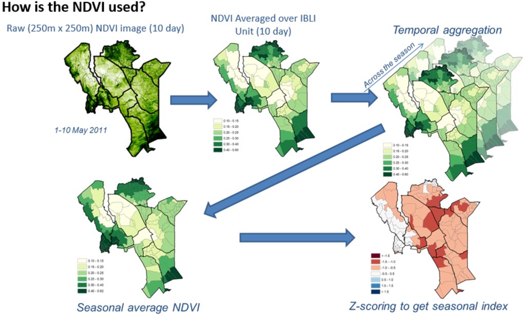
Picture 1 &2: Monthly NDVI for each insured unit in a month is derived by averaging the 10-day NDVI values for each Insured Unit over the three 10-days periods in each month, where the 10-day NDVI value for each Insured Unit is derived by averaging the pixel-level NDVI of all the pixels that fall within the insured unit boundary.
Picture 3: An accumulation of monthly NDVI over the critical months of each season starting from the beginning of the season (March for LRLD and October for SRSD).
Picture 4: There is a representation of a cumulation of monthly NDVI (CumNDVI) which represents the evolution of green vegetation and can be used as a proxy of the green biomass that has developed, and as such a proxy of the available forage across the season.
Picture 5: Deviation of Cumulative NDVI from normal conditions of the particular season and insured unit (ZCumNDVI) - is derived by
subtracting CumNDVI derived for each season and each insured unit by the long-term historical average value and dividing by long-term historical standard deviation of the particular season (SRSD or LRLD) in each
insured unit. ZCumNDVI thus measures the deviation from the historical mean,
expressed as a standard deviation. A positive ZCumNDVI value therefore indicates above normal vegetation cover while negative ZNDVI value indicates below normal vegetation. The purpose of this transformation is to provide an indicator that expresses current forage conditions in comparison to average forage conditions for each specific insurance unit
at the prescribed period within the season.
NOTE: The delineations used in this figure are just for purposes of illustration, assuming Kenya as an entire unit. However, IBLI used smaller delineated units which can be seen in the lines with lighter shade within the map.
5. 自然和人文环境
5.1 气候
年降雨量
- < 250毫米
- 251-500毫米
- 501-750毫米
- 751-1,000毫米
- 1,001-1,500毫米
- 1,501-2,000毫米
- 2,001-3,000毫米
- 3,001-4,000毫米
- > 4,000毫米
注明所考虑的参考气象站名称:
Kenya Meteorological Department
农业气候带
- 半干旱
- 干旱
5.2 地形
平均坡度:
- 水平(0-2%)
- 缓降(3-5%)
- 平缓(6-10%)
- 滚坡(11-15%)
- 崎岖(16-30%)
- 陡峭(31-60%)
- 非常陡峭(>60%)
地形:
- 高原/平原
- 山脊
- 山坡
- 山地斜坡
- 麓坡
- 谷底
垂直分布带:
- 0-100 m a.s.l.
- 101-500 m a.s.l.
- 501-1,000 m a.s.l.
- 1,001-1,500 m a.s.l.
- 1,501-2,000 m a.s.l.
- 2,001-2,500 m a.s.l.
- 2,501-3,000 m a.s.l.
- 3,001-4,000 m a.s.l.
- > 4,000 m a.s.l.
说明该技术是否专门应用于:
- 不相关
5.3 土壤
平均土层深度:
- 非常浅(0-20厘米)
- 浅(21-50厘米)
- 中等深度(51-80厘米)
- 深(81-120厘米)
- 非常深(> 120厘米)
土壤质地(表土):
- 粗粒/轻(砂质)
土壤质地(地表以下> 20厘米):
- 粗粒/轻(砂质)
表土有机质:
- 低(<1%)
5.4 水资源可用性和质量
地下水位表:
< 5米
地表水的可用性:
匮乏/没有
水质(未处理):
不良饮用水(需要处理)
水的盐度有问题吗?:
是
该区域正在发生洪水吗?:
否
5.5 生物多样性
物种多样性:
- 中等
栖息地多样性:
- 中等
5.6 应用该技术的土地使用者的特征
定栖或游牧:
- 游牧的
生产系统的市场定位:
- 混合(生计/商业
非农收入:
- 低于全部收入的10%
相对财富水平:
- 平均水平
个人或集体:
- 个人/家庭
性别:
- 女人
- 男人
土地使用者的年龄:
- 中年人
- 老年人
5.7 应用该技术的土地使用者拥有或租用的平均土地面积
- < 0.5 公顷
- 0.5-1 公顷
- 1-2 公顷
- 2-5公顷
- 5-15公顷
- 15-50公顷
- 50-100公顷
- 100-500公顷
- 500-1,000公顷
- 1,000-10,000公顷
- > 10,000公顷
注释:
Most land is communal.
5.8 土地所有权、土地使用权和水使用权
土地所有权:
- 社区/村庄
土地使用权:
- 社区(有组织)
用水权:
- 社区(有组织)
5.9 进入服务和基础设施的通道
健康:
- 贫瘠
- 适度的
- 好
教育:
- 贫瘠
- 适度的
- 好
技术援助:
- 贫瘠
- 适度的
- 好
就业(例如非农):
- 贫瘠
- 适度的
- 好
市场:
- 贫瘠
- 适度的
- 好
能源:
- 贫瘠
- 适度的
- 好
道路和交通:
- 贫瘠
- 适度的
- 好
饮用水和卫生设施:
- 贫瘠
- 适度的
- 好
6. 影响和结论性说明
6.1 该技术的现场影响
社会文化影响
食品安全/自给自足
社会经济弱势群体的情况
生态影响
减少气候和灾害风险
干旱影响
6.2 该技术的场外影响已经显现
Reduction of livestock mortality as a result of forage scarcity due to drought.
6.3 技术对渐变气候以及与气候相关的极端情况/灾害的暴露和敏感性(土地使用者认为的极端情况/灾害)
渐变气候
渐变气候
| 季节 | 气候变化/极端天气的类型 | 该技术是如何应对的? | |
|---|---|---|---|
| 年降雨量 | 减少 | 适度 |
气候有关的极端情况(灾害)
气候灾害
| 该技术是如何应对的? | |
|---|---|
| 干旱 | 好 |
其他与气候有关的极端情况(灾害)
| 其它(具体说明) | 该技术是如何应对的? |
|---|---|
| Forage scarcity | 好 |
6.4 成本效益分析
技术收益与技术建立成本相比如何(从土地使用者的角度看)?
短期回报:
稍微积极
长期回报:
积极
技术收益与技术维护成本/经常性成本相比如何(从土地使用者的角度看)?
短期回报:
积极
长期回报:
积极
6.5 技术采用
- 10-50%
如若可行,进行量化(住户数量和/或覆盖面积):
over 25,000 households
在所有采用这项技术的人当中,有多少人是自发地采用该技术,即未获得任何物质奖励/付款?:
- 10-50%
6.6 适应
最近是否对该技术进行了修改以适应不断变化的条件?:
否
6.7 该技术的优点/长处/机会
| 土地使用者眼中的长处/优势/机会 |
|---|
| The use NDVI for forage monitoring in provision of IBLI eliminates the high costs of loss verification which would otherwise be expensive and consuming in the case of vast and remote ASALs of Kenya. |
| 编制者或其他关键资源人员认为的长处/优势/机会 |
|---|
| IBLI contract design is based on robust scientific design which is easily verifiable hence boosting trust in the product. |
6.8 技术的弱点/缺点/风险及其克服方法
| 土地使用者认为的弱点/缺点/风险 | 如何克服它们? |
|---|---|
| A key concern of index-insurance products is that there might occur variances in perceived loss versus the actual payouts (basis risk) | Proper contract design should be backed with ground truthing efforts together with awareness creation. |
| 编制者或其他关键资源人员认为的弱点/缺点/风险 | 如何克服它们? |
|---|---|
| Basis risk is a weakness with IBLI as they could arise differences in perceived level of forage scarcity by the clients, | vis a vis the index trigger level indicated by the NDVI data. Increased precision in contract design alongside proper capacity and awareness creation to the pastoralists can help mitigate this challenge. |
7. 参考和链接
7.1 信息的方法/来源
- 根据报告和其他现有文档进行编译
7.2 参考可用出版物
标题、作者、年份、ISBN:
Chelang'a et. al 2017
标题、作者、年份、ISBN:
Tucker et al., 2005
7.3 链接到网络上可用的相关信息
标题/说明:
IBLI website
URL:
https://ibli.ilri.org/
链接和模块
全部展开 全部收起链接
无链接
模块
无模块


