Flat Contour Terraces [也门]
- 创建:
- 更新:
- 编制者: ahmed algalal
- 编辑者: –
- 审查者: David Streiff, Alexandra Gavilano
المدرجات الكنتورية
technologies_1174 - 也门
查看章节
全部展开 全部收起1. 一般信息
1.2 参与该技术评估和文件编制的资源人员和机构的联系方式
SLM专业人员:
SLM专业人员:
Sallam Ahmed
Agricultural Research and Extension Authority
也门
有助于对技术进行记录/评估的机构名称(如相关)
Agricultural Research and Extension Authority (AREA) - 也门1.3 关于使用通过WOCAT记录的数据的条件
编制者和关键资源人员接受有关使用通过WOCAT记录数据的条件。:
是
1.5 参考关于SLM方法(使用WOCAT记录的SLM方法)的调查问卷
leveled mountain terraces [也门]
organized collective action at a high pace for building agricultural terraces to improve livelihoods in resource-scarce regions in the ground
- 编制者: ahmed algalal
2. SLM技术的说明
2.1 技术简介
技术定义:
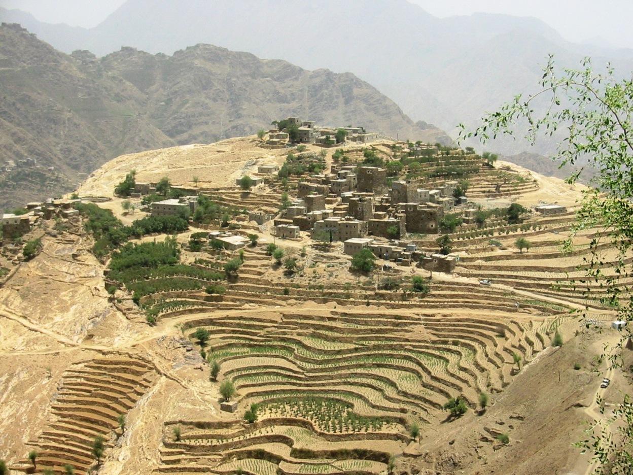
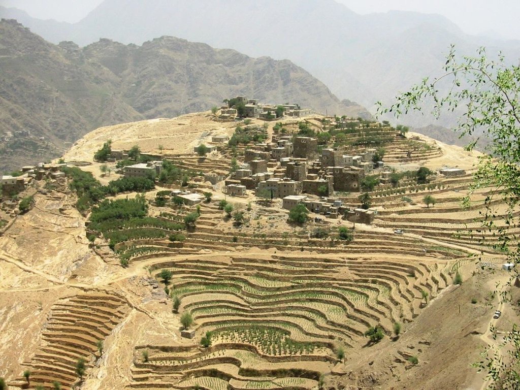
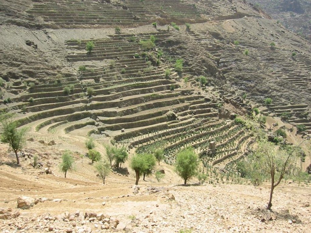
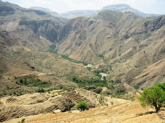
Old flat terraces were built in accordance with the contour lines and surrounded by stones to create a suitable environment for the growth of crops, slope stabilization and reduce the risk of runoff and increasing water harvesting.
2.2 技术的详细说明
说明:
The Yemeni farmer challenged the nature cruel and adopted to cope with the needs and requirements, including the construction of agricultural terraces utilizing all the resources available in the region, where he worked first on the extraction of soil located on the slopes of the mountains and booked by building a wall of stones around where were collected and brought stones from different places. Walls were built in very geometric creativity very well designed so that they work to minimize the risk of soil erosion and increase the use of water runoff without damages to the established terraces so through the construction of terraces along contour lines and making outlets in each terrace to drain excess water.
The process of building terraces using stones according to the contours, which works to prevent soil erosion and erosion, as well as help to increase soil moisture as a result harvest runoff, which leads to meet the needs of crop water and thereby increase production.
The main objective of building terraces is to increase production. The soil depth at the beginning of the establishment of the stands to be very shallow and increasing soil depth as a result of increasing deposits the soil.This process is booked by increasing the height of the wall that range between 1-3 meters, and a width runway between 1-6 meters As for the length of the runway It is 5 - 80 meters according to the contour line, which runs on reserve deposits and protect the soil from erosion.. Finally terraces are planted with annual crops mainly cereals crops, as well as perennial trees such as coffee, diamond, Qat and other perennial trees.
The terraces of the projects long-term where you need a long time to build due to the use of hands in the construction process as a result you cannot use the mechanisms, for maintenance operations in view of the building stands on the regions of steep and where the rate of runoff high result of heavy rains in a short time in addition to Regression factor that leads to increase the speed of the flow of water, which operate on a cliff erosion terraces in the event of lack of maintenance, which makes the process of ongoing maintenance is an urgent need to ensure the preservation and sustainability of the stands.
2.3 技术照片
2.5 已应用该技术的、本评估所涵盖的国家/地区/地点
国家:
也门
区域/州/省:
Hajah Governorate
有关地点的进一步说明:
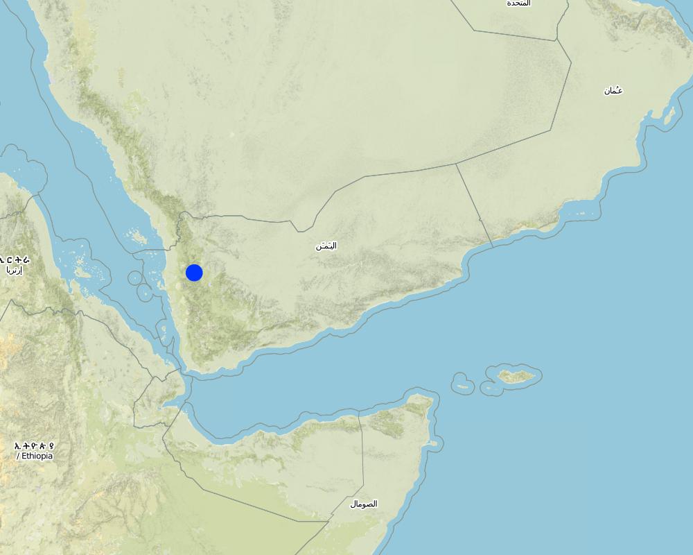
Kahlan Afar
具体说明该技术的分布:
- 均匀地分布在一个区域
注释:
Total area covered by the SLM Technology is 5.4 km2.
The study area is located in the south west of Fort Kahlan Afar and stretches along the projected water severe slope, and include seven villages spreading from the highest peak of the mountain until the bottom of the valley respectively: Bait guardian, Al Qimmeh, Bait Al Farawi, Al-ubal, Fara'ah, Bani Bram , Wadi (Valley) EabrHajr.
Map
×2.6 实施日期
如果不知道确切的年份,请说明大概的日期:
- 50多年前(传统)
2.7 技术介绍
详细说明该技术是如何引入的:
- 作为传统系统的一部分(> 50 年)
注释(项目类型等):
too old since approximately 2000 BC
3. SLM技术的分类
3.1 该技术的主要目的
- 改良生产
- 减少、预防、恢复土地退化
3.2 应用该技术的当前土地利用类型

农田
- 一年一作
- 乔木与灌木的种植
年作 - 具体指明作物:
- 谷类 - 大麦
- 谷物类 - 玉米
- 谷类 - 其他
- 谷类 - 小麦(春季)
- 豆科牧草和豆类 - 豆子
- lentils
乔木和灌木种植 - 指定作物:
- 咖啡,露天种植
- Qat, Diamond
每年的生长季节数:
- 2
具体说明:
Longest growing period in days: 240
注释:
Major land use problems (compiler’s opinion): severe slopes that works to increase the speed of runoff, which leads to soil loss
3.4 供水
该技术所应用土地的供水:
- 雨养
注释:
Also mixed rainfed - irrigated
3.5 该技术所属的SLM组
- 横坡措施
3.6 包含该技术的可持续土地管理措施

农艺措施
- A3:土壤表面处理

结构措施
- S1:阶地
注释:
Secondary measures: agronomic measures
Type of agronomic measures: contour tillage
3.7 该技术强调的主要土地退化类型

土壤水蚀
- Wt:表土流失/地表侵蚀
- Wg:冲沟侵蚀/沟蚀

生物性退化
- Bc:植被覆盖的减少

水质恶化
- Ha:干旱化
注释:
Secondary types of degradation addressed: Bc: reduction of vegetation cover, Ha: aridification
Main causes of degradation: over-exploitation of vegetation for domestic use, Heavy / extreme rainfall (intensity/amounts) (severe rainfall in a short time), other natural causes (avalanches, volcanic eruptions, mud flows, highly susceptible natural resources, extreme topography, etc.) specify (severe slopes)
Secondary causes of degradation: overgrazing, droughts (As a result of the fluctuation of rainfall), poverty / wealth (Poverty)
3.8 防止、减少或恢复土地退化
具体数量名该技术与土地退化有关的目标:
- 减少土地退化
4. 技术规范、实施活动、投入和成本
4.1 该技术的技术图纸
技术规范(与技术图纸相关):
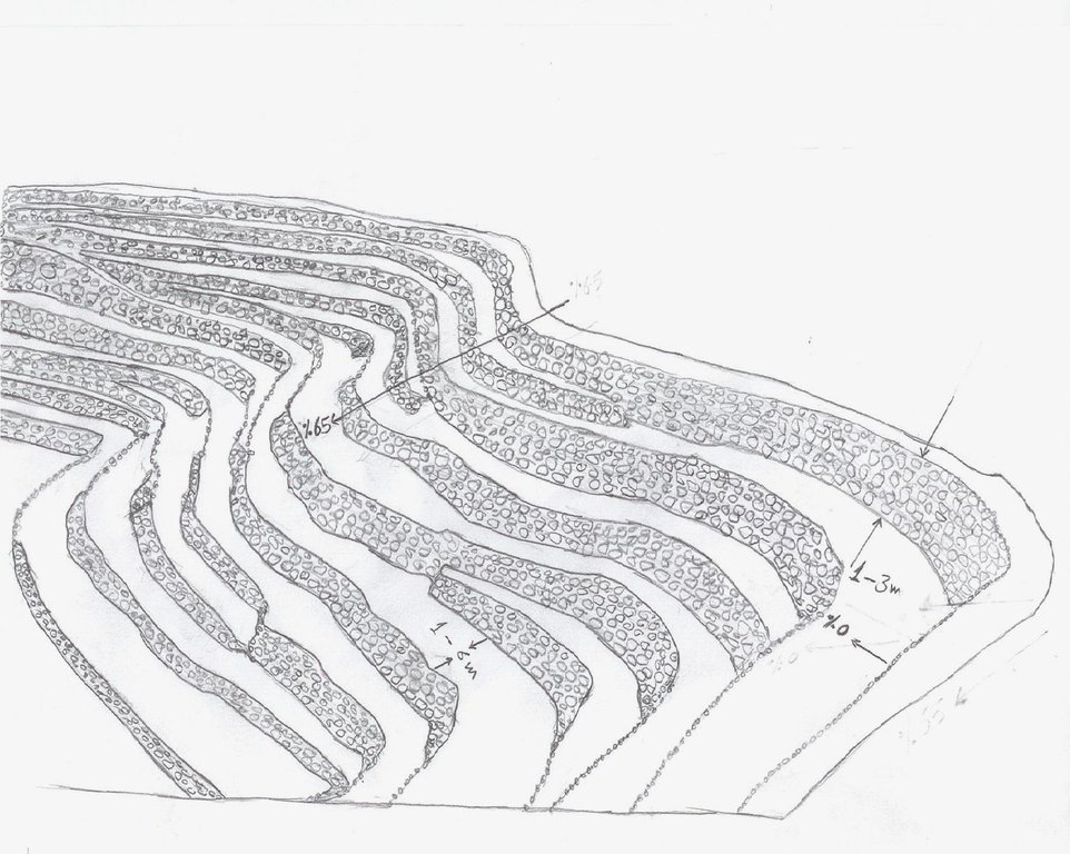
terraces built along contour lines
Location: Hajah Governorate. Kahlan Afer
Date: 10-2-2013
Technical knowledge required for field staff / advisors: moderate (does not have only a little experience)
Technical knowledge required for land users: low (Has enough experience)
Main technical functions: reduction of slope angle, reduction of slope length, water harvesting / increase water supply, sediment retention / trapping, sediment harvesting, reduction surface runoff
Secondary technical functions: increase of infiltration, water spreading
Contour tillage
Material/ species: agricultural tools, animal traction
Terrace: bench level
Vertical interval between structures (m): 1 - 3
Spacing between structures (m): 1 - 6
Height of bunds/banks/others (m): 1 - 3
Width of bunds/banks/others (m): 1 - 6
Length of bunds/banks/others (m): 5 - 80
Construction material (earth): Collecting soil and reserve deposits to increase the soil depth
Construction material (stone): Stones available in the region
Slope (which determines the spacing indicated above): 65%
If the original slope has changed as a result of the Technology, the slope today is: 0%
Lateral gradient along the structure: 0%
For water harvesting: the ratio between the area where the harvested water is applied and the total area from which water is collected is: 1:1
作者:
Algalal
4.2 有关投入和成本计算的一般信息
具体说明成本计算所用货币:
- 美元
注明雇用劳工的每日平均工资成本:
7.00
4.3 技术建立活动
| 活动 | 时间(季度) | |
|---|---|---|
| 1. | Extraction of soil | Before the rainy season |
| 2. | Collecting stones | Before the rainy season |
| 3. | Build a wall to establish a terrace | Before the rainy season |
4.4 技术建立所需要的费用和投入
| 对投入进行具体说明 | 单位 | 数量 | 单位成本 | 每项投入的总成本 | 土地使用者承担的成本% | |
|---|---|---|---|---|---|---|
| 劳动力 | Extraction of soil | ha | 1.0 | 2500.0 | 2500.0 | 100.0 |
| 劳动力 | Collecting stones | ha | 1.0 | 1162.8 | 1162.8 | 100.0 |
| 劳动力 | Build a wall to establish a terrace | ha | 1.0 | 558.0 | 558.0 | 100.0 |
| 设备 | Tools | ha | 1.0 | 46.5 | 46.5 | 100.0 |
| 设备 | Animal traction | ha | 1.0 | 186.0 | 186.0 | 100.0 |
| 技术建立所需总成本 | 4453.3 | |||||
| 技术建立总成本,美元 | 4453.3 | |||||
注释:
Duration of establishment phase: 12 month(s)
4.5 维护/经常性活动
| 活动 | 时间/频率 | |
|---|---|---|
| 1. | plowing along contour lines | Before planting |
| 2. | Repairing damaged walls | annually after the rain |
4.6 维护/经常性活动所需要的费用和投入(每年)
| 对投入进行具体说明 | 单位 | 数量 | 单位成本 | 每项投入的总成本 | 土地使用者承担的成本% | |
|---|---|---|---|---|---|---|
| 劳动力 | Plowing along contour lines | ha | 1.0 | 50.0 | 50.0 | 100.0 |
| 劳动力 | Repairing damaged walls | ha | 1.0 | 100.0 | 100.0 | 100.0 |
| 设备 | Tools | ha | 1.0 | 30.0 | 30.0 | 100.0 |
| 设备 | Animal traction | ha | 1.0 | 50.0 | 50.0 | 100.0 |
| 设备 | Tools | ha | 1.0 | 18.6 | 18.6 | 100.0 |
| 技术维护所需总成本 | 248.6 | |||||
| 技术维护总成本,美元 | 248.6 | |||||
注释:
Machinery/ tools: Shovel, local plow and a leveler, Shovel, Big hammer
calculated costs an average length of 60 meters along the wall stone and rising 2.5 meters. other operations were calculated per hectare considering that the land users who will carry the implemented works. with respect to maintenance has been calculated taking into account the fact that the stands terraces are considered investments long term and not subject to erosion annually, but in the event of a severe rain storm.
4.7 影响成本的最重要因素
描述影响成本的最决定性因素:
Collecting and transporting stones
Severe slopes
5. 自然和人文环境
5.1 气候
年降雨量
- < 250毫米
- 251-500毫米
- 501-750毫米
- 751-1,000毫米
- 1,001-1,500毫米
- 1,501-2,000毫米
- 2,001-3,000毫米
- 3,001-4,000毫米
- > 4,000毫米
农业气候带
- 半湿润
- 半干旱
Thermal climate class: temperate
5.2 地形
平均坡度:
- 水平(0-2%)
- 缓降(3-5%)
- 平缓(6-10%)
- 滚坡(11-15%)
- 崎岖(16-30%)
- 陡峭(31-60%)
- 非常陡峭(>60%)
地形:
- 高原/平原
- 山脊
- 山坡
- 山地斜坡
- 麓坡
- 谷底
垂直分布带:
- 0-100 m a.s.l.
- 101-500 m a.s.l.
- 501-1,000 m a.s.l.
- 1,001-1,500 m a.s.l.
- 1,501-2,000 m a.s.l.
- 2,001-2,500 m a.s.l.
- 2,501-3,000 m a.s.l.
- 3,001-4,000 m a.s.l.
- > 4,000 m a.s.l.
说明该技术是否专门应用于:
- 凸形情况
关于地形的注释和进一步规范:
Slopes on average: 30-80%
Altitudinal zone: 1600- 2700 m a.s.l.
5.3 土壤
平均土层深度:
- 非常浅(0-20厘米)
- 浅(21-50厘米)
- 中等深度(51-80厘米)
- 深(81-120厘米)
- 非常深(> 120厘米)
土壤质地(表土):
- 中粒(壤土、粉土)
- 细粒/重质(粘土)
表土有机质:
- 低(<1%)
如有可能,附上完整的土壤描述或具体说明可用的信息,例如土壤类型、土壤酸碱度、阳离子交换能力、氮、盐度等。:
Soil texture (topsoil): Silty Clay loam
Soil fertility is very low
Soil drainage / infiltration is medium - good
Soil water storage capacity is high
5.4 水资源可用性和质量
水质(未处理):
良好饮用水
5.5 生物多样性
物种多样性:
- 低
5.6 应用该技术的土地使用者的特征
生产系统的市场定位:
- 生计(自给)
- 混合(生计/商业)
非农收入:
- 低于全部收入的10%
相对财富水平:
- 非常贫瘠
- 贫瘠
个人或集体:
- 个人/家庭
机械化水平:
- 手工作业
- 畜力牵引
性别:
- 男人
说明土地使用者的其他有关特征:
Land users applying the Technology are mainly common / average land users
Difference in the involvement of women and men: physically women to carry hard work, so the man who does the work on the farm and women are household.
Population density: 200-500 persons/km2
Annual population growth: 3% - 4%
20% of the land users are average wealthy and own 30% of the land.
65% of the land users are poor and own 50% of the land.
15% of the land users are poor and own 20% of the land.
5.7 应用该技术的土地使用者使用的平均土地面积
- < 0.5 公顷
- 0.5-1 公顷
- 1-2 公顷
- 2-5公顷
- 5-15公顷
- 15-50公顷
- 50-100公顷
- 100-500公顷
- 500-1,000公顷
- 1,000-10,000公顷
- > 10,000公顷
这被认为是小规模、中规模还是大规模的(参照当地实际情况)?:
- 中等规模的
注释:
The average land tenure of between 0.5 - 2 hectares
5.8 土地所有权、土地使用权和水使用权
土地所有权:
- 个人,有命名
土地使用权:
- 租赁
- 个人
- Waqf
用水权:
- 社区(有组织)
- Waqf
注释:
There are three types of land ownership owned, hired and Waqf by 74%, 19%, 7%, respectively.
5.9 进入服务和基础设施的通道
健康:
- 贫瘠
- 适度的
- 好
教育:
- 贫瘠
- 适度的
- 好
技术援助:
- 贫瘠
- 适度的
- 好
就业(例如非农):
- 贫瘠
- 适度的
- 好
市场:
- 贫瘠
- 适度的
- 好
能源:
- 贫瘠
- 适度的
- 好
道路和交通:
- 贫瘠
- 适度的
- 好
饮用水和卫生设施:
- 贫瘠
- 适度的
- 好
金融服务:
- 贫瘠
- 适度的
- 好
6. 影响和结论性说明
6.1 该技术的现场影响
社会经济效应
生产
作物生产
饲料生产
生产故障风险
生产区域
土地管理
水资源可用性和质量
饮用水的可用性
注释/具体说明:
As a result of the infiltration process
收入和成本
农业收入
工作量
社会文化影响
食品安全/自给自足
文化机会
SLM/土地退化知识
livelihood and human well-being
生态影响
水循环/径流
水量
水的回收/收集
地表径流
多余水的排放
地下水位/含水层
土壤
土壤水分
土壤流失
生物多样性:植被、动物
植物多样性
栖息地多样性
6.2 该技术的场外影响已经显现
水资源可用性
下游洪水
下游淤积
注释/具体说明:
reduction of sediments
6.3 技术对渐变气候以及与气候相关的极端情况/灾害的暴露和敏感性(土地使用者认为的极端情况/灾害)
渐变气候
渐变气候
| 季节 | 增加或减少 | 该技术是如何应对的? | |
|---|---|---|---|
| 年温度 | 增加 | 好 |
气候有关的极端情况(灾害)
气象灾害
| 该技术是如何应对的? | |
|---|---|
| 局地暴雨 | 不好 |
6.4 成本效益分析
技术收益与技术建立成本相比如何(从土地使用者的角度看)?
短期回报:
轻度消极
长期回报:
积极
技术收益与技术维护成本/经常性成本相比如何(从土地使用者的角度看)?
短期回报:
积极
长期回报:
非常积极
6.5 技术采用
- > 50%
如若可行,进行量化(住户数量和/或覆盖面积):
994 households covering 100 percent of stated area
在所有采用这项技术的人当中,有多少人是自发的,即未获得任何物质奖励/付款?:
- 91-100%
注释:
994 land user families have adopted the Technology without any external material support
There is a little trend towards spontaneous adoption of the Technology
Comments on adoption trend: because the technology is adopted in the whole Yemen, but there is difficulty with regard to the sustainability of technical maintenance due to lack of financial resources and poverty which leads to migration and lack of interest in the land
6.7 该技术的优点/长处/机会
| 编制者或其他关键资源人员认为的长处/优势/机会 |
|---|
|
Creating a suitable environment for the growth of various crops How can they be sustained / enhanced? continue the process of maintenance to maintain walls and outlets |
|
Water harvesting to increase soil moisture How can they be sustained / enhanced? maintenance of water outlet constantly ensure that no water erosion by allowing excess water to drain out through the outlets. |
|
reduce runoff and Prevention of soil erosion How can they be sustained / enhanced? ongoing maintenance of outlets. |
|
discharge excess water in a systematic manner How can they be sustained / enhanced? ongoing maintenance of water exits |
|
reduce the length and angle of the slope How can they be sustained / enhanced? Maintaining the terraces |
6.8 技术的弱点/缺点/风险及其克服方法
| 编制者或其他关键资源人员认为的弱点/缺点/风险 | 如何克服它们? |
|---|---|
| Low productivity in the first years of the Created stands terraces due to poor soil fertility and lack of depth | apply fertilizer and chemical and organic fertilizers |
| In the event of very heavy rain may be susceptible to erosion terraces | ongoing maintenance of the waterways and channels to ensure that no diversion of water to areas prone to erosion and maintenance of the walls of the terraces and drain excess water. |
| Due to the construction of terraces on the hillsides with steep slopes, which makes it difficult to use farm machinery and agricultural work is done by hand, which requires many labor somewhat | the search for new technologies that fit this purpose |
7. 参考和链接
7.1 信息的方法/来源
7.2 参考可用出版物
标题、作者、年份、ISBN:
Mountain terraces study in the Kahlan Afar region (Mashreqi, et, al 2003)- 44. General Census of Population, Housing and Establishment (Census, 2004).- 45. Guide of agricultural climate in Yemen (Al Khorasani, 2005).
可以从哪里获得?成本如何?
Agricultural Research and Extension Authority, AREA Central Bureau of Statistics.Agricultural Research and Extension Authority, AREA
链接和模块
全部展开 全部收起链接

leveled mountain terraces [也门]
organized collective action at a high pace for building agricultural terraces to improve livelihoods in resource-scarce regions in the ground
- 编制者: ahmed algalal
模块
无模块


