Gully erosion management [埃塞俄比亚]
- 创建:
- 更新:
- 编制者: Gizaw Desta Gessesse
- 编辑者: –
- 审查者: Deborah Niggli, Alexandra Gavilano
Borebore lemat (Amharic)
technologies_1597 - 埃塞俄比亚
查看章节
全部展开 全部收起1. 一般信息
1.2 参与该技术评估和文件编制的资源人员和机构的联系方式
SLM专业人员:
Bekure Melese
WLRC
有助于对技术进行记录/评估的项目名称(如相关)
Water and Land Resource Centre Project (WLRC)1.3 关于使用通过WOCAT记录的数据的条件
编制者和关键资源人员接受有关使用通过WOCAT记录数据的条件。:
是
1.4 所述技术的可持续性声明
这里所描述的技术在土地退化方面是否存在问题,导致无法被认为是一种可持续的土地管理技术?:
否
1.5 参考关于SLM方法(使用WOCAT记录的SLM方法)的调查问卷
Community Organizations and Mobilization for Soil and Water … [埃塞俄比亚]
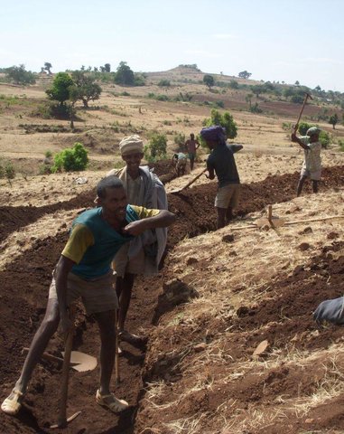
Community mobilization for soil and water conservation work in a watershed planning unit is an approach for collective action by organizing all active labor forces living in the kebele/peasant association into development group of 20-30 members and further divide into 1:5 work force to implement construction of soil and water …
- 编制者: Gizaw Desta Gessesse
'Cut and Carry' Grazing system or 'Zero Grazing' … [埃塞俄比亚]
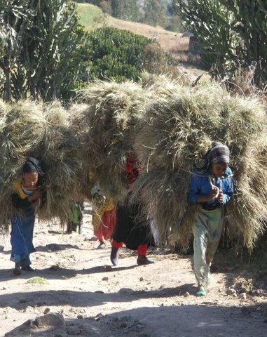
Cut and carry grazing system (alternatively called zero grazing) is an approach where the community is consulted to identify and agree on areas to be closed and protected from free grazing; establish user groups are established to share the fodder biomass harvested from communal closed areas equitably; they utilize tree/shrub …
- 编制者: Gizaw Desta Gessesse
2. SLM技术的说明
2.1 技术简介
技术定义:
Gully erosion management is the application of combination of practices to control excess or concentrated runoff generation in the gully upstream catchment area, divert excess runoff upstream of gully heads and control further development of gully using appropriate structural and vegetative measures in the head, bed and sides of the gully and eventually convert into productive land through the consultation and involvement of local community.
2.2 技术的详细说明
说明:
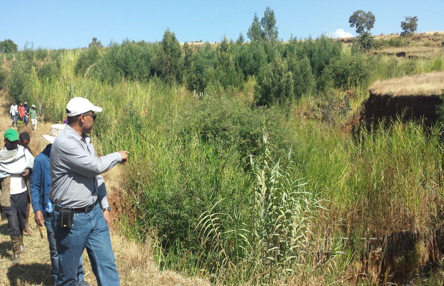
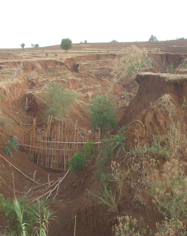
Gully erosion occurs on cultivated and grazing/pasture lands. Gully erosion management is a practice aimed to rehabilitate and protect further development of gullies and change into productive land. It involves both runoff management and erosion control activities. Gully management and treatment is different at upstream catchment area, gully head and gully section. Proper land management practices and slope treatment measures such as terraces, infiltration ditches and grass or shrub hedgerows are taking place on upstream catchment of the gully in order to reduce the rate of surface runoff. The excess runoff above the gully head is safely drained using cutoff drains into natural or properly vegetated waterways in order to reduce the surface water entering into the gully and protect the constructed physical and biological measures being washed away. Before treating gully sections, for the purpose of stability of structures and quick healing, the gully should be reshaped and planted with grass sod. Gully wall reshaping is cutting off steep slopes of active gully flanks in to gentle slope of minimum at 45% slope, up to two-third of the total depth of the gully and constructing small trenches along contours for re-vegetating slanted part of the gully walls and beds. If the gully is wide and has meandering nature with huge accumulation of runoff flowing down, it requires constructing of retaining walls, to protect displaced (not yet stabilized) soils and soil materials and the sidewalls of the reshaped gully. Stabilization of gully sections involves the use of structural and vegetative measures in the head, floor and side of the gully. The construction of physical structures inside the gully section is followed by establishment of biological measures.
Purposes of gully erosion management are: 1) rehabilitate the land damaged due to gully erosion, 2) prevent further expansion and development of gully erosion, and 3) convert the land lost by gully erosion to productive land.
Gully erosion management begins with assessment and mapping of gully erosion that helps to have an overview of erosion, to document extent of damage, to identify the nature and causes of gully formation, and gives relevant information to design appropriate measures. At establishment stage, gully management requires: catchment treatment using different land treatment measures; runoff diversion by cutoff drain; and stabilization of gully sections by physical structures and vegetative measures. Stones for the construction of terraces, cutoff drains and waterways are required. Depending on the nature of gully and available material for construction, either stones, sand bags, brush woods, bamboo mat, gabion or concrete (sand, gravel and cement) are needed for constructing check-dams in a gully section. Different tree/shrub seedlings, grass cuttings, and seedlings of fruit trees are required to reinforce and stabilize the gully sections. The respective labor requirement for stone collection, construction of retaining wall, and gully reshaping is 0.5m3/person day, 5m/person day, and 1m3/person day. Approximately 0.25, 0.50, 0.50, 0.50 , and 1.0 m3/person day is required to construct gabion, loose stone, arc weir, sand bag, and bamboo mat check-dams respectively. About 3.0 m/person day is needed to construct brushwood check dams. The treated gullies should be checked regularly. The maintenance requirement is closely monitored and immediate repair is essential to avoid further damage and eventual collapse of structures. The inputs important for maintenance include stones or other materials for check dams, seedlings to replant areas covered with non-survived seedlings.
Gully erosion is prevalent in areas where excess runoff occurs in high rainfall areas associated with moderate to high erodible soils. It occurs in range of wet highland to moist Kolla areas where annual rainfall exceeds 900mm. Its occurrence is more frequent in heavy clay soils (Vertisols) characterized by low infiltration and in clay soils (like Nitosols) characterized by low organic matter. Often, gully formation occurs on overgrazed pasture lands and inappropriately managed crop lands. Gully erosion control requires mobilization of high input or materials and labor. Larger gullies need to be rehabilitated and treated through community labor mobilization. Subsequent maintenance activities, monitoring and benefit sharing should be made by the user groups who are entitled to utilize the benefits.
The living condition depends on subsistence crop-livestock mixed farming. On average households have 5-6 family size. Crop production is meant for home consumption with small surplus for local market. The services related to water supply, energy supply, and infrastructure are low. Besides it is an asset, animals often used to cope shocks during drought periods.
2.3 技术照片
2.5 已应用该技术的、本评估所涵盖的国家/地区/地点
国家:
埃塞俄比亚
区域/州/省:
Amhara National Regional State (ANRS)
有关地点的进一步说明:
Dembecha/Mecha/Yilmana Densa
具体说明该技术的分布:
- 均匀地分布在一个区域
如果不知道精确的区域,请注明大致覆盖的区域:
- 10-100 平方千米
2.6 实施日期
如果不知道确切的年份,请说明大概的日期:
- 不到10年前(最近)
2.7 技术介绍
详细说明该技术是如何引入的:
- 在实验/研究期间
- 通过项目/外部干预
注释(项目类型等):
Since gully erosion management requires combination of practices, many actors mainly research, local development actors, community, and project are involved in the development of the technology
3. SLM技术的分类
3.1 该技术的主要目的
- 减少、预防、恢复土地退化
3.2 应用该技术的当前土地利用类型

农田
- 一年一作
- 多年一作(非木材)
- Elphant grass, Sudan grass
每年的生长季节数:
- 1
具体说明:
Longest growing period in days: 220, Longest growing period from month to month: May to December; Second longest growing period in days: 180, Second longest growing period from month to month: June to November

牧场
粗放式放牧:
- 半游牧畜牧业
集约放牧/饲料生产:
- 收割和携带/零放牧
- free grazing

森林/林地
- Susbania sesban, Acacia decurrence, treelucern, Acacia saligna
产品和服务:
- 木材
- 薪材
注释:
Livestock density (if relevant):
> 100 LU /km2
Major land use problems (compiler’s opinion): Land degradation due to different forms of soil erosion and nutrient depletion, overgrazing, shortage of pasture lands and its low productivity, excessive and inappropriate construction of traditional ditches, and increased pressure on trees for the purpose of fuel wood and timber.
Major land use problems (land users’ perception): Soil erosion and soil nutrient depletion, shortage of cultivated land, shortage of grazing land and wood for fuel wood
The type of grazing is often free grazing on communal grazing lands/pasture, supplemented with crop residues and zero grazing combined with improved forages
3.4 供水
该技术所应用土地的供水:
- 雨养
3.5 该技术所属的SLM组
- 区域封闭(停止使用,支持恢复)
3.6 包含该技术的可持续土地管理措施

植物措施
- V1:乔木和灌木覆盖层
- V2:草和多年生草本植物

结构措施
- S2:堤、岸
- S3:分级沟渠、渠道、水道
- S4:平沟、坑
- S6:墙、障碍物、栅栏、围墙
- S11:其它
注释:
Type of vegetative measures: aligned: -contour, aligned: -along boundary
3.7 该技术强调的主要土地退化类型

土壤水蚀
- Wg:冲沟侵蚀/沟蚀
- Wo:场外劣化效应

生物性退化
- Bc:植被覆盖的减少
注释:
Main causes of degradation: deforestation / removal of natural vegetation (incl. forest fires), over-exploitation of vegetation for domestic use, overgrazing, Heavy / extreme rainfall (intensity/amounts), population pressure
Secondary causes of degradation: soil management, crop management (annual, perennial, tree/shrub), urbanisation and infrastructure development (Urbanization and infrastructure development induced excessive compaction, unprotected drainage systems and lead to gully formation), floods, land tenure (Land under undefined or communal use of grazing lands are subject to mismanagement that result in gully formation), poverty / wealth
3.8 防止、减少或恢复土地退化
具体数量名该技术与土地退化有关的目标:
- 减少土地退化
- 修复/恢复严重退化的土地
4. 技术规范、实施活动、投入和成本
4.1 该技术的技术图纸
技术规范(与技术图纸相关):
A reshaped gully section treated with an integrated gully control measures including check dams made of loose stone and wooden and vegetative tree/shrub and grass hedgerows planted on the sides of gullies.
Location: Debre Mewi Learning Watershed. Yilmana Densa/West Gojam/Amhara Region
Date: 6/27/2016
Technical knowledge required for field staff / advisors: high (It requires knowledge of peak runoff and runoff management and skills to integrate different measures)
Technical knowledge required for land users: high (It needs skills to construct physical measures, and regular monitoring and maintenance of practices. The users must know and understand the growth nature and harvesting stage tree/shrub, grass species)
Main technical functions: control of concentrated runoff: impede / retard, control of concentrated runoff: drain / divert, reduction of slope angle
Secondary technical functions: reduction of slope length, improvement of ground cover, stabilisation of soil (eg by tree roots against land slides), increase of infiltration
Aligned: -contour
Vegetative material: T : trees / shrubs, G : grass
Number of plants per (ha): 2600
Spacing between rows / strips / blocks (m): 2-3
Vertical interval within rows / strips / blocks (m): 0.5-1.0
Width within rows / strips / blocks (m): 0.5
Aligned: -graded strips
Vegetative material: T : trees / shrubs
Aligned: -along boundary
Number of plants per (ha): 200
Vertical interval within rows / strips / blocks (m): 1
Width within rows / strips / blocks (m): 1
In blocks
Vegetative material: T : trees / shrubs
Vegetative measure: Alinged along side wall of gully
Vegetative material: T : trees / shrubs
Number of plants per (ha): 6800
Spacing between rows / strips / blocks (m): 2-3.0
Vertical interval within rows / strips / blocks (m): 0.5-1.0
Width within rows / strips / blocks (m): 0.5
Vegetative measure: Aligned along side wall of gully
Vegetative material: T : trees / shrubs
Number of plants per (ha): 4800
Spacing between rows / strips / blocks (m): 2-3.0
Vertical interval within rows / strips / blocks (m): 0.5
Width within rows / strips / blocks (m): 0.5
Vegetative measure: Vegetative material: T : trees / shrubs
Trees/ shrubs species: Susbania sesban, Acacia decurrence, treelucern, Acacia saligna
Grass species: Elphant grass, Sudan grass
Slope (which determines the spacing indicated above): 20-30%%
If the original slope has changed as a result of the Technology, the slope today is (see figure below): 18-25%%
Gradient along the rows / strips: 0.5%
Diversion ditch/ drainage
Depth of ditches/pits/dams (m): 0.3-0.7
Width of ditches/pits/dams (m): 1.2-2.8
Length of ditches/pits/dams (m): 100-250
Waterway
Depth of ditches/pits/dams (m): 0.3
Width of ditches/pits/dams (m): 1.5-2.0
Structural measure: Check dams
Vertical interval between structures (m): 1
Spacing between structures (m): 10-15
Height of bunds/banks/others (m): 1-1.5
Width of bunds/banks/others (m): 1.5-3.5
Construction material (earth): Excavated soil
Construction material (stone): Loose stones for check dam
Construction material (wood): Brush wood for check dam
Slope (which determines the spacing indicated above): 10-18%
If the original slope has changed as a result of the Technology, the slope today is: 8-12%
Vegetation is used for stabilisation of structures.
作者:
MOA, 2005, Water and Land Resource Center
4.2 有关投入和成本计算的一般信息
其它/国家货币(具体说明):
ETB
如相关,注明美元与当地货币的汇率(例如1美元=79.9巴西雷亚尔):1美元=:
20.0
注明雇用劳工的每日平均工资成本:
2.50
4.3 技术建立活动
| 活动 | 时间(季度) | |
|---|---|---|
| 1. | Seedling preparation | January-June |
| 2. | Seedling Transportation | June-July |
| 3. | Grass split transportation | June -July |
| 4. | Plantation of biological measures inside the gully | July |
| 5. | Surveying | Dry season |
| 6. | Reshaping of gully | Dry season |
| 7. | Construction of cutoff drains | Dry season |
| 8. | Construction of waterways | Dry season |
| 9. | Construction of stone check dams | Dry season |
4.4 技术建立所需要的费用和投入
| 对投入进行具体说明 | 单位 | 数量 | 单位成本 | 每项投入的总成本 | 土地使用者承担的成本% | |
|---|---|---|---|---|---|---|
| 劳动力 | labour | ha | 1.0 | 8319.0 | 8319.0 | 99.0 |
| 设备 | animal traction | ha | 1.0 | 9.0 | 9.0 | 100.0 |
| 设备 | tools | ha | 1.0 | 901.8 | 901.8 | 50.0 |
| 植物材料 | grass | ha | 1.0 | 20.0 | 20.0 | |
| 植物材料 | seeds | ha | 1.0 | 24.0 | 24.0 | |
| 植物材料 | seedlings | ha | 1.0 | 63.45 | 63.45 | |
| 肥料和杀菌剂 | compost/manure | ha | 1.0 | 15.86 | 15.86 | |
| 施工材料 | stone | ha | 1.0 | 1405.0 | 1405.0 | 91.0 |
| 施工材料 | wood | ha | 1.0 | 27.6 | 27.6 | |
| 施工材料 | earth | ha | 1.0 | 91.2 | 91.2 | |
| 技术建立所需总成本 | 10876.91 | |||||
| 技术建立总成本,美元 | 543.85 | |||||
注释:
Duration of establishment phase: 15 month(s)
4.5 维护/经常性活动
| 活动 | 时间/频率 | |
|---|---|---|
| 1. | Seedling preparation | January-June |
| 2. | Seedling and grass split transportation | July |
| 3. | Replanting seedlings and grass splits | July |
| 4. | Maintenance of cutoff drains/waterways | Dry season (Jan-Apr) |
| 5. | Maintenance of check dams | Dry season (Jan-Apr) |
4.6 维护/经常性活动所需要的费用和投入(每年)
| 对投入进行具体说明 | 单位 | 数量 | 单位成本 | 每项投入的总成本 | 土地使用者承担的成本% | |
|---|---|---|---|---|---|---|
| 劳动力 | labour | ha | 1.0 | 902.0 | 902.0 | 67.0 |
| 设备 | animal traction | ha | 1.0 | 4.5 | 4.5 | |
| 植物材料 | grass | ha | 1.0 | 10.3 | 10.3 | |
| 植物材料 | seedlings | ha | 1.0 | 33.0 | 33.0 | |
| 肥料和杀菌剂 | compost/manure | ha | 1.0 | 8.5 | 8.5 | |
| 施工材料 | stone | ha | 1.0 | 50.0 | 50.0 | 41.0 |
| 施工材料 | wood | ha | 1.0 | 14.4 | 14.4 | |
| 施工材料 | earth | ha | 1.0 | 45.6 | 45.6 | |
| 技术维护所需总成本 | 1068.3 | |||||
| 技术维护总成本,美元 | 53.41 | |||||
注释:
The costs are calculated on hectare basis
4.7 影响成本的最重要因素
描述影响成本的最决定性因素:
The costs for gully erosion management is dependent upon labor, material and transport costs, workability of the soil and maintenance costs.
5. 自然和人文环境
5.1 气候
年降雨量
- < 250毫米
- 251-500毫米
- 501-750毫米
- 751-1,000毫米
- 1,001-1,500毫米
- 1,501-2,000毫米
- 2,001-3,000毫米
- 3,001-4,000毫米
- > 4,000毫米
有关降雨的规范/注释:
Monsoon, 5-6 months rain and 6-7 dry months
农业气候带
- 半湿润
Thermal climate class: subtropics. The lowest temperature is above 5°C but below 18°C between November to January
5.2 地形
平均坡度:
- 水平(0-2%)
- 缓降(3-5%)
- 平缓(6-10%)
- 滚坡(11-15%)
- 崎岖(16-30%)
- 陡峭(31-60%)
- 非常陡峭(>60%)
地形:
- 高原/平原
- 山脊
- 山坡
- 山地斜坡
- 麓坡
- 谷底
垂直分布带:
- 0-100 m a.s.l.
- 101-500 m a.s.l.
- 501-1,000 m a.s.l.
- 1,001-1,500 m a.s.l.
- 1,501-2,000 m a.s.l.
- 2,001-2,500 m a.s.l.
- 2,501-3,000 m a.s.l.
- 3,001-4,000 m a.s.l.
- > 4,000 m a.s.l.
5.3 土壤
平均土层深度:
- 非常浅(0-20厘米)
- 浅(21-50厘米)
- 中等深度(51-80厘米)
- 深(81-120厘米)
- 非常深(> 120厘米)
土壤质地(表土):
- 中粒(壤土、粉土)
- 细粒/重质(粘土)
表土有机质:
- 中(1-3%)
- 低(<1%)
5.4 水资源可用性和质量
地下水位表:
5-50米
地表水的可用性:
中等
水质(未处理):
不良饮用水(需要处理)
5.5 生物多样性
物种多样性:
- 低
5.6 应用该技术的土地使用者的特征
生产系统的市场定位:
- 生计(自给)
非农收入:
- 低于全部收入的10%
相对财富水平:
- 平均水平
个人或集体:
- 团体/社区
机械化水平:
- 手工作业
- 畜力牵引
性别:
- 女人
- 男人
说明土地使用者的其他有关特征:
Land users applying the Technology are mainly common / average land users
Difference in the involvement of women and men: Women are involved in collecting stones and assisting men on heavy works
Population density: 200-500 persons/km2
Annual population growth: 2% - 3%
80% of the land users are average wealthy.
20% of the land users are poor.
Some land users involve in seasonal labor in towns and sell charcoal
5.7 应用该技术的土地使用者使用的平均土地面积
- < 0.5 公顷
- 0.5-1 公顷
- 1-2 公顷
- 2-5公顷
- 5-15公顷
- 15-50公顷
- 50-100公顷
- 100-500公顷
- 500-1,000公顷
- 1,000-10,000公顷
- > 10,000公顷
这被认为是小规模、中规模还是大规模的(参照当地实际情况)?:
- 小规模的
5.8 土地所有权、土地使用权和水使用权
土地所有权:
- 州
用水权:
- 自由进入(无组织)
- 社区(有组织)
注释:
Land use rights on crop land is individual while on grazing lands it is communal either unorganized or organized in some cases. Water is open accessible in most cases except organized communal utilization for some developed drinking water sources.
5.9 进入服务和基础设施的通道
健康:
- 贫瘠
- 适度的
- 好
教育:
- 贫瘠
- 适度的
- 好
技术援助:
- 贫瘠
- 适度的
- 好
就业(例如非农):
- 贫瘠
- 适度的
- 好
市场:
- 贫瘠
- 适度的
- 好
能源:
- 贫瘠
- 适度的
- 好
道路和交通:
- 贫瘠
- 适度的
- 好
饮用水和卫生设施:
- 贫瘠
- 适度的
- 好
金融服务:
- 贫瘠
- 适度的
- 好
6. 影响和结论性说明
6.1 该技术的现场影响
社会经济效应
生产
饲料生产
注释/具体说明:
Gullies are treated for purpose of improved grass and legume fodder production like napier, susbania, local grasses
产品多样性
注释/具体说明:
Honey, fruits can be diversified under intensive gully development
收入和成本
收入来源的多样性
注释/具体说明:
High fodder biomass provide an opportunity to do fattening; sometimes used to grow fruits;
工作量
注释/具体说明:
Under low productive soil where recovery rate is slow, establishment and maintenance cost of labor is high
社会文化影响
社区机构
注释/具体说明:
Watershed committee and user groups are established
SLM/土地退化知识
注释/具体说明:
Awareness of the community on gully management increased
冲突缓解
注释/具体说明:
Gullies are stabilized and no more conflict
contribution to human well-being
注释/具体说明:
Land users are organized into user groups and harvest the biomass (grass and fodder) for livestock feed which result in increased livestock productivity. Some land users attempt to fatten cattle and gain benefit.
生态影响
水循环/径流
地表径流
注释/具体说明:
Significant reduction of damage due to runoff
多余水的排放
注释/具体说明:
Cutoff drains used to drain excess runoff upstream
地下水位/含水层
土壤
土壤覆盖层
注释/具体说明:
Plantation of gullies increase cover and biomass production
土壤流失
注释/具体说明:
Check dams significantly reduce the soil loss from gullies
生物多样性:植被、动物
生物量/地上C
6.2 该技术的场外影响已经显现
旱季稳定可靠的水流
注释/具体说明:
Stream size and duration has improved
下游淤积
对公共/私人基础设施的破坏
注释/具体说明:
Reduction of damage on houses
6.3 技术对渐变气候以及与气候相关的极端情况/灾害的暴露和敏感性(土地使用者认为的极端情况/灾害)
气候有关的极端情况(灾害)
气象灾害
| 该技术是如何应对的? | |
|---|---|
| 局地暴雨 | 不好 |
气候灾害
| 该技术是如何应对的? | |
|---|---|
| 干旱 | 好 |
水文灾害
| 该技术是如何应对的? | |
|---|---|
| 比较和缓的(河道)洪水 | 不好 |
注释:
Gully erosion management involves combination of biological and physical measures. Strong structural measures and upstream runoff management practices should be applied to tolerate flooding.
6.4 成本效益分析
技术收益与技术建立成本相比如何(从土地使用者的角度看)?
短期回报:
稍微积极
长期回报:
积极
技术收益与技术维护成本/经常性成本相比如何(从土地使用者的角度看)?
短期回报:
积极
长期回报:
非常积极
注释:
The short term economic benefits of management of gully erosion include grass and fodder production for livestock feed. While the long term benefits may include product diversification like fruit, fodder, and grass production.
6.5 技术采用
注释:
About 3-5% of the total area of watersheds are treated with gully management. Gullies formed on crop lands and communal grazing lands are management collectively by the community labor with external material support such as gabion and seedlings
Gully management is beyond the capacity of land users. So, they are often supported with seedlings and gabions for large gullies
There is a little trend towards spontaneous adoption of the Technology
Land users show interest and motivation by delineating gully damage areas and control free grazing. They also do fencing with external support for nails and seedlings.
6.7 该技术的优点/长处/机会
| 土地使用者眼中的长处/优势/机会 |
|---|
| It increases fodder production |
| It protects further expansion and damage of settlement areas and infrastructures |
| It increases the flow of streams |
| 编制者或其他关键资源人员认为的长处/优势/机会 |
|---|
| Gully erosion management provides an immediate fodder for cut-and-carry grazing system and encourages zero grazing |
| It controls erosion and sediment transport as well it increases stream flows to downstream and subsequently changed to productive area |
| It reduces conflict among adjacent land holders due to formation of gullies |
| It does not only reduce degradation but also stabilize the soil, water and vegetation system in the area |
| It increases the awareness level of farmers about land degradation and its causes |
6.8 技术的弱点/缺点/风险及其克服方法
| 土地使用者认为的弱点/缺点/风险 | 如何克服它们? |
|---|---|
| It is labor intensive and sometimes harbor rodents and pests | Apply traditional collective action mechanisms |
| 编制者或其他关键资源人员认为的弱点/缺点/风险 | 如何克服它们? |
|---|---|
| It requires high labor for regular monitoring and maintenance of structures and protect from damage by excessive runoff | Establish by laws and procedures for collective actions among the user groups |
7. 参考和链接
7.1 信息的方法/来源
- 实地考察、实地调查
- 与土地使用者的访谈
7.2 参考可用出版物
标题、作者、年份、ISBN:
Gully Rehabilitation: What Does it Costs to Heal Gullies and Make Productive? WLRC Brief No. 3. June 2015
可以从哪里获得?成本如何?
www.wlrc-eth.org
链接和模块
全部展开 全部收起链接

Community Organizations and Mobilization for Soil and Water … [埃塞俄比亚]
Community mobilization for soil and water conservation work in a watershed planning unit is an approach for collective action by organizing all active labor forces living in the kebele/peasant association into development group of 20-30 members and further divide into 1:5 work force to implement construction of soil and water …
- 编制者: Gizaw Desta Gessesse

'Cut and Carry' Grazing system or 'Zero Grazing' … [埃塞俄比亚]
Cut and carry grazing system (alternatively called zero grazing) is an approach where the community is consulted to identify and agree on areas to be closed and protected from free grazing; establish user groups are established to share the fodder biomass harvested from communal closed areas equitably; they utilize tree/shrub …
- 编制者: Gizaw Desta Gessesse
模块
无模块


