Eradication of Lantana Camara (invasive species) for Soil Rehabilitation on Private Land [印度]
- 创建:
- 更新:
- 编制者: Santosh Gupta
- 编辑者: Noel Templer, Stephanie Katsir, Kim Arora
- 审查者: Udo Höggel
Lantana (Ram Phool)
technologies_6660 - 印度
- Eradication of Lantana Camara (invasive species) for Soil Rehabilitation on Private Land: June 21, 2023 (inactive)
- Eradication of Lantana Camara (invasive species) for Soil Rehabilitation on Private Land: Sept. 14, 2023 (inactive)
- Eradication of Lantana Camara (invasive species) for Soil Rehabilitation on Private Land: April 11, 2024 (public)
查看章节
全部展开 全部收起1. 一般信息
1.2 参与该技术评估和文件编制的资源人员和机构的联系方式
有助于对技术进行记录/评估的机构名称(如相关)
GIZ India (GIZ India) - 印度有助于对技术进行记录/评估的机构名称(如相关)
Alliance Bioversity and International Center for Tropical Agriculture (Alliance Bioversity-CIAT) - 肯尼亚有助于对技术进行记录/评估的机构名称(如相关)
Ecociate Consultants (Ecociate Consultants) - 印度1.3 关于使用通过WOCAT记录的数据的条件
编制者和关键资源人员接受有关使用通过WOCAT记录数据的条件。:
是
1.4 所述技术的可持续性声明
这里所描述的技术在土地退化方面是否存在问题,导致无法被认为是一种可持续的土地管理技术?:
否
2. SLM技术的说明
2.1 技术简介
技术定义:
Lantana camara is an invasive species having severe ecological impacts on local biodiversity and economic impact on local communities. Lantana camara has proliferated in central India and occupied many forest lands, commons, and private land. The cut rootstock method provides minimum disturbance to the soil, wherein the plants' roots are cut three inches below the ground. It is followed by lifting the bush and keeping it upside down to prevent it from gaining ground.
2.2 技术的详细说明
说明:
Introduced as an ornamental plant to India in the 1800s, Lantana has infested the forests, grazing grounds, and farmlands. It has invaded over 13 million hectares, which is around 4% of the total land area of the country. In the context of Madhya Pradesh, the species has encroached on shared and remote villages’ lands along the fringes of protected areas such as the Kanha Tiger Reserve, impacting wildlife and local communities in multiple ways.
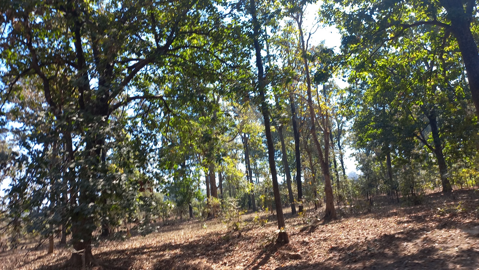
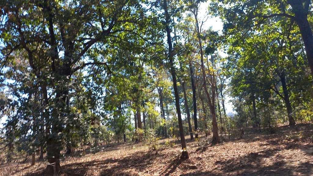
Tribals in the Kanha landscape generally inhabit upper catchments of rivers, usually having large portions of uplands as part of their landholdings. These lands have never attracted investments from land development projects. They used to cultivate millets (particularly Kodo and Kutki) every alternate year. Apart from this crop, the farmers collect tendu leaves (Diospyros Melanoxylon) from these lands every year. Keeping the soil quality in view, they take these crops every alternate year and in some cases, once in three years with a gap of two years. This gap of two years helps Lantana spread on private land.
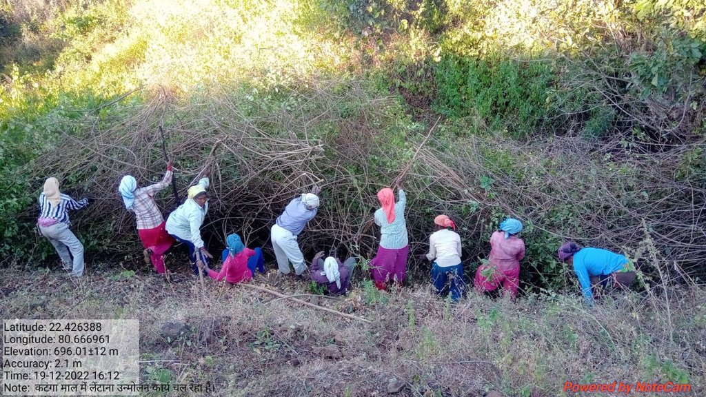
Traditional practices for controlling lantana camara are chopping the main stem, clipping aerial shoots, burning, and grubbing (total uprooting). These practices however, either led to vigorous regeneration of Lantana or were labor intensive. The cut rootstock method/technology applied under the project provides minimum disturbance to the soil, wherein the plants’ roots are cut three inches below the ground. It is followed by lifting the bush and keeping it upside down to prevent it from gaining ground.
The Foundation for Ecological Security (FES), an NGO located in India, has been working on the eradication of Lantana Camara from the commons land since 2010-11, however from the year 2016-17 onwards, with the support from GIZ, FES also started supporting village institution in eradicating Lantana from private upland. Significant activities are undertaken for the eradication of Lantana and as shown hereunder:
A. Improving community governance mechanism; local communities were engaged by ensuring that the village executive committee took the Gram Sabha (Village Governing Body) into confidence and prepared the by-laws to conserve the lantana-eradicated site. Rules and regulations were framed for the uprooting of the Lantana, its payment process, and usages of the uprooted Lantana for fencing the plot, preparation of biochar, or other usages providing ecological benefits.
B. Adoption of the ‘cut rootstock method’ for the uprooting of Lantana; removing Lantana is tricky because methods such as burning, haphazard uprooting, or cutting result in the recurrence of the species.
C. Appropriate measures were taken to minimize the recurrence of Lantana seeds through regular monitoring and plantation of grass seeds and other plants.
D. Grass seed sowing; with the active support of the village institution, the collection of indigenous grass species was done. Before the advent of the monsoon, the community prepared the grass seed ball and sowed it in the plot. A seed ball helps the seed to protect it from insects, birds, and runoff. In the rainy season, these grass seeds germinate and grow. With the grasses coming, the lantana seeds do not get a suitable environment to germinate and grow.
Eradication of Lantana from the private lands helps the communities access their lands. This has resulted in the cultivation of millets on the same land, which was otherwise left fallow for so many years.
2.3 技术照片
2.5 已应用该技术的、本评估所涵盖的国家/地区/地点
国家:
印度
区域/州/省:
Madhya Pradesh
有关地点的进一步说明:
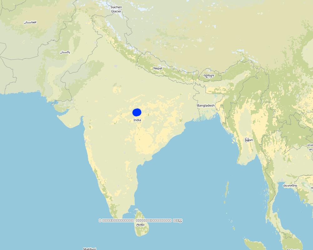
Mandla
具体说明该技术的分布:
- 适用于特定场所/集中在较小区域
技术现场是否位于永久保护区?:
否
Map
×2.6 实施日期
注明实施年份:
2015
2.7 技术介绍
详细说明该技术是如何引入的:
- 在实验/研究期间
- 通过项目/外部干预
注释(项目类型等):
FES has done extensive research and studies to find out the appropriate technologies and approaches to remove the lantana
3. SLM技术的分类
3.1 该技术的主要目的
- 减少、预防、恢复土地退化
- 保护生态系统
- 保持/提高生物多样性
- 创造有益的经济影响
3.2 应用该技术的当前土地利用类型
同一土地单元内混合使用的土地::
是
具体说明混合土地使用(作物/放牧/树木):
- 农林业

农田
- 一年一作
年作 - 具体指明作物:
- 谷类 - 小米
年作制度:
休耕 - 玉米/高粱/谷子
每年的生长季节数:
- 1
采用间作制度了吗?:
否
采用轮作制度了吗?:
是
如果是,请具体说明:
Maize-Sorghum-Millet-Fallow

牧场
粗放式放牧:
- 季节性迁移的放牧主义
集约放牧/饲料生产:
- 收割和携带/零放牧
动物类型:
- 牛 - 奶制品
是否实行作物与牲畜的综合管理?:
否
品种:
牛 - 奶制品
计数:
500

森林/林地
- (半天然)天然森林/林地
(半天然)天然森林/林地:具体说明管理类型:
- 清除枯木/剪枝
- 非木材森林的利用
(半)天然林类型:
- 北方针叶林天然植被
- Madhuca Indica
以上的树木是落叶树还是常绿树?:
- 混合落叶或常绿
产品和服务:
- 木材
- 薪材
- 水果和坚果
- 其它森林产品
- 放牧/啃牧
- 自然保持/保护
3.3 由于技术的实施,土地使用是否发生了变化?
由于技术的实施,土地使用是否发生了变化?:
- 是(请在技术实施前填写以下有关土地利用的问题)

不毛之地
具体说明:
The land was not cultivated by the farmers due to high density of lantana.
3.4 供水
该技术所应用土地的供水:
- 雨养
3.5 该技术所属的SLM组
- 农业林学
- 土壤肥力综合管理
3.6 包含该技术的可持续土地管理措施

植物措施
- V3:植被的清理
- V4:更换或清除外来/入侵物种

管理措施
- M1:改变土地使用类型
3.7 该技术强调的主要土地退化类型

化学性土壤退化
- Ca:酸化

生物性退化
- Bf:火灾的有害影响
- Bs:质量和物种组成/多样性的下降
- Bl:土壤寿命损失
3.8 防止、减少或恢复土地退化
具体数量名该技术与土地退化有关的目标:
- 减少土地退化
4. 技术规范、实施活动、投入和成本
4.1 该技术的技术图纸
技术规范(与技术图纸相关):
Drawing covering the landscape of private land where Lantana eradication was carried out. The drawing indicates the before and after situation with a change in the land profile. It can be seen that before the eradication land was covered with a thick cover of Lantana while after the eradication, land has plants and grass. The drawing also shows the slopes of the land under treatment.
作者:
Payal
日期:
09/03/2023
4.2 有关投入和成本计算的一般信息
具体说明成本和投入是如何计算的:
- 每个技术区域
注明尺寸和面积单位:
1 hectare
其它/国家货币(具体说明):
INR
如相关,注明美元与当地货币的汇率(例如1美元=79.9巴西雷亚尔):1美元=:
80.0
注明雇用劳工的每日平均工资成本:
204
4.3 技术建立活动
注释:
No establishment cost is involved in this activity.
4.5 维护/经常性活动
注释:
No maintenance cost. Only one-time cost in the case of private land.
4.6 维护/经常性活动所需要的费用和投入(每年)
| 对投入进行具体说明 | 单位 | 数量 | 单位成本 | 每项投入的总成本 | 土地使用者承担的成本% | |
|---|---|---|---|---|---|---|
| 劳动力 | Removal of lantana | ha | 1.0 | 7229.0 | 7229.0 | 16.0 |
| 技术维护所需总成本 | 7229.0 | |||||
| 技术维护总成本,美元 | 90.36 | |||||
如果土地使用者负担的费用少于100%,请注明由谁负担其余费用:
The remaning cost is being covered by the project funds routed through community participation.
注释:
The cost varies based on the density of lantana in the field. Depending on density, it varies from Rs 7729 per ha to Rs 2808 per ha.
4.7 影响成本的最重要因素
描述影响成本的最决定性因素:
The density of lantana in the field is categorized into 3: more than 1500 bushes are considered high density, and between 500-1500 are considered moderately dense, while less than 500 is known as lowly dense.
5. 自然和人文环境
5.1 气候
年降雨量
- < 250毫米
- 251-500毫米
- 501-750毫米
- 751-1,000毫米
- 1,001-1,500毫米
- 1,501-2,000毫米
- 2,001-3,000毫米
- 3,001-4,000毫米
- > 4,000毫米
指定年平均降雨量(若已知),单位为mm:
1427.00
有关降雨的规范/注释:
Monsoon season is June-September which has the majority of the rainfall
注明所考虑的参考气象站名称:
Mandla, Madhya Pradesh
农业气候带
- 半干旱
5.2 地形
平均坡度:
- 水平(0-2%)
- 缓降(3-5%)
- 平缓(6-10%)
- 滚坡(11-15%)
- 崎岖(16-30%)
- 陡峭(31-60%)
- 非常陡峭(>60%)
地形:
- 高原/平原
- 山脊
- 山坡
- 山地斜坡
- 麓坡
- 谷底
垂直分布带:
- 0-100 m a.s.l.
- 101-500 m a.s.l.
- 501-1,000 m a.s.l.
- 1,001-1,500 m a.s.l.
- 1,501-2,000 m a.s.l.
- 2,001-2,500 m a.s.l.
- 2,501-3,000 m a.s.l.
- 3,001-4,000 m a.s.l.
- > 4,000 m a.s.l.
说明该技术是否专门应用于:
- 不相关
关于地形的注释和进一步规范:
The topography of the project area consists of undulated terrain, hilly areas and forest areas
5.3 土壤
平均土层深度:
- 非常浅(0-20厘米)
- 浅(21-50厘米)
- 中等深度(51-80厘米)
- 深(81-120厘米)
- 非常深(> 120厘米)
土壤质地(表土):
- 粗粒/轻(砂质)
- 中粒(壤土、粉土)
土壤质地(地表以下> 20厘米):
- 中粒(壤土、粉土)
表土有机质:
- 低(<1%)
5.4 水资源可用性和质量
地下水位表:
> 50米
地表水的可用性:
中等
水质(未处理):
不良饮用水(需要处理)
水质请参考::
地下水和地表水
水的盐度有问题吗?:
否
该区域正在发生洪水吗?:
否
关于水质和水量的注释和进一步规范:
The locations have a river flowing close to the area; however, access to the surface and sub-surface water is a primary concern.
5.5 生物多样性
物种多样性:
- 高
栖息地多样性:
- 高
关于生物多样性的注释和进一步规范:
The area is surrounded by Kasha National Park and Phen Wildlife Sanctuary, with a good presence of forest area. Thus biodiversity is outstanding.
5.6 应用该技术的土地使用者的特征
定栖或游牧:
- 定栖的
生产系统的市场定位:
- 混合(生计/商业)
非农收入:
- > 收入的50%
相对财富水平:
- 贫瘠
个人或集体:
- 团体/社区
机械化水平:
- 手工作业
- 畜力牵引
性别:
- 女人
- 男人
土地使用者的年龄:
- 青年人
- 中年人
5.7 应用该技术的土地使用者使用的平均土地面积
- < 0.5 公顷
- 0.5-1 公顷
- 1-2 公顷
- 2-5公顷
- 5-15公顷
- 15-50公顷
- 50-100公顷
- 100-500公顷
- 500-1,000公顷
- 1,000-10,000公顷
- > 10,000公顷
这被认为是小规模、中规模还是大规模的(参照当地实际情况)?:
- 小规模的
5.8 土地所有权、土地使用权和水使用权
土地所有权:
- 个人,有命名
土地使用权:
- 个人
用水权:
- 社区(有组织)
- 个人
土地使用权是否基于传统的法律制度?:
是
具体说明:
The concerned authorities have issued landowners the land certificates.
5.9 进入服务和基础设施的通道
健康:
- 贫瘠
- 适度的
- 好
教育:
- 贫瘠
- 适度的
- 好
技术援助:
- 贫瘠
- 适度的
- 好
就业(例如非农):
- 贫瘠
- 适度的
- 好
市场:
- 贫瘠
- 适度的
- 好
能源:
- 贫瘠
- 适度的
- 好
道路和交通:
- 贫瘠
- 适度的
- 好
饮用水和卫生设施:
- 贫瘠
- 适度的
- 好
金融服务:
- 贫瘠
- 适度的
- 好
6. 影响和结论性说明
6.1 该技术的现场影响
社会经济效应
生产
作物生产
SLM之前的数量:
242 kg per ha
SLM之后的数量:
350 kg per ha
注释/具体说明:
These are the estimated figures
饲料生产
森林/林地质量
生产区域
水资源可用性和质量
饮用水的可用性
家畜用水的可用性
收入和成本
农业收入
收入来源的多样性
社会文化影响
食品安全/自给自足
社区机构
SLM/土地退化知识
社会经济弱势群体的情况
生态影响
土壤
土壤水分
土壤覆盖层
土壤流失
土壤结壳/密封
养分循环/补给
土壤有机物/地下C
生物多样性:植被、动物
植被覆盖
植物多样性
外来入侵物种
有益物种
栖息地多样性
对现场影响的评估(测量)进行具体说明:
Measurement of quantities required a very detailed study, which is not available at this point of time. Hence, many ratings given above are based on estimates.
6.2 该技术的场外影响已经显现
水资源可用性
注释/具体说明:
Increasing soil moisture in the uplands will help improve water availability in the lowlands
缓冲/过滤能力
6.4 成本效益分析
技术收益与技术建立成本相比如何(从土地使用者的角度看)?
短期回报:
非常积极
长期回报:
非常积极
技术收益与技术维护成本/经常性成本相比如何(从土地使用者的角度看)?
短期回报:
积极
长期回报:
非常积极
注释:
Short- and long-term benefits are pretty high compared to the cost involved.
6.5 技术采用
- 1-10%
如若可行,进行量化(住户数量和/或覆盖面积):
1000 hectares
在所有采用这项技术的人当中,有多少人是自发的,即未获得任何物质奖励/付款?:
- 11-50%
6.6 适应
最近是否对该技术进行了修改以适应不断变化的条件?:
否
6.7 该技术的优点/长处/机会
| 土地使用者眼中的长处/优势/机会 |
|---|
| 1. Availability of additional land for cultivation of other crops such as Millets on upland |
| 2. Improved land for fodder cultivation |
| 3. Reduced losses due to animal attacks on the standing crops as animals are now not finding the space to hide |
| 编制者或其他关键资源人员认为的长处/优势/机会 |
|---|
| Reduced human-animal conflict will lead to productivity gains for both forest dwellers and wild animals |
| Available land will be used for millet cultivation, which is rich in nutrition and well-suited to the local ecological conditions. The requirement for water is also very minimal for these crops. |
| This will also improve local biodiversity as farmers will now grow more plant varieties suitable for climatic conditions. |
6.8 技术的弱点/缺点/风险及其克服方法
| 编制者或其他关键资源人员认为的弱点/缺点/风险 | 如何克服它们? |
|---|---|
| Cultivation of crops using chemical pesticides and fertilizers may have a negative impact on both soil and the environment | Training and handholding of the farmers around the natural and sustainable farming practices |
7. 参考和链接
7.1 信息的方法/来源
- 实地考察、实地调查
2
- 与土地使用者的访谈
5
- 与SLM专业人员/专家的访谈
1
- 根据报告和其他现有文档进行编译
4
(现场)数据是什么时候汇编的?:
21/02/2023
7.2 参考可用出版物
标题、作者、年份、ISBN:
FES internal documents prepared during the year 2021-22
可以从哪里获得?成本如何?
Internal documents
链接和模块
全部展开 全部收起链接
无链接
模块
无模块


