Tree Plantation Pits in Arid Zones [沙特阿拉伯]
- 创建:
- 更新:
- 编制者: Eric Lacroix
- 编辑者: –
- 审查者: William Critchley, Rima Mekdaschi Studer
Plantation pits
technologies_7380 - 沙特阿拉伯
查看章节
全部展开 全部收起1. 一般信息
1.2 参与该技术评估和文件编制的资源人员和机构的联系方式
土地使用者:
Al Eissa Abdullah
NCVC
沙特阿拉伯
co-compiler:
co-compiler:
SLM专业人员:
Boudi Dr. Nabeel
FAO
沙特阿拉伯
有助于对技术进行记录/评估的项目名称(如相关)
Sustainable Rural Agricultural Development Programme (UTF/SAU/051/SAU) (SRAD Saudi Arabia)有助于对技术进行记录/评估的机构名称(如相关)
FAO Saudi Arabia (FAO KSA)1.3 关于使用通过WOCAT记录的数据的条件
编制者和关键资源人员接受有关使用通过WOCAT记录数据的条件。:
是
1.4 所述技术的可持续性声明
这里所描述的技术在土地退化方面是否存在问题,导致无法被认为是一种可持续的土地管理技术?:
否
注释:
This method allows sustainable plantations with a satisfactory level of success in hyper-arid zones (under 100 mm rainfall per year).
2. SLM技术的说明
2.1 技术简介
技术定义:
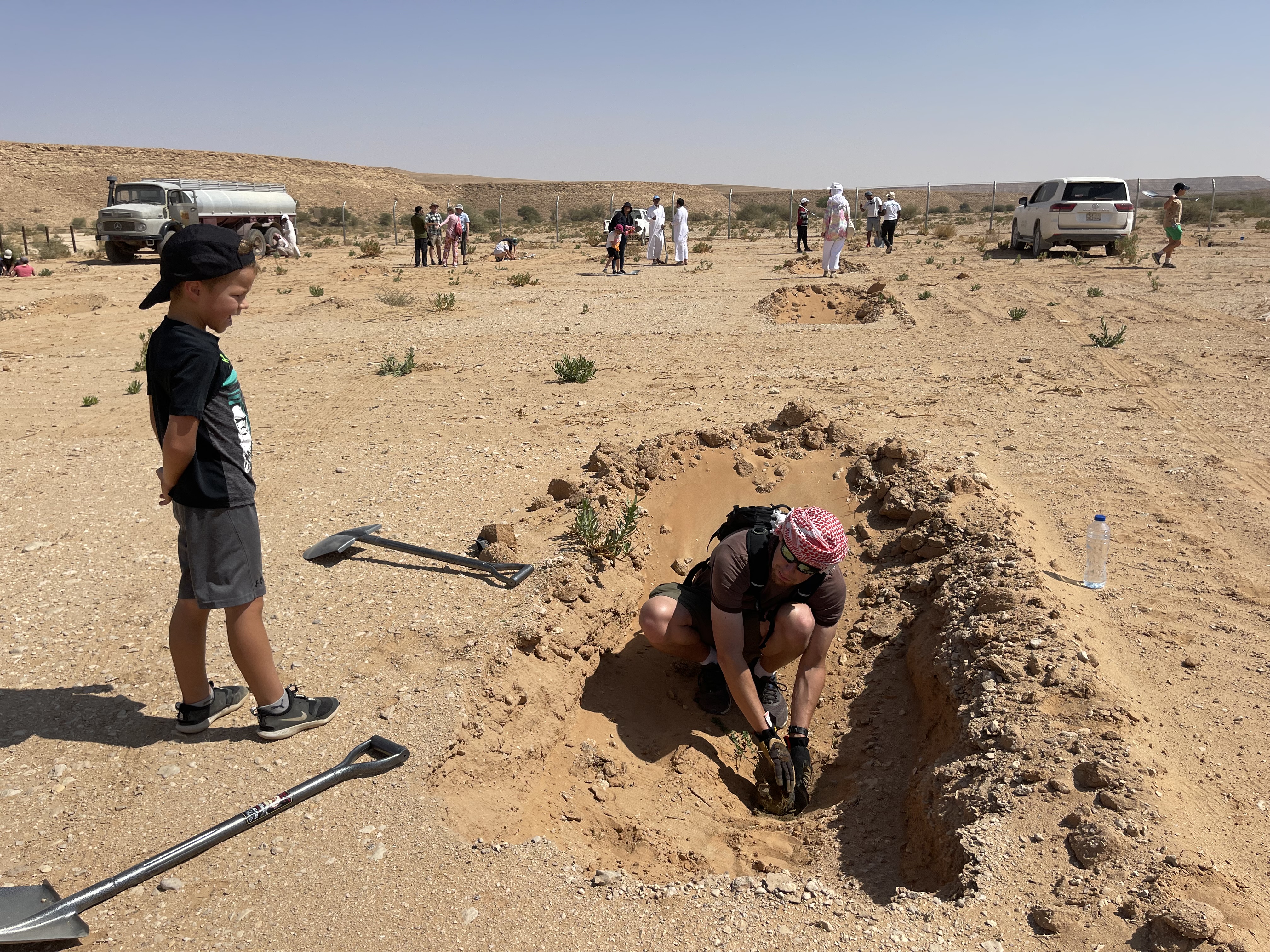
Tree plantation pits are water harvesting structures which capture rainfall runoff for trees and shrubs. They receive supplementary water until seedlings are well established. Species planted are indigenous, and provide both shade and honey.
2.2 技术的详细说明
说明:
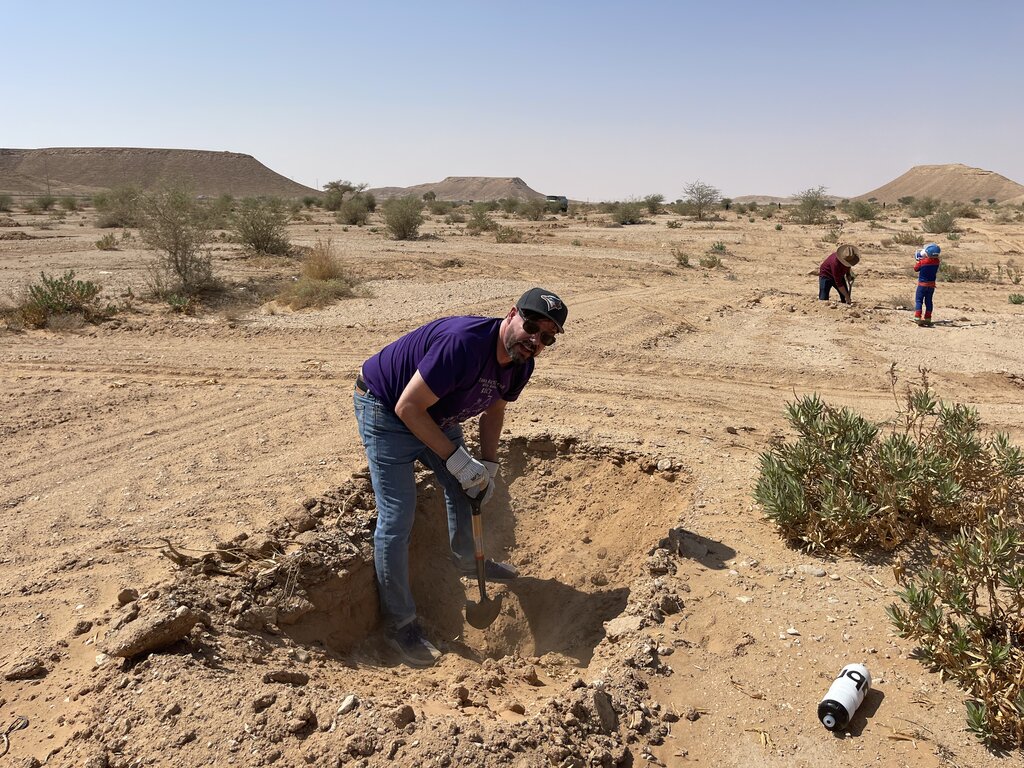
Plantation pits are water harvesting structures that capture rainfall runoff for planting trees and shrubs. They are given supplementary water until vegetation is established. The pits are dug within national parks managed by the National Centre for Vegetation Cover Development and Combating Desertification (NCVC), which is the leader in this technology.
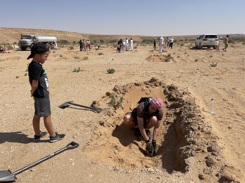
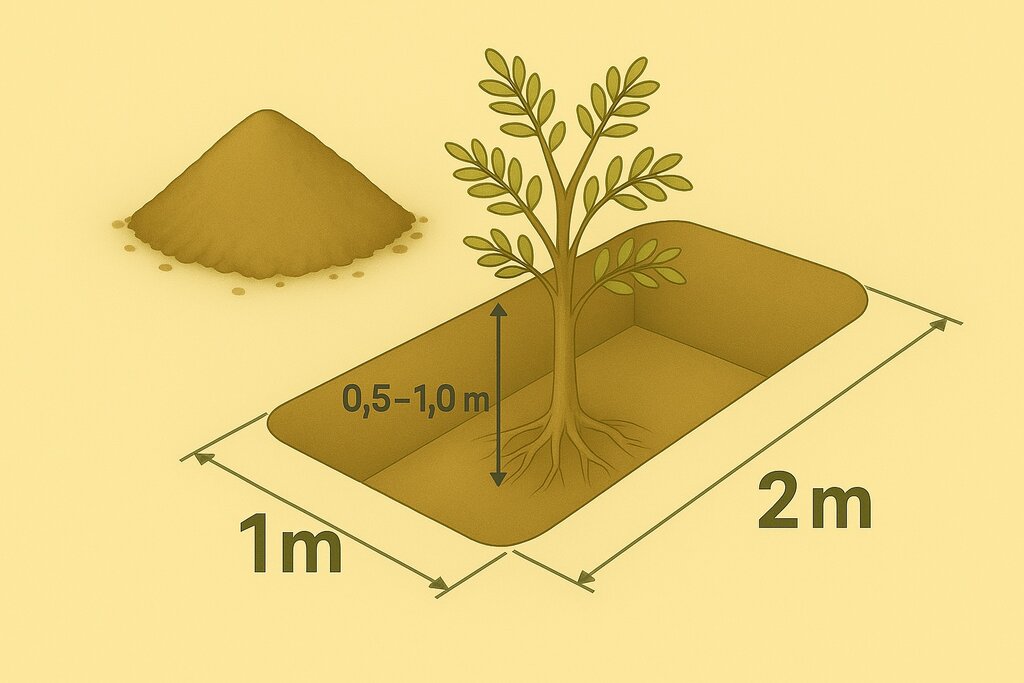
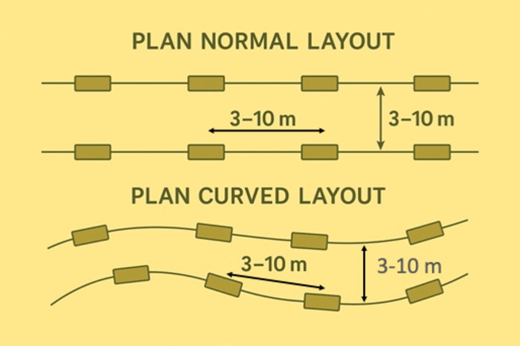
Pits may be located within wadis and sheyhib (small wadis), ranging in plots from ten to several hundred metres in length, and on high plateaux. The pits are often dug close to terraces and cross-wadi walls where runoff water is captured in the soil. Each plantation pit is rectangular, measuring (approx) 2m long, 1m wide, and up to 1m deep (depending on the depth of the soil). Spacing is from 3 to 10 metres between pits. The pits are excavated with mechanical diggers.
Pits are dug a year before planting, and they collect both runoff and the rich organic and mineral matter carried in the runoff. After one year, many annual and even perennial plants colonise the bottom of the pits. The trees and shrubs that are planted the most are Vachellia (Acacia) spp., Ziziphus spp. and Haxloylon spp. One (or two) seedlings are planted in the middle of each pit, without disturbing the existing vegetation as far as possible. These species attract bees, and beekeeping has been promoted alongside tree planting. Ziziphus honey is particularly high in value and Vachellia (acacia) honey is also good.
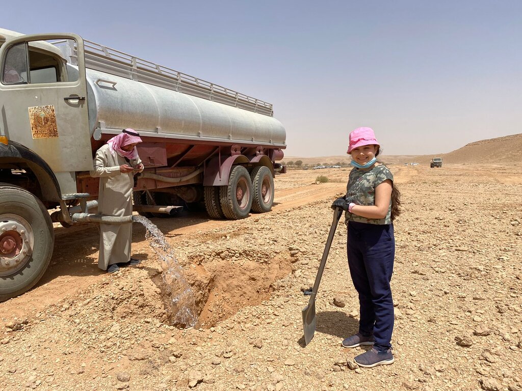
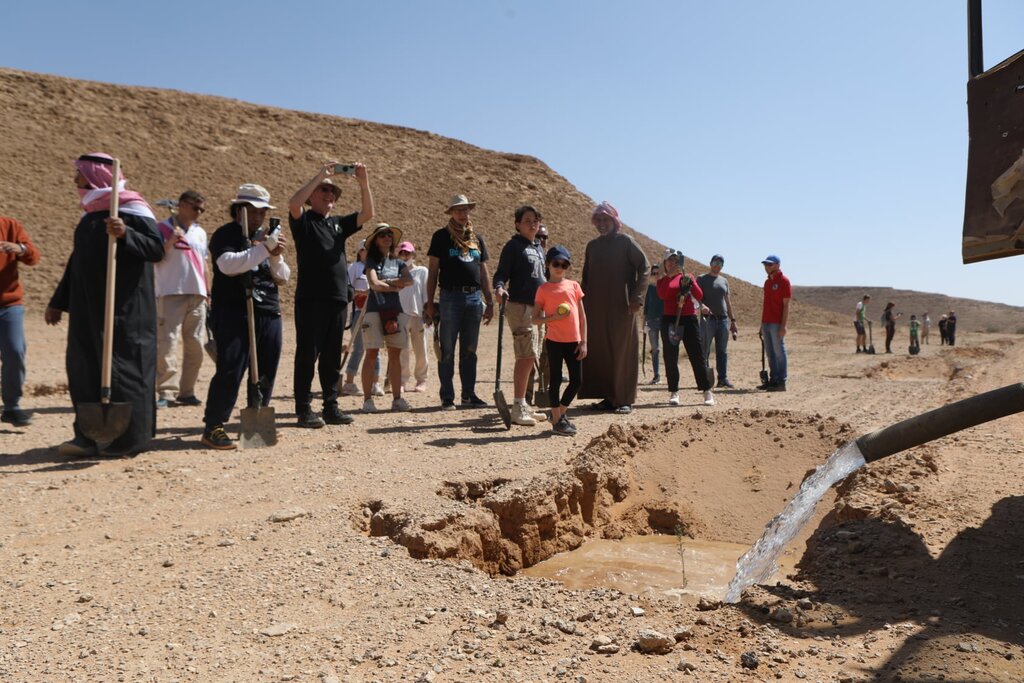
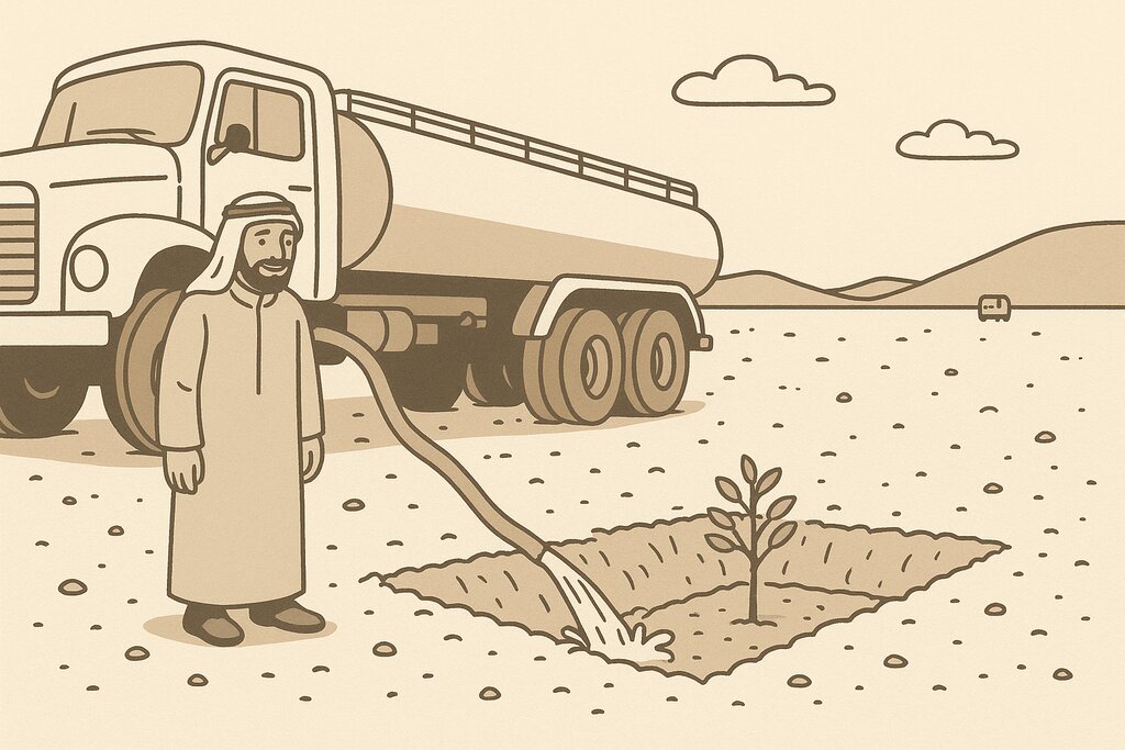
This water and nutrient harvesting technique is effective even in hyper-arid conditions, where rainfall may be less than 100 mm yearly. However, some supplemental irrigation is needed, and each pit is watered - every 4 months over 3 years - with a volume of water ranging from 20 to 100 litres each time per pit, depending on availability. Water is found in wadi beds and brought to the site in a bowser mounted on a lorry. Watering helps the plants to survive, and as it penetrates, it draws the roots down until they reach the water table. This is when watering can be stopped.
Although the costs are high, the results are generally very satisfactory regarding the survival rate. The local impact is significant when there are large blocks of pits and/ or greater numbers of pits per hectare (where this is possible). Over the last five years, a million pits have been dug.
Abdulla Al Eissa, the park manager, formulated the technical design of the pits, and FAO through the project "Strengthening MoEWA's Capacity to implement its Sustainable Rural Agricultural Development (SRAD) Programme (2019-2025) UTF/SAU/051/SAU" has been responsible for technical advice on locating pits, spacing and layout timing of operations, fertilization and planting operations. The activities are part-funded by the NCVC, while local donors and volunteers contribute the remainder.
2.3 技术照片
2.4 技术视频
注释、简短说明:
https://vimeo.com/1026092452?share=copy
日期:
04/11/2024
位置:
Thadiq national park
摄影师的名字:
Abdullah Al Eissa
2.5 已应用该技术的、本评估所涵盖的国家/地区/地点
国家:
沙特阿拉伯
区域/州/省:
Riyadh Region (Province)
有关地点的进一步说明:
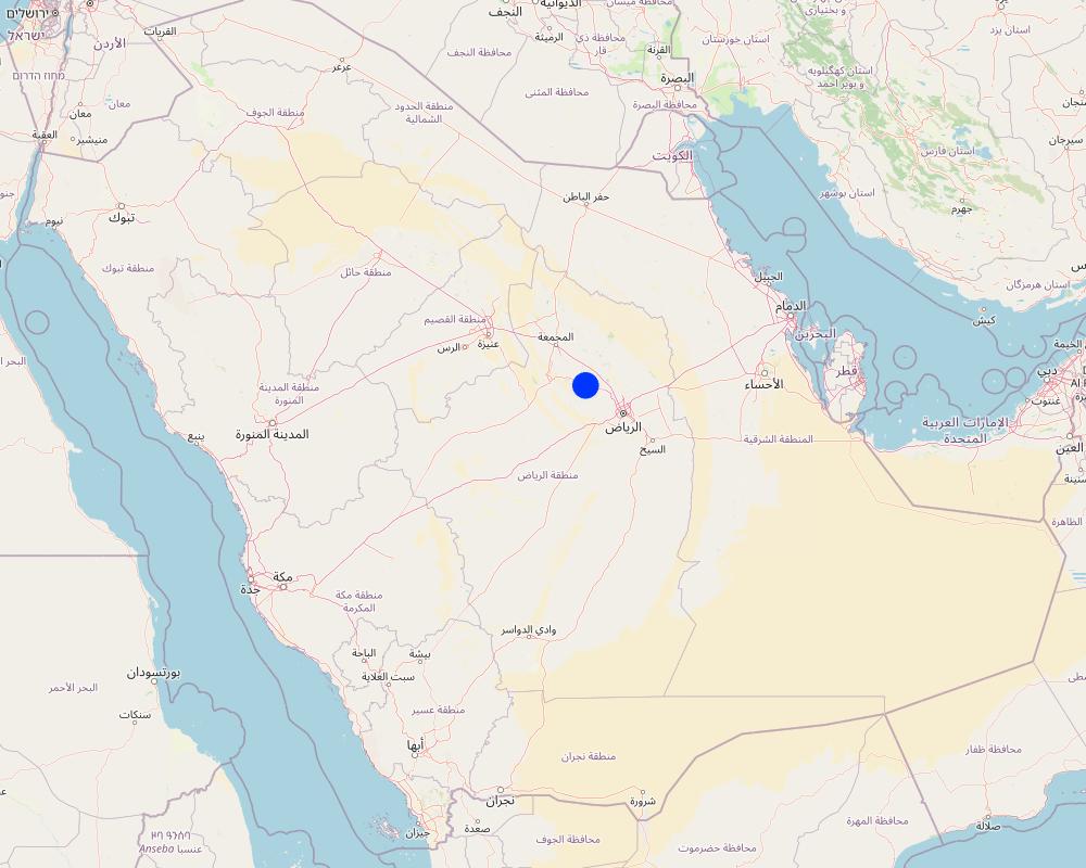
Thadiq National Park
具体说明该技术的分布:
- 均匀地分布在一个区域
如果技术均匀分布在一个区域,则指定覆盖的区域(单位为平方千米):
148.0
如果不知道精确的区域,请注明大致覆盖的区域:
- 100-1,000 平方千米
技术现场是否位于永久保护区?:
是
如果是,请具体说明:
Dispersed within Thadiq National Park
注释:
This is a protected area (category V), IUCN, not yet registered in WDPA, 145 SQKM. This protected area is within the North Riyadh Geopark UNESCO (3000 SQKM). In the future, the National Park may extend and become a IUCN Protected area Category II.
Map
×2.6 实施日期
注明实施年份:
2019
如果不知道确切的年份,请说明大概的日期:
- 不到10年前(最近)
2.7 技术介绍
详细说明该技术是如何引入的:
- 通过项目/外部干预
注释(项目类型等):
Pits are established under a project which sets out to develop vegetation to protect the environment in the National Parks and to support tourism in the region, partly financed by the NCVC (paying for workmen's salaries, etc. ) and local donors (trucks, machines) and volunteers planting.
3. SLM技术的分类
3.1 该技术的主要目的
- 减少、预防、恢复土地退化
- 保护生态系统
- 保持/提高生物多样性
- 创造有益的经济影响
- 创造有益的社会影响
3.2 应用该技术的当前土地利用类型
同一土地单元内混合使用的土地::
否

森林/林地
- (半天然)天然森林/林地
- 植树造林
(半天然)天然森林/林地:具体说明管理类型:
- 非木材森林的利用
(半)天然林类型:
- 亚热带干燥林天然植被
植树造林:说明树种的起源和组成:
- 混交品种
植树造林类型:
- 亚热带旱林人工林
- 亚热带干林人工林 - 阔叶林
树木类型:
- 金合欢树种
- 相思树
- 滇刺枣
- 埃及橡形木属
以上的树木是落叶树还是常绿树?:
- 落叶植物
产品和服务:
- 自然保持/保护
- 娱乐/旅游
- 自然灾害防护
注释:
The Royal Botanical Garden Kew's Plants of the World website now uses the name Vachellia for the genus formerly known as Acacia.
3.3 由于技术的实施,土地使用是否发生了变化?
由于技术的实施,土地使用是否发生了变化?:
- 是(请在技术实施前填写以下有关土地利用的问题)

不毛之地
3.4 供水
该技术所应用土地的供水:
- 混合雨水灌溉
注释:
Supplementary water sourced from wadi beds (3 deep wells with electrical pumps).
3.5 该技术所属的SLM组
- 天然和半天然森林管理
- 集水
- 养蜂、养殖业、家禽业、养兔业、养蚕业等
3.6 包含该技术的可持续土地管理措施

植物措施
- V1:乔木和灌木覆盖层

结构措施
- S4:平沟、坑
- S7:集水/供水/灌溉设备
3.7 该技术强调的主要土地退化类型

土壤水蚀
- Wt:表土流失/地表侵蚀
- Wg:冲沟侵蚀/沟蚀
- Wo:场外劣化效应

物理性土壤退化
- Pk:熟化和结壳
- Pu:由于其他活动而导致生物生产功能的丧失

生物性退化
- Bc:植被覆盖的减少
- Bh:栖息地丧失
- Bq:数量/生物量减少
- Bs:质量和物种组成/多样性的下降
- Bl:土壤寿命损失

水质恶化
- Ha:干旱化
- Hs:地表水良变化
- Hg:地下水/含水层水位的变化
- Hp:地表水水质下降
- Hq:地下水水质下降
3.8 防止、减少或恢复土地退化
具体数量名该技术与土地退化有关的目标:
- 减少土地退化
4. 技术规范、实施活动、投入和成本
4.1 该技术的技术图纸
技术规范(与技术图纸相关):
Each pit is 2 m long, 1m wide, up to 1m deep, spacing from 3 to 10 meters between structures in curved lines, or 3 meters apart in clusters. Watering with 20 to 100 litres depending on the availability and price of water and cost of transportation and watering. 100 pits minimum per hectare (maximum 1100, which is rare in this environment). One to three seedlings (tree, shrub, plant) per pit.
作者:
Éric Lacroix,
日期:
04/11/2024
技术规范(与技术图纸相关):
Watering system: truck with bowser (tank) and hose
作者:
ChatGPT based on an image and explanations.
日期:
04/05/2025
技术规范(与技术图纸相关):
Between lines and between pits: 3-10 meters. In lines or in curves or at random.
作者:
ChatGPT based on an image and instructions.
日期:
06/05/2025
4.2 有关投入和成本计算的一般信息
具体说明成本和投入是如何计算的:
- 每个技术区域
注明尺寸和面积单位:
hectare with 100 pits
具体说明成本计算所用货币:
- 美元
注明雇用劳工的每日平均工资成本:
33-50 dollars
4.3 技术建立活动
| 活动 | 时间(季度) | |
|---|---|---|
| 1. | Identify the site | Dry season: Year 1 |
| 2. | Layout and mark the pits with stakes | Dry season: Year 1 |
| 3. | Dig the pits | Dry season: Year 1 |
| 4. | Produce the seedlings in a nursery | Dry season: Year 1 |
| 5. | Plant the seedlings | Rainy season: Year 2 |
| 6. | Water the seedlings (and replace dead ones) | Dry season: Years 2-4 |
| 7. | Check the pits during the first rain. | Rainy season: Years 2-4 |
| 8. | Check the pits after flooding | After flooding: Years 2-4 |
注释:
Based on a 4 year period - with trees seedlings planted 1 year after the pits are dug.
4.4 技术建立所需要的费用和投入
| 对投入进行具体说明 | 单位 | 数量 | 单位成本 | 每项投入的总成本 | 土地使用者承担的成本% | |
|---|---|---|---|---|---|---|
| 劳动力 | Workers for planting | Worker/day | 5.0 | 50.0 | 250.0 | 90.0 |
| 劳动力 | Workers for watering | Worker/day | 18.0 | 33.0 | 594.0 | 90.0 |
| 设备 | Excavator for digging pits (2 x 2 x 1 m) 100 pits /ha | Hour | 25.0 | 93.0 | 2325.0 | 90.0 |
| 设备 | Truck with bowser/ tank for watering (100 litres /pit / 9 times over 3 years) | Truck/ 5000 litres | 18.0 | 47.0 | 846.0 | 90.0 |
| 植物材料 | Tree Seedlings 200 /ha | Seedling | 200.0 | 4.0 | 800.0 | |
| 技术建立所需总成本 | 4815.0 | |||||
| 技术建立总成本,美元 | 4815.0 | |||||
如果土地使用者负担的费用少于100%,请注明由谁负担其余费用:
The costs are paid through the National Park: 90% from private donations/ volunteer work and 10% by the National Center for Vegetation Cover NCVC. Seedlings supplied by NCVC.
注释:
The costs are spread over 4 years, by hectare, for 100 pits, including digging, planting - and watering for 3 years.
4.5 维护/经常性活动
| 活动 | 时间/频率 | |
|---|---|---|
| 1. | Checking the pits after the first rain | Once, after the first rain. |
| 2. | Checking the pits after floodings | After flooding. |
| 3. | Replacing seedlings when needed (with extra watering if necessary). | During the wet season |
注释:
Depending on the climate
4.6 维护/经常性活动所需要的费用和投入(每年)
| 对投入进行具体说明 | 单位 | 数量 | 单位成本 | 每项投入的总成本 | 土地使用者承担的成本% | |
|---|---|---|---|---|---|---|
| 劳动力 | Workers for maintenance including repairs, weeding and planting replacement seedlings | Worker/day | 10.0 | 50.0 | 500.0 | 100.0 |
| 植物材料 | Tree seedlings | seedling | 30.0 | 4.0 | 120.0 | |
| 技术维护所需总成本 | 620.0 | |||||
| 技术维护总成本,美元 | 620.0 | |||||
如果土地使用者负担的费用少于100%,请注明由谁负担其余费用:
Local donors 100 % of workers costs and NCVC 100 % of the seedlings.
注释:
Depending on the type of soil, drought and flooding. Figures are an average per year for first few years. Extra watering may be necessary at an extra cost for the truck/ bowser (not costed here).
4.7 影响成本的最重要因素
描述影响成本的最决定性因素:
Type of soil, drought and flooding.
5. 自然和人文环境
5.1 气候
年降雨量
- < 250毫米
- 251-500毫米
- 501-750毫米
- 751-1,000毫米
- 1,001-1,500毫米
- 1,501-2,000毫米
- 2,001-3,000毫米
- 3,001-4,000毫米
- > 4,000毫米
指定年平均降雨量(若已知),单位为mm:
70.00
有关降雨的规范/注释:
The distribution and seasonality of rainfall in Riyadh, Saudi Arabia, are characterized by low annual totals, high variability, and a distinct seasonal pattern associated with its arid desert climate.
注明所考虑的参考气象站名称:
Internet, available climate data
农业气候带
- 干旱
Arid or hyper-arid, to be exact. Riyadh region, in general, experiences a hot desert climate. Summers are extremely hot, with temperatures often exceeding 45°C (113°F), while winters are mild, with daytime temperatures averaging around 20°C (68°F). Rainfall is scarce and irregular, mostly occurring between November and April, with an annual average of less than 100 mm.
5.2 地形
平均坡度:
- 水平(0-2%)
- 缓降(3-5%)
- 平缓(6-10%)
- 滚坡(11-15%)
- 崎岖(16-30%)
- 陡峭(31-60%)
- 非常陡峭(>60%)
地形:
- 高原/平原
- 山脊
- 山坡
- 山地斜坡
- 麓坡
- 谷底
垂直分布带:
- 0-100 m a.s.l.
- 101-500 m a.s.l.
- 501-1,000 m a.s.l.
- 1,001-1,500 m a.s.l.
- 1,501-2,000 m a.s.l.
- 2,001-2,500 m a.s.l.
- 2,501-3,000 m a.s.l.
- 3,001-4,000 m a.s.l.
- > 4,000 m a.s.l.
说明该技术是否专门应用于:
- 不相关
关于地形的注释和进一步规范:
This technology is specific to the Thuwayq wadis and plateaus
5.3 土壤
平均土层深度:
- 非常浅(0-20厘米)
- 浅(21-50厘米)
- 中等深度(51-80厘米)
- 深(81-120厘米)
- 非常深(> 120厘米)
土壤质地(表土):
- 粗粒/轻(砂质)
土壤质地(地表以下> 20厘米):
- 粗粒/轻(砂质)
表土有机质:
- 低(<1%)
如有可能,附上完整的土壤描述或具体说明可用的信息,例如土壤类型、土壤酸碱度、阳离子交换能力、氮、盐度等。:
Rocky limestone soils, sometimes sandy.
5.4 水资源可用性和质量
地下水位表:
5-50米
地表水的可用性:
匮乏/没有
水质(未处理):
不可用
水质请参考::
地下水
水的盐度有问题吗?:
否
该区域正在发生洪水吗?:
是
规律性:
偶然
关于水质和水量的注释和进一步规范:
One to three floodings a year.
5.5 生物多样性
物种多样性:
- 低
栖息地多样性:
- 低
关于生物多样性的注释和进一步规范:
Arid ecosystems, low but relatively rich for the region.
5.6 应用该技术的土地使用者的特征
其它(具体说明):
Various
生产系统的市场定位:
- 混合(生计/商业)
非农收入:
- 收入的10-50%
相对财富水平:
- 平均水平
个人或集体:
- 个人/家庭
- 员工(公司、政府)
机械化水平:
- 机械化/电动
性别:
- 女人
- 男人
土地使用者的年龄:
- 儿童
- 青年人
- 中年人
- 老年人
说明土地使用者的其他有关特征:
The land manager is the Government, National Centre for Vegetation Cover Development and Combating Desertification, which facilitates tourism/ picnicking in the park and protection of the environment (for all genders and ages of tourists). Land users can be considered to be local people who volunteer their labour and use the area for recreation.
5.7 应用该技术的土地使用者使用的平均土地面积
- < 0.5 公顷
- 0.5-1 公顷
- 1-2 公顷
- 2-5公顷
- 5-15公顷
- 15-50公顷
- 50-100公顷
- 100-500公顷
- 500-1,000公顷
- 1,000-10,000公顷
- > 10,000公顷
注释:
Sizes of National Parks where such interventions are/ will be found
5.8 土地所有权、土地使用权和水使用权
土地所有权:
- 州
- under park management
- under park management
土地使用权是否基于传统的法律制度?:
否
注释:
National Park, government property
5.9 进入服务和基础设施的通道
教育:
- 贫瘠
- 适度的
- 好
就业(例如非农):
- 贫瘠
- 适度的
- 好
Tourism:
- 贫瘠
- 适度的
- 好
注释:
Tourism is with guides and tour operators - facilities are being improved
6. 影响和结论性说明
6.1 该技术的现场影响
社会经济效应
生产
森林/林地质量
注释/具体说明:
Can double the vegetation cover in 10 years
社会文化影响
娱乐机会
注释/具体说明:
Development of picnic and recreational areas once trees have grown
生态影响
水循环/径流
水量
注释/具体说明:
Recharges the water table
地表径流
地下水位/含水层
土壤
土壤水分
土壤覆盖层
土壤流失
土壤堆积
养分循环/补给
生物多样性:植被、动物
植被覆盖
生物量/地上C
植物多样性
动物多样性
栖息地多样性
减少气候和灾害风险
洪水影响
干旱影响
碳和温室气体的排放
微气候
对现场影响的评估(测量)进行具体说明:
Expert estimates/expectations
6.2 该技术的场外影响已经显现
水资源可用性
旱季稳定可靠的水流
下游洪水
下游淤积
对场外影响(测量)的评估进行具体说明:
Expert estimates/ expectations
6.3 技术对渐变气候以及与气候相关的极端情况/灾害的暴露和敏感性(土地使用者认为的极端情况/灾害)
渐变气候
渐变气候
| 季节 | 增加或减少 | 该技术是如何应对的? | |
|---|---|---|---|
| 年温度 | 增加 | 好 |
气候有关的极端情况(灾害)
气象灾害
| 该技术是如何应对的? | |
|---|---|
| 局地暴雨 | 好 |
气候灾害
| 该技术是如何应对的? | |
|---|---|
| 干旱 | 好 |
水文灾害
| 该技术是如何应对的? | |
|---|---|
| 山洪暴发 | 好 |
注释:
The impact will depend on the density of pits per hectare. Experimentation with different spacing as low as 3 metres apart could/ should be tested and evaluated for costs and results.
6.4 成本效益分析
技术收益与技术建立成本相比如何(从土地使用者的角度看)?
短期回报:
消极
长期回报:
积极
技术收益与技术维护成本/经常性成本相比如何(从土地使用者的角度看)?
短期回报:
消极
长期回报:
稍微积极
注释:
It depends on the case, but the success in terms of vegetation establishment and thus related benefits is generally very high.
6.5 技术采用
- 1-10%
如若可行,进行量化(住户数量和/或覆盖面积):
The technology is no longer experimental. It is routine in Thadiq National Park up which is creating up to 300,000 new pits per year.
在所有采用这项技术的人当中,有多少人是自发的,即未获得任何物质奖励/付款?:
- 0-10%
注释:
Joint ventures between NCVC, local donors and volunteers.
6.6 适应
最近是否对该技术进行了修改以适应不断变化的条件?:
否
6.7 该技术的优点/长处/机会
| 土地使用者眼中的长处/优势/机会 |
|---|
| Radical change to the ecosystem and landscape to improve it environmentally. |
| Attractive to tourists after 5 years. |
| 编制者或其他关键资源人员认为的长处/优势/机会 |
|---|
| Adapting to climate change (rising temperatures, increased flash flooding). |
| Necessary if we want to turn desert into forests and steppes. |
| One of the best ways to revegetate the desert. |
6.8 技术的弱点/缺点/风险及其克服方法
| 土地使用者认为的弱点/缺点/风险 | 如何克服它们? |
|---|---|
| High costs. | Use climate change budgets or convince donors and the Government and Vegetation Centre to finance it. |
| 编制者或其他关键资源人员认为的弱点/缺点/风险 | 如何克服它们? |
|---|---|
| High costs. | Use climate change budgets or convince donors and the Government and Vegetation Centre to finance it. |
7. 参考和链接
7.1 信息的方法/来源
- 实地考察、实地调查
Many times during 3 years
- 与土地使用者的访谈
In depth interviews with the National Park manager
- 与SLM专业人员/专家的访谈
In the FAO office, climate change and forest experts.
(现场)数据是什么时候汇编的?:
06/05/2023
注释:
2021-2024 many times
7.2 参考可用出版物
标题、作者、年份、ISBN:
FAO 2024. State of land degradation, desertification and sand encroachment in Saudi Arabia.
可以从哪里获得?成本如何?
FAO Project internal report, Saudi Arabia, 051. Fao-sa@fao.org
标题、作者、年份、ISBN:
FAO 2022. Forest Sector Review of The Kingdom of Saudi Arabia.
可以从哪里获得?成本如何?
FAO Project internal report, Saudi Arabia, 051. Fao-sa@fao.org
标题、作者、年份、ISBN:
FAO, 2022. National Park Sector Review of The Kingdom of Saudi Arabia.
可以从哪里获得?成本如何?
FAO Project internal report, Saudi Arabia, 051. Fao-sa@fao.org
标题、作者、年份、ISBN:
FAO, 2022. Rangeland Sector Review of The Kingdom of Saudi Arabia.
可以从哪里获得?成本如何?
FAO Project internal report, Saudi Arabia, 051. Fao-sa@fao.org
7.3 链接到网络上的相关信息
标题/说明:
National Center for Vegetation Cover NCVC
URL:
https://ncvc.gov.sa/
7.4 一般注释
Add the FAO Project UTF/SAU/051/SAU, Strengthening the Ministry of Environment, Water and Agriculture’s Capacity to Implement the Sustainable Rural Agricultural Development Programme
链接和模块
全部展开 全部收起链接
无链接
模块
无模块


