stone bund [Ethiopia]
- Creation:
- Update:
- Compiler: Eva Ludi
- Editor: –
- Reviewer: Fabian Ottiger
erkan (amharic), cab (amharic)
technologies_1389 - Ethiopia
View sections
Expand all Collapse all1. General information
1.2 Contact details of resource persons and institutions involved in the assessment and documentation of the Technology
Name of the institution(s) which facilitated the documentation/ evaluation of the Technology (if relevant)
Overseas Development Institute (ODI) - United Kingdom1.3 Conditions regarding the use of data documented through WOCAT
When were the data compiled (in the field)?
26/04/1999
The compiler and key resource person(s) accept the conditions regarding the use of data documented through WOCAT:
Ja
2. Description of the SLM Technology
2.1 Short description of the Technology
Definition of the Technology:
stone terrace more or less along the contour, combined with artificial waterways and traditional ditches to drain excess water, and heightened field borders
2.2 Detailed description of the Technology
Description:
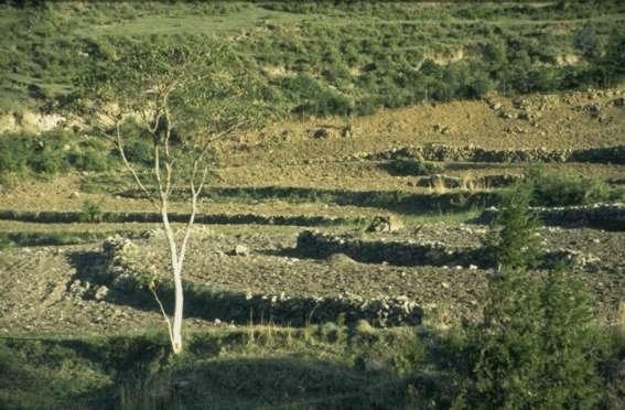
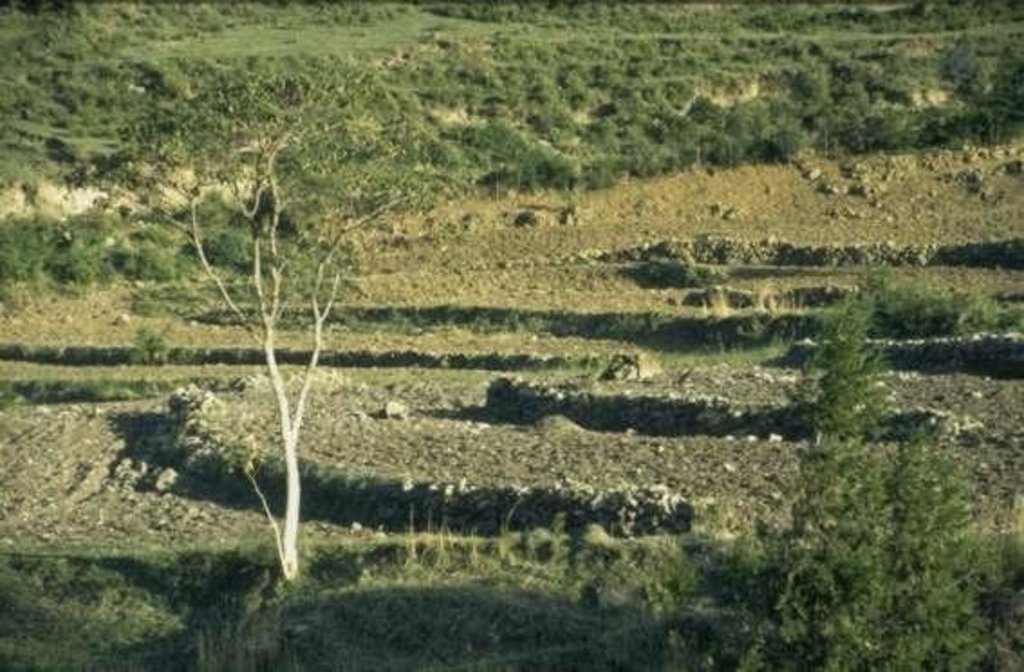
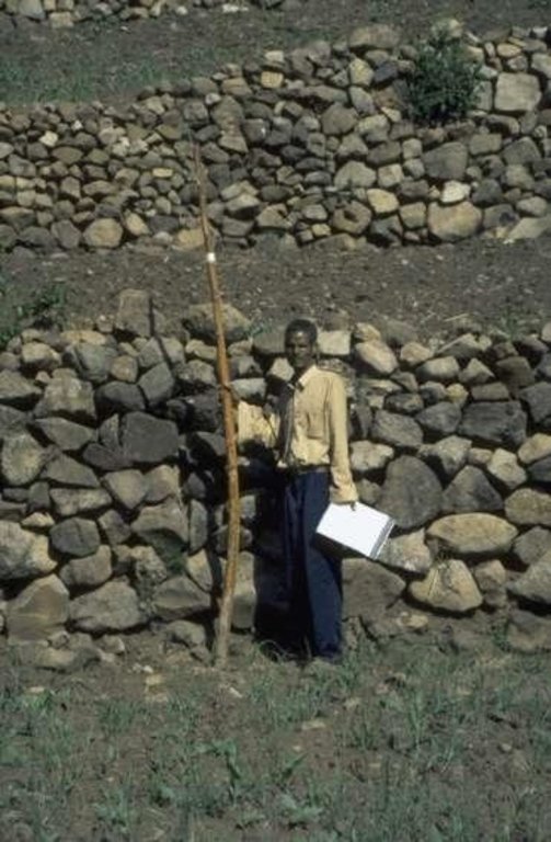
stone bunds, height 0.5 m to 2.5 m, base width 1m to 1.5 m, top width 0.2 m to 1 m (top width mainly below 0.5 m). stones are piled very carefully to form stable terraces, masonry-like, stable drystone walls. In some cases, gesho (local hop, Rhamnus prinoides) is planted above the stone terrace. Bisana (Croton macrostachytus) is planted below the stone bund or along raised field borders. Stone bunds vary in height depending on the slope angle to reach, if possible, flat terraces behind the bund. Bunds are maintained regularly and if necessary bunds are raised. The technology is applied since generations in this area. Farmers continue to build bunds on new plots. A factor favouring the construction and maintenance of bunds - compared with many areas of the Ethiopian Highlans - is that the land distribution of 1996/97 was not carried out in Mesobit & Gedeba.
2.3 Photos of the Technology
2.5 Country/ region/ locations where the Technology has been applied and which are covered by this assessment
Country:
Ethiopia
Region/ State/ Province:
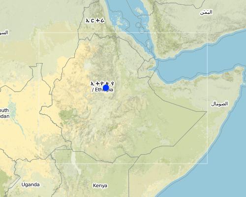
North Shewa
Map
×2.6 Date of implementation
If precise year is not known, indicate approximate date:
- more than 50 years ago (traditional)
2.7 Introduction of the Technology
Specify how the Technology was introduced:
- as part of a traditional system (> 50 years)
Comments (type of project, etc.):
No historical record
3. Classification of the SLM Technology
3.2 Current land use type(s) where the Technology is applied

Cropland
- Annual cropping
- Perennial (non-woody) cropping
Comments:
Major land use problems (compiler’s opinion): continuous cultivation and overgrazing due to high population pressure; declining soil fertility, which is only partially made up with increased inputs; pests
Major land use problems (land users’ perception): continuous cropping and overgrazing due to high population pressure, change of climate, pests
3.3 Further information about land use
Water supply for the land on which the Technology is applied:
- rainfed
Comments:
Water supply: Also mixed rainfed - irrigated
Number of growing seasons per year:
- 2
Specify:
Longest growing period from month to month: Apr - DecSecond longest growing period from month to month: Feb - May
3.4 SLM group to which the Technology belongs
- cross-slope measure
- irrigation management (incl. water supply, drainage)
- water diversion and drainage
3.5 Spread of the Technology
Specify the spread of the Technology:
- evenly spread over an area
If the Technology is evenly spread over an area, indicate approximate area covered:
- 100-1,000 km2
Comments:
Technology known since generations. Knowledge passed down from father to son. One person mentioned the year 1906 EC (1913 gregor. calendar) as the time when SWC started to be applied on a bigger scale in the area. Area of application: unknown. Information given below is for Mesobit and Gedeba KA only (ca 500 ha).
3.6 SLM measures comprising the Technology

vegetative measures
- V1: Tree and shrub cover
- V2: Grasses and perennial herbaceous plants

structural measures
- S2: Bunds, banks
- S3: Graded ditches, channels, waterways
Comments:
Main measures: structural measures
Secondary measures: vegetative measures
3.7 Main types of land degradation addressed by the Technology

soil erosion by water
- Wt: loss of topsoil/ surface erosion
- Wg: gully erosion/ gullying

chemical soil deterioration
- Cn: fertility decline and reduced organic matter content (not caused by erosion)

water degradation
- Ha: aridification
Comments:
Main type of degradation addressed: Wt: loss of topsoil / surface erosion
Secondary types of degradation addressed: Wg: gully erosion / gullying, Cn: fertility decline and reduced organic matter content, Ha: aridification
4. Technical specifications, implementation activities, inputs, and costs
4.2 Technical specifications/ explanations of technical drawing
Technical knowledge required for land users: moderate
Main technical functions: control of dispersed runoff: impede / retard
Secondary technical functions: control of concentrated runoff: drain / divert, reduction of slope angle, increase of infiltration, increase / maintain water stored in soil, sediment retention / trapping, sediment harvesting, improvement of soil structure
Trees/ shrubs species: bisana (croton macrostachytus), accacia
Perennial crops species: gesho (rhamnus prinoides)
Slope (which determines the spacing indicated above): 15.00%
If the original slope has changed as a result of the Technology, the slope today is (see figure below): 5.00%
Construction material (earth): fills up trench behind bund to form level terrace, if soil is moved to build terrace, soil is distri
Construction material (stone): stone is main material , usually stones are collected in the field, sometimes solid rock is broken,
Slope (which determines the spacing indicated above): 15%
If the original slope has changed as a result of the Technology, the slope today is: 5%
Vegetation is used for stabilisation of structures.
Other type of management: livestock management - farmers pooling small area of grazing land
4.3 General information regarding the calculation of inputs and costs
other/ national currency (specify):
Ethiopia Birr
Indicate exchange rate from USD to local currency (if relevant): 1 USD =:
7.0
4.4 Establishment activities
| Activity | Type of measure | Timing | |
|---|---|---|---|
| 1. | planting | Vegetative | beginning of and during rainy season |
| 2. | manuring | Vegetative | beginning of and during rainy season |
| 3. | collecting stones | Structural | May-June |
| 4. | piling stones | Structural | May-June |
| 5. | observing slope | Structural | |
| 6. | digging | Structural | May-June, small 'dry' season between small and big |
4.5 Costs and inputs needed for establishment
Comments:
Duration of establishment phase: 48 month(s)
4.6 Maintenance/ recurrent activities
| Activity | Type of measure | Timing/ frequency | |
|---|---|---|---|
| 1. | weeding | Vegetative | /annual, several times |
| 2. | cutting branches (gesho) | Vegetative | /every 2nd to 3rd year |
| 3. | piling stones | Structural | February-June/annual |
| 4. | reparing broken terraces | Structural | February-June/annual |
4.7 Costs and inputs needed for maintenance/ recurrent activities (per year)
Comments:
length of structure, per day one person constructs about 3 m new stone bund
4.8 Most important factors affecting the costs
Describe the most determinate factors affecting the costs:
financial costs are very small compared to manual labour. Costs for labour as indicated in 2.7.1. are given as opportunity costs!
much of the labour is done using traditional group work debo (= working party) or wenfel (= reciprocal work) or newly introduced group work (mass mobilisation).
5. Natural and human environment
5.1 Climate
Annual rainfall
- < 250 mm
- 251-500 mm
- 501-750 mm
- 751-1,000 mm
- 1,001-1,500 mm
- 1,501-2,000 mm
- 2,001-3,000 mm
- 3,001-4,000 mm
- > 4,000 mm
Specifications/ comments on rainfall:
Two growing seasons for teff
5.2 Topography
Slopes on average:
- flat (0-2%)
- gentle (3-5%)
- moderate (6-10%)
- rolling (11-15%)
- hilly (16-30%)
- steep (31-60%)
- very steep (>60%)
Landforms:
- plateau/plains
- ridges
- mountain slopes
- hill slopes
- footslopes
- valley floors
Altitudinal zone:
- 0-100 m a.s.l.
- 101-500 m a.s.l.
- 501-1,000 m a.s.l.
- 1,001-1,500 m a.s.l.
- 1,501-2,000 m a.s.l.
- 2,001-2,500 m a.s.l.
- 2,501-3,000 m a.s.l.
- 3,001-4,000 m a.s.l.
- > 4,000 m a.s.l.
5.3 Soils
Soil depth on average:
- very shallow (0-20 cm)
- shallow (21-50 cm)
- moderately deep (51-80 cm)
- deep (81-120 cm)
- very deep (> 120 cm)
Soil texture (topsoil):
- medium (loamy, silty)
- fine/ heavy (clay)
Topsoil organic matter:
- medium (1-3%)
If available, attach full soil description or specify the available information, e.g. soil type, soil PH/ acidity, Cation Exchange Capacity, nitrogen, salinity etc.
Soil depth on average: Moderately deep, also deep (soil depths estimated only. soil depth also varies depending on location in relation to stone bund.)
Soil fertility is medium
Soil infiltration/drainage is good
Soil water storage capacity is high
5.6 Characteristics of land users applying the Technology
Off-farm income:
- less than 10% of all income
Relative level of wealth:
- poor
- average
Level of mechanization:
- manual work
- animal traction
Indicate other relevant characteristics of the land users:
Annual population growth: 2% - 3%
5% of the land users are rich (yield lasts for 12 months).
80% of the land users are average wealthy (yield lasts for 8 months).
15% of the land users are poor (yield lasts for less than 8 monts and people are involved in petty trade).
Off-farm income specification: Some families rely heavily on off-farm income (petty trade, handicraft). For these families, off-farm income can be as high as 50%, usually it is in the order of 10-20%.
5.8 Land ownership, land use rights, and water use rights
Land ownership:
- state
Land use rights:
- individual
6. Impacts and concluding statements
6.4 Cost-benefit analysis
How do the benefits compare with the establishment costs (from land users’ perspective)?
Short-term returns:
neutral/ balanced
Long-term returns:
positive
How do the benefits compare with the maintenance/ recurrent costs (from land users' perspective)?
Short-term returns:
slightly positive
Long-term returns:
positive
6.5 Adoption of the Technology
Of all those who have adopted the Technology, how many have did so spontaneously, i.e. without receiving any material incentives/ payments?
- 90-100%
Comments:
Comments on acceptance with external material support: estimates
Comments on spontaneous adoption: estimates
Comments on adoption trend: young farmers are a bit more reluctant to continue building new bunds, however they maintain existing bunds.
Links and modules
Expand all Collapse allLinks
No links
Modules
No modules


