Integrated runoff water management [Uganda]
- Creation:
- Update:
- Compiler: Alex Lwakuba
- Editor: –
- Reviewer: Fabian Ottiger
technologies_1749 - Uganda
View sections
Expand all Collapse all1. General information
1.2 Contact details of resource persons and institutions involved in the assessment and documentation of the Technology
SLM specialist:
Erabu John
MMAIF, DEPT of Agriculture
Orungo subcounty, Amuria county, Katakwi District
Uganda
Name of the institution(s) which facilitated the documentation/ evaluation of the Technology (if relevant)
Ministry of Agriculture, Animal Industry, and Fisheries of Uganda (MAAIF) - Uganda1.3 Conditions regarding the use of data documented through WOCAT
When were the data compiled (in the field)?
18/04/2000
The compiler and key resource person(s) accept the conditions regarding the use of data documented through WOCAT:
Ja
2. Description of the SLM Technology
2.1 Short description of the Technology
Definition of the Technology:
This is a system of integrated runoff water and drainage management that allows cultivation in a swampy valley bottom.
2.2 Detailed description of the Technology
Description:
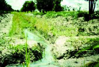
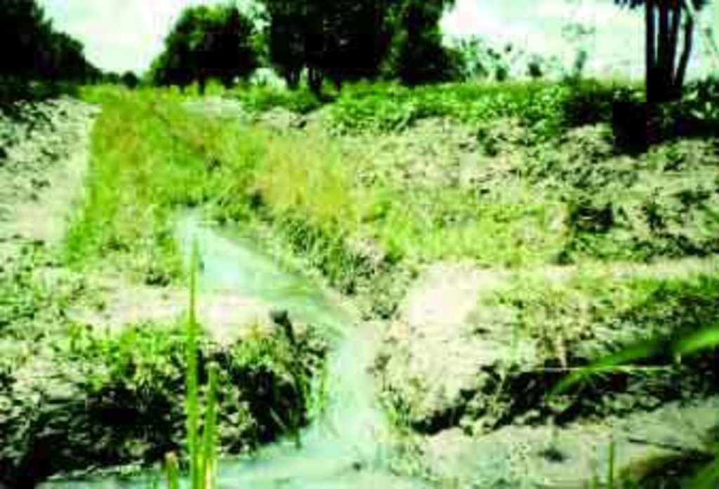
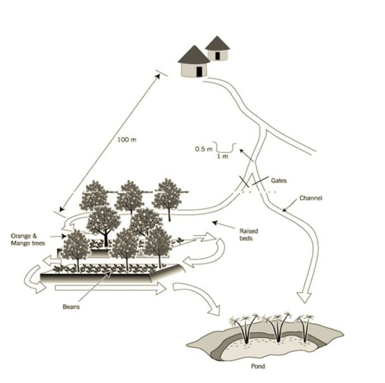
Setting up the infrastructure involves dividing the land in the valley into raised beds of ±10 m x 20 m which are separated by furrows, acting as drainage channels. Below the furrows is a pond. These furrows, however, can also fulfil the opposite role – distributing runoff water from upslope in the valley bottom if required. A diversion channel has been constructed to guide runoff from a track towards the valley. The channel is 0.5 m deep, 1 m wide, over 100 m in length and with a gradient of 0.5% - 1.0%. It is estimated that the ratio of catchment to cultivated area is 10:1. The channel is left open to divert runoff in times of shortage (though, naturally, as with any rainwater harvesting system, there has to be rain locally before it can be harvested). This water then can be held by the furrows whose outlet can be blocked. Citrus fruits (oranges) and mangoes are planted on the beds, and intercropped with annuals.
Purpose of the Technology: The purpose is production of cash crops, based on reclamation of land and control of concentrated runoff. The impact is achieved through a flexible method
of drainage/water harvesting, which helps ensure suitable moisture conditions for growth.
Establishment / maintenance activities and inputs: The main maintenance aspect is clearing inlets, channels and removing vegetation, using common household hand tools such as spades and hoes.
Natural / human environment: The technology is situated in a valley near a swamp. It consists of growing both annual and perennial crops throught the year. The farm is located in a semi-arid area. The soil is sandy loam and shallow.
2.3 Photos of the Technology
2.5 Country/ region/ locations where the Technology has been applied and which are covered by this assessment
Country:
Uganda
Region/ State/ Province:
Katakwi
Further specification of location:
Katakwi
Map
×2.6 Date of implementation
If precise year is not known, indicate approximate date:
- less than 10 years ago (recently)
2.7 Introduction of the Technology
Specify how the Technology was introduced:
- through projects/ external interventions
Comments (type of project, etc.):
an adoption from another district by the landuser but with a lot of modifications and technology
3. Classification of the SLM Technology
3.1 Main purpose(s) of the Technology
- improve production
- reduce, prevent, restore land degradation
- adapt to climate change/ extremes and its impacts
3.2 Current land use type(s) where the Technology is applied

Cropland
- Annual cropping
- Perennial (non-woody) cropping
Main crops (cash and food crops):
Major cash crop annual cropping: Rice
Major food crop annual cropping: Casava, sorghum
Major other crop annual cropping: Carrots

Mixed (crops/ grazing/ trees), incl. agroforestry
- Agroforestry
Main products/ services:
Major cash crop: Eucalyptus
Major food crop: Citrus
Comments:
Major land use problems (compiler’s opinion): the major land use problem in the area are cutting down of trees, burning of bushes lack of crop roatation and water and soil conservation methods.
Major land use problems (land users’ perception): continous cultivation leading to low yields lack of soil and water conservation methods eg ploughing across the slope
3.4 SLM group to which the Technology belongs
- irrigation management (incl. water supply, drainage)
- water diversion and drainage
- surface water management (spring, river, lakes, sea)
3.5 Spread of the Technology
Specify the spread of the Technology:
- evenly spread over an area
If the Technology is evenly spread over an area, indicate approximate area covered:
- 1-10 km2
Comments:
Total area covered by the SLM Technology is 5 m2.
the area under the technology reported covers farmers in one parish which approximates 5 km2
3.6 SLM measures comprising the Technology
3.7 Main types of land degradation addressed by the Technology

soil erosion by water
- Wt: loss of topsoil/ surface erosion
Comments:
Secondary types of degradation addressed: Wt: loss of topsoil / surface erosion
3.8 Prevention, reduction, or restoration of land degradation
Specify the goal of the Technology with regard to land degradation:
- restore/ rehabilitate severely degraded land
4. Technical specifications, implementation activities, inputs, and costs
4.1 Technical drawing of the Technology
4.2 Technical specifications/ explanations of technical drawing
Sketch of the runoff harvesting system
Uganda
Technical knowledge required for field staff / advisors: high
Technical knowledge required for land users: moderate
Main technical functions: increase / maintain water stored in soil
Secondary technical functions: improvement of ground cover, water harvesting
Structural measure: diversion ditch/cut-off drain
Spacing between structures (m): 10
Depth of ditches/pits/dams (m): 0.45
Width of ditches/pits/dams (m): 1
Length of ditches/pits/dams (m): 140
Construction material (earth): soil dug out to make channel and ditches
Slope (which determines the spacing indicated above): 2.00%
If the original slope has changed as a result of the Technology, the slope today is: 1.00%
Lateral gradient along the structure: 1.00%
For water harvesting: the ratio between the area where the harvested water is applied and the total area from which water is collected is: 1:10.00
4.3 General information regarding the calculation of inputs and costs
other/ national currency (specify):
Uganda shillings
Indicate exchange rate from USD to local currency (if relevant): 1 USD =:
1000.0
Indicate average wage cost of hired labour per day:
1.00
4.4 Establishment activities
| Activity | Type of measure | Timing | |
|---|---|---|---|
| 1. | ploughing, 2nd plough, diving the blocks, digging | Structural | dry season |
4.5 Costs and inputs needed for establishment
| Specify input | Unit | Quantity | Costs per Unit | Total costs per input | % of costs borne by land users | |
|---|---|---|---|---|---|---|
| Labour | Labour | ha | 1.0 | 270.0 | 270.0 | 100.0 |
| Equipment | Tools | ha | 1.0 | 42.0 | 42.0 | 100.0 |
| Plant material | Seeds | ha | 1.0 | 23.0 | 23.0 | 100.0 |
| Fertilizers and biocides | Compost manure | ha | 1.0 | 10.0 | 10.0 | 100.0 |
| Total costs for establishment of the Technology | 345.0 | |||||
Comments:
Duration of establishment phase: 60 month(s)
4.6 Maintenance/ recurrent activities
| Activity | Type of measure | Timing/ frequency | |
|---|---|---|---|
| 1. | cleaning inlets | Structural | during rains/each cropping season |
| 2. | cleaning channels | Structural | during rains/each cropping season |
4.7 Costs and inputs needed for maintenance/ recurrent activities (per year)
| Specify input | Unit | Quantity | Costs per Unit | Total costs per input | % of costs borne by land users | |
|---|---|---|---|---|---|---|
| Labour | Labour | ha | 1.0 | 340.0 | 340.0 | 100.0 |
| Equipment | Tools | ha | 1.0 | 315.0 | 315.0 | 100.0 |
| Plant material | Seeds | ha | 1.0 | 71.0 | 71.0 | 100.0 |
| Total costs for maintenance of the Technology | 726.0 | |||||
Comments:
structures; channels 140mts long, W 1m depth 0.45m
4.8 Most important factors affecting the costs
Describe the most determinate factors affecting the costs:
labour intensive and time consuming in the digging of channels
5. Natural and human environment
5.1 Climate
Annual rainfall
- < 250 mm
- 251-500 mm
- 501-750 mm
- 751-1,000 mm
- 1,001-1,500 mm
- 1,501-2,000 mm
- 2,001-3,000 mm
- 3,001-4,000 mm
- > 4,000 mm
Agro-climatic zone
- semi-arid
5.2 Topography
Slopes on average:
- flat (0-2%)
- gentle (3-5%)
- moderate (6-10%)
- rolling (11-15%)
- hilly (16-30%)
- steep (31-60%)
- very steep (>60%)
Landforms:
- plateau/plains
- ridges
- mountain slopes
- hill slopes
- footslopes
- valley floors
Altitudinal zone:
- 0-100 m a.s.l.
- 101-500 m a.s.l.
- 501-1,000 m a.s.l.
- 1,001-1,500 m a.s.l.
- 1,501-2,000 m a.s.l.
- 2,001-2,500 m a.s.l.
- 2,501-3,000 m a.s.l.
- 3,001-4,000 m a.s.l.
- > 4,000 m a.s.l.
5.3 Soils
Soil depth on average:
- very shallow (0-20 cm)
- shallow (21-50 cm)
- moderately deep (51-80 cm)
- deep (81-120 cm)
- very deep (> 120 cm)
Soil texture (topsoil):
- coarse/ light (sandy)
Topsoil organic matter:
- low (<1%)
If available, attach full soil description or specify the available information, e.g. soil type, soil PH/ acidity, Cation Exchange Capacity, nitrogen, salinity etc.
Soil fertility: Low
5.6 Characteristics of land users applying the Technology
Market orientation of production system:
- subsistence (self-supply)
Off-farm income:
- 10-50% of all income
Relative level of wealth:
- rich
- very rich
Level of mechanization:
- manual work
- animal traction
Indicate other relevant characteristics of the land users:
Population density: 50-100 persons/km2
Annual population growth: 1% - 2%
5% of the land users are very rich and own 30% of the land (with over 10 cows).
10% of the land users are rich and own 25% of the land (with 5 - 10 cows).
20% of the land users are average wealthy and own 20% of the land (with 3-5 cows).
25% of the land users are poor and own 15% of the land (with 1-3).
40% of the land users are poor and own 10% of the land (without cows).
Off-farm income specification: majority of farmers are poor have no access to loans
Level of mechanization: Manual labour (cleaning, weeding and harvest) and animal traction (both ranked 1)
5.7 Average area of land owned or leased by land users applying the Technology
- < 0.5 ha
- 0.5-1 ha
- 1-2 ha
- 2-5 ha
- 5-15 ha
- 15-50 ha
- 50-100 ha
- 100-500 ha
- 500-1,000 ha
- 1,000-10,000 ha
- > 10,000 ha
5.8 Land ownership, land use rights, and water use rights
Comments:
Land ownership: group, individual, not titled, individual, titled
6. Impacts and concluding statements
6.1 On-site impacts the Technology has shown
Socio-economic impacts
Production
crop production
land management
Income and costs
farm income
workload
Other socio-economic impacts
Input constraints
Socio-cultural impacts
community institutions
national institutions
SLM/ land degradation knowledge
conflict mitigation
Ecological impacts
Soil
soil moisture
Comments/ specify:
Negative: Can lead to waterlogging
soil loss
nutrient cycling/ recharge
Biodiversity: vegetation, animals
plant diversity
animal diversity
habitat diversity
Climate and disaster risk reduction
wind velocity
6.2 Off-site impacts the Technology has shown
downstream flooding
6.4 Cost-benefit analysis
How do the benefits compare with the establishment costs (from land users’ perspective)?
Short-term returns:
slightly positive
Long-term returns:
very positive
How do the benefits compare with the maintenance/ recurrent costs (from land users' perspective)?
Short-term returns:
neutral/ balanced
Long-term returns:
positive
6.5 Adoption of the Technology
Comments:
20% of land user families have adopted the Technology without any external material support
500 land user families have adopted the Technology without any external material support
Comments on spontaneous adoption: estimates
There is a little trend towards spontaneous adoption of the Technology
Comments on adoption trend: Only one close neighbour has shown interest in copying him. ‘A few’ others from further away, also have. One constraint to adoption is the large amount of labour involved in setting up the system.
6.7 Strengths/ advantages/ opportunities of the Technology
| Strengths/ advantages/ opportunities in the land user’s view |
|---|
| increased incomes |
|
increased soil moisture content How can they be sustained / enhanced? adopt mulching |
| Strengths/ advantages/ opportunities in the compiler’s or other key resource person’s view |
|---|
|
water runoff can be managed easily How can they be sustained / enhanced? constantly maintain the structure |
|
increased yields How can they be sustained / enhanced? adopt composting |
6.8 Weaknesses/ disadvantages/ risks of the Technology and ways of overcoming them
| Weaknesses/ disadvantages/ risks in the land user’s view | How can they be overcome? |
|---|---|
| need skills for the adopters | adopter need training |
| Weaknesses/ disadvantages/ risks in the compiler’s or other key resource person’s view | How can they be overcome? |
|---|---|
| labour intensive | encourage group work |
| costly to construct | encourage household savings |
Links and modules
Expand all Collapse allLinks
No links
Modules
No modules


