Terrace with Tree Barrier [Tajikistan]
- Creation:
- Update:
- Compiler: Erik Bühlmann
- Editor: –
- Reviewers: David Streiff, Alexandra Gavilano
technologies_1409 - Tajikistan
View sections
Expand all Collapse all1. General information
1.2 Contact details of resource persons and institutions involved in the assessment and documentation of the Technology
SLM specialist:
Name of the institution(s) which facilitated the documentation/ evaluation of the Technology (if relevant)
NCCR North-South (NCCR North-South) - KyrgyzstanName of the institution(s) which facilitated the documentation/ evaluation of the Technology (if relevant)
CDE Centre for Development and Environment (CDE Centre for Development and Environment) - Switzerland1.3 Conditions regarding the use of data documented through WOCAT
When were the data compiled (in the field)?
15/07/2005
The compiler and key resource person(s) accept the conditions regarding the use of data documented through WOCAT:
Ja
1.5 Reference to Questionnaire(s) on SLM Approaches
2. Description of the SLM Technology
2.1 Short description of the Technology
Definition of the Technology:
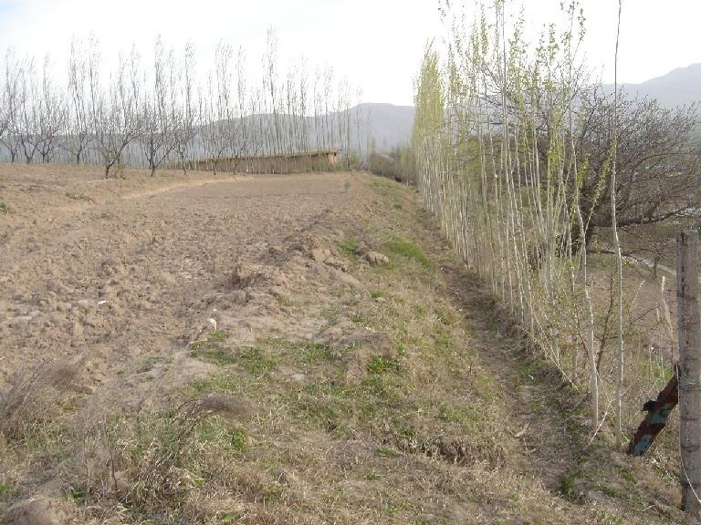
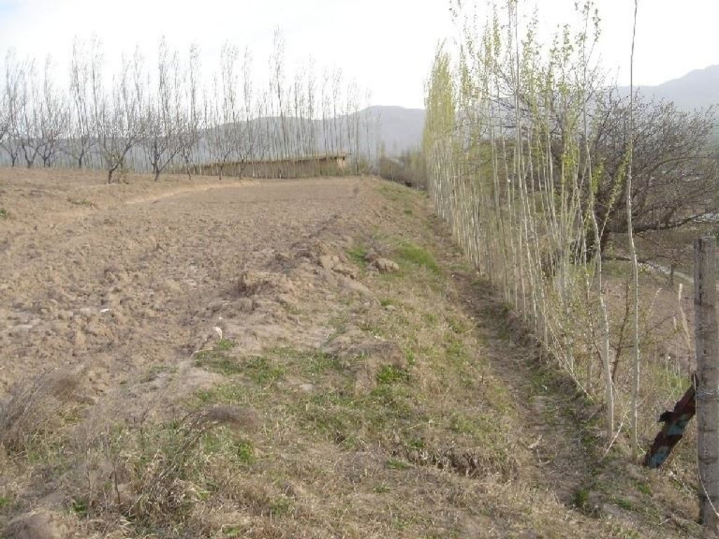
Forward sloping terraces stabilised with aligned poplar trees and adjacent grass strips
2.2 Detailed description of the Technology
Description:
On steep and severely eroded cropland a forward sloping terrace (15% gradient) was established by moving available earth with a bulldozer. Below the terraced field, a cut-off drain diverts excessive rain and irrigation water to an existing gully. The terrace and the cut off drain are stabilised by an aligned tree barrier (poplar trees planted in 0.5 metre intervals), and by two parallel grass strips of 1-2 metres in width.
The terrace was built using a bulldozer. Digging the cut-off drain and planting the poplar cuttings was done by hand. For the initial establishment of the grass strip clods were transferred from a neighbouring pasture. The poplar trees are pruned in early spring; the cut off-drain needs to be cleared of washed in soil after heavy storm events. The described terrace is established on steep cropland prone to soil erosion. The technology is relatively simple to implement.
Purpose of the Technology: The terrace was established to reduce soil erosion and subsequent fertility decline through the reduction of the slope angle. The tree barrier is planted because of the usefulness of poplar trees for construction purposes and to mark field boundaries; its capability of acting as a stabilising terrace is a very useful extra side effect.
Establishment / maintenance activities and inputs: Establishment costs and the rather low maintenance costs are offset by the benefits of the harvested wood produced. Poplar trees can be gradually felled and used for construction purposes 15 years after they are initially planted. Through reduction of the slope angle, the risk of soil erosion is lowered significantly. However, poplar trees can only be planted on land where sufficient water for irrigation is available, since they need to be watered on a weekly basis during the summer. Furthermore, the technology covers land which then cannot be used for cultivation of food crops.
2.3 Photos of the Technology
2.5 Country/ region/ locations where the Technology has been applied and which are covered by this assessment
Country:
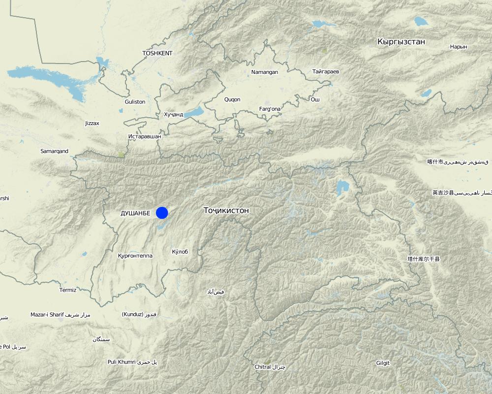
Tajikistan
Region/ State/ Province:
RRS
Further specification of location:
Faizabad Rayon
Map
×2.7 Introduction of the Technology
Specify how the Technology was introduced:
- during experiments/ research
3. Classification of the SLM Technology
3.1 Main purpose(s) of the Technology
- reduce, prevent, restore land degradation
3.2 Current land use type(s) where the Technology is applied

Cropland
- Annual cropping
Main crops (cash and food crops):
major food crop: wheat
other: flax, chickpeas

Mixed (crops/ grazing/ trees), incl. agroforestry
- Agroforestry
Main products/ services:
major cash crop: apples, apricots, cherries, pears, nuts etc
Comments:
Major land use problems (compiler’s opinion): severe water erosion (rills and gullies) and subsequent fertility decline on cropland and overgrazed pastures
Major land use problems (land users’ perception): soil erosion and fertility decline
Type of cropping system and major crops comments: If land is irrigated, then after the wheat harvest there can be immediate cultivation of vegetables
3.3 Further information about land use
Water supply for the land on which the Technology is applied:
- mixed rainfed-irrigated
Number of growing seasons per year:
- 1
Specify:
Longest growing period in days: 210Longest growing period from month to month: March to August
3.4 SLM group to which the Technology belongs
- agroforestry
- cross-slope measure
3.5 Spread of the Technology
Specify the spread of the Technology:
- evenly spread over an area
If the Technology is evenly spread over an area, indicate approximate area covered:
- 0.1-1 km2
Comments:
Total area covered by the SLM Technology is 0.5 m2.
3.6 SLM measures comprising the Technology

vegetative measures
- V1: Tree and shrub cover

structural measures
- S1: Terraces
Comments:
Main measures: structural measures
Secondary measures: vegetative measures
Type of vegetative measures: aligned: -contour, aligned: -along boundary
3.7 Main types of land degradation addressed by the Technology

soil erosion by water
- Wt: loss of topsoil/ surface erosion
- Wg: gully erosion/ gullying

chemical soil deterioration
- Cn: fertility decline and reduced organic matter content (not caused by erosion)
Comments:
Main type of degradation addressed: Wt: loss of topsoil / surface erosion, Wg: gully erosion / gullying
Secondary types of degradation addressed: Cn: fertility decline and reduced organic matter content
3.8 Prevention, reduction, or restoration of land degradation
Specify the goal of the Technology with regard to land degradation:
- prevent land degradation
Comments:
Main goals: prevention of land degradation
4. Technical specifications, implementation activities, inputs, and costs
4.1 Technical drawing of the Technology
4.2 Technical specifications/ explanations of technical drawing
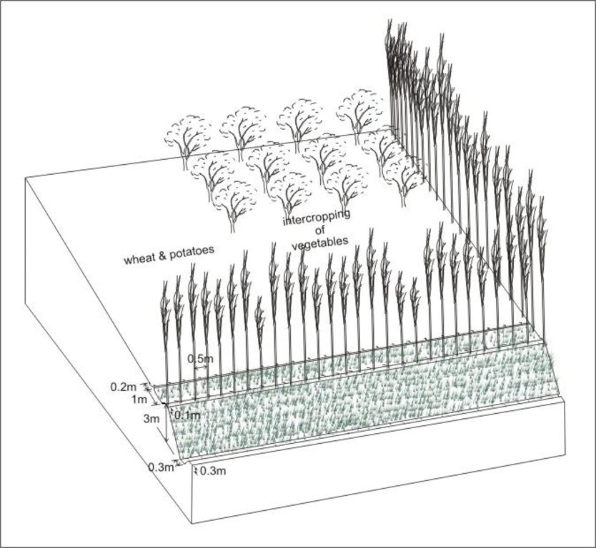
Forward sloping terrace stabilised with aligned trees and adjacent grass strips, a cut-off drain diverts irigation water at the downslope field boundary
Location: Karsang. Faizabad Rayon
Date: 15.07.2005
Technical knowledge required for field staff / advisors: moderate
Technical knowledge required for land users: moderate
Main technical functions: reduction of slope angle, reduction of slope length
Secondary technical functions: control of dispersed runoff: impede / retard, control of concentrated runoff: impede / retard, control of concentrated runoff: drain / divert, improvement of ground cover, increase / maintain water stored in soil, reduction in wind speed
Aligned: -contour
Vegetative material: T : trees / shrubs
Number of plants per (ha): 200
Vertical interval within rows / strips / blocks (m): 0.5
Aligned: -along boundary
Vegetative material: T : trees / shrubs
Number of plants per (ha): 200
Vegetative measure: aligned: contour
Vegetative material: G : grass
Width within rows / strips / blocks (m): 3
Vegetative measure: Vegetative material: G : grass
Vegetative measure: Vegetative material: G : grass
Vegetative measure: Vegetative material: G : grass
Trees/ shrubs species: poplar trees
If the original slope has changed as a result of the Technology, the slope today is (see figure below): 15.00%
Structural measure: cut-off drain
Depth of ditches/pits/dams (m): 0.1
Width of ditches/pits/dams (m): 0.2
Length of ditches/pits/dams (m): fielding
Construction material (earth): earth moved to form terrace
If the original slope has changed as a result of the Technology, the slope today is: 15%
Lateral gradient along the structure: 2%
Vegetation is used for stabilisation of structures.
4.3 General information regarding the calculation of inputs and costs
Indicate average wage cost of hired labour per day:
3.00
4.4 Establishment activities
| Activity | Type of measure | Timing | |
|---|---|---|---|
| 1. | digging of pits for tree planting | Vegetative | spring |
| 2. | planting of poplar cuttings | Vegetative | spring |
| 3. | transplanting of grass clods | Vegetative | spring |
| 4. | construction of terrace | Structural | autumn |
| 5. | digging of cut-off drain | Structural | autumn |
4.5 Costs and inputs needed for establishment
| Specify input | Unit | Quantity | Costs per Unit | Total costs per input | % of costs borne by land users | |
|---|---|---|---|---|---|---|
| Labour | Building terrace | ha | 1.0 | 80.0 | 80.0 | 100.0 |
| Labour | Planting trees | ha | 1.0 | 75.0 | 75.0 | 100.0 |
| Equipment | tools | ha | 1.0 | 10.0 | 10.0 | 100.0 |
| Total costs for establishment of the Technology | 165.0 | |||||
Comments:
Duration of establishment phase: 1 month(s)
4.6 Maintenance/ recurrent activities
| Activity | Type of measure | Timing/ frequency | |
|---|---|---|---|
| 1. | pruning of trees | Vegetative | eraly spring /annual |
| 2. | cutting of grass (grass strips) | Vegetative | summer /annual |
| 3. | irrigarion/watering of trees | Vegetative | summer /weekly |
| 4. | clearing cut-off drain from washed in soil | Structural | rainy season/after every rainfall event |
4.7 Costs and inputs needed for maintenance/ recurrent activities (per year)
| Specify input | Unit | Quantity | Costs per Unit | Total costs per input | % of costs borne by land users | |
|---|---|---|---|---|---|---|
| Labour | Prunning | ha | 1.0 | 12.0 | 12.0 | 100.0 |
| Labour | Cutting | ha | 1.0 | 3.0 | 3.0 | 100.0 |
| Total costs for maintenance of the Technology | 15.0 | |||||
Comments:
costs per 100x100m plot, costs increase if longer field boundary is on contour
5. Natural and human environment
5.1 Climate
Annual rainfall
- < 250 mm
- 251-500 mm
- 501-750 mm
- 751-1,000 mm
- 1,001-1,500 mm
- 1,501-2,000 mm
- 2,001-3,000 mm
- 3,001-4,000 mm
- > 4,000 mm
Agro-climatic zone
- sub-humid
- semi-arid
growing period 180-210 days
5.2 Topography
Slopes on average:
- flat (0-2%)
- gentle (3-5%)
- moderate (6-10%)
- rolling (11-15%)
- hilly (16-30%)
- steep (31-60%)
- very steep (>60%)
Landforms:
- plateau/plains
- ridges
- mountain slopes
- hill slopes
- footslopes
- valley floors
Altitudinal zone:
- 0-100 m a.s.l.
- 101-500 m a.s.l.
- 501-1,000 m a.s.l.
- 1,001-1,500 m a.s.l.
- 1,501-2,000 m a.s.l.
- 2,001-2,500 m a.s.l.
- 2,501-3,000 m a.s.l.
- 3,001-4,000 m a.s.l.
- > 4,000 m a.s.l.
Comments and further specifications on topography:
Altitudinal zone: Also 501-1,000 m a.s.l.
5.3 Soils
Soil depth on average:
- very shallow (0-20 cm)
- shallow (21-50 cm)
- moderately deep (51-80 cm)
- deep (81-120 cm)
- very deep (> 120 cm)
Soil texture (topsoil):
- medium (loamy, silty)
- fine/ heavy (clay)
Topsoil organic matter:
- medium (1-3%)
- low (<1%)
If available, attach full soil description or specify the available information, e.g. soil type, soil PH/ acidity, Cation Exchange Capacity, nitrogen, salinity etc.
Soil fertility: low - high
Soil drainage / infiltration: medium - good
5.6 Characteristics of land users applying the Technology
Market orientation of production system:
- subsistence (self-supply)
- mixed (subsistence/ commercial
Off-farm income:
- > 50% of all income
Relative level of wealth:
- average
- rich
Level of mechanization:
- manual work
- mechanized/ motorized
Indicate other relevant characteristics of the land users:
5% of the land users are rich and own 15% of the land.
75% of the land users are average wealthy and own 70% of the land.
Off-farm income specification: In general, all farmers (including those applying SWC technologies) are highly dependent on off-farm income which in most cases is earned in Russia either by themselves or by their relatives.
Level of mechanization: whenever possible farmer rent tractors for tillage activities. All levels of mechanization are pre-existing.
Market orientation of production system subsistence (self-supply): only surpluses are sold
5.7 Average area of land owned or leased by land users applying the Technology
- < 0.5 ha
- 0.5-1 ha
- 1-2 ha
- 2-5 ha
- 5-15 ha
- 15-50 ha
- 50-100 ha
- 100-500 ha
- 500-1,000 ha
- 1,000-10,000 ha
- > 10,000 ha
Comments:
Average area of land owned or leased by land users applying the Technology also: 0.5-1 ha,
5.8 Land ownership, land use rights, and water use rights
Land ownership:
- state
Land use rights:
- leased
6. Impacts and concluding statements
6.1 On-site impacts the Technology has shown
Socio-economic impacts
Production
crop production
Comments/ specify:
due to increase in soil fertility
wood production
Comments/ specify:
poplar trees gradually harvested for construction purposes
production area
Comments/ specify:
area occupied by grass strips, barriers and ditches
land management
Comments/ specify:
tree barriers impede accessibility with machines
Income and costs
farm income
Socio-cultural impacts
community institutions
Ecological impacts
Water cycle/ runoff
excess water drainage
Soil
soil moisture
soil loss
Climate and disaster risk reduction
wind velocity
6.2 Off-site impacts the Technology has shown
downstream flooding
6.4 Cost-benefit analysis
How do the benefits compare with the establishment costs (from land users’ perspective)?
Short-term returns:
slightly negative
Long-term returns:
very positive
How do the benefits compare with the maintenance/ recurrent costs (from land users' perspective)?
Short-term returns:
neutral/ balanced
Long-term returns:
very positive
Comments:
The terraces were established with the help of bulldozers which is costly, therefore short-term benefits are slightly negative.
6.5 Adoption of the Technology
If available, quantify (no. of households and/ or area covered):
NA
Of all those who have adopted the Technology, how many have did so spontaneously, i.e. without receiving any material incentives/ payments?
- 90-100%
Comments:
100% of land user families have adopted the Technology without any external material support
Comments on spontaneous adoption: estimates
6.7 Strengths/ advantages/ opportunities of the Technology
| Strengths/ advantages/ opportunities in the land user’s view |
|---|
| reduces soil erosion |
| slows fertility decline |
| 15 years after establishment poplar trees can be harvested, their wood is essential for construction and renovation of houses |
| Strengths/ advantages/ opportunities in the compiler’s or other key resource person’s view |
|---|
| reduces slope angle and, hence, decreases risk of soil erosion |
| relatively simple to implement |
| moderate establishment costs, low maintenance costs |
|
meets household needs for wood for construction How can they be sustained / enhanced? trees should be gradually harvested and replaced with new cuttings |
6.8 Weaknesses/ disadvantages/ risks of the Technology and ways of overcoming them
| Weaknesses/ disadvantages/ risks in the land user’s view | How can they be overcome? |
|---|---|
| loss of cropland due to structure, grass strips and trees | |
| cultivation using a tractor is impossible due to the type of terrain impeding access | |
| poplar trees require irrigation |
| Weaknesses/ disadvantages/ risks in the compiler’s or other key resource person’s view | How can they be overcome? |
|---|---|
| The poplar trees used to stabilise the structure require irrigation during summer | |
| farm operations hindered |
Links and modules
Expand all Collapse allLinks
No links
Modules
No modules


