Shelterbelts [Togo]
- Creation:
- Update:
- Compiler: Unknown User
- Editor: –
- Reviewers: Laura Ebneter, Alexandra Gavilano
Brise vents vivants / Hélim Rangou Tinn
technologies_1338 - Togo
View sections
Expand all Collapse all1. General information
1.2 Contact details of resource persons and institutions involved in the assessment and documentation of the Technology
Key resource person(s)
SLM specialist:
Gbenonchi Mawussi
Ecole Supérieure d Agronomie, Université de Lomé (ESA UL)
Togo
Name of project which facilitated the documentation/ evaluation of the Technology (if relevant)
Book project: SLM in Practice - Guidelines and Best Practices for Sub-Saharan Africa (SLM in Practice)Name of the institution(s) which facilitated the documentation/ evaluation of the Technology (if relevant)
Ecole Supérieure d'Agronomie, Université de Lomé (ESA) - Togo1.3 Conditions regarding the use of data documented through WOCAT
The compiler and key resource person(s) accept the conditions regarding the use of data documented through WOCAT:
Ja
2. Description of the SLM Technology
2.1 Short description of the Technology
Definition of the Technology:
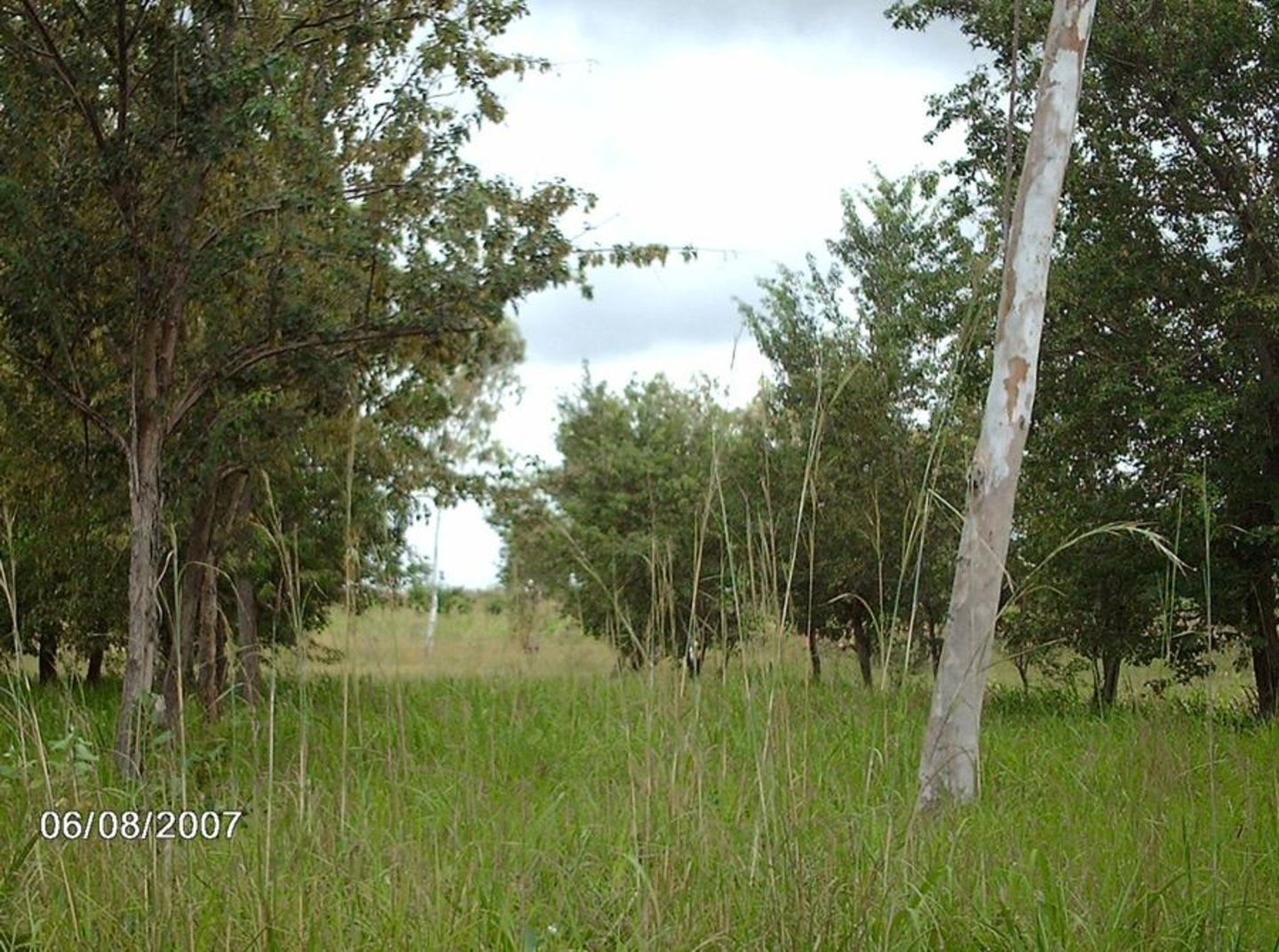
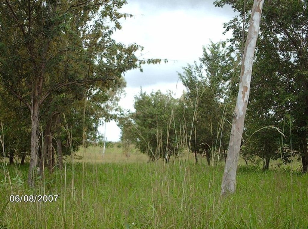
Shelterbelts made of leguminous trees and shrubs protect annual crops from wind erosion.
2.2 Detailed description of the Technology
Description:
On the vast denuded plains of Pays Kabyé in northern Togo, barriers of leguminous trees (e.g. Cassia siamea or spectabilis; a medium sized tree growing between 10-20 m tall; Albizzia procera, Leucaena leucocephala) and shrubs (Cajanus cajan, Erythrina variegate) are established between fields cultivated with annual crops such as maize. The shelterbelts provide a good micro-climate and protect the crops against the counterproductive effects of wind speed such as wind erosion, soil water loss through evaporation and physical damage to crops. The shelterbelts’ effectiveness depends on their permeability, their spacing and the direction of planting in relation to the wind direction: A proportion of 40-50% of holes (openings, void) in relation to the total surface of the shelterbelt is desirable, and establishment of tree rows perpendicularly to the main wind direction is most effective. In order to reduce lateral turbulence the wind breaks need to reach a length of minimum 10 times their height. Shelterbelts protect 15-25 times their height on the leeward and 1-2 their height on the windward side. If the area to be protected is large, several wind breaks need to be established. The denser the shelterbelts are, the better the windbreaking effect, but the higher the competition with crops for nutrients, light and water. Frequent pruning helps to avoid too much competition and provides fuelwood. In case leguminous tree species are used, soil properties can be improved through nitrogen fixation and the provision of organic matter (leaves).
2.3 Photos of the Technology
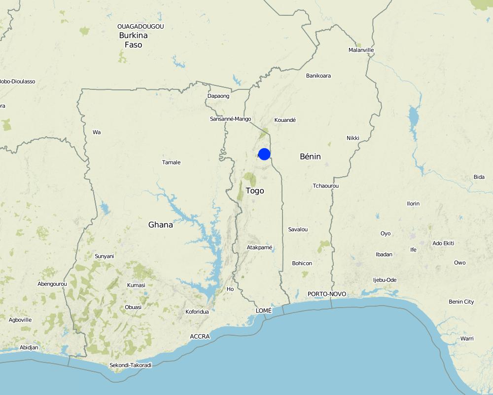
2.5 Country/ region/ locations where the Technology has been applied and which are covered by this assessment
Country:
Togo
Region/ State/ Province:
Kara
Further specification of location:
Tchitchao
Specify the spread of the Technology:
- evenly spread over an area
If precise area is not known, indicate approximate area covered:
- < 0.1 km2 (10 ha)
Comments:
Total area covered by the SLM Technology is 0.8 km2.
Map
×3. Classification of the SLM Technology
3.1 Main purpose(s) of the Technology
- improve production
- reduce, prevent, restore land degradation
- create beneficial economic impact
3.2 Current land use type(s) where the Technology is applied
Land use mixed within the same land unit:
Ja
Specify mixed land use (crops/ grazing/ trees):
- Agroforestry

Cropland
Number of growing seasons per year:
- 1
Specify:
Longest growing period in days: 180 Longest growing period from month to month: May-October

Grazing land

Forest/ woodlands
Comments:
Major land use problems (compiler’s opinion): adverse effects of wind speed on soil humidity and crop yield
Major land use problems (land users’ perception): breaking of corn stalks and therefore decline of crop yield
Future (final) land use (after implementation of SLM Technology): Mixed: Mf: Agroforestry
3.3 Has land use changed due to the implementation of the Technology?
Has land use changed due to the implementation of the Technology?
- Yes (Please fill out the questions below with regard to the land use before implementation of the Technology)
Land use mixed within the same land unit:
Ja
Specify mixed land use (crops/ grazing/ trees):
- Agroforestry

Cropland
- Annual cropping
- Tree and shrub cropping
Annual cropping - Specify crops:
- cereals - maize
- Cassia siamea or spectabilis; a medium sized tree growing between 10-20 m tall; Albizzia procera, Leucaena leucocephala, Cajanus cajan, Erythrina variegate
Is intercropping practiced?
Ja
If yes, specify which crops are intercropped:
maize
3.4 Water supply
Water supply for the land on which the Technology is applied:
- rainfed
3.5 SLM group to which the Technology belongs
- windbreak/ shelterbelt
3.6 SLM measures comprising the Technology

vegetative measures
- V1: Tree and shrub cover
Comments:
Main measures: vegetative measures
Type of vegetative measures: aligned: -against wind
3.7 Main types of land degradation addressed by the Technology

soil erosion by wind
- Et: loss of topsoil
- Eo: offsite degradation effects

water degradation
- Ha: aridification
Comments:
Main type of degradation addressed: Et: loss of topsoil, Eo: offsite degradation effects, Ha: aridification
3.8 Prevention, reduction, or restoration of land degradation
Specify the goal of the Technology with regard to land degradation:
- prevent land degradation
- reduce land degradation
4. Technical specifications, implementation activities, inputs, and costs
4.1 Technical drawing of the Technology
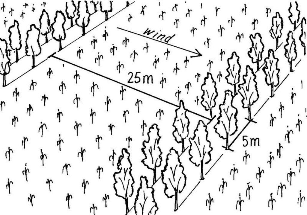
Technical specifications (related to technical drawing):
pacing between windbreak rows is 20-25 m. The row of windbreak can be of a single tree line, of double tree lines, etc. depending on wind speed and scope of protection. The in between tree line spacing is 5 m (see photo). Plant density can range from 100 – 200 plants/ha depending on the number of tree lines planed within a windbreak.
Location: Tchitchao. Préfecture de la Kozah
Technical knowledge required for field staff / advisors: high
Technical knowledge required for land users: moderate
Main technical functions: reduction in wind speed
Aligned: -against wind
Vegetative material: T : trees / shrubs
Number of plants per (ha): 40
Spacing between rows / strips / blocks (m): 20.00
Vertical interval within rows / strips / blocks (m): 5.00
Trees/ shrubs species: Cassia siamea or spectabilis, Albizzia procera, Leucaena leucocephala, Cajanus cajan, Erythrina var
Author:
Mats Gurtner, Centre for Development and Environment, University of Bern
4.2 General information regarding the calculation of inputs and costs
Specify how costs and inputs were calculated:
- per Technology area
Indicate size and area unit:
0.8km2
Specify currency used for cost calculations:
- USD
4.3 Establishment activities
| Activity | Timing (season) | |
|---|---|---|
| 1. | Determine the area to be protected and alignment of shelterbelts (1,2, or 3 lines of trees); rows to be established perpendicular to main wind direction) | during rainy season |
| 2. | Dig planting pits at a spacing of 2-3 meters | during rainy season |
| 3. | Planting of seedlings (when conditions are favourable) | during rainy season |
| 4. | Establish plant nursery | during rainy season |
| 5. | Regular irrigation of young tree seedlings after plantation; Weeding; Reduce density to a spacing 5 m between trees | during rainy season |
4.4 Costs and inputs needed for establishment
| Specify input | Unit | Quantity | Costs per Unit | Total costs per input | % of costs borne by land users | |
|---|---|---|---|---|---|---|
| Labour | Labour | ha | 1.0 | 200.0 | 200.0 | 100.0 |
| Equipment | Tools | ha | 1.0 | 86.0 | 86.0 | 100.0 |
| Plant material | Seedlings | ha | 1.0 | 90.0 | 90.0 | 100.0 |
| Total costs for establishment of the Technology | 376.0 | |||||
| Total costs for establishment of the Technology in USD | 376.0 | |||||
Comments:
Duration of establishment phase: 36 month(s)
4.5 Maintenance/ recurrent activities
| Activity | Timing/ frequency | |
|---|---|---|
| 1. | Weeding (according to necessity / speed of regrowth) | according to necessity / speed of regrowth |
| 2. | Pruning to avoid shading effect on crops |
4.6 Costs and inputs needed for maintenance/ recurrent activities (per year)
| Specify input | Unit | Quantity | Costs per Unit | Total costs per input | % of costs borne by land users | |
|---|---|---|---|---|---|---|
| Labour | Labour | ha | 1.0 | 139.0 | 139.0 | 100.0 |
| Plant material | Seedlings | ha | 1.0 | 23.0 | 23.0 | 100.0 |
| Total costs for maintenance of the Technology | 162.0 | |||||
| Total costs for maintenance of the Technology in USD | 162.0 | |||||
Comments:
Machinery/ tools: hand tools such as hoe, machete and measuring tape
the indicated costs apply per hectare unit
4.7 Most important factors affecting the costs
Describe the most determinate factors affecting the costs:
The monetary costs include the purchase of seeds, cuttings or nursery plants and labour for the preparation and planting. In certain circumstances, it is necessary to protect young trees against browsing and other damage.
5. Natural and human environment
5.1 Climate
Annual rainfall
- < 250 mm
- 251-500 mm
- 501-750 mm
- 751-1,000 mm
- 1,001-1,500 mm
- 1,501-2,000 mm
- 2,001-3,000 mm
- 3,001-4,000 mm
- > 4,000 mm
Agro-climatic zone
- sub-humid
Thermal climate class: tropics
5.2 Topography
Slopes on average:
- flat (0-2%)
- gentle (3-5%)
- moderate (6-10%)
- rolling (11-15%)
- hilly (16-30%)
- steep (31-60%)
- very steep (>60%)
Landforms:
- plateau/plains
- ridges
- mountain slopes
- hill slopes
- footslopes
- valley floors
Altitudinal zone:
- 0-100 m a.s.l.
- 101-500 m a.s.l.
- 501-1,000 m a.s.l.
- 1,001-1,500 m a.s.l.
- 1,501-2,000 m a.s.l.
- 2,001-2,500 m a.s.l.
- 2,501-3,000 m a.s.l.
- 3,001-4,000 m a.s.l.
- > 4,000 m a.s.l.
Comments and further specifications on topography:
Landforms: Also hill slopes and plateau/plains (both ranked 2)
5.3 Soils
Soil depth on average:
- very shallow (0-20 cm)
- shallow (21-50 cm)
- moderately deep (51-80 cm)
- deep (81-120 cm)
- very deep (> 120 cm)
Soil texture (topsoil):
- coarse/ light (sandy)
- medium (loamy, silty)
Topsoil organic matter:
- medium (1-3%)
If available, attach full soil description or specify the available information, e.g. soil type, soil PH/ acidity, Cation Exchange Capacity, nitrogen, salinity etc.
Soil fertility: Medium
Soil drainage/infiltration: Medium (ranked 1) and good (ranked 2)
5.6 Characteristics of land users applying the Technology
Market orientation of production system:
- mixed (subsistence/ commercial)
Off-farm income:
- less than 10% of all income
Relative level of wealth:
- rich
Individuals or groups:
- individual/ household
Level of mechanization:
- manual work
Indicate other relevant characteristics of the land users:
Land users applying the Technology are mainly Leaders / privileged
Population density: 200-500 persons/km2
1% of the land users are rich and own 100% of the land.
Off-farm income specification: these revenues are lower than for farmers who did not implement the wind breaks
5.7 Average area of land used by land users applying the Technology
- < 0.5 ha
- 0.5-1 ha
- 1-2 ha
- 2-5 ha
- 5-15 ha
- 15-50 ha
- 50-100 ha
- 100-500 ha
- 500-1,000 ha
- 1,000-10,000 ha
- > 10,000 ha
Is this considered small-, medium- or large-scale (referring to local context)?
- small-scale
5.8 Land ownership, land use rights, and water use rights
Land ownership:
- individual, titled
Land use rights:
- individual
6. Impacts and concluding statements
6.1 On-site impacts the Technology has shown
Socio-economic impacts
Production
crop production
wood production
Comments/ specify:
And forest products (fruits)
production area
Comments/ specify:
Area occupied by tree hedges
Income and costs
expenses on agricultural inputs
Comments/ specify:
Collection of seedlings
farm income
workload
Comments/ specify:
Extra work
Other socio-economic impacts
Socio-cultural impacts
SLM/ land degradation knowledge
Ecological impacts
Soil
soil moisture
Comments/ specify:
Through evaporation
soil loss
Comments/ specify:
Loss of topsoil through wind erosion
Biodiversity: vegetation, animals
pest/ disease control
Comments/ specify:
Nesting sites for predatory birds
Climate and disaster risk reduction
wind velocity
Other ecological impacts
Shade for crops
6.2 Off-site impacts the Technology has shown
wind transported sediments
6.4 Cost-benefit analysis
How do the benefits compare with the establishment costs (from land users’ perspective)?
Short-term returns:
positive
Long-term returns:
positive
How do the benefits compare with the maintenance/ recurrent costs (from land users' perspective)?
Short-term returns:
positive
Long-term returns:
very positive
6.5 Adoption of the Technology
Of all those who have adopted the Technology, how many did so spontaneously, i.e. without receiving any material incentives/ payments?
- 91-100%
Comments:
100% of land user families have adopted the Technology without any external material support
There is no trend towards spontaneous adoption of the Technology
Comments on adoption trend: There is no growing trend of spontaneous adoption in the region since the windbreak technology is little known by most farmers
6.7 Strengths/ advantages/ opportunities of the Technology
| Strengths/ advantages/ opportunities in the compiler’s or other key resource person’s view |
|---|
|
Reduced wind speed How can they be sustained / enhanced? No exploitation or destruction of trees |
|
Soil conservation How can they be sustained / enhanced? Avoid burning the shelter belts |
|
Provision of forestry products How can they be sustained / enhanced? Reglementation of use of these products |
| High aestethic value of trees in the landscape |
|
Increased crop yield How can they be sustained / enhanced? Maintain the micro-climate generated by the shelter belts |
6.8 Weaknesses/ disadvantages/ risks of the Technology and ways of overcoming them
| Weaknesses/ disadvantages/ risks in the land user’s view | How can they be overcome? |
|---|---|
| Reduced area for cultivation of crops | establish the minimum of shelterbelts necessary for optimal protection |
| Reduced crop yields alongside shelterbelts (competition for nutrients, light, water) | avoid dense planting of trees and shrubs; frequently prune the trees |
| Shelterbelts provide habitat for vermins / pests (rats, insects) | frequently hunt these animals |
| Increased labour inputs |
7. References and links
7.1 Methods/ sources of information
7.2 References to available publications
Title, author, year, ISBN:
Care International au Togo. 1997. Agroforestry training and demonstrations in northern Togo. Final report to European Union B7-5040/93/21
Title, author, year, ISBN:
Louppe, D., H. Yossi. 1999. Les haies vives défensives en zones sèches et sub-humides d'Afrique de l'Ouest. Atelier Jachères, Dakar.
Title, author, year, ISBN:
Ariga, E. S., 1997. Availability and Role of Multipurpose Trees and Shrubs in Sustainable Agriculture in Kenya. Journal of Sustainable Agriculture 10:2/3, 25-35.
Links and modules
Expand all Collapse allLinks
No links
Modules
No modules


